



2 to 4 marks in almost every Class 11 Geography annual paper come from NCERT Notes Class 11 Geography Chapter 9 Atmospheric Circulation and Weather Systems. This is the chapter that finally explains why wind blows and why cyclones spin the way they do. A sea breeze and a hurricane share the same basic cause, according to the latest 2026-27 CBSE syllabus.
- Weightage: pressure, wind forces and the three-cell circulation model return almost every year, often as a labelled diagram question.
- Builds forward: the pressure belts and wind system here set up Water in the Atmosphere and World Climate later in the book.
- Format: a 27-page PDF with pressure-belt, general-circulation, front and cyclone diagrams, plus a quick-recall mnemonic appendix.
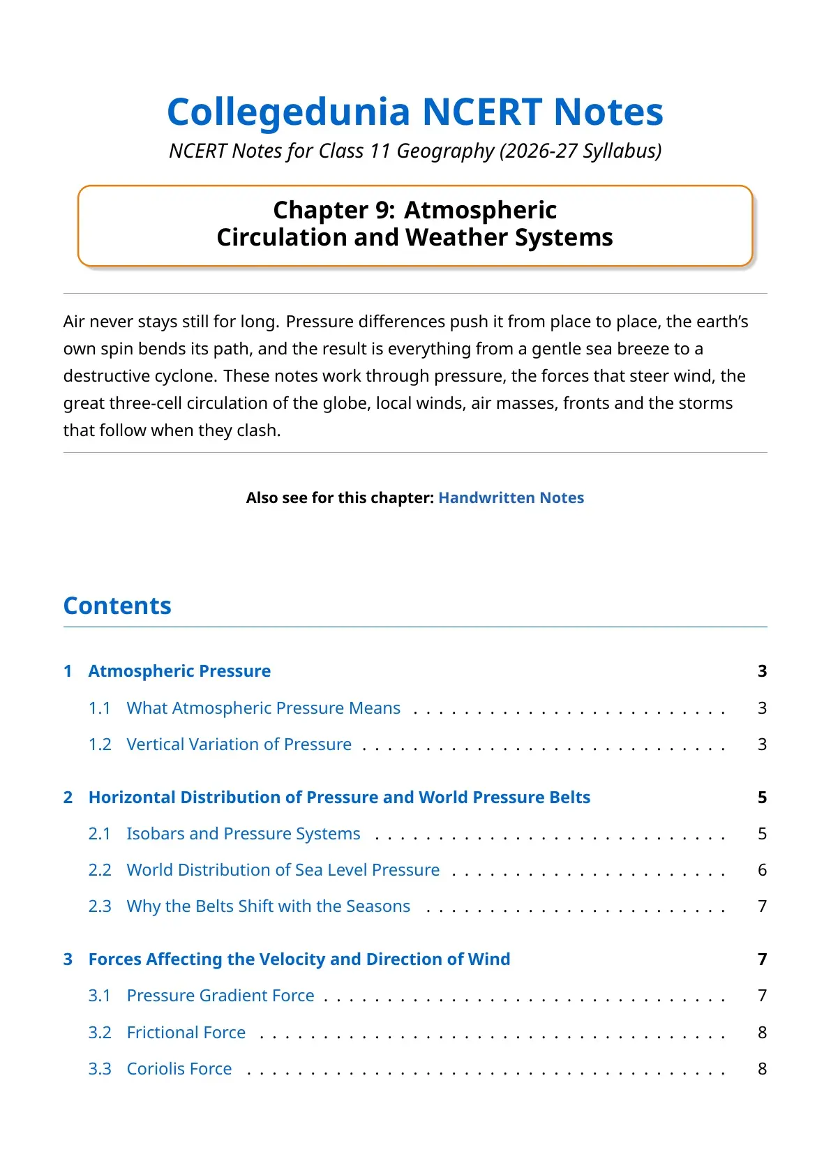
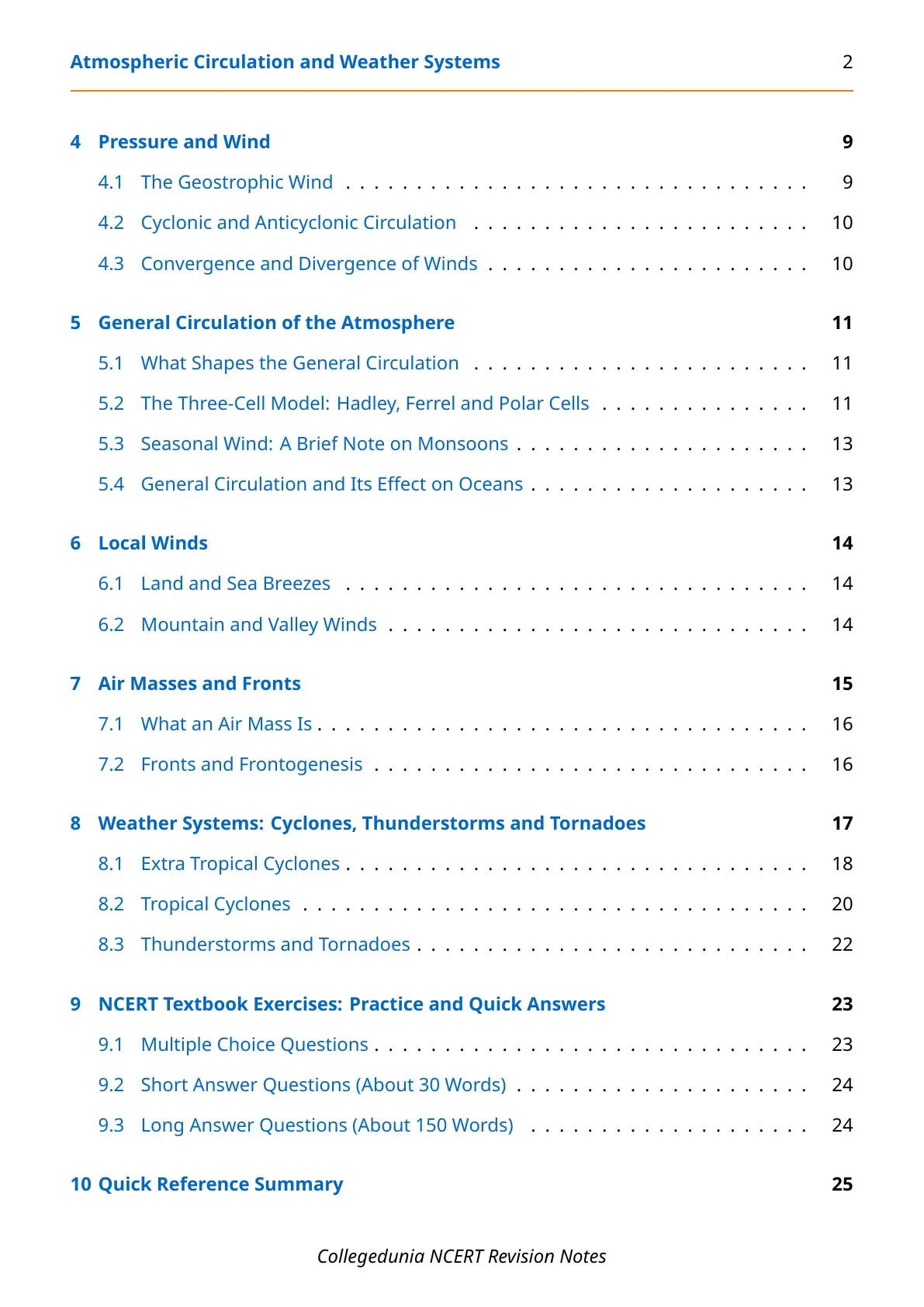
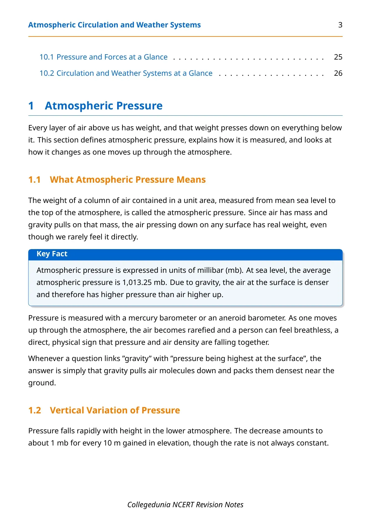
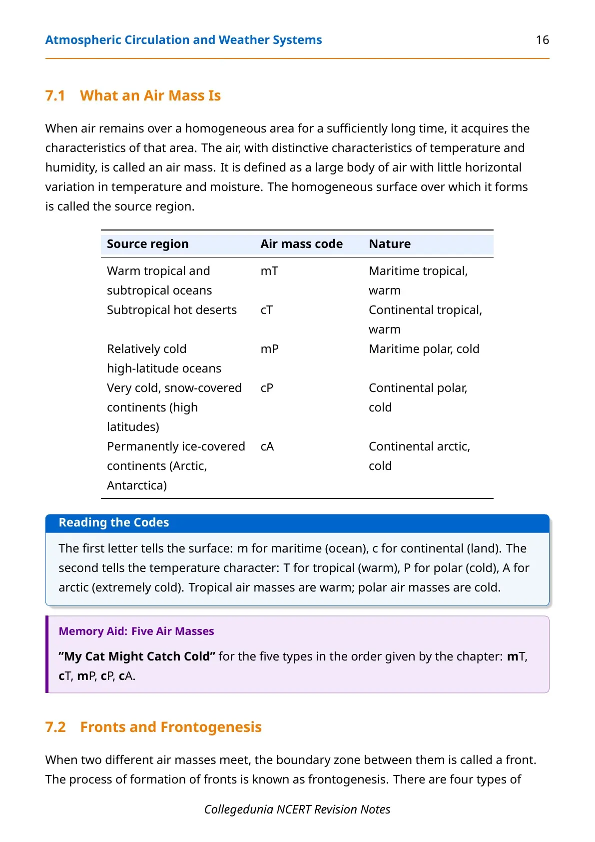
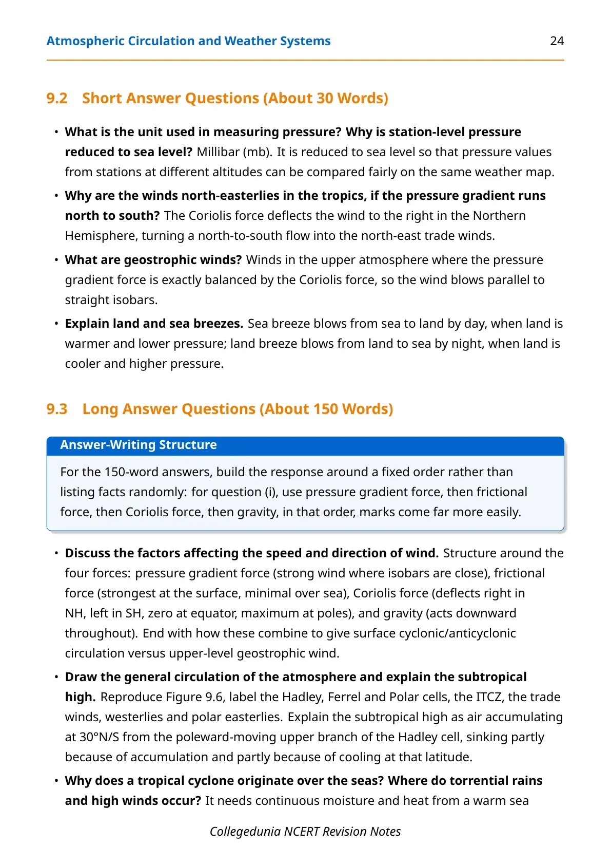
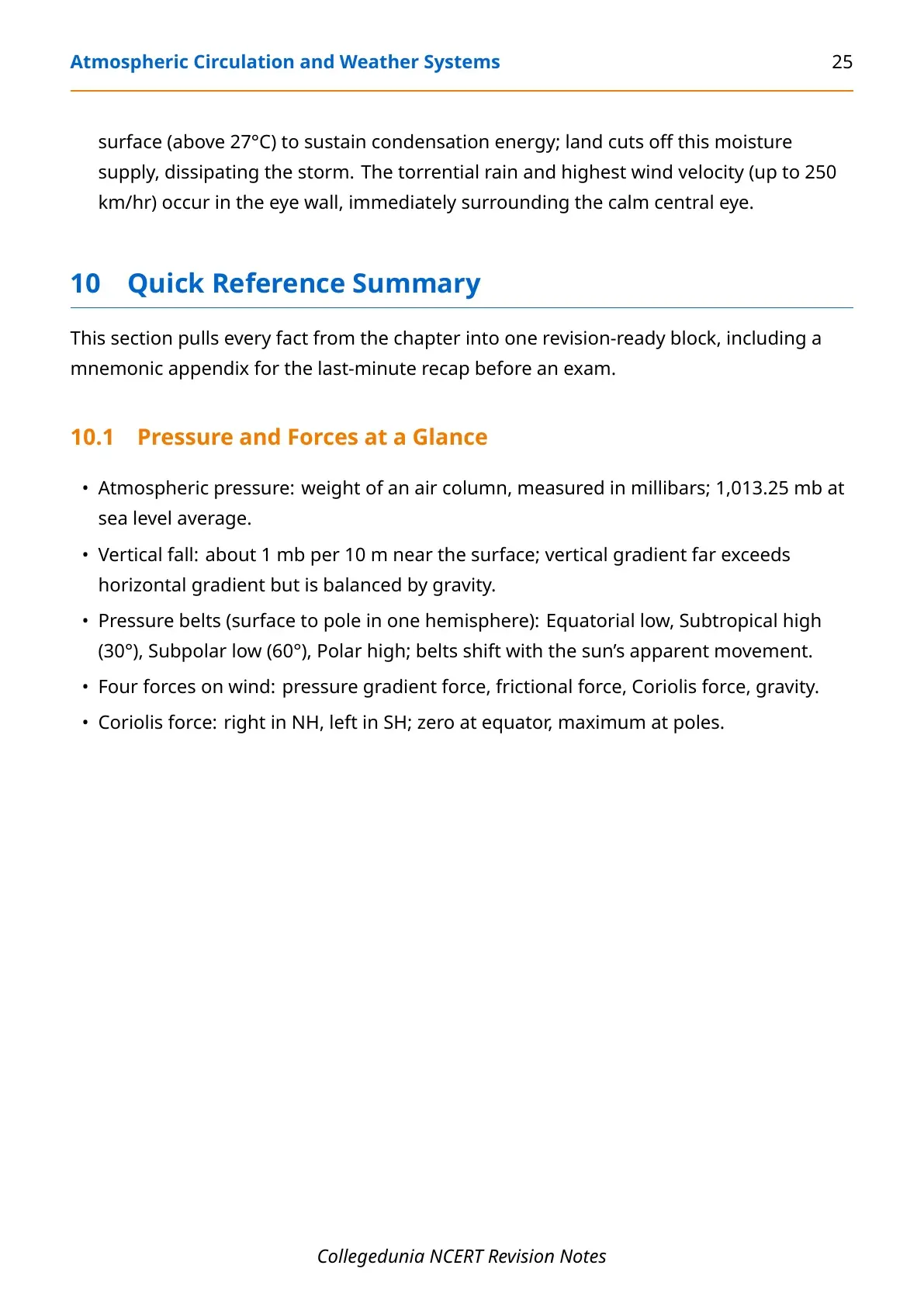
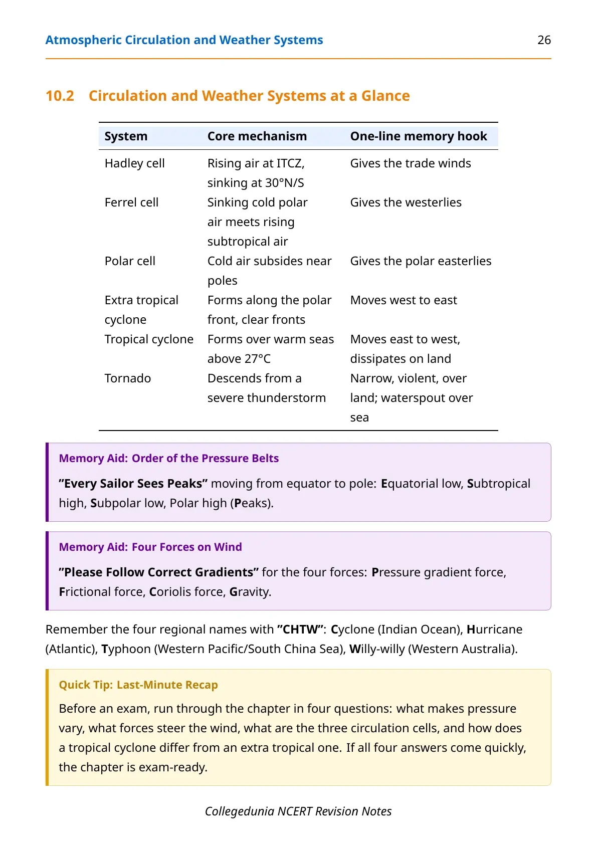
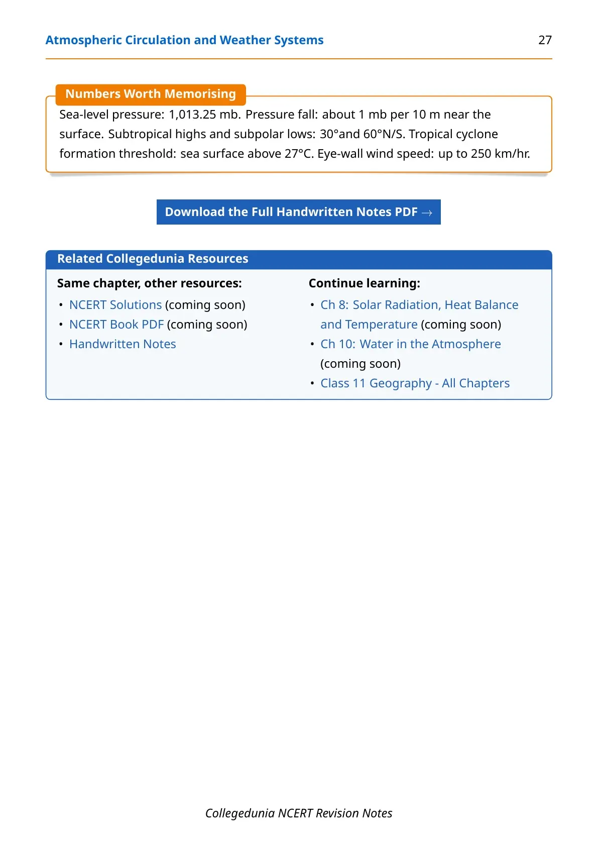
These NCERT Notes Class 11 Geography Chapter 9 Atmospheric Circulation and Weather Systems are curated by subject experts and checked against the 2026-27 NCERT textbook. They are organised the same way the chapter flows: pressure, wind forces, general circulation, local winds, air masses and fronts, and weather systems.
Student Feedback: What 11,860 students told us about this chapter. In a Collegedunia poll of 11,860 Class 11 Geography students conducted before their 2026-27 annual exams, 64% mixed up cyclonic and anticyclonic wind direction between the two hemispheres. Most, however, could define pressure gradient force correctly.
Why Atmospheric Circulation and Weather Systems Matters for Class 11 Geography
NCERT Notes Class 11 Geography Chapter 9 Atmospheric Circulation and Weather Systems is the chapter that turns pressure differences into moving air, and moving air into weather. The Class 11 annual paper usually draws one diagram question on the general circulation of the atmosphere and one short-answer question on cyclones or fronts.
- Direct exam value: the Coriolis force, the three-cell model and the cyclone versus anticyclone table are asked almost every year, as MCQs or as a labelled diagram.
- Builds later chapters: Water in the Atmosphere and World Climate and Climate Change both assume this chapter's pressure and wind logic is already known.
Atmospheric Circulation and Weather Systems Video Explanation
Source: UPSC Wallah on YouTube
How Collegedunia's Notes Help You With Atmospheric Circulation and Weather Systems
Collegedunia's notes split this chapter into the parts students actually get tested on: how pressure varies, what forces steer the wind, how the atmosphere circulates as a whole, and how that circulation turns violent in a cyclone.
- 2026-27 NCERT Alignment: every figure, from the sea-level pressure average to the cyclone eye-wall wind speed, matches the current textbook edition.
- Force-by-Force Walkthrough: pressure gradient, friction and Coriolis explained one at a time, then combined into the geostrophic wind.
- Three-Cell Model Simplified: Hadley, Ferrel and Polar cells broken into short, memorable rules instead of one dense paragraph.
- NCERT Exercise Practice: quick-answer prompts that mirror the textbook's MCQ, short-answer and long-answer sets.
Atmospheric Circulation and Weather Systems Glossary
Sixteen terms from this chapter cover almost every question the Class 11 exam asks on pressure, wind and weather systems.
| Term | One-Line Definition |
|---|---|
| Atmospheric pressure | The weight of a column of air from mean sea level to the top of the atmosphere, in millibars. |
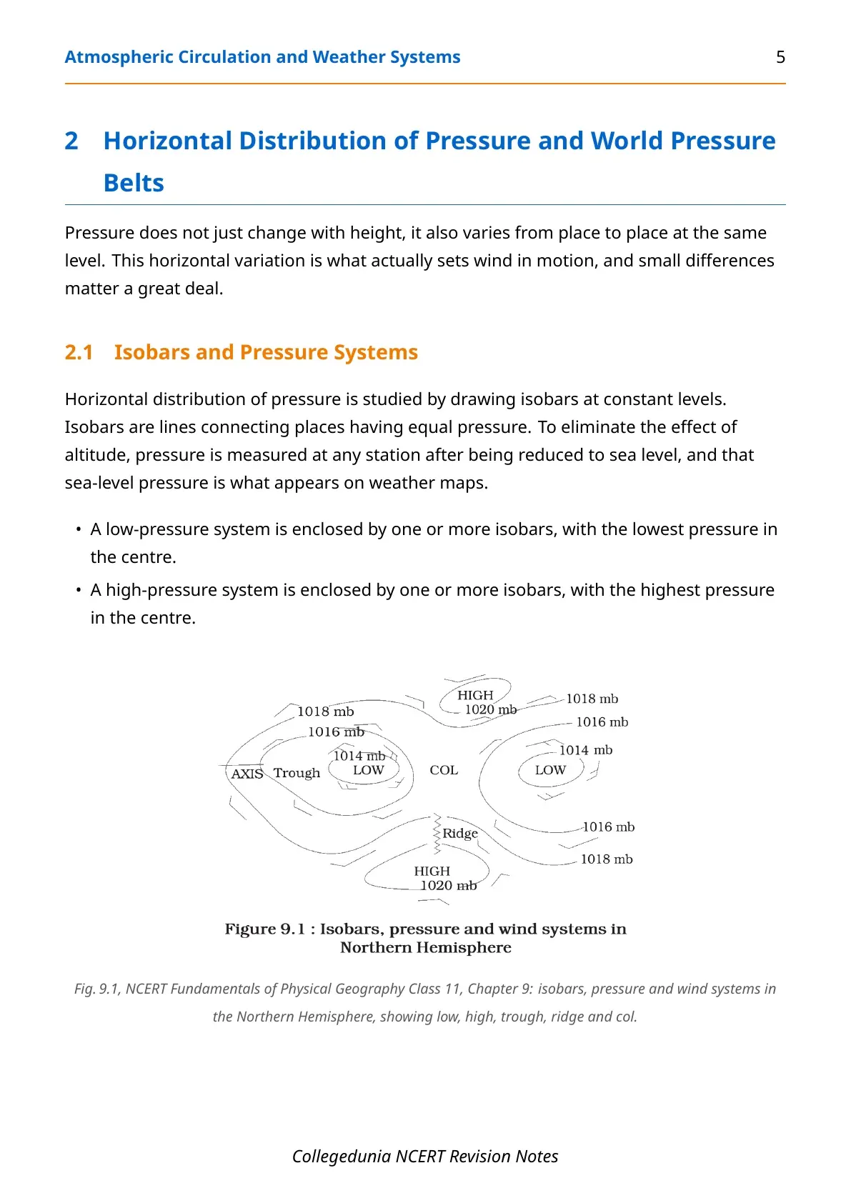
| Isobar | A line on a weather map joining places with equal atmospheric pressure. |
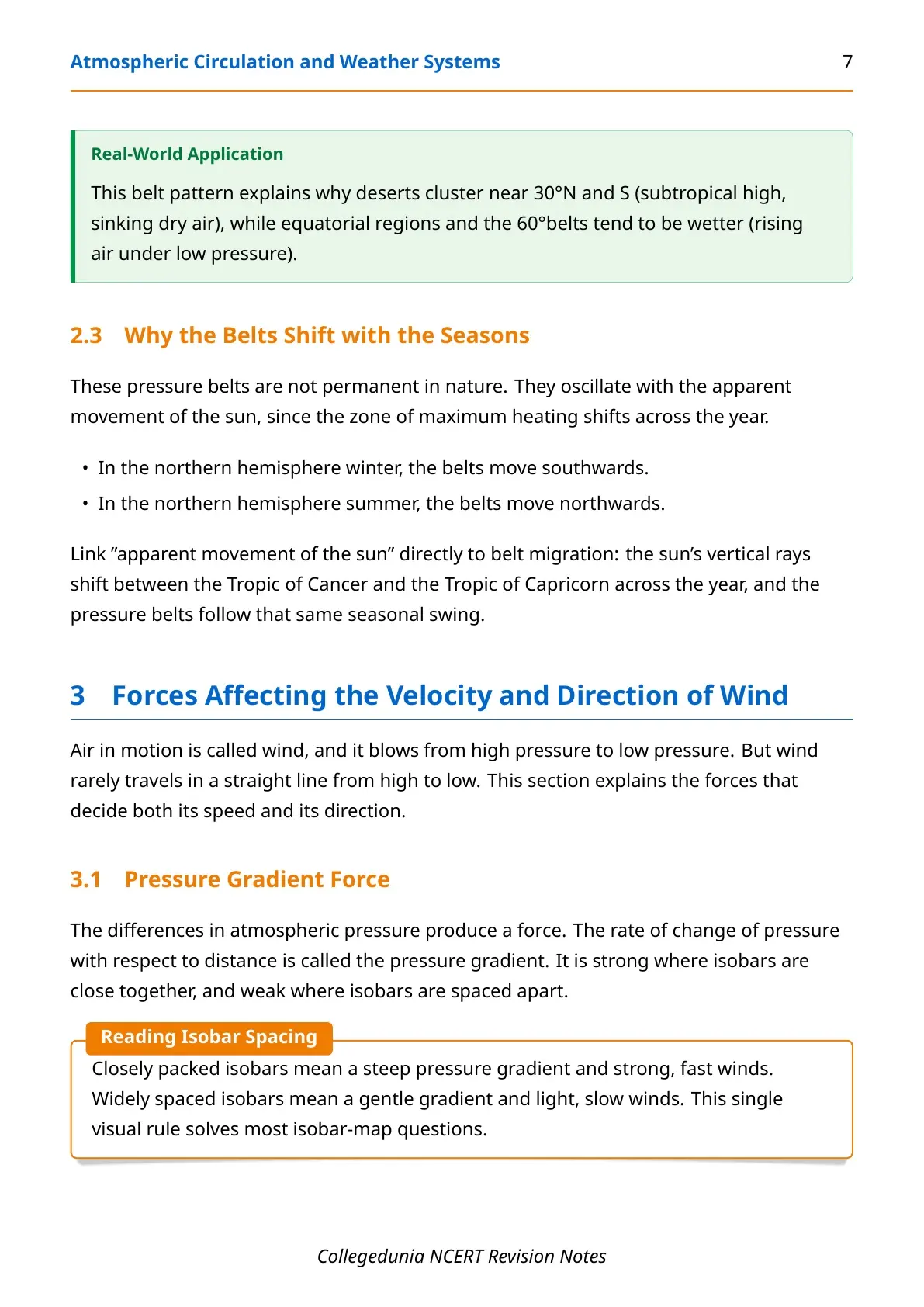
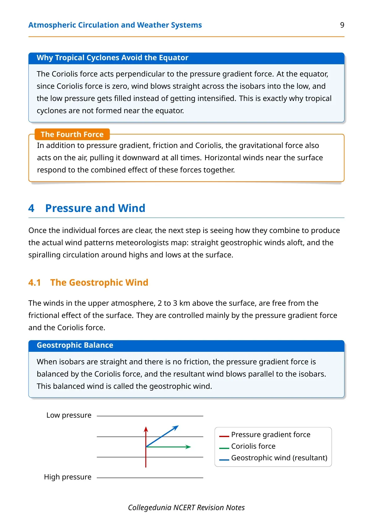
| Pressure gradient force | The force produced by the rate of change of pressure over distance; stronger where isobars are close. |
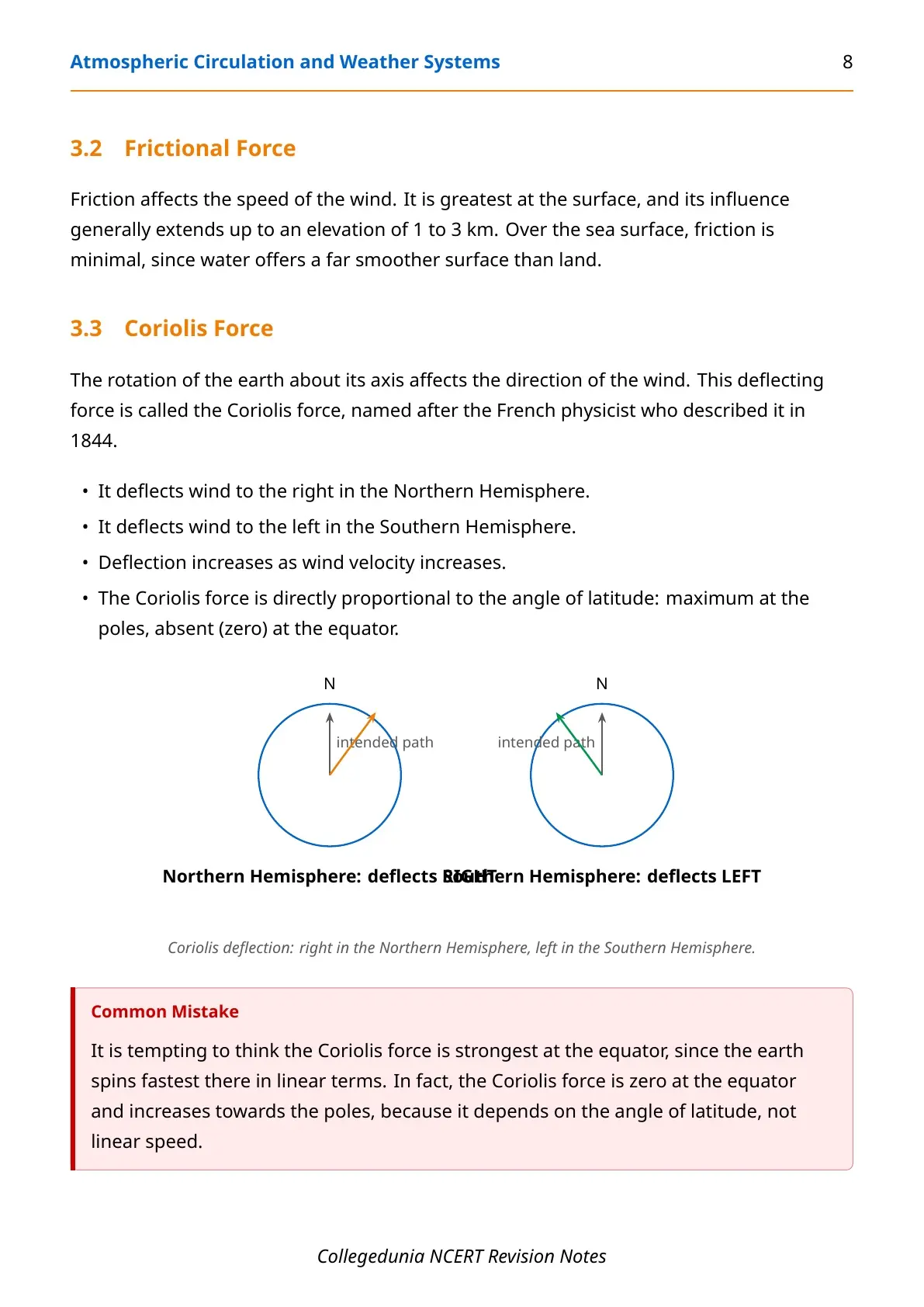
| Coriolis force | The deflecting force from the earth's rotation; right in the Northern Hemisphere, left in the Southern. |
| Geostrophic wind | The upper-air wind that blows parallel to straight isobars once pressure gradient and Coriolis force balance. |
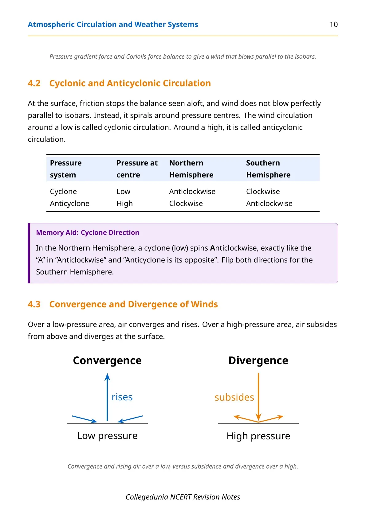
| Cyclonic circulation | Wind circulation around a low-pressure centre; anticlockwise in the NH, clockwise in the SH. |
| Anticyclonic circulation | Wind circulation around a high-pressure centre; clockwise in the NH, anticlockwise in the SH. |
| ITCZ | Inter Tropical Convergence Zone; the low-pressure belt near the equator where trade winds meet and rise. |
| Hadley cell | The tropical circulation cell between the ITCZ and about 30°N/S. |
| Air mass | A large body of air with little horizontal variation in temperature and moisture, named by its source region. |
| Front | The boundary zone where two different air masses meet. |
| Frontogenesis | The process by which a front forms. |
| Extra tropical cyclone | A mid- or high-latitude storm that forms along the polar front, with a clear frontal system. |
| Tropical cyclone | A violent storm forming over warm tropical oceans (above 27°C), with no frontal system. |
| Eye of the storm | The calm, low-pressure centre of a mature tropical cyclone, surrounded by the eye wall. |
| Landfall | The point where a tropical cyclone crosses the coast and begins to dissipate. |
What the Atmospheric Circulation and Weather Systems Chapter Covers
The NCERT chapter moves in a fixed order: how pressure varies, what forces act on wind, how the whole atmosphere circulates, and how that circulation produces day-to-day weather and destructive storms.
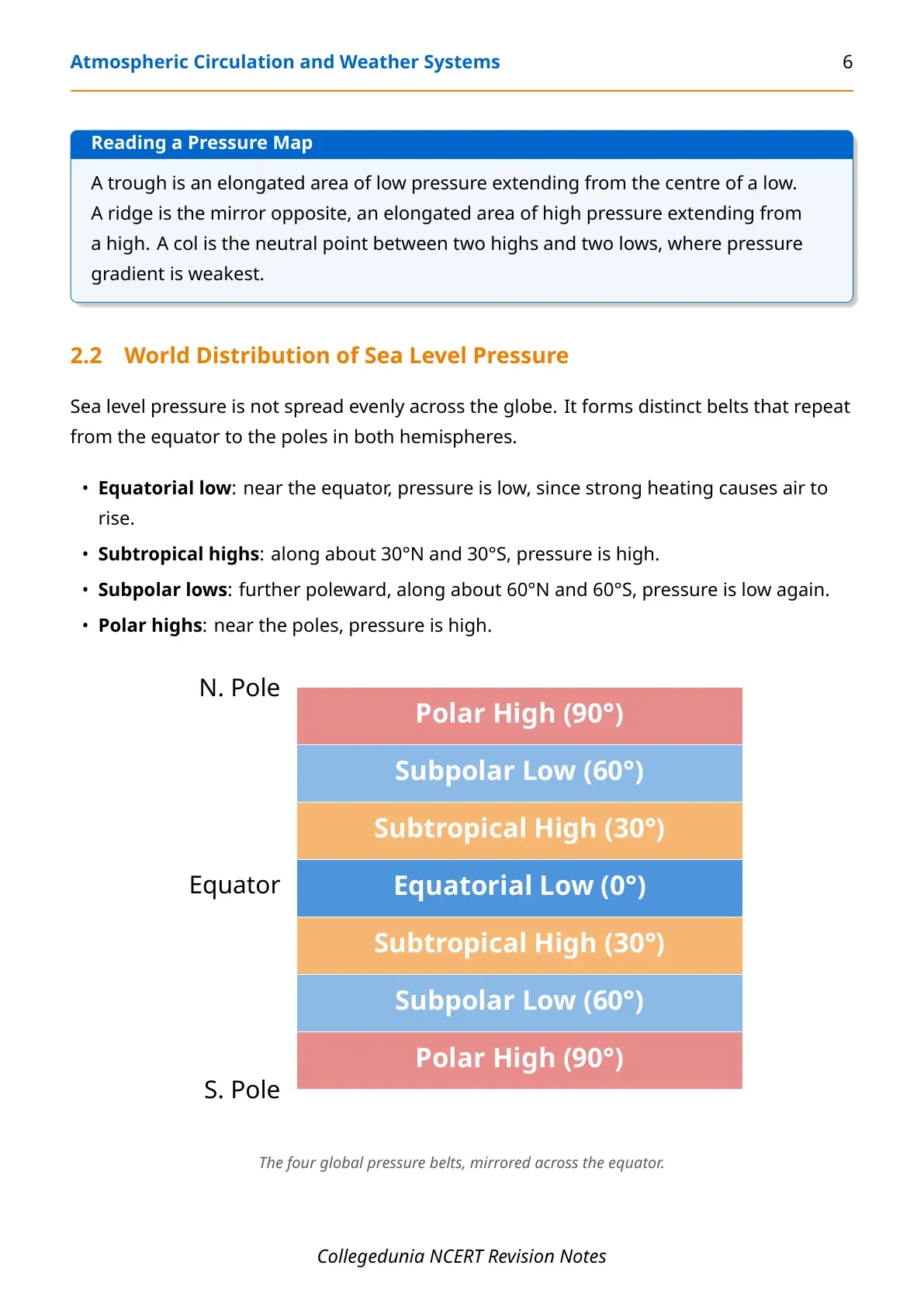
- Pressure: vertical and horizontal variation, isobars, and the four world pressure belts.
- Wind forces: pressure gradient force, friction, Coriolis force, and the resulting geostrophic and cyclonic winds.
- General circulation: the Hadley, Ferrel and Polar cells, plus El Nino and the southern oscillation.
- Local winds, air masses and fronts: land and sea breeze, mountain and valley winds, and the four types of fronts.
- Weather systems: extra tropical cyclones, tropical cyclones, thunderstorms and tornadoes.
Atmospheric Pressure and the World Pressure Belts
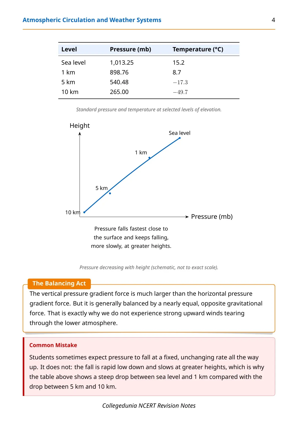
The weight of a column of air is called atmospheric pressure, measured in millibars. The average pressure at sea level is 1,013.25 mb, and pressure falls fast with height, about 1 mb for every 10 m gained in elevation near the surface.
| Belt | Approx. Latitude | Pressure Type |
|---|---|---|
| Equatorial low | 0° | Low, from strong heating and rising air |
| Subtropical high | 30°N and 30°S | High, from sinking air |
| Subpolar low | 60°N and 60°S | Low |
| Polar high | 90°N and 90°S | High |
These belts are not fixed. They oscillate with the apparent movement of the sun, shifting south in the northern winter and north in the northern summer. On a weather map, pressure is shown using isobars, lines joining places of equal pressure, always measured after reducing station pressure to sea level so different stations can be compared fairly.
Forces That Decide Wind Speed and Direction
Wind blows from high pressure to low pressure, but four forces together decide exactly how fast and in which direction it actually moves.
| Force | What It Does |
|---|---|
| Pressure gradient force | Strong where isobars are close together, weak where they are spaced apart. |
| Frictional force | Greatest at the surface, extends up to 1-3 km, minimal over the sea. |
| Coriolis force | Deflects wind right in the NH, left in the SH; zero at the equator, maximum at the poles. |
| Gravity | Acts downward at all times, balancing the strong vertical pressure gradient. |
Because the Coriolis force is zero at the equator, wind there blows straight across isobars into a low instead of curving around it, so the low keeps filling up rather than intensifying. This is exactly why tropical cyclones never form right at the equator, one of the most frequently asked reasoning questions in this chapter.
When pressure gradient force and Coriolis force balance out over straight isobars with no friction, the result is the geostrophic wind, blowing parallel to the isobars. At the surface, friction breaks this balance and wind spirals instead, giving cyclonic circulation around a low and anticyclonic circulation around a high.
| System | Pressure at Centre | Northern Hemisphere | Southern Hemisphere |
|---|---|---|---|
| Cyclone | Low | Anticlockwise | Clockwise |
| Anticyclone | High | Clockwise | Anticlockwise |
General Circulation of the Atmosphere: The Three-Cell Model
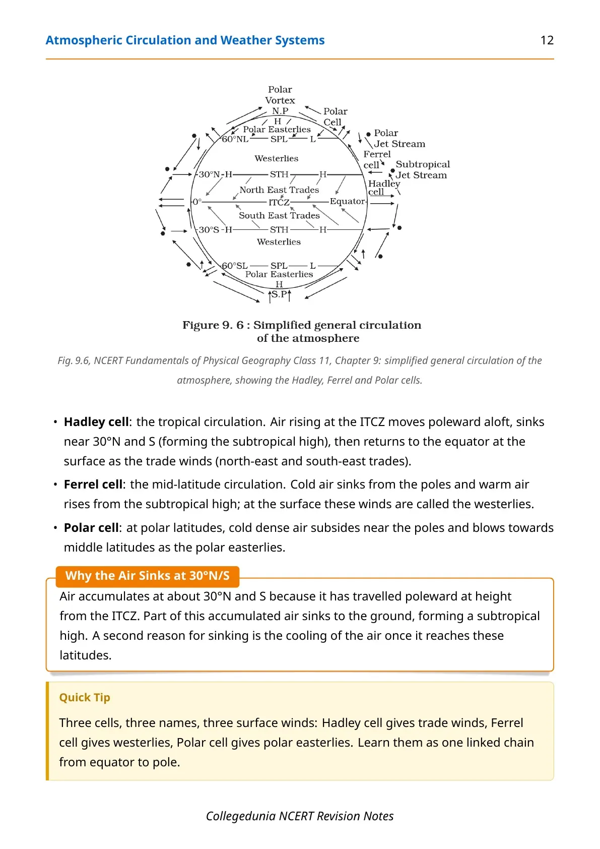
The planet-wide pattern of wind movement is called the general circulation of the atmosphere. NCERT explains it using three linked circulation cells stacked from the equator to the pole in each hemisphere.
- Hadley cell: air rises at the ITCZ, moves poleward aloft, sinks near 30°N/S, and returns as the trade winds.
- Ferrel cell: sinking cold polar air meets rising subtropical air; surface winds here are the westerlies.
- Polar cell: cold, dense air subsides near the poles and blows outward as the polar easterlies.
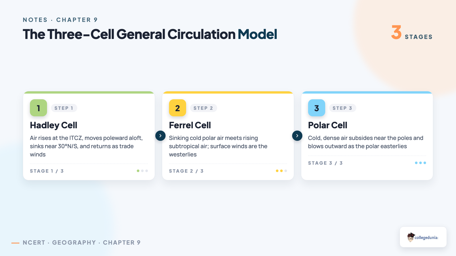
Air accumulates and sinks at about 30°N and 30°S partly because it has travelled poleward from the ITCZ and partly because it cools at that latitude, and this sinking air is exactly what forms the subtropical high described earlier in this chapter.
This global circulation also drives the ocean. Warming of the central Pacific that drifts toward South America is called El Nino; the linked pressure shift over the Pacific is the southern oscillation; together they are called ENSO, and a strong ENSO year can bring drought to Australia, floods to China, and disturbed rainfall to India.
Local Winds, Air Masses and Fronts
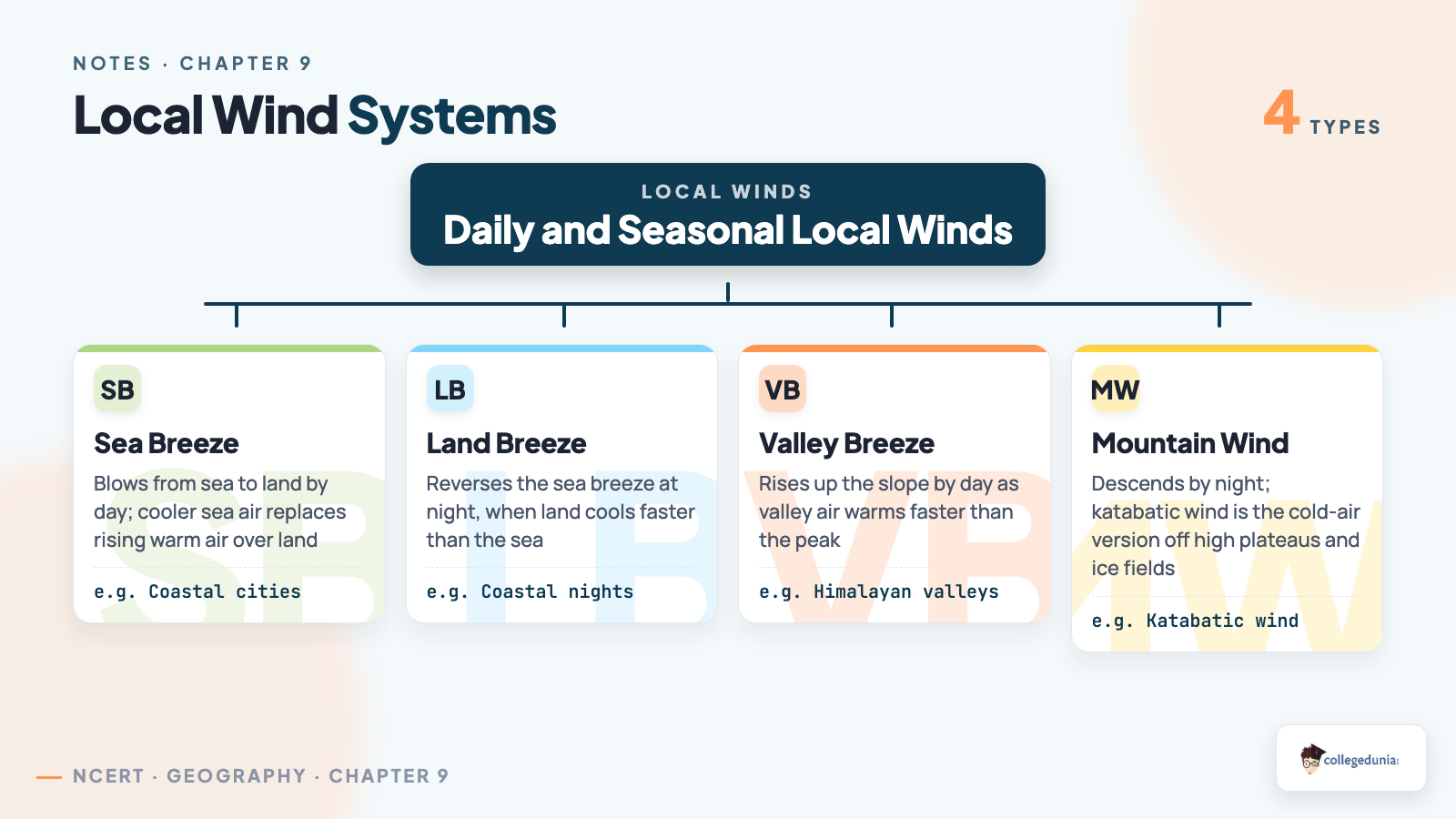
Not every wind fits the planet-wide pattern. Daily and seasonal heating differences create smaller, local wind systems, and where two different air bodies meet, the boundary itself becomes a weather-making zone.
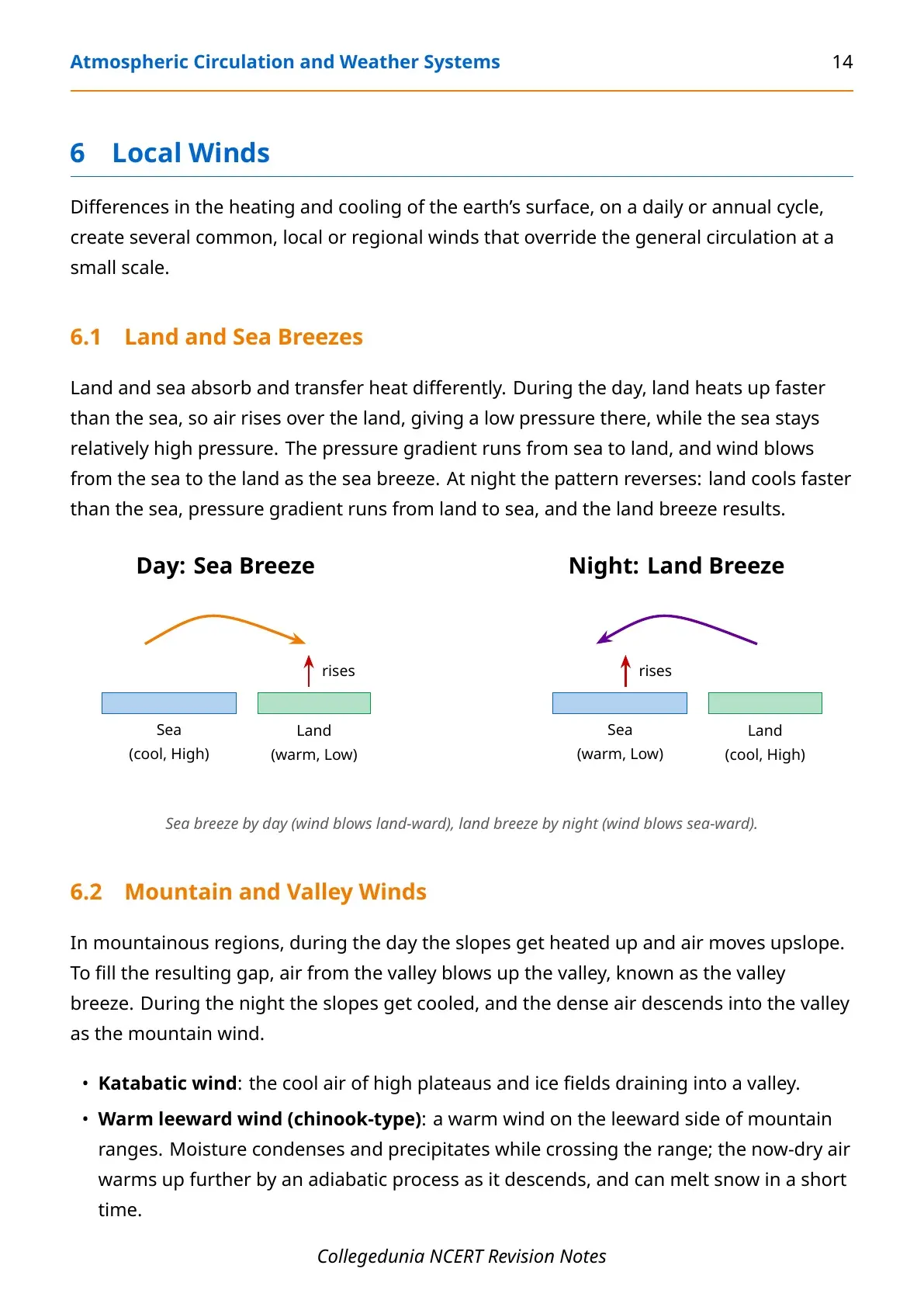
- Sea breeze blows from sea to land by day; land breeze reverses it by night.
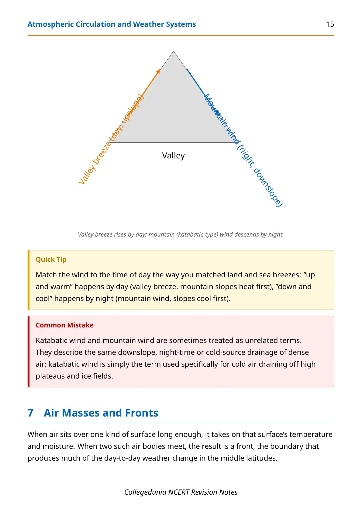
- Valley breeze rises by day; mountain wind (including katabatic wind off high plateaus) descends by night.
- Air mass: a large body of air with near-uniform temperature and moisture, classified by source region as mT, cT, mP, cP or cA.
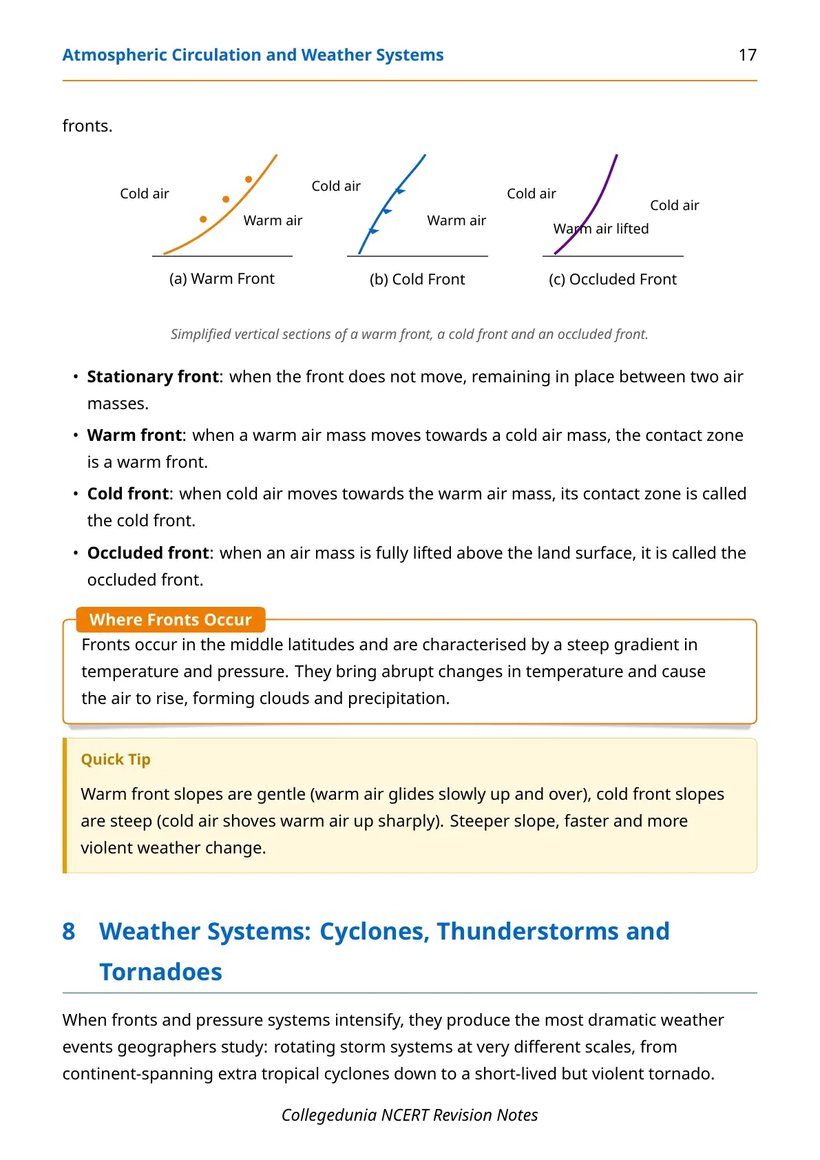
- Front: the boundary between two air masses, of four types: cold, warm, stationary and occluded.
Fronts occur only in the middle latitudes, where they bring a steep gradient in temperature and pressure, abrupt weather change, and precipitation, the exact set-up that later produces an extra tropical cyclone.
Weather Systems: Cyclones, Thunderstorms and Tornadoes
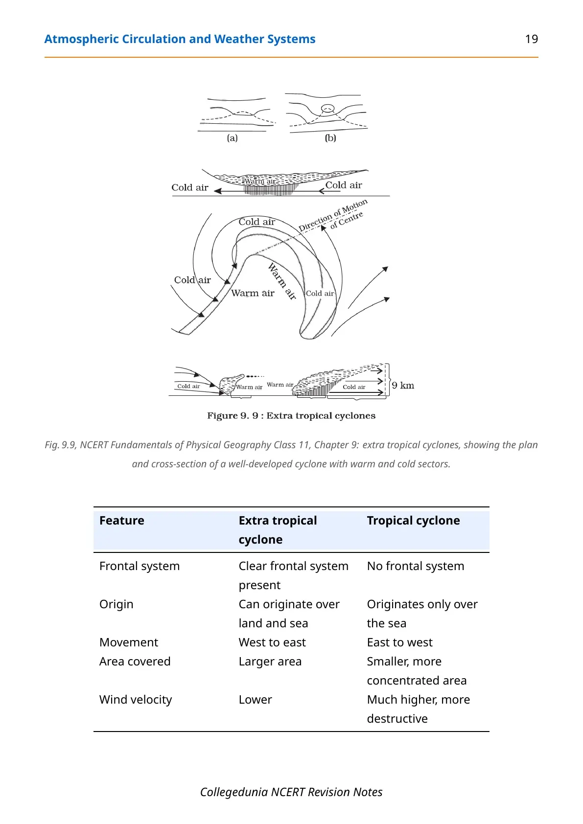
When fronts and pressure systems intensify, the result is the chapter's most dramatic content: rotating storms at very different scales, from a continent-wide extra tropical cyclone down to a short, violent tornado.
| Feature | Extra Tropical Cyclone | Tropical Cyclone |
|---|---|---|
| Frontal system | Clear frontal system present | No frontal system |
| Origin | Land and sea | Only over warm seas (above 27°C) |
| Movement | West to east | East to west |
| Wind velocity | Lower | Much higher, more destructive |
A mature tropical cyclone has a calm, low-pressure eye at its centre, surrounded by the eye wall, where wind can reach 250 km per hour with torrential rain. It is called a Cyclone in the Indian Ocean, a Hurricane in the Atlantic, a Typhoon in the western Pacific and South China Sea, and a Willy-willy in western Australia.
Thunderstorms form from intense convection on hot, moist days, sometimes producing hail or, when moisture is short, a dust storm instead. A severe thunderstorm can spawn a tornado, a narrow, spiralling wind of very low central pressure; over the sea, the same feature is called a waterspout.
Common Mistakes Students Make in Atmospheric Circulation and Weather Systems
- Reversing cyclone direction between hemispheres - anticlockwise around a low in the NH, but clockwise around the same low in the SH.
- Assuming Coriolis force is strongest at the equator - it is actually zero there and increases toward the poles.
- Confusing extra tropical and tropical cyclones - only the extra tropical cyclone has a clear frontal system, and it moves west to east, not east to west.
- Mixing up katabatic wind and mountain wind - katabatic wind is specifically cold air draining off high plateaus and ice fields; mountain wind is the broader night-time downslope flow.
Real-World Uses of Atmospheric Circulation Concepts
The ideas in this chapter explain weather events that show up in the news every year, which makes them easier to remember.
- Coastal weather: the daily sea breeze and land breeze cycle is why coastal cities feel cooler afternoons than inland ones.
- Cyclone forecasting: the Indian Meteorological Department tracks eye-wall wind speed and the point of landfall for every Bay of Bengal cyclone.
- Long-range monsoon forecasts: ENSO and the southern oscillation are watched closely because a strong El Nino year often means a weaker Indian monsoon.
- Aviation and mountain travel: pilots and hill-station planners both account for local mountain and valley winds and for jet-stream-linked turbulence.
How to Use These Notes Most Effectively
NCERT Notes Class 11 Geography Chapter 9 Atmospheric Circulation and Weather Systems rewards learning the forces and cells as a chain, not as isolated facts.
- Learn the four wind forces first. Pressure gradient, friction, Coriolis, gravity, in that order.
- Draw the three-cell model from memory. Hadley, Ferrel, Polar, with the ITCZ and subtropical high labelled.
- Recite the cyclone versus anticyclone table last, since hemisphere reversal is the single most common slip in this chapter.
Quick Mnemonic Recall for This Chapter
- Pressure belts, equator to pole: "Every Sailor Sees Peaks" - Equatorial low, Subtropical high, Subpolar low, Polar high.
- Four wind forces: "Please Follow Correct Gradients" - Pressure gradient, Friction, Coriolis, Gravity.
- Cyclone naming by ocean: "CHTW" - Cyclone (Indian Ocean), Hurricane (Atlantic), Typhoon (Pacific/South China Sea), Willy-willy (Australia).
Other NCERT Resources for Atmospheric Circulation and Weather Systems
This table lists every Collegedunia resource for the NCERT Notes Class 11 Geography Chapter 9 Atmospheric Circulation and Weather Systems chapter.
| Resource | Link |
|---|---|
| Notes (this page) | Atmospheric Circulation and Weather Systems Class 11 Geography Notes |
| Handwritten Notes | (coming soon) |
| NCERT Solutions | (coming soon) |
| NCERT Book PDF | (coming soon) |
Atmospheric Circulation and Weather Systems: Topics Students Often Get Confused About
Three pairs of terms cause most of the confusion in this chapter, because the names sound similar but the ideas are different.
- Geostrophic wind vs cyclonic circulation - geostrophic wind blows parallel to isobars aloft with no friction; cyclonic circulation is the surface spiral once friction is added.
- Extra tropical cyclone vs tropical cyclone - the extra tropical cyclone has a clear frontal system and moves west to east; the tropical cyclone has none and moves east to west.
- Tornado vs waterspout - the same violent, spiralling wind is called a tornado over land and a waterspout over the sea.
NCERT Notes for Class 11 Geography: All Chapters
Use this table to move to any other Class 11 Geography chapter's notes once this chapter is done.
| Chapter | Resource |
|---|---|
| Chapter 1 | Geography as a Discipline Notes (Coming Soon) |
| Chapter 2 | The Origin and Evolution of the Earth Notes (Coming Soon) |
| Chapter 3 | Interior of the Earth Notes (Coming Soon) |
| Chapter 4 | Distribution of Oceans and Continents Notes (Coming Soon) |
| Chapter 5 | Geomorphic Processes Notes (Coming Soon) |
| Chapter 6 | Landforms and their Evolution Notes (Coming Soon) |
| Chapter 7 | Composition and Structure of Atmosphere Notes (Coming Soon) |
| Chapter 8 | Solar Radiation, Heat Balance and Temperature Notes (Coming Soon) |
| Chapter 9 | Atmospheric Circulation and Weather Systems Notes |
| All Chapters | Class 11 Geography, All Chapters (Coming Soon) |
Atmospheric Circulation and Weather Systems Class 11 Geography Notes FAQs
Ques. Where can I download the Class 11 Geography Chapter 9 Notes PDF?
Ans. You can download the NCERT Notes Class 11 Geography Chapter 9 Atmospheric Circulation and Weather Systems PDF directly from this page, free of cost.
Ques. Are these notes based on the 2026-27 NCERT syllabus?
Ans. Yes. These notes follow the current 2026-27 NCERT textbook for Class 11 Geography, chapter by chapter, in the same order as the printed book.
Ques. How many pages is the Class 11 Geography Chapter 9 Notes PDF?
Ans. The Notes PDF runs about 27 pages and covers atmospheric pressure, the forces affecting wind, general circulation, local winds, air masses and fronts, and weather systems.
Ques. What is atmospheric pressure?
Ans. Atmospheric pressure is the weight of a column of air from mean sea level to the top of the atmosphere, measured in millibars. The average pressure at sea level is 1,013.25 mb.
Ques. How is the Coriolis force defined?
Ans. The Coriolis force is the deflecting force caused by the earth's rotation. It deflects wind to the right in the Northern Hemisphere and to the left in the Southern Hemisphere, and it is zero at the equator and maximum at the poles.
Ques. What are the three cells of the general circulation of the atmosphere?
Ans. The three cells are the Hadley cell (tropics), the Ferrel cell (mid-latitudes, giving the westerlies) and the Polar cell (polar latitudes, giving the polar easterlies).
Ques. How is a tropical cyclone different from an extra tropical cyclone?
Ans. A tropical cyclone forms only over warm seas above 27°C, has no frontal system, and moves east to west. An extra tropical cyclone forms along the polar front, has a clear frontal system, and moves west to east.
Ques. What are the four types of fronts?
Ans. The four types of fronts are cold, warm, stationary and occluded. All four occur mainly in the middle latitudes, where they bring a steep gradient in temperature and pressure.



Comments