



Class 11 Geography Chapter 6 Landforms and their Evolution packs more than 50 named landforms into a single chapter, more than any other chapter in the book. It carries 4 to 6 marks in the CBSE Board exam and is a returning UPSC prelims topic. The 2026-27 NCERT keeps every landform group intact, and this page hosts the notes PDF.
- CBSE Weightage: 4 to 6 marks, usually a short-answer question on one landform group plus a diagram-based question.
- UPSC and State PSC Relevance: a core geomorphology topic, asked almost every year in prelims general studies and in the geography optional paper.
- Format: a 22-page PDF with four original NCERT figures, colour diagrams for every landform group and a one-page facts recap.
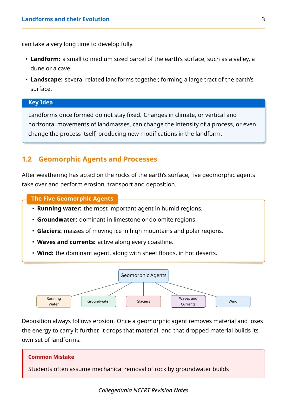
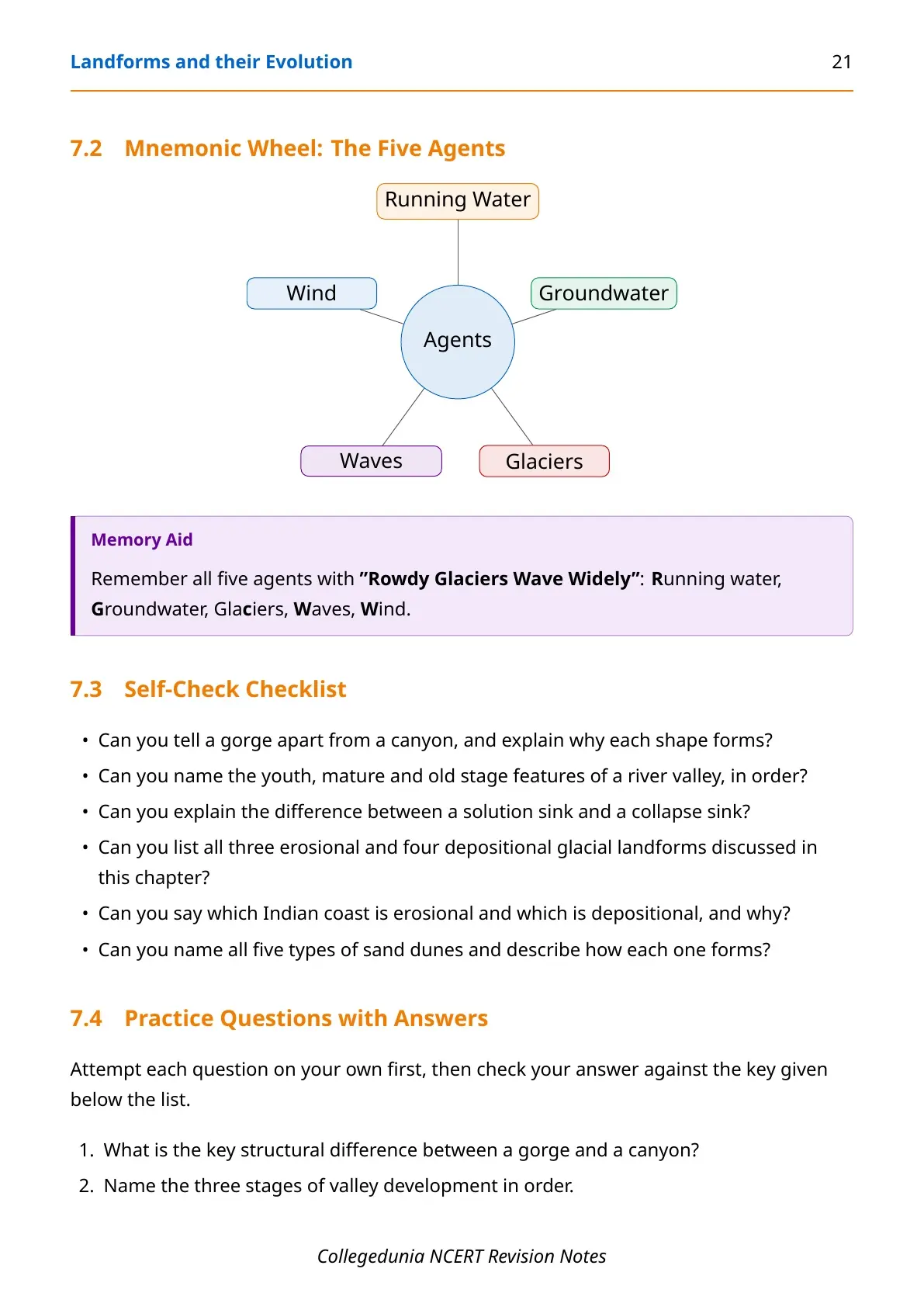
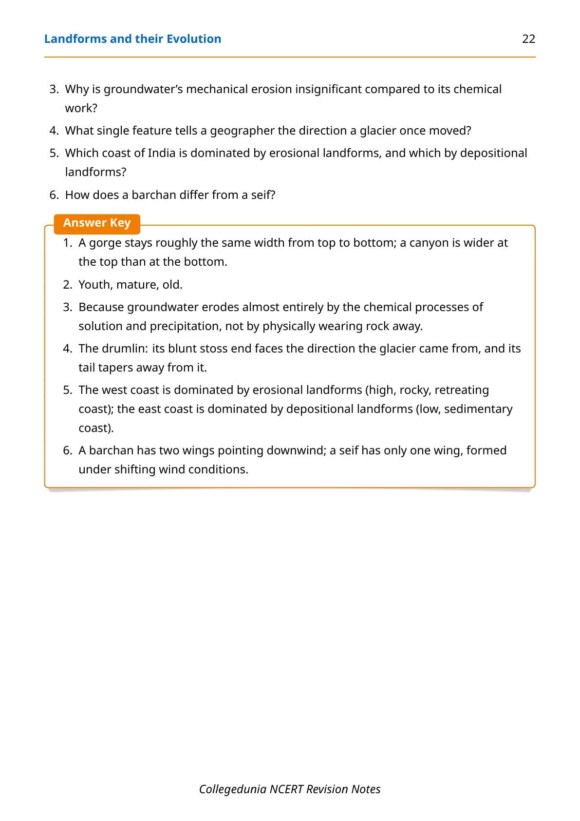
These NCERT Notes Class 11 Geography Chapter 6 Landforms and their Evolution are curated by subject experts, checked against the 2026-27 NCERT textbook, and organised the same way the chapter itself flows: geomorphic agents, running water, groundwater, glaciers, coasts and wind.
You can find the complete notes for this chapter, including every geomorphic agent, landform group and memory aid, in the article below.
|
Table of Contents |
Why Landforms and their Evolution Matters for Boards and Competitive Exams
NCERT Notes Class 11 Geography Chapter 6 Landforms and their Evolution matters for two exams at once. CBSE Boards ask a diagram-based question from it almost every year, and UPSC prelims treats it as a returning geomorphology topic across general studies and the geography optional paper.
Landforms and their Evolution: Introduction Video
Source: Magnet Brains on YouTube
How Collegedunia's Notes Help You With Landforms and their Evolution
Collegedunia's notes group every landform by the process that built it, so the chapter reads as five short stories instead of one long list.
- 2026-27 NCERT Alignment: every landform matches the current syllabus, with the original NCERT figures reproduced inside the PDF.
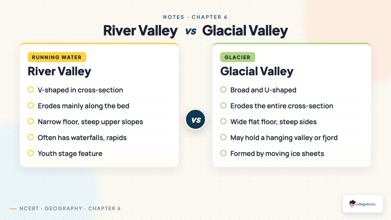
- Landform Comparison Tables: gorge versus canyon, river valley versus glacial valley, bar versus barrier bar, side by side.
- Memory Aids: a mnemonic for the five agents and one for the youth-mature-old sequence.
- India-Specific Examples: real sites for every agent, from the Kaveri gorge to the Thar Desert dunes.
Landforms and their Evolution Glossary
Twelve terms from NCERT Notes Class 11 Geography Chapter 6 Landforms and their Evolution cover almost every diagram-based question in this chapter.
| Term | One-Line Definition |
|---|---|
| Landform | A small to medium sized part of the earth's surface shaped by one geomorphic agent. |
| Landscape | Several related landforms together, forming a larger tract of the earth's surface. |
| Peneplain | A nearly flat plain produced by long-continued stream erosion. |
| Monadnock | A resistant, low remnant hill standing above a peneplain. |
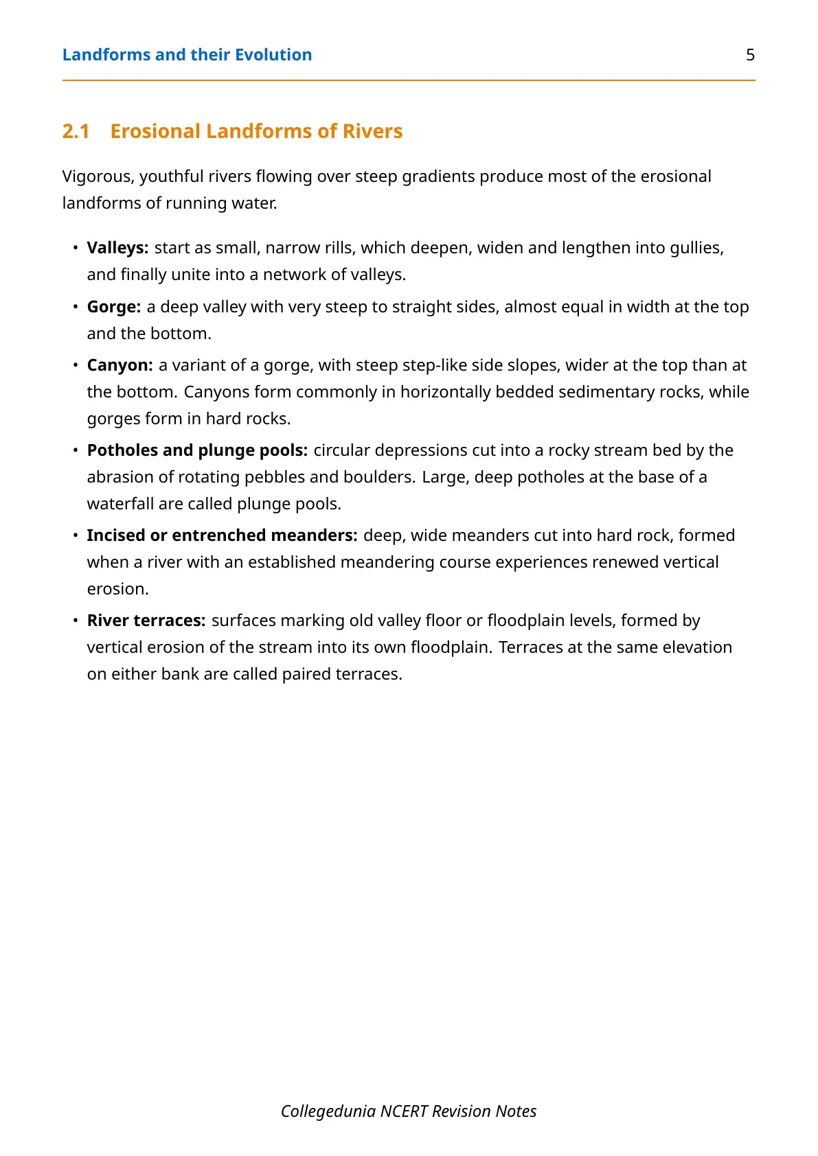
| Gorge | A deep valley with steep sides of roughly equal width top to bottom. |
| Karst topography | A landscape shaped by the solution and precipitation of limestone or dolomite. |
| Cirque | A steep-walled hollow at the head of a glacial valley. |
| Fjord | A glacial valley flooded by the sea after the glacier retreats. |
| Moraine | An unsorted ridge of rock debris deposited directly by a glacier. |
| Spit | A barrier bar that stays attached to a headland at one end. |
| Lagoon | A body of water sealed off from the sea by a barrier bar or spit. |
| Pediplain | A low, near-featureless desert surface formed by the backward retreat of pediments. |
What Landforms and their Evolution Chapter Covers
The NCERT Notes Class 11 Geography Chapter 6 Landforms and their Evolution move through six blocks: how a landform differs from a landscape, the youth-mature-old cycle, and the agents that give the chapter its name.
- Landforms, landscapes and evolution: what each term means, plus the youth, mature and old stages that end in a peneplain with monadnocks.
- Running water: erosional landforms like gorges and canyons, and depositional landforms like alluvial fans, deltas and floodplains.
- Groundwater and karst topography: sinkholes, uvalas, lapies and caves, plus stalactites, stalagmites and pillars.
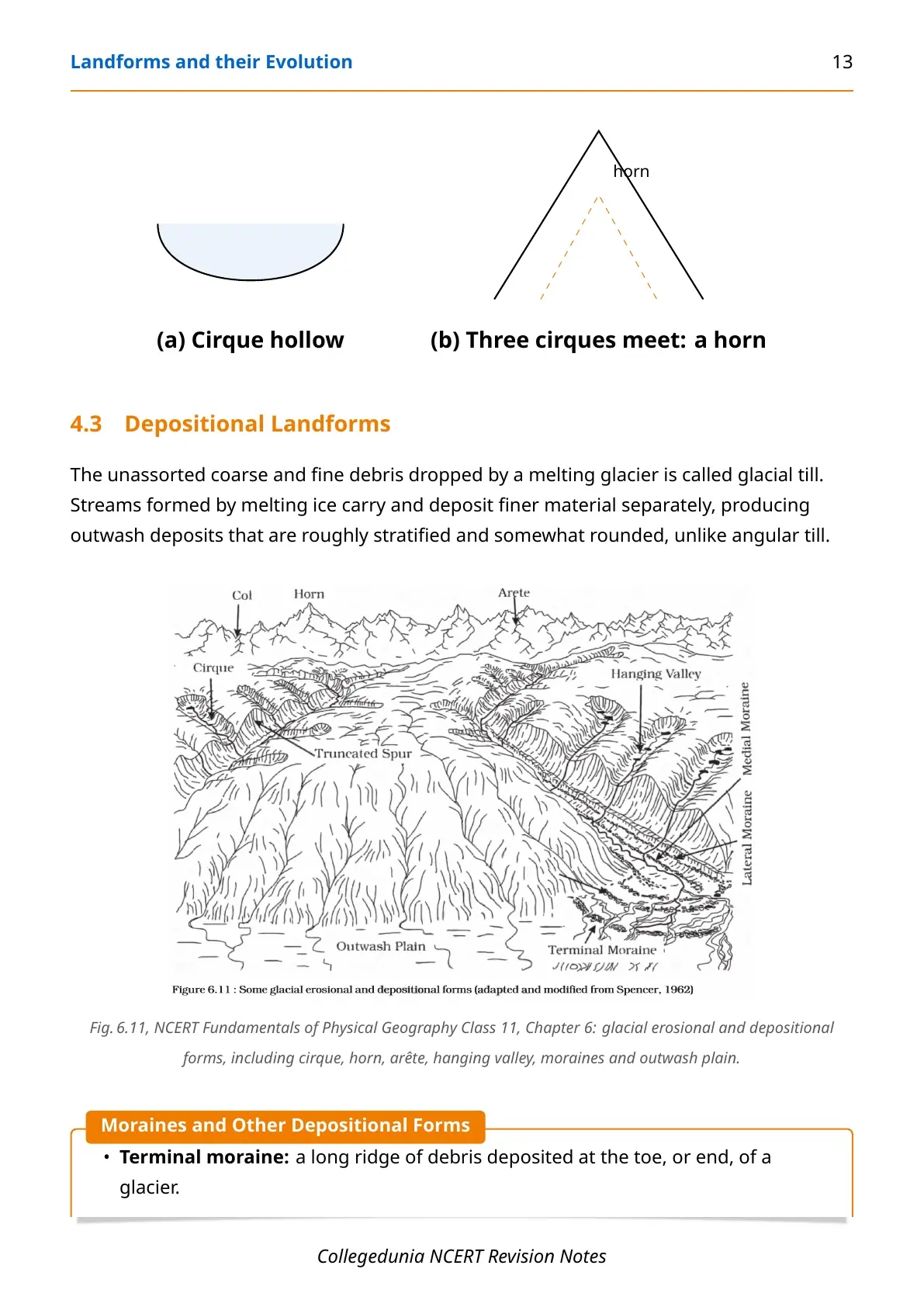
- Glaciers: cirques, horns, arêtes and U-shaped valleys, plus till, outwash, moraines, eskers and drumlins.
- Waves and currents: India's high rocky west coast versus its low sedimentary east coast, cliffs, stacks, beaches and lagoons.
- Wind: pediments, pediplains, playas and five named types of sand dunes.
Landforms and their Evolution: Geomorphic Agents and Facts at a Glance
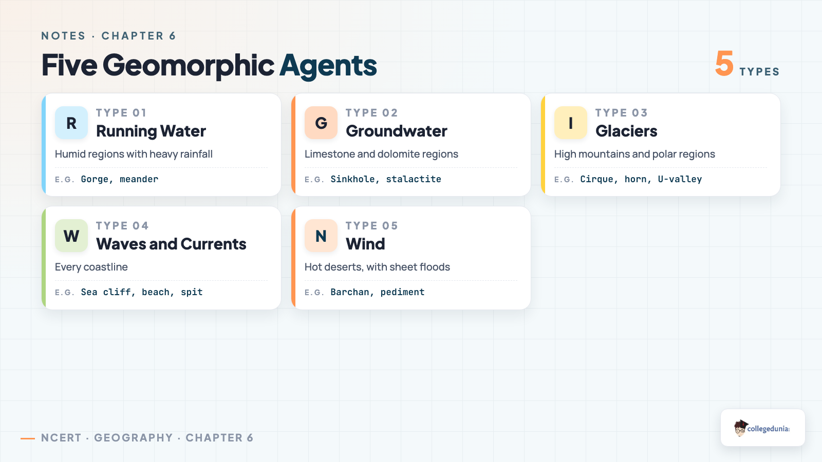
Five geomorphic agents do almost all the work in this chapter, and each one leads in a different kind of landscape. The table below maps each agent to where it is strongest and the one landform most students are asked to identify from it.
| Geomorphic Agent | Where It Leads | Signature Landform |
|---|---|---|
| Running water | Humid regions with heavy rainfall | Gorge, meander, oxbow lake |
| Groundwater | Limestone and dolomite regions | Sinkhole, stalactite, stalagmite |
| Glaciers | High mountains and polar regions | Cirque, horn, U-shaped valley |
| Waves and currents | Every coastline | Sea cliff, beach, spit |
| Wind | Hot deserts, with sheet floods | Barchan, pediment, inselberg |
Running Water: Erosional and Depositional River Landforms
Running water is the most important geomorphic agent in humid regions. Vigorous, youthful rivers on steep gradients build most of the erosional landforms, while gentler stretches downstream build the depositional ones.
- Gorge: a deep valley with steep sides, roughly the same width top to bottom.
- Canyon: steep, step-like sides, wider at the top than at the bottom, typical of horizontally bedded sedimentary rock.
- Potholes and plunge pools: circular depressions cut by rotating pebbles, with plunge pools forming at the base of a waterfall.
- Alluvial fans and deltas: cone-shaped deposits at a mountain foot slope, and sorted deposits where a river's load reaches the sea.
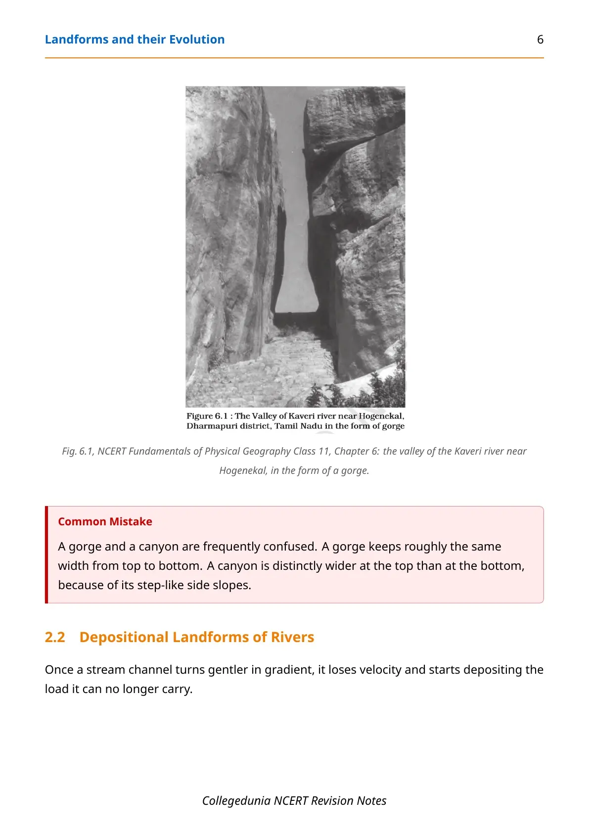
- Meanders and oxbow lakes: loop-like channels on gentle gradients; a cut-off loop is left isolated as an oxbow lake.
- Natural levees and point bars: coarse ridges built along river banks during repeated flooding.
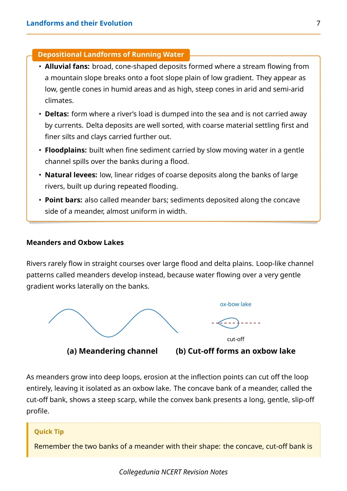
A river valley passes through the same youth, mature and old stages, moving from a shallow V-shaped valley to a wide, flat valley near sea level.
Groundwater and Karst Topography
Groundwater's erosional work is almost entirely chemical, so it shapes its own distinctive landscape only in limestone and dolomite. This landscape is called karst topography, named after the Karst region in the Balkans.
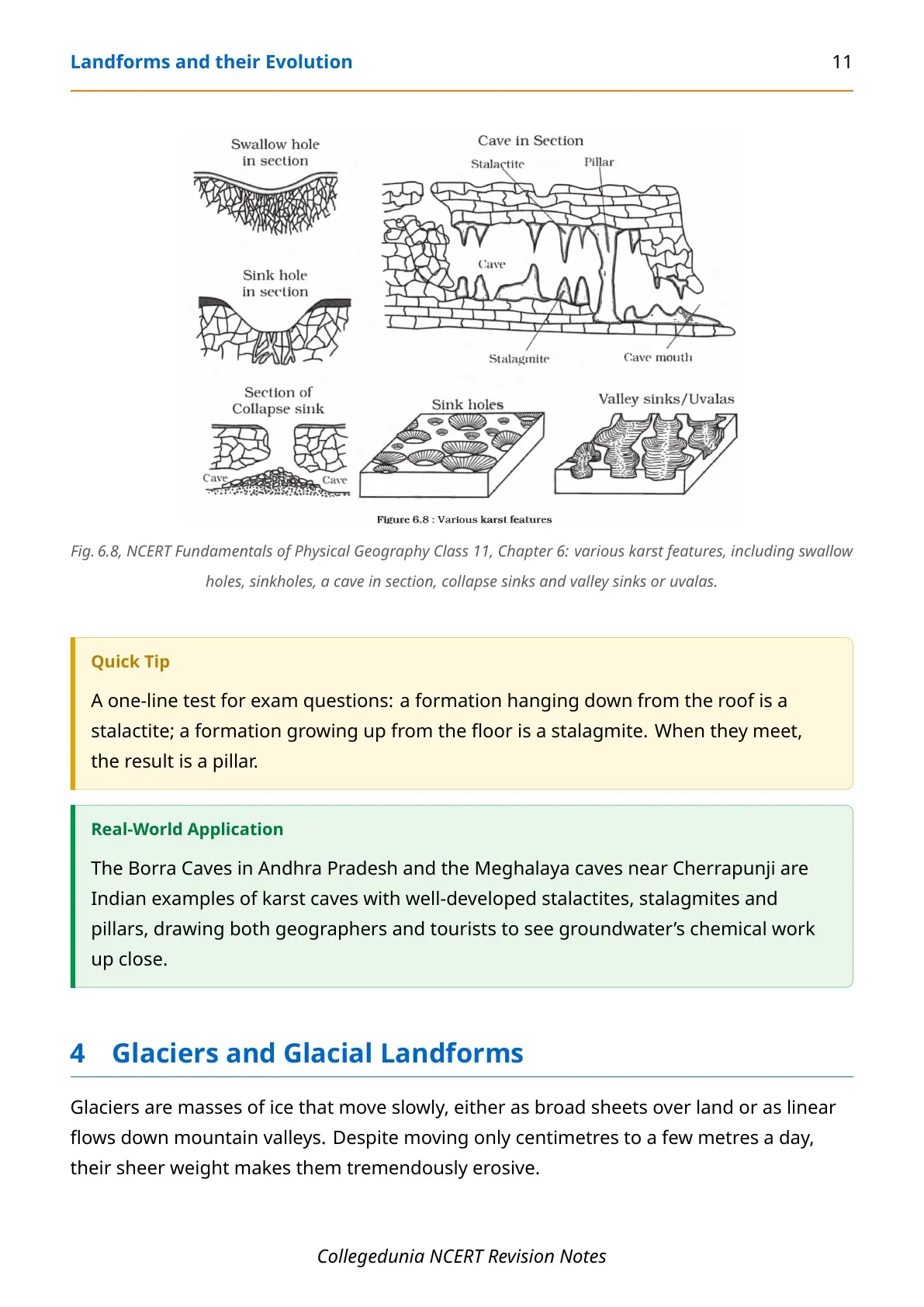
- Sinkholes: funnel-shaped openings; a solution sink forms by dissolving rock, a collapse sink forms when a cave roof falls in.
- Uvalas or valley sinks: long trenches formed when several sinkholes merge.
- Lapies: an irregular surface of pits and ridges across a wide area, which can smooth into a limestone pavement.
- Caves and their deposits: stalactites hang from the roof, stalagmites rise from the floor, and a pillar forms where the two meet.
Glaciers and Glacial Landforms
Glaciers move only centimetres to a few metres a day, but their sheer weight makes them powerfully erosive, dragging angular rock blocks along a valley floor.
- Cirque: the most common glacial landform, a steep-walled trough at a valley head; a lake left behind is a tarn.
- Horn and arête: a horn forms where three or more cirques meet at a sharp peak; an arête is the ridge between two cirques.
- Glacial valley or trough: broad and U-shaped, unlike a river valley's narrow V shape; filled with sea water it becomes a fjord.
- Moraines: terminal, lateral, ground and medial ridges mark where a glacier dropped its till.
- Eskers and drumlins: eskers are ridges left by streams under the ice; drumlins are oval till ridges with a blunt end facing the glacier.
Waves, Currents and Coastal Landforms
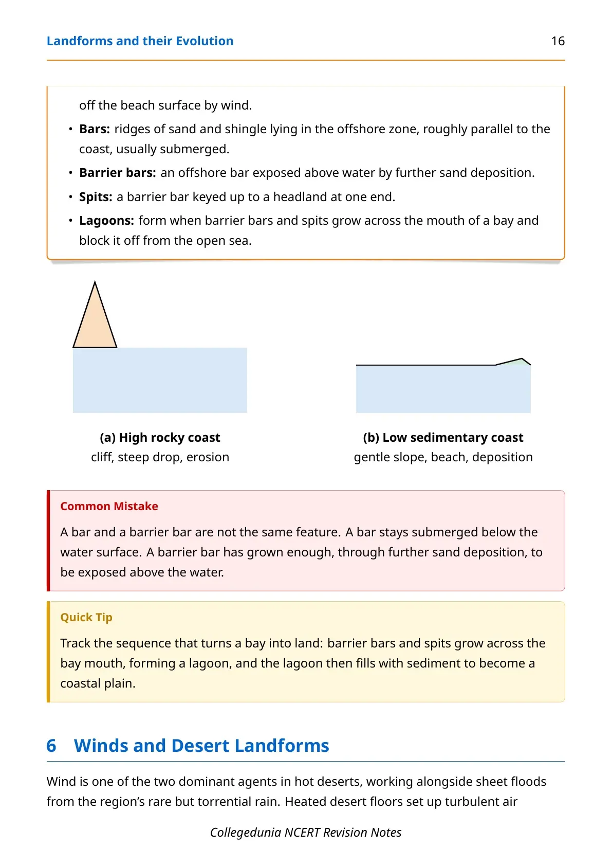
Coastal processes act fast and can be the most destructive of all geomorphic action. NCERT explains coastal evolution through two contrasting coast types.
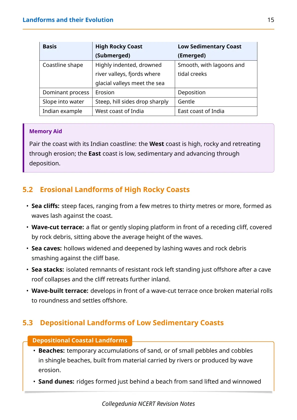
| Basis | High Rocky Coast | Low Sedimentary Coast |
|---|---|---|
| Dominant process | Erosion | Deposition |
| Coastline shape | Indented, drowned valleys, fjords | Smooth, with lagoons and tidal creeks |
| Landforms | Sea cliffs, wave-cut terraces, sea stacks | Beaches, bars, spits, lagoons |
| Indian example | West coast of India | East coast of India |
A barrier bar forms when an offshore bar is pushed above water by more sand. A spit is a barrier bar keyed up to a headland; bars and spits growing across a bay mouth seal it into a lagoon.
Winds and Desert Landforms
Wind and sheet floods together shape hot deserts, working through deflation, abrasion and impact. Much of a desert landscape owes more to sudden torrential rain than to wind alone.
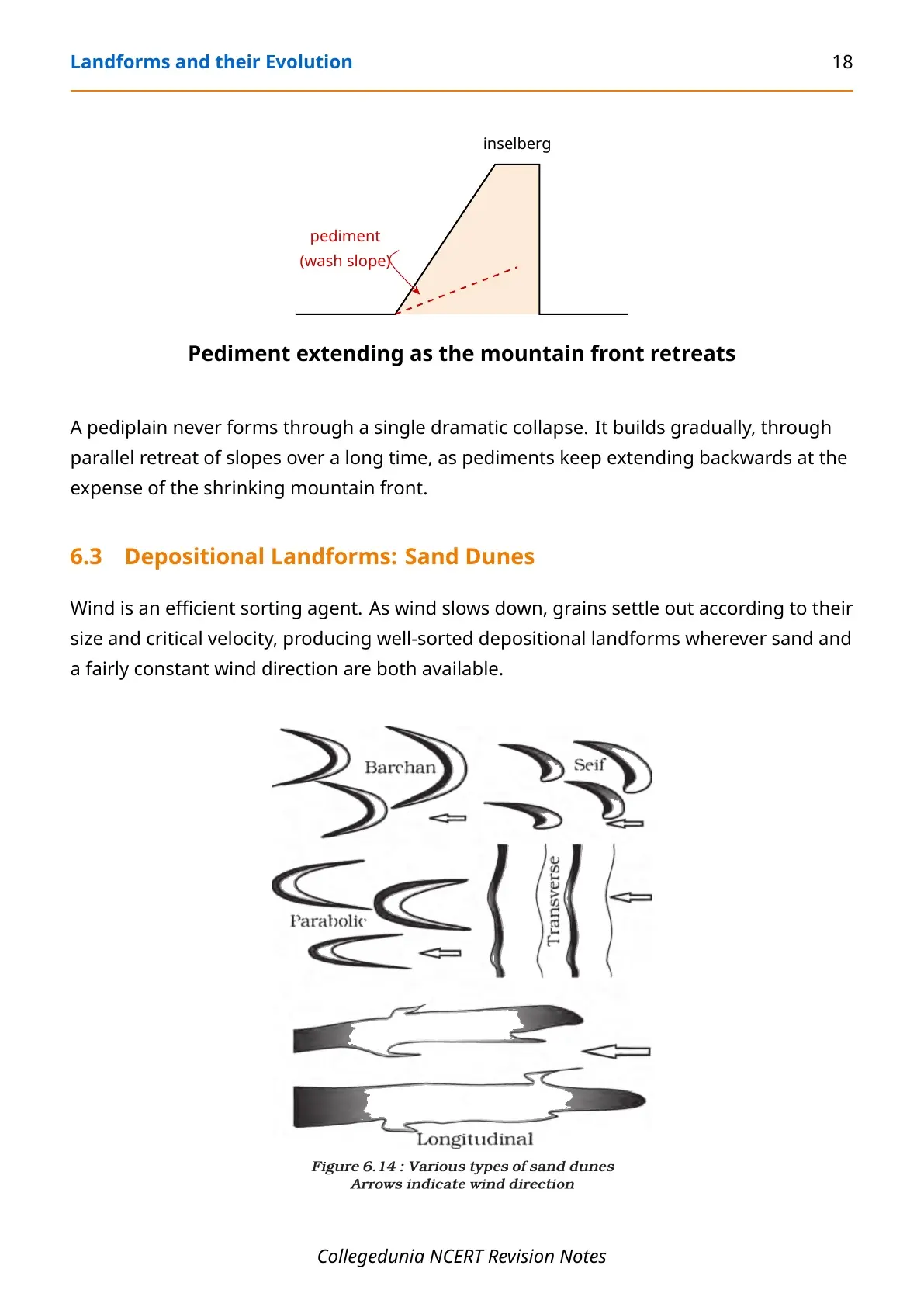
- Pediments and pediplains: rocky floors that grow backward as a mountain front retreats, leaving an inselberg above a flattened pediplain.
- Playas: shallow desert basin floors that fill briefly with water; a salt-covered playa is an alkali flat.
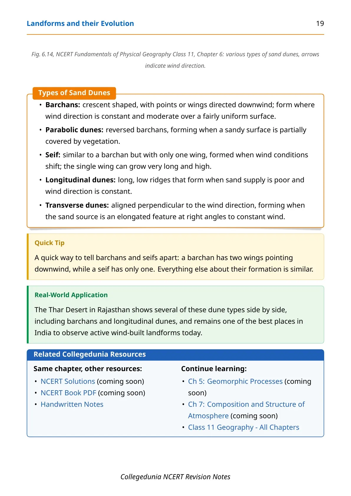
- Barchans and parabolic dunes: crescent dunes with two wings downwind, and their vegetation-anchored, reversed counterpart.
- Seif, longitudinal and transverse dunes: a seif has only one wing; longitudinal ridges run along a poor sand supply; transverse dunes sit perpendicular to a constant wind.
Common Mistakes Students Make in Landforms and their Evolution
- Assuming groundwater builds karst landforms mainly by wearing away rock mechanically; physical removal is insignificant next to solution and precipitation.
- Treating erosion and deposition as separate topics: deposition always follows once an agent loses the energy to carry its load.
- Assuming a pediplain forms through one dramatic event, when it actually builds gradually through the parallel retreat of slopes.
- Forgetting that a single river can show more than one stage at once, a youthful gorge upstream and mature meanders downstream.
Student Feedback: What 9,340 students told us about this chapter. In a Collegedunia poll of 9,340 Class 11 Geography students conducted before their 2026-27 annual exams, 58% picked the wrong shape when asked to sketch a glacial valley, more often drawing a river valley's V shape instead of the correct U shape.
How to Use These Notes Most Effectively
Read these notes in the same six-block order as the printed chapter.
- First pass: read the geomorphic agents table and the overview list to fix the map.
- Second pass: work through each landform group with the glossary open alongside.
- Final revision: use the Common Mistakes box and the Confusion Pairs list the night before the exam.
Other NCERT Resources for Landforms and their Evolution
The table below lists every Collegedunia resource for this chapter, including the page you are reading.
| Resource | Link |
|---|---|
| Notes (this page) | Landforms and their Evolution Class 11 Geography Notes |
| Handwritten Notes | Landforms and their Evolution Class 11 Handwritten Notes |
| NCERT Solutions | Coming Soon |
| NCERT Book PDF | Coming Soon |
Landforms and their Evolution: Topics Students Often Get Confused About
Four pairs of landforms account for most of the marks lost here, because students remember the name but mix up the shape or process.
- Gorge vs canyon - a gorge keeps roughly the same width top to bottom; a canyon is distinctly wider at the top, thanks to step-like side slopes.
- Solution sink vs collapse sink - a solution sink forms purely by dissolving rock; a collapse sink forms only after an underground cave roof falls in.
- River valley vs glacial valley - a river valley is V-shaped in cross-section; a glacial valley is broad and U-shaped, since ice erodes the whole cross-section.
- Bar vs barrier bar - a bar stays submerged below the water surface; a barrier bar has been pushed above water by further sand deposition.
Real-World Examples of Landforms and their Evolution in India
Every geomorphic agent in this chapter has a well-known Indian example.
- Kaveri gorge: a classic youthful gorge near Hogenekal, Tamil Nadu, while the same river shows mature meanders downstream.
- Ganga plain: wide floodplains and meanders typical of a river landscape in its mature and old stages.
- Borra and Meghalaya caves: Indian karst caves with well-developed stalactites, stalagmites and pillars.
- Gangotri and Alkapuri glaciers: feed the Bhagirathi and Alaknanda, which join at Devprayag to form the Ganga.
- Thar Desert: shows barchans and longitudinal dunes side by side, active wind-built landforms still forming today.
NCERT Notes for Class 11 Geography: All Chapters
Use this table to move to any other Class 11 Geography chapter's notes once this chapter is done.
| Chapter | Resource |
|---|---|
| Chapter 1 | Geography as a Discipline Notes (Coming Soon) |
| Chapter 2 | The Origin and Evolution of the Earth Notes (Coming Soon) |
| Chapter 3 | Interior of the Earth Notes (Coming Soon) |
| Chapter 5 | Geomorphic Processes Notes (Coming Soon) |
| Chapter 6 | Landforms and their Evolution Notes |
| Chapter 7 | Composition and Structure of Atmosphere Notes (Coming Soon) |
| All Chapters | Class 11 Geography, All Chapters (Coming Soon) |
Landforms and their Evolution Class 11 Geography Notes FAQs
Ques. Where can I download the Class 11 Geography Chapter 6 Notes PDF?
Ans. You can download the NCERT Notes Class 11 Geography Chapter 6 Landforms and their Evolution PDF directly from this page, free of cost.
Ques. Are these notes based on the 2026-27 NCERT syllabus?
Ans. Yes. These notes follow the current 2026-27 NCERT textbook for Class 11 Geography, chapter by chapter, in the same order as the printed book.
Ques. How many pages is the Class 11th Geography Chapter 6 Notes PDF?
Ans. The Notes PDF runs about 22 pages and covers geomorphic agents, running water, groundwater and karst topography, glaciers, coastal landforms, and wind and desert landforms.
Ques. What are the five geomorphic agents in this chapter?
Ans. The five geomorphic agents are running water, groundwater, glaciers, waves and currents, and wind. Each one leads in a different type of region and builds its own set of landforms.
Ques. What is the difference between a gorge and a canyon?
Ans. A gorge keeps roughly the same width from top to bottom. A canyon is wider at the top than at the bottom, because of its step-like side slopes, and forms mainly in horizontally bedded sedimentary rock.
Ques. What is karst topography?
Ans. Karst topography is a landscape formed by groundwater dissolving and re-depositing calcium carbonate in limestone and dolomite regions, producing sinkholes, caves, stalactites and stalagmites. It is named after the Karst region in the Balkans.
Ques. Why is a glacial valley U-shaped while a river valley is V-shaped?
Ans. A river erodes mainly along its bed, producing a narrow V-shaped valley. A glacier is a solid mass of ice that erodes its entire cross-section as it moves, which widens the valley floor and steepens the sides into a broad U shape.
Ques. Which coast of India is erosional and which is depositional?
Ans. India's west coast is a high, rocky, submerged coast, shaped mainly by erosional landforms like cliffs and stacks. Its east coast is a low, sedimentary, emerged coast, shaped mainly by depositional landforms like beaches, spits and lagoons.



Comments