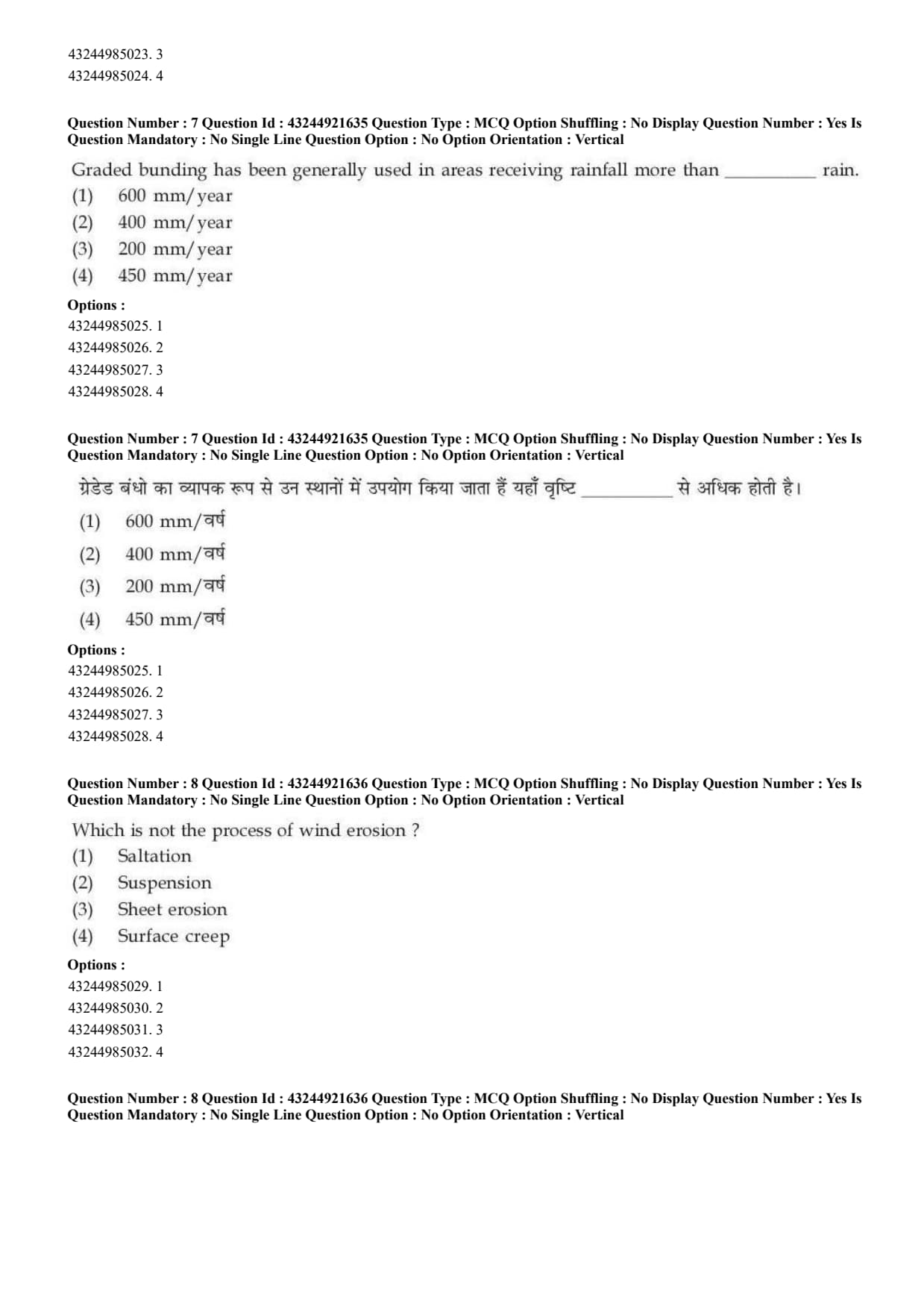
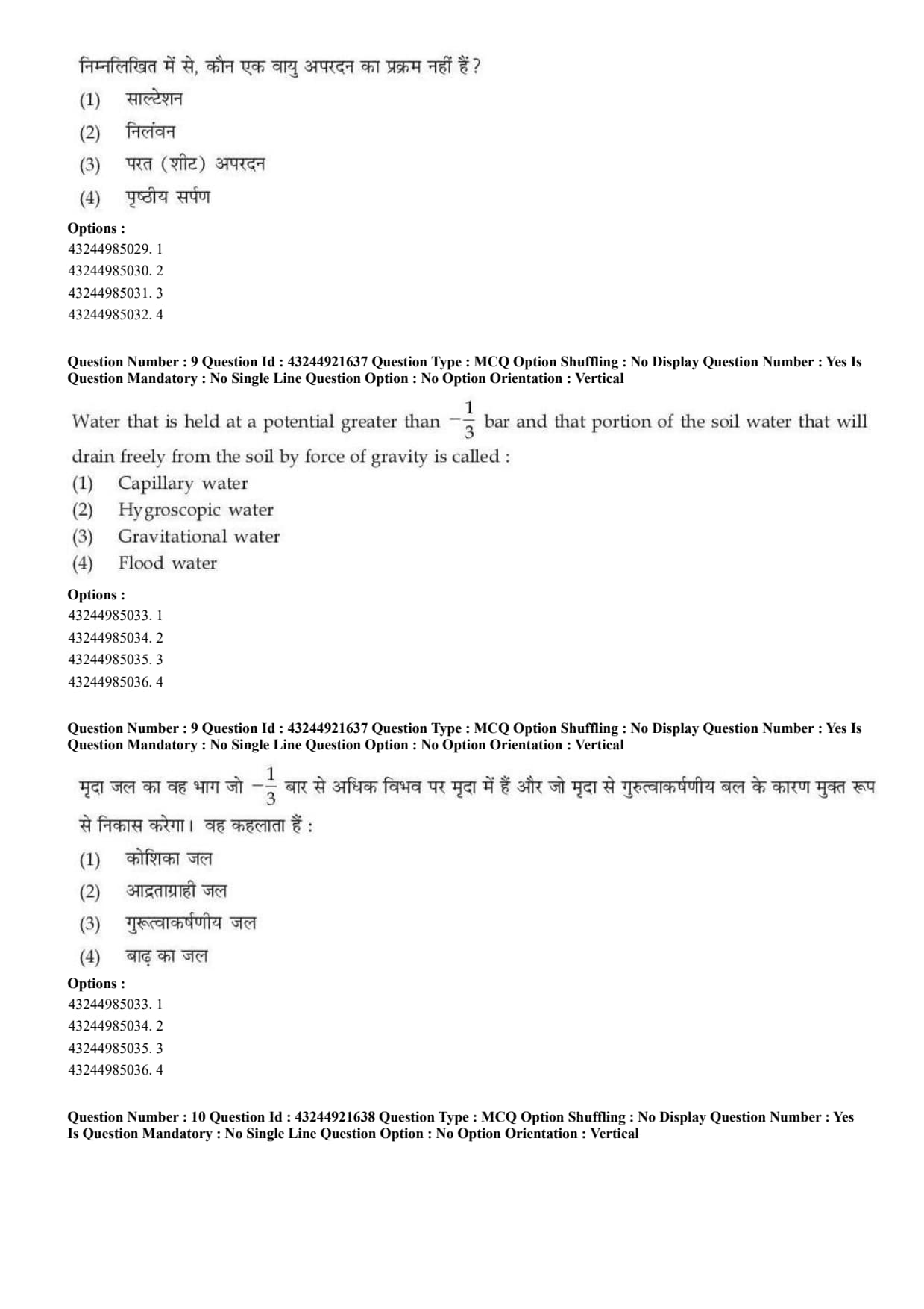
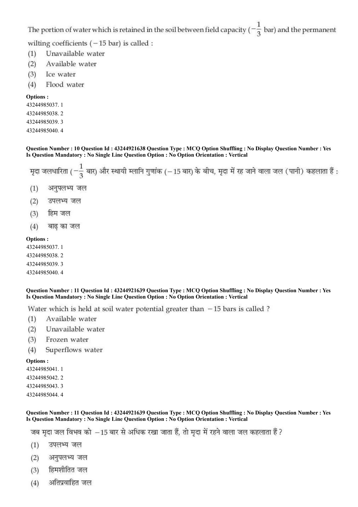
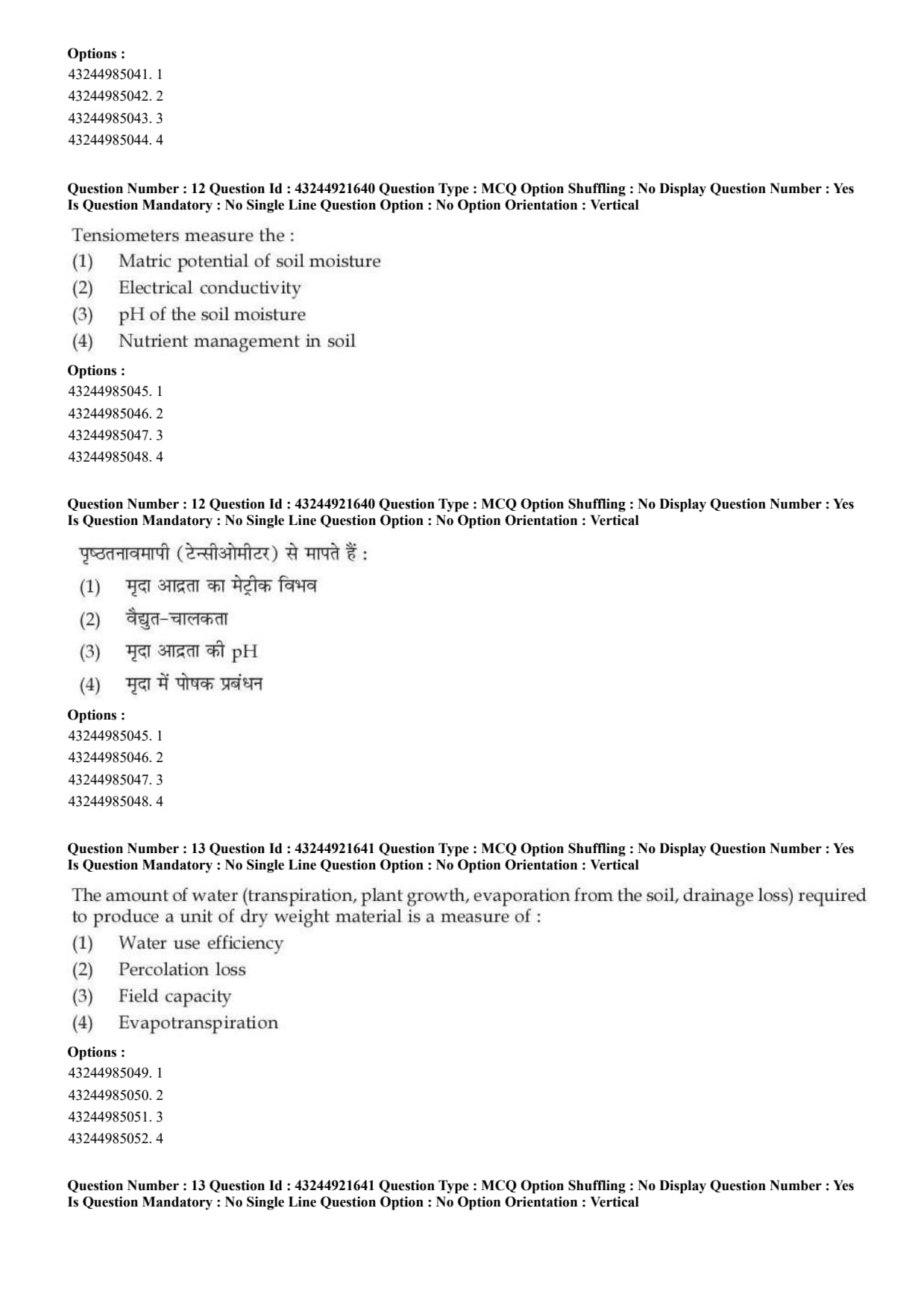
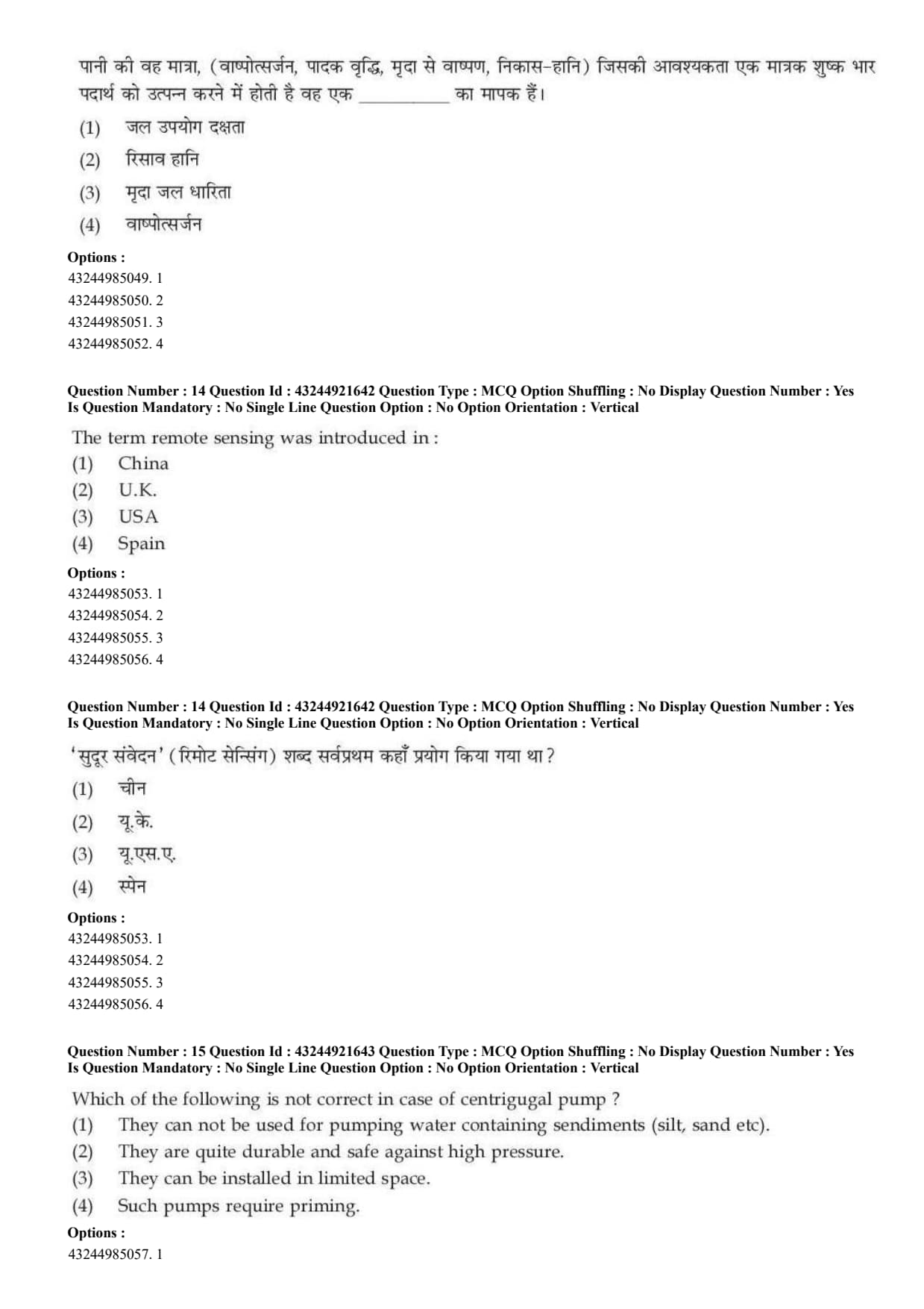
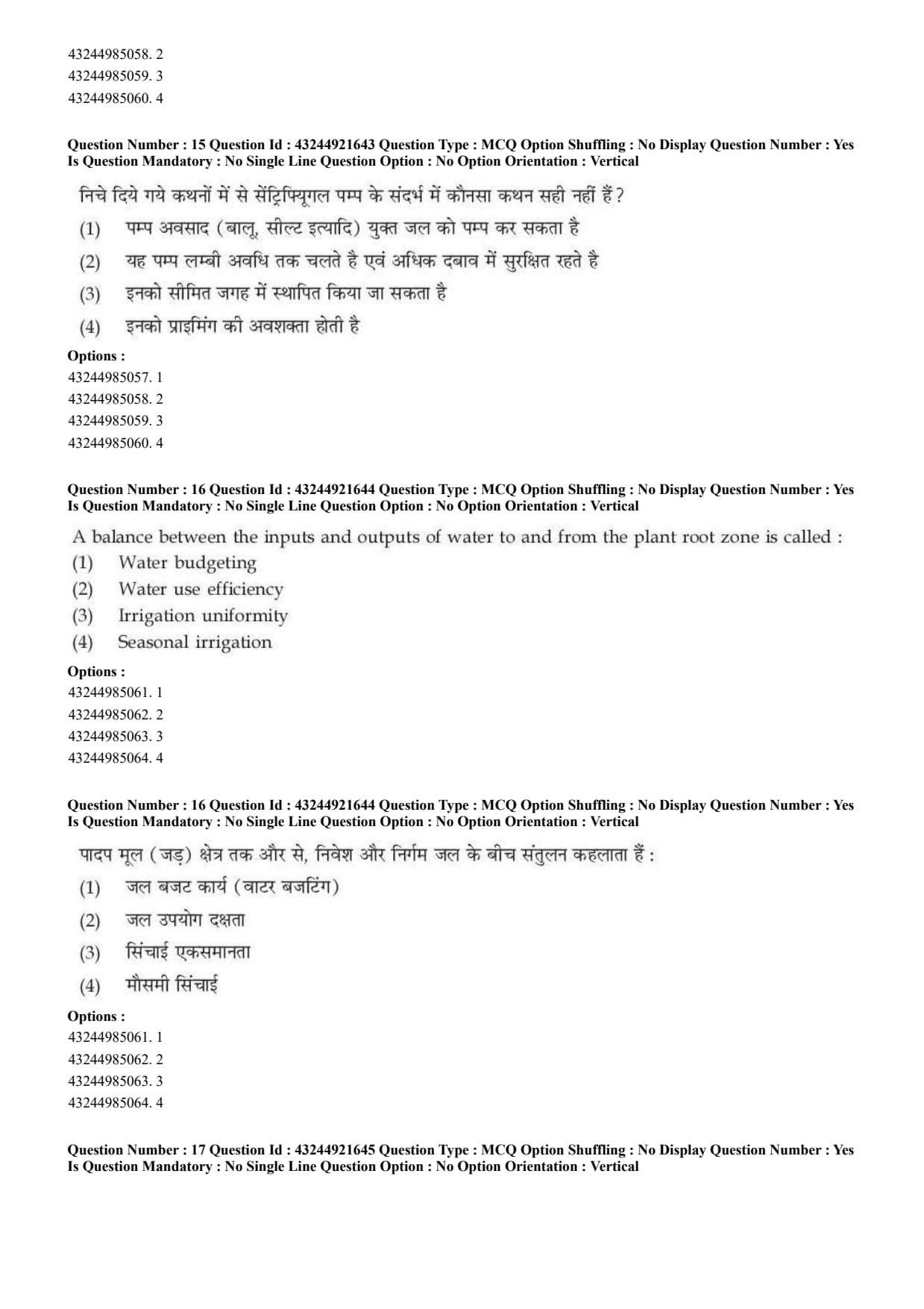
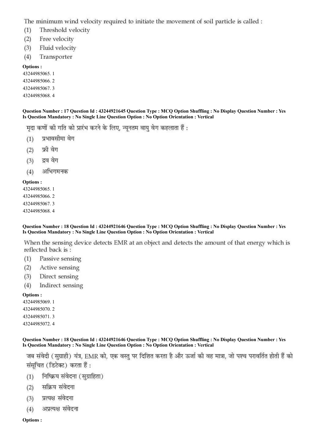
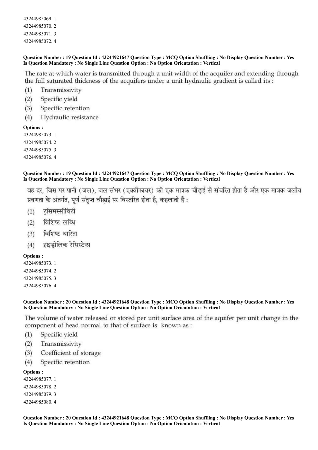
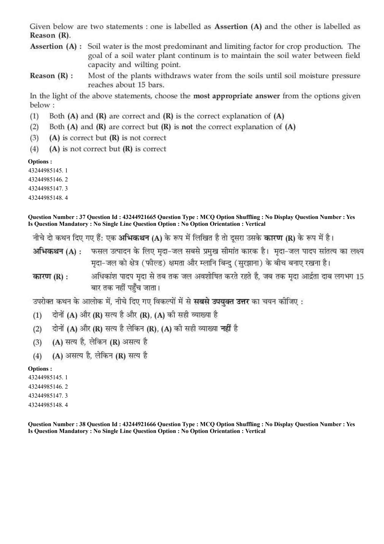
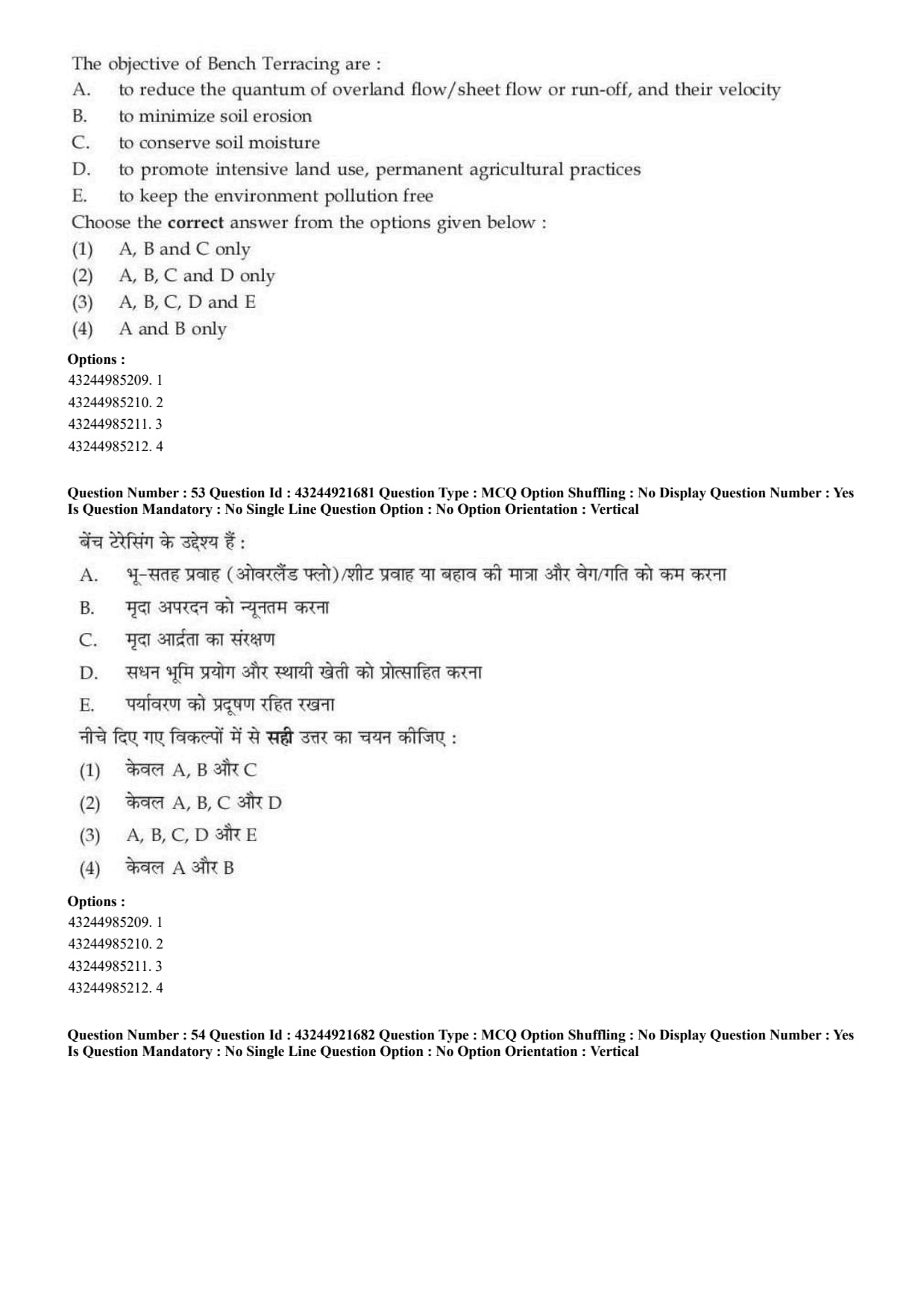
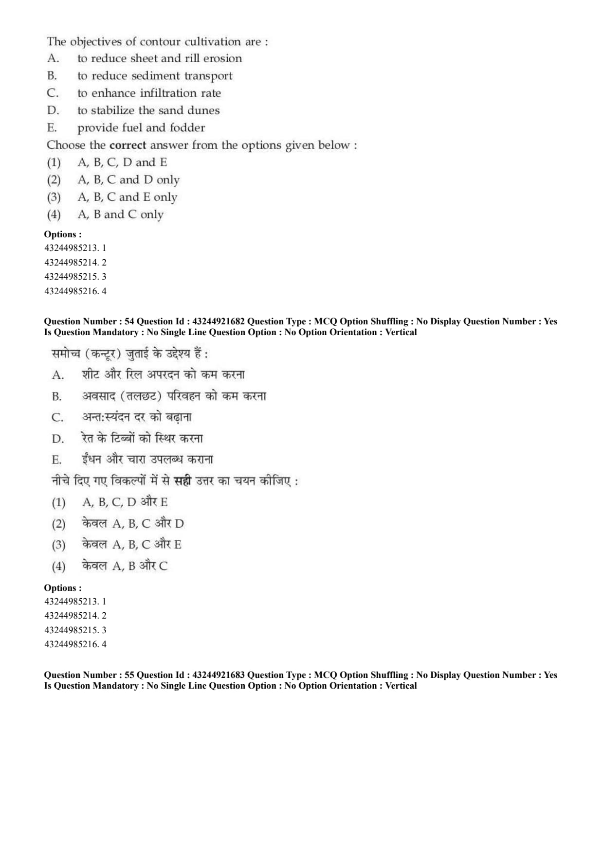
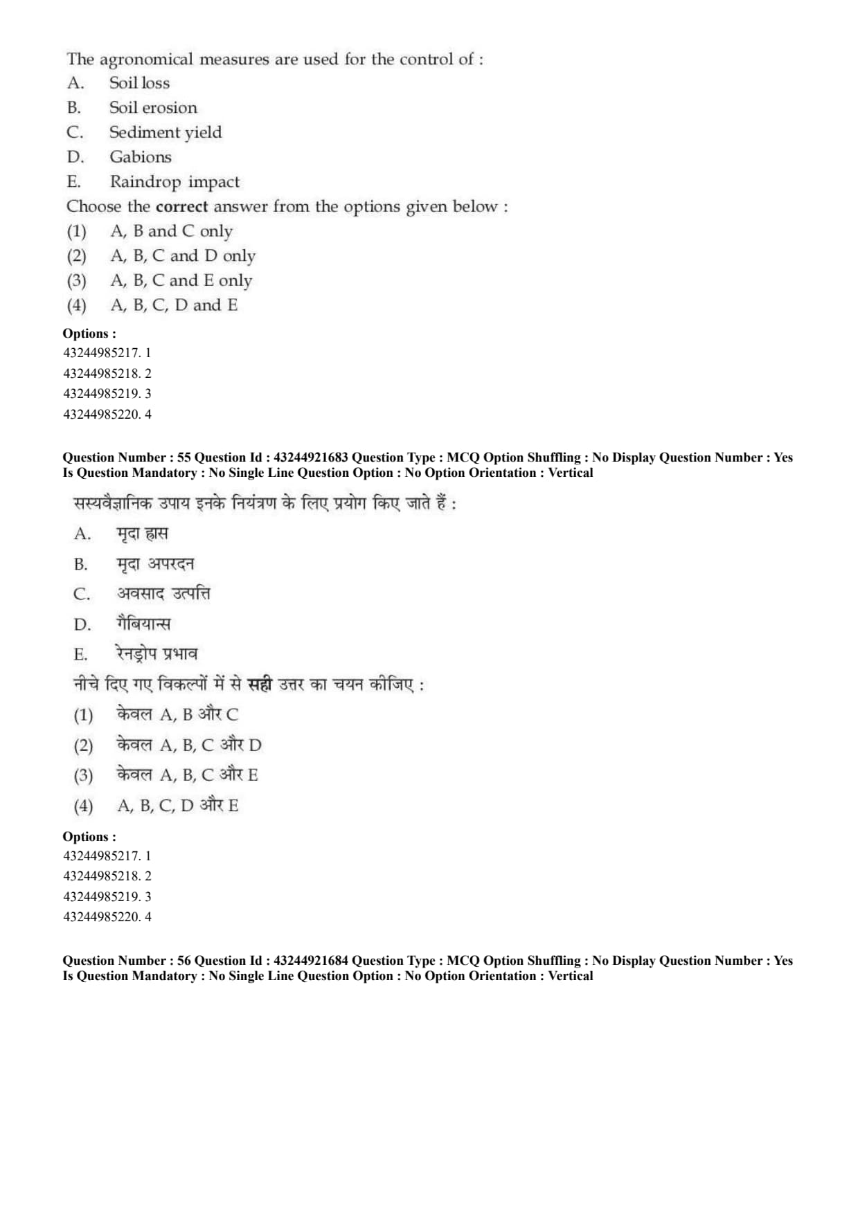
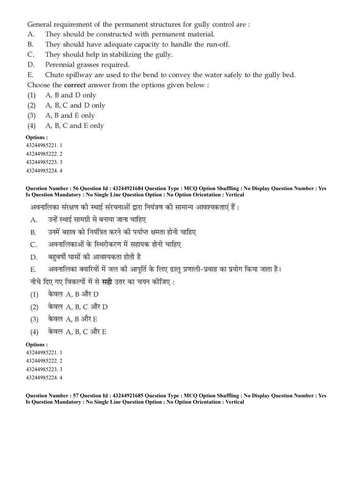
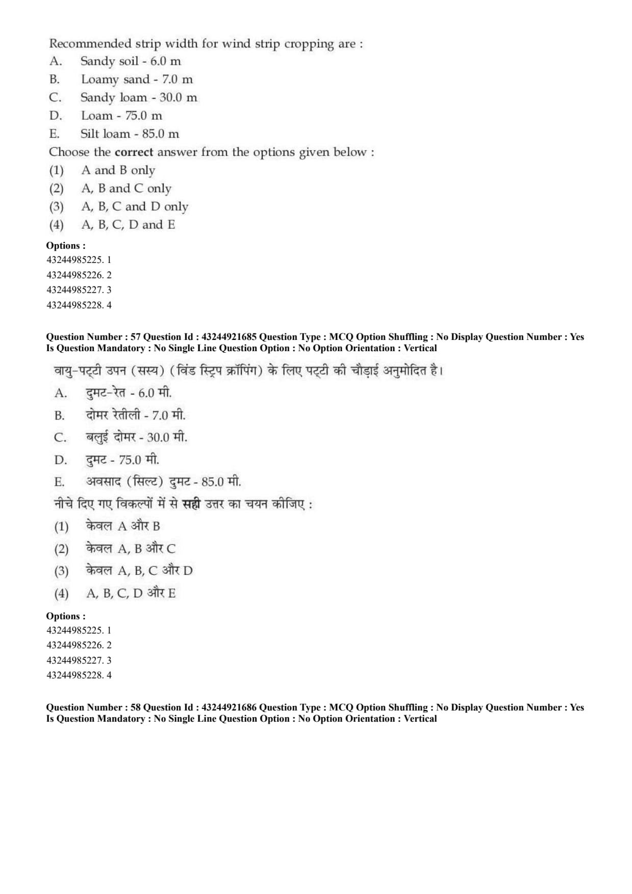
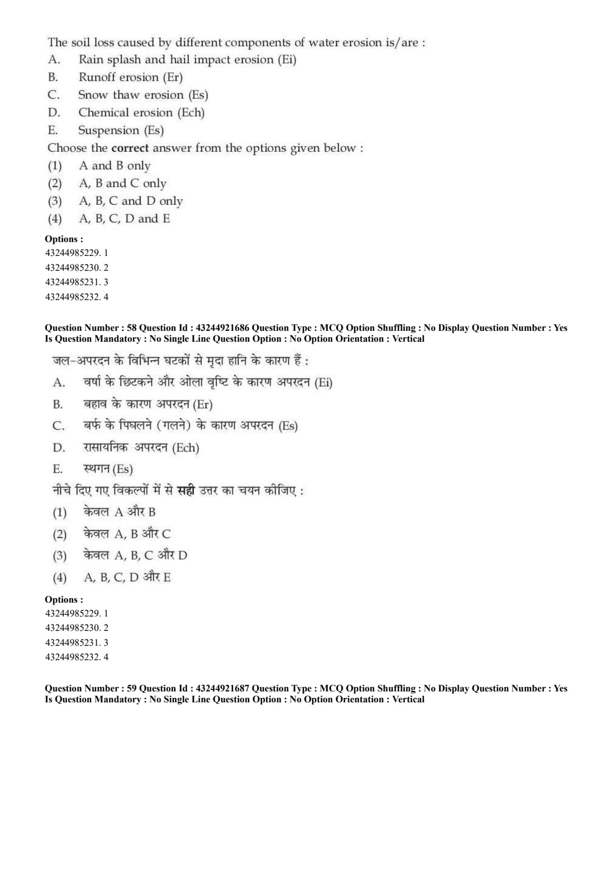
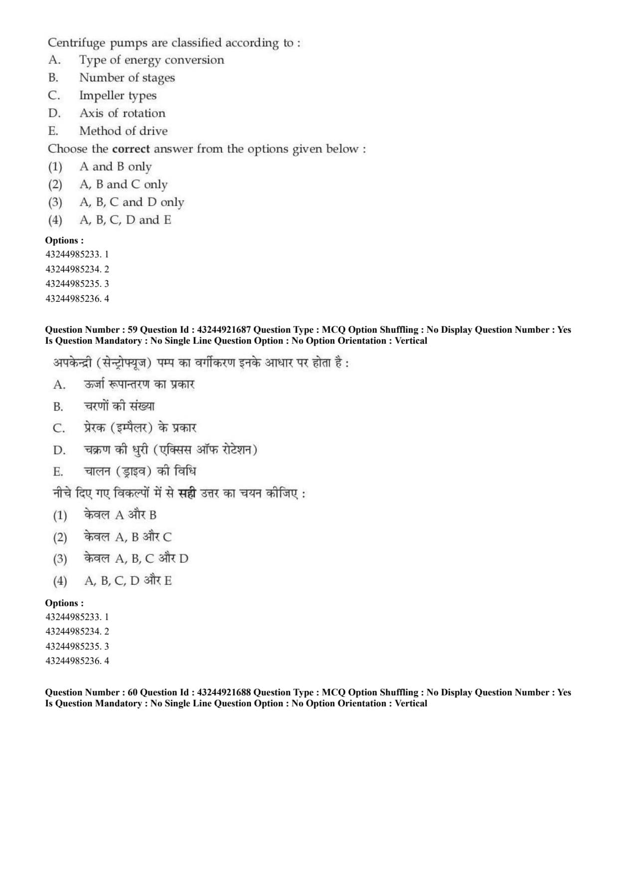
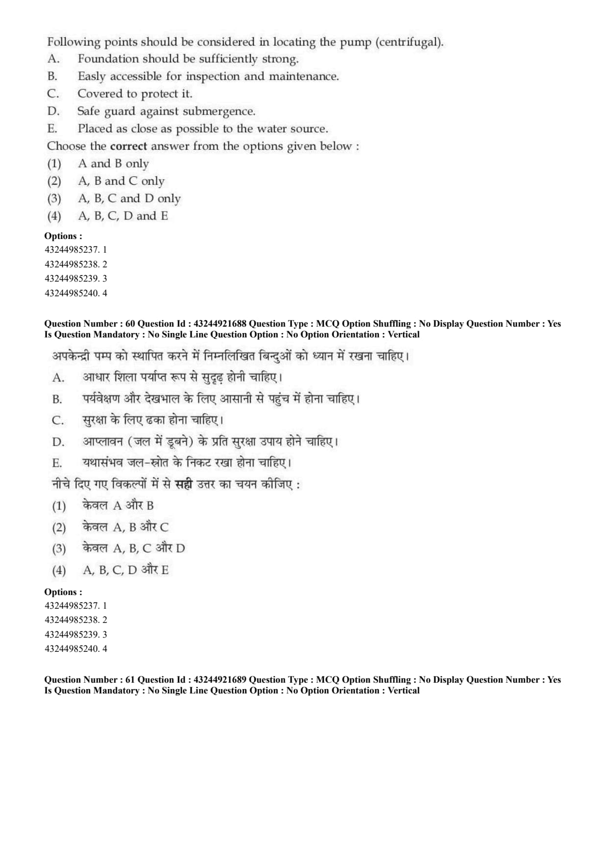
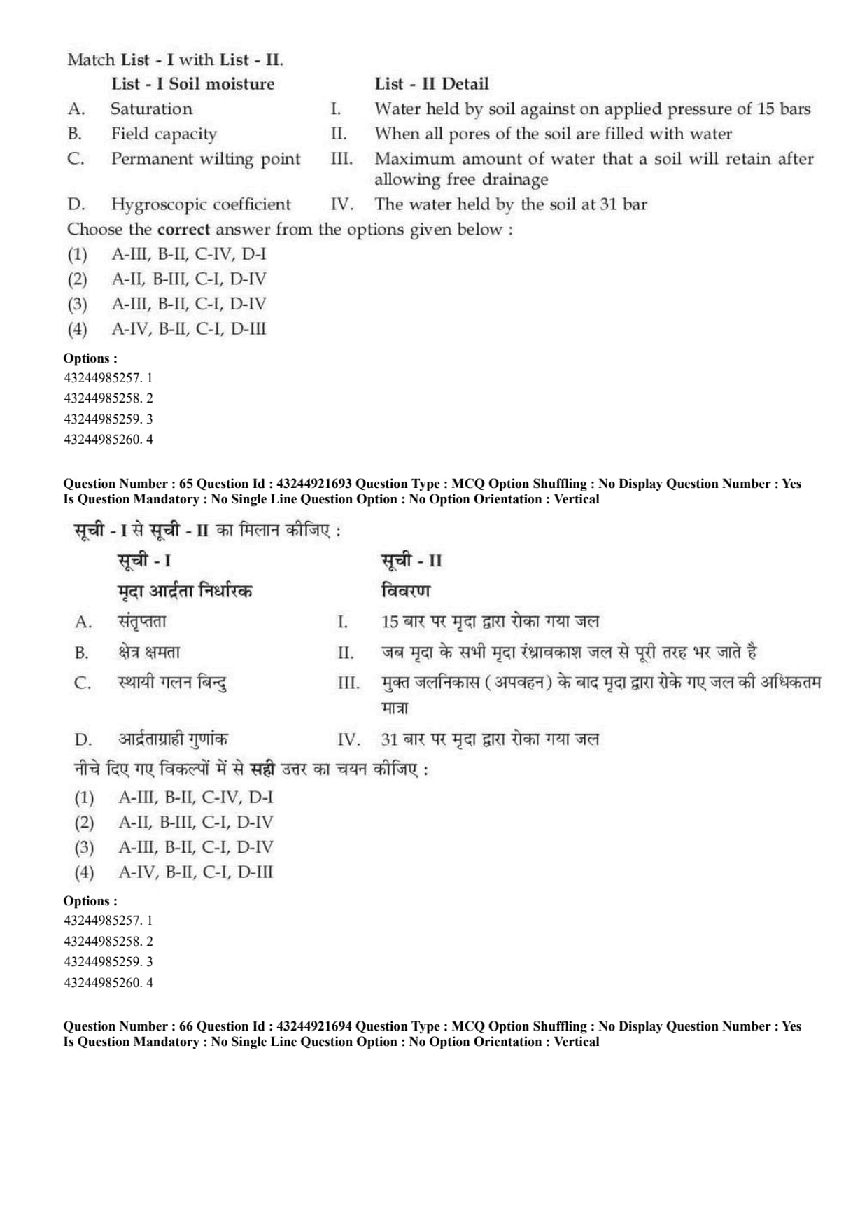
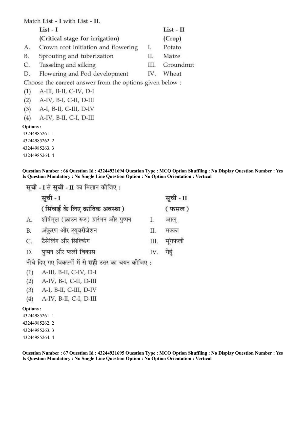
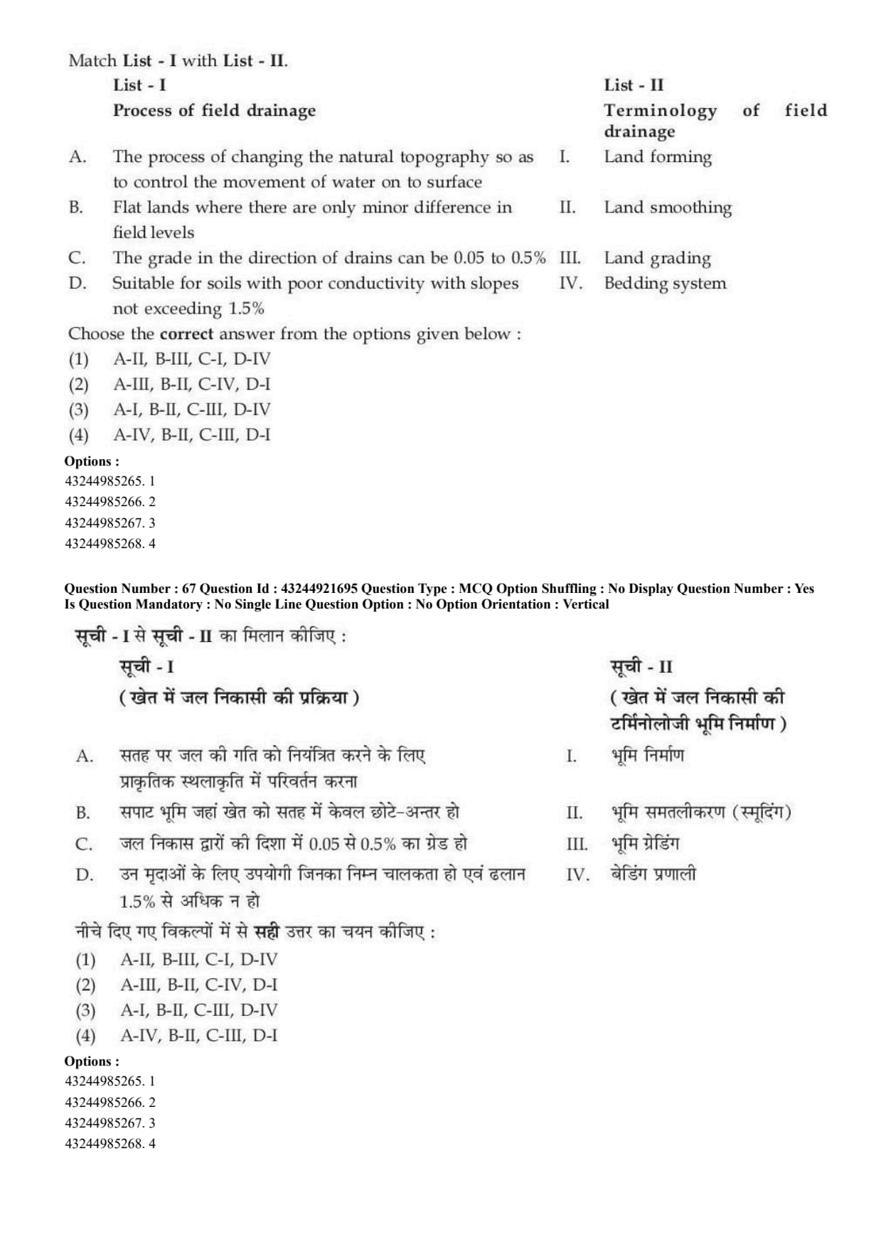
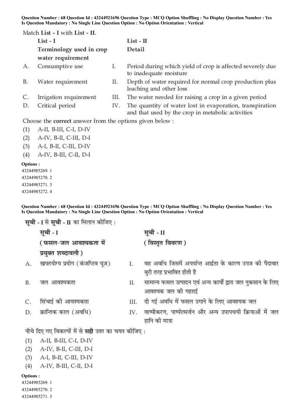
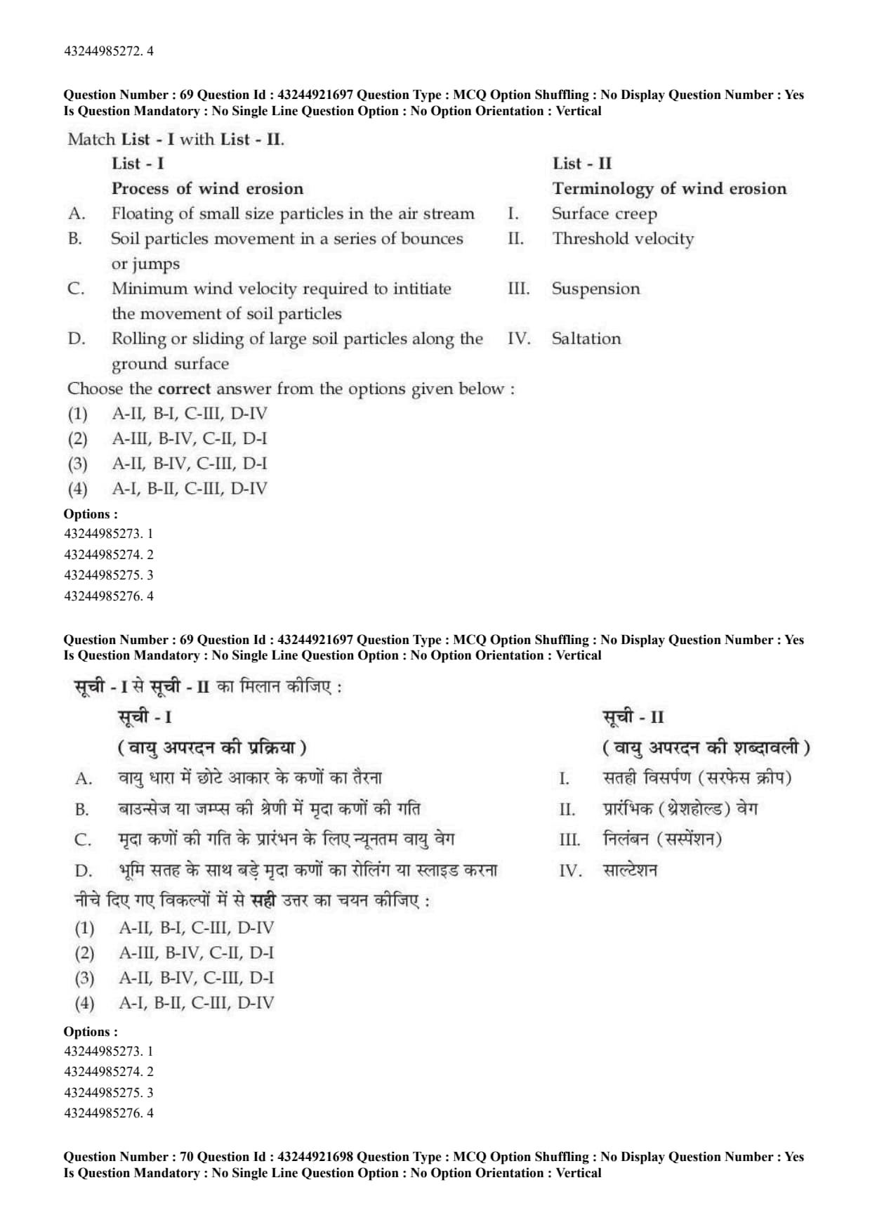
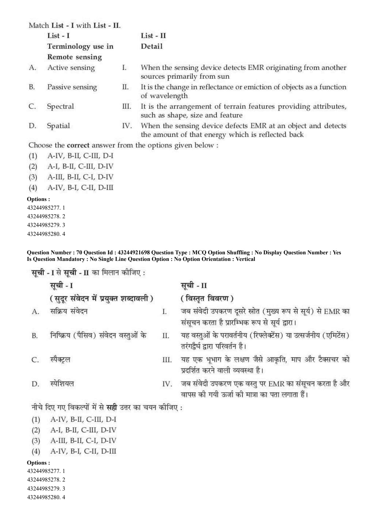
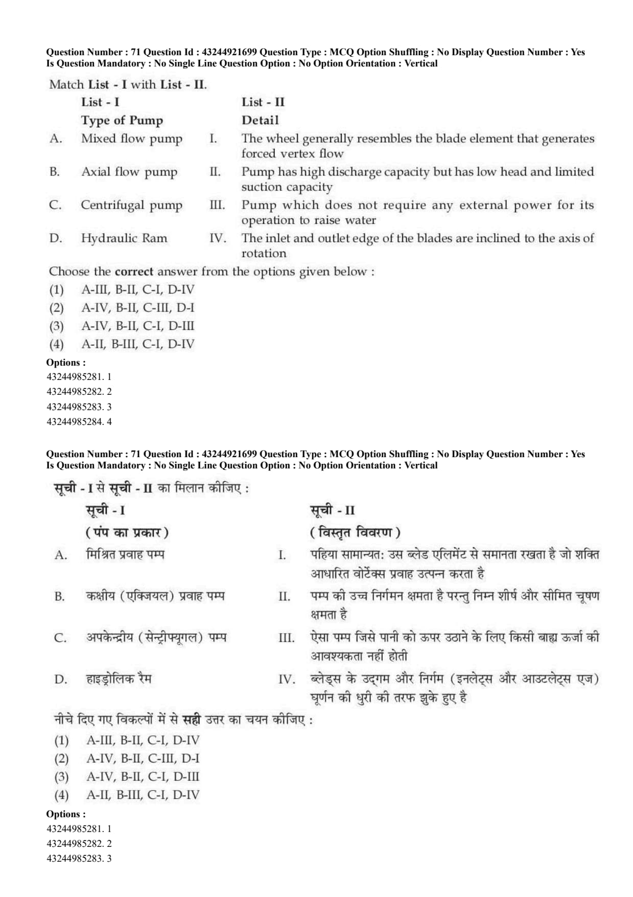
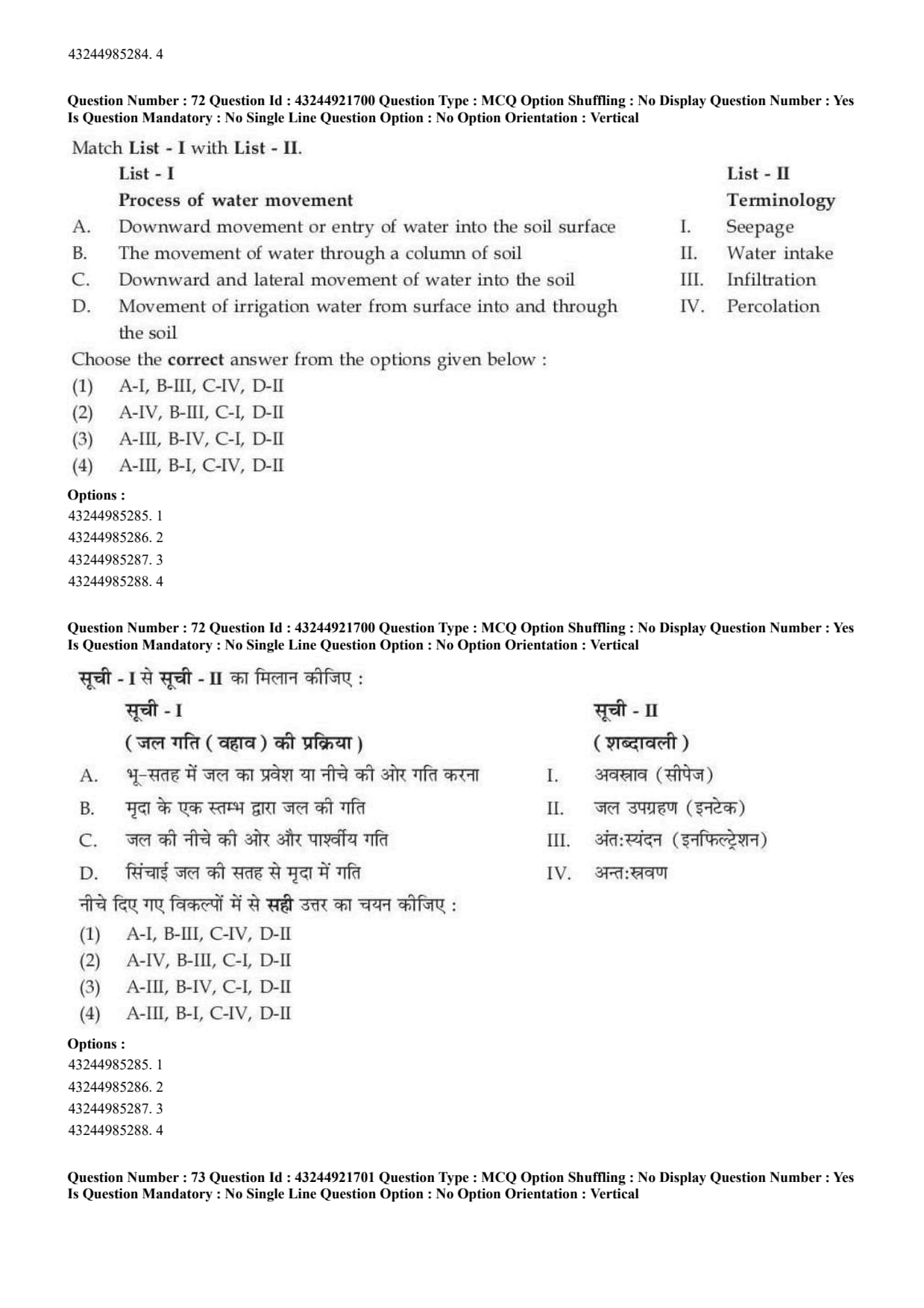
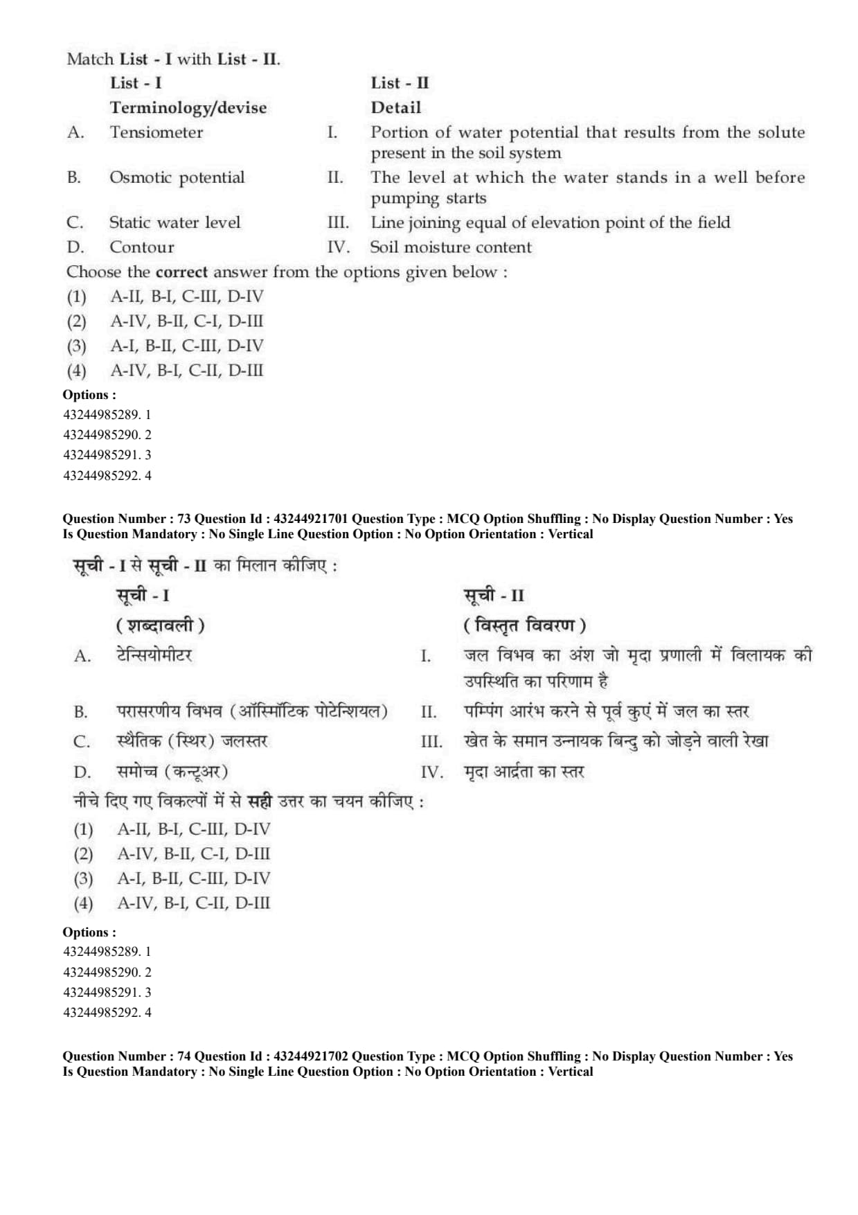
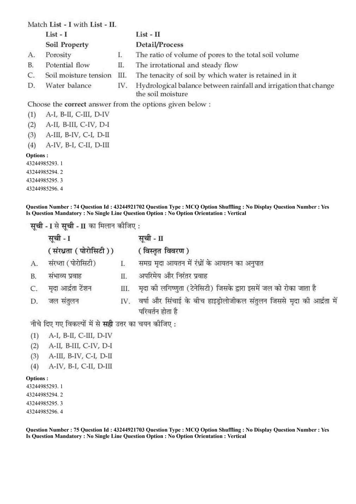
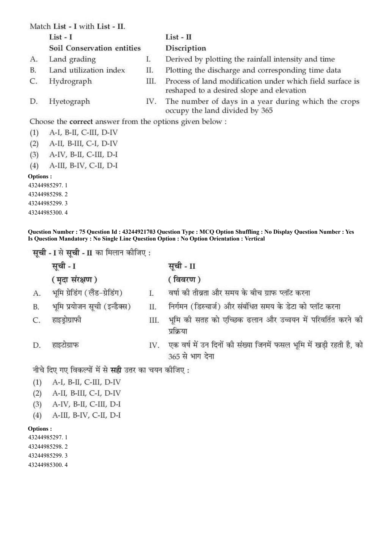
CUET PG 2026 Soil Science Question Paper is available for download here. The National Testing Agency (NTA) conducted the CUET PG 2026 Soil Science (SCQP26) examination on March 11, 2026, during Shift 1 from 09:00 AM to 10:30 AM.

CUET PG 2026 Soil Science Question Paper with Solutions PDF

CUET PG 2026 Soil Science Question Paper Download PDF Check Solutions

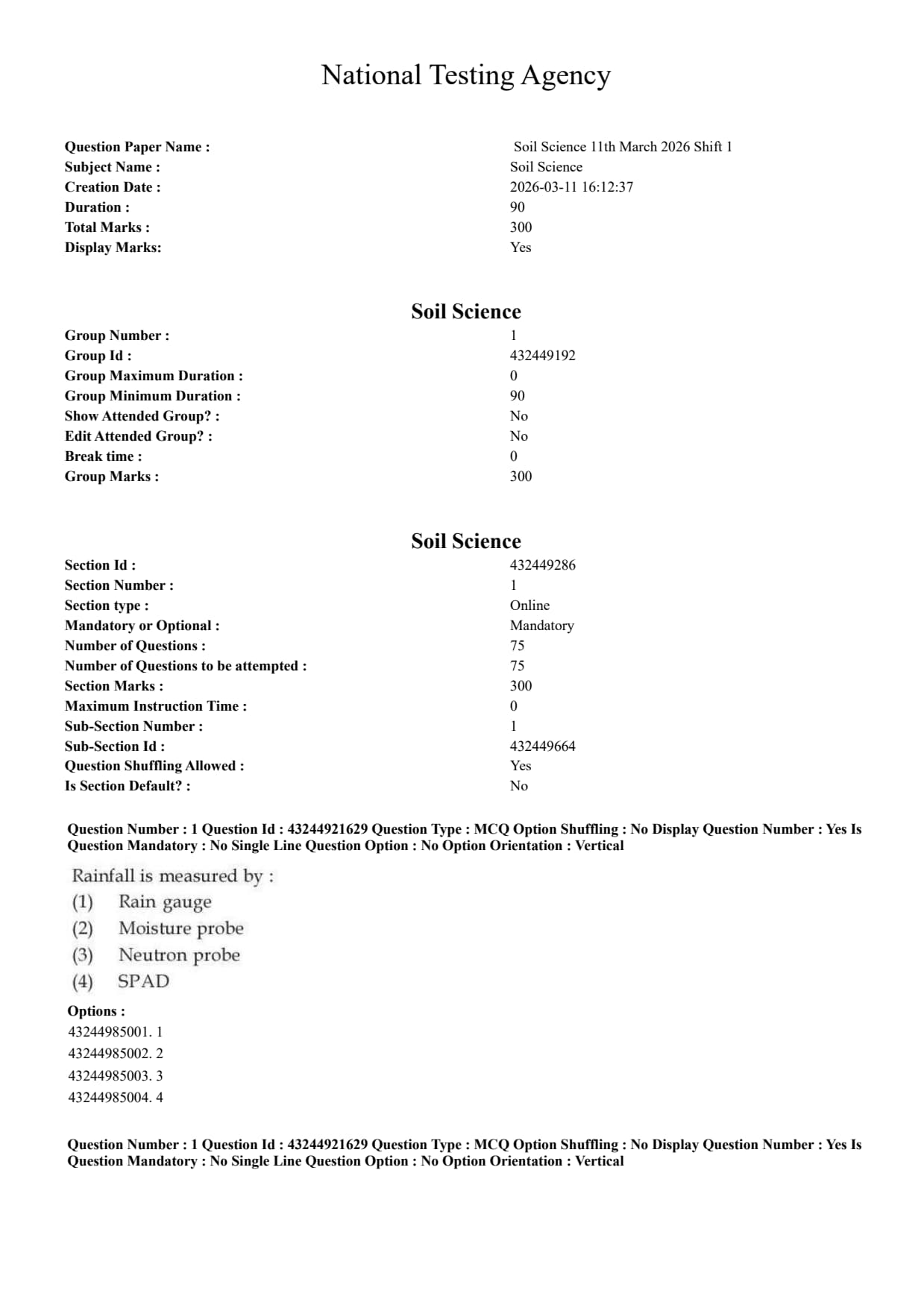
Question 1:

Rainfall is measured by:

  • (A) Rain gauge
  • (B) Moisture meter
  • (C) Neutron probe
  • (D) SPAD
Correct Answer: (A) Rain gauge
View Solution


Concept:

Rainfall is the amount of precipitation received over a particular area during a given period of time. It is usually measured in millimetres.


Step 1: Identify the required parameter.

The question asks about the instrument used to measure rainfall.
\[ Parameter=Rainfall \]


Step 2: Identify the correct instrument.

Rainfall is measured by using a rain gauge.
\[ Rainfall \rightarrow Rain gauge \]


Step 3: Eliminate other options.

Moisture meter is used for measuring moisture.

Neutron probe is used for measuring soil moisture.

SPAD meter is used for measuring leaf chlorophyll content.
\[ \therefore Correct Answer is (A) \] Quick Tip: Rainfall is measured by a rain gauge and is generally expressed in millimetres.


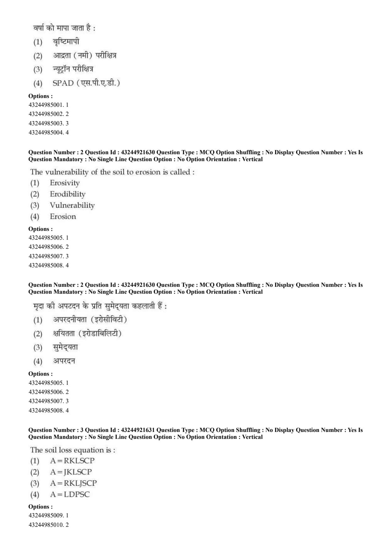
Question 2:

The vulnerability of the soil to erosion is called:

  • (A) Erosivity
  • (B) Erodibility
  • (C) Vulnerability
  • (D) Erosion
Correct Answer: (B) Erodibility
View Solution


Concept:

Soil erosion depends on both the power of the erosive agent and the susceptibility of soil to be detached and transported.


Step 1: Understand erosivity.

Erosivity refers to the ability of rainfall or wind to cause erosion.
\[ Erosivity=erosive power of rainfall or wind \]


Step 2: Understand erodibility.

Erodibility refers to the vulnerability or susceptibility of soil to erosion.
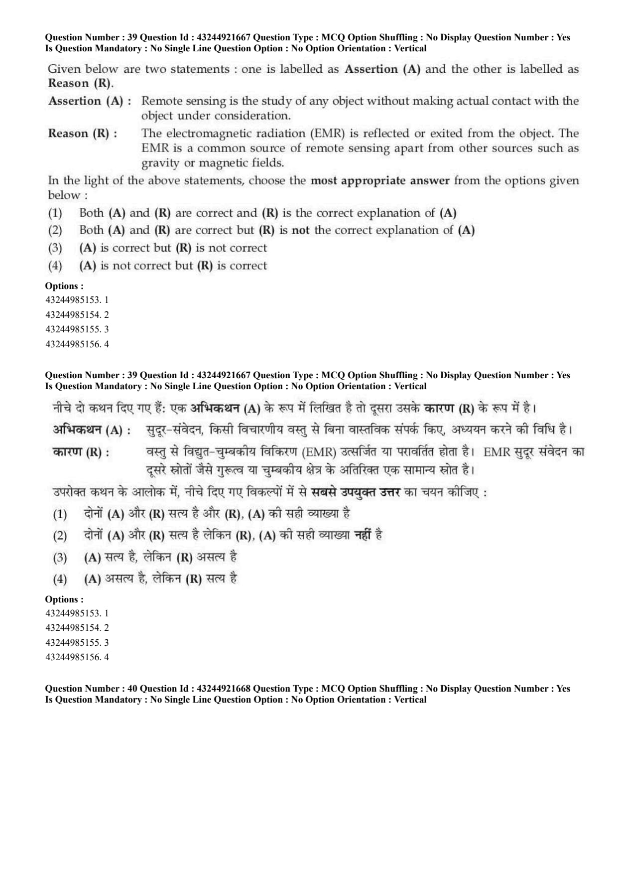
\[ Erodibility=soil's susceptibility to erosion \]


Step 3: Apply the definition.

The question asks about the vulnerability of soil to erosion.

Therefore, it is called:
\[ Erodibility \]
\[ \therefore Correct Answer is (B) \] Quick Tip: Erosivity is the power of rainfall or wind, while erodibility is the susceptibility of soil to erosion.


Question 3:

The soil loss equation is:

  • (A) \(A=RKLSCP\)
  • (B) \(A=JKLSCP\)
  • (C) \(A=RKLJSCP\)
  • (D) \(A=LDPSC\)
Correct Answer: (A) \(A=RKLSCP\)
View Solution


Concept:

The Universal Soil Loss Equation is used to estimate average annual soil loss due to water erosion.


Step 1: Write the standard equation. \[ A=R\times K\times LS\times C\times P \]


Step 2: Meaning of symbols. \[ A=average annual soil loss \] \[ R=rainfall erosivity factor \] \[ K=soil erodibility factor \] \[ LS=slope length and steepness factor \] \[ C=crop management factor \] \[ P=conservation practice factor \]


Step 3: Match with option.

The given compact form is:
\[ A=RKLSCP \]
\[ \therefore Correct Answer is (A) \] Quick Tip: USLE is \(A=RKLSCP\), where \(R\) is erosivity and \(K\) is erodibility.


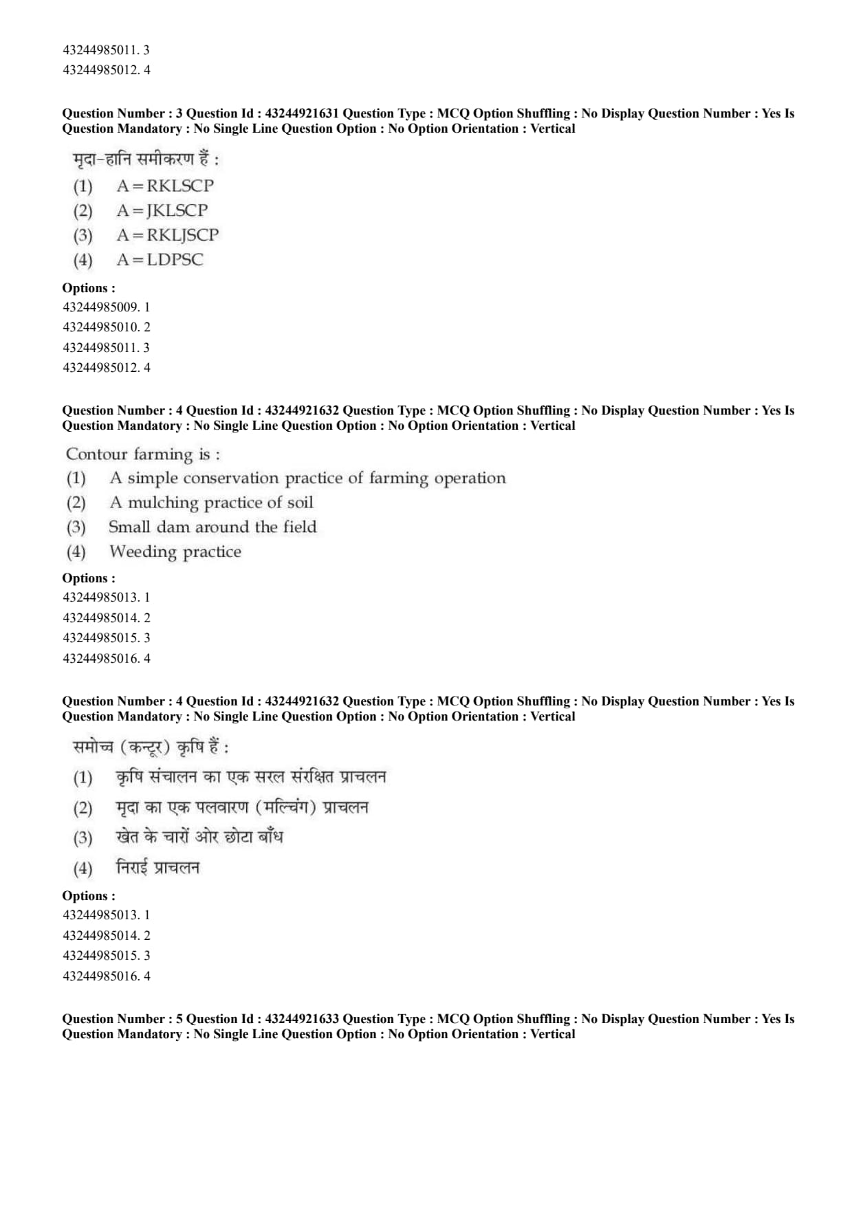
Question 4:

Contour farming is:

  • (A) A simple conservation practice of farming operation
  • (B) A mulching practice of soil
  • (C) Small dam around the field
  • (D) Weeding practice
Correct Answer: (A) A simple conservation practice of farming operation
View Solution


Concept:

Contour farming is a soil and water conservation practice used on sloping lands.


Step 1: Understand contour farming.

In contour farming, field operations such as ploughing, sowing and cultivation are done along contour lines.
\[ Contour lines=lines joining points of equal elevation \]


Step 2: Effect of contour farming.

This practice reduces the speed of runoff water and decreases soil erosion.


Step 3: Select the correct option.

Since contour farming is used to conserve soil and water, it is a simple conservation practice.
\[ \therefore Correct Answer is (A) \] Quick Tip: Contour farming means farming along contour lines to reduce runoff and soil erosion.


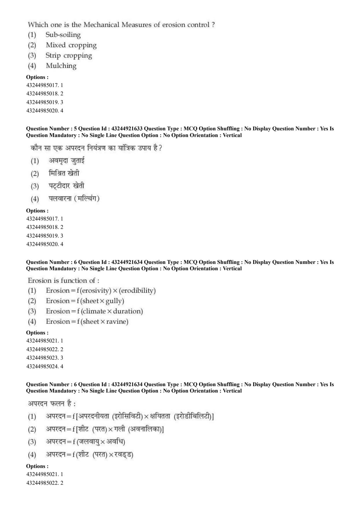
Question 5:

Which one is the mechanical measure of erosion control?

  • (A) Sub-soiling
  • (B) Mixed cropping
  • (C) Strip cropping
  • (D) Mulching
Correct Answer: (A) Sub-soiling
View Solution


Concept:

Erosion control measures may be agronomic, mechanical or vegetative. Mechanical measures involve physical modification of land or soil.


Step 1: Check sub-soiling.

Sub-soiling is a mechanical operation in which hard compact layers below the surface soil are broken using implements.
\[ Sub-soiling=mechanical measure \]


Step 2: Check other options.

Mixed cropping, strip cropping and mulching are agronomic or vegetative conservation practices.


Step 3: Final answer.

Among the given options, the mechanical measure is:
\[ Sub-soiling \]
\[ \therefore Correct Answer is (A) \] Quick Tip: Mechanical erosion control measures involve physical operations or structures; sub-soiling is one such measure.


Question 6:

Erosion is function of:

  • (A) Erosion = f(erosivity) × (erodibility)
  • (B) Erosion = f(sheet × gully)
  • (C) Erosion = f(climate × duration)
  • (D) Erosion = f(sheet × ravine)
Correct Answer: (A) Erosion \(=f(\text{erosivity})\times(\text{erodibility})\)
View Solution


Concept:

Soil erosion mainly depends on two important factors: erosivity and erodibility.


Step 1: Understand erosivity.

Erosivity is the power of rainfall, runoff or wind to cause erosion.
\[ Erosivity=erosive power of agent \]


Step 2: Understand erodibility.

Erodibility is the susceptibility of soil to erosion.
\[ Erodibility=soil vulnerability \]


Step 3: Combine both factors.

Erosion occurs when erosive force acts on erodible soil.
\[ Erosion=f(erosivity\timeserodibility) \]
\[ \therefore Correct Answer is (A) \] Quick Tip: Erosion depends on the erosive power of the agent and the erodibility of soil.


Question 7:

Graded bunding has been generally used in areas receiving rainfall more than \hspace{1cm} rain.

  • (A) \(600\ mm/year\)
  • (B) \(400\ mm/year\)
  • (C) \(200\ mm/year\)
  • (D) \(450\ mm/year\)
Correct Answer: (A) \(600\ \text{mm/year}\)
View Solution


Concept:

Bunds are soil and water conservation structures. They may be contour bunds or graded bunds depending on rainfall and drainage requirement.


Step 1: Understand graded bunding.

Graded bunds are constructed with a mild longitudinal grade so that excess runoff water can be safely drained.


Step 2: Rainfall condition.

Graded bunding is generally suitable in relatively higher rainfall areas where safe disposal of excess runoff is required.


Step 3: Select rainfall value.

It is generally used where rainfall is more than:
\[ 600\ mm/year \]
\[ \therefore Correct Answer is (A) \] Quick Tip: Graded bunds are useful in higher rainfall areas because they allow safe disposal of excess runoff.


Question 8:

Which is not the process of wind erosion?

  • (A) Saltation
  • (B) Suspension
  • (C) Sheet erosion
  • (D) Surface creep
Correct Answer: (C) Sheet erosion
View Solution


Concept:

Wind erosion involves movement of soil particles by wind through different mechanisms.


Step 1: Processes of wind erosion.

The major processes of wind erosion are:
\[ Saltation \] \[ Suspension \] \[ Surface creep \]


Step 2: Check sheet erosion.

Sheet erosion is a type of water erosion in which a thin layer of soil is removed uniformly by runoff water.


Step 3: Final answer.

Since sheet erosion is not a wind erosion process:
\[ \therefore Correct Answer is (C) \] Quick Tip: Wind erosion occurs mainly by saltation, suspension and surface creep.


Question 9:

Water that is held at a potential greater than \(-\frac{1}{3}\) bar and that portion of soil water that will drain freely from the soil by force of gravity is called:

  • (A) Capillary water
  • (B) Hygroscopic water
  • (C) Gravitational water
  • (D) Flood water
Correct Answer: (C) Gravitational water
View Solution


Concept:

Soil water is classified as gravitational water, capillary water and hygroscopic water depending on how strongly it is held by soil particles.


Step 1: Understand gravitational water.

Gravitational water is water that occupies large pores and drains freely under the force of gravity.


Step 2: Relation with field capacity.

Field capacity is around: \[ -\frac{1}{3}\ bar \]

Water held at potential greater than this drains out freely.


Step 3: Identify the type.

The freely draining water is:
\[ Gravitational water \]
\[ \therefore Correct Answer is (C) \] Quick Tip: Gravitational water drains freely from soil due to gravity and is generally not available to plants for long.


Question 10:

The portion of water which is retained in the soil between field capacity \(\left(-\frac{1}{3}\ bar\right)\) and the permanent wilting coefficient \((-15\ bar)\) is called:

  • (A) Unavailable water
  • (B) Available water
  • (C) Ice water
  • (D) Flood water
Correct Answer: (B) Available water
View Solution


Concept:

Available water is the portion of soil water that plants can absorb and use for growth.


Step 1: Field capacity.

Field capacity is the amount of water retained in soil after excess gravitational water has drained away.
\[ Field capacity\approx -\frac{1}{3}\ bar \]


Step 2: Permanent wilting point.

Permanent wilting point is the moisture level below which plants cannot recover turgidity.
\[ PWP\approx -15\ bar \]


Step 3: Available water range.

Water present between field capacity and permanent wilting point is available water.
\[ Available water=FC-PWP \]
\[ \therefore Correct Answer is (B) \] Quick Tip: Available water is the water held between field capacity and permanent wilting point.


Question 11:

Water which is held at soil water potential greater than \(-15\) bars is called:

  • (A) Available water
  • (B) Unavailable water
  • (C) Frozen water
  • (D) Superfluous water
Correct Answer: (A) Available water
View Solution


Concept:

Permanent wilting point is generally taken at about \(-15\) bars. Below this level, plants cannot extract water effectively.


Step 1: Understand the given potential.

The question says:
\[ Soil water potential greater than -15\ bars \]


Step 2: Compare with permanent wilting point.

Water above permanent wilting point is generally available to plants, especially when it lies between field capacity and wilting point.


Step 3: Final answer.

Therefore, water held at potential greater than \(-15\) bars is called:
\[ Available water \]
\[ \therefore Correct Answer is (A) \] Quick Tip: Water below \(-15\) bars is mostly unavailable; water above this limit is generally considered available.


Question 12:

Tensiometers measure the:

  • (A) Matric potential of soil moisture
  • (B) Electrical conductivity
  • (C) pH of the soil moisture
  • (D) Nutrient management in soil
Correct Answer: (A) Matric potential of soil moisture
View Solution


Concept:

A tensiometer is an instrument used to measure soil water tension or suction.


Step 1: Understand soil water tension.

Soil water tension shows how strongly water is held by soil particles.


Step 2: Relation with matric potential.

The force due to soil matrix attraction is called matric potential.
\[ Tensiometer \rightarrow Matric potential \]


Step 3: Eliminate other options.

Electrical conductivity is measured by EC meter.

Soil pH is measured by pH meter.

Nutrient management is not measured by tensiometer.
\[ \therefore Correct Answer is (A) \] Quick Tip: Tensiometer measures soil water suction or matric potential.


Question 13:

The amount of water including transpiration, plant growth, evaporation from the soil, and drainage loss required to produce a unit of dry weight material is a measure of:

  • (A) Water use efficiency
  • (B) Percolation loss
  • (C) Field capacity
  • (D) Evapotranspiration
Correct Answer: (A) Water use efficiency
View Solution


Concept:

Water use efficiency expresses the relationship between plant production and the amount of water used.


Step 1: Understand water use.

Water used by a crop includes transpiration, evaporation, drainage loss and water used in plant growth.


Step 2: Connect water use with dry matter production.

When water use is related to production of unit dry matter, it becomes a measure of water use efficiency.
\[ WUE=\frac{Dry matter or yield}{Water used} \]


Step 3: Select correct option.

The best matching term among the options is:
\[ Water use efficiency \]
\[ \therefore Correct Answer is (A) \] Quick Tip: Water use efficiency relates crop production to the amount of water used.


Question 14:

The term remote sensing was introduced in:

  • (A) China
  • (B) U.K.
  • (C) USA
  • (D) Spain
Correct Answer: (C) USA
View Solution


Concept:

Remote sensing is the science of obtaining information about objects or areas without direct physical contact.


Step 1: Understand remote sensing.

Remote sensing uses electromagnetic radiation reflected or emitted from the surface.


Step 2: Origin of the term.

The term remote sensing was introduced in the USA.
\[ Remote sensing term \rightarrow USA \]


Step 3: Final answer. \[ \therefore Correct Answer is (C) \] Quick Tip: Remote sensing means collecting information without direct contact with the object.


Question 15:

Which of the following is not correct in case of centrifugal pump?

  • (A) They cannot be used for pumping water containing sediments like silt and sand
  • (B) They are quite durable and safe against high pressure
  • (C) They can be installed in limited space
  • (D) Such pumps require priming
Correct Answer: (B) They are quite durable and safe against high pressure
View Solution


Concept:

Centrifugal pumps are commonly used pumps for irrigation and water lifting. They operate by converting mechanical energy into kinetic energy and then into pressure energy.


Step 1: Check sediment condition.

Centrifugal pumps are generally not suitable for pumping water containing large amounts of silt and sand because sediments may damage the pump parts.
\[ (A) is correct \]


Step 2: Check installation space.

Centrifugal pumps are compact and can be installed in limited space.
\[ (C) is correct \]


Step 3: Check priming.

Most centrifugal pumps require priming before starting.
\[ (D) is correct \]


Step 4: Identify the incorrect statement.

The statement that centrifugal pumps are safe against high pressure is not the most correct general statement, because they are generally used for low to moderate head conditions.
\[ \therefore Correct Answer is (B) \] Quick Tip: Centrifugal pumps usually require priming and are not ideal for muddy or sediment-laden water.


Question 16:

A balance between the inputs and outputs of water to and from the plant root zone is called:

  • (A) Water budgeting
  • (B) Water use efficiency
  • (C) Irrigation uniformity
  • (D) Seasonal irrigation
Correct Answer: (A) Water budgeting
View Solution


Concept:

Water budgeting is the accounting of water inputs and outputs in a soil-plant system.


Step 1: Identify water inputs.

Water inputs may include:
\[ Rainfall \] \[ Irrigation \]


Step 2: Identify water outputs.

Water outputs may include:
\[ Evaporation \] \[ Transpiration \] \[ Runoff \] \[ Percolation \]


Step 3: Define the balance.

The balance between water input and water output in the root zone is called water budgeting.
\[ \therefore Correct Answer is (A) \] Quick Tip: Water budgeting means accounting of water inputs and outputs in the crop root zone.


Question 17:

The minimum wind velocity required to initiate the movement of soil particle is called:

  • (A) Threshold velocity
  • (B) Free velocity
  • (C) Fluid velocity
  • (D) Transporter
Correct Answer: (A) Threshold velocity
View Solution


Concept:

Wind erosion begins only when wind speed becomes strong enough to detach and move soil particles.


Step 1: Understand the condition.

Soil particles do not move at very low wind velocity.


Step 2: Define threshold velocity.

The minimum wind velocity needed to start movement of soil particles is called threshold velocity.
\[ Threshold velocity=minimum velocity for particle movement \]


Step 3: Final answer. \[ \therefore Correct Answer is (A) \] Quick Tip: Threshold velocity is the minimum wind speed required to start soil particle movement.


Question 18:

When the sensor detects EMR at an object and detects the amount of that energy which is reflected back, it is:

  • (A) Passive sensing
  • (B) Active sensing
  • (C) Direct sensing
  • (D) Indirect sensing
Correct Answer: (A) Passive sensing
View Solution


Concept:

Remote sensing may be active or passive depending on the source of electromagnetic radiation.


Step 1: Passive sensing.

Passive sensors detect naturally available radiation reflected or emitted by objects.
\[ Passive sensing=detects reflected natural EMR \]


Step 2: Active sensing.

Active sensors send their own energy towards the object and then measure the returned signal.
\[ Active sensing=sensor provides its own energy \]


Step 3: Apply the statement.

The question says the sensor detects EMR reflected back from the object. This matches passive sensing.
\[ \therefore Correct Answer is (A) \] Quick Tip: Passive sensing uses naturally reflected or emitted radiation, while active sensing sends its own energy.


Question 19:

The rate at which water is transmitted through a unit width of the aquifer and extending through the full saturated thickness of the aquifer under a unit hydraulic gradient is called its:

  • (A) Transmissivity
  • (B) Specific yield
  • (C) Specific retention
  • (D) Hydraulic resistance
Correct Answer: (A) Transmissivity
View Solution


Concept:

Aquifer properties describe how water is stored and transmitted underground.


Step 1: Understand transmissivity.

Transmissivity is the rate at which water is transmitted through a unit width of an aquifer under a unit hydraulic gradient.


Step 2: Mathematical meaning.

Transmissivity is related to hydraulic conductivity and saturated thickness:
\[ T=K b \]

where, \[ K=hydraulic conductivity \] \[ b=saturated thickness of aquifer \]


Step 3: Select the correct option.

The definition given in the question is exactly the definition of transmissivity.
\[ \therefore Correct Answer is (A) \] Quick Tip: Transmissivity describes how much water an aquifer can transmit through its saturated thickness.


Question 20:

The volume of water released or stored per unit surface area of the aquifer per unit change in the component of head normal to that surface is known as:

  • (A) Specific yield
  • (B) Transmissivity
  • (C) Coefficient of storage
  • (D) Specific retention
Correct Answer: (C) Coefficient of storage
View Solution


Concept:

Storage properties of an aquifer describe how much water is released from or taken into storage due to change in hydraulic head.


Step 1: Understand coefficient of storage.

Coefficient of storage is the volume of water that an aquifer releases from or takes into storage per unit surface area per unit change in head.


Step 2: Compare with transmissivity.

Transmissivity describes water transmission, not storage.
\[ Transmissivity \rightarrow movement of water \]


Step 3: Compare with specific yield and specific retention.

Specific yield is the water actually drained by gravity from saturated soil or rock.

Specific retention is the water retained against gravity.


Step 4: Final answer.

The definition given in the question matches:
\[ Coefficient of storage \]
\[ \therefore Correct Answer is (C) \] Quick Tip: Coefficient of storage tells how much water an aquifer releases or stores due to change in hydraulic head.


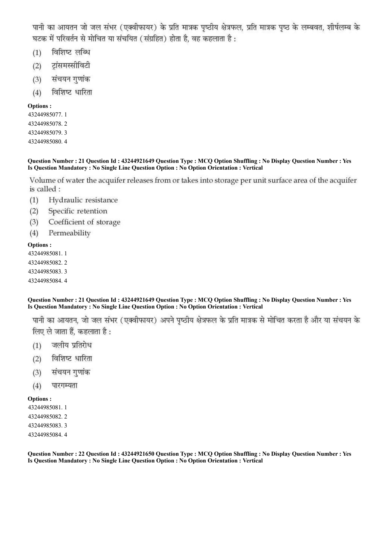
Question 21:

Volume of water the aquifer releases from or takes into storage per unit surface area of the aquifer is called:

  • (A) Hydraulic resistance
  • (B) Specific retention
  • (C) Coefficient of storage
  • (D) Permeability
Correct Answer: (C) Coefficient of storage
View Solution


Concept:

Aquifer storage properties explain how much water an aquifer can release or store.


Step 1: Understand the meaning of coefficient of storage.

Coefficient of storage is related to the volume of water released from or taken into storage by an aquifer.
\[ Coefficient of storage=water released or stored per unit aquifer area \]


Step 2: Compare with other options.

Hydraulic resistance is related to opposition to water flow.

Specific retention is the water retained by soil or rock against gravity.

Permeability is the ability of soil or rock to transmit water.


Step 3: Final answer.

The term given in the question matches coefficient of storage.
\[ \therefore Correct Answer is (C) \] Quick Tip: Coefficient of storage describes the water released from or stored in an aquifer per unit area.


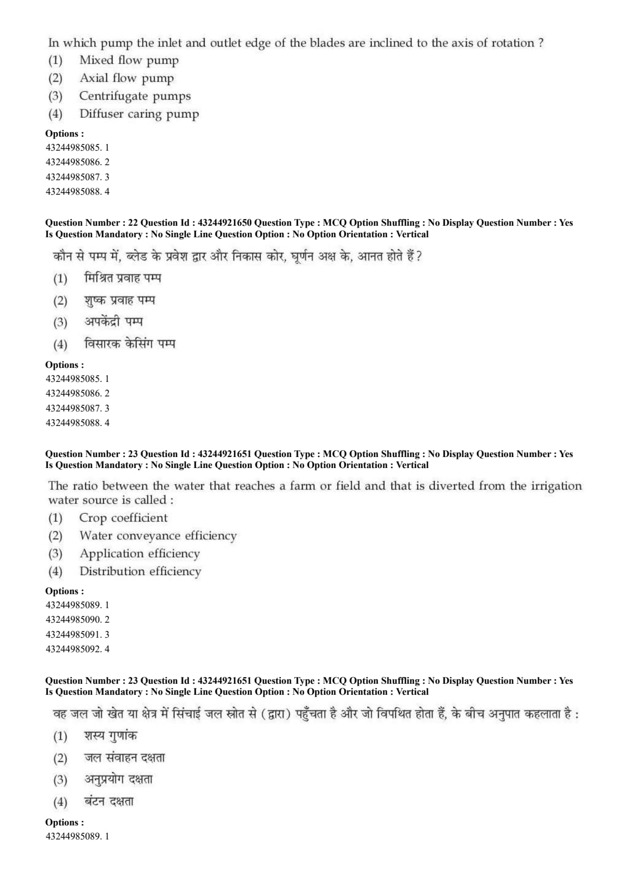
Question 22:

In which pump the inlet and outlet edge of the blades are inclined to the axis of rotation?

  • (A) Mixed flow pump
  • (B) Axial flow pump
  • (C) Centrifugal pumps
  • (D) Diffuser casing pump
Correct Answer: (A) Mixed flow pump
View Solution


Concept:

Pumps are classified according to the direction of flow of water through the impeller.


Step 1: Understand mixed flow pump.

In a mixed flow pump, water moves partly in axial direction and partly in radial direction.


Step 2: Blade arrangement.

In mixed flow pumps, the inlet and outlet edges of the blades are inclined to the axis of rotation.
\[ Inclined blade edges \Rightarrow Mixed flow pump \]


Step 3: Compare with other pumps.

In axial flow pumps, flow is mainly parallel to the axis.

In centrifugal pumps, flow is mainly radial.


Therefore, the correct pump is:
\[ Mixed flow pump \]
\[ \therefore Correct Answer is (A) \] Quick Tip: Mixed flow pump has both axial and radial flow characteristics.


Question 23:

The ratio between the water that reaches a farm or field and that is diverted from the irrigation water source is called:

  • (A) Crop coefficient
  • (B) Water conveyance efficiency
  • (C) Application efficiency
  • (D) Distribution efficiency
Correct Answer: (B) Water conveyance efficiency
View Solution


Concept:

Irrigation efficiency describes how effectively water is conveyed, applied, and distributed in the field.


Step 1: Understand conveyance efficiency.

Water conveyance efficiency compares water delivered to the field with water diverted from the source.
\[ E_c=\frac{Water delivered to field}{Water diverted from source}\times100 \]


Step 2: Identify the given definition.

The question states the ratio of water reaching the farm or field to the water diverted from the irrigation source.


This exactly represents:
\[ Water conveyance efficiency \]


Step 3: Final answer.
\[ \therefore Correct Answer is (B) \] Quick Tip: Conveyance efficiency measures water loss during transport from source to field.


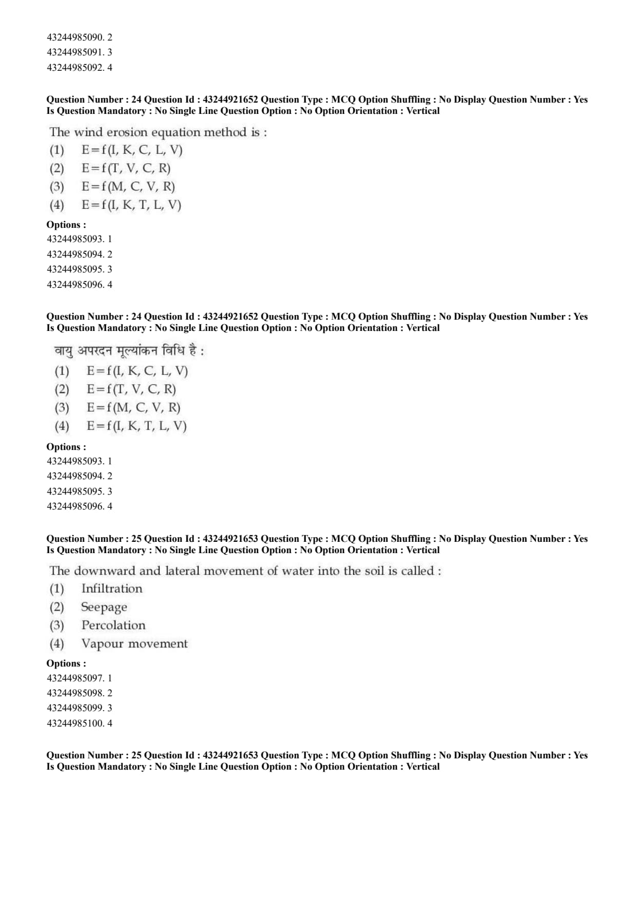
Question 24:

The wind erosion equation method is:

  • (A) \(E=f(I,K,C,L,V)\)
  • (B) \(E=f(T,V,C,R)\)
  • (C) \(E=f(M,C,V,R)\)
  • (D) \(E=f(I,K,T,L,V)\)
Correct Answer: (A) \(E=f(I,K,C,L,V)\)
View Solution


Concept:

Wind erosion equation is used to estimate soil loss caused by wind erosion.


Step 1: Write the wind erosion equation.

The wind erosion equation is expressed as:
\[ E=f(I,K,C,L,V) \]


Step 2: Meaning of terms. \[ E=estimated soil loss by wind erosion \] \[ I=soil erodibility factor \] \[ K=soil ridge roughness factor \] \[ C=climatic factor \] \[ L=unsheltered distance \] \[ V=vegetative cover factor \]


Step 3: Match with options.

The correct form given in the options is:
\[ E=f(I,K,C,L,V) \]
\[ \therefore Correct Answer is (A) \] Quick Tip: Wind erosion equation is commonly represented as \(E=f(I,K,C,L,V)\).


Question 25:

The downward and lateral movement of water into the soil is called:

  • (A) Infiltration
  • (B) Seepage
  • (C) Percolation
  • (D) Vapour movement
Correct Answer: (B) Seepage
View Solution


Concept:

Water movement in soil may occur in different directions and by different processes.


Step 1: Understand infiltration.

Infiltration is the entry of water into the soil surface.


Step 2: Understand percolation.

Percolation is mainly the downward movement of water through soil layers.


Step 3: Understand seepage.

Seepage refers to downward and lateral movement of water through soil or porous material.
\[ Downward and lateral movement=Seepage \]


Step 4: Final answer.
\[ \therefore Correct Answer is (B) \] Quick Tip: Infiltration means entry into soil, percolation means downward movement, and seepage includes downward and lateral movement.


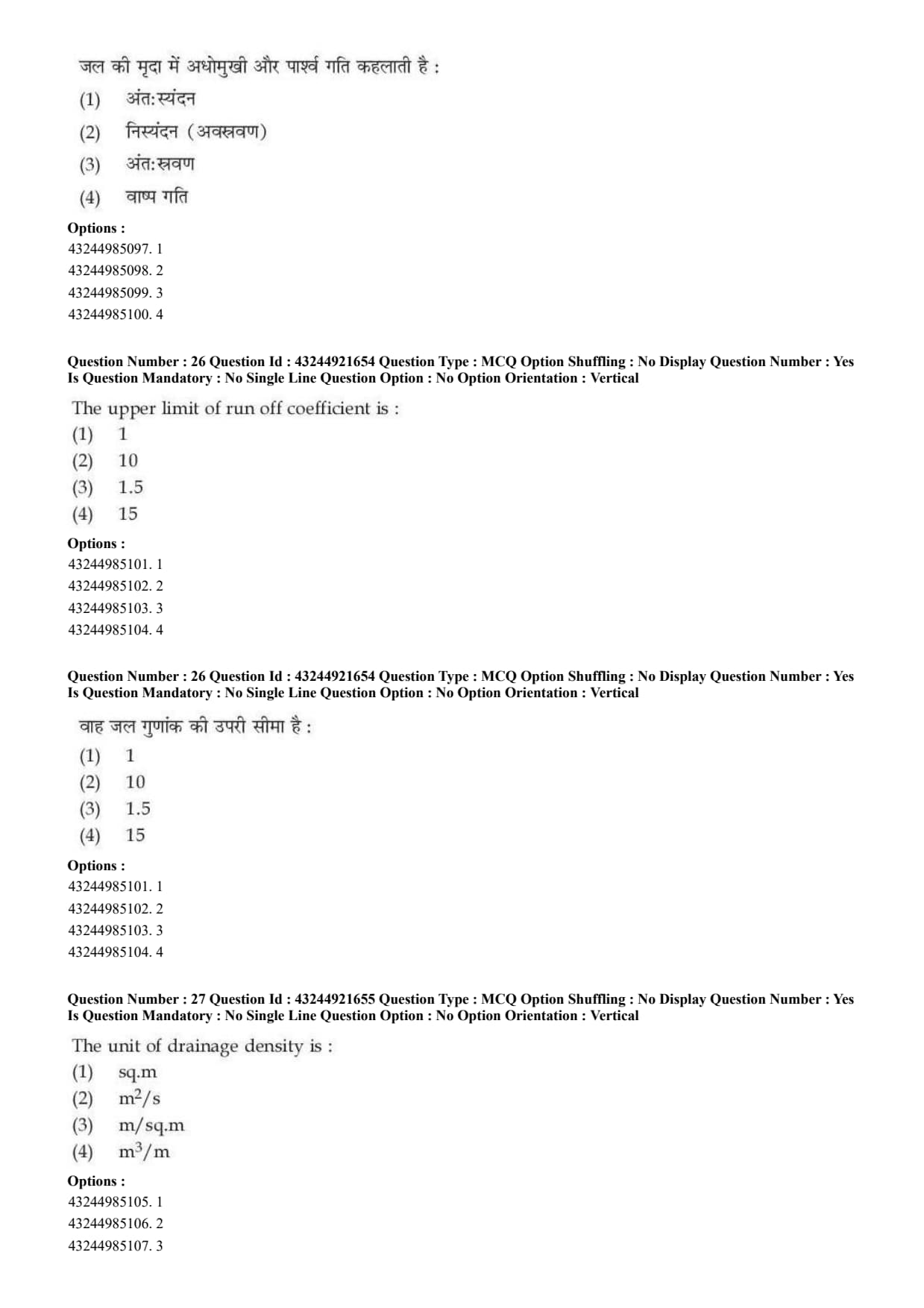
Question 26:

The upper limit of run off coefficient is:

  • (A) \(1\)
  • (B) \(10\)
  • (C) \(1.5\)
  • (D) \(15\)
Correct Answer: (A) \(1\)
View Solution


Concept:

Runoff coefficient is the ratio of runoff to rainfall.
\[ C=\frac{Runoff}{Rainfall} \]


Step 1: Understand the minimum and maximum value.

If no rainfall becomes runoff, then:
\[ C=0 \]

If all rainfall becomes runoff, then:
\[ C=1 \]


Step 2: Determine the upper limit.

Since runoff cannot be greater than total rainfall in the simple runoff coefficient concept, the maximum value is:
\[ 1 \]
\[ \therefore Correct Answer is (A) \] Quick Tip: Runoff coefficient generally ranges from \(0\) to \(1\).


Question 27:

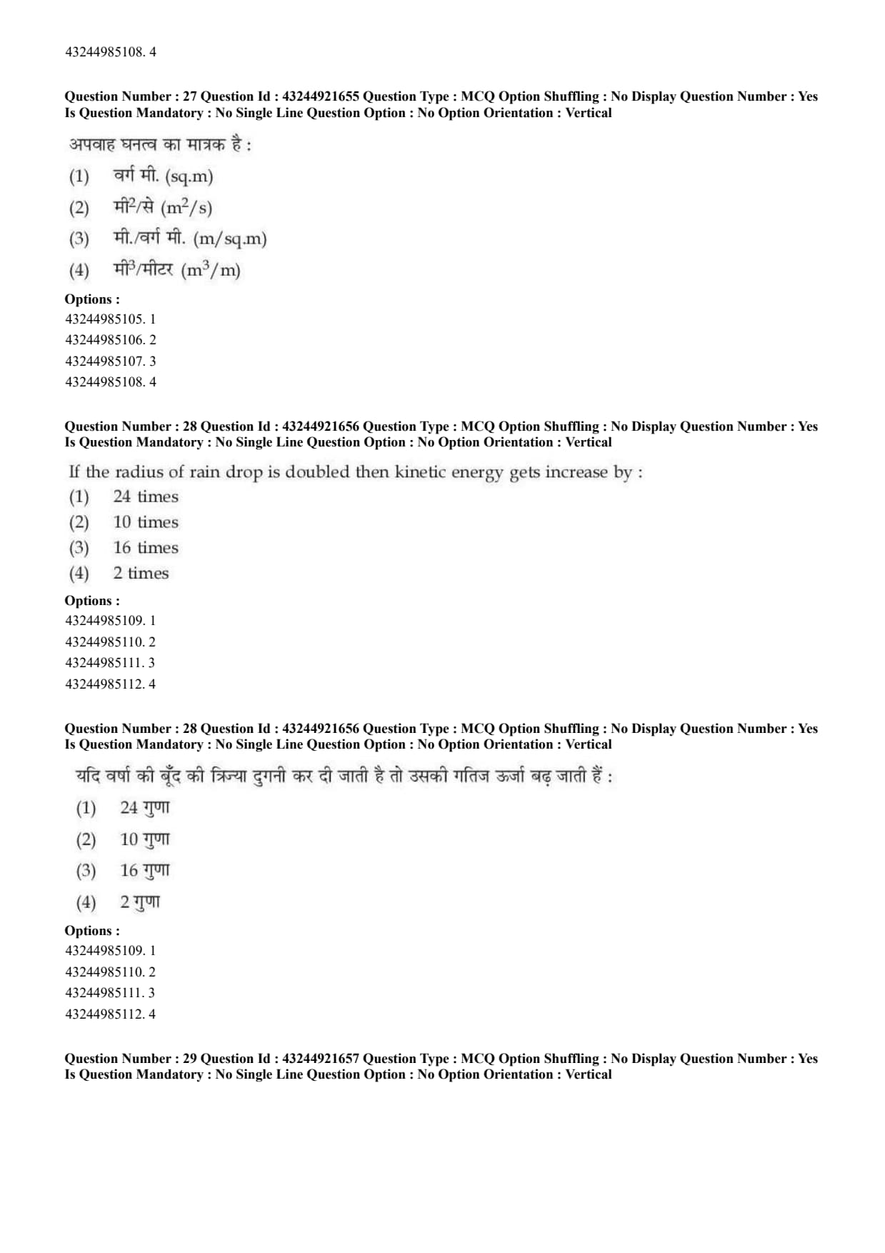
The unit of drainage density is:

  • (A) sq.m
  • (B) \(m^2/s\)
  • (C) \(m/sq.m\)
  • (D) \(m^3/m\)
Correct Answer: (C) \(m/sq.m\)
View Solution


Concept:

Drainage density is a measure of the total length of drainage channels per unit area of drainage basin.


Step 1: Write the formula. \[ D_d=\frac{Total length of streams}{Area of basin} \]


Step 2: Write units.

Length is measured in metre:
\[ m \]

Area is measured in square metre:
\[ sq.m \]

Therefore, unit becomes:
\[ \frac{m}{sq.m} \]


Step 3: Final answer.
\[ \therefore Correct Answer is (C) \] Quick Tip: Drainage density is total stream length per unit basin area.


Question 28:

If the radius of rain drop is doubled then kinetic energy gets increase by:

  • (A) \(24\) times
  • (B) \(10\) times
  • (C) \(16\) times
  • (D) \(2\) times
Correct Answer: (C) \(16\) times
View Solution


Concept:

Kinetic energy of a raindrop depends on its mass and velocity.
\[ KE=\frac{1}{2}mv^2 \]


Step 1: Relation of mass with radius.

A raindrop is approximately spherical.
\[ Volume\propto r^3 \]

Since mass is proportional to volume:
\[ m\propto r^3 \]


Step 2: Effect of radius on kinetic energy.

In rainfall erosivity concepts, kinetic energy of rain drop is commonly related strongly to drop size. When radius is doubled, the kinetic energy increases by:
\[ 2^4=16 \]


Step 3: Final answer.
\[ \therefore Correct Answer is (C) \] Quick Tip: Larger raindrops have much higher kinetic energy and therefore greater erosive power.


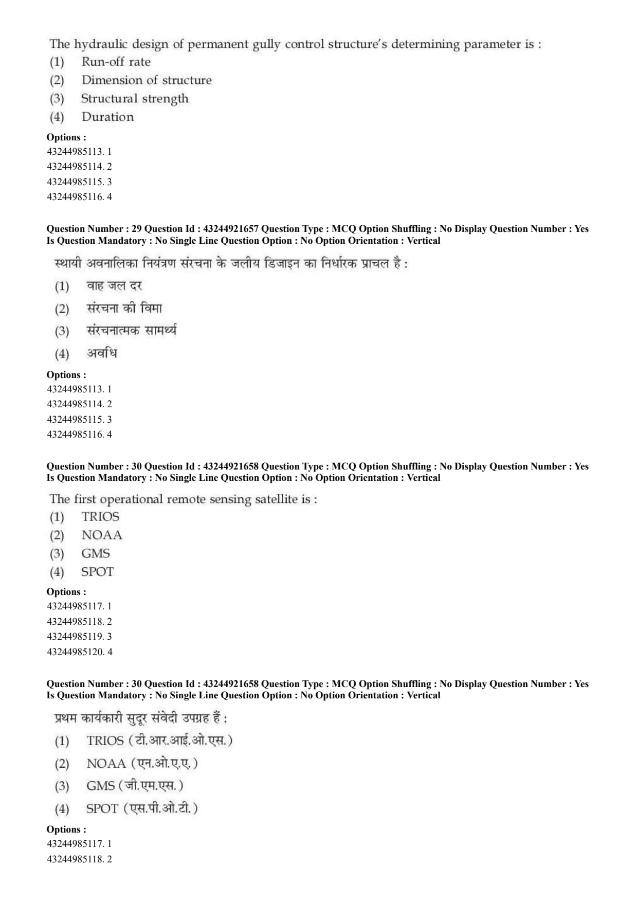
Question 29:

The hydraulic design of permanent gully control structure's determining parameter is:

  • (A) Run-off rate
  • (B) Dimension of structure
  • (C) Structural strength
  • (D) Duration
Correct Answer: (A) Run-off rate
View Solution


Concept:

Permanent gully control structures are designed to safely handle runoff water and prevent further gully erosion.


Step 1: Understand hydraulic design.

Hydraulic design is concerned with the flow of water through or over the structure.


Step 2: Main determining factor.

The important factor for hydraulic design is the rate of runoff that the structure must safely pass.
\[ Hydraulic design \Rightarrow Run-off rate \]


Step 3: Final answer.
\[ \therefore Correct Answer is (A) \] Quick Tip: Hydraulic design of gully control structures mainly depends on runoff rate.


Question 30:

The first operational remote sensing satellite is:

  • (A) TRIOS
  • (B) NOAA
  • (C) GMS
  • (D) SPOT
Correct Answer: (A) TRIOS
View Solution


Concept:

Remote sensing satellites are used to collect information about the earth surface and atmosphere from space.


Step 1: Identify the earliest operational satellite among options.

Among the given options, TRIOS/TIROS is considered the earliest operational remote sensing satellite series.


Step 2: Compare with other satellites.

NOAA, GMS and SPOT were later satellite systems used for weather and earth observation purposes.


Step 3: Final answer.
\[ \therefore Correct Answer is (A) \] Quick Tip: TIROS was among the earliest operational satellite systems used for remote sensing and meteorological observation.


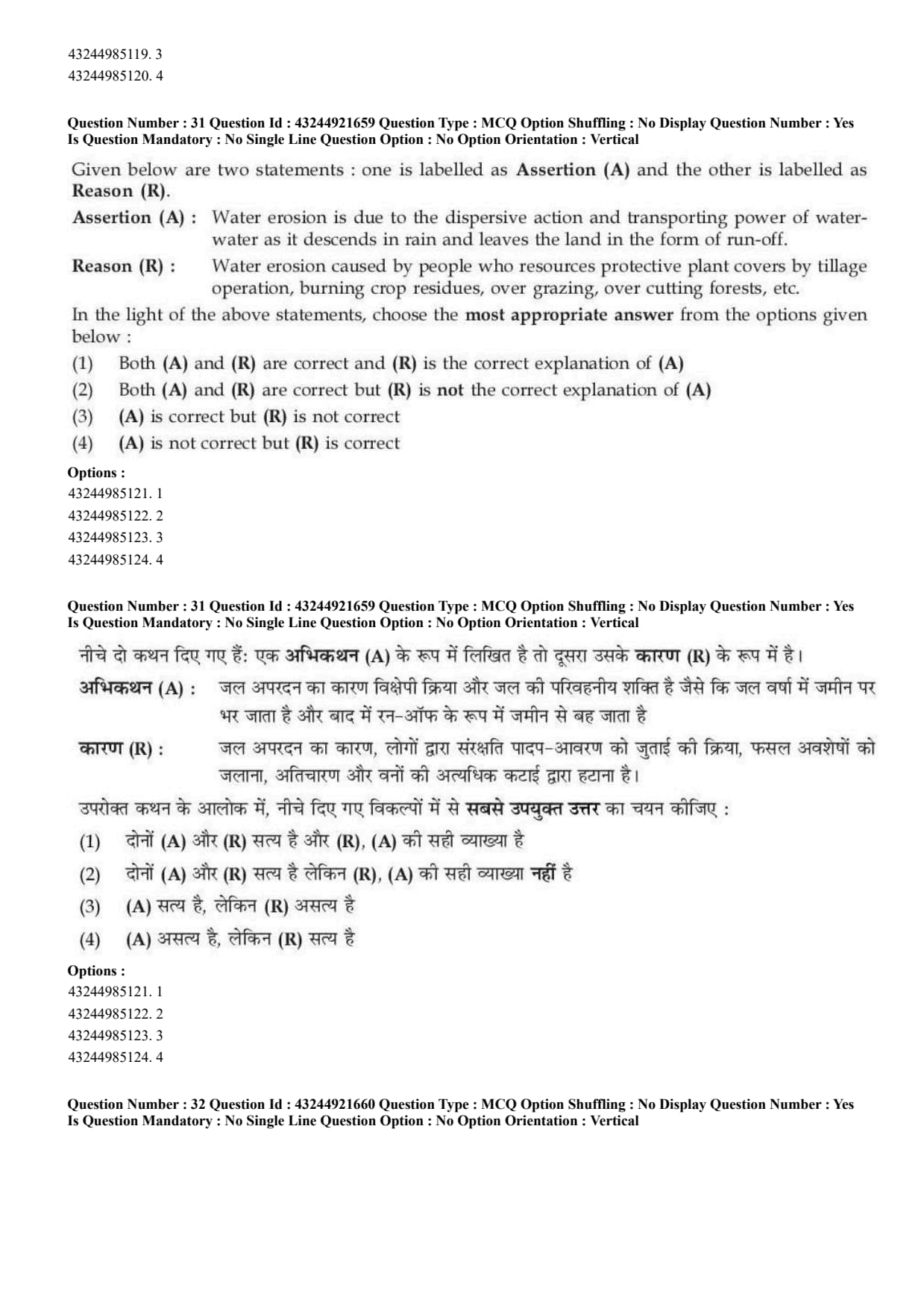
Question 31:

Given below are two statements:

Assertion (A): Water erosion is due to the dispersive action and transporting power of water as it descends in rain and leaves the land in the form of run-off.

Reason (R): Water erosion is caused by people who remove protective plant covers by tillage operation, burning crop residues, over grazing, over cutting forests, etc.

  • (A) Both A and R are correct and R is the correct explanation of A
  • (B) Both A and R are correct but R is not the correct explanation of A
  • (C) A is correct but R is not correct
  • (D) A is not correct but R is correct
Correct Answer: (B) Both A and R are correct but R is not the correct explanation of A
View Solution


Concept:

Water erosion occurs when rainfall and runoff detach and transport soil particles.


Step 1: Check Assertion.

The assertion says that water erosion occurs due to the dispersive and transporting power of water.

Rain drops detach soil particles and runoff carries them away.
\[ A is correct \]


Step 2: Check Reason.

The reason says that human activities like burning crop residues, overgrazing, overcutting forests and improper tillage remove protective cover.

This increases water erosion.
\[ R is also correct \]


Step 3: Check explanation.

Reason gives a cause that increases erosion, but it does not directly explain the physical mechanism of dispersive and transporting power of water.
\[ R is not the correct explanation of A \]
\[ \therefore Correct Answer is (B) \] Quick Tip: Vegetative cover protects soil from raindrop impact and runoff erosion.


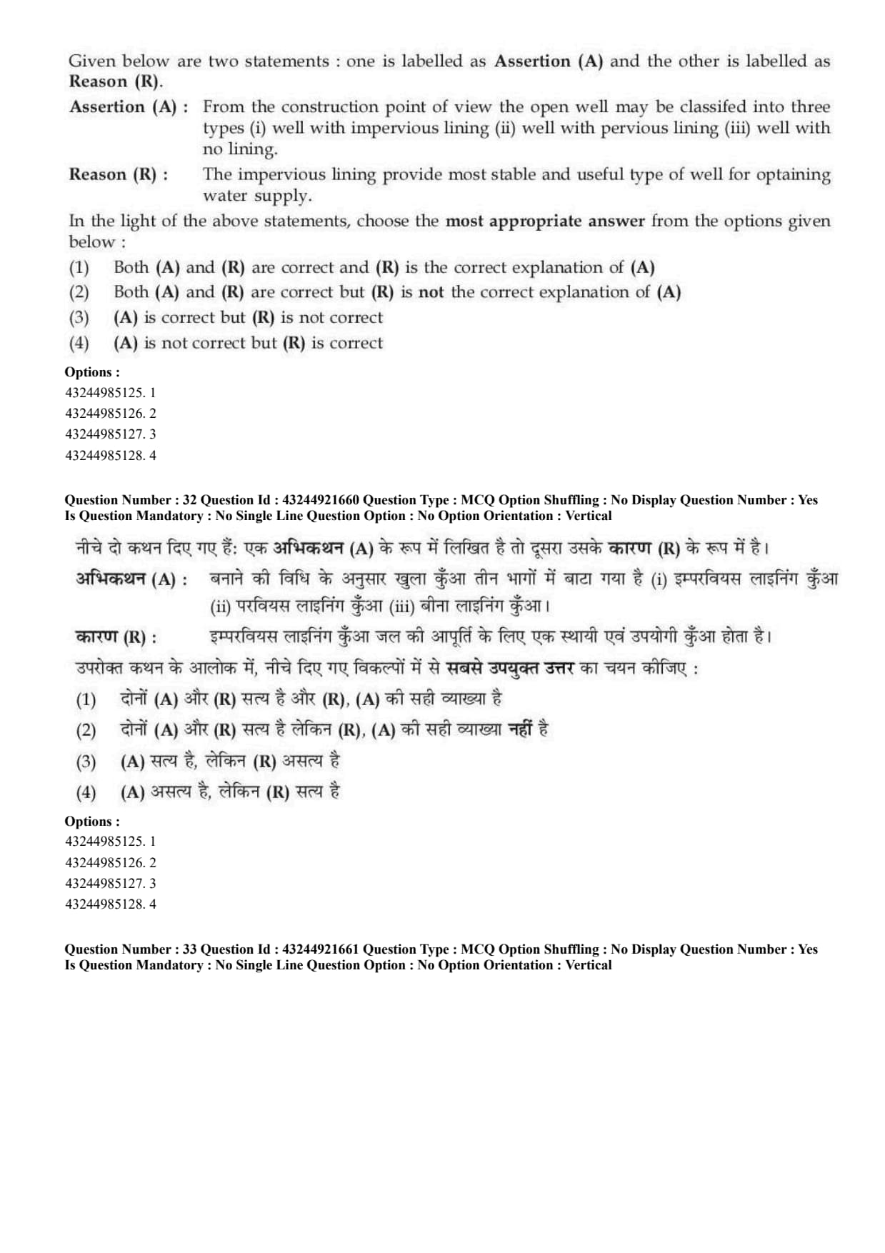
Question 32:

Given below are two statements:

Assertion (A): From the construction point of view, the open well may be classified into three types: well with impervious lining, well with pervious lining and well with no lining.

Reason (R): The impervious lining provides most stable and useful type of well for obtaining water supply.

  • (A) Both A and R are correct and R is the correct explanation of A
  • (B) Both A and R are correct but R is not the correct explanation of A
  • (C) A is correct but R is not correct
  • (D) A is not correct but R is correct
Correct Answer: (B) Both A and R are correct but R is not the correct explanation of A
View Solution


Concept:

Open wells may be classified on the basis of construction and lining.


Step 1: Check Assertion.

Open wells may have impervious lining, pervious lining or no lining.
\[ A is correct \]


Step 2: Check Reason.

Impervious lining gives stability to well walls and is useful for obtaining water supply.
\[ R is correct \]


Step 3: Check explanation.

Reason describes the usefulness of impervious lining, but it does not explain why wells are classified into three types.
\[ R is not the correct explanation of A \]
\[ \therefore Correct Answer is (B) \] Quick Tip: In Assertion-Reason questions, both statements may be true, but the reason must directly explain the assertion.


Question 33:

Given below are two statements:

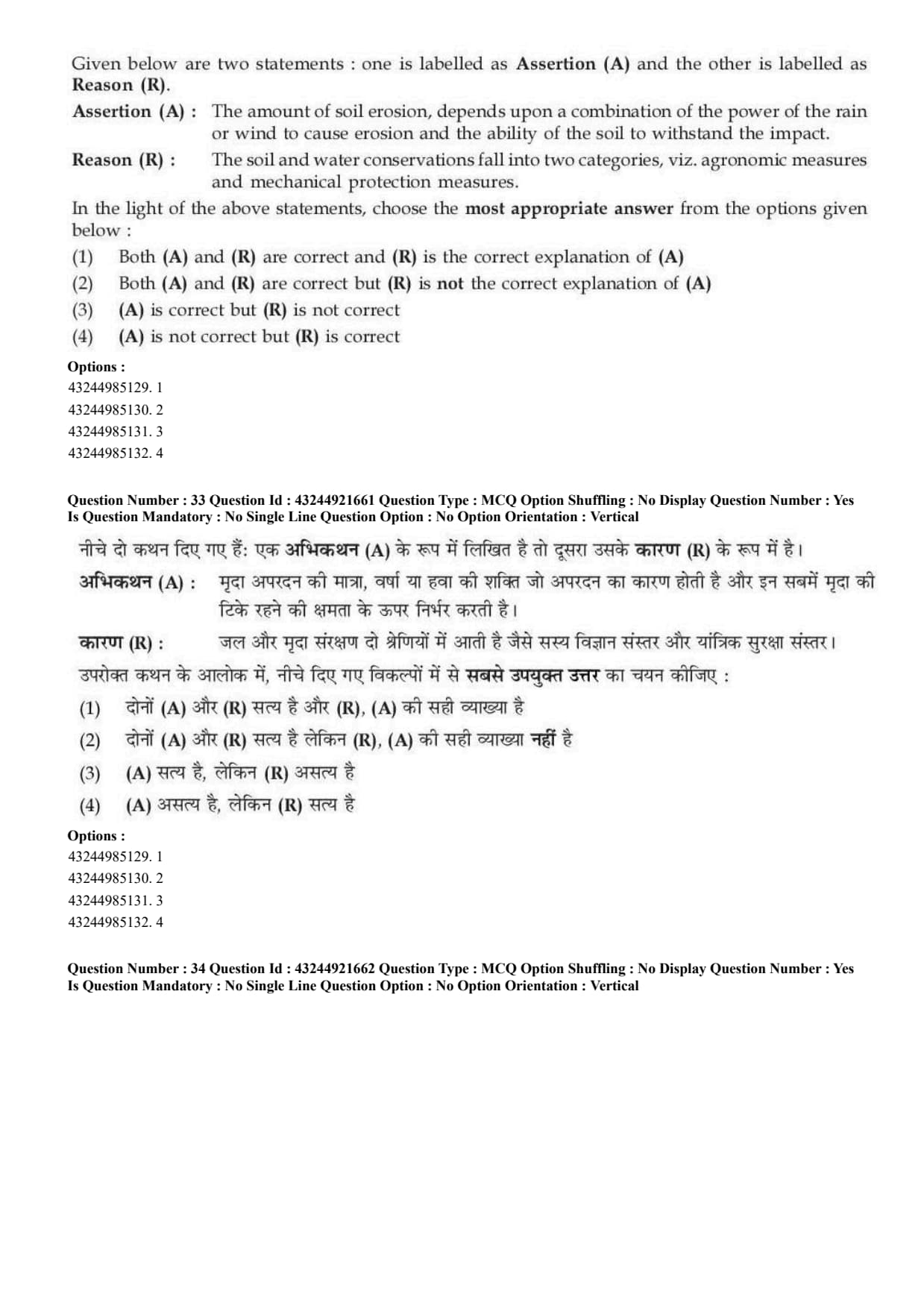
Assertion (A): The amount of soil erosion depends upon a combination of the power of rain or wind to cause erosion and the ability of the soil to withstand the impact.

Reason (R): The soil and water conservation falls into two categories, viz. agronomic measures and mechanical protection measures.

  • (A) Both A and R are correct and R is the correct explanation of A
  • (B) Both A and R are correct but R is not the correct explanation of A
  • (C) A is correct but R is not correct
  • (D) A is not correct but R is correct
Correct Answer: (B) Both A and R are correct but R is not the correct explanation of A
View Solution


Concept:

Soil erosion depends on erosivity and erodibility.


Step 1: Check Assertion.

Rain or wind provides erosive force. Soil resistance decides how easily soil particles are detached.
\[ A is correct \]


Step 2: Check Reason.

Soil and water conservation measures are broadly grouped into agronomic and mechanical measures.
\[ R is correct \]


Step 3: Check explanation.

Reason classifies conservation measures, but it does not explain the amount of soil erosion.
\[ R is not the correct explanation of A \]
\[ \therefore Correct Answer is (B) \] Quick Tip: Soil erosion depends on erosivity of the agent and erodibility of the soil.


Question 34:

Given below are two statements:

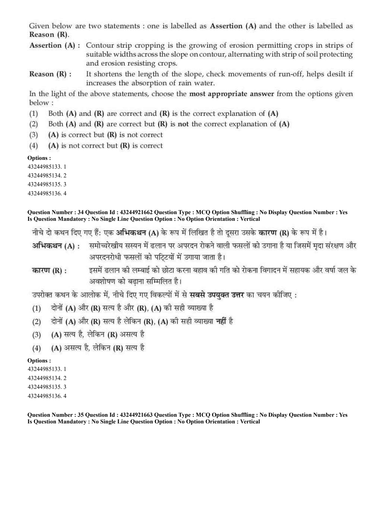
Assertion (A): Contour strip cropping is the growing of erosion permitting crops in strips of suitable widths across the slope on contour, alternating with strips of soil protecting and erosion resisting crops.

Reason (R): It shortens the length of the slope, checks movements of run-off, helps desilt if increases the absorption of rain water.

  • (A) Both A and R are correct and R is the correct explanation of A
  • (B) Both A and R are correct but R is not the correct explanation of A
  • (C) A is correct but R is not correct
  • (D) A is not correct but R is correct
Correct Answer: (A) Both A and R are correct and R is the correct explanation of A
View Solution


Concept:

Contour strip cropping is a soil conservation practice used on sloping lands.


Step 1: Check Assertion.

In contour strip cropping, erosion permitting crops and erosion resisting crops are grown in alternate strips across the slope along the contour.
\[ A is correct \]


Step 2: Check Reason.

This practice shortens slope length, slows runoff, traps soil particles and increases water absorption.
\[ R is correct \]


Step 3: Check explanation.

The reason explains why contour strip cropping helps in soil conservation.
\[ R correctly explains A \]
\[ \therefore Correct Answer is (A) \] Quick Tip: Contour strip cropping reduces erosion by slowing runoff and trapping soil particles.


Question 35:

Given below are two statements:

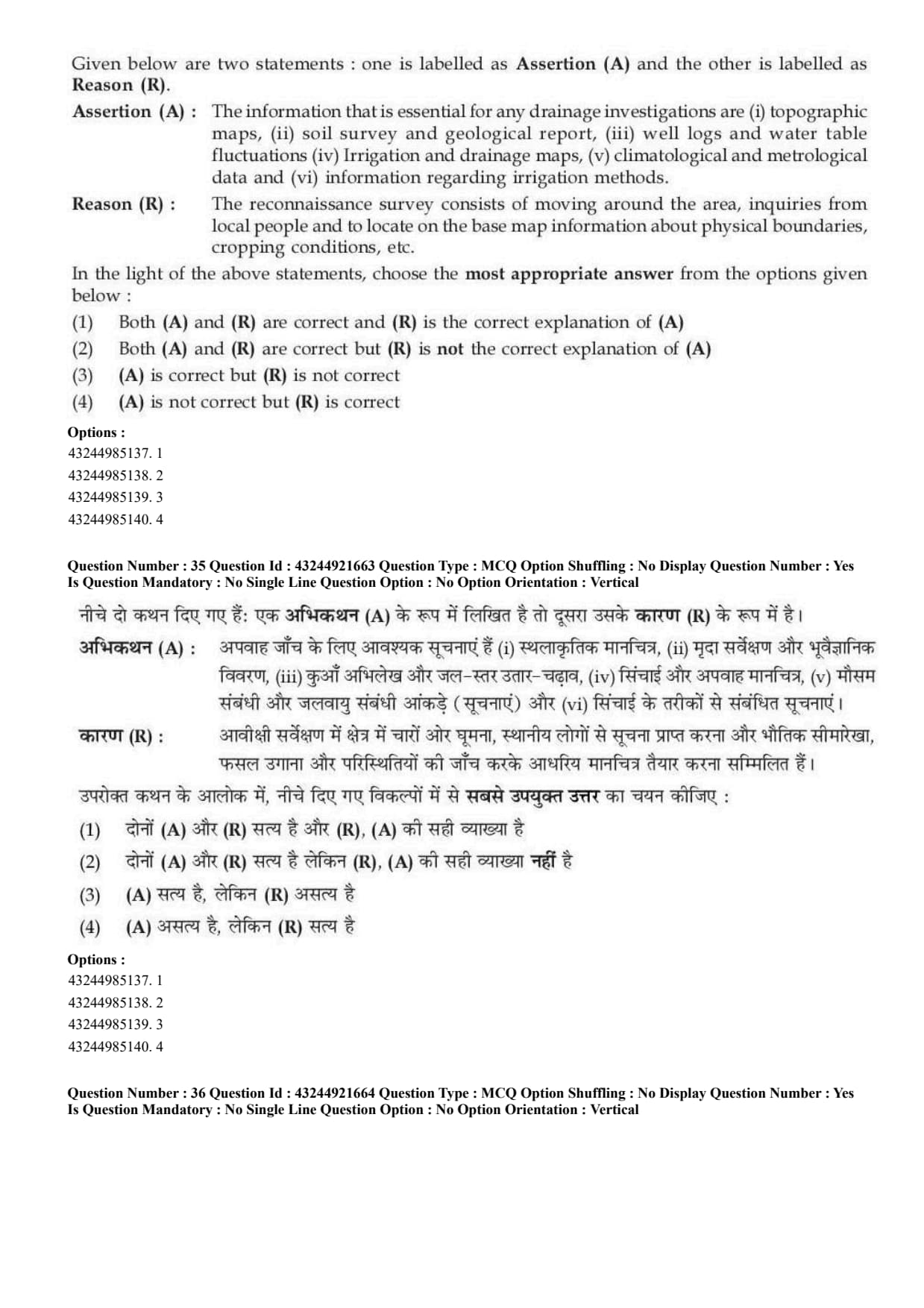
Assertion (A): The information that is essential for any drainage investigations are topographic maps, soil survey and geological report, well logs and water table fluctuations, irrigation and drainage maps, climatological and meteorological data and information regarding irrigation methods.

Reason (R): The reconnaissance survey consists of moving around the area, inquiries from local people and to locate on the base map information about physical boundaries, cropping conditions, etc.

  • (A) Both A and R are correct and R is the correct explanation of A
  • (B) Both A and R are correct but R is not the correct explanation of A
  • (C) A is correct but R is not correct
  • (D) A is not correct but R is correct
Correct Answer: (B) Both A and R are correct but R is not the correct explanation of A
View Solution


Concept:

Drainage investigation requires collection of physical, hydrological, soil and climatic information.


Step 1: Check Assertion.

Drainage investigation needs maps, soil survey, geological reports, water table data, drainage maps and climatic information.
\[ A is correct \]


Step 2: Check Reason.

Reconnaissance survey is a preliminary field survey in which general information is collected by moving through the area and interacting with local people.
\[ R is correct \]


Step 3: Check explanation.

Reason describes reconnaissance survey, but it does not directly explain the complete list of information essential for drainage investigation.
\[ R is not the correct explanation of A \]
\[ \therefore Correct Answer is (B) \] Quick Tip: Drainage investigations need maps, soil data, water table data, rainfall data and field observations.


Question 36:

Given below are two statements:

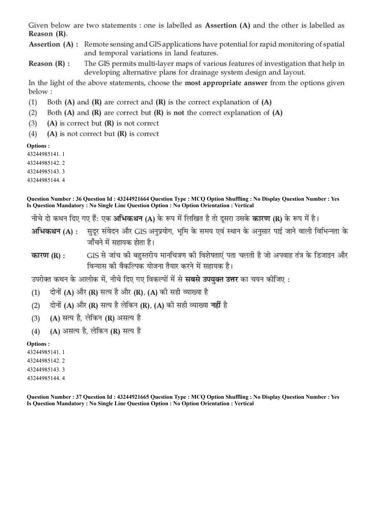
Assertion (A): Remote sensing and GIS applications have potential for rapid monitoring of spatial and temporal variations in land features.

Reason (R): The GIS permits multi-layer maps of various features of investigation that help in developing alternative plans for drainage system design and layout.

  • (A) Both A and R are correct and R is the correct explanation of A
  • (B) Both A and R are correct but R is not the correct explanation of A
  • (C) A is correct but R is not correct
  • (D) A is not correct but R is correct
Correct Answer: (A) Both A and R are correct and R is the correct explanation of A
View Solution


Concept:

Remote sensing and GIS are useful tools for land and water resource planning.


Step 1: Check Assertion.

Remote sensing helps in monitoring spatial and temporal variations in land features quickly.
\[ A is correct \]


Step 2: Check Reason.

GIS allows preparation and analysis of multi-layer maps such as soil, drainage, slope, land use and water table maps.
\[ R is correct \]


Step 3: Check explanation.

The reason explains how GIS and remote sensing support planning and monitoring for drainage system design and land feature analysis.
\[ R correctly explains A \]
\[ \therefore Correct Answer is (A) \] Quick Tip: Remote sensing provides spatial data, while GIS helps analyse multiple map layers.


Question 37:

Given below are two statements:

Assertion (A): Soil water is the most predominant and limiting factor for crop production. The goal of a soil-water-plant continuum is to maintain the soil water between field capacity and wilting point.

Reason (R): Most of the plants withdraw water from the soils until soil moisture pressure reaches about 15 bars.

  • (A) Both A and R are correct and R is the correct explanation of A
  • (B) Both A and R are correct but R is not the correct explanation of A
  • (C) A is correct but R is not correct
  • (D) A is not correct but R is correct
Correct Answer: (A) Both A and R are correct and R is the correct explanation of A
View Solution


Concept:

Crop production depends strongly on availability of soil water in the root zone.


Step 1: Check Assertion.

Soil water is a major limiting factor for crop growth. The useful water range for plants lies between field capacity and permanent wilting point.
\[ A is correct \]


Step 2: Check Reason.

Most plants can extract water until soil moisture tension reaches about 15 bars. This point is known as the permanent wilting point.
\[ R is correct \]


Step 3: Check explanation.

The reason explains why soil water should be maintained between field capacity and wilting point.
\[ R correctly explains A \]
\[ \therefore Correct Answer is (A) \] Quick Tip: Available soil water lies between field capacity and permanent wilting point.


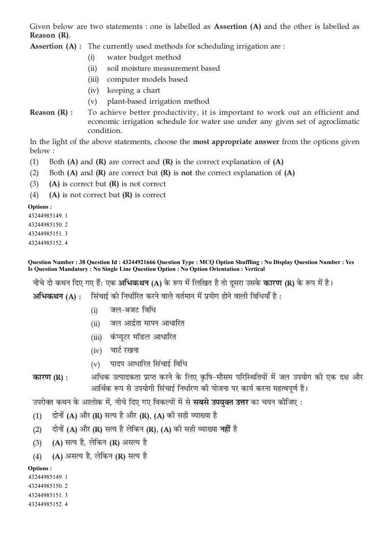
Question 38:

Given below are two statements:

Assertion (A): The currently used methods for scheduling irrigation are water budget method, soil moisture measurement based, computer models based, keeping a chart and plant-based irrigation method.

Reason (R): To achieve better productivity, it is important to work out an efficient and economic irrigation schedule for water use under any given set of agroclimatic condition.

  • (A) Both A and R are correct and R is the correct explanation of A
  • (B) Both A and R are correct but R is not the correct explanation of A
  • (C) A is correct but R is not correct
  • (D) A is not correct but R is correct
Correct Answer: (A) Both A and R are correct and R is the correct explanation of A
View Solution


Concept:

Irrigation scheduling means deciding when and how much water should be applied to crops.


Step 1: Check Assertion.

Irrigation can be scheduled using water budget, soil moisture measurement, computer models, charts and plant-based methods.
\[ A is correct \]


Step 2: Check Reason.

Efficient irrigation scheduling improves productivity and avoids wastage of water.
\[ R is correct \]


Step 3: Check explanation.

The reason explains why irrigation scheduling methods are used.
\[ R correctly explains A \]
\[ \therefore Correct Answer is (A) \] Quick Tip: Irrigation scheduling helps apply water at the right time and in the right amount.


Question 39:

Given below are two statements:

Assertion (A): Remote sensing is the study of any object without making actual contact with the object under consideration.

Reason (R): The electromagnetic radiation reflected or emitted from the object is a common source of remote sensing apart from other sources such as gravity or magnetic fields.

  • (A) Both A and R are correct and R is the correct explanation of A
  • (B) Both A and R are correct but R is not the correct explanation of A
  • (C) A is correct but R is not correct
  • (D) A is not correct but R is correct
Correct Answer: (A) Both A and R are correct and R is the correct explanation of A
View Solution


Concept:

Remote sensing is used to obtain information about objects or areas without physical contact.


Step 1: Check Assertion.

Remote sensing studies objects without direct contact.
\[ A is correct \]


Step 2: Check Reason.

Remote sensing commonly uses electromagnetic radiation reflected or emitted from objects.
\[ R is correct \]


Step 3: Check explanation.

The reason explains how remote sensing is possible without physical contact.
\[ R correctly explains A \]
\[ \therefore Correct Answer is (A) \] Quick Tip: Remote sensing obtains information without contact by detecting reflected or emitted energy.


Question 40:

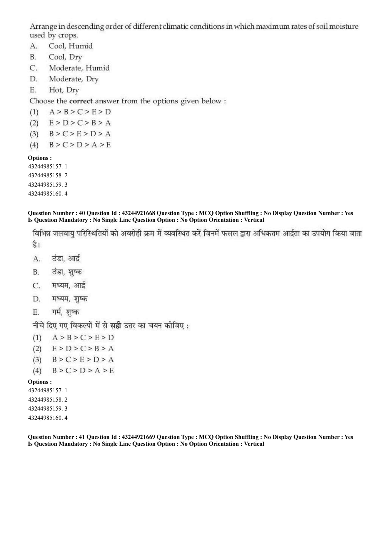
Arrange in descending order of different climatic conditions in which maximum rates of soil moisture are used by crops.

A. Cool, Humid;
B. Cool, Dry;
C. Moderate, Humid;
D. Moderate, Dry;
E. Hot, Dry.

  • (A) A \(>\) B \(>\) C \(>\) E \(>\) D
  • (B) E \(>\) D \(>\) C \(>\) B \(>\) A
  • (C) B \(>\) C \(>\) E \(>\) D \(>\) A
  • (D) B \(>\) C \(>\) D \(>\) A \(>\) E
Correct Answer: (B) E \(>\) D \(>\) C \(>\) B \(>\) A
View Solution


Concept:

Soil moisture use by crops depends on temperature, humidity and evaporative demand.


Step 1: Highest soil moisture use.

Hot and dry climate has the highest evaporative demand. Therefore, crops use maximum soil moisture under:
\[ E=Hot, Dry \]


Step 2: Next condition.

Moderate and dry climate has lower demand than hot dry but higher than humid conditions.
\[ D=Moderate, Dry \]


Step 3: Humid and cool conditions.

Moderate humid has more moisture use than cool dry and cool humid. Cool humid has the lowest soil moisture use.
\[ C=Moderate, Humid \] \[ B=Cool, Dry \] \[ A=Cool, Humid \]


Step 4: Final descending order. \[ E>D>C>B>A \]
\[ \therefore Correct Answer is (B) \] Quick Tip: Soil moisture use is highest in hot dry climates and lowest in cool humid climates.


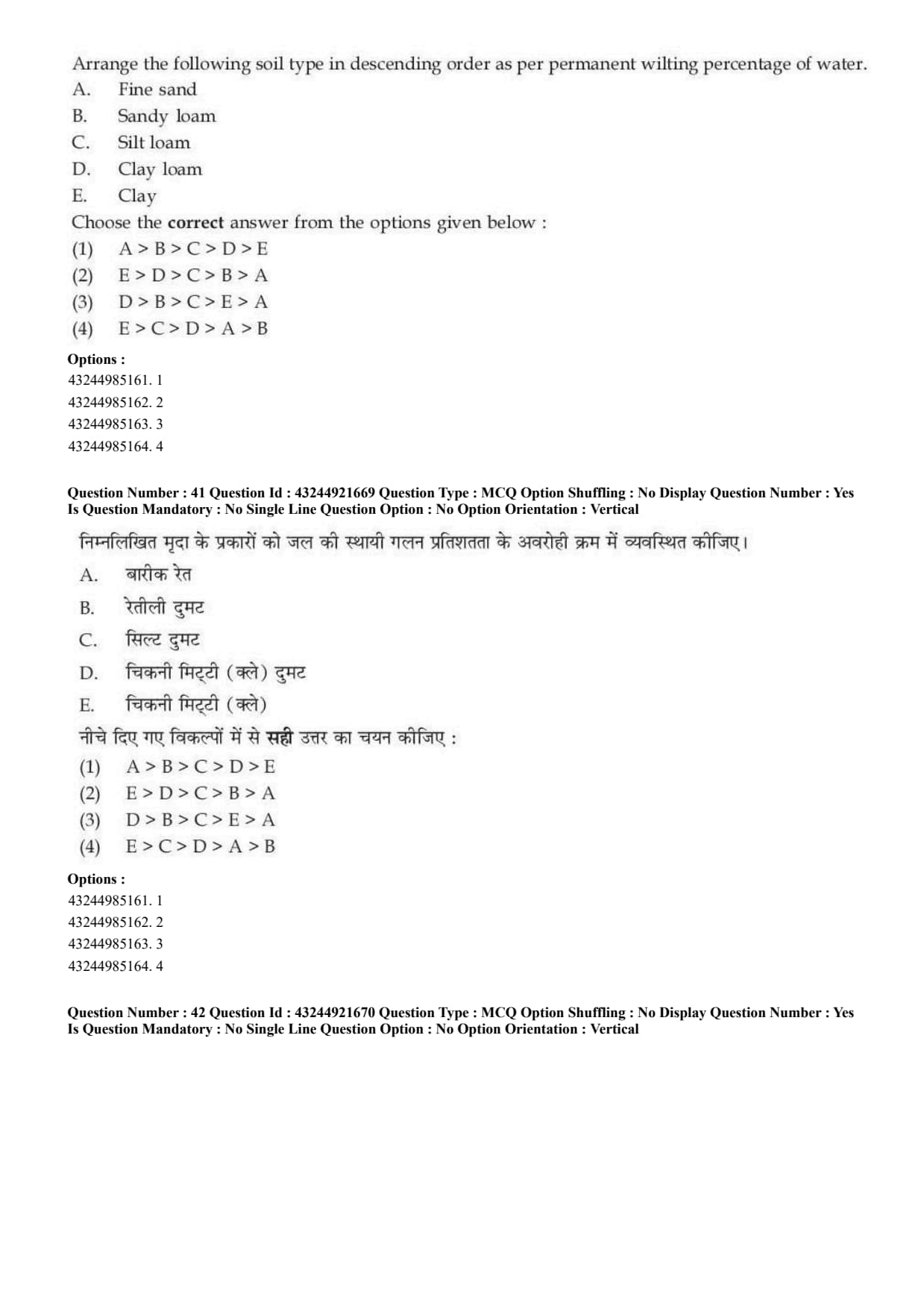
Question 41:

Arrange the following soil types in descending order as per permanent wilting percentage of water.
A. Fine sand,
B. Sandy loam,
C. Silt loam,
D. Clay loam,
E. Clay.

  • (A) A \(>\) B \(>\) C \(>\) D \(>\) E
  • (B) E \(>\) D \(>\) C \(>\) B \(>\) A
  • (C) D \(>\) B \(>\) C \(>\) E \(>\) A
  • (D) E \(>\) C \(>\) D \(>\) A \(>\) B
Correct Answer: (B) E \(>\) D \(>\) C \(>\) B \(>\) A
View Solution


Concept:

Permanent wilting percentage depends mainly on soil texture. Fine-textured soils hold more water at permanent wilting point because they have more clay particles and more micropores.


Step 1: Understand texture effect.

Clay soils have very fine particles and large surface area.
\[ Clay soil \Rightarrow high water holding at wilting point \]

Fine sand has coarse particles and large pores, so it holds the least amount of water at wilting point.
\[ Fine sand \Rightarrow low water holding at wilting point \]


Step 2: Arrange from highest to lowest.

The descending order of permanent wilting percentage is:
\[ Clay>Clay loam>Silt loam>Sandy loam>Fine sand \]


Step 3: Convert into given symbols. \[ E>D>C>B>A \]
\[ \therefore Correct Answer is (B) \] Quick Tip: Permanent wilting percentage generally increases with clay content. Clay soil has the highest and sandy soil has the lowest wilting percentage.


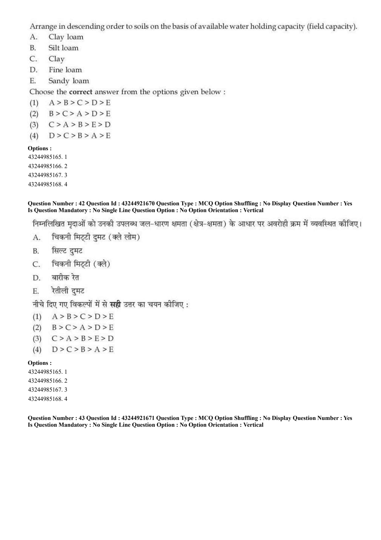
Question 42:

Arrange in descending order the soils on the basis of available water holding capacity.
A. Clay loam,
B. Silt loam,
C. Clay,
D. Fine loam,
E. Sandy loam.

  • (A) A \(>\) B \(>\) C \(>\) D \(>\) E
  • (B) B \(>\) C \(>\) A \(>\) D \(>\) E
  • (C) C \(>\) A \(>\) B \(>\) E \(>\) D
  • (D) D \(>\) C \(>\) B \(>\) A \(>\) E
Correct Answer: (B) B \(>\) C \(>\) A \(>\) D \(>\) E
View Solution


Concept:

Available water holding capacity depends on soil texture, pore size distribution and water retention ability.


Step 1: Understand available water holding capacity.

Available water is the water held between field capacity and permanent wilting point.
\[ Available water=Field capacity-Permanent wilting point \]


Step 2: Compare soil textures.

Silt loam generally has high available water holding capacity because it has a good balance of macro and micropores.

Clay and clay loam also hold considerable water, while sandy loam holds comparatively less water.


Step 3: Arrange the given soils.

The descending order is:
\[ Silt loam>Clay>Clay loam>Fine loam>Sandy loam \]


Step 4: Convert into given symbols. \[ B>C>A>D>E \]
\[ \therefore Correct Answer is (B) \] Quick Tip: Medium-textured soils like silt loam generally have very good available water holding capacity.


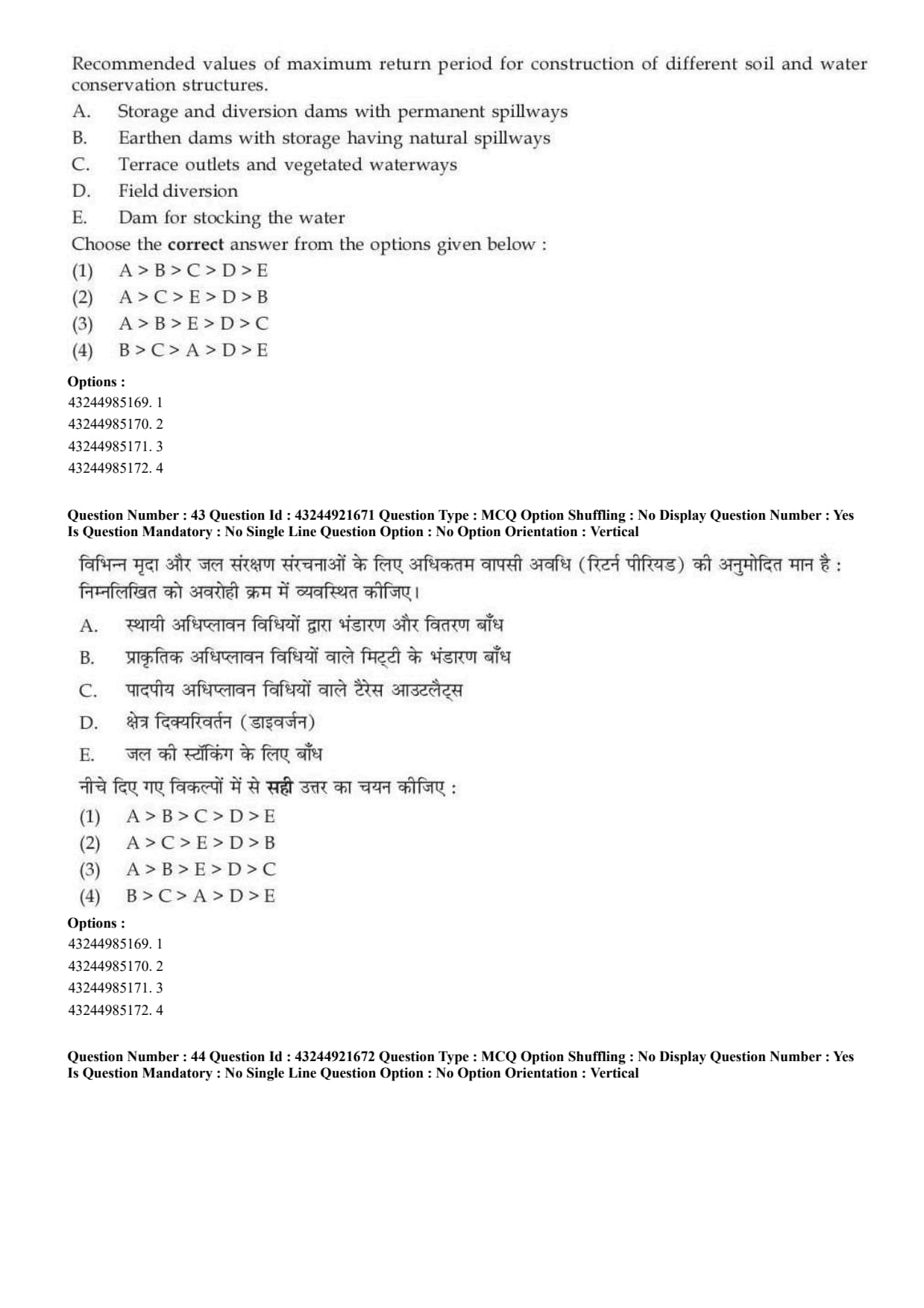
Question 43:

Arrange the recommended values of maximum return period for construction of different soil and water conservation structures.
A. Storage and diversion dams with permanent spillways,
B. Earthen dams with storage having natural spillways,
C. Terrace outlets and vegetated waterways,
D. Field diversion,
E. Dam for stocking the water.

  • (A) A \(>\) B \(>\) C \(>\) D \(>\) E
  • (B) A \(>\) C \(>\) E \(>\) D \(>\) B
  • (C) A \(>\) B \(>\) E \(>\) D \(>\) C
  • (D) B \(>\) C \(>\) A \(>\) D \(>\) E
Correct Answer: (C) A \(>\) B \(>\) E \(>\) D \(>\) C
View Solution


Concept:

Return period is important in the design of soil and water conservation structures. Larger and more permanent structures are designed for higher return periods.


Step 1: Highest return period.

Storage and diversion dams with permanent spillways are important permanent structures, so they require the highest return period.
\[ Highest=A \]


Step 2: Next important structure.

Earthen dams with storage and natural spillways also need high return period.
\[ Next=B \]


Step 3: Remaining structures.

Dams for stocking water, field diversions, terrace outlets and vegetated waterways are then arranged according to their relative design importance.
\[ E>D>C \]


Step 4: Final order. \[ A>B>E>D>C \]
\[ \therefore Correct Answer is (C) \] Quick Tip: Permanent and high-risk water conservation structures are designed for higher return periods than smaller field structures.


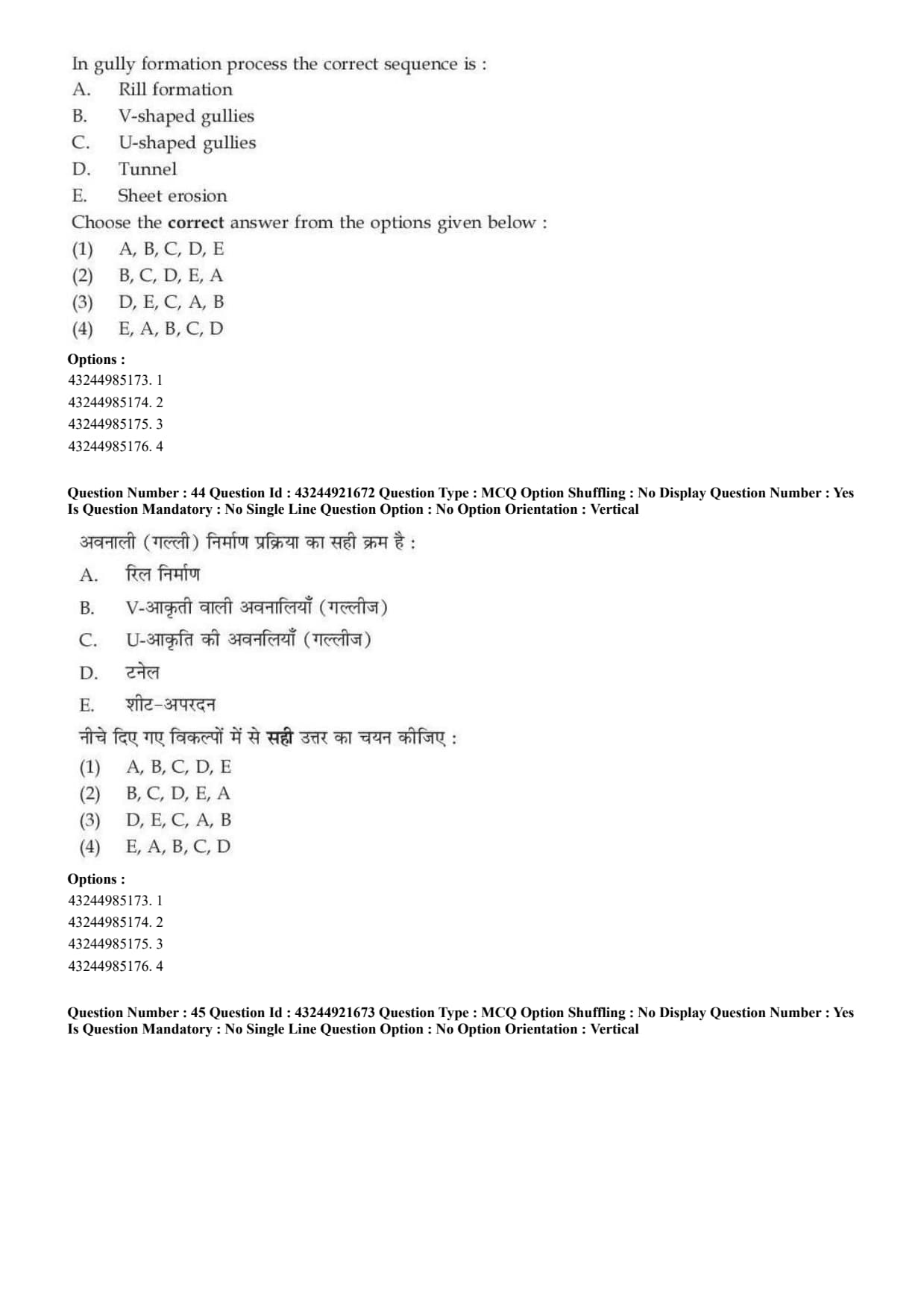
Question 44:

In gully formation process the correct sequence is:
A. Rill formation,
B. V-shaped gullies,
C. U-shaped gullies,
D. Tunnel,
E. Sheet erosion.

  • (A) A, B, C, D, E
  • (B) B, C, D, E, A
  • (C) D, E, C, A, B
  • (D) E, A, B, C, D
Correct Answer: (D) E, A, B, C, D
View Solution


Concept:

Gully formation is a gradual process. It starts from removal of a thin layer of soil and finally develops into deeper channels.


Step 1: Sheet erosion.

The process starts with sheet erosion, where a thin layer of soil is removed uniformly.
\[ First step=E \]


Step 2: Rill formation.

As runoff gets concentrated, small channels called rills are formed.
\[ Second step=A \]


Step 3: V-shaped gullies.

Rills enlarge and deepen to form V-shaped gullies.
\[ Third step=B \]


Step 4: U-shaped gullies.

With further erosion and widening, U-shaped gullies are formed.
\[ Fourth step=C \]


Step 5: Tunnel.

Advanced subsurface erosion may result in tunnel formation.
\[ Fifth step=D \]


Therefore, the correct sequence is: \[ E,A,B,C,D \]
\[ \therefore Correct Answer is (D) \] Quick Tip: Gully formation commonly begins with sheet erosion and rill erosion before developing into larger gullies.


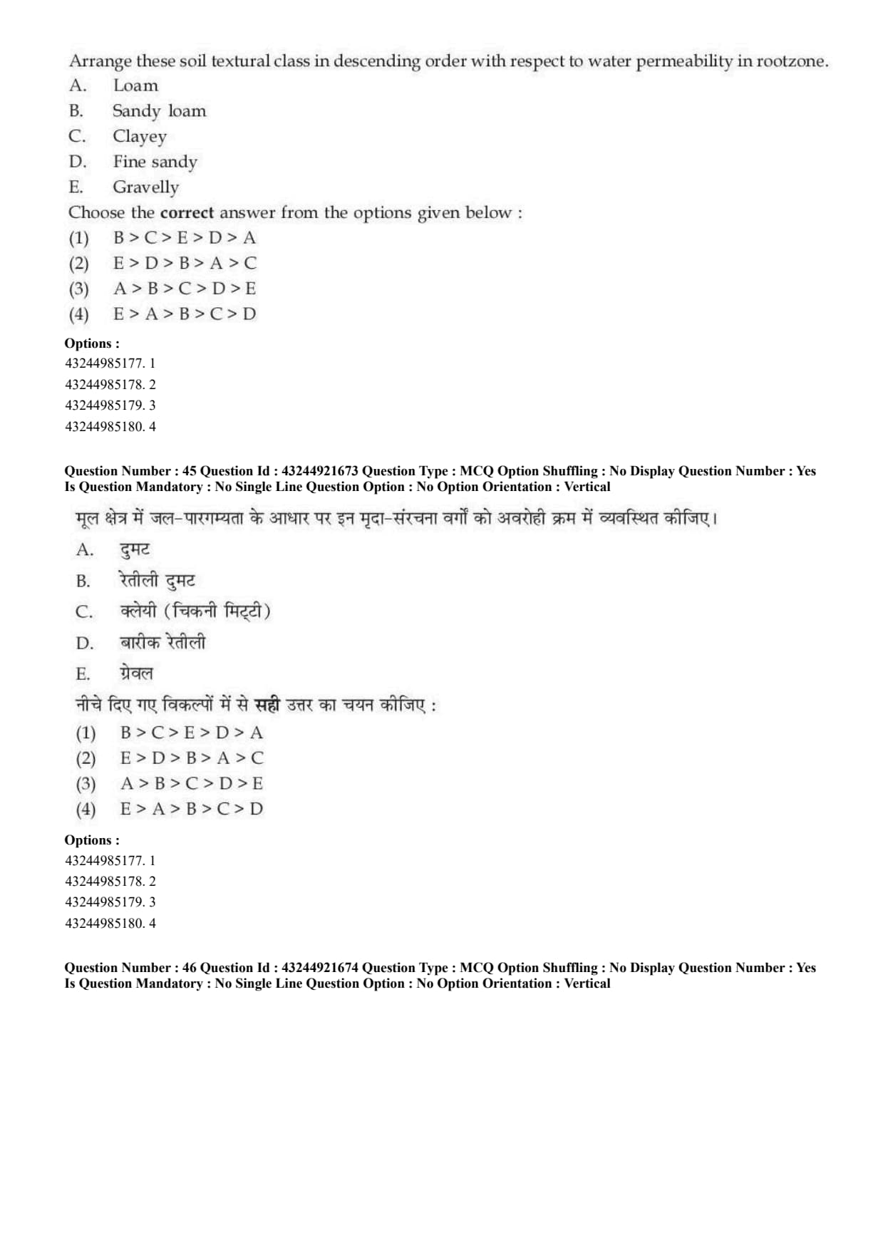
Question 45:

Arrange these soil textural classes in descending order with respect to water permeability in root zone.
A. Loam,
B. Sandy loam,
C. Clayey,
D. Fine sandy,
E. Gravelly.

  • (A) B \(>\) C \(>\) E \(>\) D \(>\) A
  • (B) E \(>\) D \(>\) B \(>\) A \(>\) C
  • (C) A \(>\) B \(>\) C \(>\) D \(>\) E
  • (D) E \(>\) A \(>\) B \(>\) C \(>\) D
Correct Answer: (B) E \(>\) D \(>\) B \(>\) A \(>\) C
View Solution


Concept:

Water permeability is higher in coarse-textured soils because they contain larger pores. It is lower in clayey soils because clay has very small pores.


Step 1: Highest permeability.

Gravelly soil has the largest pore spaces.
\[ Highest permeability=E \]


Step 2: Next soils.

Fine sandy soil and sandy loam have more sand particles, so they have higher permeability than loam and clayey soil.
\[ D>B>A>C \]


Step 3: Lowest permeability.

Clayey soil has the lowest permeability.
\[ Lowest=C \]


Step 4: Final descending order. \[ E>D>B>A>C \]
\[ \therefore Correct Answer is (B) \] Quick Tip: Permeability is highest in coarse-textured soils and lowest in clayey soils.


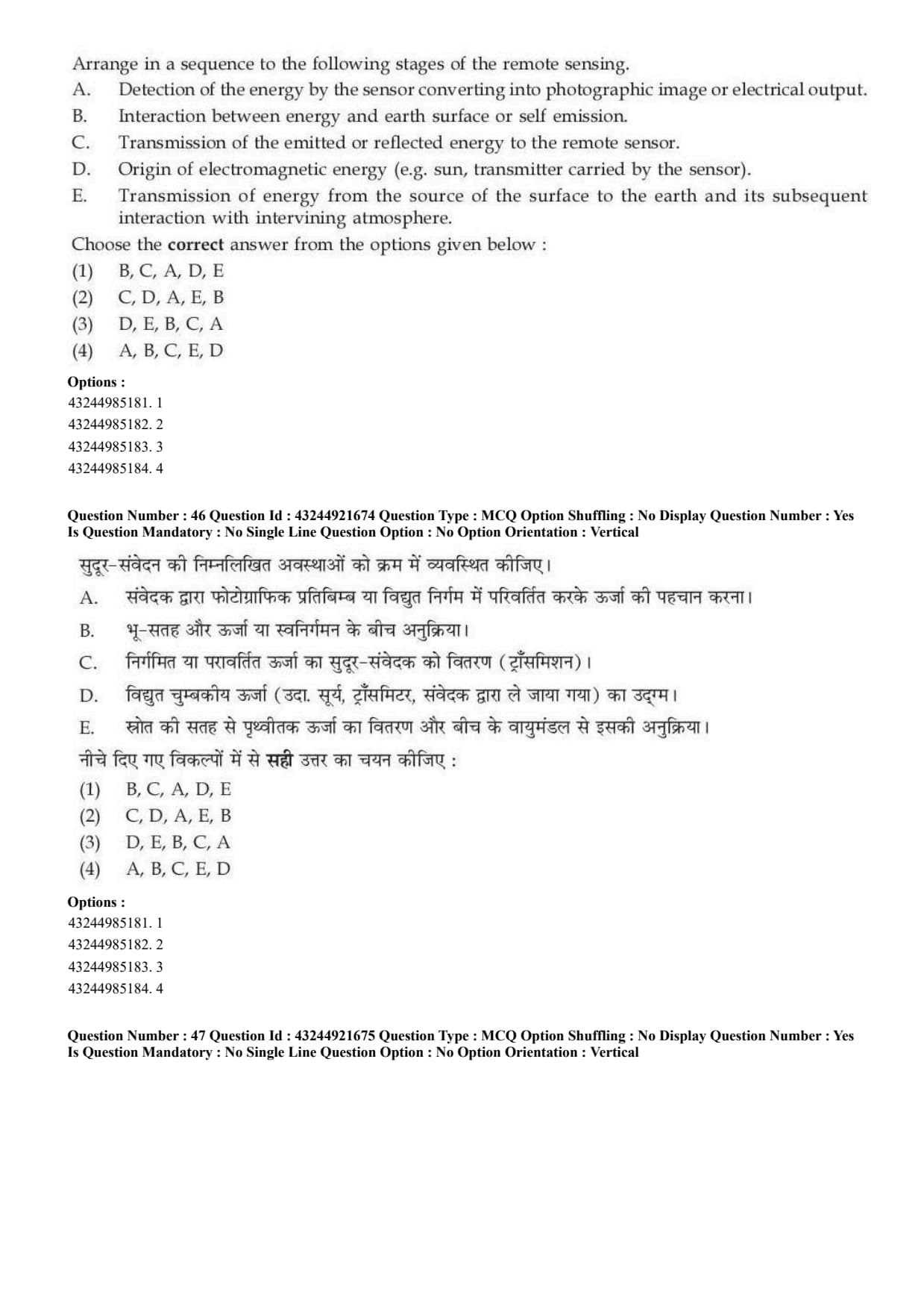
Question 46:

Arrange in a sequence the following stages of remote sensing.
A. Detection of the energy by the sensor converting into photographic image or electrical output,
B. Interaction between energy and earth surface or self emission,
C. Transmission of the emitted or reflected energy to the remote sensor,
D. Origin of electromagnetic energy,
E. Transmission of energy from the source to the earth surface and its interaction with atmosphere.

  • (A) B, C, A, D, E
  • (B) C, D, A, E, B
  • (C) D, E, B, C, A
  • (D) A, B, C, E, D
Correct Answer: (C) D, E, B, C, A
View Solution


Concept:

Remote sensing involves energy source, transmission, interaction with target, reflected energy reaching sensor, and detection.


Step 1: Origin of energy.

First, electromagnetic energy originates from a source such as the sun or a transmitter.
\[ First step=D \]


Step 2: Transmission through atmosphere.

Energy travels from source to earth surface and interacts with the atmosphere.
\[ Second step=E \]


Step 3: Interaction with surface.

Energy interacts with the earth surface or target.
\[ Third step=B \]


Step 4: Energy reaches sensor.

The reflected or emitted energy is transmitted to the sensor.
\[ Fourth step=C \]


Step 5: Detection by sensor.

Finally, the sensor detects energy and converts it into an image or electrical signal.
\[ Fifth step=A \]


Therefore: \[ D,E,B,C,A \]
\[ \therefore Correct Answer is (C) \] Quick Tip: Remote sensing sequence is energy source, atmospheric path, target interaction, energy received by sensor, and data output.


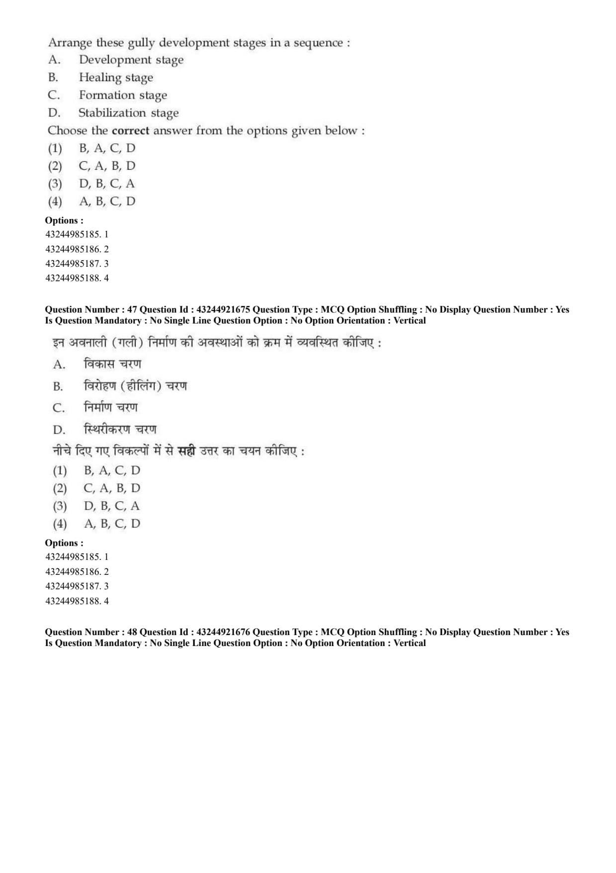
Question 47:

Arrange these gully development stages in a sequence.
A. Development stage,
B. Healing stage,
C. Formation stage,
D. Stabilization stage.

  • (A) B, A, C, D
  • (B) C, A, B, D
  • (C) D, B, C, A
  • (D) A, B, C, D
Correct Answer: (B) C, A, B, D
View Solution


Concept:

A gully passes through different stages from its beginning to stabilization.


Step 1: Formation stage.

The first stage is formation, where the gully starts developing due to concentrated runoff.
\[ First step=C \]


Step 2: Development stage.

After formation, the gully deepens and widens.
\[ Second step=A \]


Step 3: Healing stage.

Later, vegetation and deposition may start healing the gully.
\[ Third step=B \]


Step 4: Stabilization stage.

Finally, the gully becomes stabilized.
\[ Fourth step=D \]


Thus, the correct sequence is: \[ C,A,B,D \]
\[ \therefore Correct Answer is (B) \] Quick Tip: Gully development sequence is formation, development, healing and stabilization.


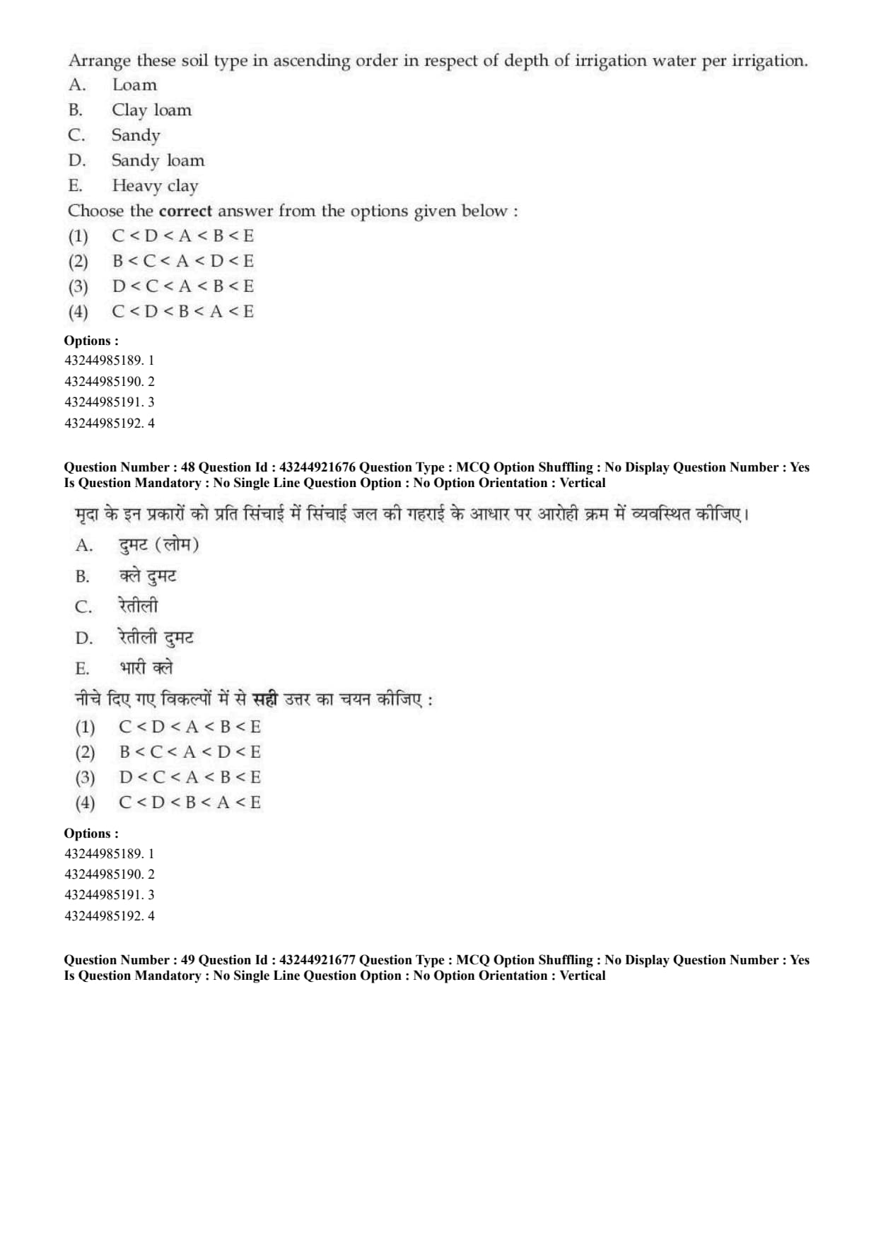
Question 48:

Arrange these soil types in ascending order in respect of depth of irrigation water per irrigation.
A. Loam,
B. Clay loam,
C. Sandy,
D. Sandy loam,
E. Heavy clay.

  • (A) C \(<\) D \(<\) A \(<\) B \(<\) E
  • (B) B \(<\) C \(<\) A \(<\) D \(<\) E
  • (C) D \(<\) C \(<\) A \(<\) B \(<\) E
  • (D) C \(<\) D \(<\) B \(<\) A \(<\) E
Correct Answer: (A) C \(<\) D \(<\) A \(<\) B \(<\) E
View Solution


Concept:

Depth of irrigation water depends on the water holding capacity of soil. Sandy soils require less depth per irrigation, while clayey soils require more.


Step 1: Lowest irrigation depth.

Sandy soil has low water holding capacity, so less water is applied per irrigation.
\[ Lowest=C \]


Step 2: Intermediate soils.

Sandy loam requires more than sandy soil. Loam requires more than sandy loam. Clay loam requires still more.
\[ D


Step 3: Highest irrigation depth.

Heavy clay has high water holding capacity, so it needs the highest depth per irrigation.
\[ Highest=E \]


Step 4: Final ascending order. \[ C \[ \therefore Correct Answer is (A) \] Quick Tip: Sandy soil needs smaller irrigation depth but more frequent irrigation; clayey soil needs larger depth but less frequent irrigation.


Question 49:

Arrange these irrigation methods with increasing water use efficiency.
A. Sprinkler method,
B. Flood method,
C. Drip method,
D. Basin method.

  • (A) D \(<\) C \(<\) A \(<\) B
  • (B) C \(<\) B \(<\) A \(<\) D
  • (C) B \(<\) D \(<\) A \(<\) C
  • (D) C \(<\) D \(<\) B \(<\) A
Correct Answer: (C) B \(<\) D \(<\) A \(<\) C
View Solution


Concept:

Water use efficiency depends on how effectively irrigation water is applied and used by the crop.


Step 1: Flood method.

Flood irrigation usually has the lowest water use efficiency because losses are high.
\[ Lowest=B \]


Step 2: Basin method.

Basin method is better than flood method but still has more losses than sprinkler and drip.
\[ Next=D \]


Step 3: Sprinkler method.

Sprinkler method has better water use efficiency than surface irrigation methods.
\[ Next=A \]


Step 4: Drip method.

Drip irrigation applies water directly near the root zone, so it has the highest water use efficiency.
\[ Highest=C \]


Thus: \[ B \[ \therefore Correct Answer is (C) \] Quick Tip: Drip irrigation has the highest water use efficiency among common irrigation methods.


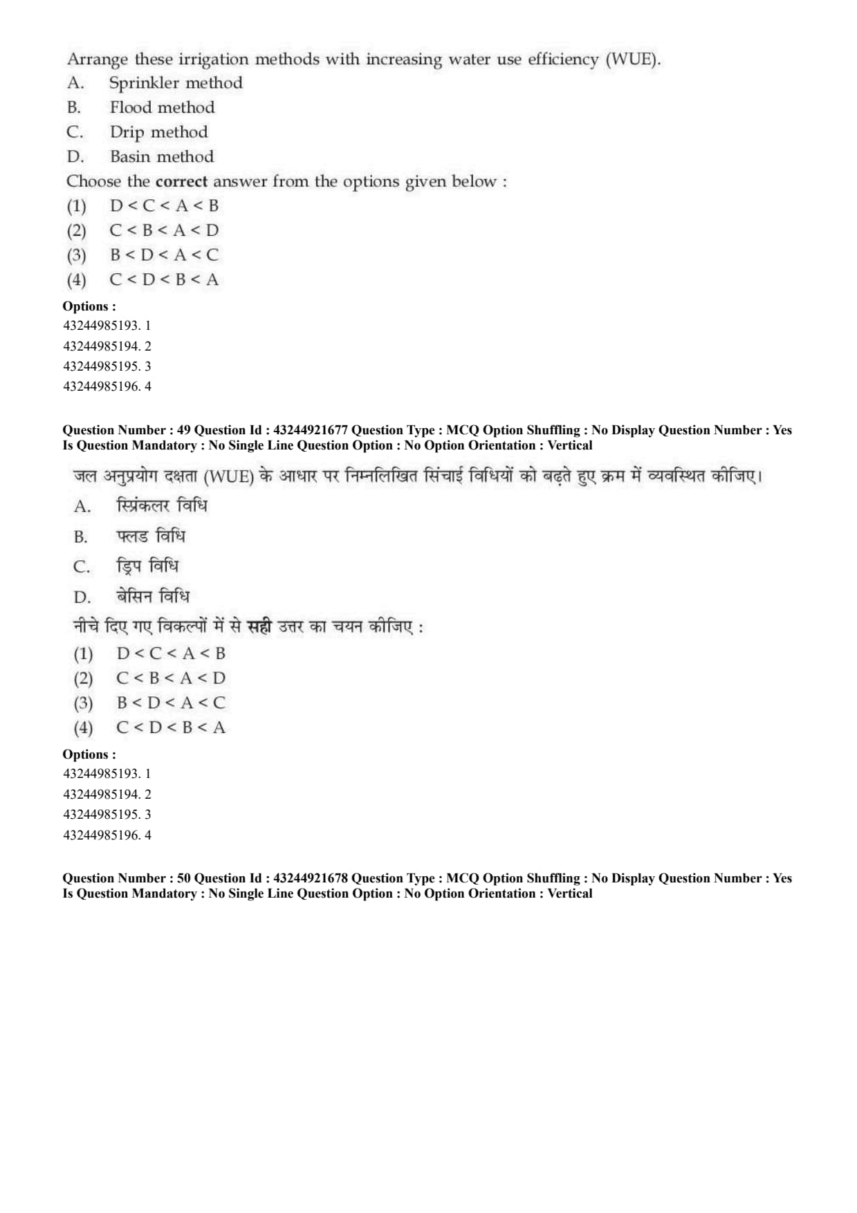
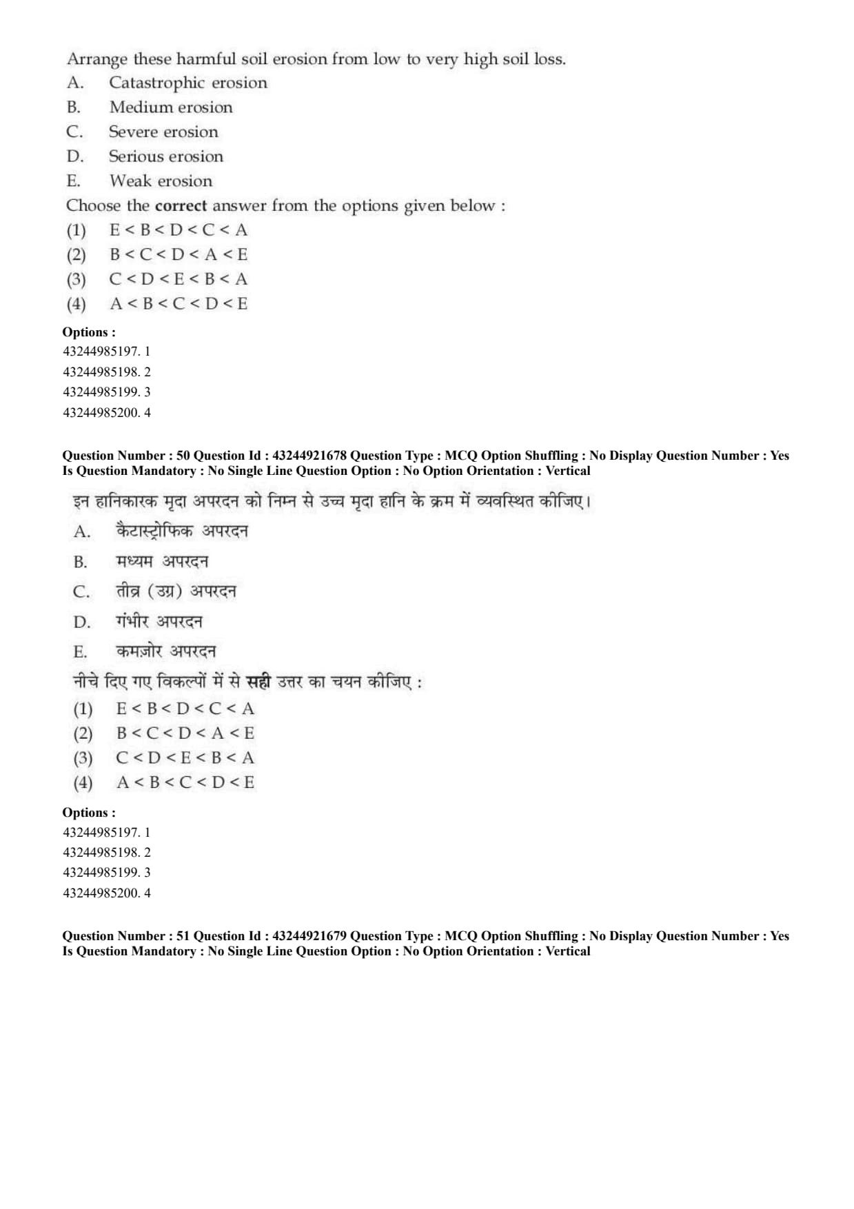
Question 50:

Arrange these harmful soil erosion classes from low to very high soil loss.
A. Catastrophic erosion,
B. Medium erosion,
C. Severe erosion,
D. Serious erosion,
E. Weak erosion.

  • (A) E \(<\) B \(<\) D \(<\) C \(<\) A
  • (B) B \(<\) C \(<\) D \(<\) A \(<\) E
  • (C) C \(<\) D \(<\) E \(<\) B \(<\) A
  • (D) A \(<\) B \(<\) C \(<\) D \(<\) E
Correct Answer: (A) E \(<\) B \(<\) D \(<\) C \(<\) A
View Solution


Concept:

Soil erosion may be classified according to the severity of soil loss.


Step 1: Lowest erosion.

Weak erosion causes the lowest soil loss.
\[ Lowest=E \]


Step 2: Medium and serious erosion.

Medium erosion is followed by serious erosion.
\[ B


Step 3: Severe and catastrophic erosion.

Severe erosion causes high soil loss, while catastrophic erosion causes very high soil loss.
\[ C


Step 4: Final order. \[ E \[ \therefore Correct Answer is (A) \] Quick Tip: Severity of erosion increases from weak to medium, serious, severe and catastrophic.


Question 61:

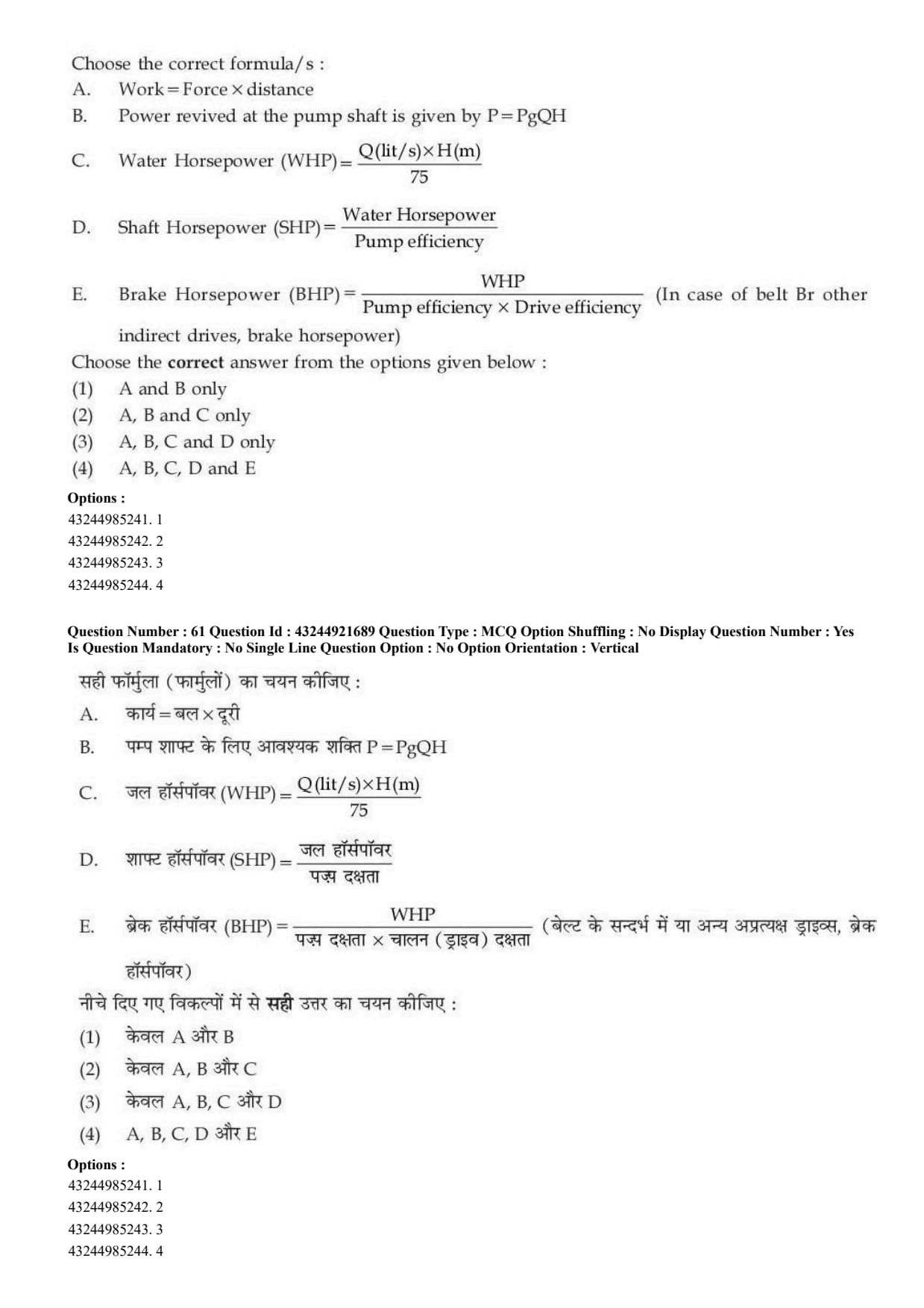
Choose the correct formula/s:
[label=\Alph*.]
\(Work = Force \times distance\)
Power revived at the pump shaft is given by \(P = \rho g Q H\)
\(Water Horsepower (WHP) = \frac{Q(lit/s) \times H(m)}{75}\)
\(Shaft Horsepower (SHP) = \frac{Water Horsepower}{Pump efficiency}\)
\(Brake Horsepower (BHP) = \frac{WHP}{Pump efficiency \times Drive efficiency}\) (In case of belt Br other indirect drives, brake horsepower)

Choose the correct answer from the options given below:

Correct Answer: (C) A, C and D only
View Solution


Concept:


In pump and fluid power calculations, different types of power are used.

The main terms are:
\[ WHP = Water Horsepower \]
\[ SHP = Shaft Horsepower \]
\[ BHP = Brake Horsepower \]

Water horsepower is the useful power given to water.

Shaft horsepower is the power supplied at the pump shaft.

Brake horsepower is the power supplied by the driving machine or motor to the shaft.

Because of losses in the pump and drive system, the power required at the shaft or motor is generally greater than the useful water horsepower.


Step 1: {\color{redChecking formula A.


Formula A is: \[ Work = Force \times distance \]

This is the standard formula of work done when force acts in the direction of displacement.

So, statement A is correct.
\[ A \Rightarrow Correct \]


Step 2: {\color{redChecking formula B.


Formula B is: \[ P = \rho gQH \]

Here, \[ \rho = density of water \] \[ g = acceleration due to gravity \] \[ Q = discharge \] \[ H = head \]

The formula: \[ P = \rho gQH \]

gives the hydraulic power or water power.

It represents the useful power delivered to water.

But the statement says that this is the power received at the pump shaft.

Power at the pump shaft should include pump efficiency.

Actually, \[ Shaft\ Power = \frac{\rho gQH}{Pump\ efficiency} \]

Therefore, statement B is not correct.
\[ B \Rightarrow Incorrect \]


Step 3: {\color{redChecking formula C.


Formula C is: \[ Water\ Horsepower\ (WHP)=\frac{Q(lit/s)\times H(m)}{75} \]

When discharge is given in litre per second and head is given in metre, the water horsepower is calculated as: \[ WHP = \frac{Q \times H}{75} \]

This is a standard formula in metric horsepower.

So, statement C is correct.
\[ C \Rightarrow Correct \]


Step 4: {\color{redChecking formula D.


Formula D is: \[ Shaft\ Horsepower\ (SHP)=\frac{Water\ Horsepower}{Pump\ efficiency} \]

Pump efficiency is given by: \[ Pump\ efficiency = \frac{Water\ Horsepower}{Shaft\ Horsepower} \]

Rearranging the formula: \[ Shaft\ Horsepower = \frac{Water\ Horsepower}{Pump\ efficiency} \]

Therefore, statement D is correct.
\[ D \Rightarrow Correct \]


Step 5: {\color{redChecking formula E.


Formula E is: \[ BHP=\frac{WHP}{Pump\ efficiency \times Drive\ efficiency} \]

This formula is used when both pump efficiency and drive efficiency are considered.

But in the given options, there is no option containing A, C, D and E only.

Also, the option containing E includes B also, and statement B is incorrect because \(\rho gQH\) is hydraulic power, not shaft power.

So, according to the given options, the correct combination is: \[ A,\ C,\ D \]


Step 6: {\color{redFinal conclusion.


The correct statements are: \[ A,\ C,\ D \]

Hence, the correct answer is: \[ \boxed{(C) A, C and D only} \] Quick Tip: Remember: \[ P=\rho gQH \] gives water power or hydraulic power, not shaft power. Shaft power is greater because pump losses must be considered: \[ SHP=\frac{WHP}{Pump\ efficiency} \]


Question 63:

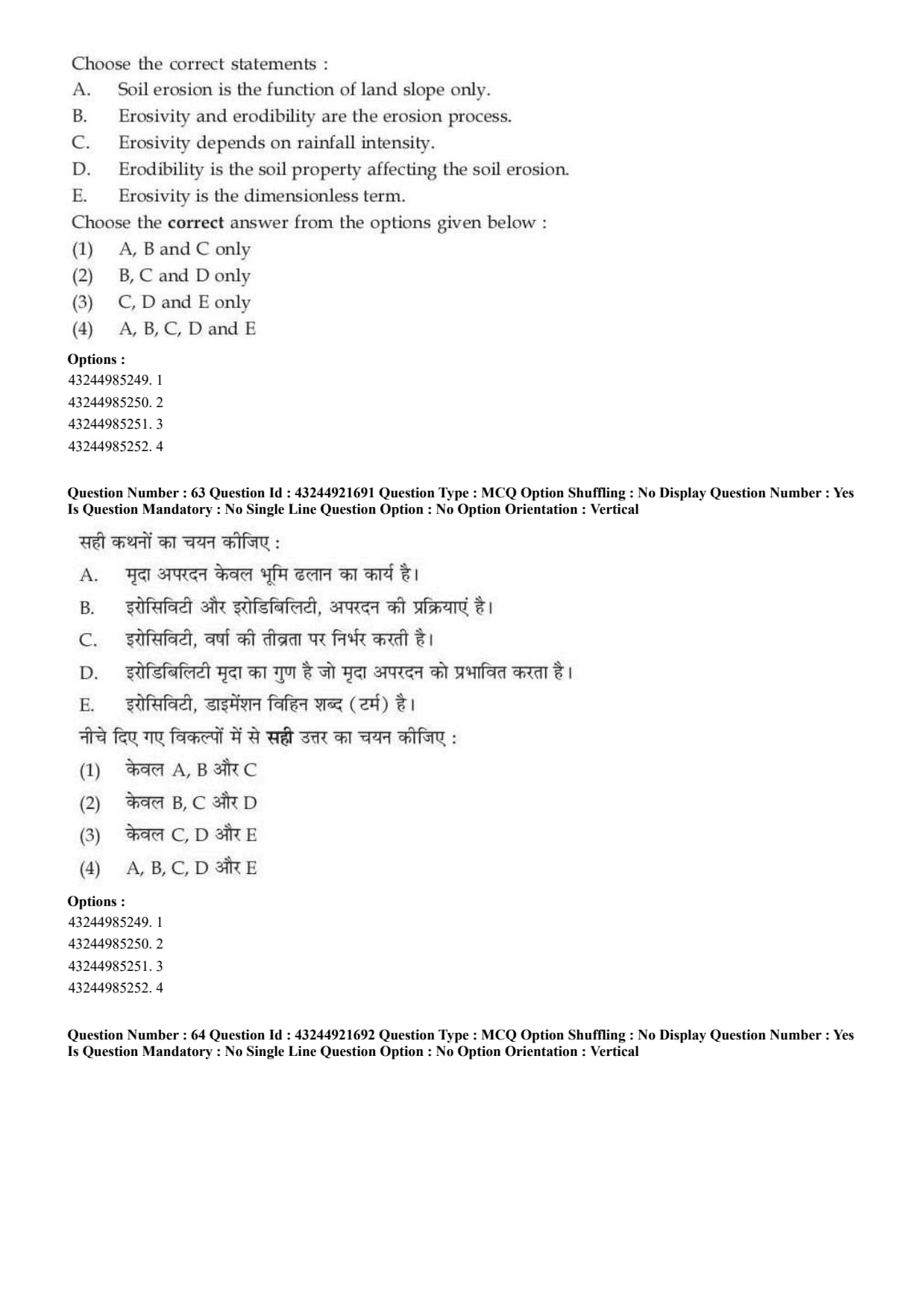
Choose the correct statements:
A. Soil erosion is the function of land slope only.
B. Erosivity and erodibility are the erosion process.
C. Erosivity depends on rainfall intensity.
D. Erodibility is the soil property affecting the soil erosion.
E. Erosivity is the dimensionless term.


CUET PG 2026 Exam Analysis