




The Ring of Fire and the Himalaya-forming plate collision appear in nearly every UPSC prelims paper, and Class 11 Geography Chapter 4 Distribution of Oceans and Continents is therefore one of the highest-yield chapters for competitive exams, worth 4 to 6 marks in CBSE Boards too. The current 2026-27 NCERT keeps all four sections intact. This page hosts the notes PDF and a full plate-boundary reference table.
- CBSE Weightage: 4 to 6 marks, usually one short-answer question on plate boundaries plus one on the Indian plate's journey.
- UPSC and State PSC Relevance: a near-certain prelims topic, especially the Ring of Fire, sea floor spreading and the Himalaya-forming collision.
- Format: a 22-page PDF with the original NCERT plate-boundary map, the Indian plate's 225-million-year timeline and a full plates table.
These NCERT Notes Class 11 Geography Chapter 4 Distribution of Oceans and Continents are curated by subject experts, checked against the 2026-27 NCERT textbook, and organised the same way the chapter flows: continental drift, sea floor spreading, plate tectonics and the Indian plate's journey.
Student Feedback: What 9,340 students told us. In a Collegedunia poll before 2026-27 exams, 58% flipped the depth rule for ridge and trench earthquakes, the opposite of what is true.
|
Table of Contents |
Why Distribution of Oceans and Continents Matters for Boards and Beyond
Every world map is a snapshot of a process that never stopped. The continents joined as recently as 200 million years ago, and they still move, at roughly the speed your fingernails grow. This chapter covers the two competing theories, continental drift and plate tectonics, that explain why oceans and continents sit exactly where they do.
- Boards test the evidence chain: examiners ask which fossil, rock or glacial deposit proves which claim, so matching evidence to keyword is its own scoring skill.
- UPSC and state PSC exams love this chapter: the Ring of Fire, the three boundary types and the Himalaya-Deccan Traps timeline appear across prelims almost every year.
Continental Drift and Plate Tectonics Explained
Source: Tulsi Global Academy 2.0 on YouTube
How Collegedunia's Notes Help You With Distribution of Oceans and Continents
The NCERT Notes Class 11 Geography Chapter 4 Distribution of Oceans and Continents turn a dense, evidence-heavy chapter into a sequence you can revise the night before an exam.
- Every named piece of evidence, jig-saw-fit, tillite, placer deposits, fossil distribution, laid out with the exact exam keyword.
- All three plate boundary types matched to a real example each.
- The full Indian plate timeline, 225 million years ago to today, mapped against the Himalayas and Deccan Traps.
Continental Drift: Wegener's 1912 Theory
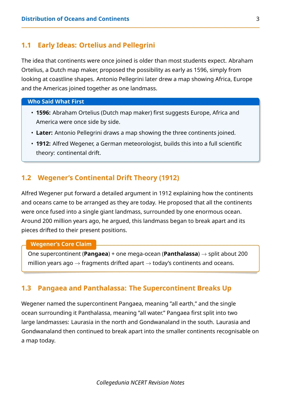
Abraham Ortelius, a Dutch map maker, first suggested in 1596 that the continents once sat side by side, purely from coastline shapes. Antonio Pellegrini later drew a map showing Africa, Europe and the Americas joined. Alfred Wegener, a German meteorologist, built this into a full theory in 1912: continental drift.
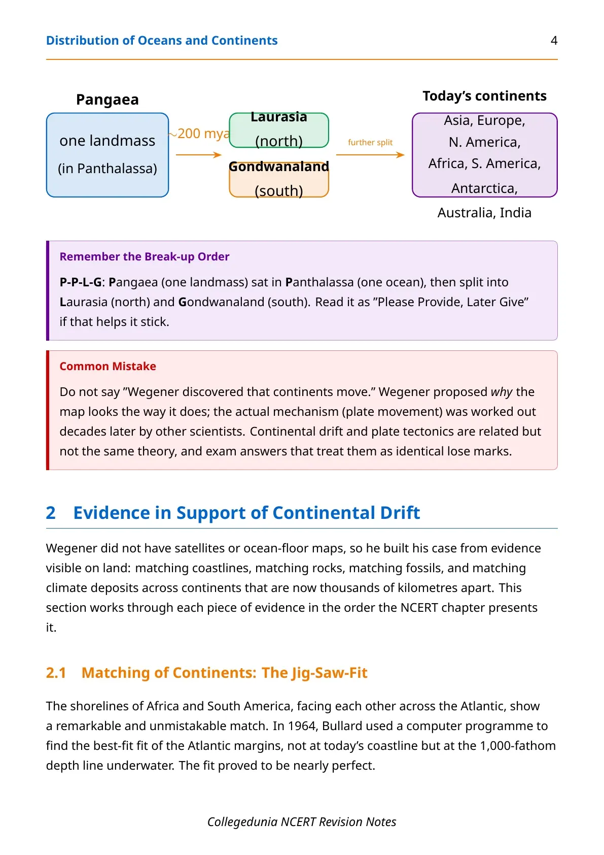
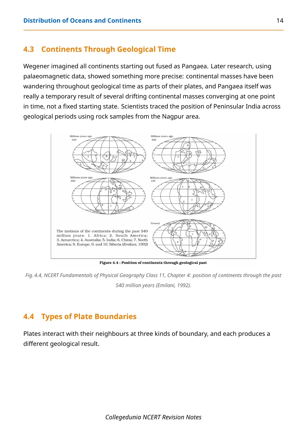
Wegener proposed every continent was once fused into one supercontinent, Pangaea ("all earth"), surrounded by one mega-ocean, Panthalassa ("all water"). Around 200 million years ago, Pangaea split into Laurasia in the north and Gondwanaland in the south, which then broke apart further into today's continents.
| Who | Contribution | Year |
|---|---|---|
| Abraham Ortelius | First suggested continents were once joined, from coastline shapes | 1596 |
| Antonio Pellegrini | Drew a map showing Africa, Europe and the Americas joined | Before 1912 |
| Alfred Wegener | Built the full continental drift theory around Pangaea and Panthalassa | 1912 |
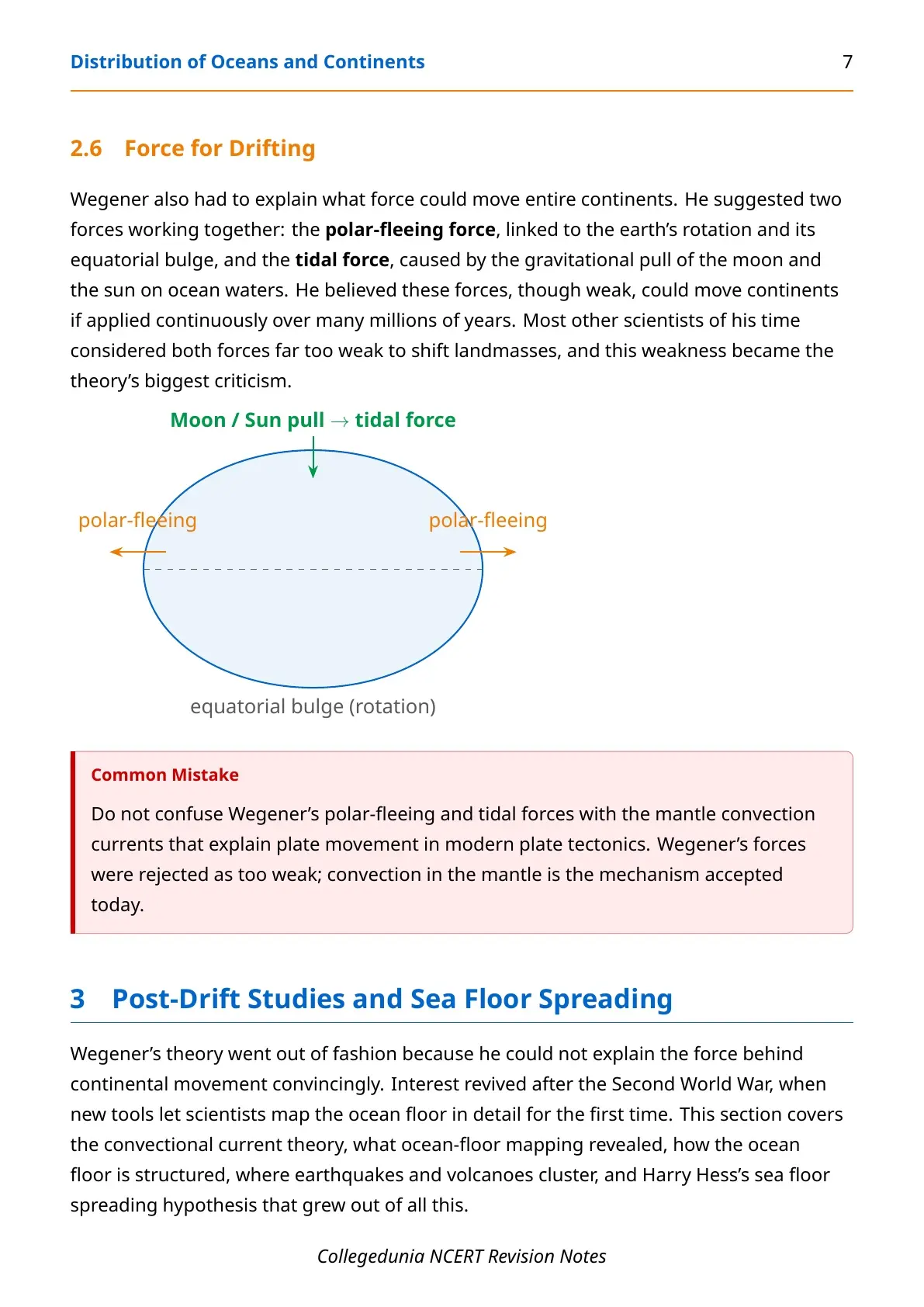
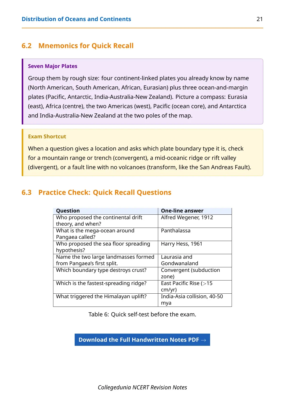
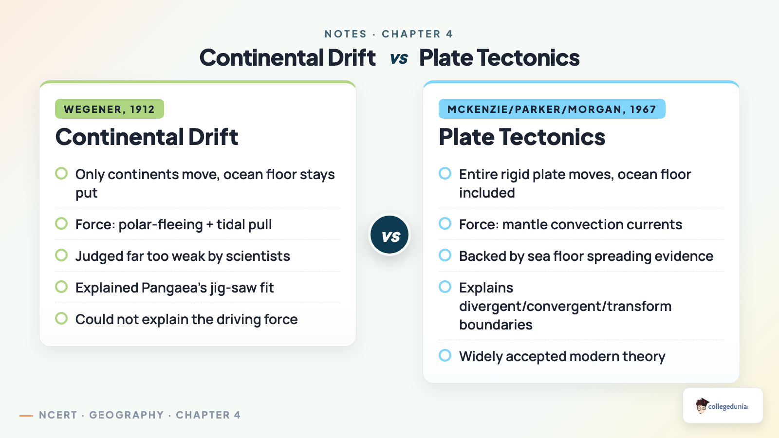
Wegener suggested two forces: the polar-fleeing force, linked to earth's rotation and its equatorial bulge, and the tidal force, from the moon and sun's pull on ocean waters. Most scientists judged both far too weak to shift landmasses, and this became the theory's biggest criticism.
Common mistake: do not write that Wegener "discovered continents move." He proposed why the map looks this way; the mechanism, plate movement, was worked out decades later. The two theories are related, not identical.
Evidence for Continental Drift
Wegener had no satellites or ocean-floor maps, so he built his case from evidence visible on land: matching coastlines, rocks, fossils and glacial deposits across continents now thousands of kilometres apart.
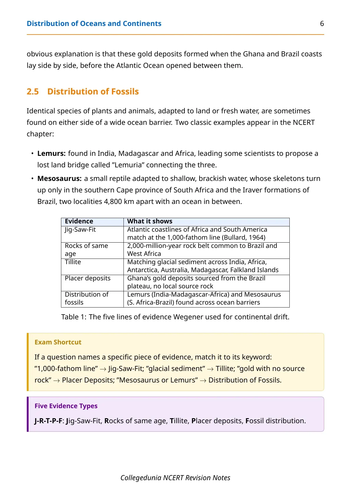
| Evidence | What it shows |
|---|---|
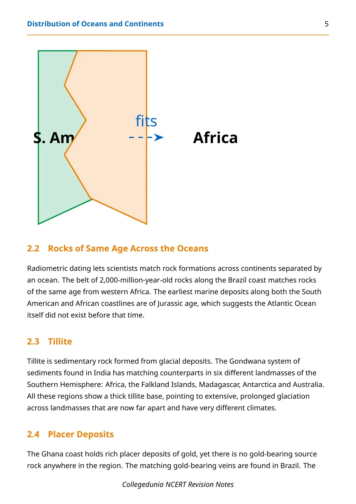
| Jig-Saw-Fit | Atlantic coastlines of Africa and South America match almost perfectly at the 1,000-fathom depth line, confirmed by Bullard's 1964 computer fit |
| Rocks of same age | A 2,000-million-year-old rock belt is common to the Brazil coast and western Africa |
| Tillite | Matching glacial sediment (tillite) is found across India, Africa, Antarctica, Australia, Madagascar and the Falkland Islands |
| Placer deposits | Ghana's gold-bearing placer deposits have no local source rock; the matching gold veins sit in Brazil |
| Distribution of fossils | Lemurs (India, Madagascar, Africa) and Mesosaurus (South Africa, Brazil) are found on either side of oceans they could never have swum across |
Mesosaurus is worth remembering by name: a small reptile of shallow, brackish water, its skeletons turn up only in South Africa's Cape province and Brazil's Iraver formations, two spots 4,800 km apart with an ocean between them today.
Sea Floor Spreading and Ocean Floor Configuration
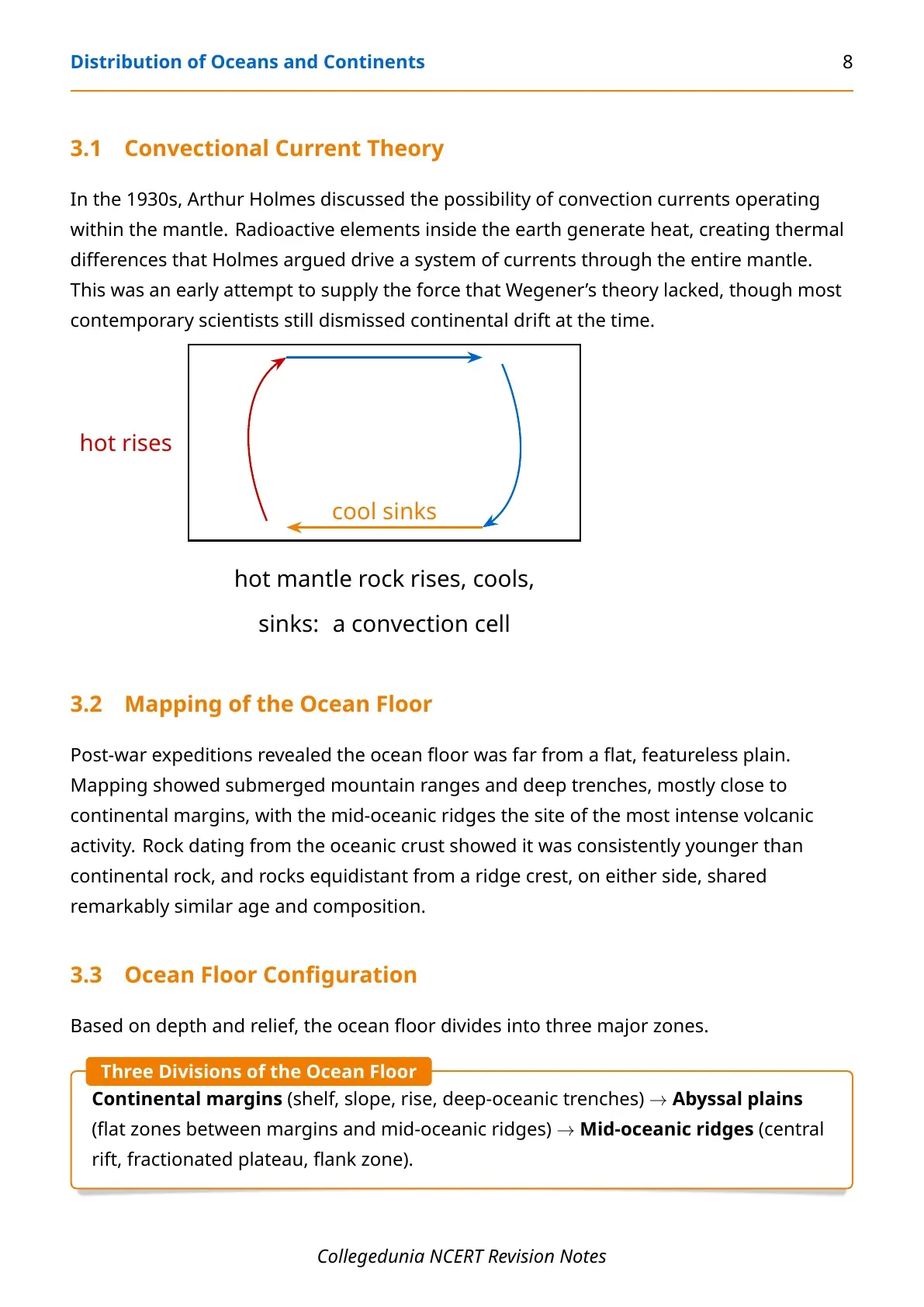
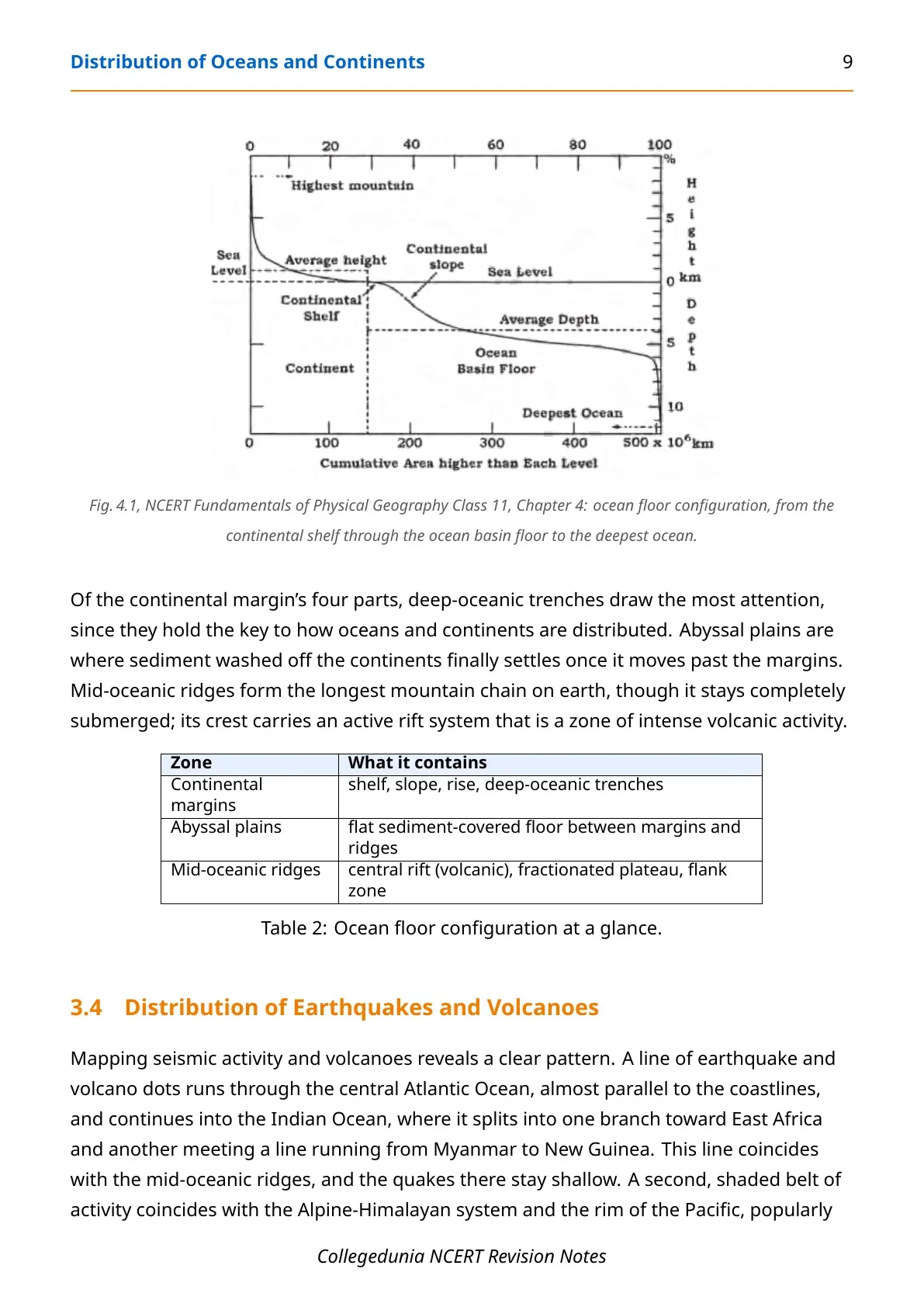
Wegener's theory lost favour once critics picked apart his weak force mechanism. Interest returned only after the Second World War, when new tools let scientists map the ocean floor in detail. In the 1930s, Arthur Holmes had already proposed that radioactive decay inside the earth drives convection currents through the mantle, an early attempt at the force Wegener's theory lacked. Post-war mapping showed the ocean floor holds submerged mountain ranges and deep trenches, and that oceanic crust is consistently younger than continental rock.
| Zone | What it contains |
|---|---|
| Continental margins | Shelf, slope, rise, deep-oceanic trenches |
| Abyssal plains | Flat, sediment-covered floor between margins and ridges |
| Mid-oceanic ridges | Central rift (volcanic), fractionated plateau, flank zone; the longest mountain chain on earth, though entirely submerged |
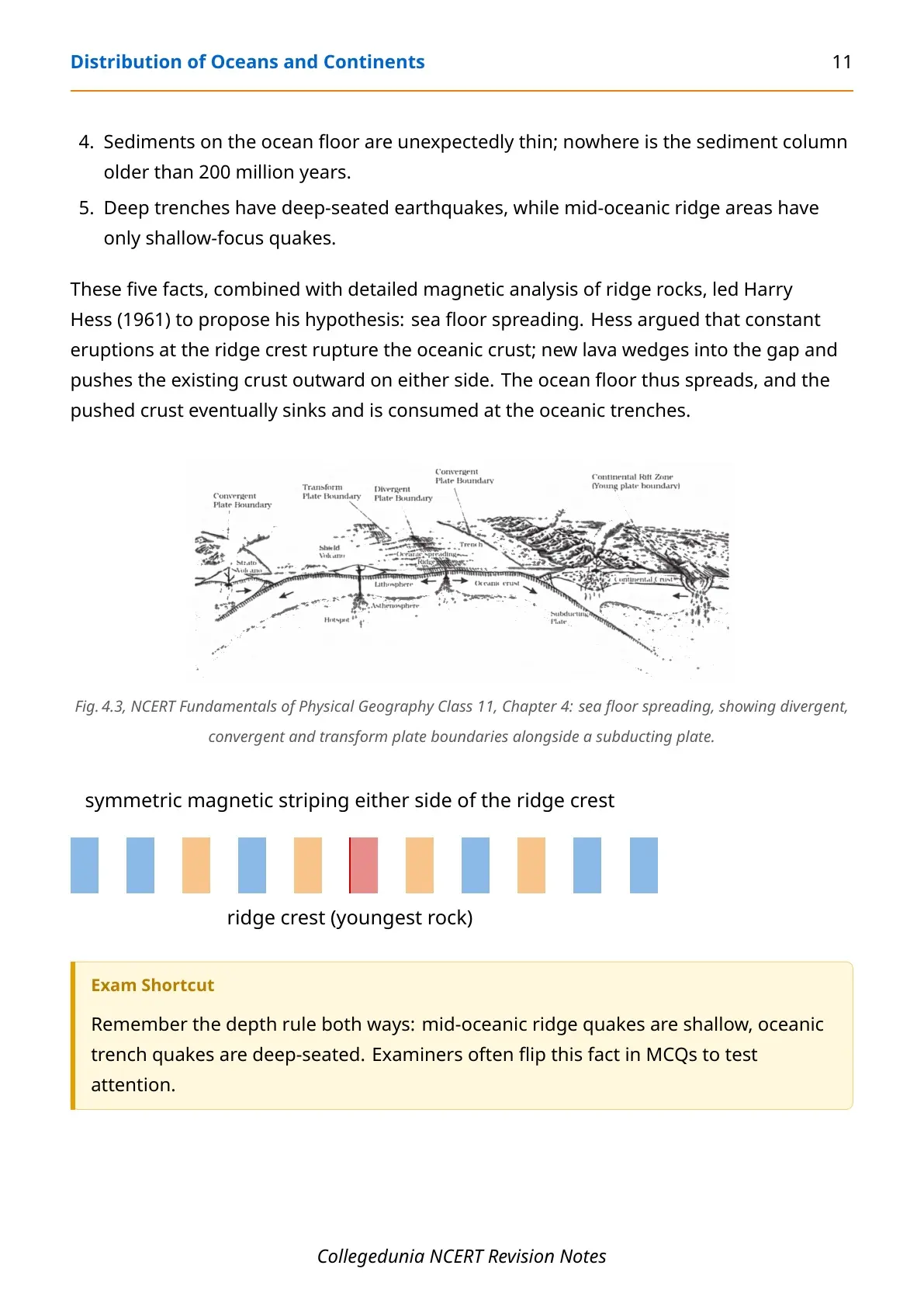
Five facts, unavailable to Wegener, led Harry Hess to his 1961 sea floor spreading hypothesis: eruptions at the ridge crest rupture the oceanic crust, new lava wedges in, and the existing crust is pushed outward on either side, eventually sinking at deep-oceanic trenches.
- Rocks equidistant from a ridge crest share the same age, composition and magnetic properties; oceanic crust is nowhere older than 200 million years, against continental rock's 3,200 million.
- Mid-oceanic ridges have only shallow-focus quakes; deep trenches have deep-seated ones.
Plate Tectonics: Boundaries and the Seven Major Plates
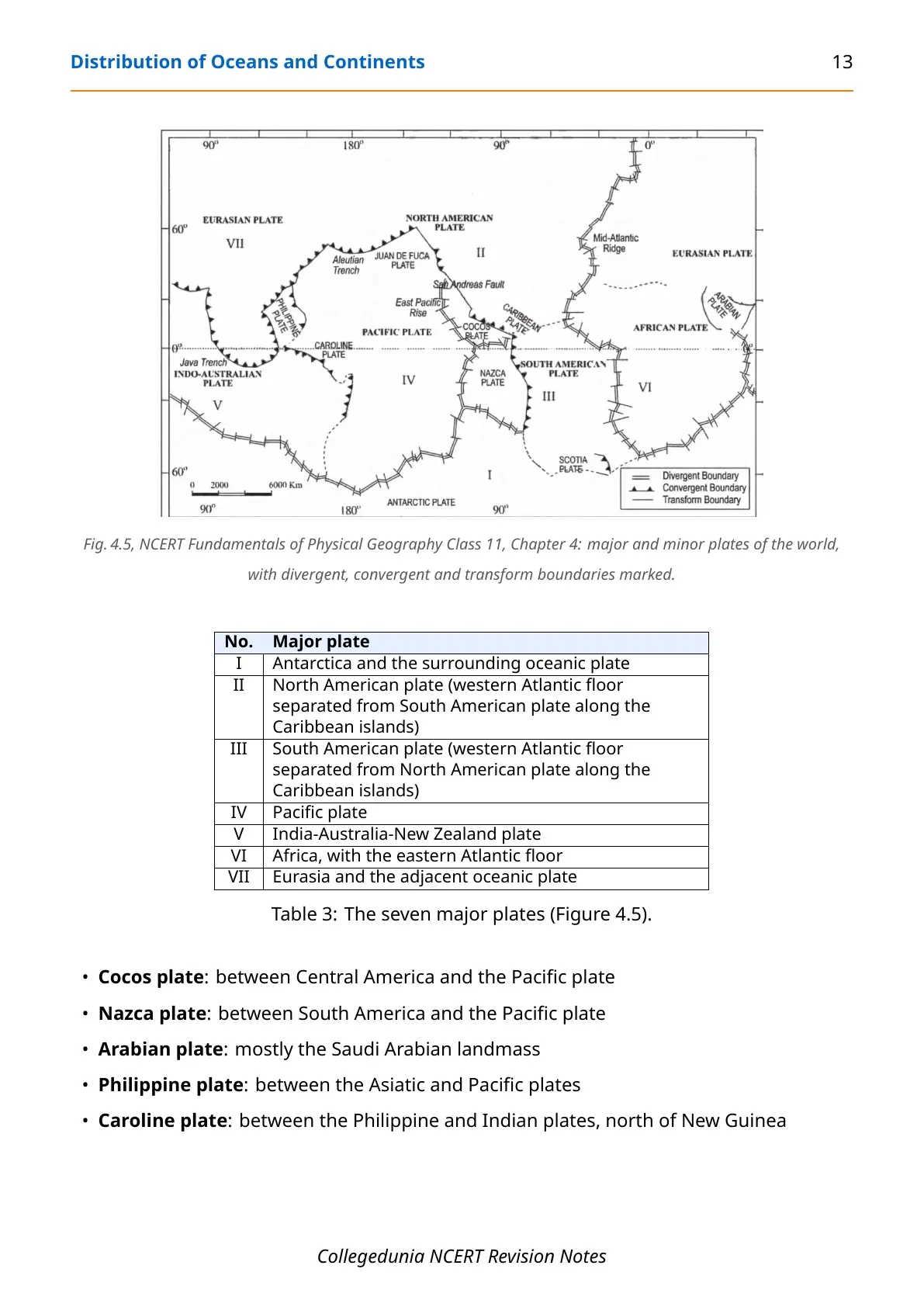
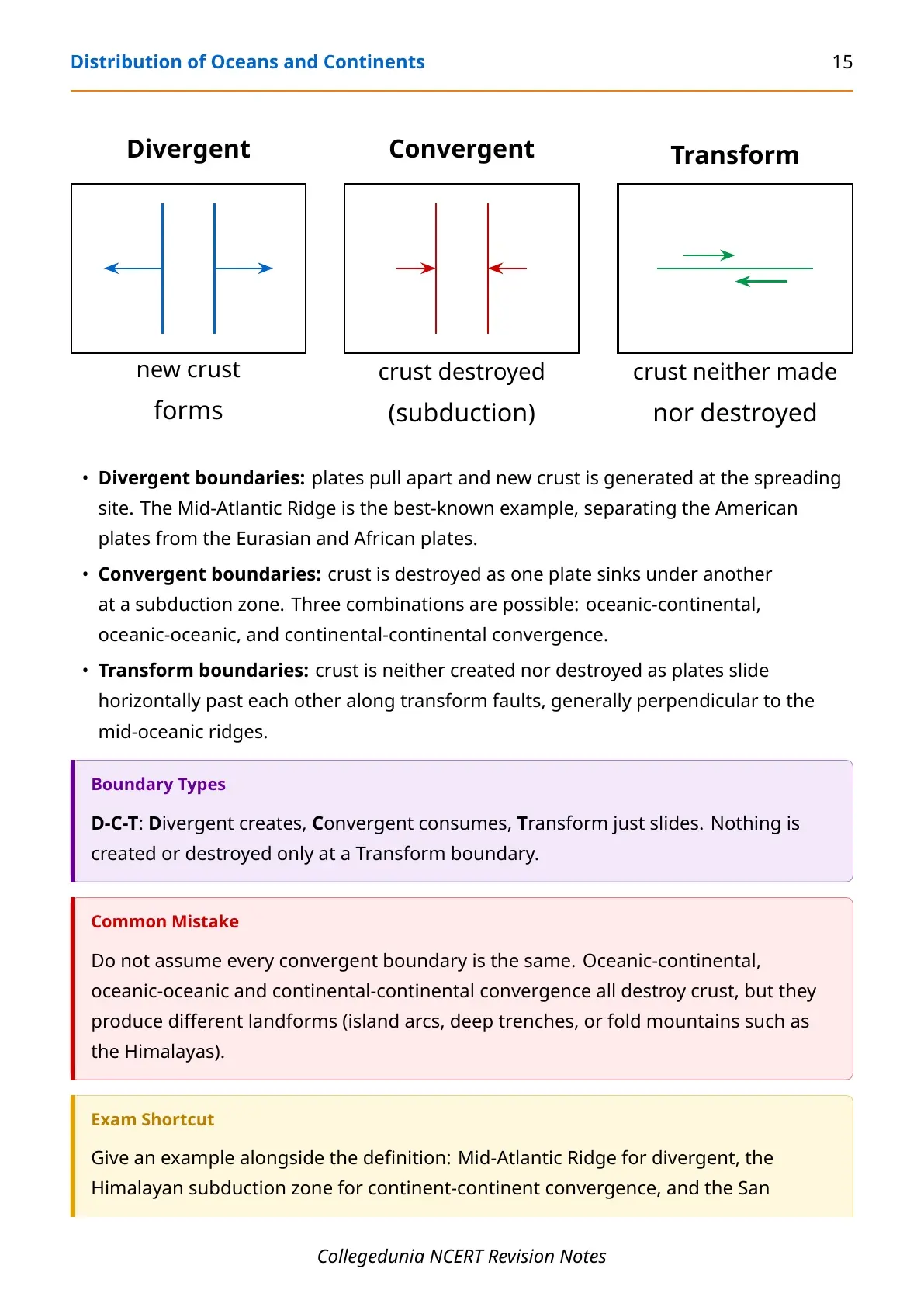
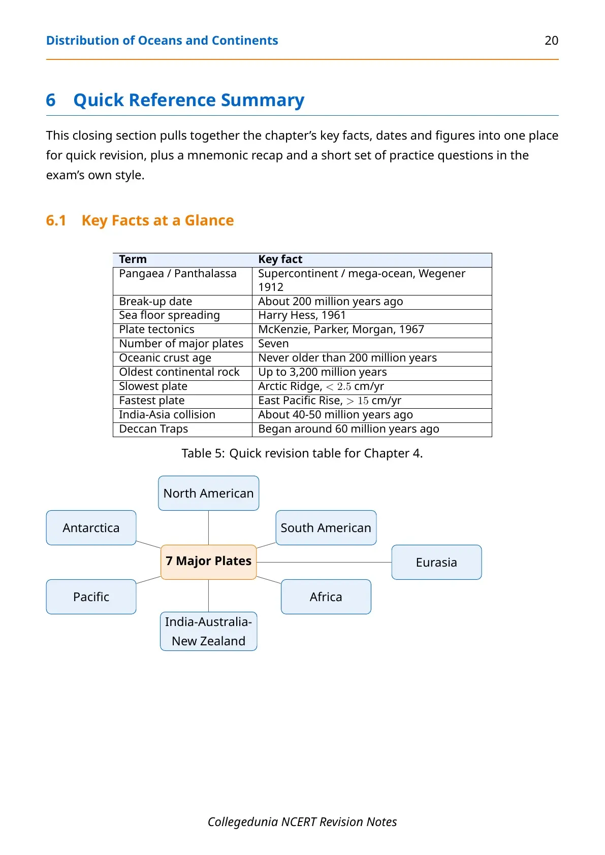
Sea floor spreading revived interest, and in 1967 McKenzie, Parker and Morgan combined the evidence into plate tectonics. A tectonic plate is a massive slab riding over the asthenosphere as one rigid unit, so the plate moves, not the continent alone. The lithosphere splits into seven major plates and several minor ones (Cocos, Nazca, Arabian, Philippine, Caroline), which interact at their edges in three ways.
| Boundary | What happens | Example |
|---|---|---|
| Divergent | Plates pull apart; new crust forms at the spreading site | Mid-Atlantic Ridge |
| Convergent | Crust is destroyed as one plate sinks under another (subduction); can be oceanic-continental, oceanic-oceanic or continental-continental | Himalayan subduction zone |
| Transform | Plates slide horizontally past each other; crust is neither made nor destroyed | San Andreas Fault |
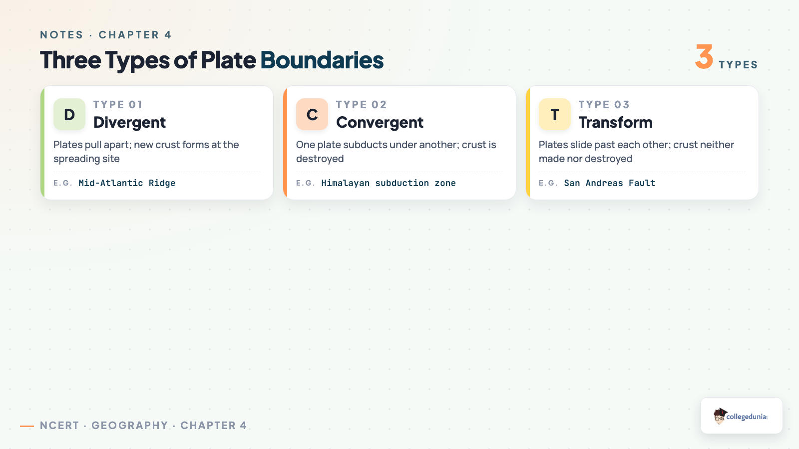
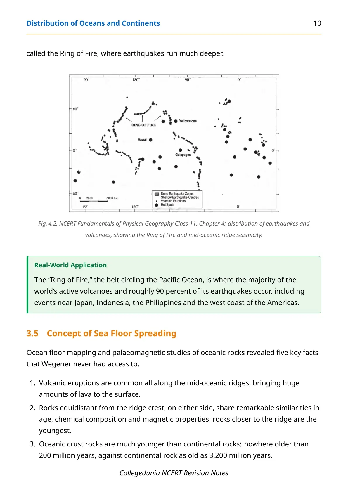
Plate speed varies widely: the Arctic Ridge moves slowest, under 2.5 cm a year, while the East Pacific Rise near Easter Island moves fastest, over 15 cm a year. Earthquake and volcano mapping shows a shallow belt along the mid-oceanic ridges, and a deeper belt along the Alpine-Himalayan system and Pacific rim, the Ring of Fire.
Key Facts You Must Memorise Before the Exam
- Pangaea split roughly 200 million years ago into Laurasia (north) and Gondwanaland (south).
- The five evidence types for continental drift: jig-saw-fit, rocks of same age, tillite, placer deposits, fossil distribution.
- Harry Hess proposed sea floor spreading in 1961; McKenzie, Parker and Morgan formalised plate tectonics in 1967.
- The earth's lithosphere has seven major plates and several minor ones.
- Only a transform boundary neither creates nor destroys crust; divergent creates it, convergent destroys it.
- The Ring of Fire accounts for roughly 90 percent of the world's earthquakes.
Movement of the Indian Plate and the Formation of the Himalayas
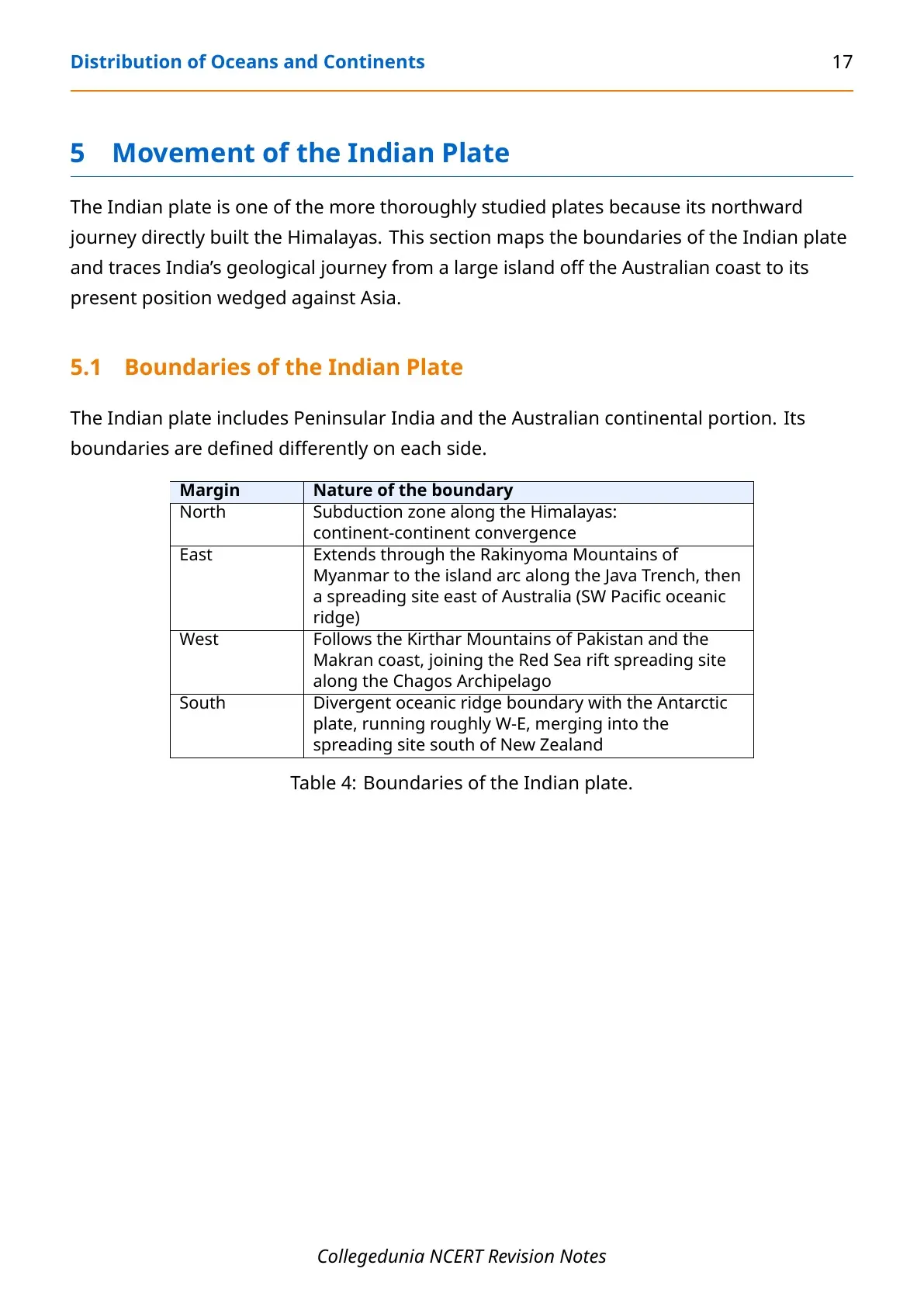
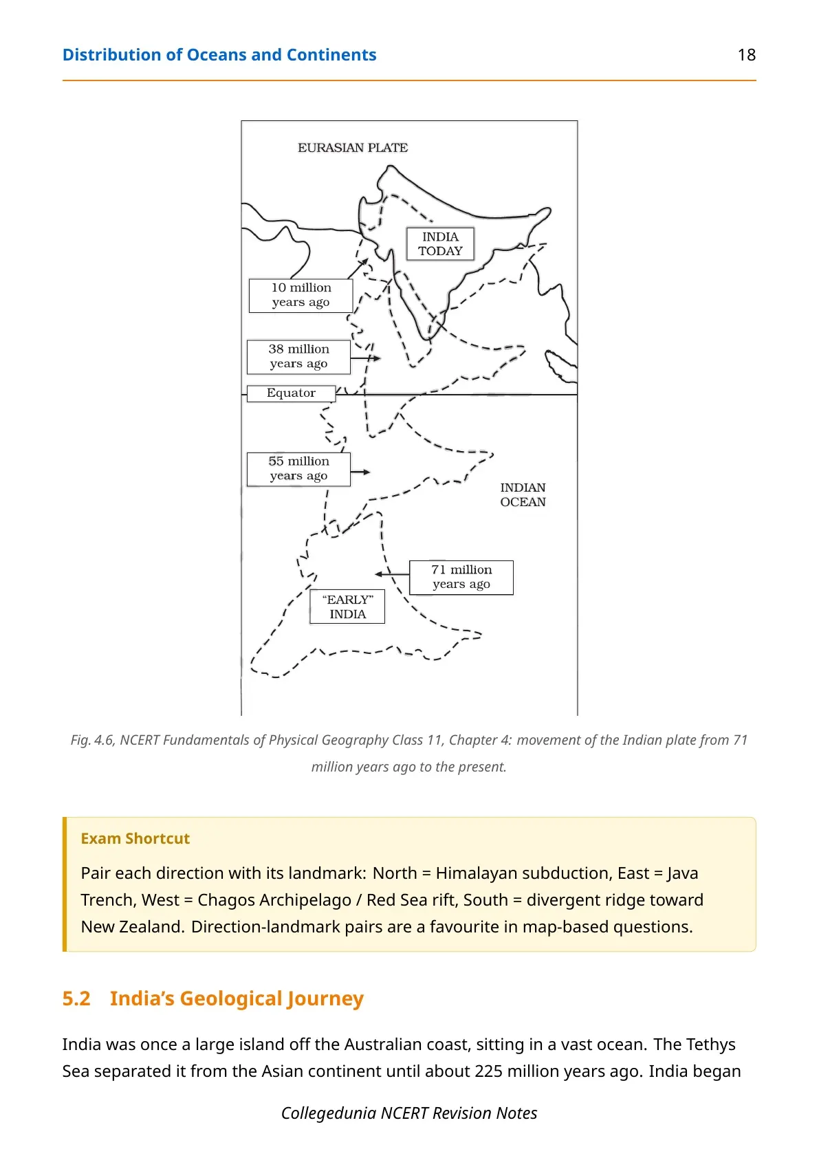
The Indian plate includes Peninsular India and the Australian continental portion. Its north margin is a subduction zone along the Himalayas, east runs through Myanmar to the Java Trench, west follows Pakistan's Kirthar Mountains to the Red Sea rift, and south is a divergent ridge with the Antarctic plate.
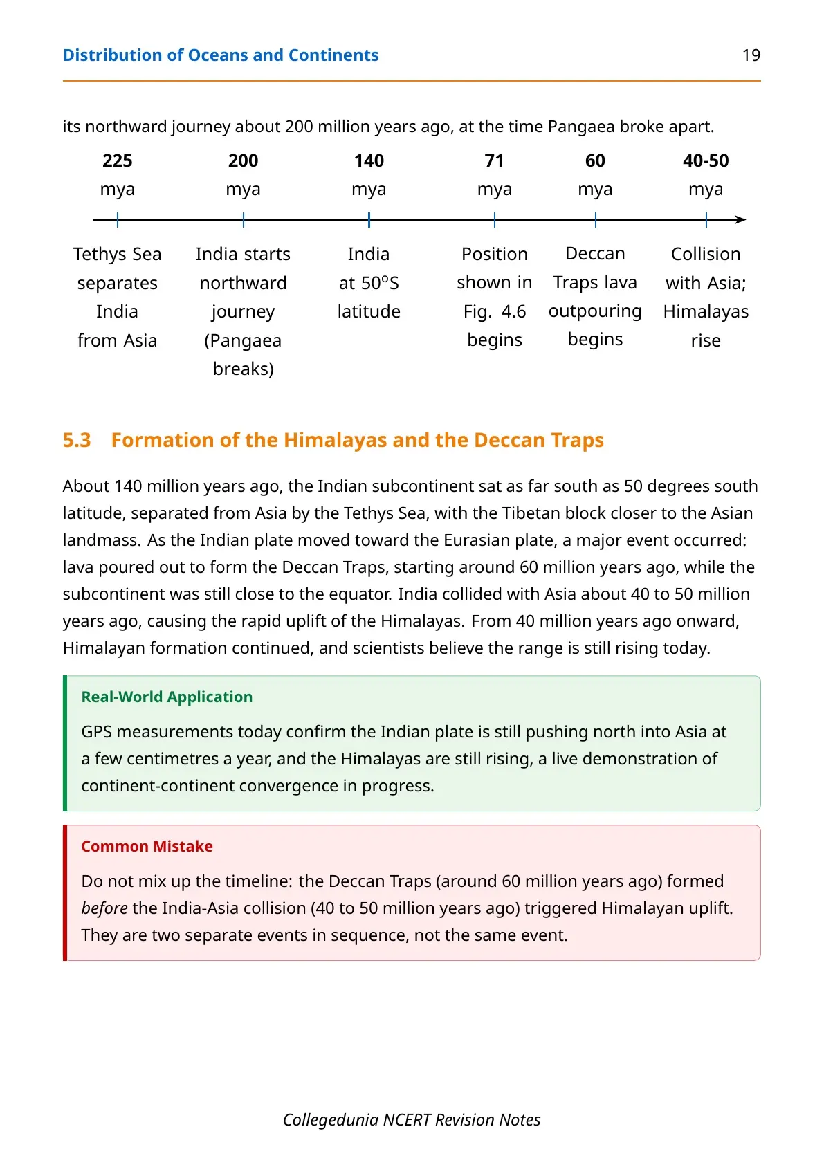
| Time | Event |
|---|---|
| 225 million years ago | Tethys Sea separates India from Asia |
| 200 million years ago | Pangaea breaks apart; India starts its northward journey |
| 140 million years ago | India sits at 50 degrees south latitude |
| 71 million years ago | Position recorded in the NCERT chapter's reference map |
| 60 million years ago | Deccan Traps lava outpouring begins, while India is still near the equator |
| 40 to 50 million years ago | India collides with Asia; the Himalayas begin their rapid uplift |
Common mistake: do not merge the Deccan Traps eruptions (around 60 million years ago) with the India-Asia collision (40 to 50 million years ago). The Traps formed first; the collision that raised the Himalayas came later.
Where This Chapter Fits: Cross-Chapter Concept Map
Chapter 4 links the earth's interior to its surface landforms.
- Chapter 3 (Interior of the Earth) supplies the crust-mantle-core structure plate tectonics runs on, plates ride the asthenosphere just below the lithosphere.
- Chapters 5 and 6 (Geomorphic Processes; Landforms) build on plate boundaries: fold mountains, rift valleys and volcanic landforms are their surface results.
- Chapter 2 (Origin and Evolution of the Earth) covers where the rock material came from before plate movement began redistributing it.
Real-World Applications of Plate Tectonics
- Iceland sits on the Mid-Atlantic Ridge, a divergent boundary, so new crust is being created beneath the island right now, which is why it has so many volcanoes and hot springs.
- Japan and Indonesia sit on the Ring of Fire, where roughly 90 percent of the world's earthquakes occur, driven by subduction along the Pacific rim.
Most Repeated Board Questions in Distribution of Oceans and Continents
The NCERT Notes Class 11 Geography Chapter 4 Distribution of Oceans and Continents track examiner-favourite questions below.
Q1. What is continental drift theory? Wegener's 1912 theory: all continents were once joined as Pangaea, surrounded by one ocean, Panthalassa, which broke apart around 200 million years ago into today's continents.
Q2. Name any three evidences for continental drift. Any three of: jig-saw-fit, rocks of the same age across separated continents, tillite common to India, Africa, Antarctica and Australia, Ghana's placer gold with no local source rock, or Mesosaurus fossils in South Africa and Brazil.
Q3. Differentiate between divergent, convergent and transform boundaries. Divergent: plates part, new crust forms. Convergent: one plate subducts, crust is destroyed. Transform: plates slide past, crust survives.
Q4. What is sea floor spreading? Harry Hess's 1961 idea that new crust forms at mid-oceanic ridges and pushes older crust outward, which sinks back at deep-oceanic trenches.
Other NCERT Resources for Distribution of Oceans and Continents
This table lists every Collegedunia resource for the NCERT Notes Class 11 Geography Chapter 4 Distribution of Oceans and Continents chapter.
| Resource | Link |
|---|---|
| Notes (this page) | Distribution of Oceans and Continents Class 11 Geography Notes |
| Handwritten Notes | (coming soon) |
| NCERT Solutions | (coming soon) |
| NCERT Book PDF | (coming soon) |
NCERT Notes for Class 11 Geography: All Chapters
Use this table to move to any other Class 11 Geography chapter's notes once this chapter is done.
| Chapter | Resource |
|---|---|
| Chapter 1 | Geography as a Discipline Notes (coming soon) |
| Chapter 2 | The Origin and Evolution of the Earth Notes |
| Chapter 3 | Interior of the Earth Notes |
| Chapter 4 | Distribution of Oceans and Continents Notes |
| Chapter 5 | Geomorphic Processes Notes (coming soon) |
| All Chapters | Class 11 Geography, All Chapters |
Distribution of Oceans and Continents Class 11 Geography Notes FAQs
Ques. Where can I download the Class 11 Geography Chapter 4 Notes PDF?
Ans. You can download the NCERT Notes Class 11 Geography Chapter 4 Distribution of Oceans and Continents PDF directly from this page, free of cost.
Ques. Are these notes based on the 2026-27 NCERT syllabus?
Ans. Yes. These notes follow the current 2026-27 NCERT textbook for Class 11 Geography, chapter by chapter, in the same order as the printed book.
Ques. How many pages is the Class 11th Geography Chapter 4 Notes PDF?
Ans. The Notes PDF runs about 22 pages and covers continental drift, evidence for drift, sea floor spreading, plate tectonics and the movement of the Indian plate.
Ques. What is the difference between continental drift and plate tectonics?
Ans. Continental drift, proposed by Wegener in 1912, explained why the continents fit together but could not explain the force behind their movement. Plate tectonics, formalised in 1967, showed that entire rigid plates, ocean floor included, move due to convection currents in the mantle.
Ques. What are the three types of plate boundaries?
Ans. Divergent boundaries where plates move apart and new crust forms, convergent boundaries where one plate subducts under another and crust is destroyed, and transform boundaries where plates slide past each other and crust is neither created nor destroyed.
Ques. How many major plates make up the earth's lithosphere?
Ans. The earth's lithosphere is divided into seven major plates, Antarctic, North American, South American, Pacific, India-Australia-New Zealand, African and Eurasian, along with several minor plates such as Cocos, Nazca and Arabian.
Ques. When did the Indian plate collide with Asia to form the Himalayas?
Ans. The Indian plate collided with the Eurasian plate roughly 40 to 50 million years ago, and that continent-continent convergence triggered the rapid uplift of the Himalayas, a process that continues even today.



Comments