The NCERT Solutions for Class 11 Geography Chapter 9 Atmospheric Circulation and Weather Systems cover all 9 textbook questions from the latest 2026-27 NCERT book. The chapter explains pressure belts, pressure gradient force, Coriolis force, winds, air masses, fronts and tropical cyclones in a step-by-step answer format.
Covers every Chapter 9 exercise question with direct answers and expert explanations.
Focuses on high scoring ideas: pressure belts, winds, geostrophic flow, air masses and cyclones.
Useful for school exams because answers connect NCERT facts with diagrams and weather-map logic.
Student Feedback: In a Collegedunia poll of 10,140 Class 11 Geography students preparing for the 2026-27 school exams, 69% said wind direction became easier after pressure gradient force and Coriolis force were revised together.
Source: 2026-27 Class 11 Geography student poll across CBSE schools.
Every answer in this chapter set is checked against the 2026-27 NCERT Geography textbook and written so that students can revise the fact, explanation and diagram framing together.
Atmospheric Circulation and Weather Systems explains why air moves, how global pressure belts form and why local winds, air masses and cyclones produce different weather conditions. The solutions PDF follows the NCERT exercise order so that students can move from MCQs to short answers, diagram-based explanations and project work without mixing the concepts.
Chapter area
What students must know
Where it helps
Atmospheric pressure
Pressure is measured in millibars and decreases rapidly with height
Question 1(i) and Question 2(i)
Pressure belts
Equatorial lows, subtropical highs, subpolar lows and polar highs shift with the sun
Question 1(ii) and Question 3(ii)
Wind forces
Pressure gradient force starts wind, friction slows it and Coriolis force changes direction
Questions 2(ii) and 3(i)
Air masses and fronts
Large uniform source regions form air masses and meeting air masses form fronts
Question 1(iv)
Tropical cyclones
Warm seas supply moisture and latent heat for intense low-pressure storms
Question 3(iii)
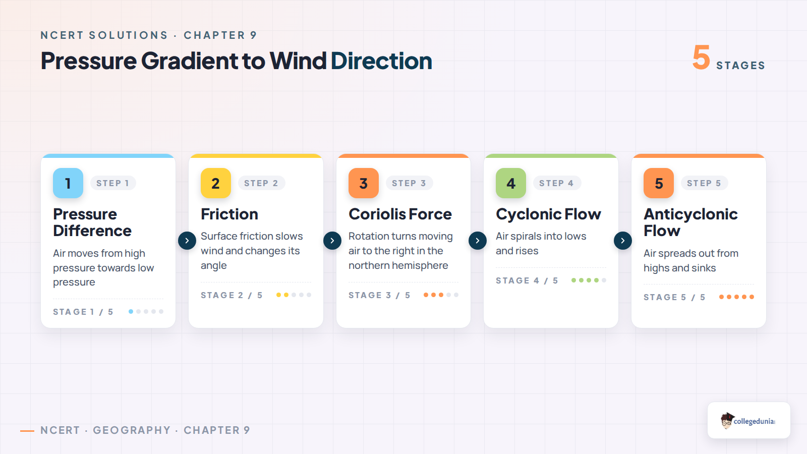
Start this chapter with the pressure chain: pressure difference creates wind, Earth rotation deflects wind and surface friction changes the final path. Once this chain is clear, the long answers become easier to frame.
Atmospheric Circulation and Weather Systems Video Explanation
Pressure Belts and Wind Forces in Atmospheric Circulation
Wind is air in horizontal motion, and its first cause is a pressure difference. Air begins moving from a high-pressure area towards a low-pressure area. Near the ground, friction reduces wind speed, while the Coriolis force turns moving air to the right in the northern hemisphere and to the left in the southern hemisphere.
Pressure gradient force: the force caused by pressure difference over distance.
Frictional force: the surface effect that slows wind and changes its angle near the ground.
Coriolis force: the deflecting force linked with Earth's rotation.
Geostrophic wind: upper-air wind that flows parallel to isobars when pressure gradient force and Coriolis force balance each other.
This is why the answer to the trade-wind question does not stop at high pressure and low pressure. It also explains how Coriolis force converts the north-to-south pressure gradient into north easterlies in the northern hemisphere.
Cyclone, Anticyclone and Weather System Concepts
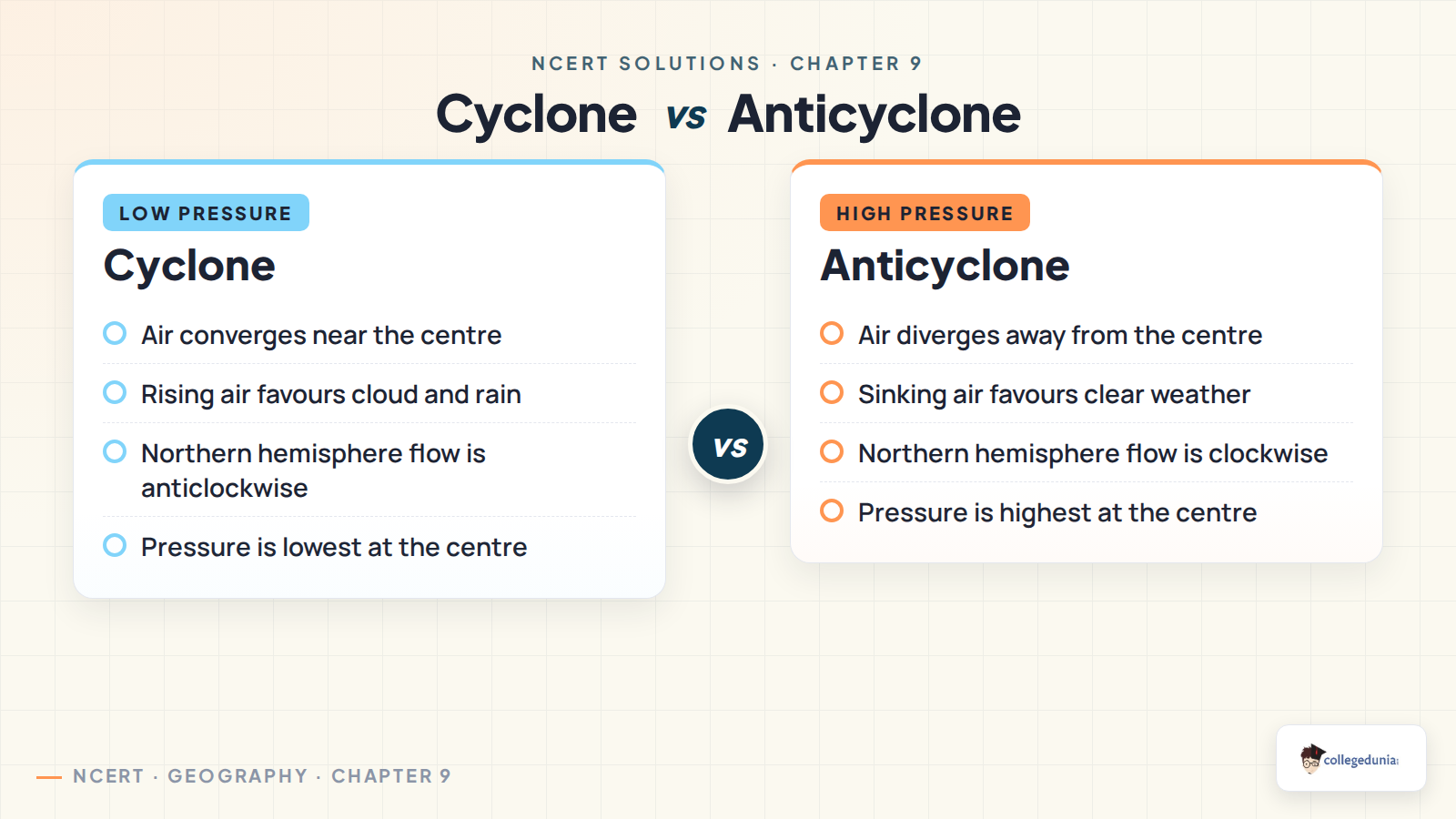
Chapter 9 uses pressure systems to explain weather. A cyclone is linked with low pressure, convergence and rising air, so it can bring cloud, rain and strong winds. An anticyclone is linked with high pressure, divergence and sinking air, so it usually brings clearer and more stable weather.
Feature
Cyclone
Anticyclone
Pressure centre
Lowest pressure at the centre
Highest pressure at the centre
Surface air movement
Converges towards the centre
Diverges away from the centre
Vertical air movement
Rising air
Sinking air
Usual weather
Cloud, rain and strong winds
Clearer and calmer weather
The tropical cyclone answer depends on the same logic. Warm seas provide moisture and heat, the low-pressure centre draws air inward and the eyewall becomes the zone of strongest winds and heaviest rainfall.
How to Write Better Answers for Atmospheric Circulation and Weather Systems
Chapter 9 answers score well when students write cause and effect in order. For pressure questions, begin with the pressure difference and then add wind movement. For wind-direction questions, add Coriolis force after pressure gradient force. For cyclone questions, connect warm sea, low pressure, moist rising air, condensation and intense rainfall.
Use exact NCERT terms. Write pressure gradient force, Coriolis force, geostrophic wind, air mass, front and eyewall clearly.
Explain direction carefully. Mention that northern hemisphere motion is deflected to the right before naming north easterlies or anticlockwise flow.
Draw only simple labelled diagrams. For general circulation, show Hadley, Ferrel and Polar cells with rising and sinking zones.
Connect weather with air movement. Rising air supports cloud and rain, while sinking air supports stable weather.
All NCERT Solutions for Class 11 Geography Chapter 9 Atmospheric Circulation and Weather Systems with Step-by-Step Solutions
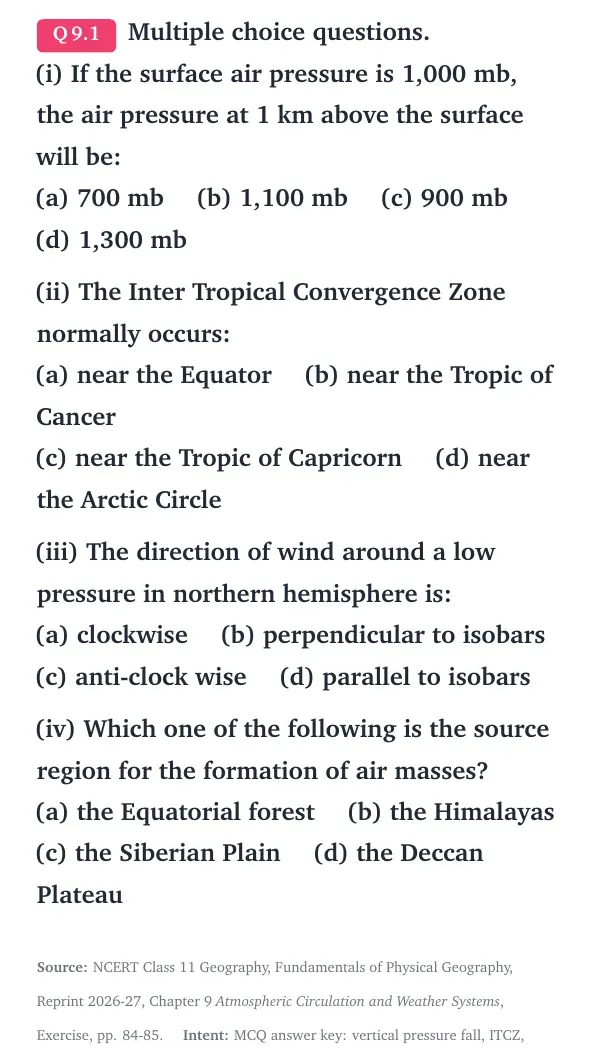
Q 9.1
Multiple choice questions. (i) If the surface air pressure is 1,000 mb, the air pressure at 1 km above the surface will be:
(a) 700 mb (b) 1,100 mb (c) 900 mb (d) 1,300 mb
(ii) The Inter Tropical Convergence Zone normally occurs:
(a) near the Equator (b) near the Tropic of Cancer
(c) near the Tropic of Capricorn (d) near the Arctic Circle
(iii) The direction of wind around a low pressure in northern hemisphere is:
(a) clockwise (b) perpendicular to isobars
(c) anti-clock wise (d) parallel to isobars
(iv) Which one of the following is the source region for the formation of air masses?
(a) the Equatorial forest (b) the Himalayas
(c) the Siberian Plain (d) the Deccan Plateau
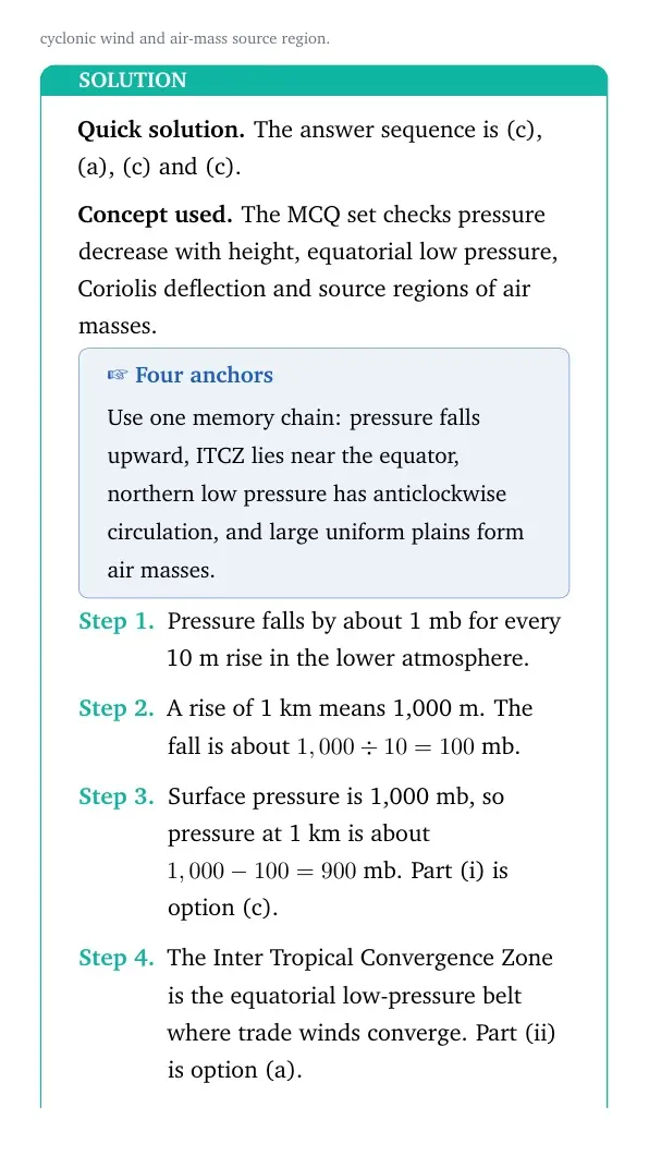
The answer sequence is (c), (a), (c) and (c).
Concept used. The MCQ set checks pressure decrease with height, equatorial low pressure, Coriolis deflection and source regions of air masses.
Four anchors
Use one memory chain: pressure falls upward, ITCZ lies near the equator, northern low pressure has anticlockwise circulation, and large uniform plains form air masses.
Pressure falls by about 1 mb for every 10 m rise in the lower atmosphere.
A rise of 1 km means 1,000 m. The fall is about 1,000 ÷ 10 = 100 mb.
Surface pressure is 1,000 mb, so pressure at 1 km is about 1,000 - 100 = 900 mb. Part (i) is option (c).
The Inter Tropical Convergence Zone is the equatorial low-pressure belt where trade winds converge. Part (ii) is option (a).
Around a low pressure in the northern hemisphere, winds spiral anticlockwise because of Coriolis deflection. Part (iii) is option (c).
Air masses form over large source regions with uniform temperature and humidity. The Siberian Plain is such a region. Part (iv) is option (c).
The final answers are (i) (c) 900 mb, (ii) (a) near the Equator, (iii) (c) anti-clock wise and (iv) (c) the Siberian Plain.
AR
Aditi Rao
M.A. Geography, University of Delhi
Verified Expert
Quick reading. Treat each MCQ as one direct textbook clue rather than a long theory problem.
The first item uses the vertical pressure rule. A 1 km climb lowers pressure by about 100 mb, so 1,000 mb becomes 900 mb.
ITCZ stands for the meeting zone of the trade winds. In its normal position, it lies near the equator.
A low-pressure centre makes air converge. In the northern hemisphere, Coriolis force turns that inward flow to the right, giving anticlockwise circulation.
A source region must be broad and physically uniform. The Siberian Plain is a wide continental surface, so it can form a cold continental air mass.
The other options in part (iv) are unsuitable because mountains, plateaus and dense equatorial forests are not broad uniform source surfaces in the same way.
Why this matters. The answer key comes from four chapter basics: vertical pressure gradient, equatorial convergence, cyclonic circulation and air-mass origin.
The answer sequence is (c), (a), (c) and (c).
Q 9.2
What is the unit used in measuring pressure? Why is the pressure measured at station level reduced to the sea level in preparation of weather maps?
Pressure is measured in millibar. Station pressure is reduced to sea level so values from high and low places can be compared on the same weather map.
Concept used. Atmospheric pressure is the weight of an air column above a unit area. It changes with height, so altitude must be adjusted before comparison.
Use comparison
Write both parts: the unit is millibar, and sea-level reduction removes the effect of altitude.
NCERT expresses atmospheric pressure in millibar, written as mb.
At sea level, the average atmospheric pressure is about 1,013.2 mb.
Pressure decreases with height because the air column above a high station is shorter.
A hill station and a coastal station may have different readings mainly because of altitude.
Weather maps need to compare pressure from place to place, not altitude from place to place.
Therefore, station-level pressure is reduced to sea level before isobars are drawn.
Pressure is measured in millibar. It is reduced to sea level on weather maps so pressure values from stations at different heights can be compared fairly.
RM
Rohan Mehta
M.Sc Earth Science, IIT Kharagpur
Verified Expert
Map-making angle. A weather map must show real horizontal pressure differences, not the height of each station.
Atmospheric pressure is recorded with instruments such as a mercury barometer or an aneroid barometer.
The unit used in the NCERT chapter is millibar.
Pressure falls upward in the lower atmosphere. This means a mountain station naturally records lower pressure than a lowland station.
If raw station readings were used directly, isobars would partly show relief instead of weather systems.
Reducing every station value to sea level places all readings on a common reference plane.
This lets meteorologists compare pressure gradients and identify highs, lows and wind directions more correctly.
Why this matters. Sea-level reduction is a correction step. It helps the map show circulation, not altitude bias.
The unit is millibar, and pressure is reduced to sea level to make all station readings comparable on weather maps.
Q 9.3
While the pressure gradient force is from north to south, i.e. from the subtropical high pressure to the equator in the northern hemisphere, why are the winds north easterlies in the tropics.
The pressure gradient pushes air towards the equatorial low, but Coriolis force deflects moving air to the right in the northern hemisphere. So the winds blow as north easterlies.
Concept used. Pressure gradient force starts wind from high pressure to low pressure. Coriolis force changes its direction because the earth rotates.
Name both forces
Do not answer with pressure alone. The turning happens because Coriolis force acts on moving air.
In the northern tropics, subtropical high pressure lies near 30∘ N.
The equatorial region has low pressure, so pressure gradient force pushes air from north to south.
Once the air starts moving, the rotation of the earth affects its path.
In the northern hemisphere, Coriolis force deflects moving air to the right.
A wind moving from north towards the equator is therefore turned towards the west.
Because it comes from the north-east and blows towards the south-west, it is called a north easterly wind.
The winds become north easterlies because Coriolis force deflects the north-to-south tropical flow to the right in the northern hemisphere.
KI
Kavya Iyer
M.Sc Geography, Savitribai Phule Pune University
Verified Expert
Force-balance view. The pressure gradient gives the first push, while rotation bends the path.
The basic pressure slope is from the subtropical high-pressure belt towards the equatorial low-pressure belt.
Without earth rotation, the wind would move almost straight from north to south.
Earth rotation adds Coriolis force to any moving air.
In the northern hemisphere, this force always turns moving air to its right side.
For air moving equatorward, the right-side turn is towards the west.
The wind is named from the direction it comes from. Since it comes from the north-east, it is called a north easterly.
Why this matters. Wind names describe origin direction. A north easterly is not moving towards the north-east; it is coming from the north-east.
The tropical winds are north easterlies because equatorward winds are turned rightward by Coriolis force in the northern hemisphere.
Q 9.4
What are the geotrophic winds?
Geostrophic winds are upper-air winds that blow parallel to isobars when pressure gradient force is balanced by Coriolis force.
Concept used. NCERT uses the term geostrophic wind in the chapter body. It is a wind formed by balance between pressure gradient force and Coriolis force.
Keyword pair
Remember the pair: pressure gradient force plus Coriolis force. Friction is weak in the upper atmosphere.
Winds in the upper atmosphere, about 2 to 3 km above the surface, are largely free from surface friction.
These winds are mainly controlled by pressure gradient force and Coriolis force.
Pressure gradient force acts from high pressure towards low pressure and is perpendicular to isobars.
Coriolis force acts perpendicular to the moving wind.
When both forces balance each other, the wind does not cross the isobars strongly.
It blows parallel to the isobars. This balanced wind is called geostrophic wind.
Geostrophic winds are upper-air winds that blow parallel to isobars when pressure gradient force and Coriolis force are in balance.
NJ
Neha Joshi
M.A. Geography, Jawaharlal Nehru University
Verified Expert
Balance idea. Geostrophic wind is easiest to understand as a no-friction, upper-air balance.
Near the ground, friction slows the wind and changes its direction.
Above the friction layer, that surface drag becomes weak.
The pressure gradient force tries to move air across isobars from high pressure to low pressure.
Coriolis force turns the moving air and grows stronger as wind speed increases.
A balance is reached when Coriolis force equals the pressure gradient force.
The resulting wind flows along the isobars instead of directly across them.
Why this matters. The term explains why upper-air winds often run along pressure lines on weather charts.
Geostrophic wind is the upper-air wind that flows parallel to isobars under a balance of pressure gradient force and Coriolis force.
Q 9.5
Explain the land and sea breezes.
Sea breeze blows from sea to land during the day. Land breeze blows from land to sea at night. Both form because land heats and cools faster than water.
Concept used. Land and sea breezes are local winds caused by daily differences in heating and pressure over land and sea.
Use day and night
Divide the answer into daytime sea breeze and night-time land breeze.
During the day, land heats faster than the nearby sea.
Warm air over land rises and creates a local low-pressure area.
The sea remains relatively cooler and has relatively higher pressure.
Air therefore blows from sea to land. This daytime wind is called sea breeze.
At night, land cools faster than the sea.
The sea is then relatively warmer, so air rises over the sea.
Higher pressure over the cooler land pushes air from land to sea. This night wind is called land breeze.
Sea breeze is the daytime wind from sea to land, while land breeze is the night-time wind from land to sea, both caused by unequal heating of land and water.
AS
Arjun Singh
M.Sc Geology, Banaras Hindu University
Verified Expert
Pressure-cycle reading. These breezes reverse because the warmer surface changes between day and night.
Land has lower specific heat than water, so it heats more quickly after sunrise.
The warm land surface heats the air above it. That air expands and rises.
Rising air lowers pressure over land, while the cooler sea has higher pressure.
Air moves from the sea towards the land, giving a cool sea breeze during the day.
After sunset, land loses heat quickly and becomes cooler than the sea.
The relatively warmer sea now has rising air and lower pressure.
Air moves out from the cooler land towards the sea, forming the land breeze.
Why this matters. The same rule explains both breezes: air moves from relatively high pressure to relatively low pressure.
Land and sea breezes are daily coastal winds caused by the faster heating and faster cooling of land compared with sea water.
Q 9.6
Discuss the factors affecting the speed and direction of wind.
Wind speed and direction are mainly affected by pressure gradient force, friction and Coriolis force. Gravity acts downward, while local surface conditions modify the flow near the ground.
Concept used. Wind is air in horizontal motion. It starts because of pressure differences, then its path is shaped by surface drag and earth rotation.
Use the force list
NCERT names three horizontal controls: pressure gradient force, frictional force and Coriolis force.
Pressure gradient force begins the movement of air. It acts from high pressure towards low pressure.
The pressure gradient is strong where isobars are close together.
A strong pressure gradient gives faster winds, while widely spaced isobars give slower winds.
Frictional force slows the wind near the surface.
Friction is strongest over rough land surfaces and weaker over the sea.
Its effect usually extends up to about 1 to 3 km above the surface.
Coriolis force is caused by the rotation of the earth.
It deflects winds to the right in the northern hemisphere and to the left in the southern hemisphere.
Coriolis force is absent at the equator and becomes maximum near the poles.
Wind velocity also matters because faster winds are deflected more strongly.
Gravity acts downward, and vertical pressure forces are usually balanced by gravity.
The speed and direction of wind are controlled by pressure gradient force, frictional force and Coriolis force, with gravity acting vertically.
FK
Farah Khan
M.A. Geography, Jamia Millia Islamia
Verified Expert
Three-force method. Start with the force that starts wind, then add the two controls that modify it.
Pressure gradient force is the driving force. It is produced by differences in atmospheric pressure.
The closer the isobars, the sharper the pressure change over distance and the faster the wind.
Friction acts against motion. It reduces wind speed most strongly near the ground.
Land surfaces have trees, buildings and relief, so they create more friction than smooth ocean water.
Because friction slows wind, it also changes the way Coriolis force acts near the surface.
Coriolis force comes from earth rotation and changes wind direction.
In the northern hemisphere, the deflection is to the right. In the southern hemisphere, it is to the left.
The deflection increases with latitude and wind speed.
Together, these controls explain why surface winds cross isobars, while upper-air winds may blow nearly parallel to them.
Why this matters. A wind answer should never stop at "air moves from high to low pressure." Direction also needs friction and Coriolis force.
Wind speed depends mainly on pressure gradient and friction; wind direction is shaped mainly by Coriolis force along with friction near the surface.
Q 9.7
Draw a simplified diagram to show the general circulation of the atmosphere over the globe. What are the possible reasons for the formation of subtropical high pressure over 30o N and S latitudes?
General circulation has Hadley, Ferrel and Polar cells in each hemisphere. Subtropical highs form near 30∘ N and S because air descending from the Hadley cells becomes dry, dense and divergent.
Concept used. General circulation is the broad pattern of planetary winds. It forms because heating, pressure belts, earth rotation, continents, oceans and seasonal movement work together.
Draw first, explain next
Label the equator, 30∘, 60∘ and poles. Then connect the diagram to descending air near 30∘.
Strong heating near the equator makes air warm, light and rising. This forms the equatorial low.
The rising air moves poleward in the upper atmosphere.
Around 30∘ N and S, part of this upper air cools and sinks.
Sinking air becomes compressed and denser, so pressure increases near the surface.
The descending air also becomes dry because it warms during descent.
Near the surface, this air diverges towards the equator as trade winds and towards higher latitudes as westerlies.
Earth rotation and the seasonal movement of pressure belts help shape the circulation into cells.
Continents and oceans modify the belts, so the pattern shifts with the apparent movement of the sun.
Subtropical high pressure forms near 30∘ N and S mainly because upper-air branches of the Hadley cells descend, compress, dry out and diverge at the surface.
MN
Meera Nair
Ph.D Geography, IISc Bangalore
Verified Expert
Cell-circulation angle. The 30∘ highs are the sinking limbs of the Hadley cells.
Begin at the equator, where strong insolation heats the surface and causes convection.
Warm air rises at the ITCZ and creates a low-pressure belt.
At upper levels, this air spreads poleward because more air is continuously rising from below.
By about 30∘ latitude, the poleward upper air has cooled enough to subside.
Subsiding air is compressed by the weight of the atmosphere above it.
Compression raises density and pressure at the surface, creating subtropical high-pressure belts.
These highs are also linked with dry weather because sinking air discourages cloud formation.
Surface divergence from these highs feeds both the trade winds towards the equator and the westerlies towards middle latitudes.
Why this matters. The diagram and explanation must match. The subtropical highs are not random belts; they are where air descends in the circulation cell.
The subtropical highs form because air that rose near the equator descends around 30∘ N and S, producing compression, dry conditions and surface divergence.
Q 9.8
Why does tropical cyclone originate over the seas? In which part of the tropical cyclone do torrential rains and high velocity winds blow and why?
Tropical cyclones originate over warm seas because they need heat and water vapour. Torrential rain and the strongest winds occur around the eye wall, where moist air rises violently.
Concept used. A tropical cyclone is an intense low-pressure system. It grows when warm ocean water supplies heat, moisture and rising unstable air.
Use eye and eye wall
The centre or eye is calm. The most violent weather is around it in the eye wall.
Tropical cyclones need warm sea surfaces, usually with high evaporation.
Warm ocean water supplies large amounts of water vapour to the lower atmosphere.
Moist air rises and cools, and condensation releases latent heat.
This released heat strengthens uplift and deepens the low-pressure centre.
Over land, the cyclone loses its main moisture and heat source, so it weakens.
The Coriolis force is also needed to give the rotating circulation its spin, so cyclones do not form exactly at the equator.
The eye of a mature cyclone is relatively calm because air sinks there.
The most violent zone is the eye wall around the eye.
In the eye wall, air spirals inward, rises rapidly and condenses into tall clouds.
This is why torrential rains and high velocity winds occur in the eye wall.
Tropical cyclones originate over warm seas because they need heat and moisture. Torrential rain and the strongest winds blow in the eye wall, where moist air rises rapidly around the calm eye.
SK
Sanya Kapoor
M.Sc Geography, University of Calcutta
Verified Expert
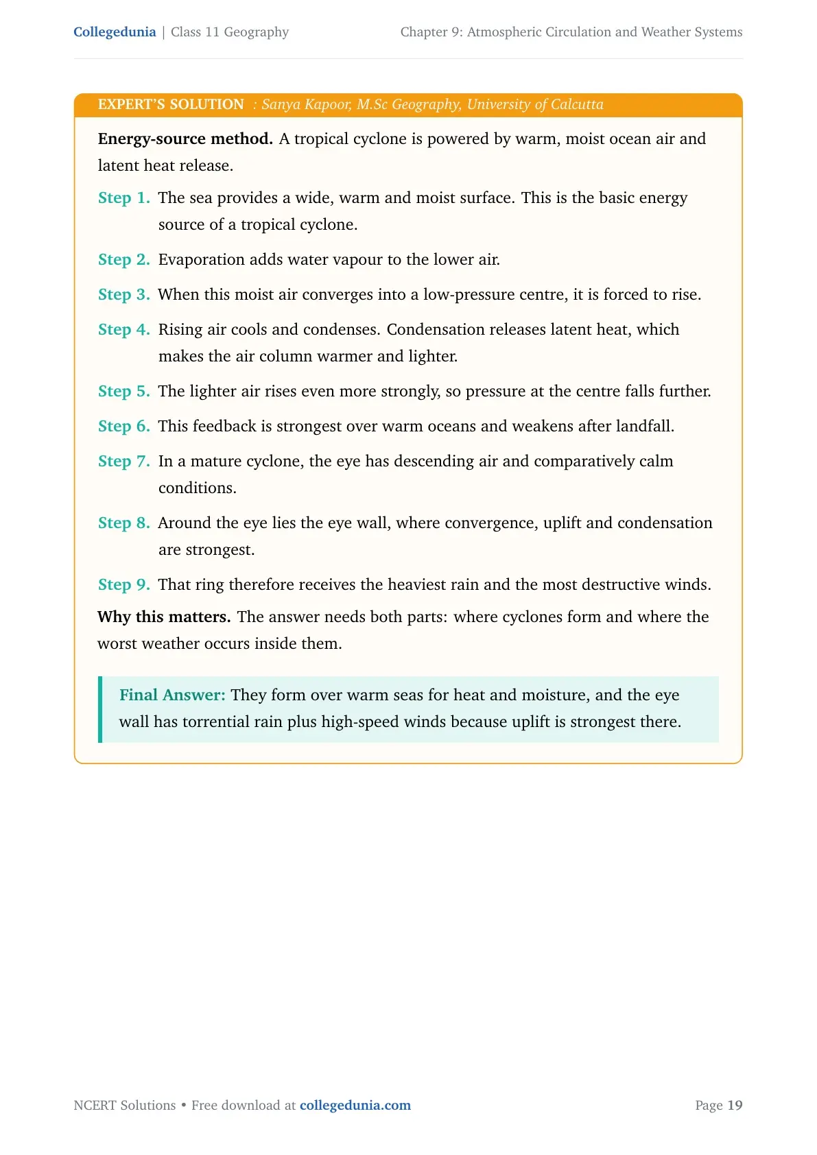
Energy-source method. A tropical cyclone is powered by warm, moist ocean air and latent heat release.
The sea provides a wide, warm and moist surface. This is the basic energy source of a tropical cyclone.
Evaporation adds water vapour to the lower air.
When this moist air converges into a low-pressure centre, it is forced to rise.
Rising air cools and condenses. Condensation releases latent heat, which makes the air column warmer and lighter.
The lighter air rises even more strongly, so pressure at the centre falls further.
This feedback is strongest over warm oceans and weakens after landfall.
In a mature cyclone, the eye has descending air and comparatively calm conditions.
Around the eye lies the eye wall, where convergence, uplift and condensation are strongest.
That ring therefore receives the heaviest rain and the most destructive winds.
Why this matters. The answer needs both parts: where cyclones form and where the worst weather occurs inside them.
They form over warm seas for heat and moisture, and the eye wall has torrential rain plus high-speed winds because uplift is strongest there.
Q 9.9
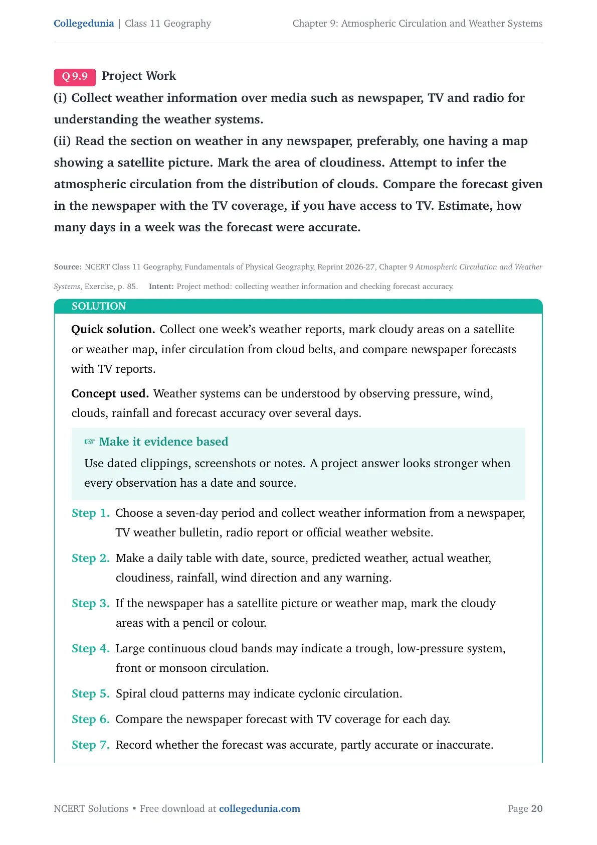
Project Work
(i) Collect weather information over media such as newspaper, TV and radio for understanding the weather systems.
(ii) Read the section on weather in any newspaper, preferably, one having a map showing a satellite picture. Mark the area of cloudiness. Attempt to infer the atmospheric circulation from the distribution of clouds. Compare the forecast given in the newspaper with the TV coverage, if you have access to TV. Estimate, how many days in a week was the forecast were accurate.
Collect one week's weather reports, mark cloudy areas on a satellite or weather map, infer circulation from cloud belts, and compare newspaper forecasts with TV reports.
Concept used. Weather systems can be understood by observing pressure, wind, clouds, rainfall and forecast accuracy over several days.
Make it evidence based
Use dated clippings, screenshots or notes. A project answer looks stronger when every observation has a date and source.
Choose a seven-day period and collect weather information from a newspaper, TV weather bulletin, radio report or official weather website.
Make a daily table with date, source, predicted weather, actual weather, cloudiness, rainfall, wind direction and any warning.
If the newspaper has a satellite picture or weather map, mark the cloudy areas with a pencil or colour.
Large continuous cloud bands may indicate a trough, low-pressure system, front or monsoon circulation.
Spiral cloud patterns may indicate cyclonic circulation.
Compare the newspaper forecast with TV coverage for each day.
Record whether the forecast was accurate, partly accurate or inaccurate.
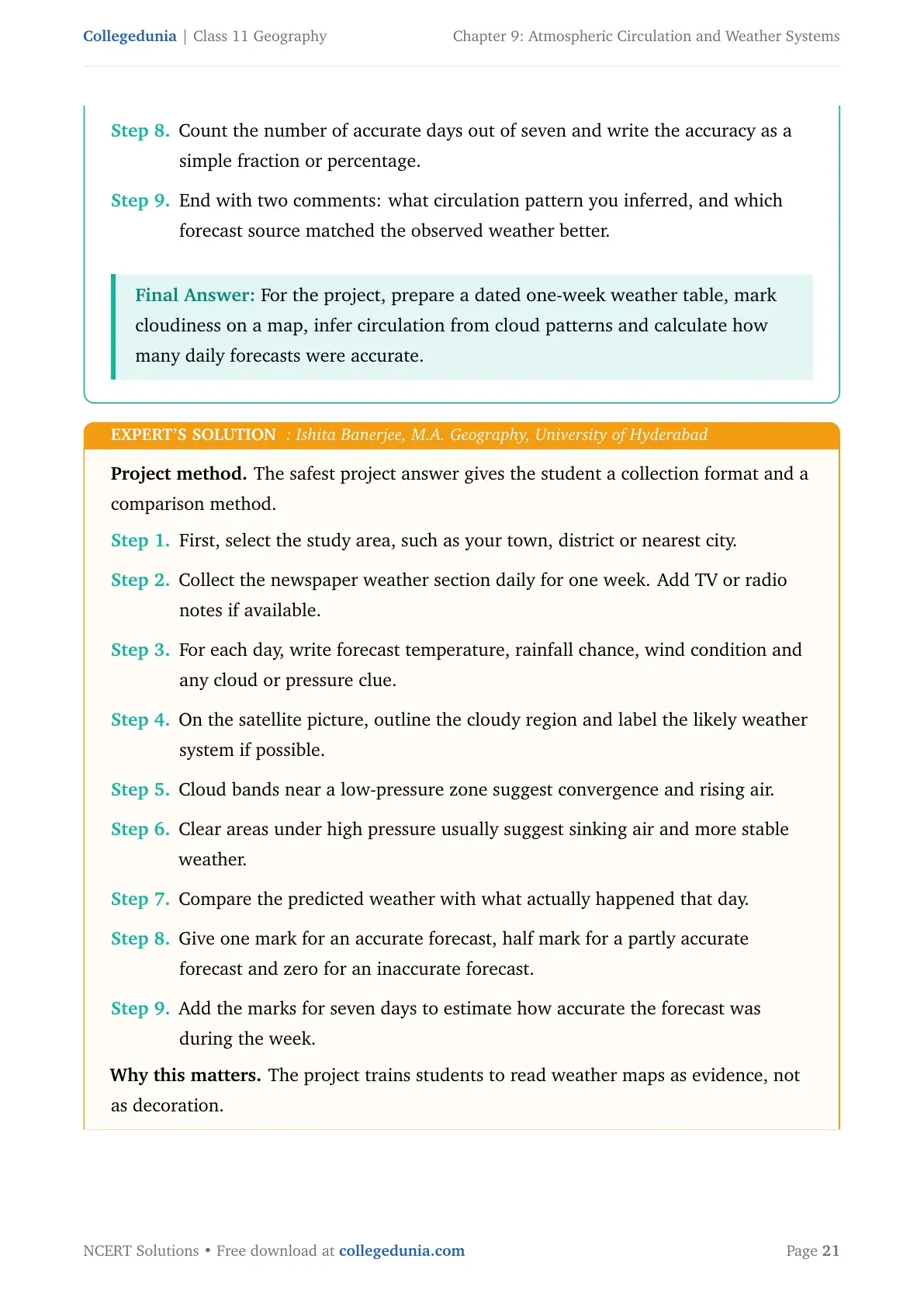
Count the number of accurate days out of seven and write the accuracy as a simple fraction or percentage.
End with two comments: what circulation pattern you inferred, and which forecast source matched the observed weather better.
For the project, prepare a dated one-week weather table, mark cloudiness on a map, infer circulation from cloud patterns and calculate how many daily forecasts were accurate.
IB
Ishita Banerjee
M.A. Geography, University of Hyderabad
Verified Expert
Project method. The safest project answer gives the student a collection format and a comparison method.
First, select the study area, such as your town, district or nearest city.
Collect the newspaper weather section daily for one week. Add TV or radio notes if available.
For each day, write forecast temperature, rainfall chance, wind condition and any cloud or pressure clue.
On the satellite picture, outline the cloudy region and label the likely weather system if possible.
Cloud bands near a low-pressure zone suggest convergence and rising air.
Clear areas under high pressure usually suggest sinking air and more stable weather.
Compare the predicted weather with what actually happened that day.
Give one mark for an accurate forecast, half mark for a partly accurate forecast and zero for an inaccurate forecast.
Add the marks for seven days to estimate how accurate the forecast was during the week.
Why this matters. The project trains students to read weather maps as evidence, not as decoration.
A complete project should include collected reports, a marked cloudiness map, inferred circulation, a forecast comparison and a one-week accuracy estimate.
Related Geography Resources for Atmospheric Circulation and Weather Systems
Use the solutions PDF for solved answers, then move to the NCERT book and notes when you want to revise chapter theory in a different format.
Ques. How many questions are solved in Class 11 Geography Chapter 9 Atmospheric Circulation and Weather Systems?
Ans. The PDF solves all 9 NCERT exercise questions from Chapter 9, including MCQs, short answers, long answers and the project-work task.
Ques. What are the most important topics in Atmospheric Circulation and Weather Systems?
Ans. The most important topics are atmospheric pressure, pressure belts, pressure gradient force, Coriolis force, geostrophic wind, air masses, fronts and tropical cyclones.
Ques. Why are tropical cyclones explained with warm seas in the NCERT Solutions?
Ans. Tropical cyclones need warm ocean water for moisture and latent heat. This supports rising air, low pressure, thick cloud, torrential rain and high-velocity winds near the eyewall.
Ques. Are these NCERT Solutions updated for the 2026-27 syllabus?
Ans. Yes. The answers are written for the 2026-27 NCERT Class 11 Geography textbook and follow the current exercise order for Chapter 9.












Comments