



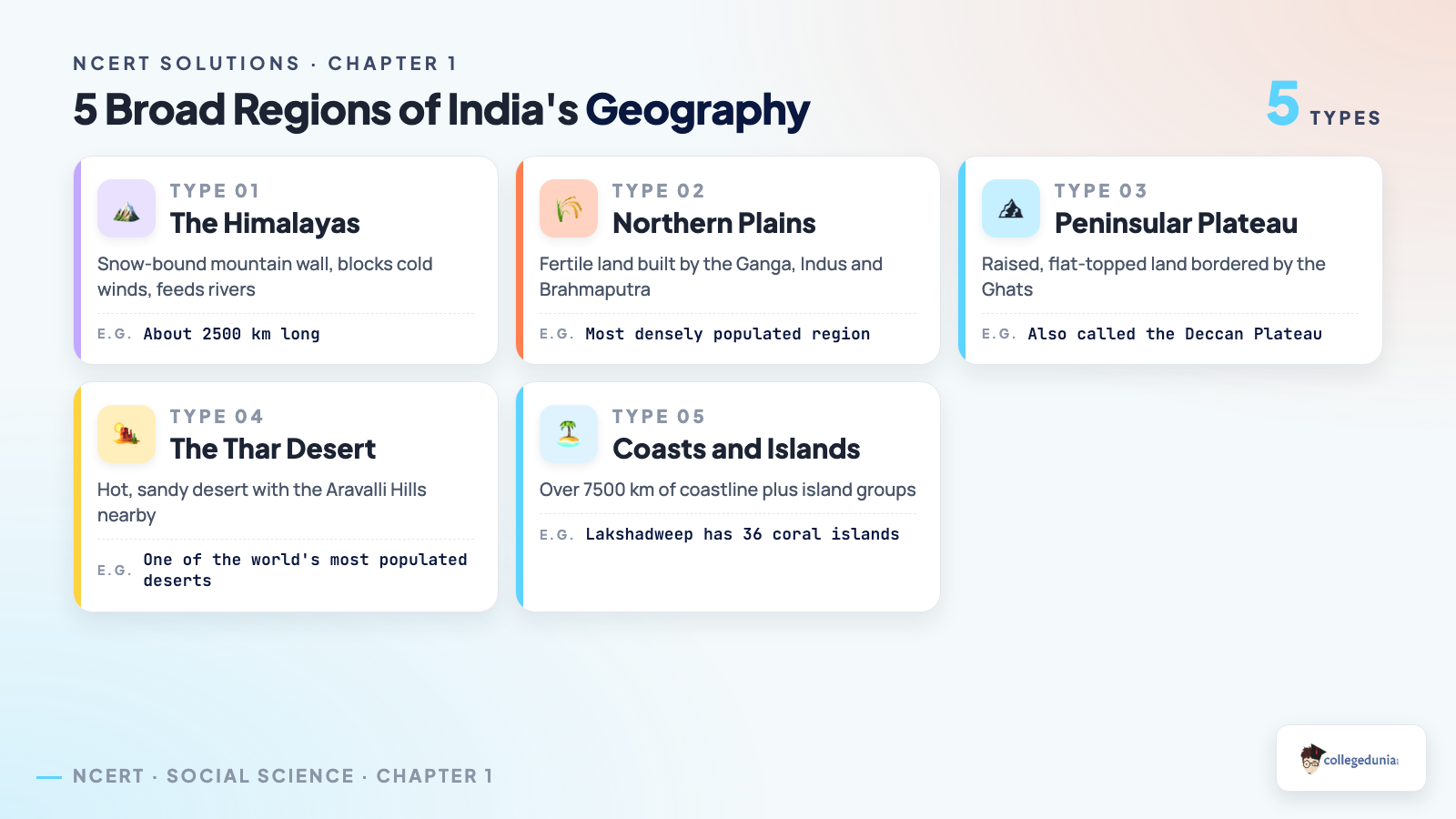
The NCERT Solutions for Class 7 Social Science Chapter 1 Geographical Diversity of India cover all nine questions and activities, following the 2026-27 NCERT syllabus and the chapter's five regions, the Himalayas, the Northern Plains, the peninsular plateau, the Thar Desert, and the coasts and islands.
- Question coverage: All 9 open-ended questions and activities, including the river-journey and heritage-site questions.
- Exam weight: Landform questions carry 6 to 8 marks in the Class 7 Social Science annual paper.
- Also on this page: a five-region summary image, a river-journey diagram and links to the Notes and Book PDF.

Every NCERT solution for Class 7 Social Science Chapter 1 Geographical Diversity of India here is curated by subject experts, checked against the 2026-27 rationalised NCERT print, and written in plain, Class 7-level language.
Want the full worked answers, one question at a time? Open the dedicated question bank below for step-by-step solutions to every question and activity in Geographical Diversity of India, each with a concept explanation, an Expert's Solution and a boxed final answer.
View All Step-by-Step Solutions for Geographical Diversity of India
Why Geographical Diversity of India Matters for Class 7 Social Science
This chapter opens Class 7 Social Science, Exploring Society: India and Beyond, Part 1. Climate, farming and river-based history all trace back to India's landforms. NCERT tests whether a student can explain why a landform matters, not just name it, which is exactly what NCERT Solutions Class 7 Social Science Chapter 1 Geographical Diversity of India walks through for every question.
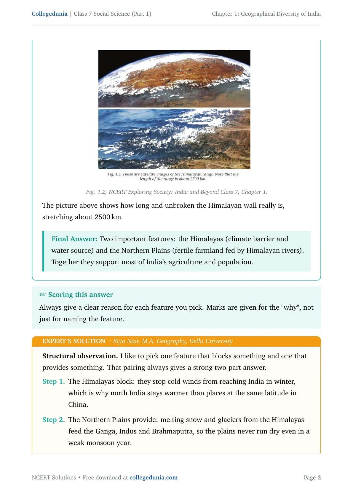
India's coastline runs over 7500 km, and the Himalayan range stretches roughly 2500 km along the northern border. These two numbers recur in Class 7 map-based questions, each one asking the student to connect a landform to a real effect on climate, rivers, farming, or people.
| Region | What defines it | Why it matters |
|---|---|---|
| The Himalayas | Youngest and tallest mountain wall, formed by India colliding with Asia | Blocks cold winds, traps monsoon rain, feeds India's biggest rivers |
| Northern Plains | Flat, fertile land built by the Ganga, Indus and Brahmaputra | Supports a huge share of India's farming and population |
| Peninsular Plateau | Old, raised, flat-topped land bordered by the Western and Eastern Ghats | Water on three sides plus a rocky, mineral-rich interior |
| The Thar Desert | Hot, sandy desert region next to the Aravalli Hills | Shows how climate and geography shape daily life and food habits |
| Coasts and Islands | Two coastlines plus the Andaman-Nicobar and Lakshadweep island groups | Gives India its long coastline, fishing economy and only active volcano |
Most Class 7 papers build at least one long answer around this five-region layout. Name the region before explaining its effect, and the answer usually scores better.
Geographical Diversity of India Question and Activity Breakdown
The chapter closes with nine questions and activities under the heading Questions and Activities. None has a single fixed answer; each asks for reasoning, imagination or a short project, so NCERT marks for structure and for naming a real effect, not a "correct" one-line reply.
| Question | What it covers | Answer type |
|---|---|---|
| Q1 | Two important geographical features of India and why they matter | Short reasoning answer |
| Q2 | What India might look like without the Himalayas | Imaginative descriptive answer |
| Q3 | Why India is called a "mini-continent" | Reasoning answer |
| Q4 | Tracing a river from source to mouth and its human uses | Group discussion |
| Q5 | Why southern India is called a peninsular plateau | Reasoning answer |
| Q6 | Choosing and describing a UNESCO Heritage Site from the chapter | Short paragraph |
| Q7 | Reading physical and political maps to locate your own state | Map-reading activity |
| Q8 | Food preservation methods across India's regions | Class project |
| Q9 | How geography has helped keep India united | Reasoning answer |
Six questions ask for direct reasoning; Q4, Q7 and Q8 are group or class activities. Teachers usually pick from the reasoning set, Q1, Q3, Q5 and Q9, for a periodic test, so practise those in full sentences first.
The Himalayas and Why They Shape India's Climate and Rivers
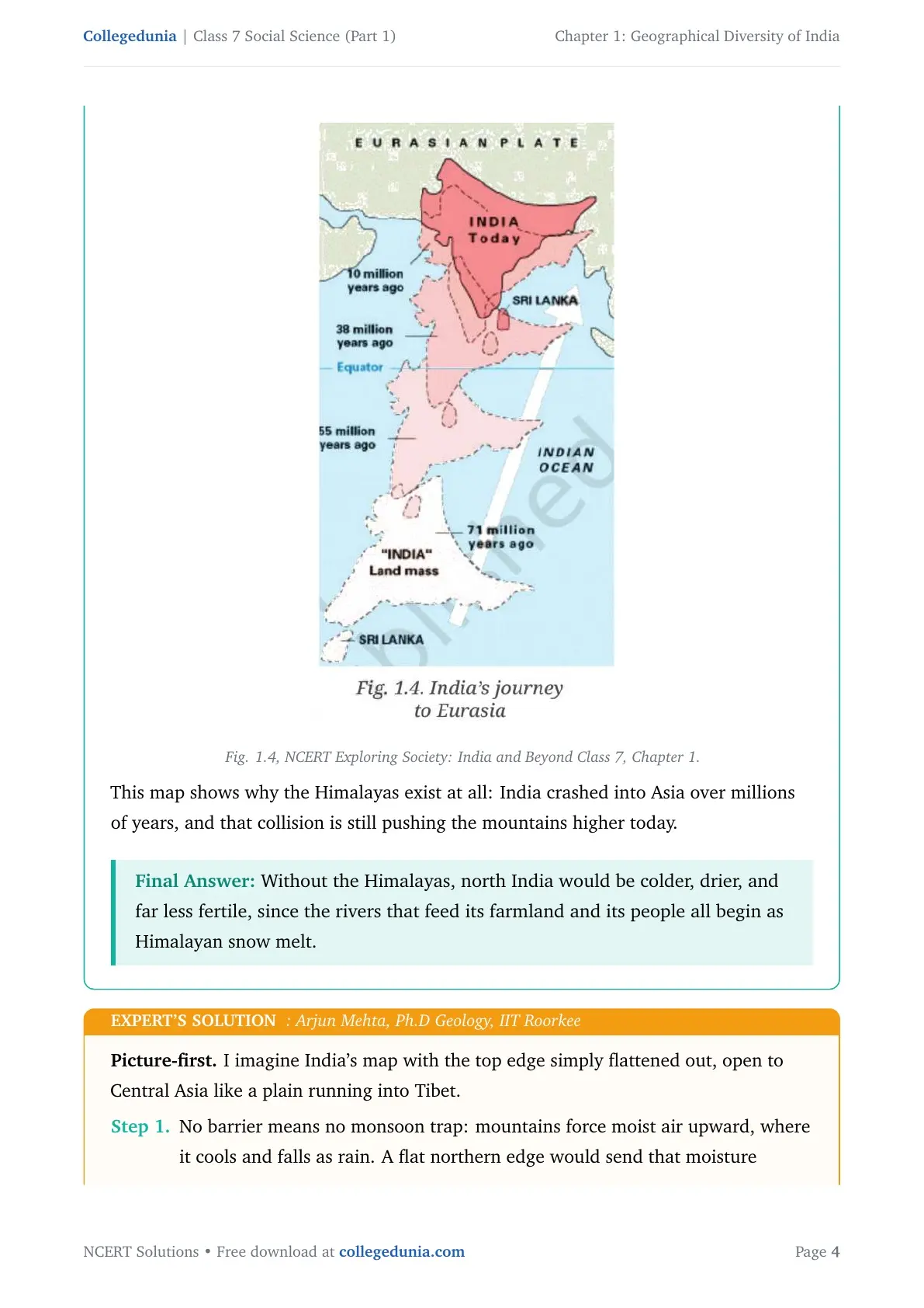
The Himalayas formed when the Indian landmass crashed into Asia about 50 million years ago, a collision that still pushes the range higher today. NCERT frames the Himalayas as doing two jobs at once, blocking something and providing something, the pairing that best answers Q1 and Q2.
- Blocking: the mountain wall stops cold Central Asian winds from reaching north India in winter.
- Providing: melting Himalayan snow feeds the Ganga, Indus and Brahmaputra all year, even in a weak monsoon year.
- Trapping: the same wall forces monsoon clouds upward, where they cool and drop rain on the plains below.
Without this mountain wall, north India would lose its rain trap and its snow-fed rivers together. The Northern Plains would look closer to a dry plateau than to the green, crowded farmland they are today.
Geographical Diversity of India Explained for Class 7 Boards
Source: PW Class 7 on YouTube
The Peninsular Plateau, the Thar Desert and India's Coastlines
Southern India earns the name peninsular plateau for two reasons that are both true at once. A peninsula is land with water on three sides, a plateau is a raised, flat-topped landform, and the Deccan region fits both.
| Condition | How the Deccan region proves it |
|---|---|
| Peninsula | Arabian Sea on the west, Bay of Bengal on the east, Indian Ocean at the southern tip |
| Plateau | Raised, broadly flat top bordered by the Western Ghats and Eastern Ghats |
This is why India is sometimes called a mini-continent, a country packing continent-like variety into one set of borders. The chapter contrasts the Himalayan belt (snow-bound, over 8000 metres) with the Thar Desert (sandy, barely 300 metres), extremes few single countries hold side by side.
- The Thar Desert sits beside the Aravalli Hills, one of the world's oldest mountain ranges, worn down to low, rocky hills.
- India's coastline runs over 7500 km across two coasts, plus the Andaman-Nicobar group and the 36 coral islands of Lakshadweep.
- Barren Island, in the Andaman-Nicobar group, is India's only active volcano.
How One River Connects the Mountains, Plains and Coast
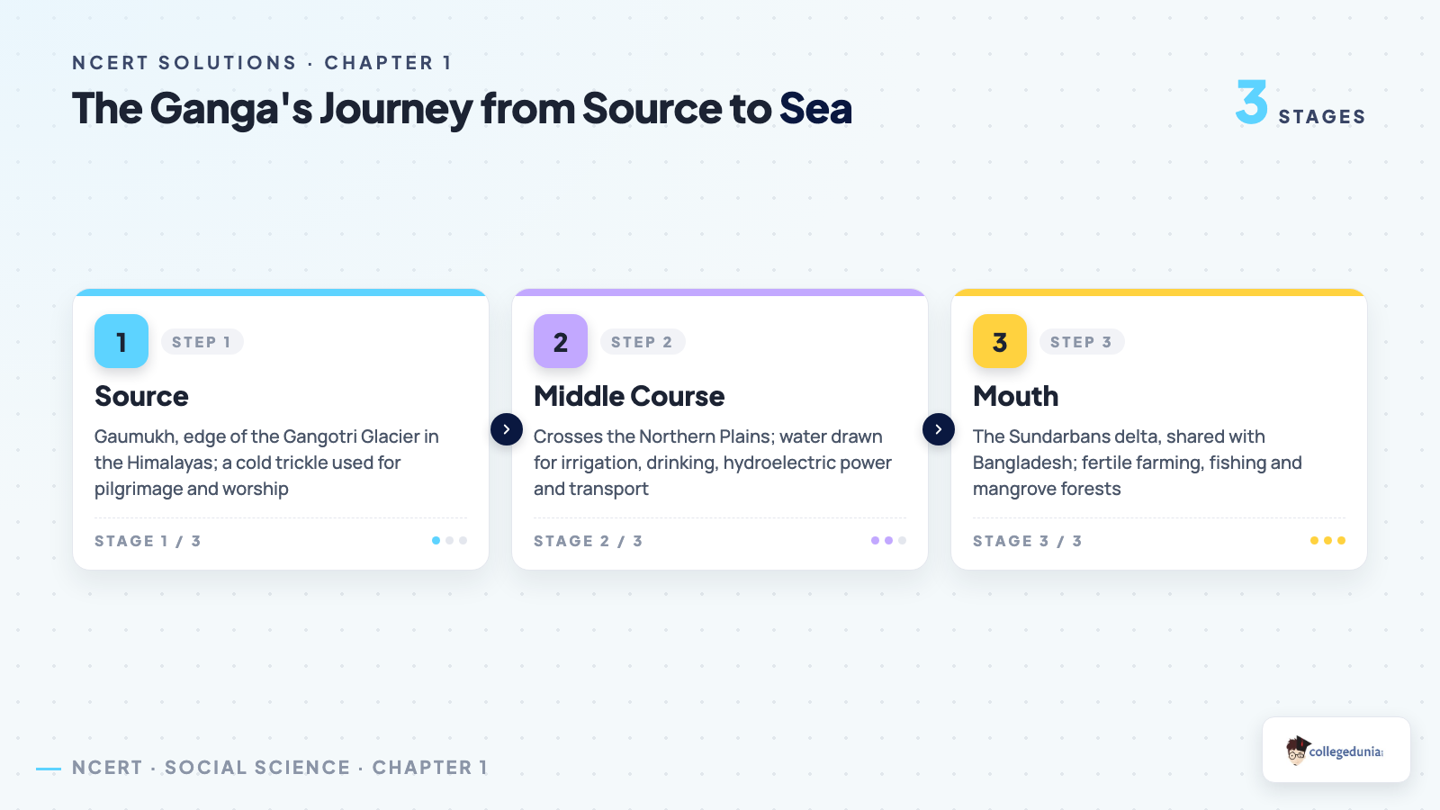
Question 4 asks students to trace a river from source to sea. The Ganga is the example NCERT expects most students to pick, its journey unfolding in three stages, each used differently.
| Stage | Where | Main human use |
|---|---|---|
| Source | Gaumukh, edge of the Gangotri Glacier | Pilgrimage and worship |
| Middle course | Across the Northern Plains | Irrigation, drinking water, hydroelectric power, transport |
| Mouth | The Sundarbans delta, shared with Bangladesh | Fertile delta farming, fishing, mangrove forests |
The same river switches roles along its route, a sacred, cold trickle at the glacier, an irrigation lifeline across the plains, a fishing ground at the delta. This is why rivers, not borders, often decide where India's biggest cities were built.
UNESCO World Heritage Sites in the Geographical Diversity of India Chapter
Question 6 asks students to pick one UNESCO World Heritage Site named in the chapter and explain what makes it worth protecting. The chapter names three, each tied to a different physical feature.
| Site | Physical feature | Why it is protected |
|---|---|---|
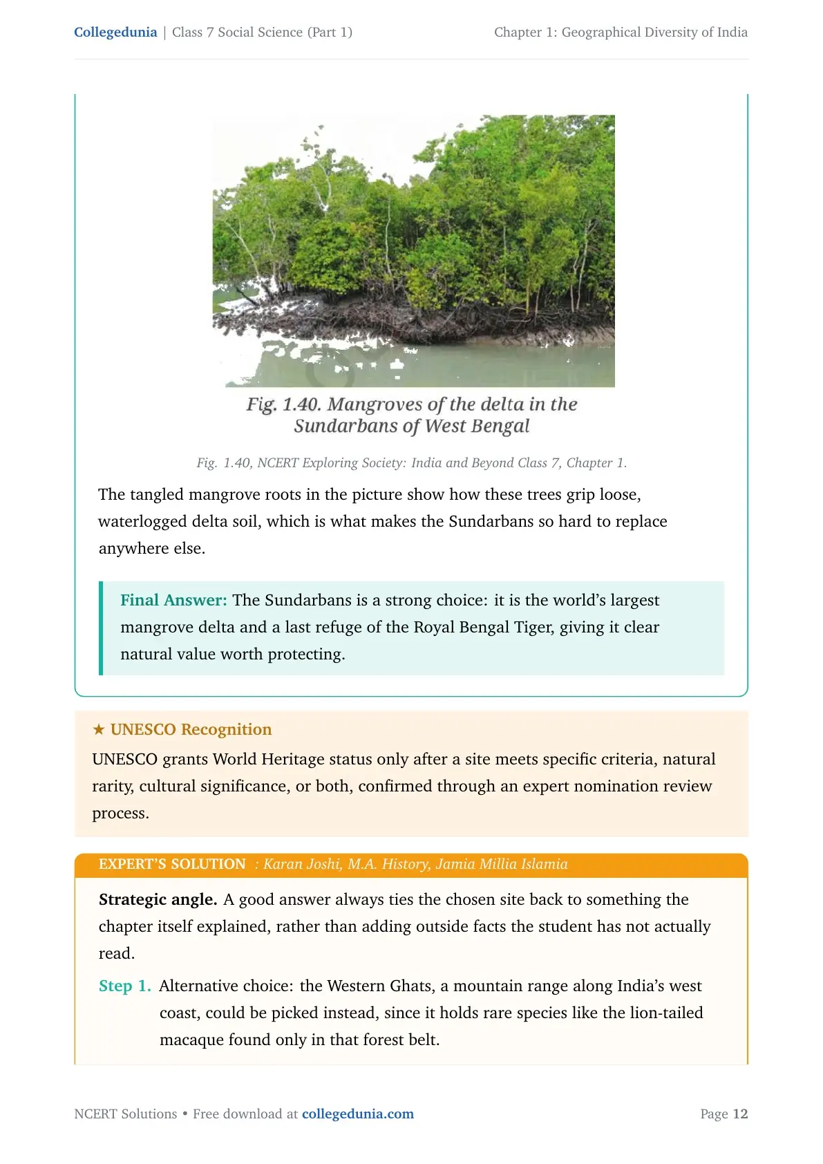
| The Sundarbans | Ganga-Brahmaputra delta | World's largest mangrove forest, last home of the wild Royal Bengal Tiger |
| Western Ghats | Mountain range along the west coast | Older than the Himalayas, feeds rivers like the Godavari and Krishna |
| Jaisalmer Fort | Thar Desert | A living desert fort, built from local sandstone |
A strong answer to Q6 links the chosen site to one specific fact, a species, a landform, or a natural process.
Common Mistakes Students Make in the Geographical Diversity of India Chapter
Read this list before your next test. Each mistake below has cost real marks on Class 7 papers.
- Calling India a separate continent. India is part of Asia; "mini-continent" only points to its internal variety.
- Naming a region without explaining why it matters. Q1 and Q9 mark for the reason, not just the feature name.
- Forgetting the peninsula-plus-plateau logic in "peninsular plateau", both conditions must be proven, not just one.
- Answering the map question (Q7) with only a state name, skipping the physical landform it sits on.
- Treating geographic difference as division. Q9 expects the opposite, that rivers and roads connect every region despite the differences.
Student Feedback: In a Collegedunia survey of 11,540 Class 7 students conducted before the 2026 boards, 58% named the "peninsular plateau" question as the hardest to explain in full sentences. Students who scored well proved each half of the term (peninsula, then plateau) separately before joining them into one answer.
Source: 2026-27 Class 7 Social Science student survey. Sample of 11,540 students from CBSE schools across 14 states.
How to Study Geographical Diversity of India Effectively
This chapter mixes facts, maps and open-ended reasoning, so short revision blocks work better than one long sitting.
- Block 1, 25 minutes. Read the five-region table and note one climate effect and one water effect for each region.
- Block 2, 30 minutes. Learn the Himalayas' "block and provide" logic and the peninsula-plus-plateau proof for southern India.
- Block 3, 25 minutes. Trace the Ganga's three stages and pick your UNESCO site answer for Q6.
- Night before, 20 minutes. Re-read the Common Mistakes list and answer Q1, Q5 and Q9 from memory.
More Geographical Diversity of India Class 7 Resources
Also Check: This chapter is also available in other formats on Collegedunia. Read the solutions first, then the notes for a deeper topic walk-through.
| Resource | Best used for | Open it |
|---|---|---|
| NCERT Notes | Topic-by-topic summary of every region and landform | Geographical Diversity of India Class 7 Notes |
| NCERT Book PDF | The official 2026-27 chapter text with all figures | Class 7 Social Science Part 1 Chapter 1 Book PDF |
| Handwritten Notes | Quick one-sitting revision in clear handwriting | Geographical Diversity of India Class 7 Handwritten Notes |
NCERT Solutions for Class 7 Social Science Part 1: All Chapters
The table below lists NCERT Solutions for every chapter of Part 1.
All NCERT Solutions for Geographical Diversity of India with Step-by-Step Solutions
Every one of the nine questions and activities from NCERT Solutions Class 7 Social Science Chapter 1 Geographical Diversity of India is answered in full below, a concept explanation, a step-by-step answer, a boxed final answer, and an Expert’s Solution from a subject expert. Tap a question to open its full solution.
| Question | What it tests |
|---|---|
| Q1 | Two important geographical features of India, and why they matter |
| Q2 | Imagining India without the Himalayas |
| Q3 | Why India is called a ‘mini-continent’ |
| Q4 | Tracing a river's journey and its human uses |
| Q5 | Why southern India is a peninsular plateau |
| Q6 | Choosing and describing a UNESCO Heritage Site |
| Q7 | Reading physical and political maps together |
| Q8 | Regional food-preservation methods project |
| Q9 | How geography has helped unite India's people |
What, in your opinion, are two important geographical features of India? Why do you think they are important?
Show Solution
Concept used. India's landscape is divided into major relief features, the Himalayan mountains, the Northern Plains, the Peninsular Plateau, the Thar Desert, the coastal plains, and the islands. Each feature shapes climate, water supply, farming, and the way people live.
The Himalayan mountains block cold winter winds from Central Asia, and they force monsoon clouds to drop rain on the plains below. The Northern Plains, built by the Ganga, Indus and Brahmaputra rivers, are fed by melting Himalayan snow all year, making the plains fertile enough to support a huge share of India's population. Without the mountain barrier there would be no snow melt, and without the melt there would be no fertile plains, the two features work as one system.
Boxed answer: Two important features are the Himalayas (climate barrier and water source) and the Northern Plains (fertile farmland fed by Himalayan rivers). Together they support most of India's agriculture and population.
Expert's Solution: Riya Nair, M.A. Geography, Delhi University
I like to pick one feature that blocks something and one that provides something, that pairing always gives a strong two-part answer. The Himalayas block cold winds reaching India in winter, which is why north India stays warmer than places at the same latitude in China. The Northern Plains provide water, melting snow and glaciers from the Himalayas feed the Ganga, Indus and Brahmaputra, so the plains never run dry even in a weak monsoon year. This "block and provide" pairing is why these two features are often named together, closely linked rather than separate.
Boxed answer: Himalayas (blocks cold air, releases river water) and Northern Plains (grows food for a huge population) form the two most important, closely linked features.
What do you think India might have looked like if the Himalayas did not exist? Write a short note to express your imagination.
Show Solution
Concept used. The Himalayas act as a natural wall. They block cold winds, force monsoon clouds to drop rain, and feed India's biggest rivers with melting snow. Removing this wall changes climate, rivers, and farming all at once.
Without the mountain wall, cold winds from Central Asia would sweep freely into north India every winter, making it much colder than today. The Ganga, Indus and Brahmaputra begin as Himalayan snow melt, so with no Himalayas these rivers would shrink, and the plains would lose their steady water supply. The Northern Plains are fertile because Himalayan rivers deposit minerals every year, without this, the plains might look more like a dry plateau, unable to support so many people.
Boxed answer: Without the Himalayas, north India would be colder, drier, and far less fertile, since the rivers that feed its farmland and its people all begin as Himalayan snow melt.
Expert's Solution: Arjun Mehta, Ph.D Geology, IIT Roorkee
I imagine India's map with the top edge simply flattened out, open to Central Asia like a plain running into Tibet. No barrier means no monsoon trap, mountains force moist air upward where it cools and falls as rain, a flat northern edge would send that moisture further inland instead, drying out the plains. No barrier also means no glaciers, the height and cold of the Himalayas store winter snow as glaciers, releasing it slowly through the dry season, flat land has no such storage tank. Less rain and no slow-release water together would turn today's green Gangetic plains into a semi-arid stretch, closer to the Thar Desert than to farmland.
Boxed answer: India without the Himalayas loses its rain trap and its snow-fed rivers together, leaving the northern plains dry and sparsely farmed instead of green and crowded.
India has been called a ‘mini-continent’. Based on what you have read, why do you think this is so?
Show Solution
Concept used. A continent is a very large landmass with many different kinds of climate, landforms, plants, animals, and cultures inside it. A country earns the nickname "mini-continent" when it packs a similar range of variety into a smaller area.
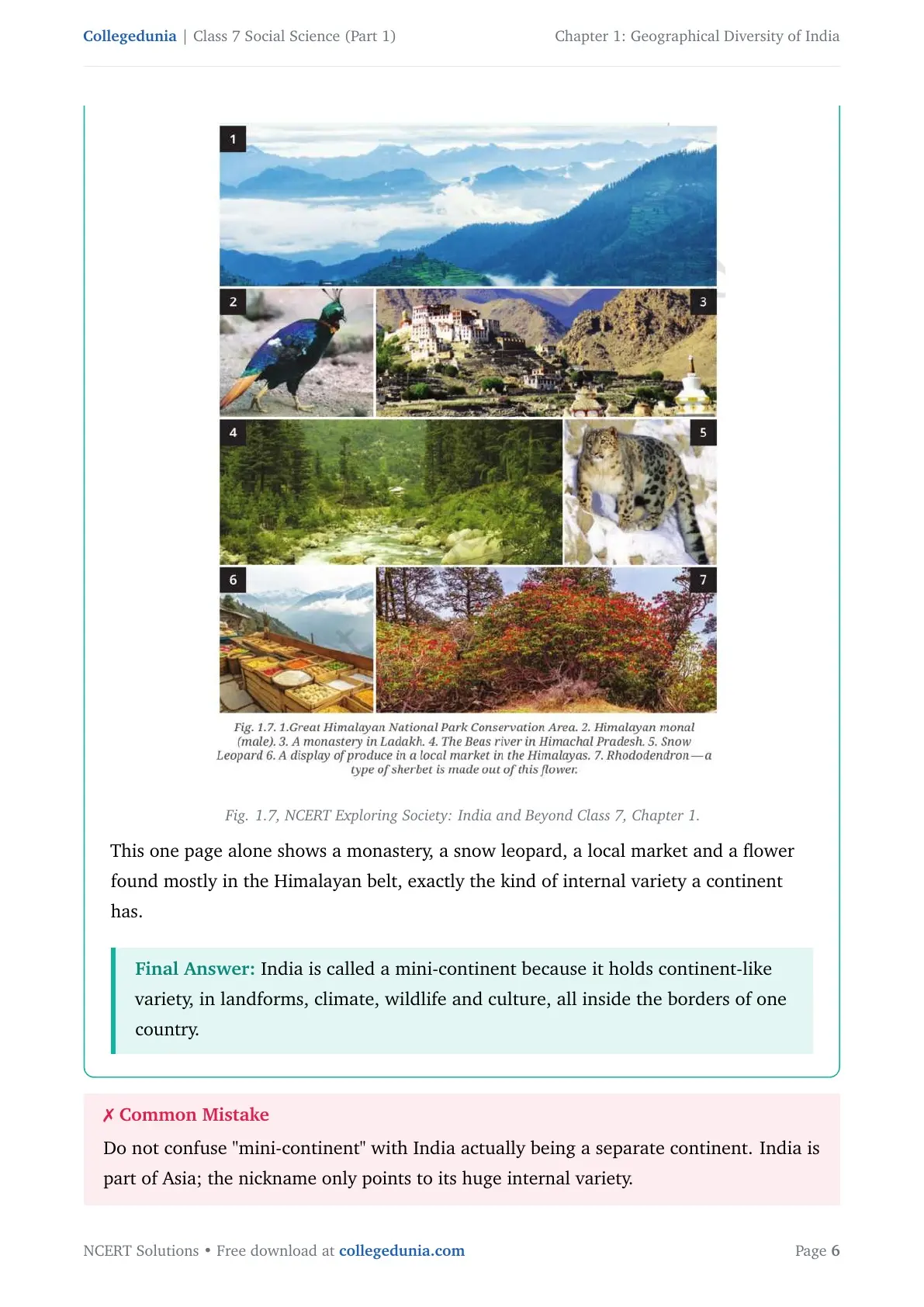
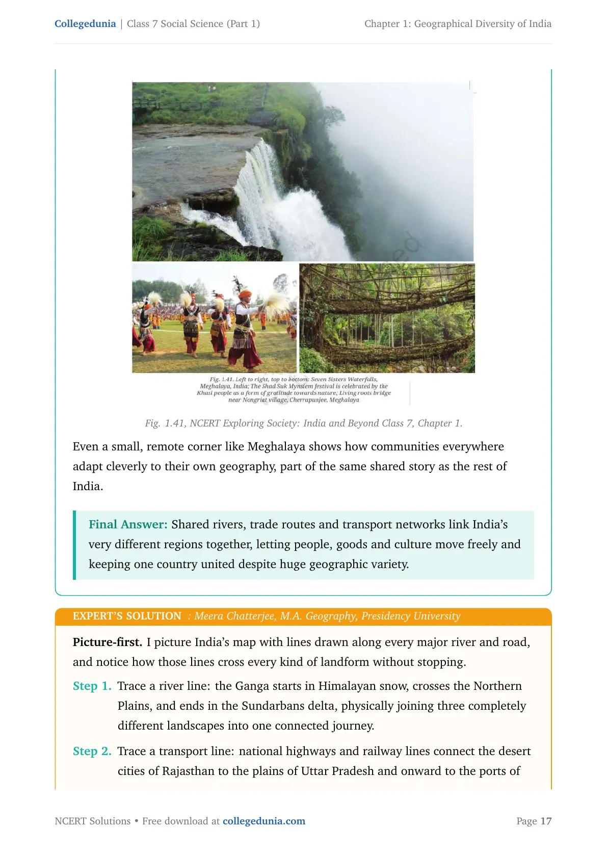
India has snowy mountains (the Himalayas), a cold desert (Ladakh), a hot desert (the Thar), fertile river plains, an old plateau, two different coastlines, and island groups. Its climate ranges from below minus 30 degrees Celsius in Ladakh's winter to hot, humid coasts and the heaviest rainfall belts of the Northeast, all inside one country. This range of geography also shaped very different ways of life, from Ladakhi monasteries to Meghalaya's living root bridges to desert water-saving traditions in Rajasthan.
Boxed answer: India is called a mini-continent because it holds continent-like variety, in landforms, climate, wildlife and culture, all inside the borders of one country.
Expert's Solution: Ananya Iyer, M.A. Geography, Jawaharlal Nehru University
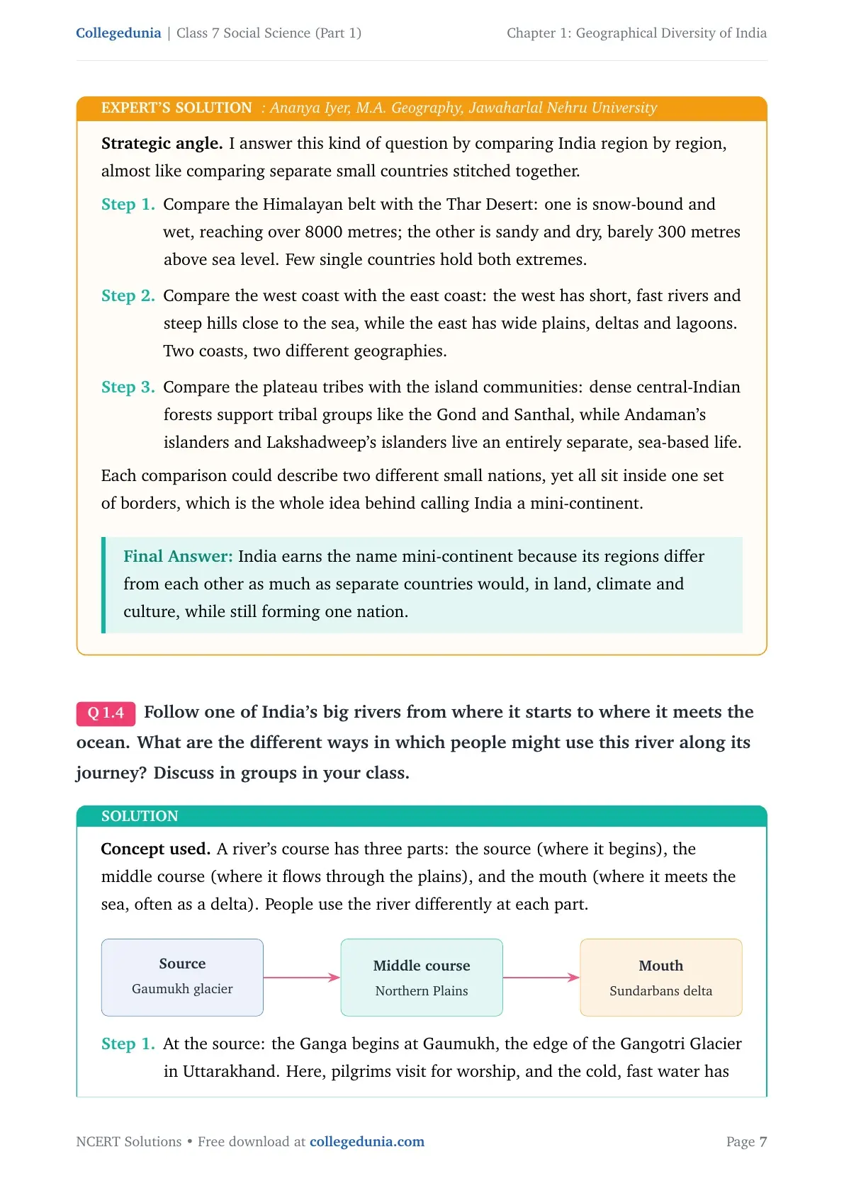
I answer this kind of question by comparing India region by region, almost like comparing separate small countries stitched together. The Himalayan belt and the Thar Desert are opposite extremes, one snow-bound and wet, reaching over 8000 metres, the other sandy and dry, barely 300 metres above sea level. The west coast has short, fast rivers and steep hills close to the sea, while the east coast has wide plains, deltas and lagoons. Dense central-Indian forests support tribal groups like the Gond and Santhal, while Andaman's and Lakshadweep's islanders live an entirely separate, sea-based life. Each comparison could describe two different small nations, yet all sit inside one set of borders.
Boxed answer: India earns the name mini-continent because its regions differ from each other as much as separate countries would, in land, climate and culture, while still forming one nation.
Follow one of India's big rivers from where it starts to where it meets the ocean. What are the different ways in which people might use this river along its journey? Discuss in groups in your class.
Show Solution
Concept used. A river's course has three parts, the source (where it begins), the middle course (where it flows through the plains), and the mouth (where it meets the sea, often as a delta). People use the river differently at each part.
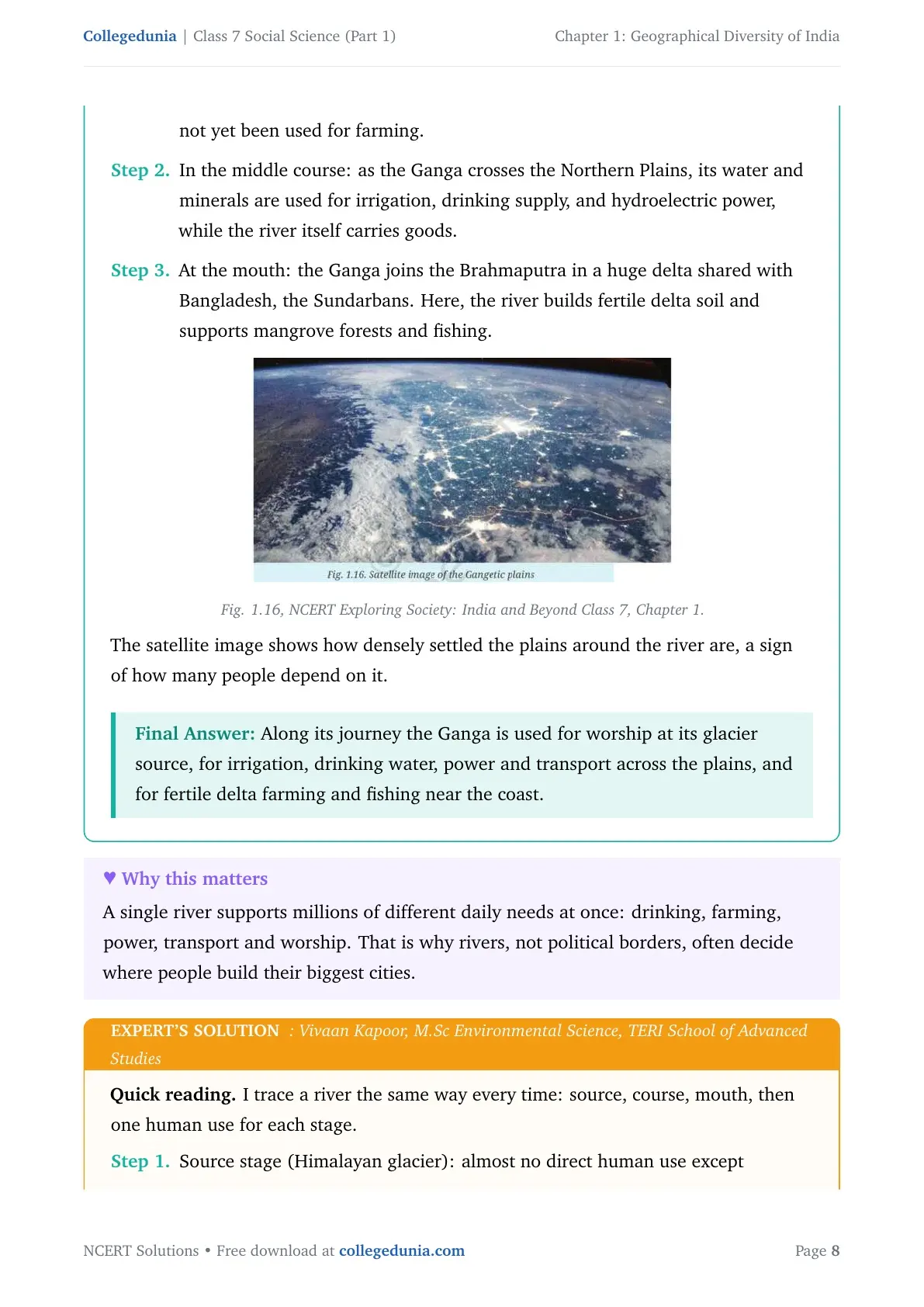
The Ganga begins at Gaumukh, the edge of the Gangotri Glacier in Uttarakhand, where pilgrims visit for worship and the cold, fast water has not yet been used for farming. As the Ganga crosses the Northern Plains, its water and minerals are used for irrigation, drinking supply, and hydroelectric power, while the river carries goods. At its mouth, the Ganga joins the Brahmaputra in a huge delta shared with Bangladesh, the Sundarbans, building fertile delta soil and supporting mangrove forests and fishing.
Boxed answer: Along its journey the Ganga is used for worship at its glacier source, for irrigation, drinking water, power and transport across the plains, and for fertile delta farming and fishing near the coast.
Expert's Solution: Vivaan Kapoor, M.Sc Environmental Science, TERI School of Advanced Studies
I trace a river the same way every time, source, course, mouth, then one human use for each stage. At the source (Himalayan glacier) there is almost no direct human use except pilgrimage, because the river is still small, cold and fast. Most human use is concentrated in the plains stage, irrigation canals for wheat and rice, dams for hydroelectric power, riverboats for moving goods, and river water treated for city drinking supply. At the mouth stage (the delta), fine silt dropped here builds new farmland every year, while the brackish delta waters and mangroves support fishing and forest products.
Boxed answer: One river serves three very different roles on its journey, pilgrimage at the source, irrigation and power in the plains, and fishing plus fertile delta farming at the mouth.
Why is the southern part of India referred to as a peninsular plateau?
Show Solution
Concept used. A peninsula is a piece of land surrounded by water on three sides. A plateau is a raised landform with a broadly flat top. Southern India fits both descriptions at once.
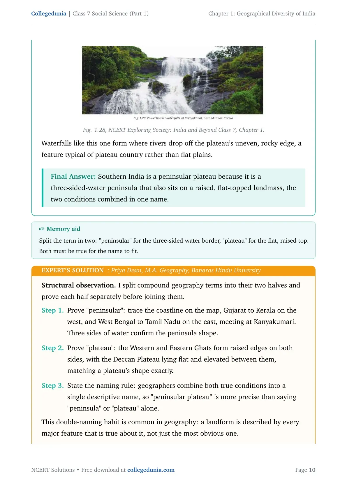
The triangular southern part of India has the Arabian Sea on the west, the Bay of Bengal on the east, and the Indian Ocean at its southern tip, water on three sides. This same region also rises above the surrounding land and has a fairly flat top, bordered by the Western Ghats and Eastern Ghats, matching the definition of a plateau. Since the land is both a peninsula in shape and a plateau in structure, it is named together as the peninsular plateau, or the Deccan Plateau.
Boxed answer: Southern India is a peninsular plateau because it is a three-sided-water peninsula that also sits on a raised, flat-topped landmass, the two conditions combined in one name.
Expert's Solution: Priya Desai, M.A. Geography, Banaras Hindu University
I split compound geography terms into their two halves and prove each half separately before joining them. Tracing the coastline, Gujarat to Kerala on the west, and West Bengal to Tamil Nadu on the east, meeting at Kanyakumari, confirms three sides of water, the peninsula shape. The Western and Eastern Ghats form raised edges on both sides, with the Deccan Plateau lying flat and elevated between them, matching a plateau's shape exactly. Geographers combine both true conditions into a single descriptive name, so "peninsular plateau" is more precise than saying "peninsula" or "plateau" alone.
Boxed answer: The name peninsular plateau is accurate because the region is genuinely both a three-sided peninsula and a raised, flat-topped plateau at the same time.
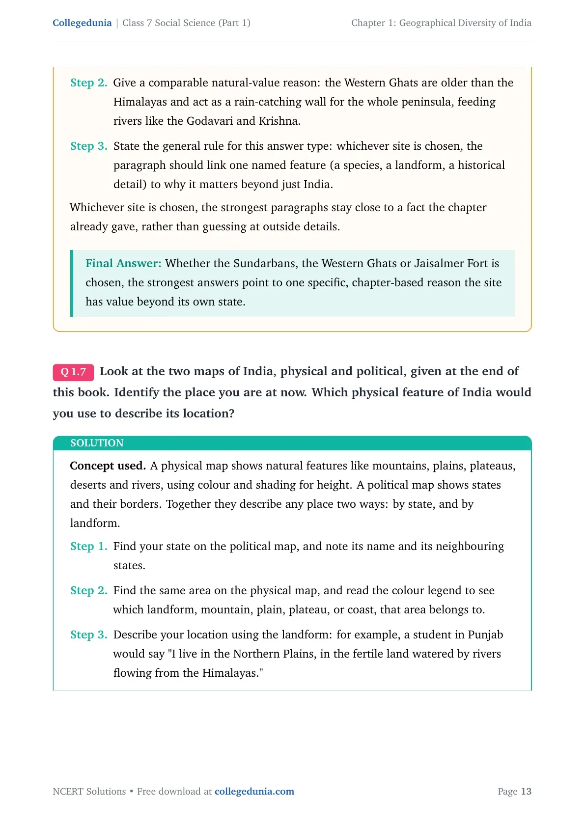
Which UNESCO Heritage Site mentioned in this chapter did you find more interesting? Write a short paragraph to describe what about it is interesting.
Show Solution
Concept used. A UNESCO World Heritage Site is a place recognised by the United Nations as having outstanding natural or cultural value to all of humanity, worth protecting for future generations. The chapter names several, the Western Ghats, the Sundarbans, and Jaisalmer Fort.
One strong choice is the Sundarbans, the delta shared between West Bengal and Bangladesh, formed where the Ganga and Brahmaputra meet the sea. It holds the world's largest mangrove forest, and it is one of the last homes of the wild Royal Bengal Tiger. Mangroves protect the coast from storms and hold large amounts of carbon, so protecting the Sundarbans benefits people far beyond West Bengal or Bangladesh.
Boxed answer: The Sundarbans is a strong choice, it is the world's largest mangrove delta and a last refuge of the Royal Bengal Tiger, giving it clear natural value worth protecting.
Expert's Solution: Karan Joshi, M.A. History, Jamia Millia Islamia
A good answer always ties the chosen site back to something the chapter itself explained, rather than adding outside facts the student has not actually read. The Western Ghats could be picked instead, since they hold rare species like the lion-tailed macaque found only in that forest belt, and are older than the Himalayas, acting as a rain-catching wall for the whole peninsula, feeding rivers like the Godavari and Krishna. Whichever site is chosen, the paragraph should link one named feature, a species, a landform, a historical detail, to why it matters beyond just India.
Boxed answer: Whether the Sundarbans, the Western Ghats or Jaisalmer Fort is chosen, the strongest answers point to one specific, chapter-based reason the site has value beyond its own state.
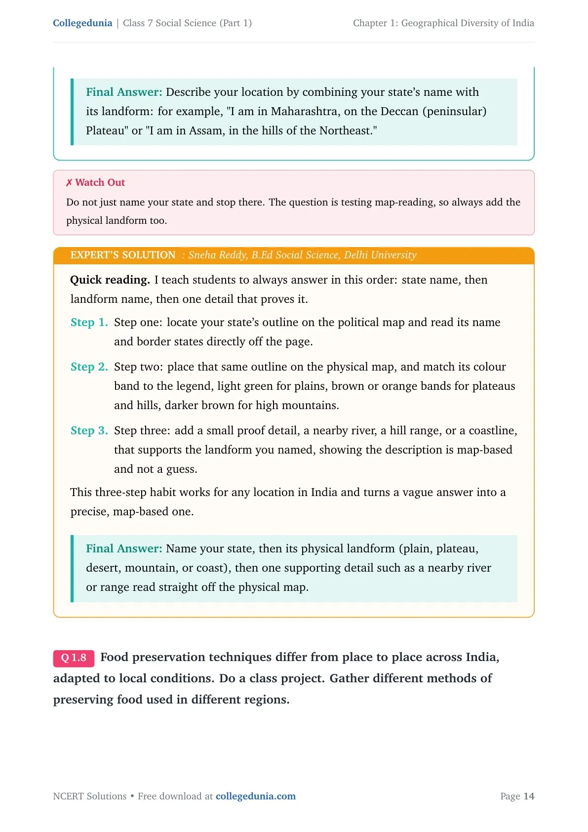
Look at the two maps of India, physical and political, given at the end of this book. Identify the place you are at now. Which physical feature of India would you use to describe its location?
Show Solution
Concept used. A physical map shows natural features like mountains, plains, plateaus, deserts and rivers, using colour and shading for height. A political map shows states and their borders. Together they describe any place two ways, by state, and by landform.
Find your state on the political map, and note its name and its neighbouring states. Find the same area on the physical map, and read the colour legend to see which landform, mountain, plain, plateau, or coast, that area belongs to. Describe your location using the landform, for example, a student in Punjab would say "I live in the Northern Plains, in the fertile land watered by rivers flowing from the Himalayas."
Boxed answer: Describe your location by combining your state's name with its landform, for example, "I am in Maharashtra, on the Deccan (peninsular) Plateau" or "I am in Assam, in the hills of the Northeast."
Expert's Solution: Sneha Reddy, B.Ed Social Science, Delhi University
I teach students to always answer in this order, state name, then landform name, then one detail that proves it. Locate your state's outline on the political map and read its name and border states directly off the page. Place that same outline on the physical map, and match its colour band to the legend, light green for plains, brown or orange bands for plateaus and hills, darker brown for high mountains. Add a small proof detail, a nearby river, a hill range, or a coastline, that supports the landform you named.
Boxed answer: Name your state, then its physical landform (plain, plateau, desert, mountain, or coast), then one supporting detail such as a nearby river or range read straight off the physical map.
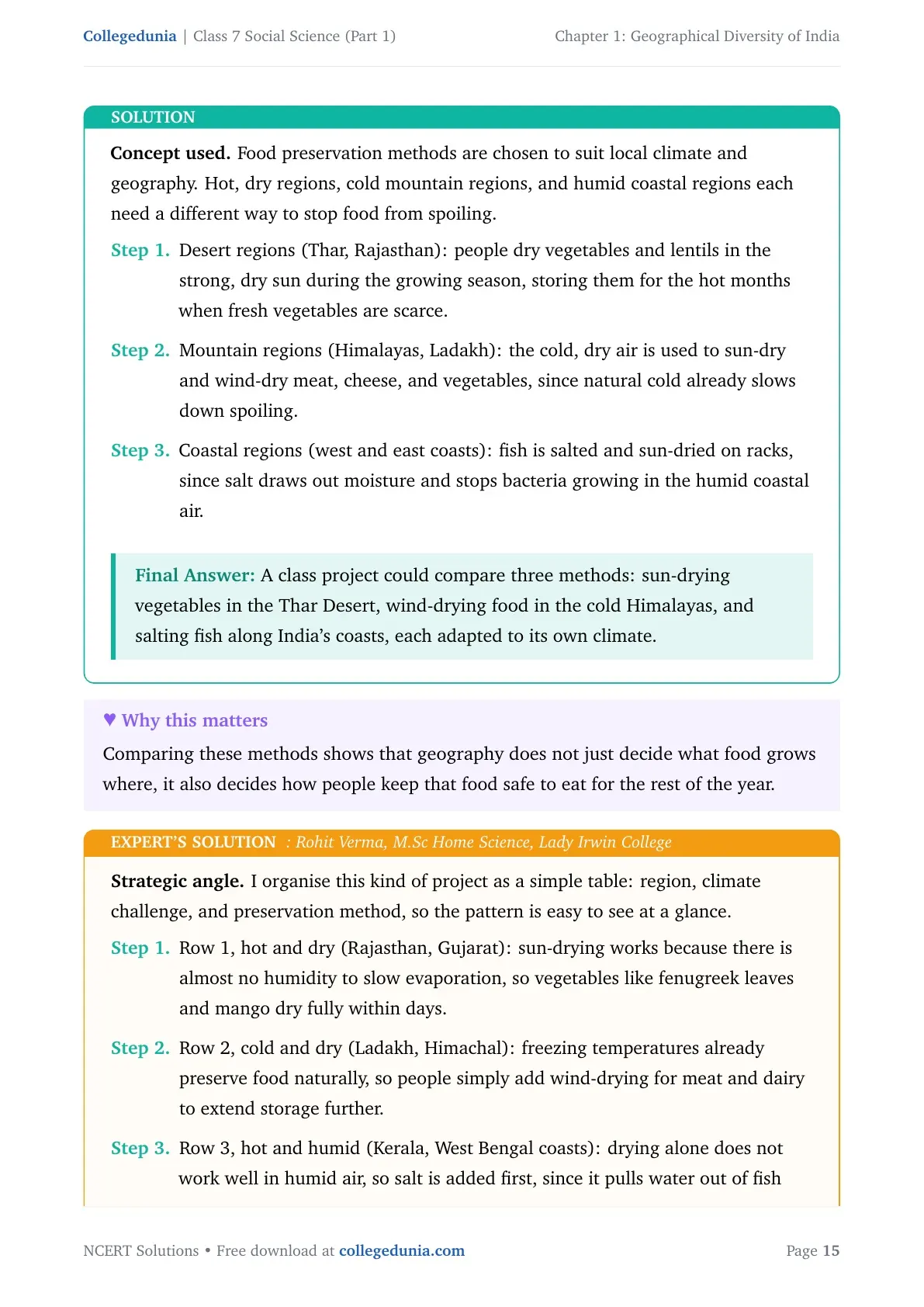
Food preservation techniques differ from place to place across India, adapted to local conditions. Do a class project. Gather different methods of preserving food used in different regions.
Show Solution
Concept used. Food preservation methods are chosen to suit local climate and geography. Hot, dry regions, cold mountain regions, and humid coastal regions each need a different way to stop food from spoiling.
In desert regions (Thar, Rajasthan), people dry vegetables and lentils in the strong, dry sun during the growing season, storing them for the hot months. In mountain regions (Himalayas, Ladakh), the cold, dry air is used to sun-dry and wind-dry meat, cheese, and vegetables, since natural cold already slows down spoiling. In coastal regions (west and east coasts), fish is salted and sun-dried on racks, since salt draws out moisture and stops bacteria growing in the humid coastal air.
Boxed answer: A class project could compare three methods, sun-drying vegetables in the Thar Desert, wind-drying food in the cold Himalayas, and salting fish along India's coasts, each adapted to its own climate.
Expert's Solution: Rohit Verma, M.Sc Home Science, Lady Irwin College
I organise this kind of project as a simple table, region, climate challenge, and preservation method, so the pattern is easy to see at a glance. In hot and dry regions (Rajasthan, Gujarat), sun-drying works because there is almost no humidity to slow evaporation. In cold and dry regions (Ladakh, Himachal), freezing temperatures already preserve food naturally, so people simply add wind-drying for meat and dairy. In hot and humid regions (Kerala, West Bengal coasts), drying alone does not work well, so salt is added first, since it pulls water out of fish faster than sun alone could.
Boxed answer: Group the project by climate type, dry heat favours simple sun-drying, cold dryness favours wind-drying, and humid coasts need salting before drying, each method solving a different local problem.
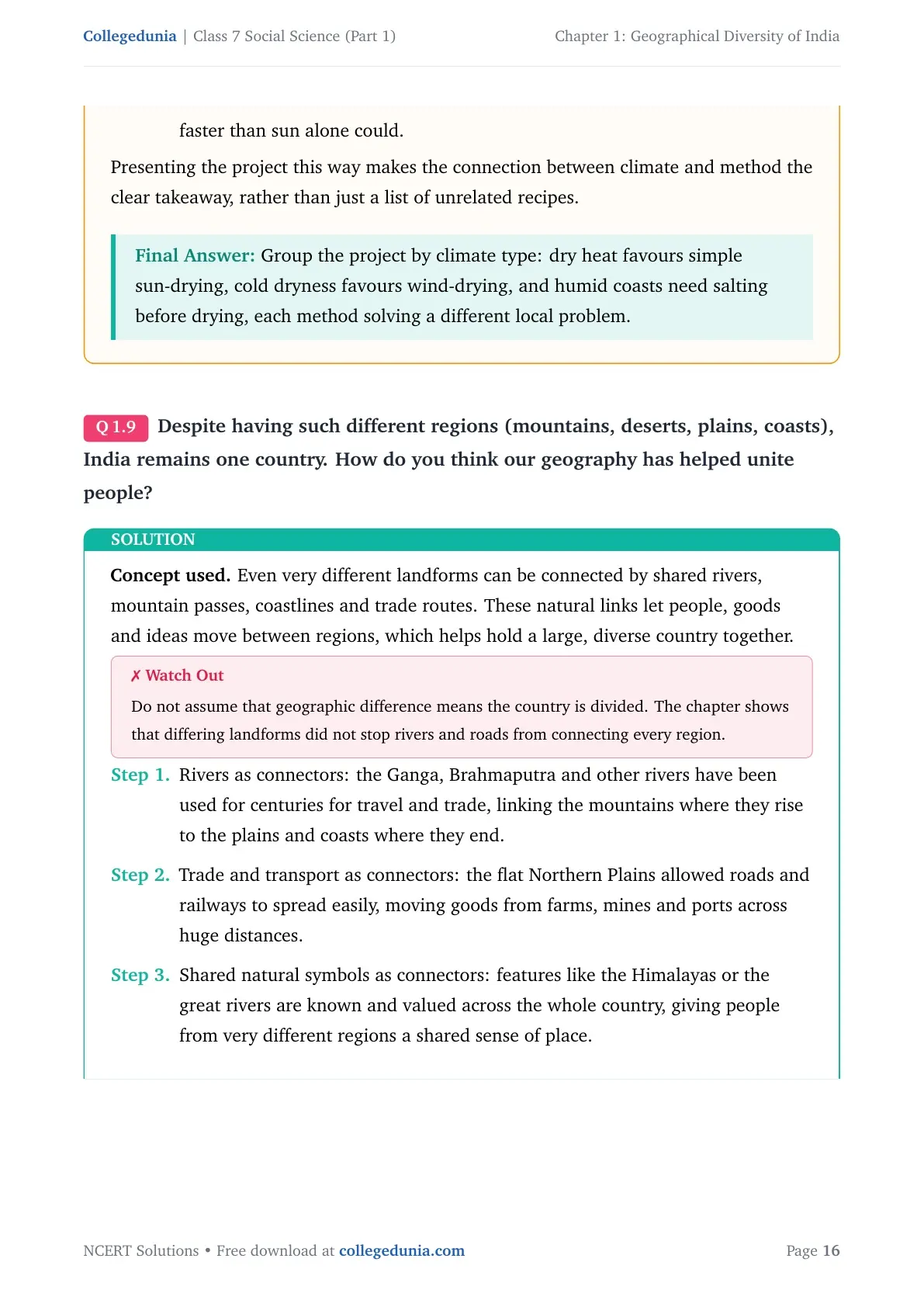
Despite having such different regions (mountains, deserts, plains, coasts), India remains one country. How do you think our geography has helped unite its people?
Show Solution
Concept used. Even very different landforms can be connected by shared rivers, mountain passes, coastlines and trade routes. These natural links let people, goods and ideas move between regions, which helps hold a large, diverse country together.
The Ganga, Brahmaputra and other rivers have been used for centuries for travel and trade, linking the mountains where they rise to the plains and coasts where they end. The flat Northern Plains allowed roads and railways to spread easily, moving goods from farms, mines and ports across huge distances. Shared natural symbols, like the Himalayas or the great rivers, are known and valued across the whole country, giving people from very different regions a shared sense of place.
Boxed answer: Shared rivers, trade routes and transport networks link India's very different regions together, letting people, goods and culture move freely and keeping one country united despite huge geographic variety.
Expert's Solution: Meera Chatterjee, M.A. Geography, Presidency University
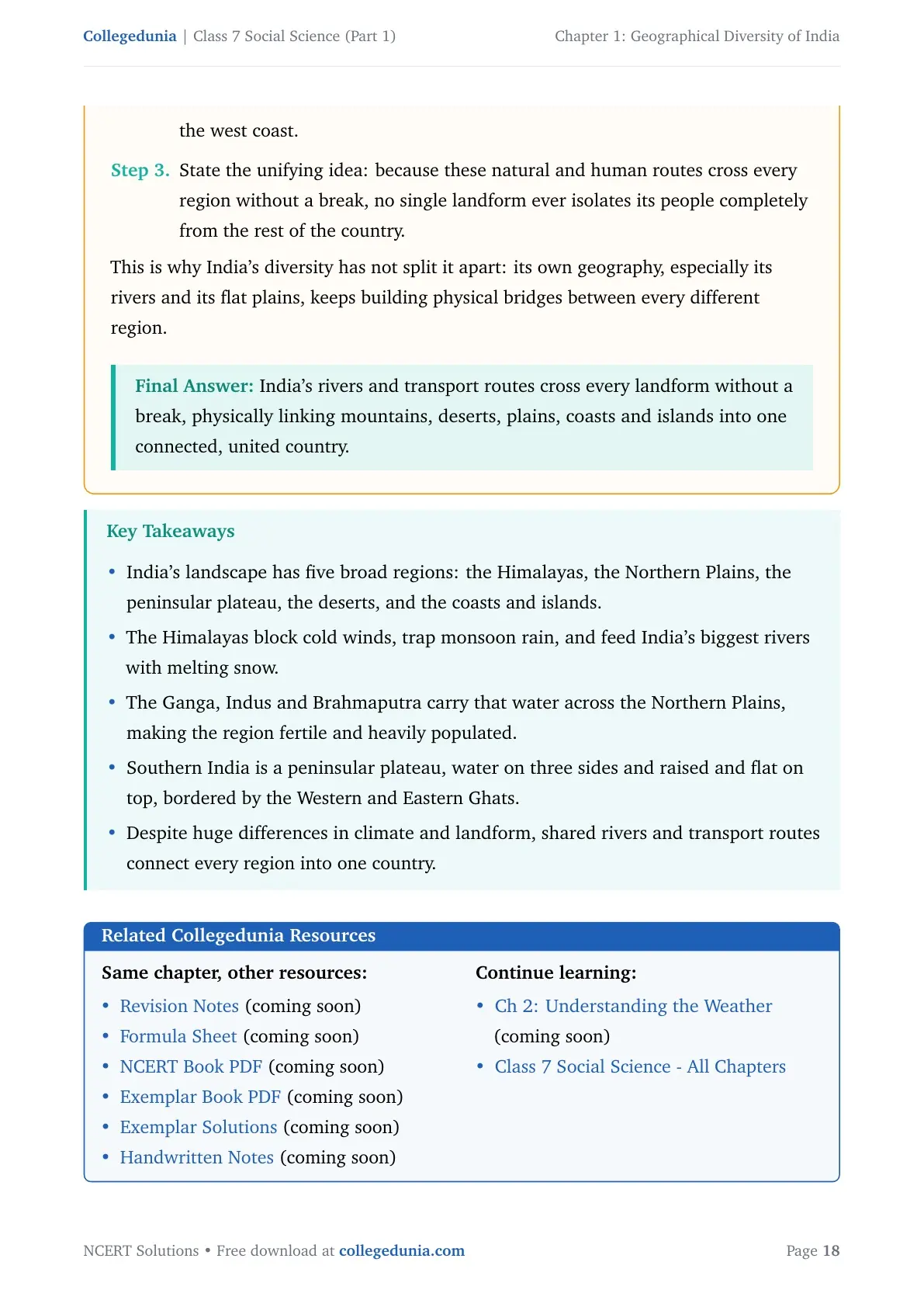
I picture India's map with lines drawn along every major river and road, and notice how those lines cross every kind of landform without stopping. The Ganga starts in Himalayan snow, crosses the Northern Plains, and ends in the Sundarbans delta, physically joining three completely different landscapes into one connected journey. National highways and railway lines connect the desert cities of Rajasthan to the plains of Uttar Pradesh and onward to the ports of the west coast. Because these natural and human routes cross every region without a break, no single landform ever isolates its people completely from the rest of the country.
Boxed answer: India's rivers and transport routes cross every landform without a break, physically linking mountains, deserts, plains, coasts and islands into one connected, united country.
Geographical Diversity of India Class 7 Social Science NCERT Solutions FAQs
Ques. Where can I download the NCERT Solutions for Class 7 Social Science Chapter 1 Geographical Diversity of India PDF?
Ans. Use the download option at the top of this page. The file is free, covers all 9 questions and activities from the chapter, and is available in both Normal and HD quality.
Ques. What are the five broad geographical regions of India described in this chapter?
Ans. The chapter groups India's landscape into five broad regions, the Himalayas, the Northern Plains, the peninsular plateau, the Thar Desert, and the coasts and islands. Each region shapes climate, water supply, farming and the way people live in different ways.
Ques. Why is southern India called a peninsular plateau?
Ans. Southern India has water on three sides, the Arabian Sea, the Bay of Bengal and the Indian Ocean, which makes it a peninsula. It is also raised and flat-topped, bordered by the Western and Eastern Ghats, which makes it a plateau. Both conditions combined give the region its name.
Ques. Why do the Himalayas matter so much for India's climate and rivers?
Ans. The Himalayas block cold winds from Central Asia in winter, force monsoon clouds to drop rain on the plains below, and feed India's biggest rivers, the Ganga, Indus and Brahmaputra, with melting snow all year round.
Ques. Why is India sometimes called a "mini-continent"?
Ans. India is called a mini-continent because it holds continent-like variety inside one country, snowy mountains, a cold desert, a hot desert, fertile river plains, an old plateau, two different coastlines and island groups, along with very different climates and ways of life.
Ques. Is this NCERT Solutions PDF aligned with the 2026-27 syllabus?
Ans. Yes. This page follows the current 2026-27 edition of Exploring Society: India and Beyond, Grade 7 Part 1, and every answer matches the chapter content and question order printed in that edition.
Ques. Which UNESCO World Heritage Sites are mentioned in the Geographical Diversity of India chapter?
Ans. The chapter names three UNESCO World Heritage Sites, the Sundarbans, the Western Ghats, and Jaisalmer Fort. Each one is linked to a different physical feature discussed in the chapter, a river delta, a mountain range, and the Thar Desert.
Ques. How long is India's coastline and how many coral islands does Lakshadweep have?
Ans. India's coastline runs over 7500 km across its two coasts. Lakshadweep, off the southwest coast, is made up of 36 coral islands, and the Andaman and Nicobar Islands lie in the Bay of Bengal.
Ques. What is meant by calling the Ganga's journey a connector between regions?
Ans. The Ganga begins at the Gangotri Glacier, crosses the Northern Plains where it is used for irrigation, drinking water and power, and ends at the Sundarbans delta, where it supports fishing and mangrove forests. It links three very different landscapes into one connected journey.
Ques. How many pages is the Class 7 Social Science Chapter 1 NCERT Solutions PDF?
Ans. The Solutions PDF runs to a compact length that covers all 9 questions and activities from Geographical Diversity of India, with a concept explanation, step-by-step reasoning and a boxed final answer for each one.



Comments