




These Class 12 Geography Chapter 8 International Trade handwritten notes are a topper's genuine handwritten pages for quick last-mile revision, in line with the 2026-27 CBSE syllabus. They cover all key ideas in the chapter: basis of international trade, balance of trade, types of trade, ports and their classification, free trade, and concerns related to globalisation. Use the PDF in the 24 hours before the board paper.
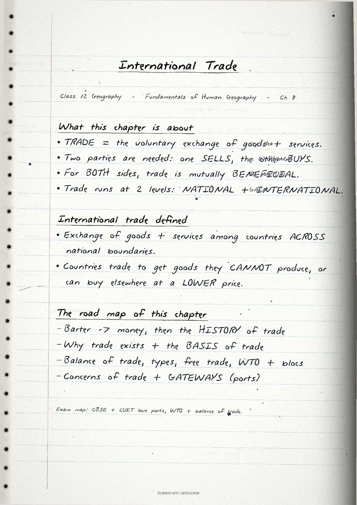
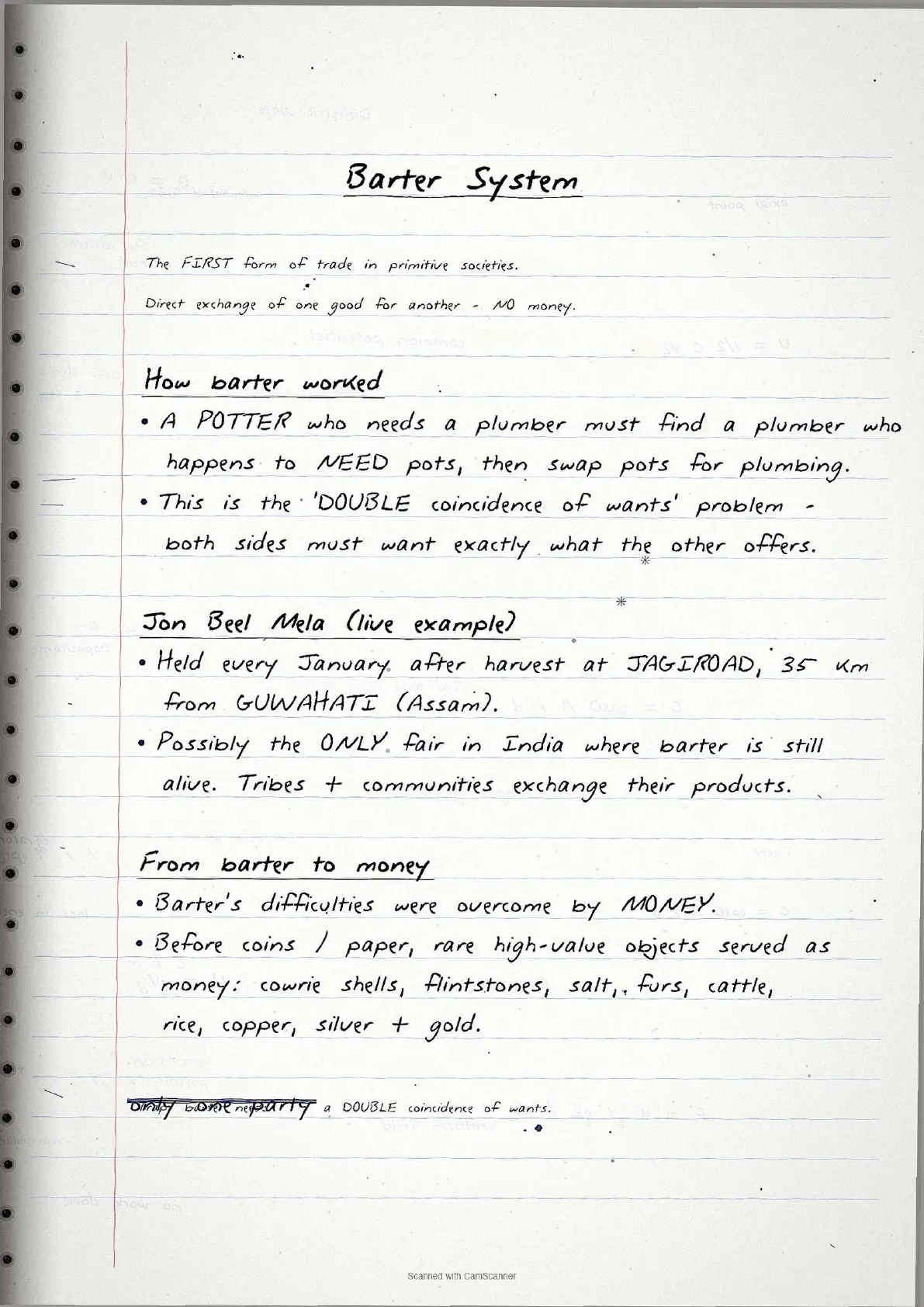
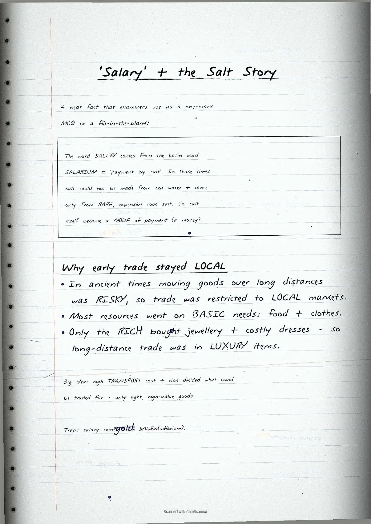
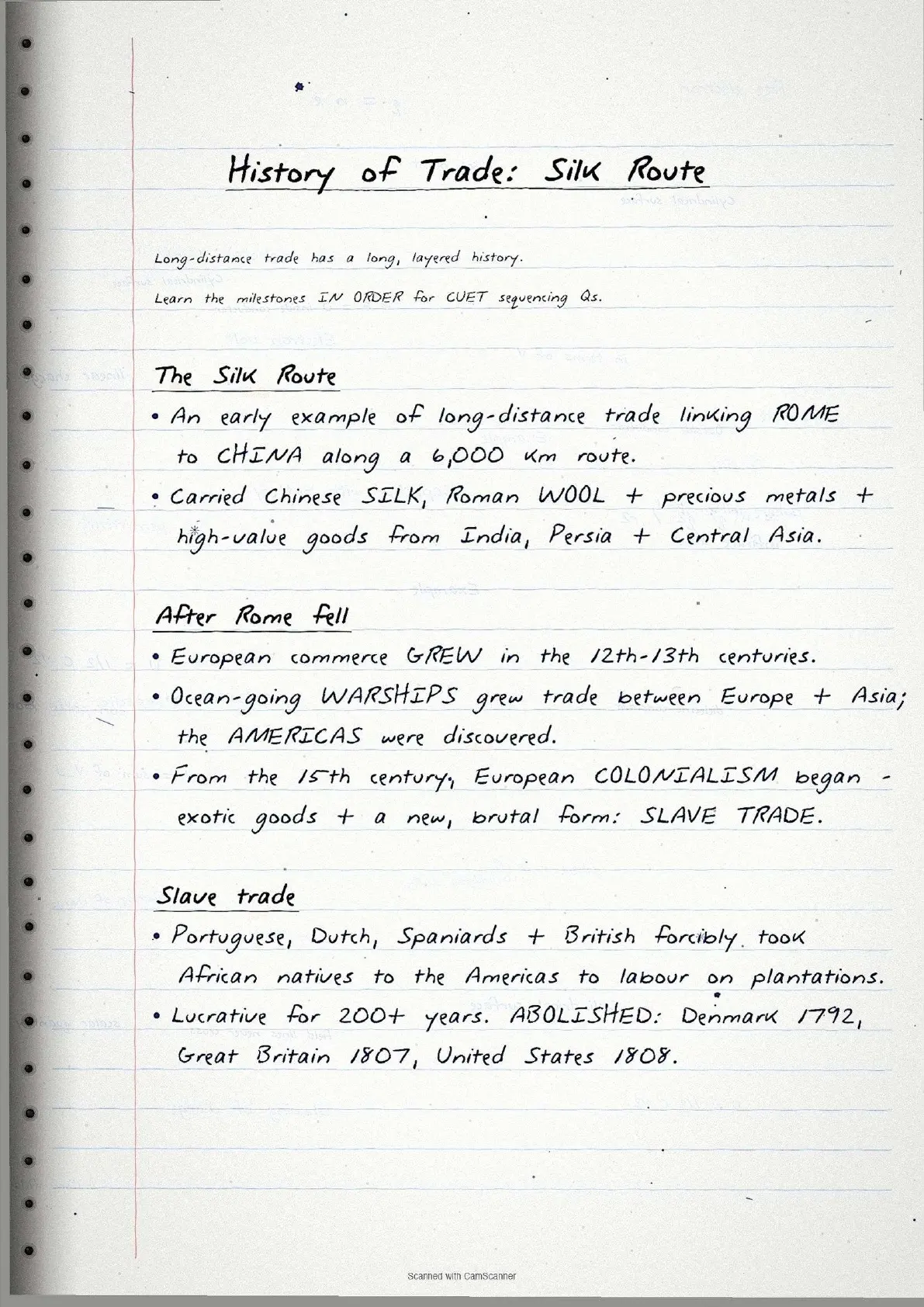
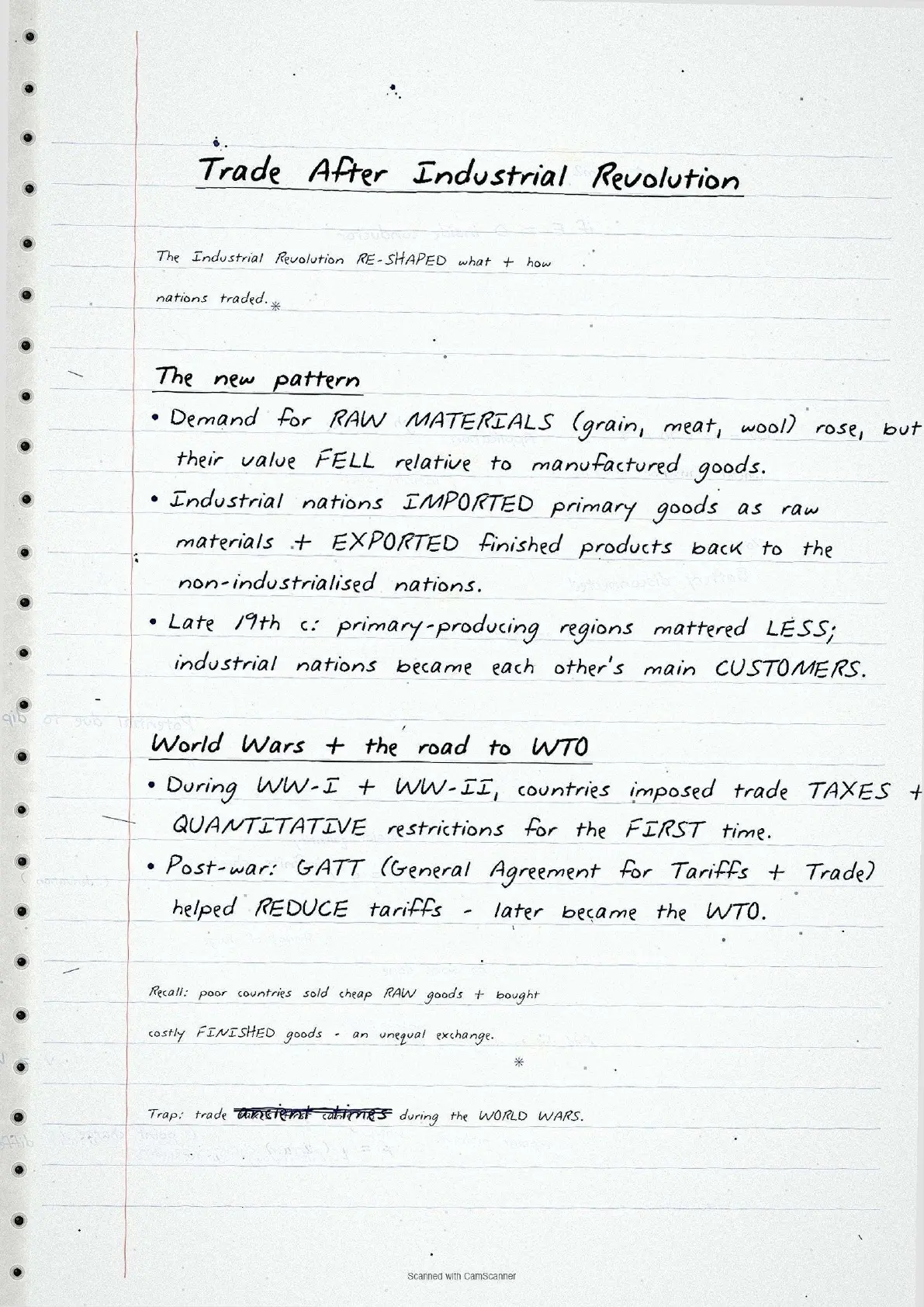
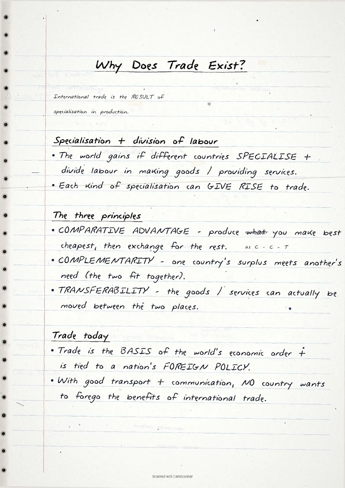
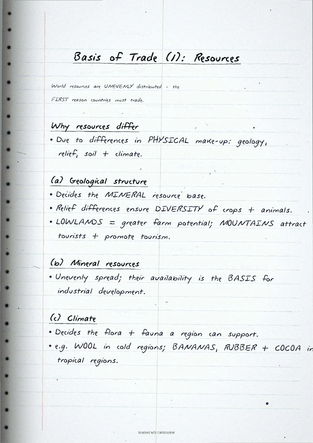
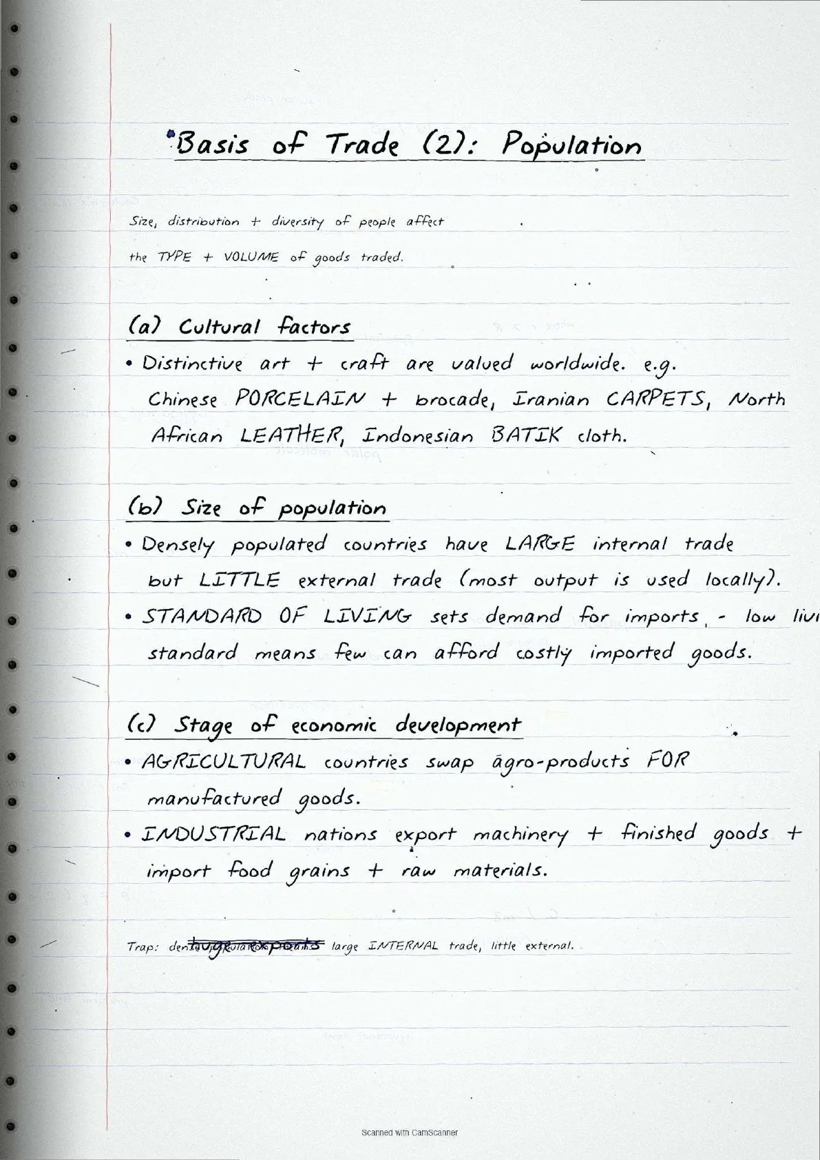
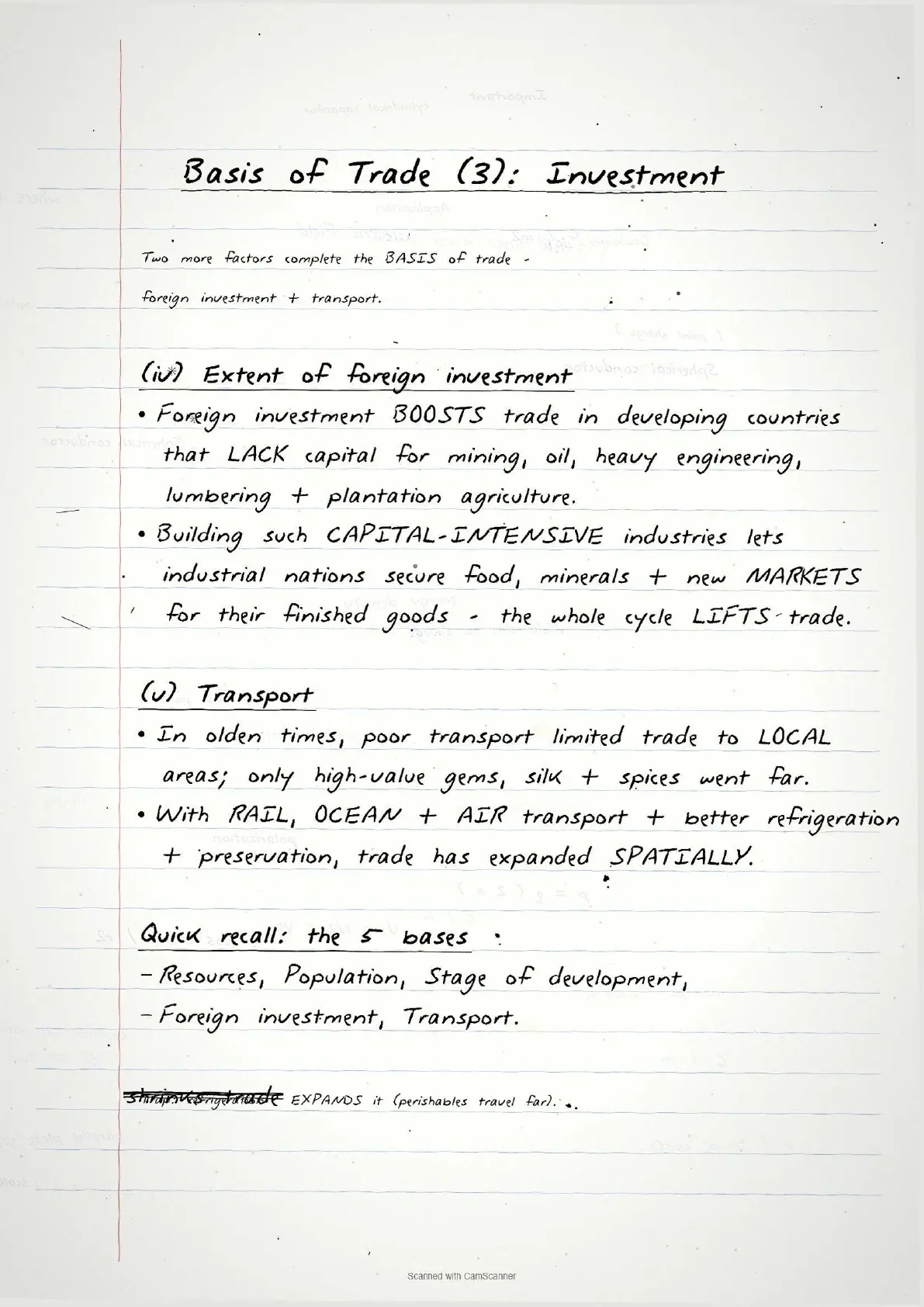
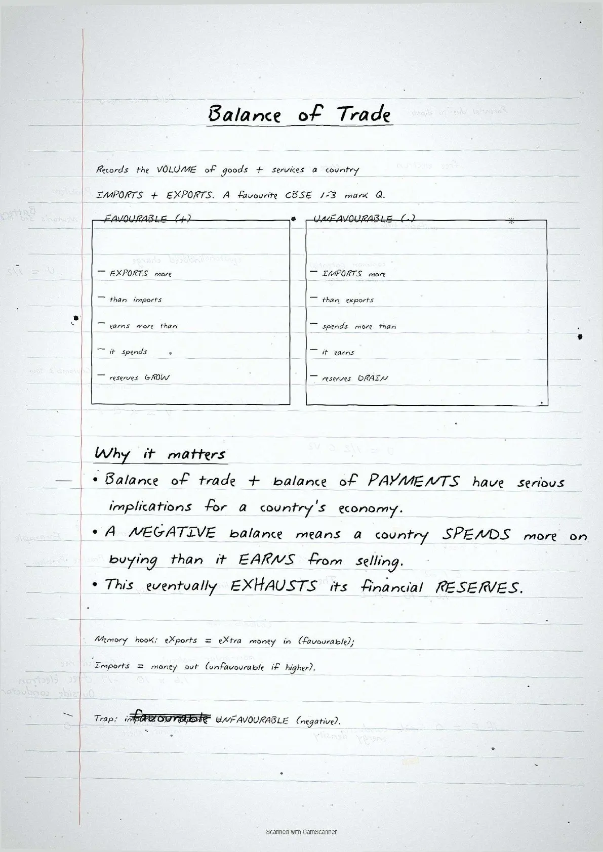
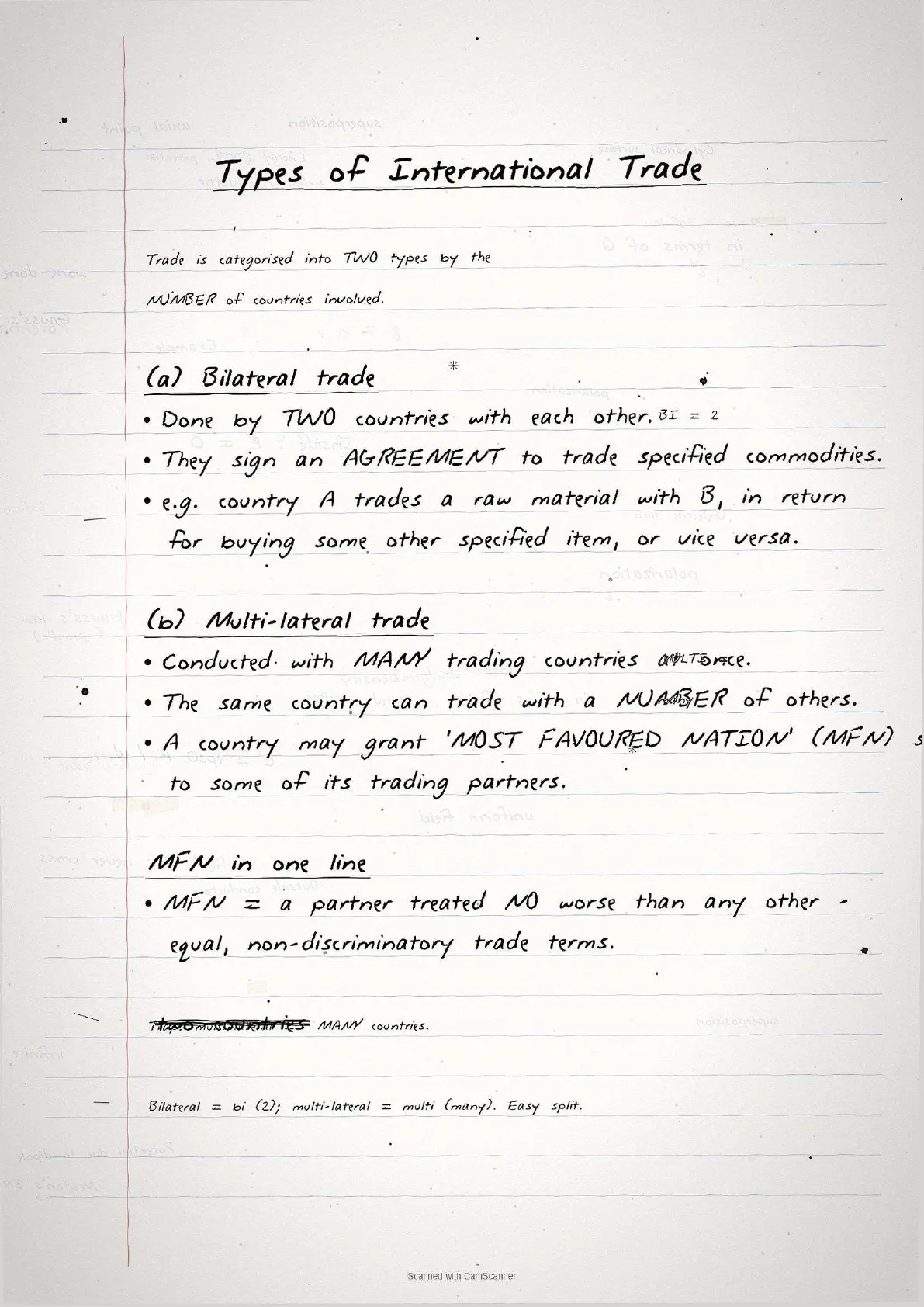
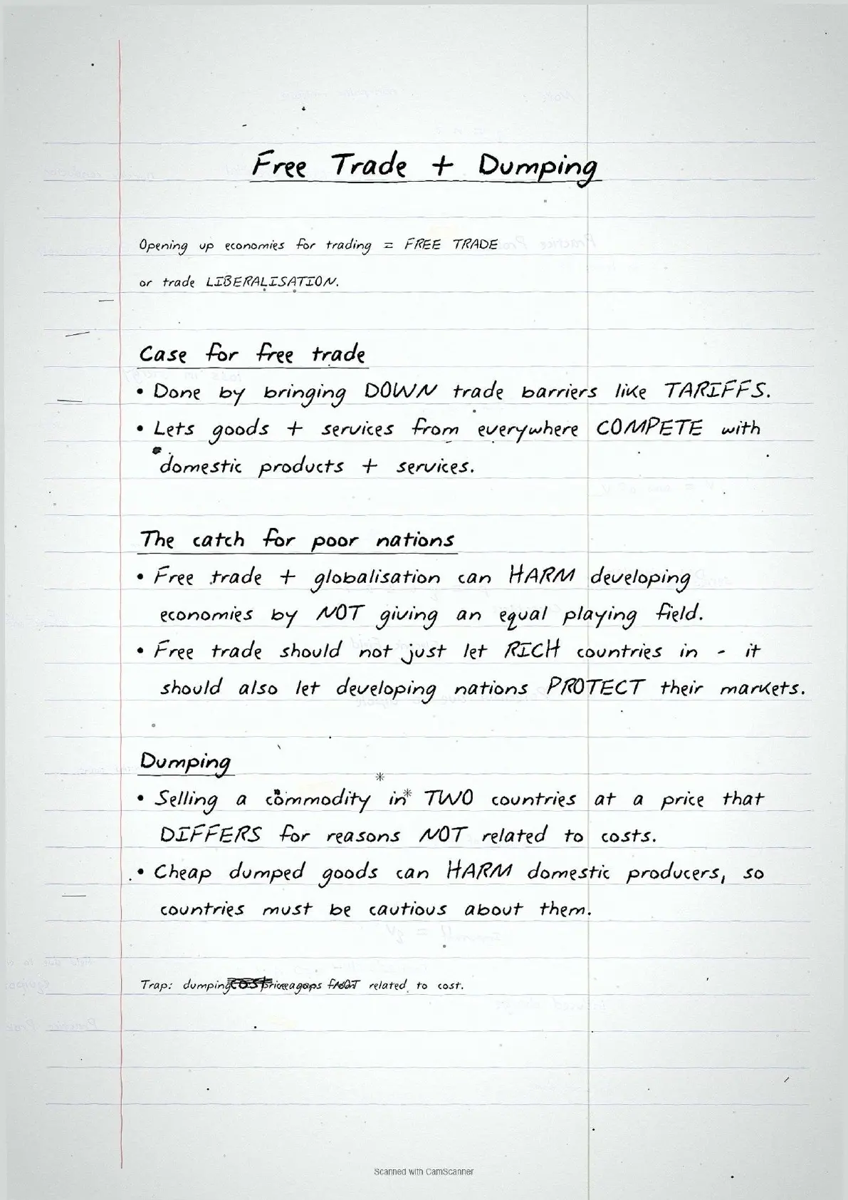
- Topper's handwritten revision notes covering all of CBSE Class 12 Geography Fundamentals of Human Geography Chapter 8.
- 5-6 marks weightage in the Class 12 Geography board paper, with basis of trade, balance of trade, types of ports and free trade vs protectionism worked out by hand in comparison boxes.
- Pairs with the typed NCERT Solutions, typed Notes and the official NCERT Book PDF for the same chapter.
Every page of these international trade class 12 handwritten notes is mapped to the 2026-27 NCERT Fundamentals of Human Geography textbook and cross-checked against the last five years of CBSE Class 12 Geography board papers.
Student Feedback
69% of Class 12 students said handwritten notes feel faster to scan than typed PDFs in the final 48 hours before the board exam, and 4 out of 5 said pen-on-paper concept boxes stick in memory better when revising international trade class 12 geography. Most finished one full pass in about 20 minutes.
Source: 2026-27 Class 12 Geography handwritten-notes feedback poll, 8,640 CBSE students.
What These Handwritten Notes Include
The international trade class 12 geography handwritten notes PDF is a 3 to 4 page revision file. It covers every concept tested in CBSE Class 12 Geography Chapter 8: the meaning and history of trade, the five bases of trade, balance of trade, types of trade, dumping and free trade, types of ports, and the concerns related to globalisation. The file is built for last-mile revision, not first-time concept building.
| Page | What the page covers | Approx revision time |
|---|---|---|
| Page 1 | Meaning of trade, barter system, history of international trade (Silk Route, colonial trade, WTO), comparative advantage, basis of trade. | 6 minutes |
| Page 2 | Balance of trade (favourable vs unfavourable), types of trade (bilateral vs multilateral), Most Favoured Nation status, dumping, free trade. | 5 minutes |
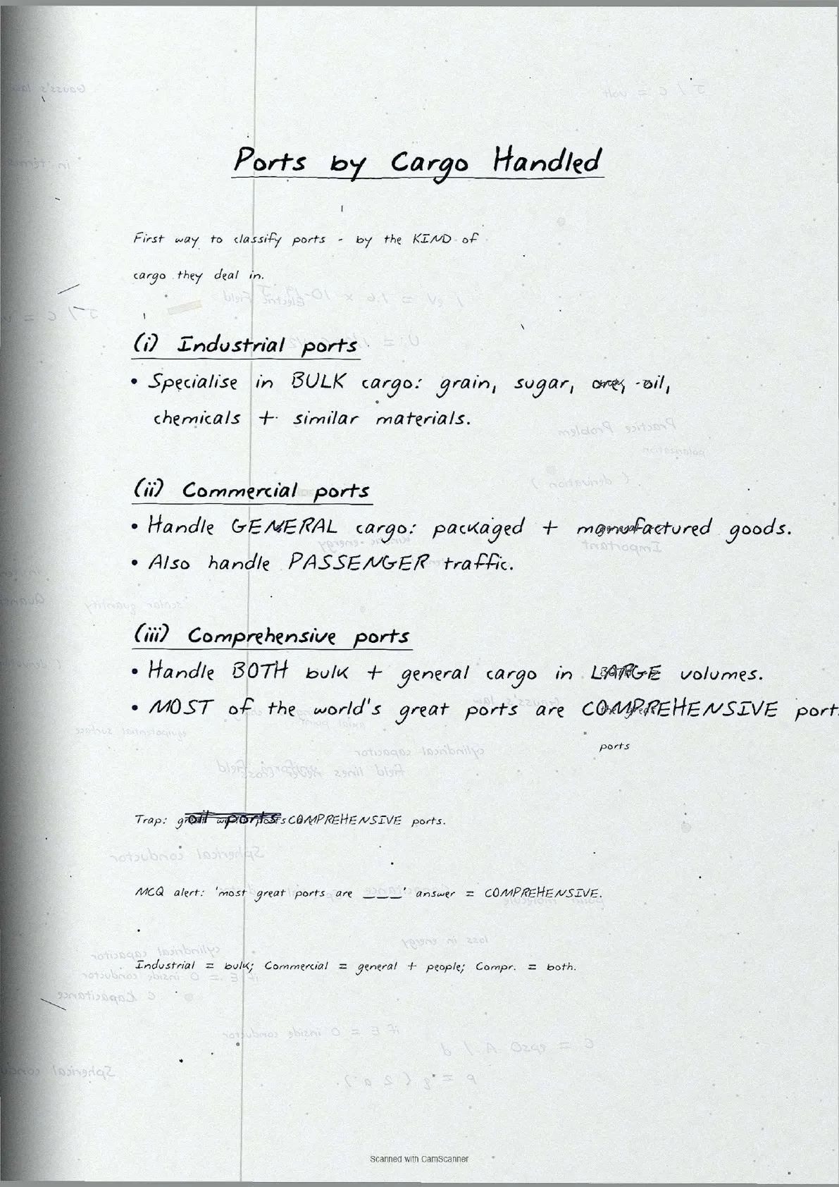
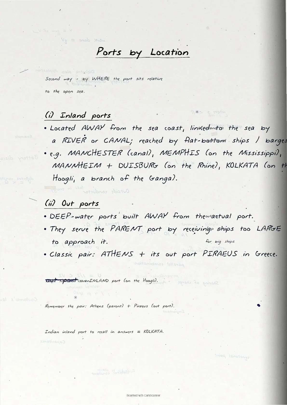
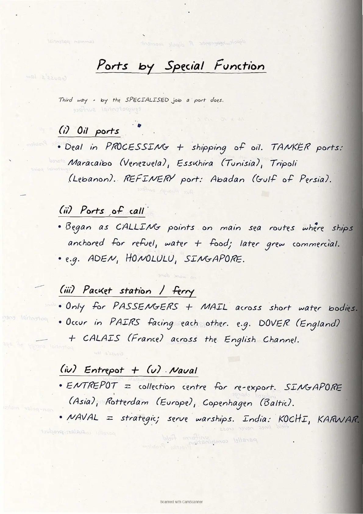
| Page 3 | Types of ports by cargo (industrial, commercial, comprehensive) and by location (inland, out ports) and by function (oil, packet station, entrepot, naval). | 6 minutes |
| Page 4 | Benefits vs concerns of international trade, globalisation and sustainable development, WTO functions, trading blocs. | 5 minutes |
Key Concepts and Definitions
The table below lists every definition and key idea students need to memorise for the CBSE Class 12 Geography board paper, in the order they appear in the notes.
| Concept | Handwritten definition (as drawn) | NCERT exercise Q |
|---|---|---|
| International Trade | Exchange of goods and services among countries across national boundaries; based on comparative advantage, complementarity and transferability | Q2(ii) |
| Barter System | Direct exchange of goods without using money; replaced by money because of the "double coincidence of wants" problem | Q1(i) |
| Comparative Advantage | A country benefits by producing what it can make at a relatively lower opportunity cost than others; basis of specialisation in trade | Q2(ii) |
| Balance of Trade | Record of volume of goods/services imported vs exported; favourable = exports exceed imports; unfavourable = imports exceed exports | Q2(ii) |
| Bilateral Trade | Trade between two countries based on a mutual agreement to exchange specified commodities | Q1(iii) |
| Multilateral Trade | Trade conducted with many countries simultaneously; a country may grant Most Favoured Nation (MFN) status to select partners | Q1(iii) |
| Dumping | Selling a commodity in two countries at a price that differs for reasons not related to costs; harms domestic producers of the importing country | Q1(ii) |
| Free Trade / Liberalisation | Opening economies by reducing trade barriers like tariffs; allows goods and services from everywhere to compete with domestic products | Q2(iii) |
| Comprehensive Ports | Handle both bulk and general cargo in large volumes; most of the world's great ports fall in this category | Q1(i) |
| Inland Ports | Located away from sea coast; linked to sea via river or canal; examples - Manchester (canal), Kolkata (Hoogli), Memphis (Mississippi) | Q3(i) |
| Entrepot Ports | Collection centres where goods from different countries are brought for re-export; Singapore (Asia), Rotterdam (Europe), Copenhagen (Baltic) | Q3(i) |
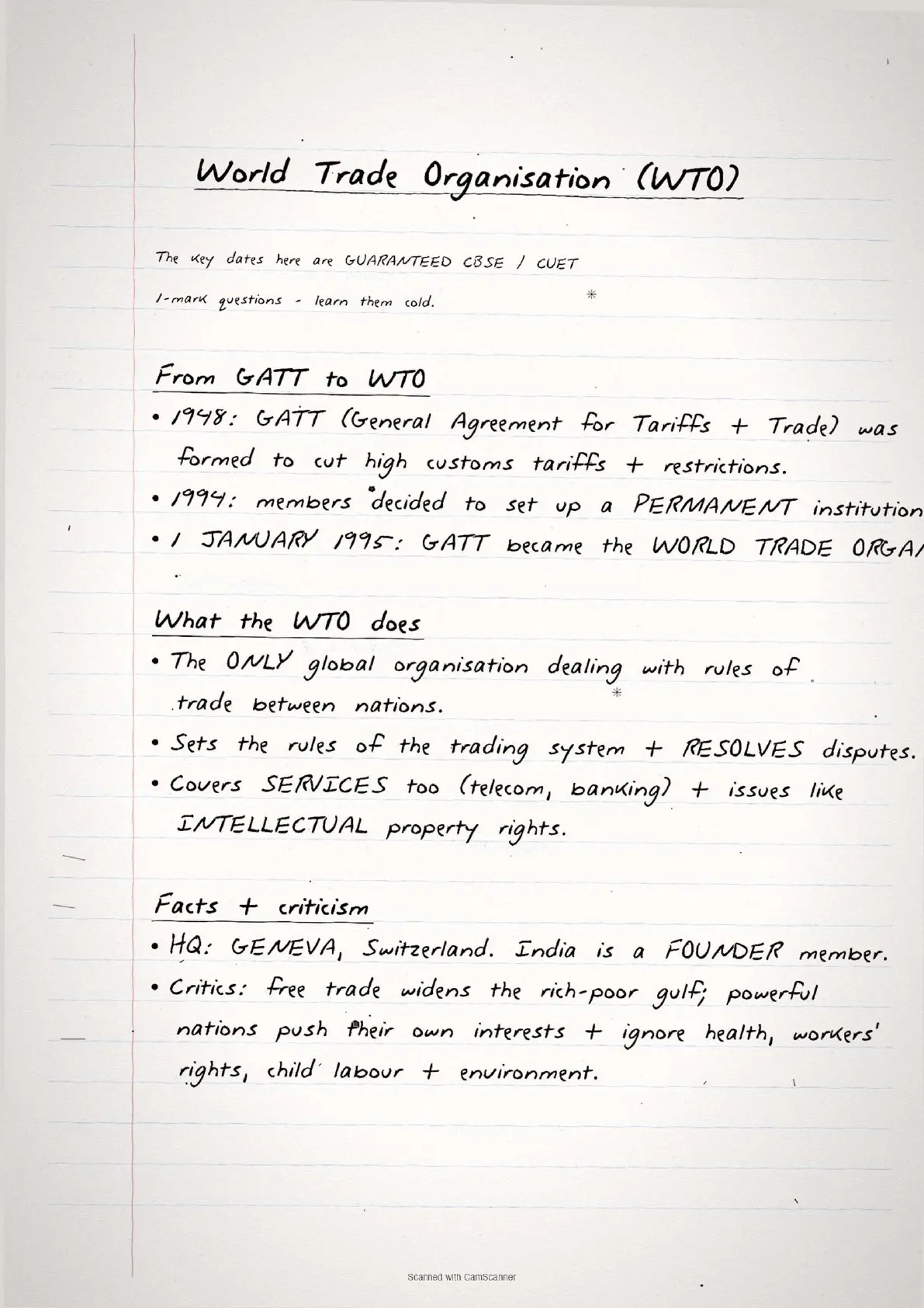
| WTO (World Trade Organisation) | Replaced GATT; helps reduce tariffs and settle trade disputes; promotes rules-based international trade among member nations | Q2(i) |
Basis of International Trade: Five Factors
The NCERT textbook lists five main reasons why international trade happens. The notes capture all five, each linked to a real-world example that CBSE markers reward as the application component.
| Factor | Key idea from NCERT | Real-world example (from handwritten notes) |
|---|---|---|
| 1. Difference in National Resources | Geological structure, climate and mineral distribution vary across countries, making some goods available only in specific regions | Wool produced in cold regions; rubber and cocoa in tropical regions; oil in the Gulf states |
| 2. Population Factors | Size, cultural diversity and standard of living of population determines type and volume of goods traded | China's porcelain and brocades; Iran's carpets; Indonesian batik cloth sought globally |
| 3. Stage of Economic Development | Agricultural countries export agro-products and import manufactured goods; industrial nations export machinery and import raw materials | India exports cotton yarn, imports industrial machinery; USA imports oil, exports aircraft |
| 4. Extent of Foreign Investment | Foreign capital develops mining, oil drilling and plantation industries in developing countries, creating export capacity and import markets | FDI in African mining creates mineral exports and demand for finished goods from investing nations |
| 5. Transport | Expansion of rail, sea and air transport, plus refrigeration, enabled spatial expansion of trade from local to global | Ancient: only gems and spices traded far; Modern: all goods shipped via container vessels |
Important: In board exams, a question on the basis of international trade expects students to name all five factors with one example each. Listing only three or four loses method marks even if the explanations are correct.
Balance of Trade and Types of International Trade
The balance of trade class 12 geography concept is one of the most directly tested topics in this chapter. Favourable means exports exceed imports; unfavourable means imports exceed exports.
| Concept | Definition | Consequence |
|---|---|---|
| Favourable Balance of Trade | Exports exceed imports (positive balance) | Country earns more foreign exchange than it spends; builds financial reserves |
| Unfavourable Balance of Trade | Imports exceed exports (negative balance) | Country spends more on buying goods than it earns by selling; leads to exhaustion of financial reserves |
| Bilateral Trade | Two countries trade specified commodities under a mutual agreement | Predictable exchange volumes; good for strategic commodities but limits flexibility |
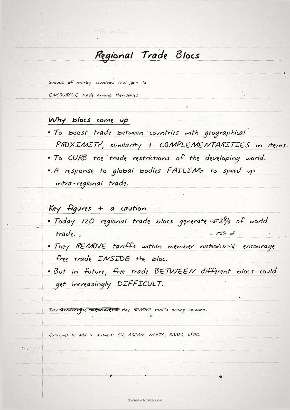
| Multilateral Trade | One country trades with many partners simultaneously; MFN status grants lower tariffs to select partners | Wider market access; higher total trade volume; basis of WTO framework |
Ports: Gateways of International Trade
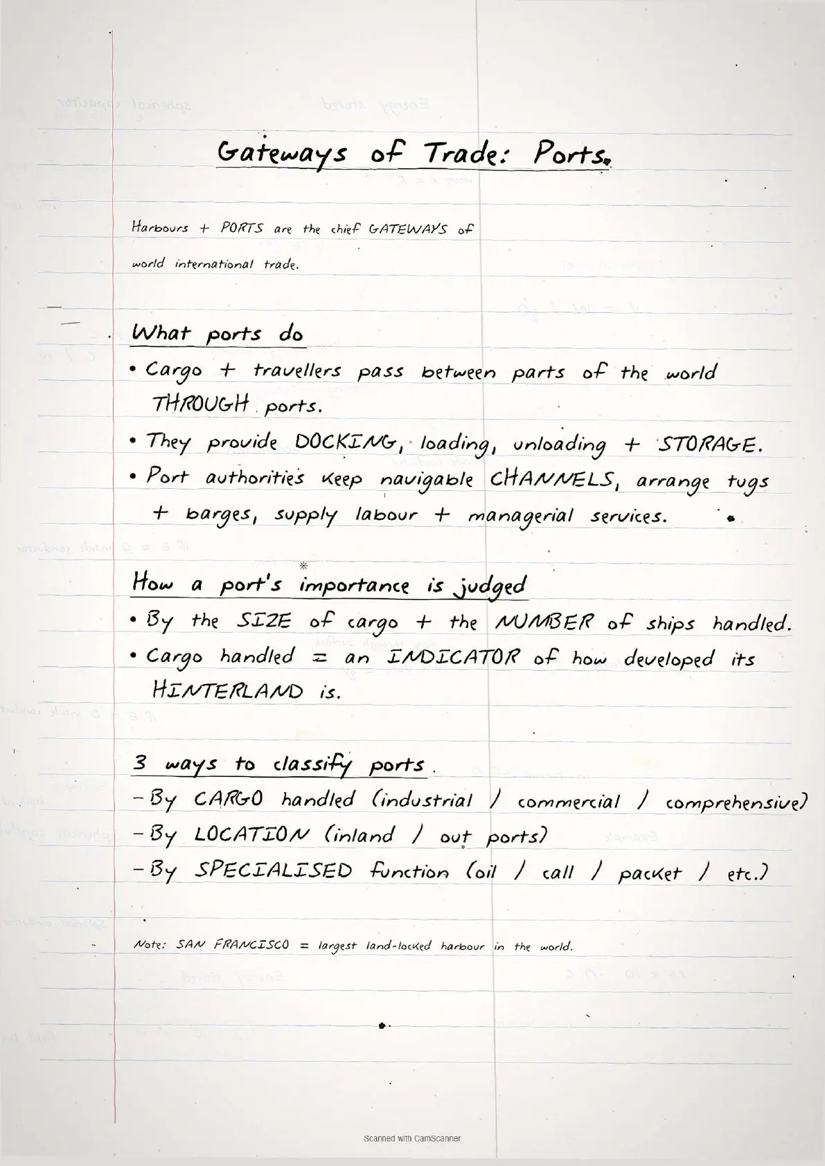
The types of ports class 12 geography section is the most detail-heavy part of Chapter 8. Ports are classified three ways: by cargo, by location, and by specialised function.
Classification by Type of Cargo
| Port Type | What it handles | Example |
|---|---|---|
| Industrial Ports | Bulk cargo: grain, sugar, ore, oil, chemicals | Oil terminals in the Gulf region |
| Commercial Ports | General cargo (packaged products, manufactured goods) + passenger traffic | Major container ports worldwide |
| Comprehensive Ports | Both bulk and general cargo in large volumes; most world-class ports fall here | Rotterdam, Shanghai, Singapore |
Classification by Location
- Inland Ports: Located away from the sea coast; linked to the sea through a river or canal; accessible to flat-bottom ships or barges. Examples: Manchester (linked by canal), Kolkata (on Hoogli river), Memphis (on Mississippi river), Rhine ports like Mannheim and Duisburg.
- Out Ports: Deep water ports built away from the main port to handle ships too large to enter the parent port. Classic example: Athens and Piraeus in Greece.
Classification by Specialised Function
| Port Type | Key feature | Examples |
|---|---|---|
| Oil Ports | Deals in oil processing and shipping (tanker or refinery) | Maracaibo (Venezuela), Abadan (Gulf of Persia) |
| Ports of Call | Originally refuelling/watering stops on main sea routes; later developed as commercial ports | Aden, Honolulu, Singapore |
| Packet Stations (Ferry Ports) | Transport passengers and mail over short water crossings; come in pairs facing each other | Dover (England) and Calais (France) |
| Entrepot Ports | Collection centres for goods from different countries for re-export | Singapore (Asia), Rotterdam (Europe), Copenhagen (Baltic) |
| Naval Ports | Strategic ports serving warships; have repair workshops | Kochi and Karwar (India) |
Common Mistakes to Avoid
The six repeat-offender mistakes CBSE examiners flag each year on international trade class 12 geography questions:
- Mixing up Balance of Trade and Balance of Payments. Balance of Trade records only goods and services. Balance of Payments is broader and includes capital transfers as well. The two are often confused in short-answer questions.
- Saying Dumping is always illegal. The NCERT text defines dumping as selling at different prices for non-cost reasons; it is harmful to domestic producers but the chapter does not call it illegal in all contexts. Overstating this loses marks.
- Confusing Bilateral and Multilateral Trade. Bilateral = two countries, one specific agreement. Multilateral = one country, many partners. Students often reverse these in fill-in-the-blank questions.
- Wrong examples for Entrepot Ports. Many students write Mumbai or Chennai as Entrepot ports, but the NCERT explicitly names Singapore, Rotterdam and Copenhagen. Stick to the textbook examples.
- Forgetting that Packet Stations come in pairs. Dover and Calais is the standard NCERT example. Writing only one of the pair or inventing a non-textbook pair loses the example mark.
- Treating Free Trade as purely beneficial. The NCERT chapter explicitly states that free trade can harm developing countries by creating unfavourable conditions. A one-sided answer on free trade loses 1 to 2 marks in a 5-mark question.
Previous Year Question Trends
The CBSE Class 12 Geography board paper has consistently tested Chapter 8 with 5 to 8 marks over the last five years, split across one theory question and one classification or case-based question.
| Year | Question asked | Marks | Notes page to revise |
|---|---|---|---|
| 2025 | Classify ports on the basis of location with examples + why nations trade (comparative advantage) | 5 + 3 | Page 3 + Page 1 |
| 2024 | Distinguish between favourable and unfavourable balance of trade + define WTO | 3 + 2 | Page 2 |
| 2023 | Types of ports based on specialised function with examples + what is dumping | 5 + 2 | Page 3 + Page 2 |
| 2022 | Explain the basis of international trade with any two factors + bilateral vs multilateral | 5 + 3 | Page 1 + Page 2 |
| 2021 | Why are ports called gateways of international trade + comprehensive ports definition | 3 + 2 | Page 3 |
The ports-classification question appeared in three of the five papers, so revise all three classification systems (by cargo, by location, by function) together, not selectively.
Other Resources for Class 12 Geography Chapter 8 International Trade
Pair these handwritten notes with the matching NCERT Solutions, typed Notes and the official NCERT Book chapter for Class 12 Geography Chapter 8.
| Resource | What it covers | Open |
|---|---|---|
| Handwritten Notes | Topper's handwritten revision pages for last-mile board exam prep. | You are here |
| NCERT Solutions | Step-by-step answers to all exercise questions with Expert's Solution alternatives. | Class 12 Geography Chapter 8 NCERT Solutions |
| Notes | Concept-first typed revision notes with definitions, classifications, trade theory and common mistakes. | Class 12 Geography Chapter 8 Notes |
| NCERT Book PDF | Official NCERT Fundamentals of Human Geography Chapter 8 textbook in PDF form. | Class 12 Geography Chapter 8 NCERT Book PDF |
| Subject Hub | All chapters of Class 12 Geography with every resource in one place. | Class 12 Geography Subject Hub |
All Chapters Handwritten Notes for Class 12 Geography Fundamentals of Human Geography
Related Links: Use the table below to navigate to the handwritten notes for the other chapters of Class 12 Geography Fundamentals of Human Geography. Every chapter ships with the same concept boxes and common-mistake callouts.
| Chapter | Topic | Handwritten Notes link |
|---|---|---|
| Chapter 1 | Human Geography Nature and Scope | Class 12 Geography Chapter 1 Handwritten Notes |
| Chapter 2 | The World Population Distribution Density and Growth | Class 12 Geography Chapter 2 Handwritten Notes |
| Chapter 3 | Human Development | Class 12 Geography Chapter 3 Handwritten Notes |
| Chapter 4 | Primary Activities | Class 12 Geography Chapter 4 Handwritten Notes |
| Chapter 5 | Secondary Activities | Class 12 Geography Chapter 5 Handwritten Notes |
| Chapter 6 | Tertiary and Quaternary Activities | Class 12 Geography Chapter 6 Handwritten Notes |
| Chapter 7 | Transport and Communication | Coming soon |
| Chapter 8 | International Trade | You are here |
International Trade Class 12 Geography Handwritten Notes FAQs
Ques. What are these international trade class 12 geography handwritten notes meant to be used for?
Ans. The international trade class 12 geography handwritten notes are a topper's genuine handwritten revision file: they compress the full NCERT Chapter 8 of Fundamentals of Human Geography into 3 to 4 pages of hand-drawn concept boxes, trade classification tables and common-mistake callouts. Students typically use the file for last-mile revision in the 24 hours before the board paper, paired with the typed Notes PDF for concept building and the NCERT Solutions PDF for full-answer practice.
Ques. What is the basis of international trade according to NCERT Class 12 Geography?
Ans. The NCERT Class 12 Geography textbook lists five bases of international trade: (1) Difference in national resources (geological structure, minerals, climate), (2) Population factors (cultural diversity, population size and standard of living), (3) Stage of economic development (agricultural vs industrialised countries trade differently), (4) Extent of foreign investment (capital from industrial nations develops export industries in developing countries), and (5) Transport (expansion of rail, sea and air transport enabled spatial expansion of trade). The handwritten notes show all five in a single numbered box on Page 1 so students can count them off before writing the board exam answer.
Ques. What is the difference between favourable and unfavourable balance of trade in Class 12 Geography?
Ans. A favourable balance of trade occurs when a country's exports exceed its imports (positive balance), meaning the country earns more foreign exchange than it spends. An unfavourable or negative balance of trade occurs when imports exceed exports, meaning the country spends more buying goods than it earns by selling, which can ultimately exhaust financial reserves. The NCERT textbook notes that a persistent negative balance of payments has serious economic implications for a country. The handwritten notes show this as a weighing scale diagram with exports and imports on opposite sides, making the distinction instantly visual.
Ques. What are the types of ports mentioned in NCERT Class 12 Geography Chapter 8?
Ans. NCERT Class 12 Geography Chapter 8 classifies ports in three ways. By type of cargo: Industrial Ports (bulk cargo like grain and oil), Commercial Ports (general cargo and passengers), and Comprehensive Ports (both bulk and general cargo; most world-class ports fall here). By location: Inland Ports (linked to sea via river or canal, like Kolkata on the Hoogli or Manchester via canal) and Out Ports (deep water ports handling large ships that cannot reach the main port, like Piraeus for Athens). By specialised function: Oil Ports, Ports of Call, Packet Stations (ferry ports), Entrepot Ports (re-export hubs like Singapore, Rotterdam, Copenhagen), and Naval Ports (strategic ports like Kochi and Karwar in India).
Ques. What is dumping in international trade according to NCERT Class 12?
Ans. According to NCERT Class 12 Geography, dumping is the practice of selling a commodity in two countries at a price that differs for reasons not related to production costs. A country or company sells goods in a foreign market at a price lower than in the domestic market, which can harm domestic producers in the importing country. The NCERT chapter warns that countries must be cautious about dumped goods because along with free trade, cheaper dumped goods can harm domestic industries. The handwritten notes put a one-line definition in a red-bordered box on Page 2 so students cannot miss it during the final revision pass.
Ques. What is the role of WTO in international trade as per NCERT Class 12?
Ans. The WTO (World Trade Organisation) replaced the earlier GATT (General Agreement on Tariffs and Trade) and helps reduce tariffs among member nations, promotes rules-based international trade, and provides a platform for settling trade disputes. During the post-World War II period, GATT helped in reducing tariff barriers. The WTO continues this role while also addressing issues like intellectual property, services trade and agriculture. The NCERT textbook notes that while free trade and the WTO promote open markets, developing countries need to ensure the playing field is fair and domestic producers are protected from harmful dumping.
Ques. What is an entrepot port and which are the key examples from NCERT?
Ans. An entrepot port is a collection centre where goods are brought from different countries for re-export to other destinations. Rather than being the final consumer of the goods, the entrepot country acts as a trading hub. The NCERT Class 12 Geography textbook gives three key examples students must memorise: Singapore as the entrepot for Asia, Rotterdam as the entrepot for Europe, and Copenhagen as the entrepot for the Baltic region. Students who write Mumbai or Chennai as entrepot ports in the board exam lose the example mark, because these are not the NCERT-specified examples for this term.
Ques. What are the concerns related to international trade mentioned in NCERT Class 12?
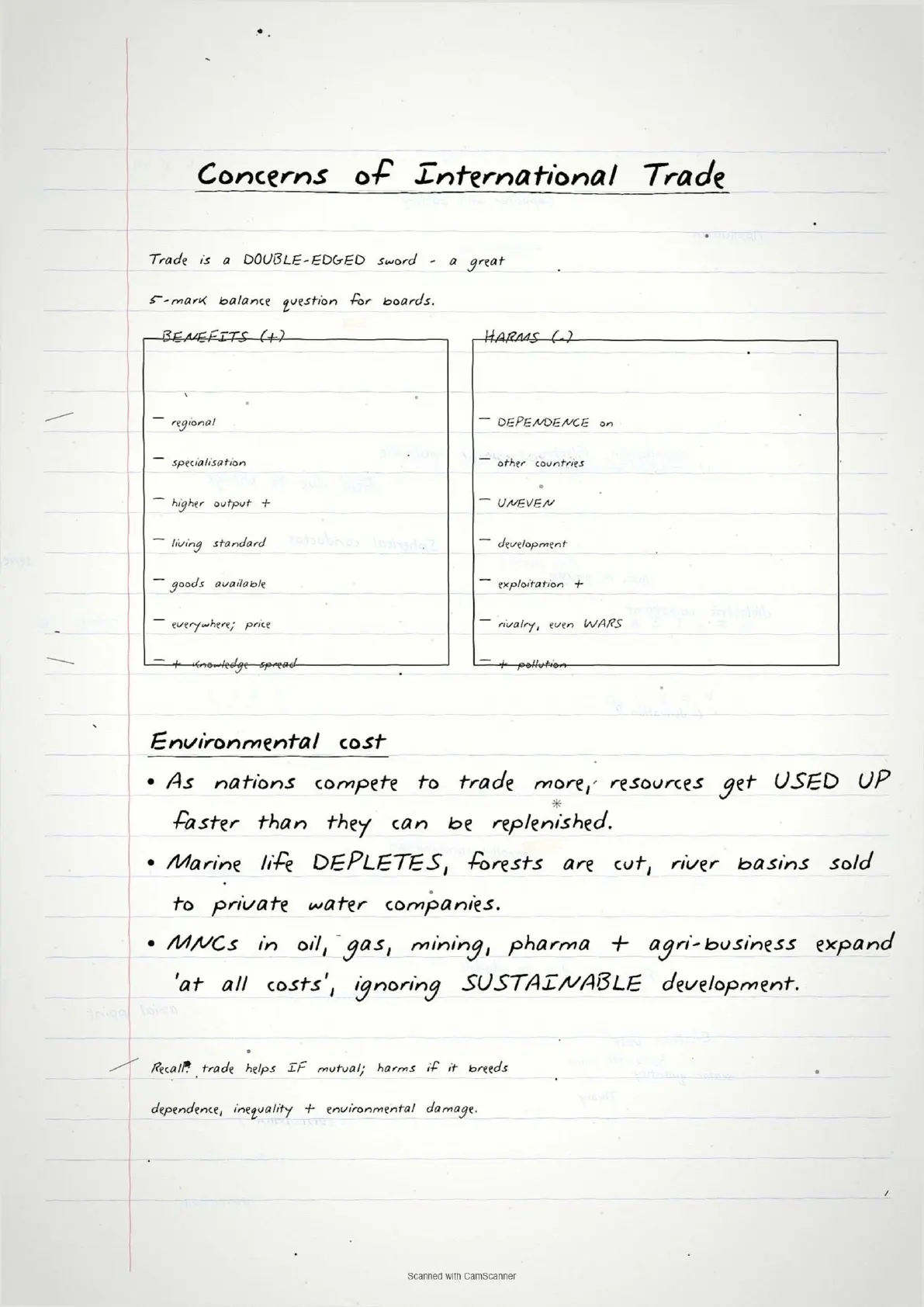
Ans. The NCERT Class 12 Geography textbook lists both benefits and concerns of international trade. Benefits include regional specialisation, higher production, better standard of living, worldwide availability of goods, equalisation of prices and wages, and diffusion of knowledge and culture. Concerns include dependence on other countries, uneven development, exploitation, commercial rivalry leading to wars, environmental damage (forests cut, rivers privatised, marine life depleting), and multinational corporations expanding without following sustainable development norms. The chapter explicitly states that global trade affects the environment and health of people worldwide, and that profit-only motives without environmental consideration lead to serious future implications.
Ques. How is bilateral trade different from multilateral trade in Class 12 Geography?
Ans. Bilateral trade is conducted between exactly two countries that enter a specific agreement to exchange defined commodities with each other. For example, Country A agrees to trade a specific raw material with Country B in exchange for a specific manufactured product. Multilateral trade is conducted by one country with many trading partners simultaneously. A country engaged in multilateral trade may also grant "Most Favoured Nation" (MFN) status to select partners, which means those partners receive lower tariff rates than others. The WTO framework is built around multilateral trade principles, with nearly all member nations trading with each other under common rules.
Ques. Are these international trade handwritten notes enough for the CBSE Class 12 Geography board exam?
Ans. The handwritten notes are sufficient for the concept-recall and classification components of the chapter, covering the 5 to 8 marks that Chapter 8 typically contributes to the Class 12 Geography board paper. The file covers the basis of trade (5 factors), balance of trade, types of trade, all port classifications with NCERT examples, free trade concerns and WTO. Students aiming for 90-plus should pair the handwritten file with the matching NCERT Solutions PDF (exercise questions with step-by-step answers) and at least one map-based practice set, since CBSE Geography papers often include map marking for ports or trade routes.
Ques. What is the history of international trade summarised in NCERT Class 12 Chapter 8?
Ans. The NCERT Class 12 Geography chapter traces trade history from the primitive barter system (direct goods exchange, still practised at the Jon Beel Mela in Assam) through the introduction of money (salt, copper, gold as early currencies), the Silk Route (Rome to China, 6,000 km, carrying silk, wool and spices), European colonial trade (12th to 13th century ocean-going ships), slave trade (Portuguese, Dutch, British capturing African natives for plantation labour, abolished by 1808), the Industrial Revolution (raw materials flowing to factories, manufactured goods flowing back), World War disruptions (tariffs and restrictions), and finally the post-war WTO era (reduction of tariffs, open multilateral trade). The handwritten notes show this as a timeline on Page 1.



Comments