




These Class 12 Geography Chapter 6 Planning and Sustainable Development in Indian Context notes cover every NCERT definition, the target area planning programmes, the Bharmaur and Indira Gandhi Canal case studies and the Brundtland definition, aligned to the 2026-27 syllabus. Built for night-before revision.
- Concept-first revision: sectoral vs regional planning and the target area approach (HADP, DPAP, ITDP).
- Both case studies: Bharmaur tribal region and the Indira Gandhi Canal command area, with their benefits, ecological impacts and measures.
- Cross-links to the matching NCERT Solutions, Handwritten Notes and NCERT Book PDF.
These notes are written by Collegedunia geography experts, mapped to the 2026-27 NCERT India: People and Economy textbook and the last five years of CBSE, CUET and UPSC trends.
Student Feedback
71% of students found the two case studies (Bharmaur and Indira Gandhi Canal) the most confusing to revise, and 3 out of 4 rated the Brundtland definition and sustainable development measures as best revised from a printed sheet.
Source: 2026-27 Class 12 Geography student poll, 9,240 students across 15 states.
Quick Concept Recap: Planning and Sustainable Development at a Glance
Chapter 6 explains how India uses planning to reduce regional imbalances and achieve sustainable growth. Two big ideas run through it: target area planning (special attention to backward regions) and sustainable development (meeting today's needs without harming future generations).
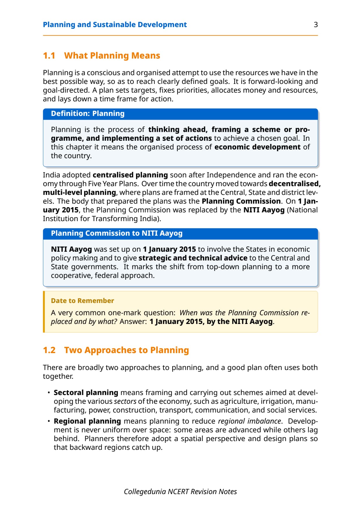
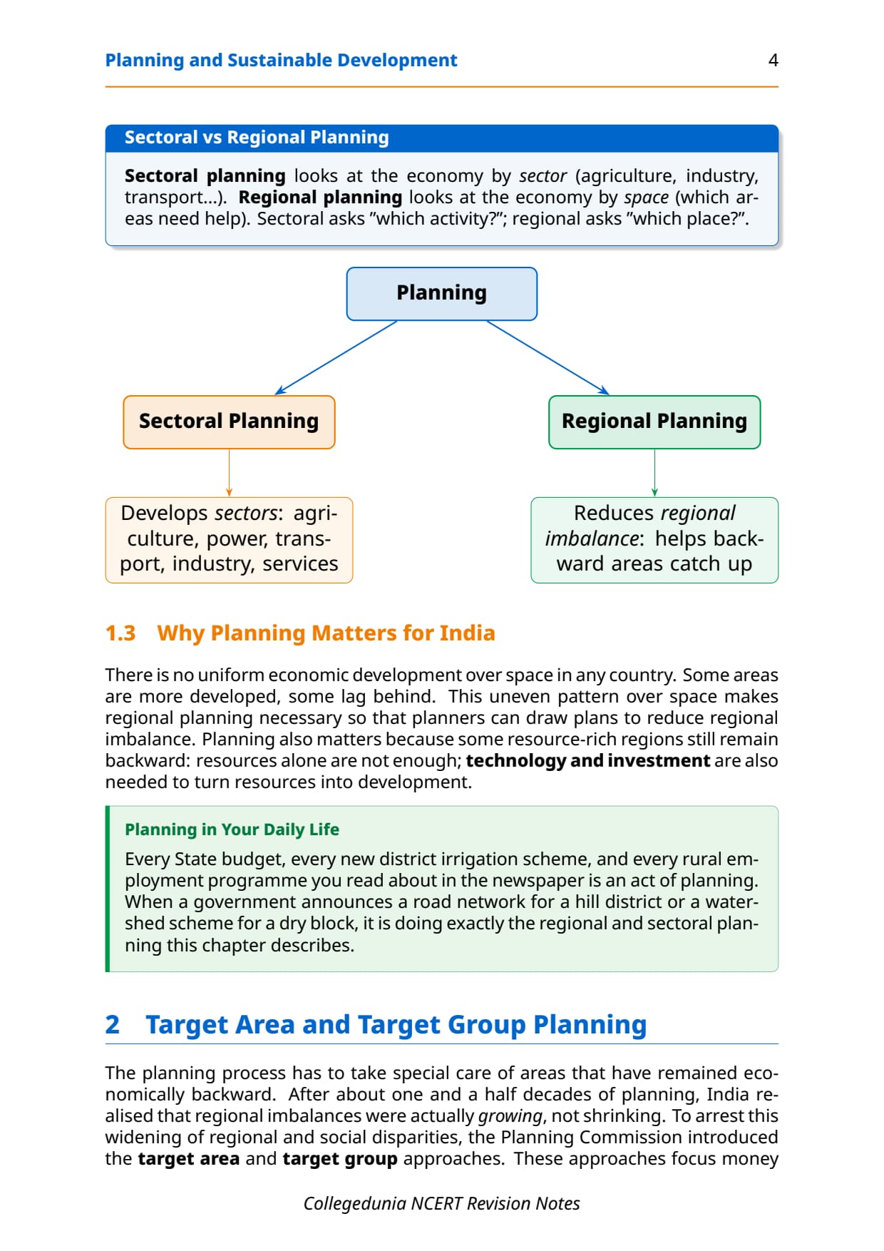
- Two types of planning: sectoral (developing sectors like agriculture and transport) and regional (reducing gaps between developed and backward areas).
- Target area approach: HADP, DPAP and ITDP are the three major programmes CBSE asks about most.
- Two case studies: Bharmaur (ITDP in Himachal Pradesh) and the Indira Gandhi Canal command area (Thar Desert, Rajasthan).
- NITI Aayog replaced the Planning Commission on 1 January 2015 and involves states in policy-making.
Read these notes first, then use the matching NCERT Solutions for Chapter 6 for drill.
Source: HUMAN-AT-EASE on YouTube
Key Definitions for Planning and Sustainable Development Class 12
Most theory questions start with a definition, in the one-line form CBSE markers expect.
| Term | One-line definition | NCERT section pointer |
|---|---|---|
| Planning | The process of thinking, formulating a scheme or programme, and implementing a set of actions to achieve a specific development goal; differs from traditional hit-and-miss methods. | Chapter 6 intro |
| Sectoral Planning | Formulation and implementation of schemes aimed at developing various sectors of the economy such as agriculture, irrigation, manufacturing, power, transport and social infrastructure. | Chapter 6 intro |
| Regional Planning | Planning with a spatial perspective that aims to reduce regional imbalances in development across different parts of a country. | Chapter 6 intro |
| Target Area Planning | An approach that directs development programmes towards specific backward areas or groups to correct regional and social disparities; introduced by the Planning Commission of India. | Target Area Planning section |
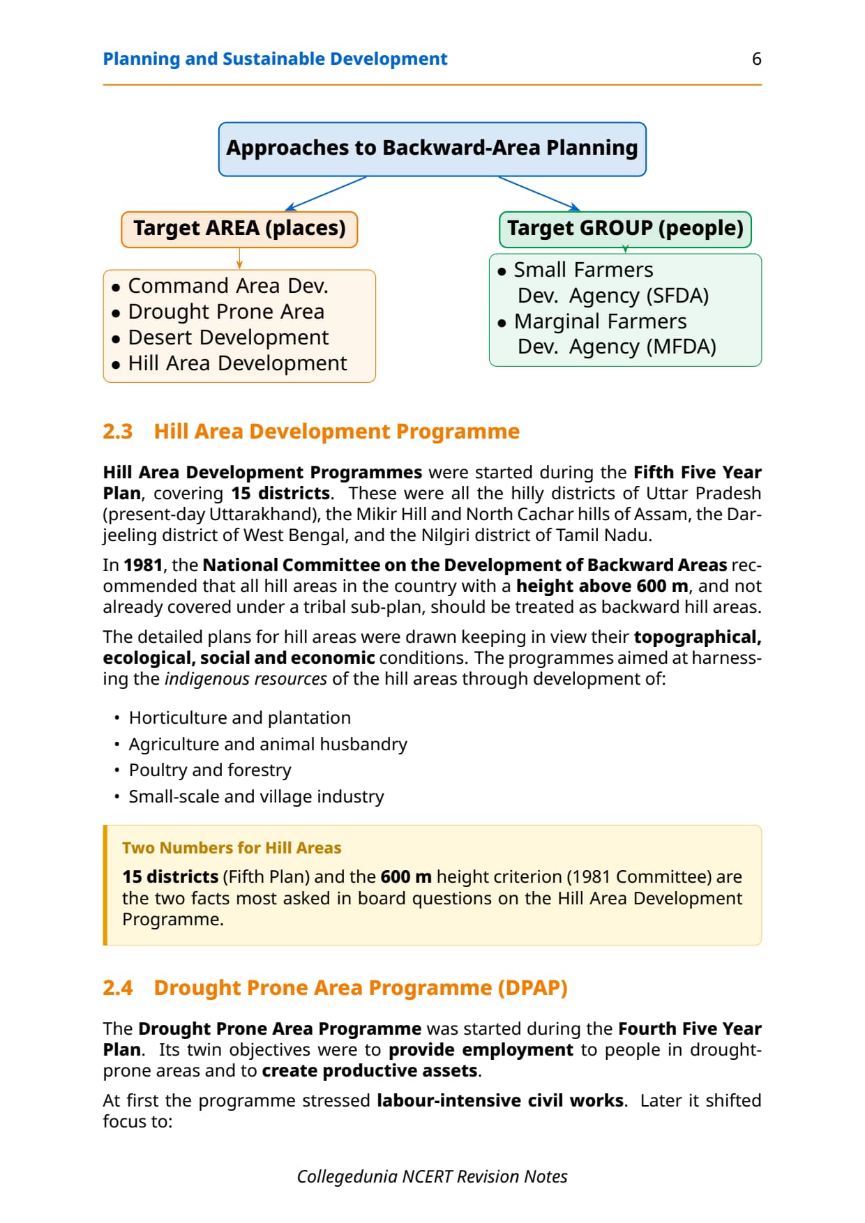
| Hill Area Development Programme (HADP) | A programme initiated in the Fifth Five Year Plan covering hilly districts of states like Uttar Pradesh, Assam, West Bengal and Tamil Nadu, focused on horticulture, forestry and small-scale industry. | Hill Area section |
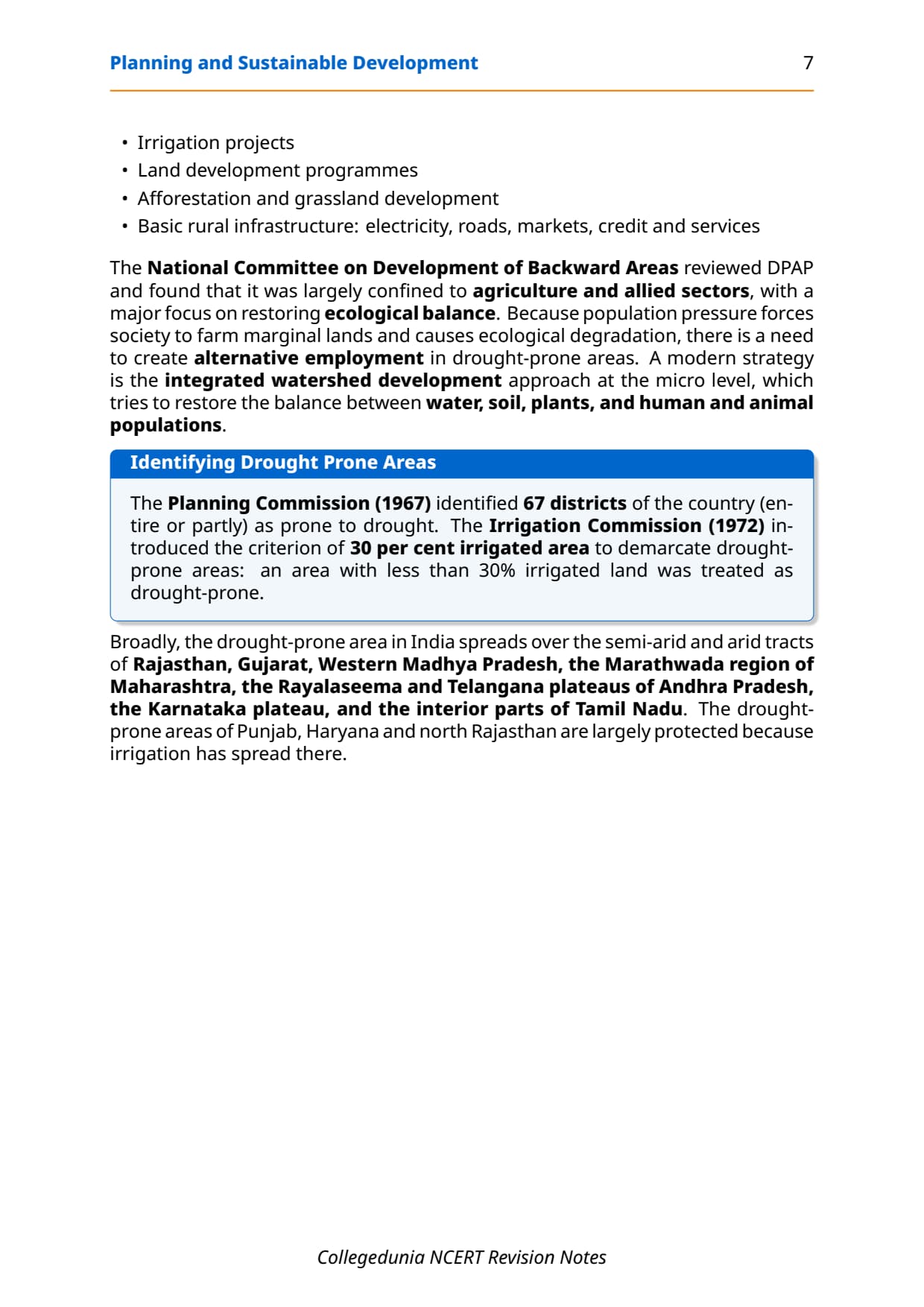
| Drought Prone Area Programme (DPAP) | A programme started in the Fourth Five Year Plan to provide employment and create productive assets in drought-prone areas through land development, afforestation and watershed management. | Drought Prone section |
| Integrated Tribal Development Project (ITDP) | A development plan designed to improve the quality of life of tribal communities and narrow the gap between tribal and non-tribal areas; Bharmaur in Himachal Pradesh is the key NCERT example. | Bharmaur case study |
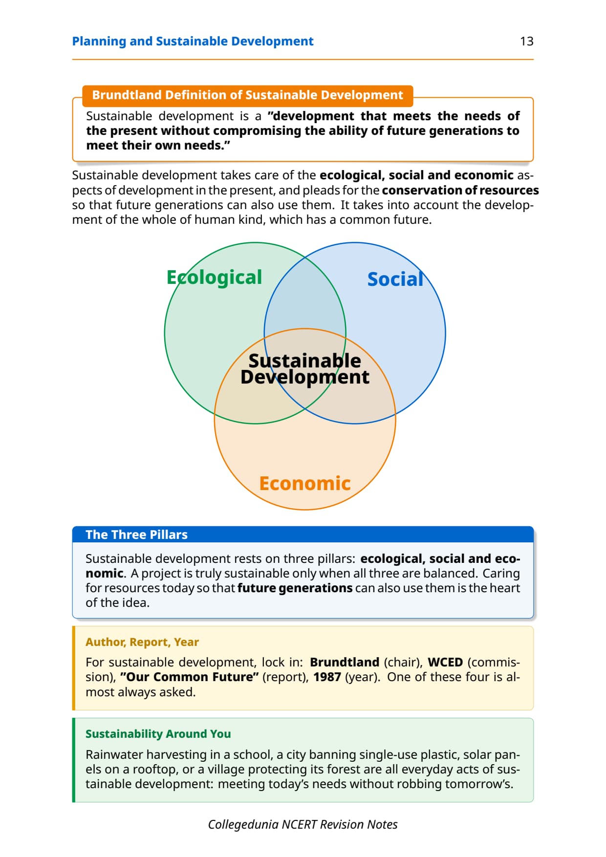
| Sustainable Development | "Development that meets the needs of the present without compromising the ability of future generations to meet their own needs." (Brundtland Report, 1987). | Sustainable Development section |
| WCED (World Commission on Environment and Development) | A United Nations body headed by Gro Harlem Brundtland that published the report 'Our Common Future' (1987), which introduced the globally accepted definition of sustainable development. | Sustainable Development section |
| Transhumance | A form of pastoral nomadism in which herders move their livestock seasonally between highland pastures in summer and lowland areas in winter; practised by the Gaddis of Bharmaur. | Bharmaur case study |
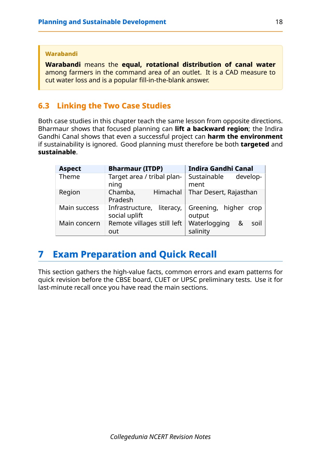
| Warabandi System | A system of equal distribution of canal water in the command area of an outlet, ensuring each land holding gets a fair share of irrigation water. | Indira Gandhi Canal section |
| NITI Aayog | The policy think-tank that replaced the Planning Commission on 1 January 2015, with the objective of involving states in economic policy-making and providing strategic advice to governments. | Chapter 6 intro box |
These definitions cover most one-mark and 3-mark theory questions. Write them out once before moving to the programmes below.
Target Area Planning: HADP, DPAP and ITDP Programmes
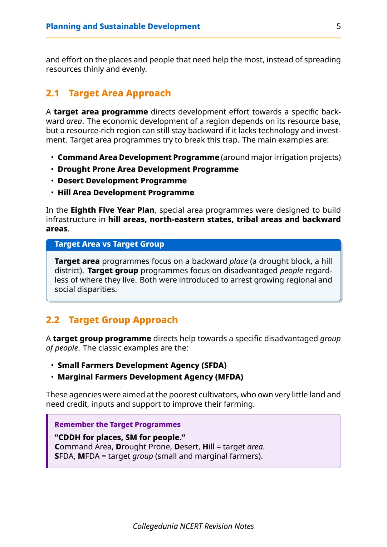
The Planning Commission introduced target area and target group approaches after disparities kept widening despite planning. Three programmes come up in nearly every CBSE exam, compared in the table below.
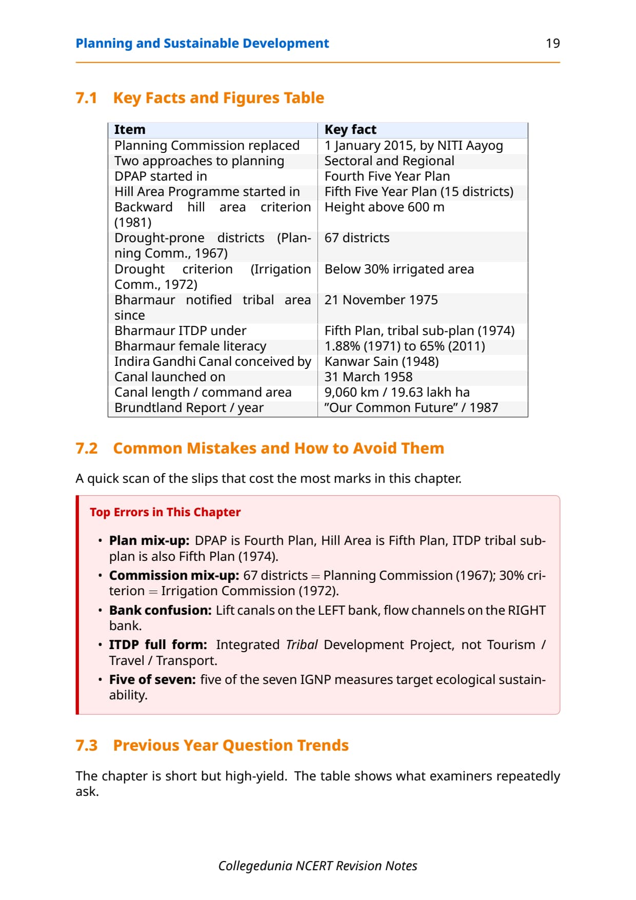
HADP (Fifth Plan) targets hill areas above 600 m through horticulture, forestry and small industry. DPAP (Fourth Plan) creates employment and productive assets in semi-arid tracts via micro-level watershed development. ITDP came under the 1974 tribal sub-plan; Bharmaur was one of five ITDPs in Himachal Pradesh, for the Gaddi tribe. Target group schemes like SFDA and MFDA support small and marginal farmers.
| Programme | Started in | Target area | Key focus |
|---|---|---|---|
| HADP | Fifth Five Year Plan | Hill areas above 600 m (Uttarakhand, Assam, West Bengal, Tamil Nadu) | Horticulture, forestry, animal husbandry, small industry |
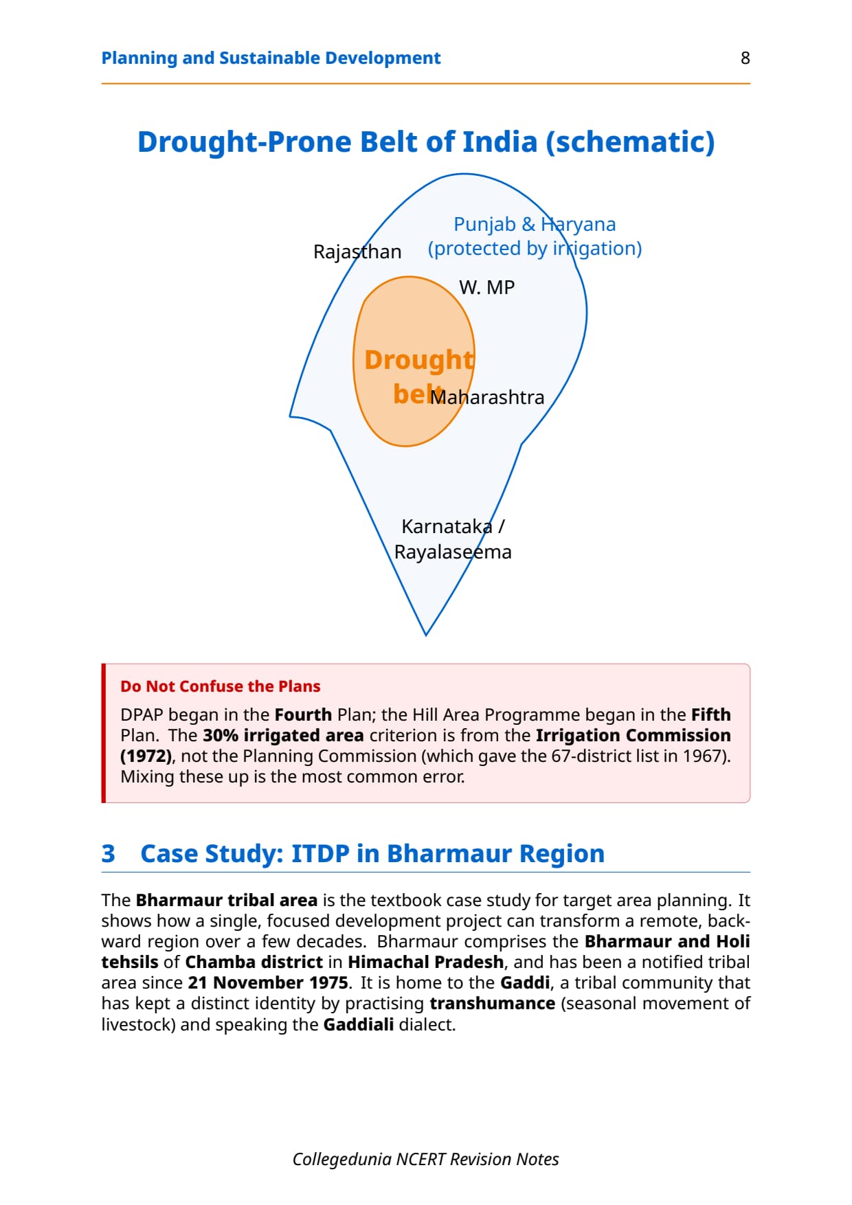
| DPAP | Fourth Five Year Plan | Semi-arid and arid tracts of Rajasthan, Gujarat, Maharashtra, AP, Karnataka, Tamil Nadu | Employment, irrigation, afforestation, watershed development |
| ITDP | Fifth Five Year Plan (1974) | Notified tribal areas; Bharmaur (Chamba, Himachal Pradesh) is NCERT case | Infrastructure, transport, social services, agriculture |
Case Study: Integrated Tribal Development Project in Bharmaur Region
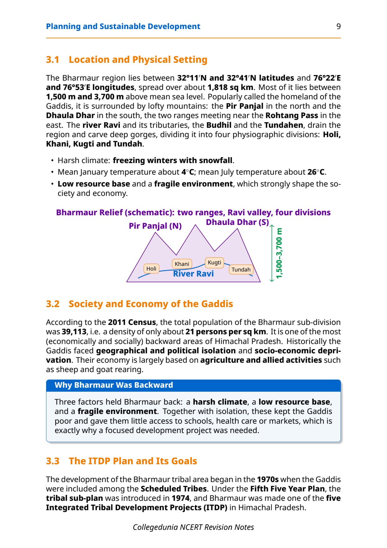
Bharmaur is a tribal sub-division of Chamba district, Himachal Pradesh, notified as a tribal area on 21 November 1975. It is the homeland of the Gaddi community, who practise transhumance and speak Gaddiali. The 2011 Census recorded 39,113 people, and it was one of the state's most backward areas, its economy based on agriculture and sheep and goat rearing. Isolation, harsh climate and a low resource base kept it marginalised.
What the ITDP delivered
The tribal sub-plan built transport, communication, agricultural support and social services, with its biggest gains in infrastructure and social indicators.
- Infrastructure: schools, healthcare, potable water, roads and electricity, mostly along the Ravi in Holi and Khani; Tundah and Kugti stay under-served.
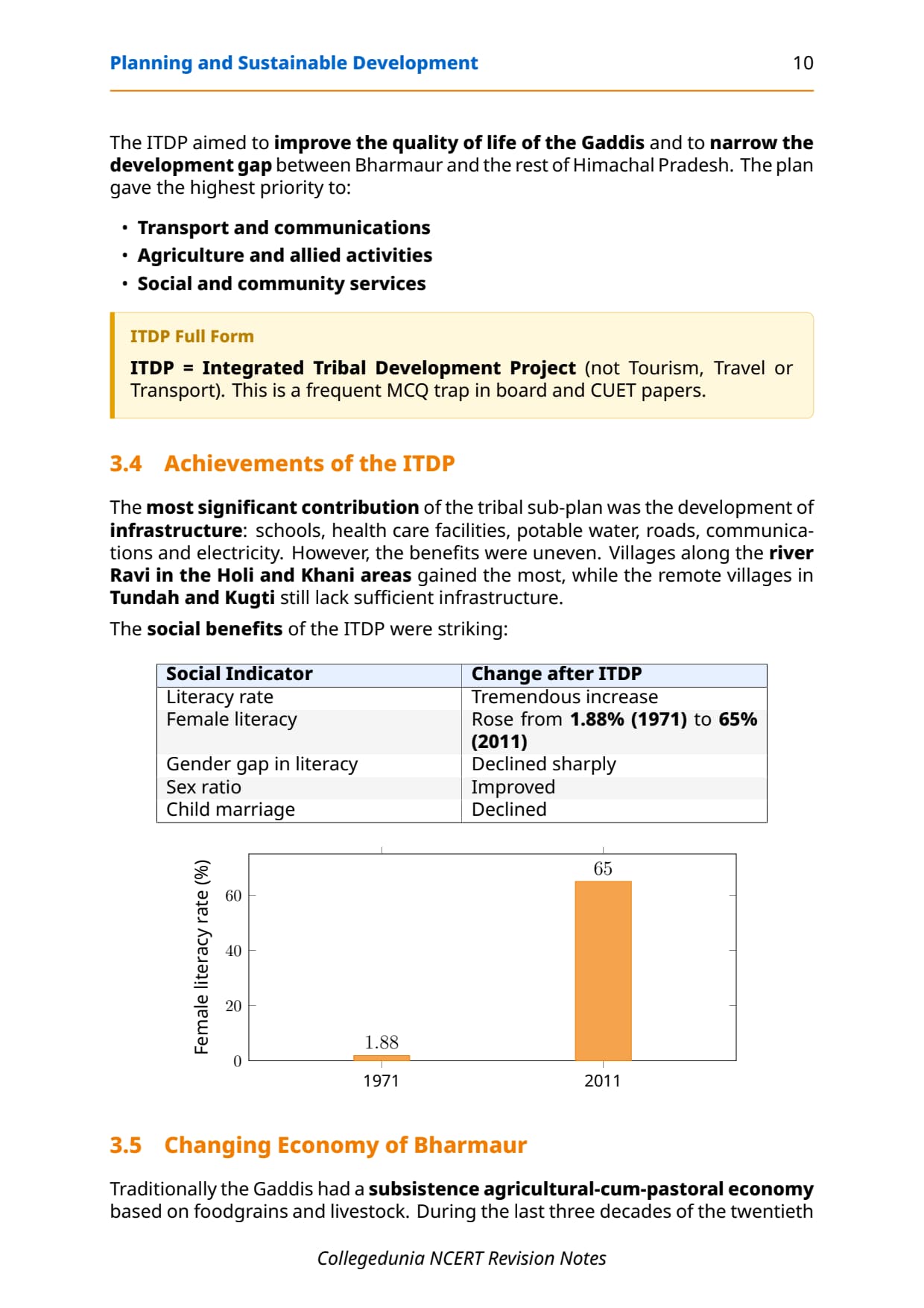
- Female literacy: rose from 1.88 per cent (1971) to 65 per cent (2011), one of the sharpest jumps under any tribal sub-plan.
- Social change: sex ratio improved, child marriage declined, and a shift to pulses and cash crops cut dependence on livestock. Only about one-tenth of households still practise transhumance.
Memory hook for Bharmaur: 1975 (notified tribal area), 39,113 (2011 population), 1.88 per cent to 65 per cent (female literacy, 1971 to 2011). CBSE asks these figures in 1-mark and 3-mark answers.
Sustainable Development: Concept, Evolution and Brundtland Definition
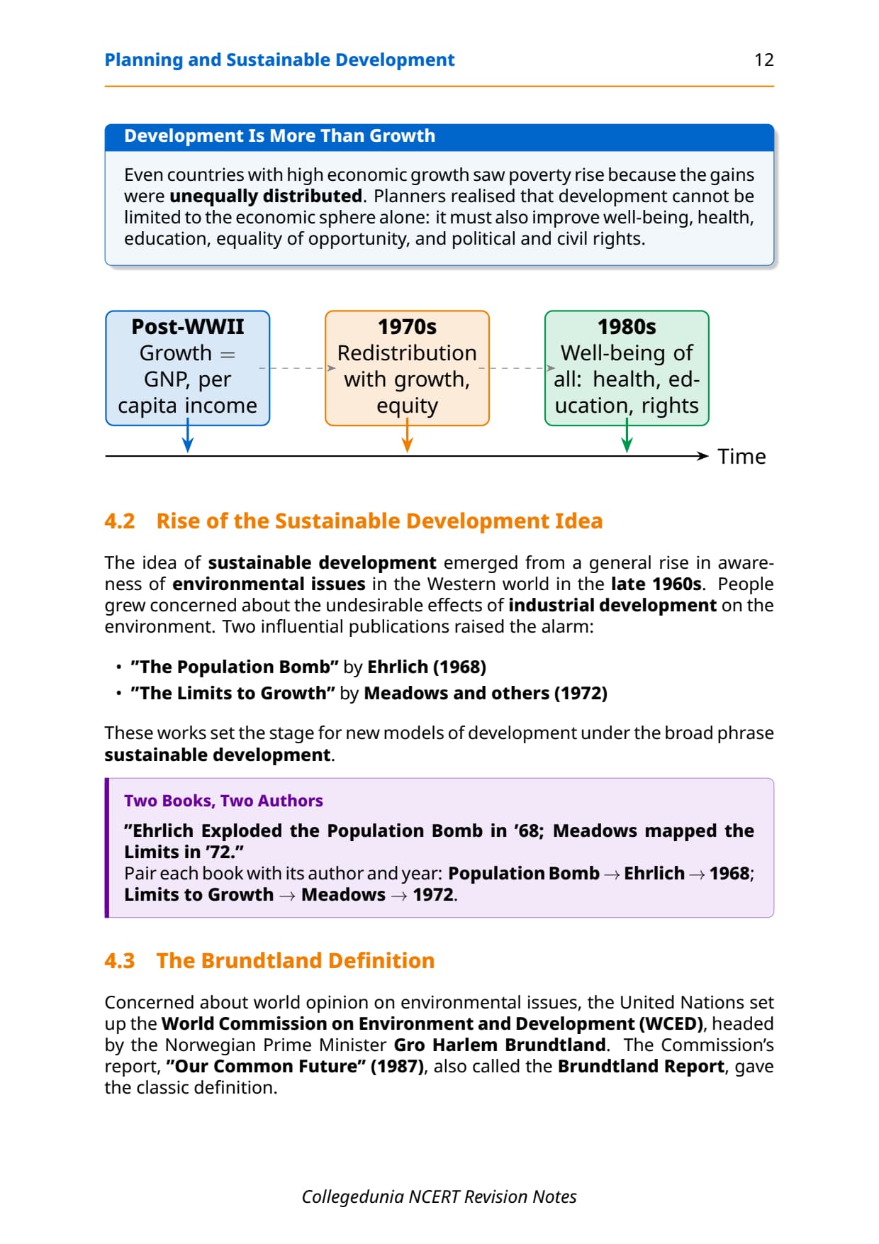
Development once meant only economic growth (GNP, per capita income), but high-growth 1970s economies still saw rising poverty, so the idea widened to include equity, well-being, health, education and rights. Books like 'The Population Bomb' (1968) and 'The Limits to Growth' (1972) warned that the earth's resources could not sustain endless growth, so the UN set up the WCED.
The Brundtland Report and its definition
The WCED, headed by Gro Harlem Brundtland, published 'Our Common Future' in 1987. It defined sustainable development as "development that meets the needs of the present without compromising the ability of future generations to meet their own needs." It rests on three pillars:
- Ecological: conserving biodiversity, using resources within regeneration limits and cutting pollution.
- Social: fair access to resources and opportunities, especially for tribal groups and small farmers.
- Economic: diversifying the base so communities do not depend on a single sector.
Case Study: Indira Gandhi Canal Command Area
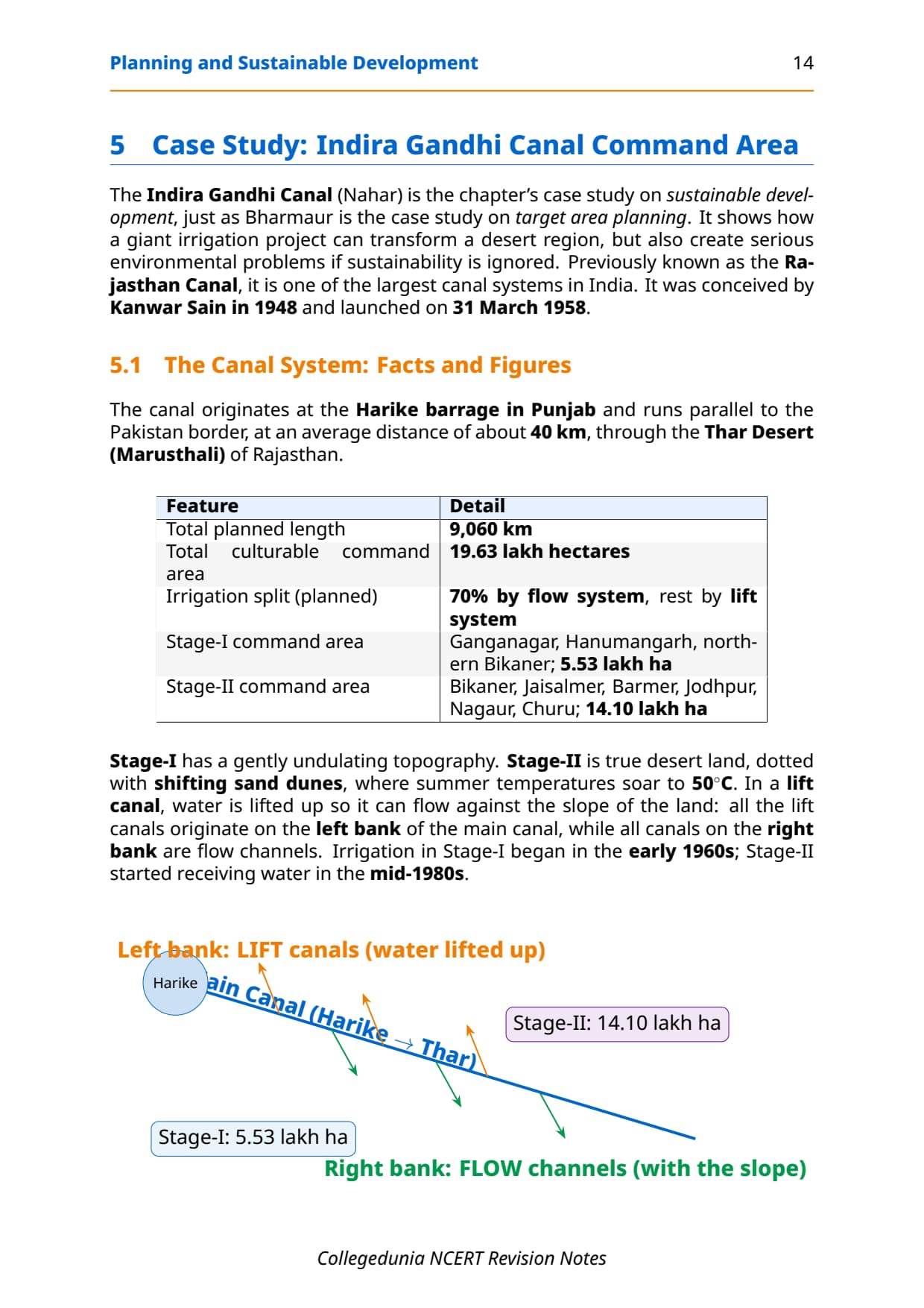
Indira Gandhi Canal (earlier Rajasthan Canal) is one of India's largest canal systems, conceptualised by Kanwar Sain in 1948 and launched on 31 March 1958. It originates at Harike barrage in Punjab and runs roughly parallel to the Pakistan border (about 40 km away) through the Thar Desert of Rajasthan. Total planned length is 9,060 km, serving a culturable command area of 19.63 lakh hectares.
Two stages of the command area
- Stage-I: Ganganagar, Hanumangarh and northern Bikaner; 5.53 lakh hectares; gently undulating; irrigation from early 1960s.
- Stage-II: Bikaner, Jaisalmer, Barmer, Jodhpur, Nagaur and Churu; 14.10 lakh hectares; shifting dunes, summers up to 50 degrees C; irrigation from mid-1980s.
Positive impacts of canal irrigation
Canal water turned desert into cultivable land. Key positive changes:
- Higher soil moisture enabled year-round cropping instead of rain-fed farming.
- Cultivated area and cropping intensity rose sharply.
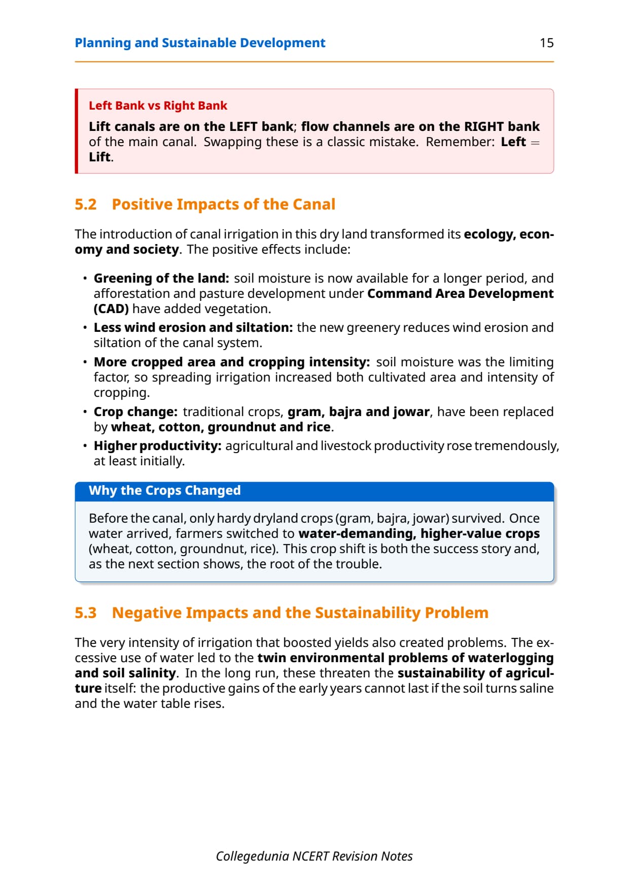
- Traditional crops (gram, bajra, jowar) gave way to higher-value wheat, cotton, groundnut and rice.
- Afforestation and pasture development under the CAD scheme greened the landscape and cut wind erosion and canal siltation.
- Agricultural and livestock productivity rose in the early decades.
Negative impacts and ecological problems
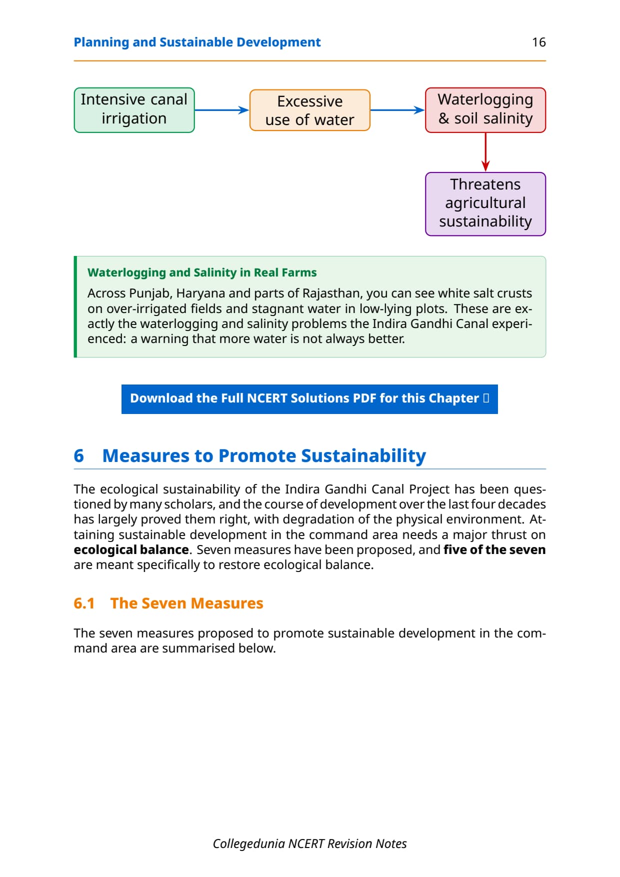
Intensive irrigation created two major problems:
- Waterlogging: seepage raised the water table, making soil anaerobic and unsuitable for most crops.
- Soil salinity: as waterlogged soils dried, salts crystallised on the surface, making land unproductive.
These twin problems undermine long-run sustainability and show why development without ecological planning creates its own problems.
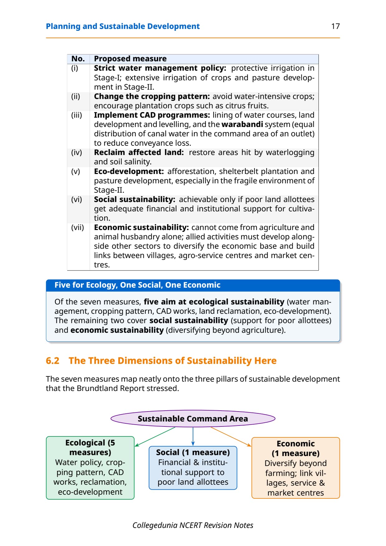
Seven measures for sustainable development in the command area
| # | Measure | Sustainability pillar addressed |
|---|---|---|
| 1 | Strict implementation of water management policy (protective irrigation in Stage-I; extensive irrigation and pasture development in Stage-II). | Ecological |
| 2 | Avoid water-intensive crops; encourage plantation crops like citrus fruits instead. | Ecological |
| 3 | Effective implementation of CAD programmes: lining of water courses, land levelling and warabandi (equal water distribution) to reduce conveyance loss. | Ecological |
| 4 | Reclaim areas already affected by waterlogging and soil salinity. | Ecological |
| 5 | Eco-development through afforestation, shelterbelt plantation and pasture development, especially in the fragile Stage-II environment. | Ecological |
| 6 | Provide adequate financial and institutional support for land allottees with poor economic backgrounds so they can actually cultivate their holdings. | Social |
| 7 | Diversify the economic base beyond agriculture and animal husbandry; link basic villages with agro-service centres and market centres to build functional economic networks. | Economic |
Tip: CBSE asks students to "suggest measures" for the canal area almost every alternate year. This seven-point list covers both the 4-mark and 6-mark versions. Five of the seven are ecological, which shows where the emphasis lies.
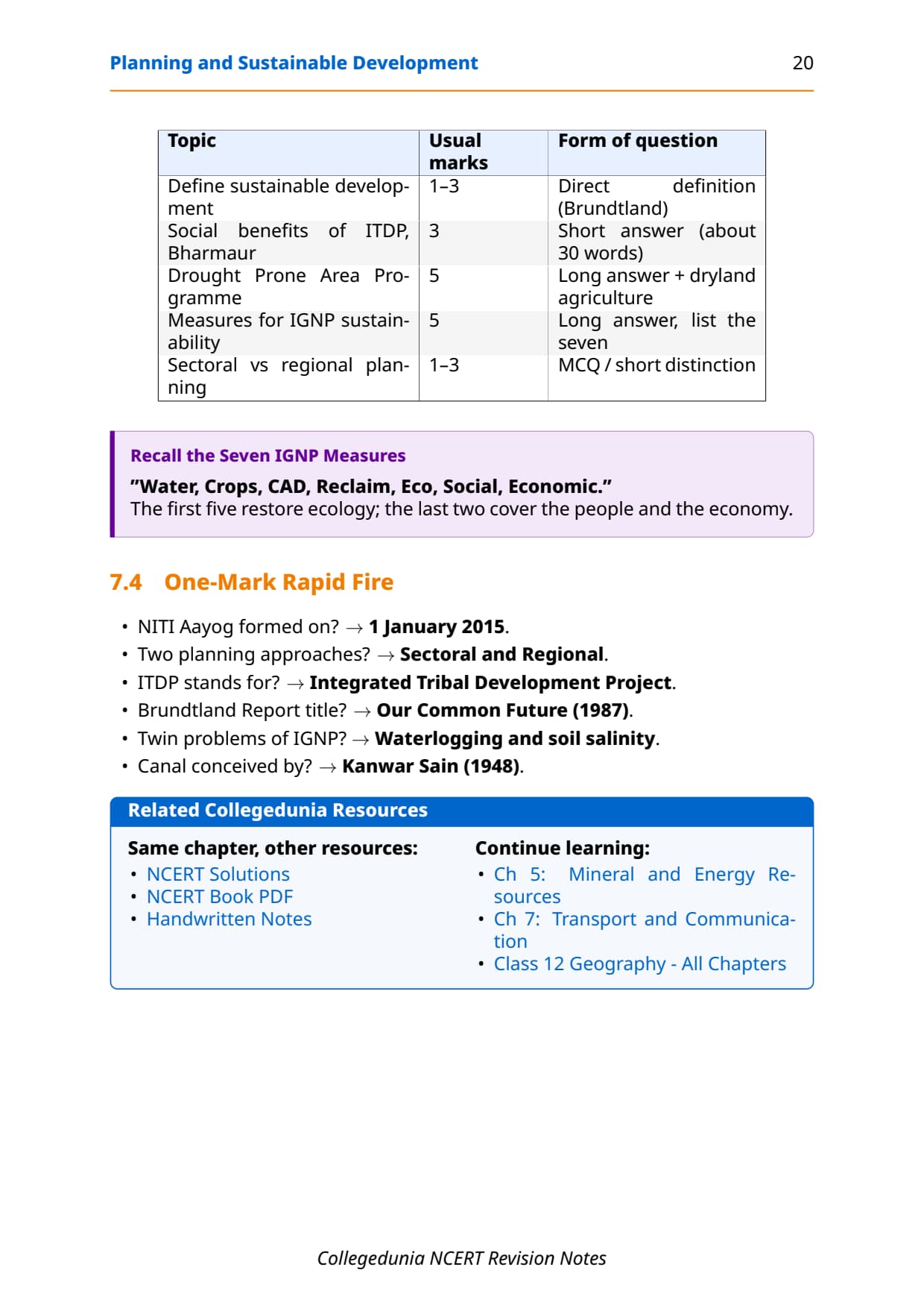
Previous Year Question Trends from Chapter 6
Important questions follow a consistent pattern. The table maps what CBSE has asked over the last five years.
| Year | Question type asked | Marks | Notes section to revise |
|---|---|---|---|
| 2025 | Define sustainable development + social benefits of ITDP in Bharmaur region | 3 + 3 | Brundtland Definition + Bharmaur case study |
| 2024 | Positive impacts of Indira Gandhi Canal command area irrigation + correct ITDP full form (MCQ) | 4 + 1 | Indira Gandhi Canal section + Key Definitions |
| 2023 | Measures for sustainable development in IGC command area (150 words) | 6 | Seven measures table |
| 2022 | Drought Prone Area Programme: objectives and strategies + regional planning definition | 4 + 2 | DPAP section + Key Definitions |
| 2021 | Hill Area Development Programme + concept of target area planning | 3 + 3 | HADP section + Target Area Planning section |
The chapter carries an effective 8 to 10 marks per year across theory and case-study answers.
Other Resources for Class 12 Geography Chapter 6 Planning and Sustainable Development
Pair these notes with the matching resources below.
| Resource | What it covers | Open |
|---|---|---|
| Notes | Concept-first revision notes covering planning types, target area programmes, two case studies and sustainable development framework. | You are here |
| NCERT Solutions | Step-by-step answers to all exercise questions with worked case-study answers for Bharmaur and Indira Gandhi Canal. | Class 12 Geography Chapter 6 NCERT Solutions |
| Handwritten Notes | A topper's genuine handwritten revision pages for last-minute board exam practice. | Class 12 Geography Chapter 6 Handwritten Notes |
| NCERT Book PDF | Official NCERT India: People and Economy Chapter 6 textbook in PDF form. | Class 12 Geography Chapter 6 NCERT Book PDF |
| Subject Hub | All chapters of Class 12 Geography with every resource in one place. | Class 12 Geography Subject Hub |
All Chapters Notes for Class 12 Geography (India: People and Economy)
Related Links: Notes for the other Class 12 Geography (India: People and Economy) chapters.
| Chapter | Topic | Notes link |
|---|---|---|
| Chapter 1 | Population: Distribution, Density, Growth and Composition | Class 12 Geography Population Notes |
| Chapter 2 | Human Settlements | Class 12 Geography Human Settlements Notes |
| Chapter 3 | Land Resources and Agriculture | Class 12 Geography Land Resources Notes |
| Chapter 4 | Water Resources | Class 12 Geography Water Resources Notes |
| Chapter 5 | Mineral and Energy Resources | Coming soon |
| Chapter 6 | Planning and Sustainable Development in Indian Context | You are here |
| Chapter 7 | Transport and Communication | Coming soon |
| Chapter 8 | International Trade | Coming soon |
| Chapter 9 | Geographical Perspective on Selected Issues and Problems | Coming soon |
NCERT Notes Class 12 Geography Chapter 6 Planning and Sustainable Development FAQs
Ques. What is planning and sustainable development class 12 about?
Ans. The planning and sustainable development class 12 chapter explains how India uses planned programmes to reduce regional imbalances (target area planning) and why economic growth must not destroy the resource base future generations will need (sustainable development). The chapter has two major case studies: the Bharmaur tribal region in Himachal Pradesh (ITDP) and the Indira Gandhi Canal command area in Rajasthan. These notes compress both case studies, all key definitions and the Brundtland definition into a single revision file.
Ques. What is the Brundtland definition of sustainable development for Class 12?
Ans. The Brundtland definition of sustainable development is: "development that meets the needs of the present without compromising the ability of future generations to meet their own needs." This definition was given in the WCED report 'Our Common Future' (1987), headed by Norwegian Prime Minister Gro Harlem Brundtland. CBSE asks for this exact definition in 2-mark and 3-mark questions almost every year, so students should memorise it word-for-word from this notes file.
Ques. What does ITDP stand for in Class 12 Geography?
Ans. ITDP stands for Integrated Tribal Development Project. The NCERT Class 12 Geography chapter uses Bharmaur in Chamba district of Himachal Pradesh as the key example of an ITDP. This is also a direct MCQ in the NCERT exercise: students must not confuse ITDP with Integrated Tourism Development Programme or Integrated Transport Development Programme, which are common wrong answers in the multiple-choice question. The Key Definitions table in these notes flags this trap explicitly.
Ques. What are the social benefits of ITDP in Bharmaur tribal region?
Ans. The social benefits of ITDP in Bharmaur include a dramatic rise in female literacy from 1.88 per cent in 1971 to 65 per cent in 2011, improvement in sex ratio, a significant decline in child marriage and a reduction in gender inequality in literacy levels. Infrastructure development (schools, healthcare facilities, potable water and roads) also improved quality of life across the region, though remote villages in Tundah and Kugti still lack adequate services. These benefits are the standard 30-word answer CBSE expects for the Bharmaur social benefits question.
Ques. What are the positive and negative impacts of Indira Gandhi Canal on the command area?
Ans. Positive impacts include increased soil moisture, expansion of cultivated area, replacement of low-value crops (gram, bajra) with high-value crops (wheat, cotton, groundnut, rice), greening of the landscape through afforestation under CAD, and reduction in wind erosion. Negative impacts are waterlogging (rising water table due to excessive irrigation) and soil salinity (salt crystals forming on the surface as waterlogged soil dries). Both problems reduce the long-run productivity of agricultural land and are the main reason ecological sustainability measures are needed in the command area.
Ques. What are the main differences between sectoral planning and regional planning?
Ans. Sectoral planning focuses on developing specific sectors of the economy (agriculture, irrigation, manufacturing, power, transport, communication and social infrastructure) across the whole country. Regional planning focuses on reducing spatial inequalities between different geographic areas of the country by identifying and supporting backward regions. Sectoral planning is sector-driven; regional planning is space-driven. CBSE asks this distinction as a 2-mark question, and it is covered in the Key Definitions table of these planning and sustainable development class 12 notes.
Ques. What is the Hill Area Development Programme (HADP)?
Ans. The Hill Area Development Programme (HADP) was initiated during the Fifth Five Year Plan and initially covered 15 districts, including all hilly districts of present-day Uttarakhand, parts of Assam (Mikir Hills and North Cachar Hills), Darjeeling district of West Bengal and Nilgiri district of Tamil Nadu. The National Committee on the Development of Backward Areas (1981) later recommended treating all hill areas above 600 metres (not covered under tribal sub-plan) as backward hill areas. The programme aimed at harnessing indigenous resources through horticulture, plantation, animal husbandry, poultry, forestry and small-scale industry.
Ques. What is the Drought Prone Area Programme (DPAP) and which areas does it cover?
Ans. DPAP was initiated during the Fourth Five Year Plan with two main objectives: providing employment in drought-prone areas and creating productive assets. It covers semi-arid and arid tracts of Rajasthan, Gujarat, western Madhya Pradesh, the Marathwada region of Maharashtra, the Rayalseema and Telangana plateaus of Andhra Pradesh, the Karnataka plateau and highlands, and interior parts of Tamil Nadu. The key strategy recommended by the National Committee on Development of Backward Areas was the integrated watershed development approach, which restores balance between water, soil, plants and human and animal populations at the micro-level.
Ques. What are the seven measures to promote sustainable development in the Indira Gandhi Canal command area?
Ans. The seven measures are: (1) strict implementation of water management policy (protective irrigation in Stage-I, extensive irrigation and pasture development in Stage-II); (2) avoiding water-intensive crops and encouraging plantation crops like citrus fruits; (3) effective CAD implementation - lining water courses, levelling land and applying the warabandi system; (4) reclaiming areas affected by waterlogging and soil salinity; (5) eco-development through afforestation, shelterbelt plantation and pasture development; (6) providing financial and institutional support to poor land allottees; and (7) diversifying the economic base beyond agriculture through functional linkages between villages, agro-service centres and market centres. Five of the seven are ecological measures, one is social and one is economic.
Ques. What is the warabandi system mentioned in NCERT Chapter 6?
Ans. The warabandi system is a method of equal distribution of canal water within the command area of an outlet, so each land holding gets a fair, time-scheduled share of irrigation water. It is one of the Command Area Development (CAD) programme measures recommended to reduce conveyance loss in the Indira Gandhi Canal command area. The warabandi system, along with lining of water courses and land levelling, is part of the third sustainable development measure listed in the NCERT chapter and in the seven-measures table of these planning and sustainable development class 12 notes.
Ques. What is NITI Aayog and how does it differ from the Planning Commission?
Ans. NITI Aayog replaced the Planning Commission on 1 January 2015. The Planning Commission had centralised plan-formulation responsibility at the centre, state and district levels. NITI Aayog changed this approach by involving states as active partners in economic policy-making rather than treating them as passive recipients of central directives. It provides strategic and technical advice to both central and state governments. For the CBSE exam, the key fact to remember is the date (1 January 2015) and the shift from centralised to decentralised, state-participatory policy-making.
Ques. Is this chapter important for CUET and UPSC preparation?
Ans. Yes. For CUET Geography, this chapter is directly tested through case-study based MCQs on Bharmaur ITDP and the Indira Gandhi Canal command area, as well as definition questions on sustainable development and regional planning. For UPSC Preliminary, the chapter is relevant to the Indian economy and environment sections, especially sustainable development policy, river and canal systems of India, and tribal development schemes. Students should pay particular attention to the Brundtland definition, the NITI Aayog transition and the ecological problems of the IGC command area, as all three appear in UPSC optional Geography papers as well.



Comments