




These Class 12 Geography Chapter 4 Water Resources notes cover every NCERT definition, surface and groundwater resources, sectoral demand, water quality problems and conservation methods, aligned to the 2026-27 syllabus for a quick night-before revision.
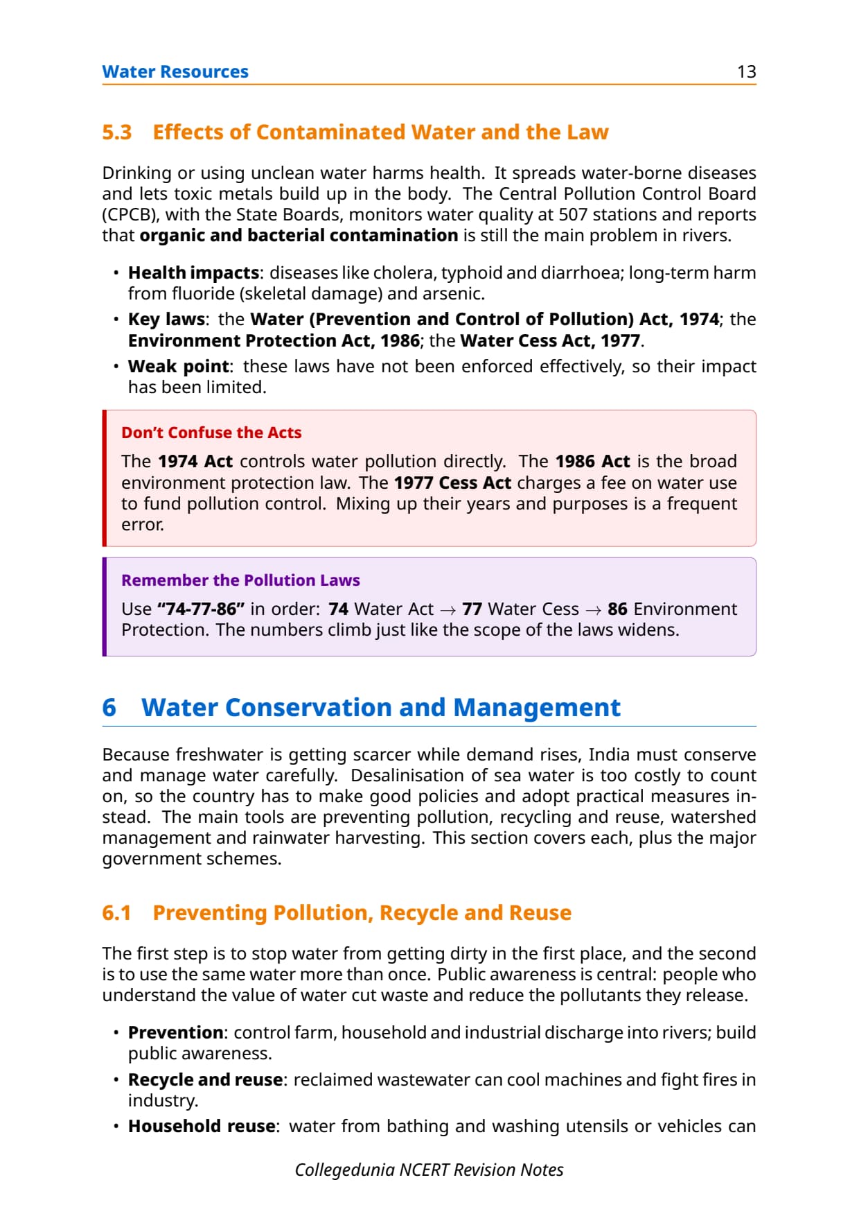

- Concept-first revision: India's water availability (4,000 cubic km precipitation, 1,122 cubic km utilisable), surface and groundwater sources and sectoral demand.
- Key schemes (PMKSY, Jal Kranti Abhiyan, watershed programmes) with CBSE-ready one-line points.
- Cross-pointers to the matching Solutions, Handwritten Notes and NCERT Book PDF.
Every line is written by Collegedunia geography subject experts, mapped to the 2026-27 NCERT India: People and Economy textbook and checked against the last five years of CBSE Class 12 Geography board papers.
Student Feedback
74% of students found the difference between utilisable water and total availability the most-confused area, and 3 out of 4 rated the sectoral utilisation table and watershed management as most worth revising.
Source: 2026-27 Class 12 Geography student poll, 10,450 students.
Quick Concept Recap: Water Resources at a Glance
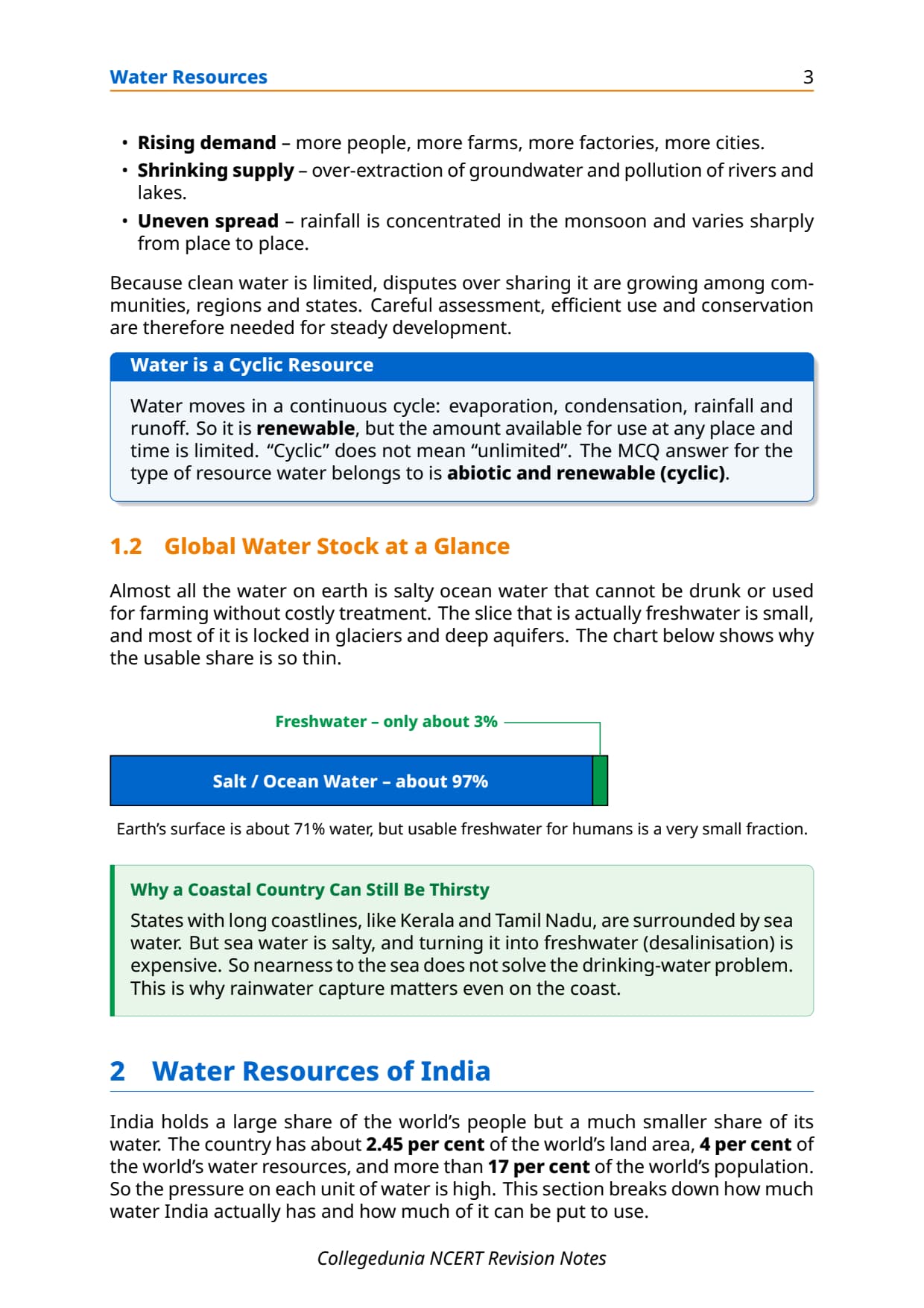
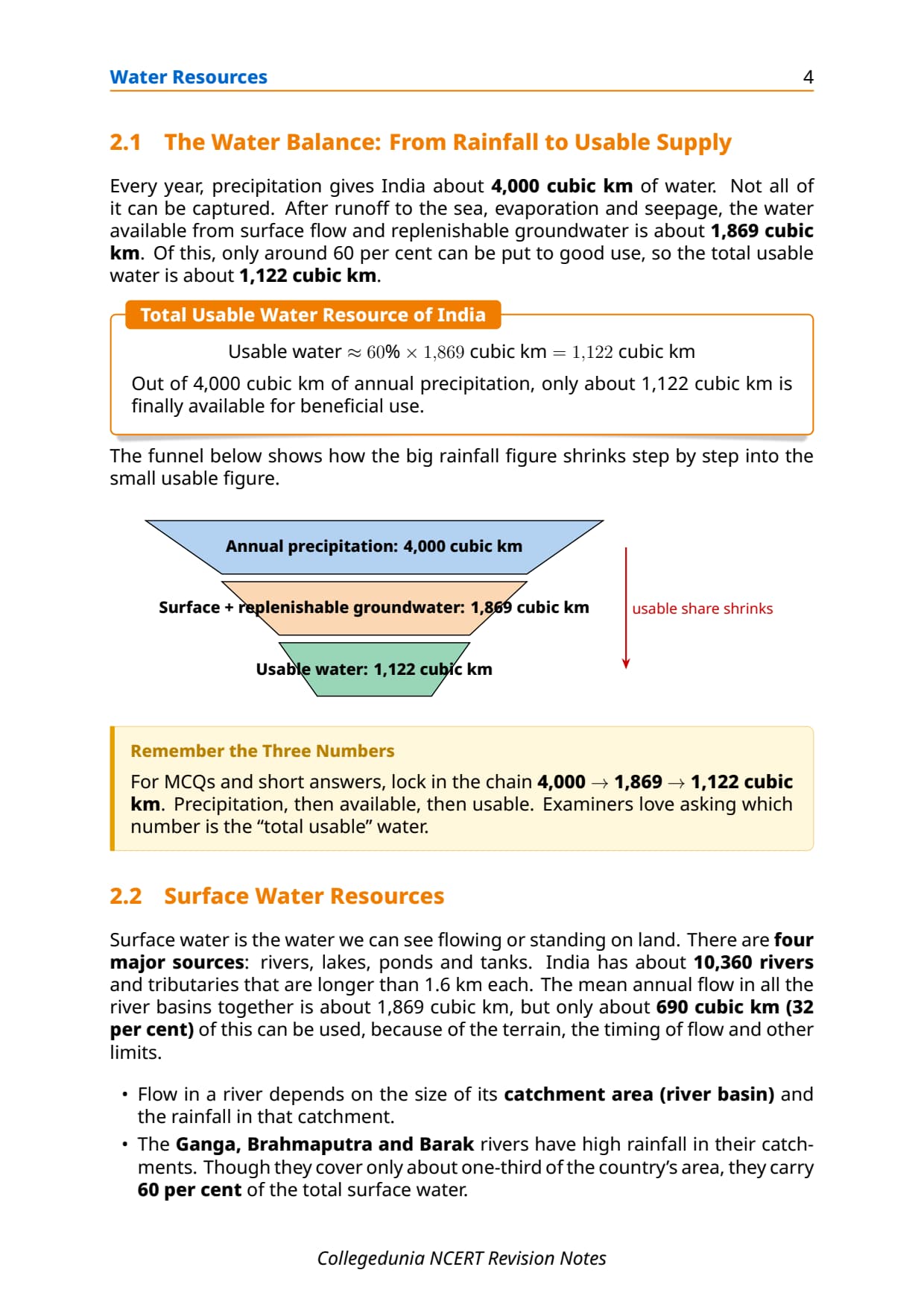
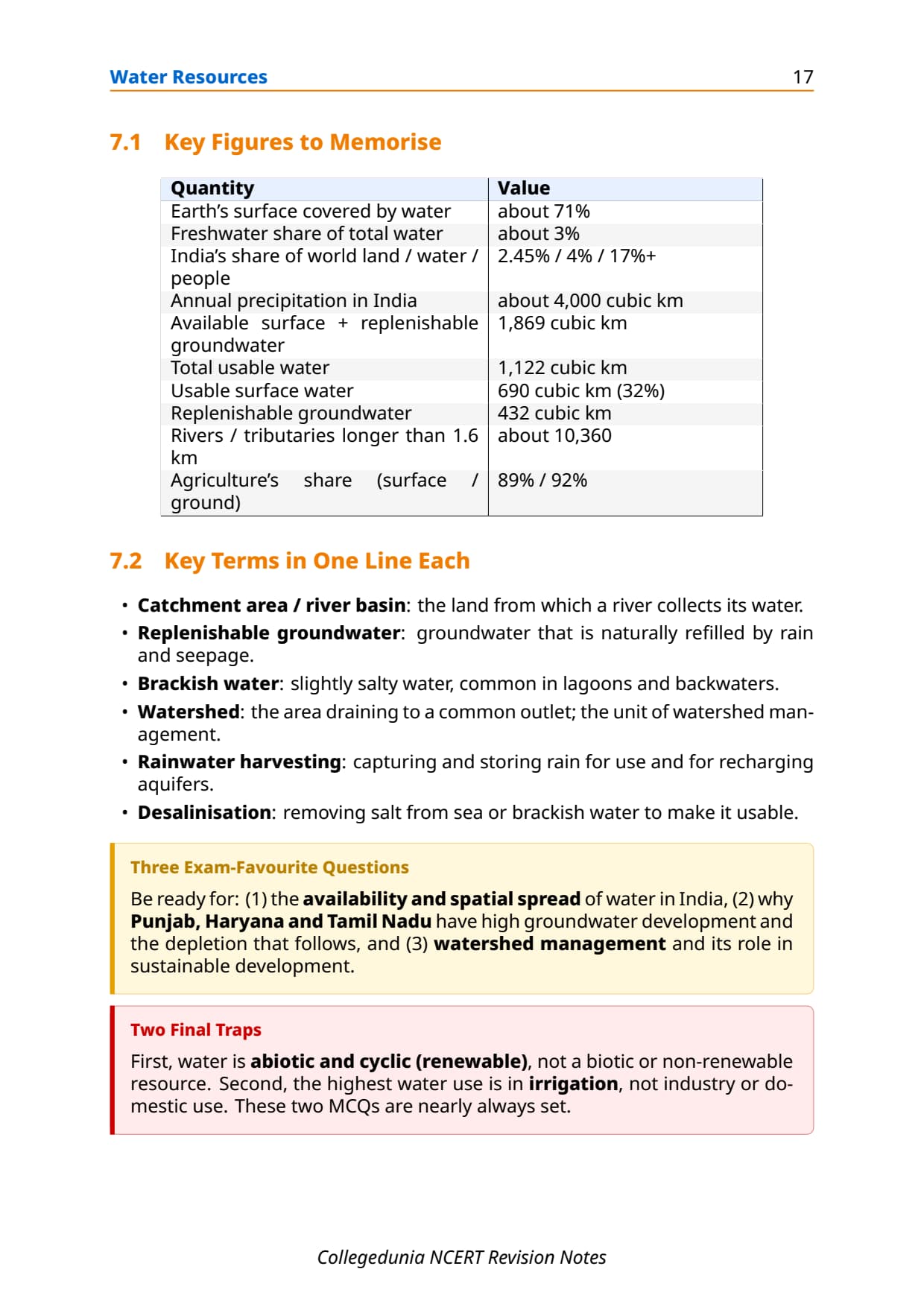
Freshwater is scarce: only about 3% of Earth's water is fresh. India has 4% of world water resources but over 17% of world population, so demand outstrips supply. Total availability is about 4,000 cubic km a year, of which 1,122 cubic km is utilisable (60% of the 1,869 cubic km of surface plus replenishable groundwater).
Read these notes first, then use the NCERT Solutions for Chapter 4 Water Resources for exercise practice.
Source: HUMAN-AT-EASE on YouTube
Key Definitions for Water Resources Class 12 Notes
Every objective question starts with a definition. The ones below are in the form CBSE markers expect.
| Term | One-line definition | NCERT pointer |
|---|---|---|
| Utilisable Water Resource | The fraction of total surface and groundwater that can practically be put to beneficial use, accounting for topographical, hydrological and quality constraints; about 1,122 cubic km for India. | Water Resources of India section |
| Replenishable Groundwater | Groundwater that is recharged by precipitation and surface infiltration each year; India's total replenishable groundwater is about 432 cubic km. | Groundwater Resources |
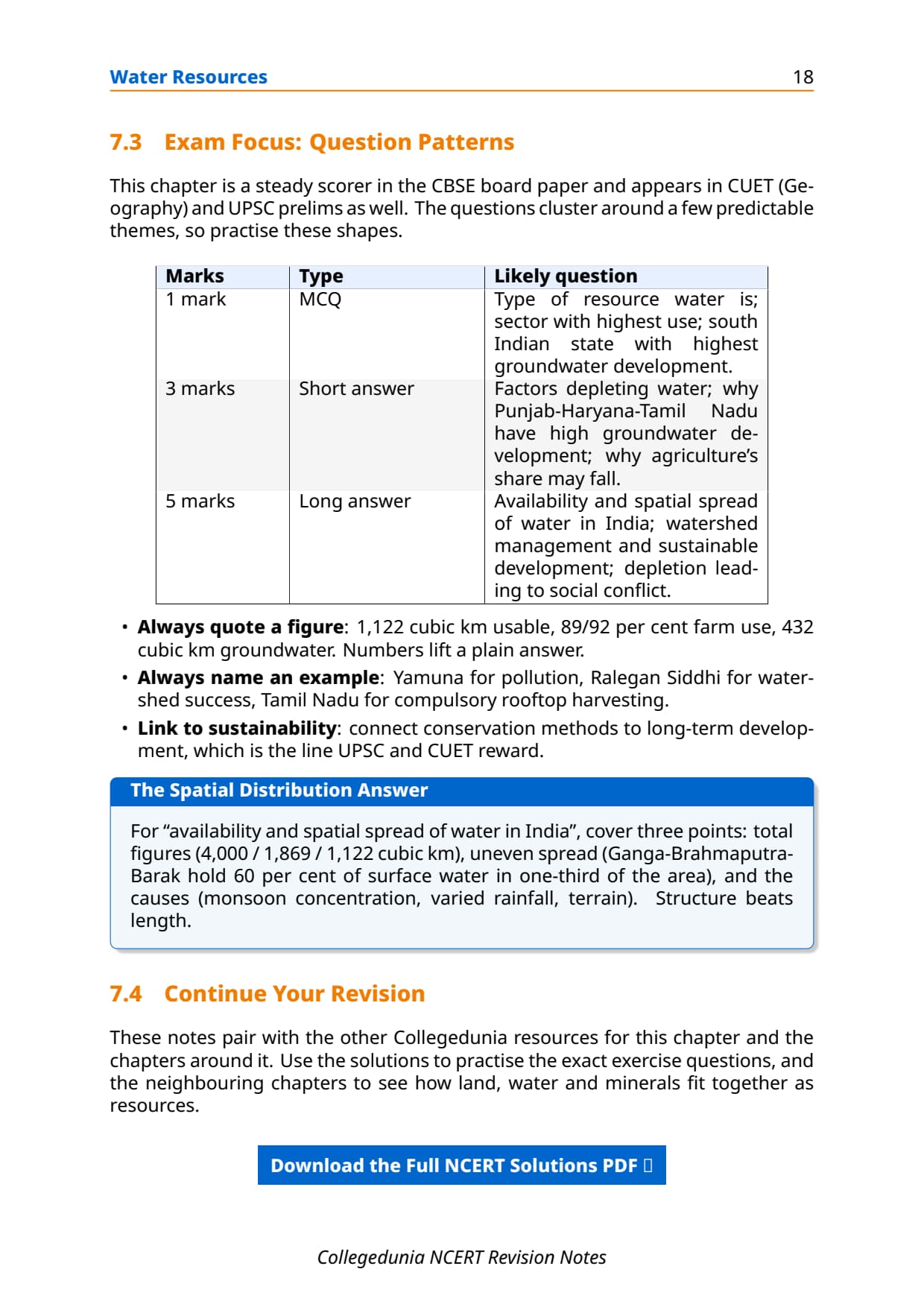
| Watershed | A land area that drains into a common point such as a stream, river or lake; the basic unit for planning water conservation and management in India. | Water Conservation section |
| Watershed Management | Efficient management and conservation of surface and groundwater resources within a watershed through sustainable land-use practices, including treating degraded lands to reduce soil erosion and improve water retention. | Water Conservation section |
| Rainwater Harvesting | The collection and storage of rainwater from rooftops and open surfaces in tanks or underground structures for domestic and agricultural use, reducing dependence on groundwater. | Water Conservation section |
| Kund / Tanka | A covered underground rainwater harvesting tank, traditionally built near or inside a house or village in Rajasthan to store harvested rainwater during the dry season. | Rainwater Harvesting section |
| Water Pollution | The deterioration of water quality by the entry of micro-organisms, chemicals, industrial effluents and other wastes that render water unfit for human or ecological use. | Deterioration of Water Quality |
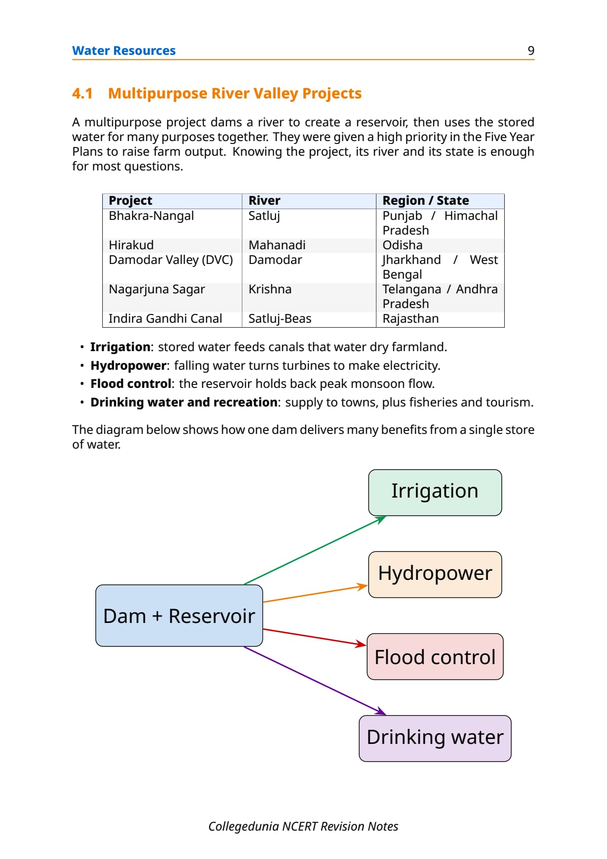
| Multipurpose River Valley Project | A large dam and canal system designed to serve multiple purposes simultaneously, including irrigation, flood control, hydropower, navigation and domestic water supply; examples include Bhakra-Nangal and Hirakud. | Water Demand section |
| Lagoon | A coastal water body separated from the sea by a narrow strip of land; found in Kerala, Odisha and West Bengal; contains brackish water used for fishing and growing certain crops. | Lagoons and Backwaters |
| Desalination | The process of removing dissolved salts from seawater or brackish water to produce freshwater suitable for drinking or irrigation; considered negligible in India due to high cost. | Water Conservation section |
These cover about 8 of 10 theory questions CBSE has asked since 2021. Write each one out before moving on.
Surface Water and Groundwater Resources of India
India's water resources are surface water (rivers, lakes, ponds, tanks, lagoons) and groundwater.
Surface Water: Rivers and River Basins
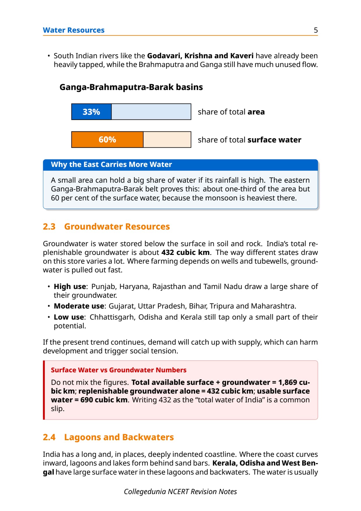
India has about 10,360 rivers longer than 1.6 km, with a mean annual flow of 1,869 cubic km, of which only 690 cubic km (32%) is usable.
- High-flow basins: the Ganga, Brahmaputra and Barak carry 60% of surface water on about one-third of India's area.
- Low-flow regions: north-western India and the Deccan plateau; south Indian rivers are already largely harnessed.
Groundwater Resources
India's replenishable groundwater is about 432 cubic km, recharged by rain, rivers and canals. Its use is very uneven.
| Category | States | Utilisation level |
|---|---|---|
| Very high utilisation | Punjab, Haryana, Rajasthan, Tamil Nadu | Groundwater table declining; over-extraction a serious concern |
| Moderate utilisation | Gujarat, Uttar Pradesh, Bihar, Tripura, Maharashtra | Sustainable at current rates but rising demand needs watch |
| Low utilisation | Chhattisgarh, Odisha, Kerala | Large untapped potential; geography and policy limit extraction |
Lagoons and Backwaters
The indented coastline has lagoons in Kerala, Odisha and West Bengal. Their brackish water supports fishing and salt-tolerant crops, so lagoons count as surface water though not freshwater.
Water Demand and Sectoral Utilisation
India's water demand is dominated by agriculture. Post-Independence multipurpose projects like Bhakra-Nangal, Hirakud and the Indira Gandhi Canal were built partly to deliver irrigation at scale.
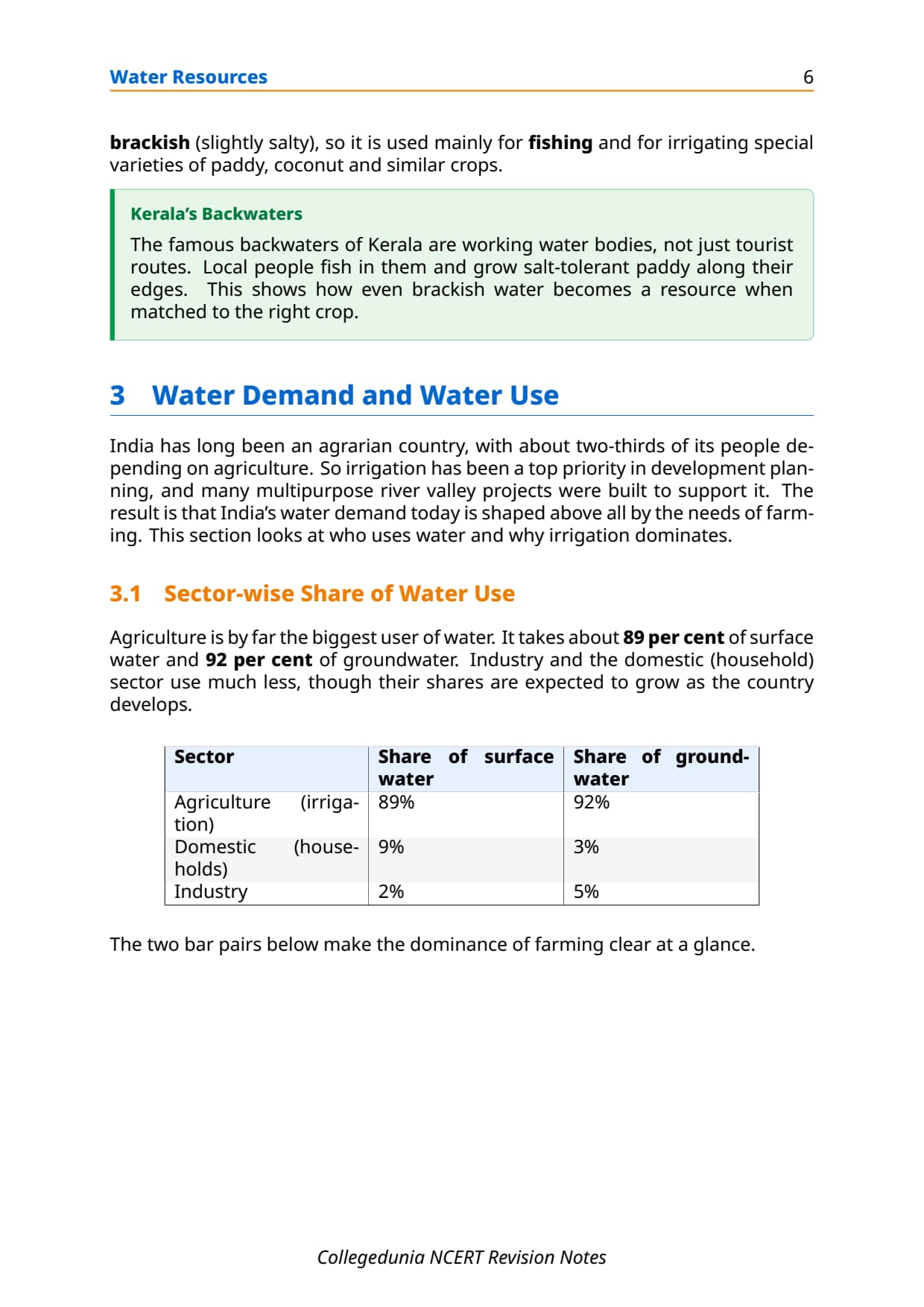
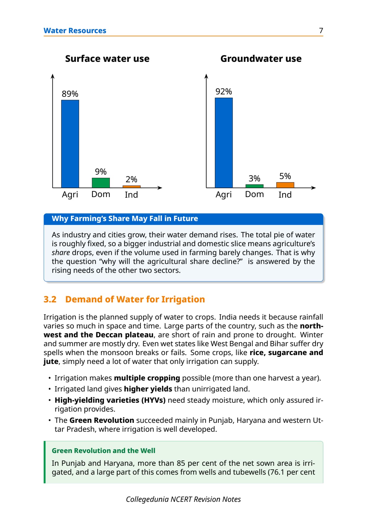
| Sector | Share of Surface Water Used | Share of Groundwater Used |
|---|---|---|
| Agriculture (irrigation) | 89% | 92% |
| Industry | 2% | 5% |
| Domestic | 9% | 3% |
So water conservation in India is really about farm water management. As industry and domestic use grow, agriculture's share may fall, but its volume stays large. CBSE builds descriptive questions around this agricultural dominance.
Irrigation: Need, Types and Regional Patterns
India cannot rely on rainfall alone. Rain varies sharply by place and season, the monsoon lasts only four months and sometimes fails, and crops like rice and sugarcane need more than rain gives.
Why Irrigation Is Necessary
- North-western India and the Deccan plateau get too little rain for rainfed farming; winter and summer are dry.
- Monsoon breaks or failure ruin standing crops even in wet regions.
- HYV crops need assured moisture, and irrigated land is far more productive.
Regional Irrigation Patterns
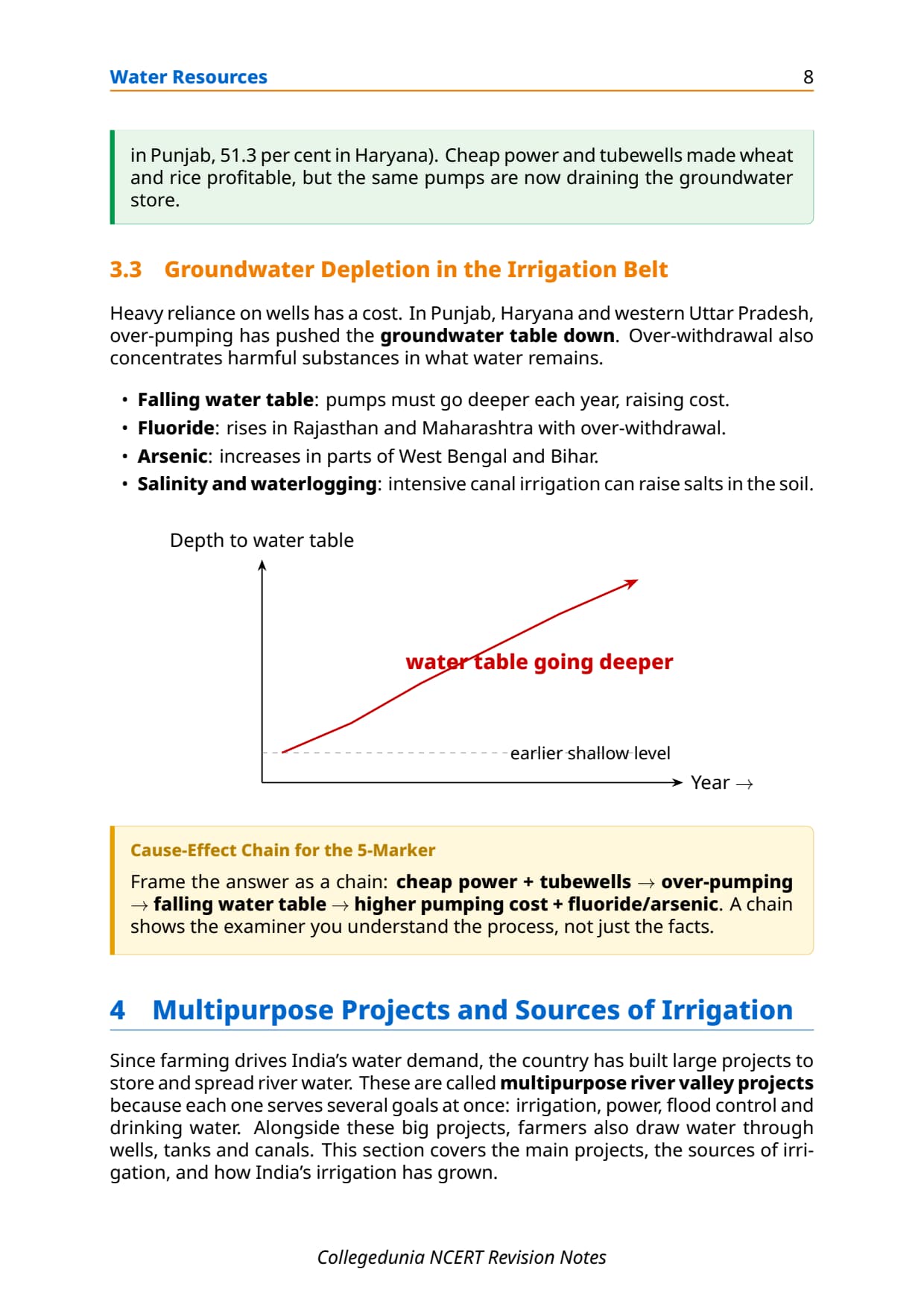
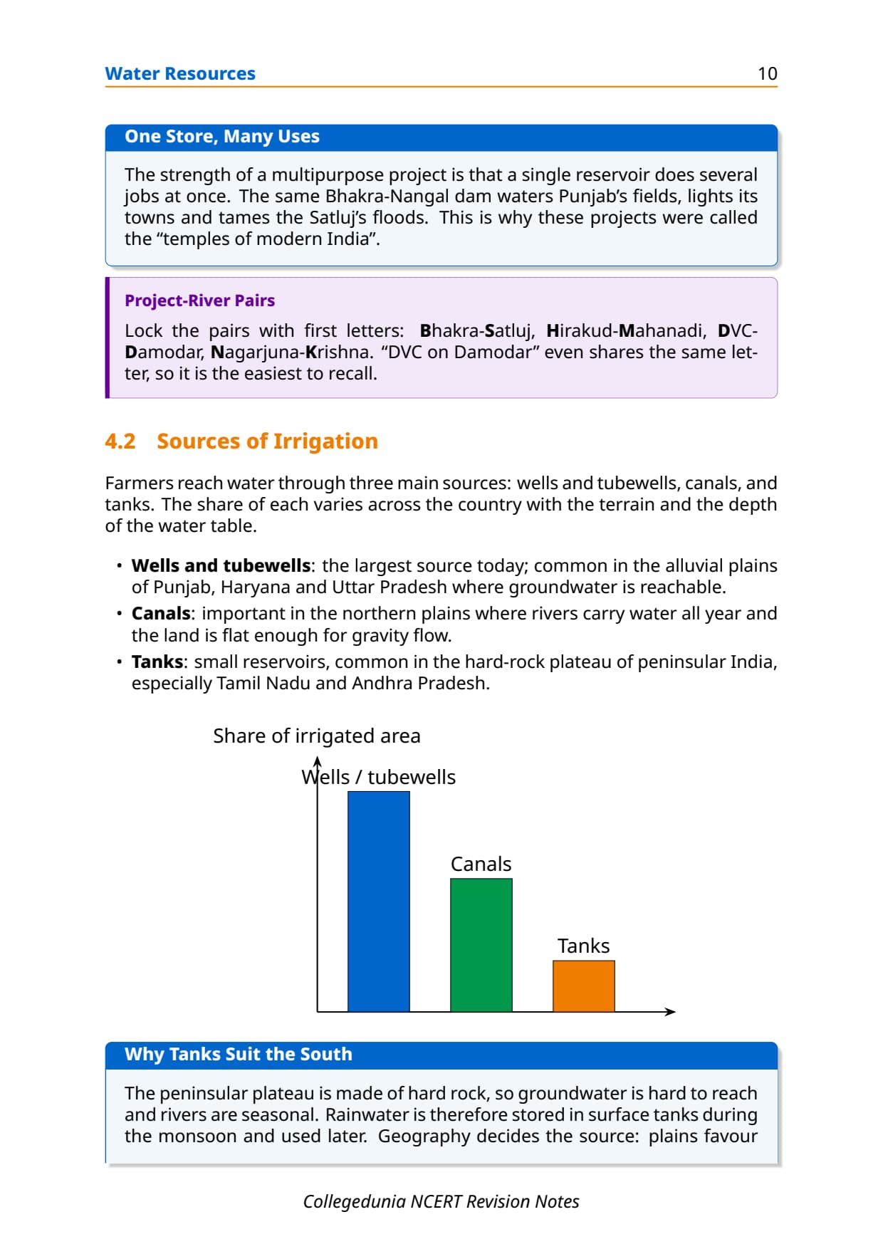
Over 85% of the net sown area in Punjab, Haryana and western Uttar Pradesh is irrigated, mostly by wells and tube wells (76.1% of net irrigated area in Punjab, 51.3% in Haryana). This has lowered the groundwater table, and over-withdrawal has raised fluoride in Rajasthan and Maharashtra and arsenic in West Bengal and Bihar.
Memory hook: Punjab and Haryana are both the irrigation success story and the groundwater-depletion warning. The tube wells feeding HYV crops now drain the aquifer. CBSE sets this as a cause-effect question.
Emerging Water Problems: Quality and Scarcity
India faces two linked problems: falling water per person and falling quality. Population grows faster than new sources appear, while effluents, farm chemicals and sewage pollute rivers, lakes and groundwater.
Water Scarcity
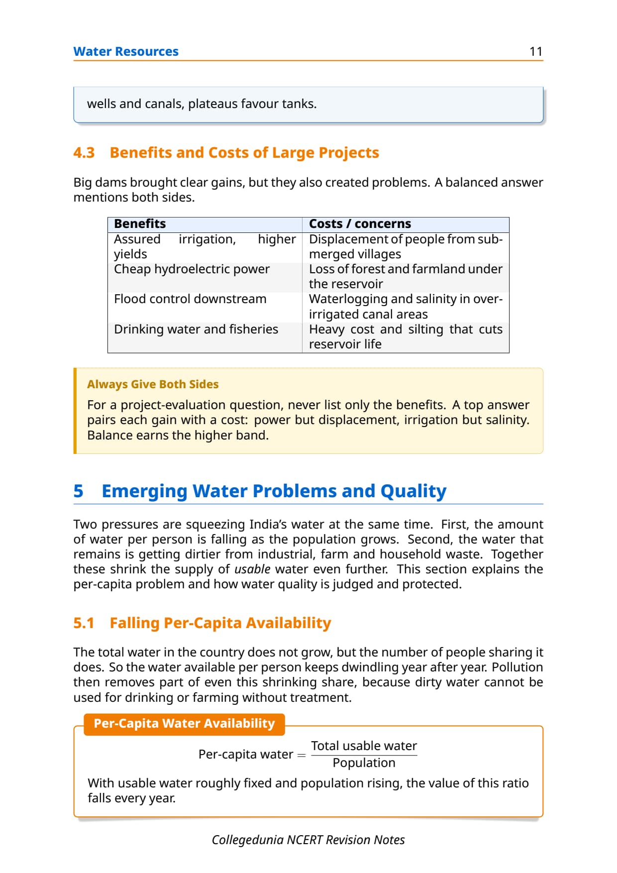
Per capita availability drops every year. Inter-state water-sharing disputes (Krishna, Cauvery, Ravi-Beas) are already common, and NCERT warns scarcity may be India's biggest challenge ahead.
Water Quality Problems
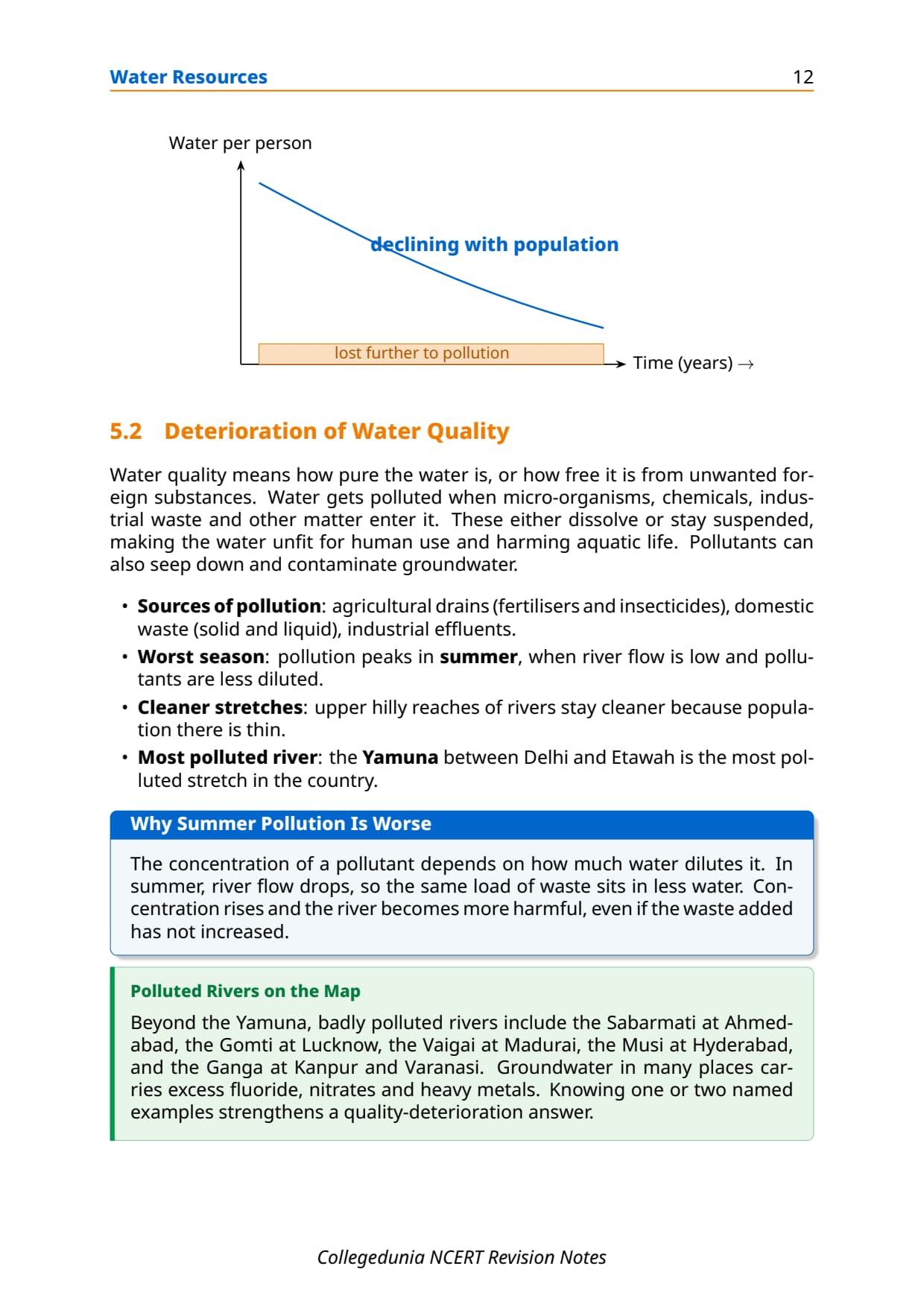
Micro-organisms, chemicals and waste degrade aquatic systems and seep into groundwater. Main problems:
- Industrial pollution: heavy metals and toxic chemicals from factories on rivers like the Ganga.
- Agricultural chemicals: fertiliser run-off causes eutrophication (algal bloom); pesticides collect in water and soil.
- Fluoride and arsenic: from over-extraction in Rajasthan, Maharashtra, West Bengal and Bihar; untreated sewage adds coliform bacteria and BOD load.
Water Conservation and Management Methods
NCERT covers four conservation strategies: watershed management, rainwater harvesting, desalination and river inter-linking. The first two are most tested.
Watershed Management
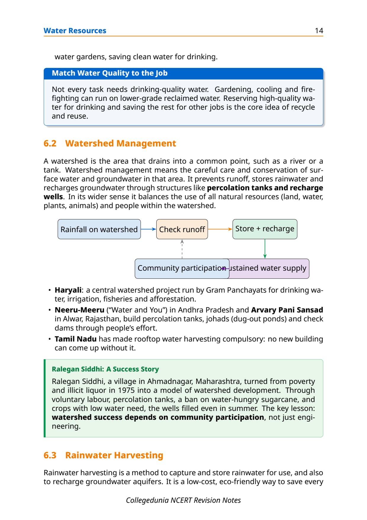
Watershed management uses the watershed (land draining to a common point) as the planning unit. It plants vegetation on degraded slopes and builds check dams, percolation tanks and contour bunds to cut runoff, recharge groundwater and reduce erosion. CBSE often asks students to define it and explain its role in sustainable development.
Rainwater Harvesting
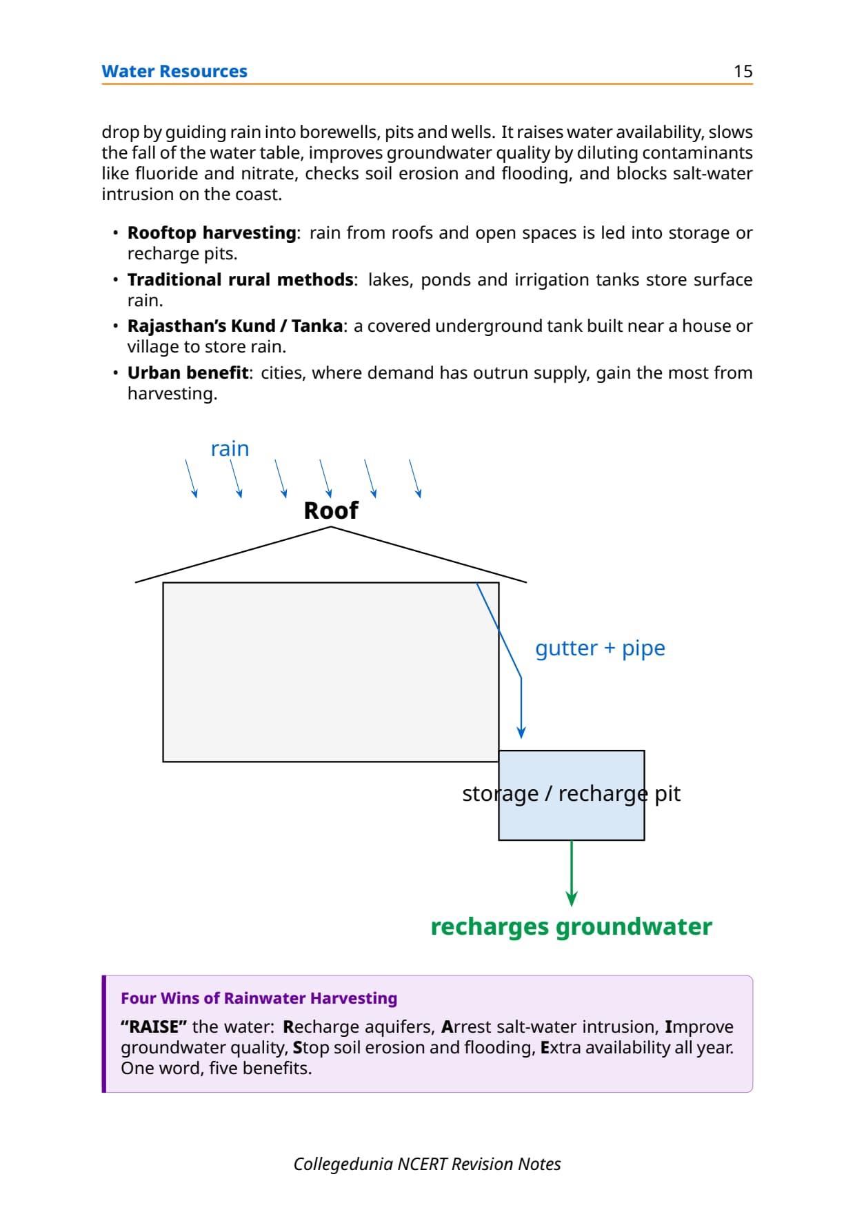
Rainwater harvesting collects rain from rooftops and open spaces, or lets it percolate to recharge aquifers. In arid Rajasthan the Kund or Tanka is a covered underground cistern near the house. It bridges the dry-season gap and cuts groundwater dependence.
Other Conservation Methods
- Desalination: removing salt from seawater; useful on coasts but negligible in India due to high energy cost.
- Inter-linking of rivers: moving surplus water from the Ganga-Brahmaputra basins to deficit peninsular basins; still under study.
- Pricing of water: treating water as an economic good to cut waste, as the National Water Policy 2012 recommends.
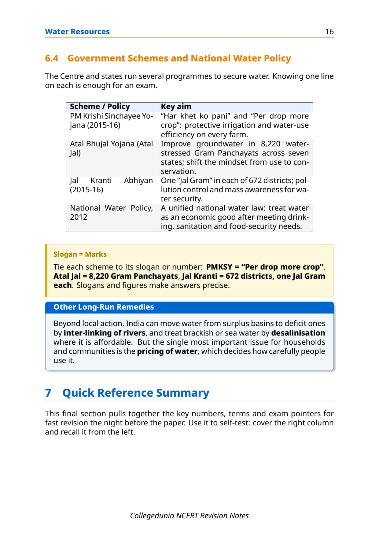
Government Schemes: PMKSY, Jal Kranti Abhiyan and National Water Policy 2012
Three policy instruments shape water management. Know the aim and launch year of each.
Pradhan Mantri Krishi Sinchayee Yojana (PMKSY, 2015-16)
PMKSY ensures protective irrigation for every farm (slogans: Har Khet Ko Pani, Per Drop More Crop). It expands assured-irrigation area and promotes drip and sprinkler irrigation.
Jal Kranti Abhiyan (2015-16)
Jal Kranti Abhiyan seeks water security through better per capita availability. It develops a Jal Gram in one water-stressed village in each of 672 districts and runs awareness drives.
National Water Policy 2012
The National Water Policy 2012 frames how water is managed. It calls for a national water framework law, treats water as an economic good after drinking, sanitation, food security and ecological needs are met, and introduces water auditing.
Previous Year Question Trends from Water Resources Class 12
The table maps the last five years so students focus on the likeliest question types.
| Year | Question type asked | Marks | Notes section to revise |
|---|---|---|---|
| 2025 | Define watershed management + explain its role in sustainable development | 3 + 5 | Water Conservation and Management section |
| 2024 | Factors responsible for depletion of water resources + groundwater problems in Punjab | 3 + 3 | Emerging Water Problems + Irrigation section |
| 2023 | Distinguish surface water from groundwater in India; which states have highest groundwater development? | 3 + 2 | Surface Water and Groundwater section |
| 2022 | Discuss availability of water resources in India and factors determining spatial distribution | 5 | Surface Water and Groundwater section |
| 2021 | Why is agriculture's share in total water used expected to decline? + water contamination impacts | 3 + 3 | Water Demand section + Emerging Water Problems section |
The chapter carries about 8 to 10 marks per year across MCQs and written answers.
Other Resources for Class 12 Geography Chapter 4 Water Resources
Pair these notes with the NCERT Solutions, Handwritten Notes and NCERT Book PDF below.
| Resource | What it covers | Open |
|---|---|---|
| Notes | Concept-first revision notes covering water availability, surface and groundwater distribution, sectoral demand, water problems, conservation methods and government schemes. | You are here |
| NCERT Solutions | Step-by-step answers to all exercise questions including the three MCQs, four 30-word questions and three 150-word questions with full detail. | Class 12 Geography Chapter 4 NCERT Solutions |
| Handwritten Notes | Topper's handwritten revision pages for last-minute board exam practice. | Class 12 Geography Chapter 4 Handwritten Notes |
| NCERT Book PDF | Official NCERT India: People and Economy Chapter 4 textbook in PDF form. | Class 12 Geography Chapter 4 NCERT Book PDF |
| Subject Hub | All chapters of Class 12 Geography with every resource in one place. | Class 12 Geography Subject Hub |
All Chapters Notes for Class 12 Geography India: People and Economy
Related Links: Notes for the other chapters of Class 12 Geography India: People and Economy.
| Chapter | Topic | Notes link |
|---|---|---|
| Chapter 1 | Population: Distribution, Density, Growth and Composition | Class 12 Geography Chapter 1 IPE Notes |
| Chapter 2 | Human Settlements | Class 12 Geography Chapter 2 IPE Notes |
| Chapter 3 | Land Resources and Agriculture | Class 12 Geography Chapter 3 IPE Notes |
| Chapter 4 | Water Resources | You are here |
| Chapter 5 | Mineral and Energy Resources | Class 12 Geography Chapter 5 IPE Notes |
| Chapter 6 | Planning and Sustainable Development in Indian Context | Class 12 Geography Chapter 6 IPE Notes |
| Chapter 7 | Transport and Communication | Class 12 Geography Chapter 7 IPE Notes |
| Chapter 8 | International Trade | Class 12 Geography Chapter 8 IPE Notes |
| Chapter 9 | Geographical Perspective on Selected Issues and Problems | Class 12 Geography Chapter 9 IPE Notes |
NCERT Notes Class 12 Geography Chapter 4 Water Resources FAQs
Ques. What are the water resources class 12 notes meant to be used for?
Ans. The water resources class 12 notes are a concept-first revision file that compress the entire NCERT Chapter 4 of Class 12 India: People and Economy into a printable study guide. They include India's total and utilisable water availability, surface water and groundwater distribution, sectoral demand patterns, irrigation needs, water quality problems, conservation methods and all three major government schemes. Students typically use these notes for a 30-minute first-pass revision and a 20-minute night-before pass; the worked answers to the NCERT exercise questions live in the matching NCERT Solutions PDF, not in this Notes file.
Ques. What is the total utilisable water resource of India according to Class 12 Geography?
Ans. India receives about 4,000 cubic km of water through precipitation each year. Of this, the availability from surface water and replenishable groundwater is 1,869 cubic km. However, only about 60% of this can be put to beneficial use due to topographical, hydrological and other constraints. This gives India a total utilisable water resource of approximately 1,122 cubic km per year. India accounts for about 4% of the world's water resources but more than 17% of the world's population, which explains why water scarcity is a pressing issue despite the large nominal figure.
Ques. Which states have the highest groundwater utilisation in India, and why?
Ans. Punjab, Haryana, Rajasthan and Tamil Nadu have the highest groundwater utilisation among all states. In Punjab, 76.1% of the net irrigated area is irrigated through wells and tube wells; in Haryana the figure is 51.3%. The reason is the intensive irrigated agriculture these states practise, driven by the Green Revolution adoption of HYV crops that require assured soil moisture. Since canal supply alone is insufficient, farmers draw heavily from aquifers. The consequence is a declining groundwater table in these states, which is now a serious concern for long-term agricultural sustainability.
Ques. What factors are responsible for the depletion of water resources in India?
Ans. The NCERT chapter identifies two main sets of factors. On the demand side, rapid population growth increases per capita pressure on water resources; agricultural intensification (especially HYV crop cultivation) raises water demand for irrigation; and industrial and urban growth increases water demand from non-agricultural sectors. On the supply side, pollution from industrial effluents, agricultural chemicals and untreated domestic sewage reduces the volume of usable water; over-extraction of groundwater depletes aquifer levels; and inadequate conservation infrastructure means most rainwater runs off rather than recharging groundwater. Together, these forces reduce both the quantity and quality of usable water.
Ques. What is watershed management and how does it help sustainable development?
Ans. Watershed management is the efficient management and conservation of surface and groundwater resources within a watershed, achieved through sustainable land-use practices. The watershed is used as the basic planning unit. Activities include planting vegetation on degraded slopes to hold soil and slow runoff, building small check dams and percolation tanks to retain rainwater, and contour bunding to encourage infiltration. Watershed management helps sustainable development in three main ways: it improves groundwater recharge (raising water tables and improving dry-season river flows), reduces soil erosion and downstream flooding, and increases land productivity, providing livelihood options to communities in semi-arid areas.
Ques. What is rainwater harvesting and what are its main benefits in India?
Ans. Rainwater harvesting is the collection and storage of rainwater from rooftops and open spaces for domestic use, or the diversion of rainwater into the ground to recharge aquifers. Traditional forms include lakes, ponds and irrigation tanks, especially in south India. In Rajasthan, the Kund or Tanka is a covered underground cistern historically used to store rainwater in arid conditions. Benefits include: bridging the demand-supply gap during dry seasons; reducing community dependence on groundwater for domestic use; saving the energy required to pump groundwater as recharge raises the water table; and providing urban areas with a decentralised water source where centralised supply has already fallen behind demand.
Ques. Why is agriculture's share in total water used expected to decline in India?
Ans. Agriculture currently accounts for 89% of surface water and 92% of groundwater use in India. However, as the economy develops, the shares of the industrial and domestic sectors will increase because industrialisation requires more process water and a rising urban population demands more domestic supply. The NCERT chapter notes that this structural shift is already under way as India's manufacturing and service sectors grow. Additionally, improved irrigation efficiency through drip and sprinkler systems (promoted under PMKSY) will reduce the volume of water agriculture needs per unit of output. The absolute volume may remain large, but agriculture's percentage share of total water use is expected to fall over coming decades.
Ques. What are the key features of the National Water Policy 2012 in class 12 Geography?
Ans. The National Water Policy 2012 was formulated to provide a framework for planned development and management of India's water resources. Key features are: (1) a call for a national water framework law and comprehensive inter-state river legislation; (2) treating water as an economic good after meeting drinking water, sanitation, food security and ecological needs; (3) climate change adaptation strategies for water structures; (4) development of water footprints and water auditing to benchmark efficient use; (5) removing the large disparity between urban and rural water supply norms; and (6) community participation in managing water resource projects. The policy marks a shift from treating water as a free resource to recognising it as a finite economic good that must be priced and rationed.
Ques. What is PMKSY and what are its main objectives?
Ans. Pradhan Mantri Krishi Sinchayee Yojana (PMKSY) was launched by the Central Government in 2015-16 with the vision of ensuring access to protective irrigation for all agricultural farms in India. Its two main slogans summarise its aims: Har Khet Ko Pani (water to every field) and Per Drop More Crop (maximum crop output per unit of water). Specific objectives include expanding cultivable area under assured irrigation, promoting integration of water source, distribution and efficient use, improving on-farm water use efficiency through drip and sprinkler irrigation, introducing sustainable water conservation practices, and developing rain-fed areas using a watershed approach to provide soil and water conservation and livelihood options.
Ques. What is the Jal Kranti Abhiyan and when was it launched?
Ans. Jal Kranti Abhiyan was launched by the Government of India in 2015-16 to ensure water security by improving per capita water availability. The programme aims to involve local bodies, NGOs and ordinary citizens in creating awareness about water conservation. Its key activities are: selecting one water-stressed village in each of India's 672 districts to develop as a Jal Gram with model water management; identifying model command areas of about 1,000 hectares across all regions; combating groundwater pollution and constructing arsenic-free wells; and running mass awareness campaigns through schools, social media, radio and print. It is designed to provide livelihood and food security through water security at the grassroots level.
Ques. Is the Class 12 Geography Chapter 4 syllabus changing in 2026-27?
Ans. No major reductions in 2026-27. The India: People and Economy textbook chapter structure is unchanged for the current cycle, and the CBSE marking scheme continues to reward well-organised answers that link concepts to specific regions, data and government policies. These water resources class 12 notes for the 2026-27 cycle are aligned to the unchanged textbook and the latest CBSE sample paper released for the 2026 boards. Students should focus especially on watershed management, rainwater harvesting, the sectoral water utilisation table, groundwater depletion in Punjab and Haryana, and the three government schemes (PMKSY, Jal Kranti Abhiyan and National Water Policy 2012).



Comments