




Inside these Class 12 Geography Chapter 3 Land Resources and Agriculture notes you get every NCERT definition, the nine land-use categories, cropping seasons, major crops and the Green Revolution, all aligned to the 2026-27 syllabus. They are built for a quick, full-chapter revision the night before the exam.
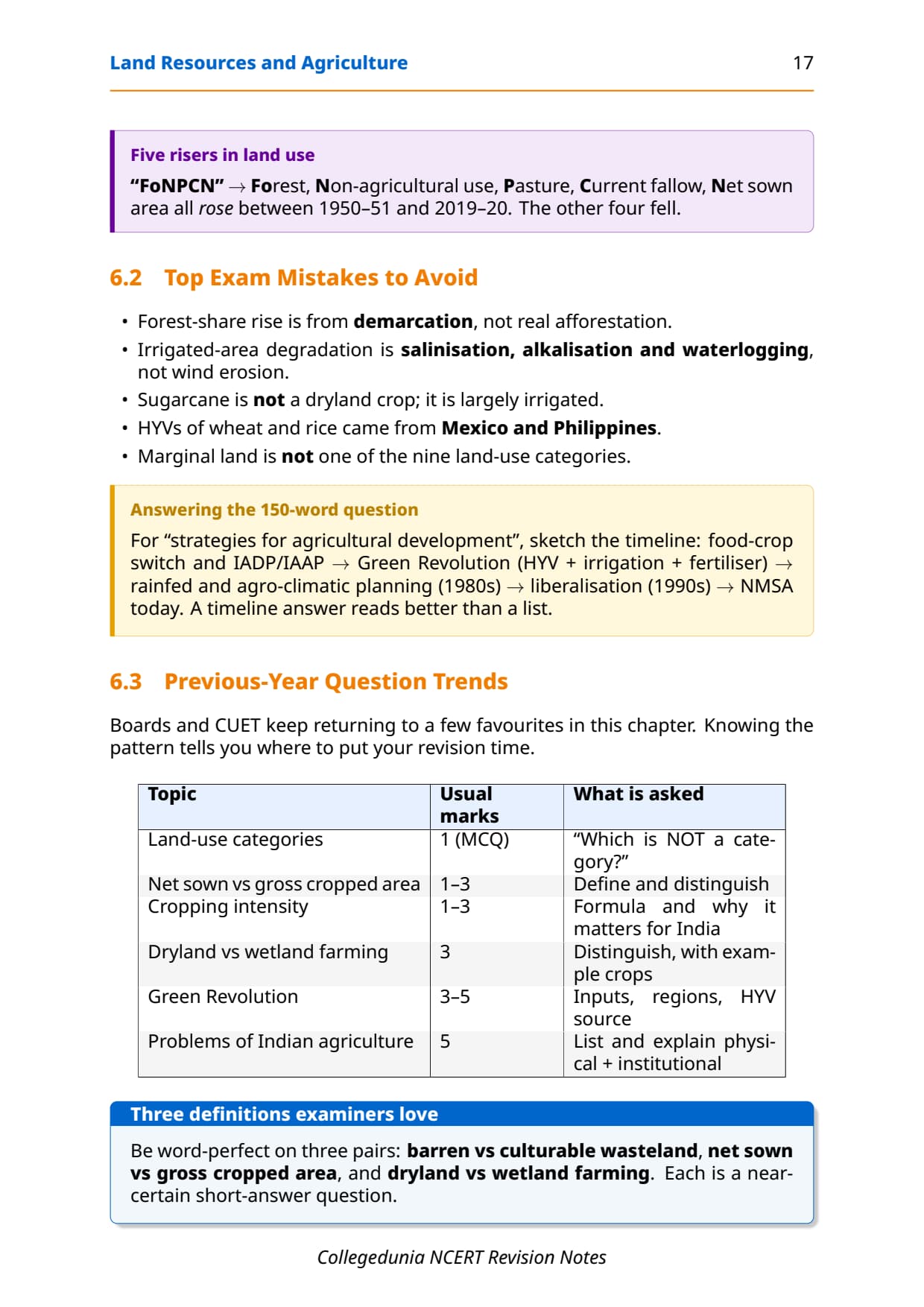


- Concept-first revision for the entire chapter: land-use categories (nine types), land-use changes from 1950-51 to 2019-20, common property resources, cropping seasons, major food and commercial crops, and the Green Revolution.
- All key definitions for land resources and agriculture class 12, the Cropping Intensity formula (CI = GCA/NSA x 100), and the crop-wise facts CBSE, CUET and UPSC repeatedly test.
- Cross-pointers to the matching NCERT Solutions, Handwritten Notes and NCERT Book PDF, so students see exactly where each concept gets applied in a worked answer.
Student Feedback
71% of Class 12 students found the nine land-use categories the most confusing part of this chapter, and 3 out of 4 rated the cropping-season and crop-distribution tables as the most useful revision tool. Most finished a full revision from these notes in about 30 minutes.
Source: 2026-27 Class 12 Geography student poll, 9,240 CBSE students.
Quick Concept Recap: Land Resources and Agriculture at a Glance
Chapter 3 of NCERT Class 12 India: People and Economy treats land as India's most basic resource: it supports agriculture, settlements, forests and infrastructure. India's reporting area is about 328.7 million hectares, tracked by the Land Revenue Department.
- Nine land-use categories: forests, barren and wastelands, non-agricultural uses, permanent pasture and grazing land, miscellaneous tree crops and groves, culturable wasteland, current fallow, fallow other than current fallow, and net area sown.
- Three cropping seasons: kharif (June-September), rabi (October-March) and zaid (April-June), each growing a distinct set of crops tied to rainfall and temperature.
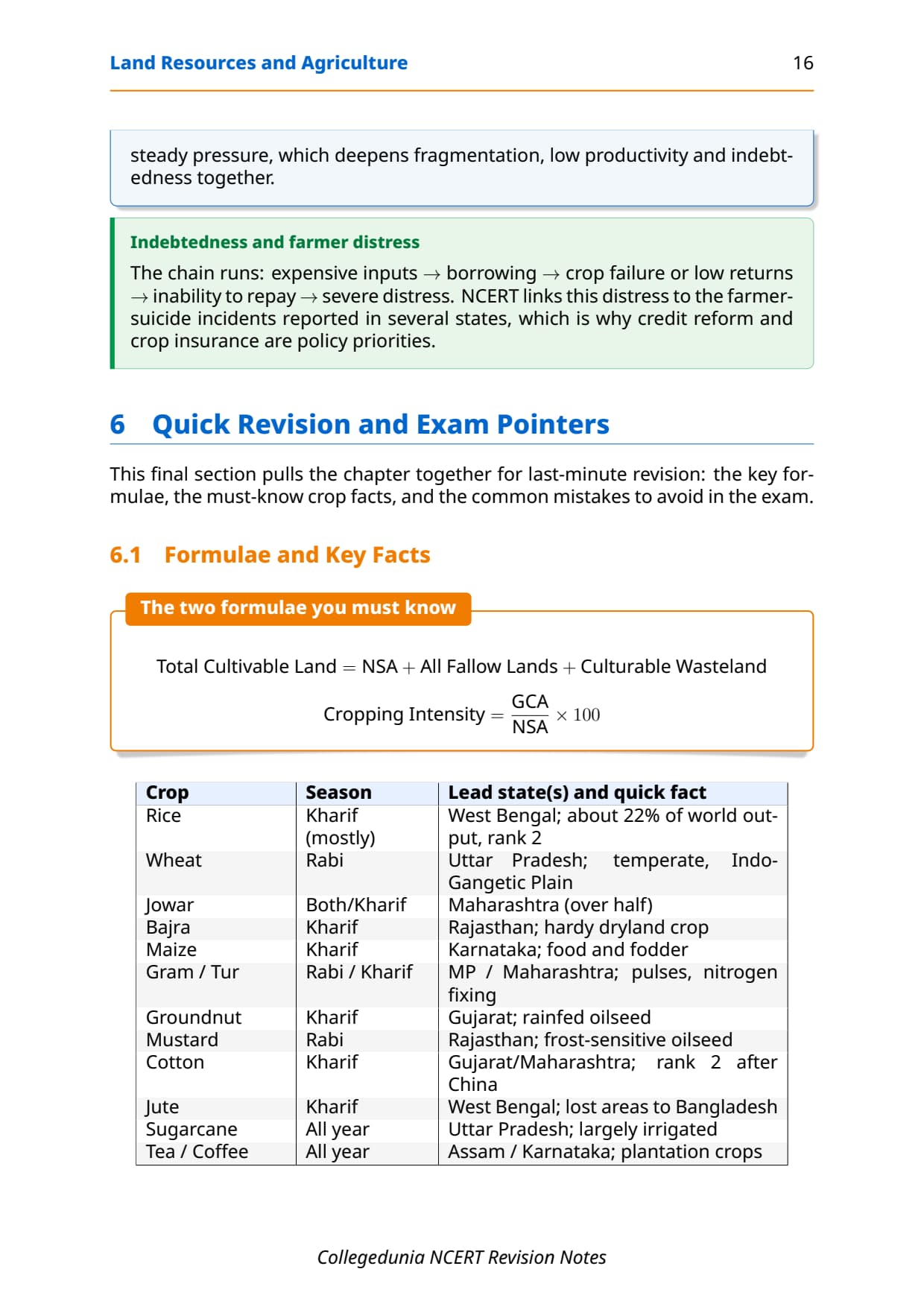
- Cropping Intensity formula: CI (%) = (Gross Cropped Area / Net Sown Area) x 100; a CI above 100% means multi-cropping.
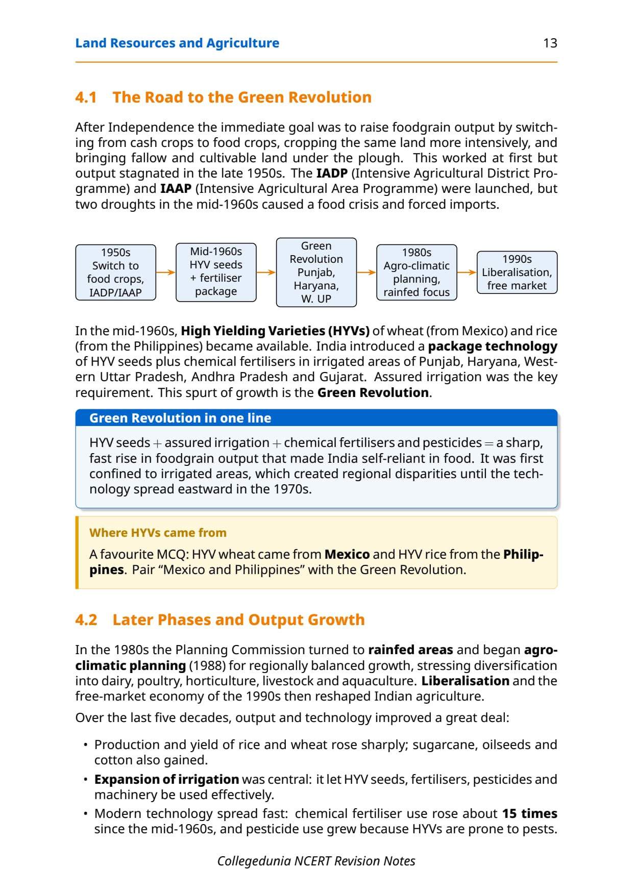
- Green Revolution (mid-1960s): HYV seeds from Mexico (wheat) and Philippines (rice), chemical fertilisers and assured irrigation transformed Punjab, Haryana, western Uttar Pradesh, Andhra Pradesh and Gujarat into high-yield zones.
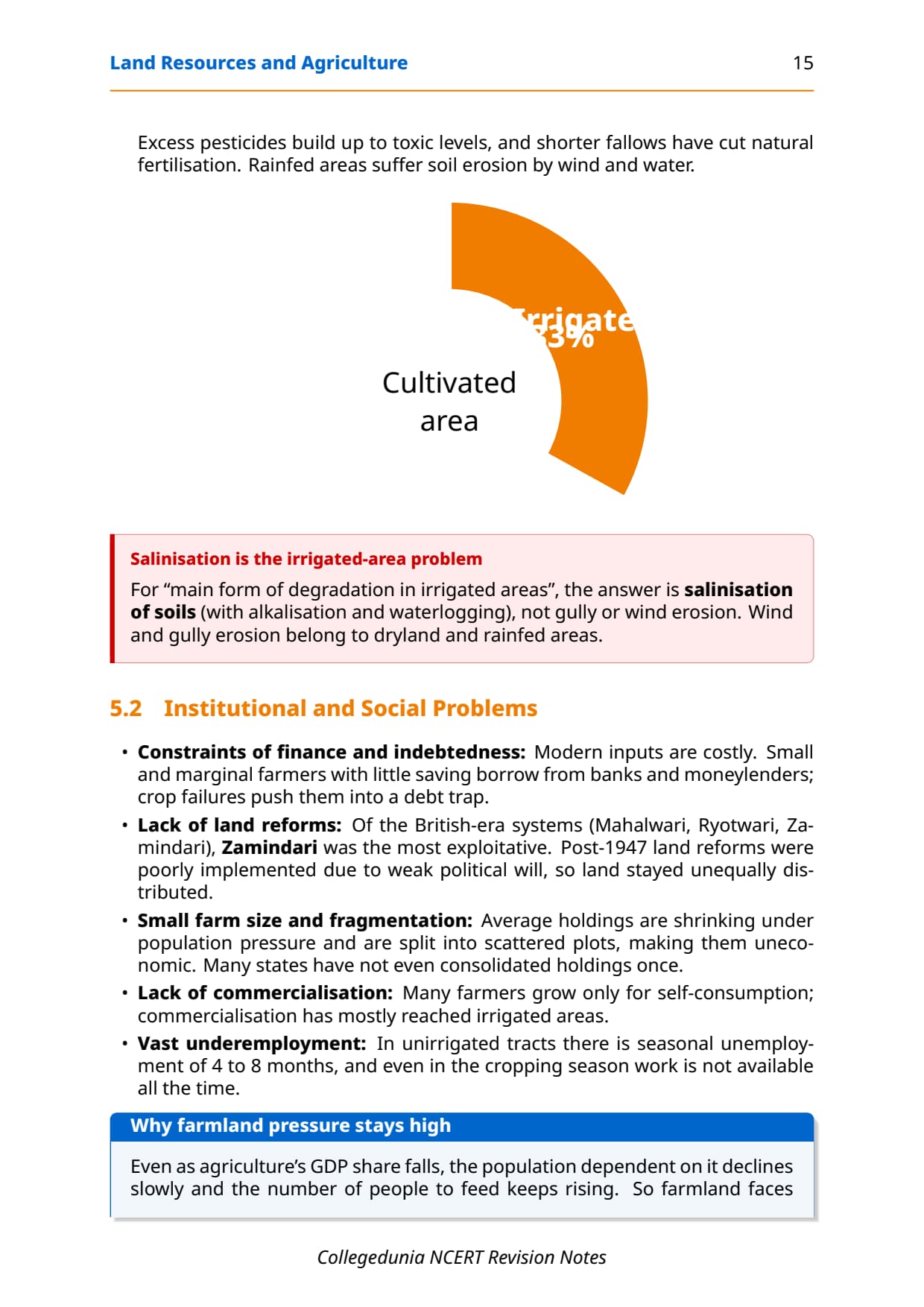
- Major challenges: dependence on erratic monsoon (only 33% area irrigated), low productivity versus global benchmarks, indebtedness of small farmers, lack of effective land reforms and degradation of cultivable land.
Read these notes first, then use the matching NCERT Solutions for Class 12 Geography Chapter 3 for the exercise drill.
Source: Humanities Wallah - Class 12th on YouTube
Key Definitions for Land Resources and Agriculture Class 12
Every objective-type question on this chapter starts with a definition. The table below gives one-line definitions in the exact form CBSE markers expect.
| Term | One-line definition | NCERT pointer |
|---|---|---|
| Net Area Sown (NAS) | The physical extent of land on which crops are actually sown and harvested in an agricultural year; each piece of land counted only once. | Land-use categories |
| Gross Cropped Area (GCA) | The total area sown during an agricultural year counting each parcel as many times as it is cropped; GCA is always greater than or equal to NAS. | Cropping Intensity section |
| Cropping Intensity (CI) | The ratio of GCA to NAS, expressed as a percentage; CI above 100 means the same land is cropped more than once a year. | Agricultural Land Use section |
| Culturable Wasteland | Land left uncultivated for more than five years but capable of being brought under cultivation through reclamation; also called cultural wasteland. | Land-use categories |
| Current Fallow | Cultivable land left without cultivation for one agricultural year or less to allow the soil to recover fertility naturally. | Land-use categories |
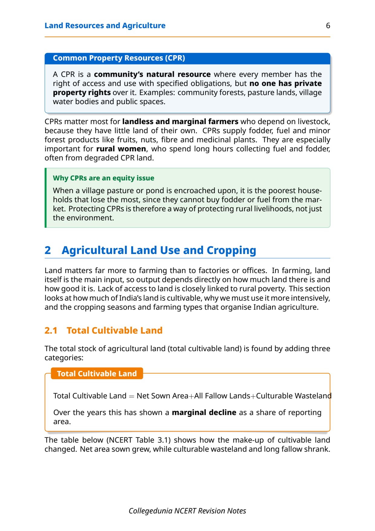
| Common Property Resources (CPR) | Land owned by the state for community use; includes village forests, pasture lands and water bodies where every member has access rights but no property rights. | CPR section |
| Dryland Farming | Rainfed farming in regions with annual rainfall less than 75 cm; grows hardy drought-resistant crops like ragi, bajra, moong and gram using soil moisture conservation techniques. | Types of Farming |
| Wetland Farming | Farming in areas where rainfall exceeds the soil moisture requirement of crops during the rainy season; grows water-intensive crops like rice, jute and sugarcane. | Types of Farming |
| Green Revolution | The rapid increase in foodgrain output in the mid-1960s driven by High Yielding Variety (HYV) seeds, chemical fertilisers and assured irrigation, primarily in Punjab, Haryana and western Uttar Pradesh. | Agricultural Development |
| High Yielding Varieties (HYV) | New seed varieties of wheat (developed in Mexico) and rice (developed in Philippines) introduced in India from mid-1960s; require assured irrigation and higher fertiliser inputs to deliver high output. | Agricultural Development |
These ten definitions cover about 8 of the 10 one-mark and 3-mark theory questions CBSE has asked on this topic since 2021.
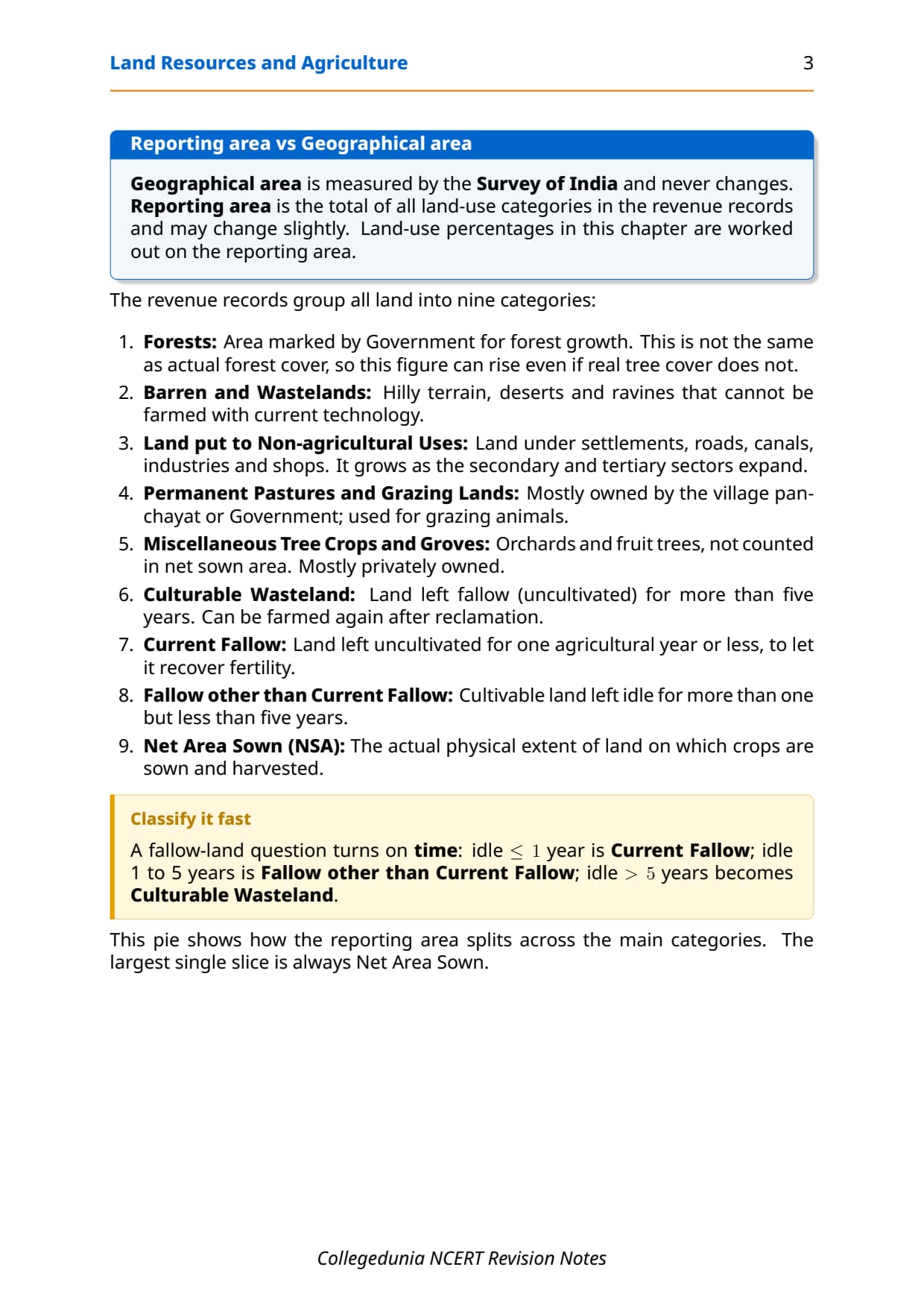
Nine Land-Use Categories (Quick Reference)
Land-use records in India are maintained by the Land Revenue Department, and all nine categories add up to the reporting area. Students confuse these categories most often in map-based questions, so the table below puts every key distinction side by side.
| Category | Key feature | Common exam trap |
|---|---|---|
| Forests | Area demarcated by government for forest growth; may differ from actual forest cover. | Forest area can increase without any real increase in tree cover if more area is notified. |
| Barren and Wasteland | Hilly terrains, deserts and ravines that cannot be cultivated with available technology. | Not the same as culturable wasteland; barren land cannot be reclaimed easily. |
| Non-agricultural Uses | Settlements (urban and rural), roads, canals, industries, shops; growing fastest of all categories. | This category grows at the expense of agricultural land and wastelands around cities. |
| Permanent Pasture and Grazing Land | Mostly owned by village Panchayat or government; part of Common Property Resources. | Only a small share is privately owned; most is communal. |
| Misc. Tree Crops and Groves | Orchards and fruit trees not included in net sown area; mostly privately owned. | Declining trend due to pressure from agricultural expansion. |
| Culturable Wasteland | Left fallow more than 5 years; can be reclaimed and cultivated. | Left more than 5 years = culturable wasteland; 1-5 years = fallow other than current fallow. |
| Current Fallow | Left uncultivated for one agricultural year or less to rest the soil. | Fallowing is a deliberate cultural practice, not abandonment; land comes back the next season. |
| Fallow other than Current Fallow | Cultivable land left uncultivated for more than 1 year but less than 5 years. | If left more than 5 years, reclassified as culturable wasteland. |
| Net Area Sown | Physical extent of land actually sown and harvested; each plot counted once regardless of how many crops grown. | Net area sown is less than gross cropped area whenever multi-cropping occurs. |
- Total cultivable land = Net Area Sown + All Fallow Lands + Culturable Wasteland: about 57.7% of India's reporting area in 2019-20.
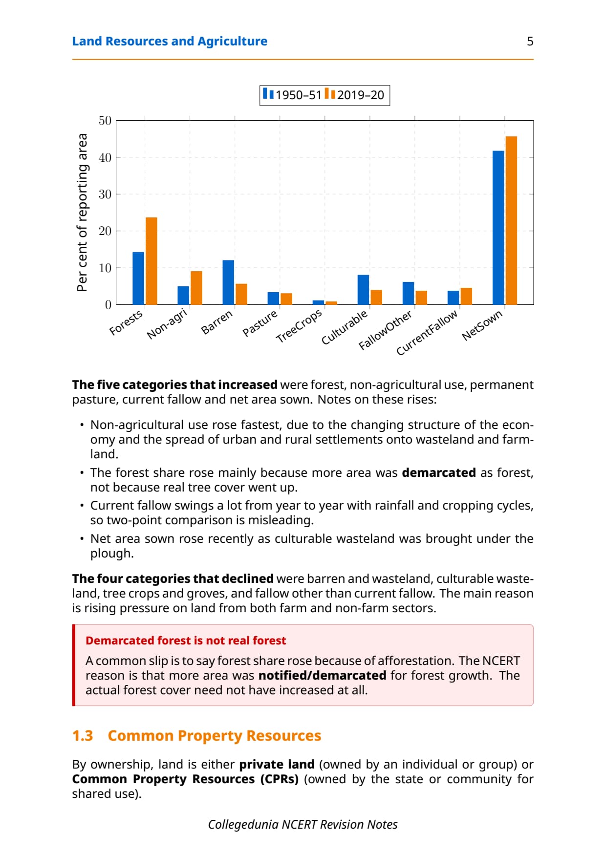
- Declining categories (1950-51 to 2019-20): barren wasteland, culturable wasteland, misc. tree crops and groves, fallow other than current fallow.
- Increasing categories: forests (notified area), non-agricultural uses (fastest growth), permanent pasture, current fallow and net area sown.
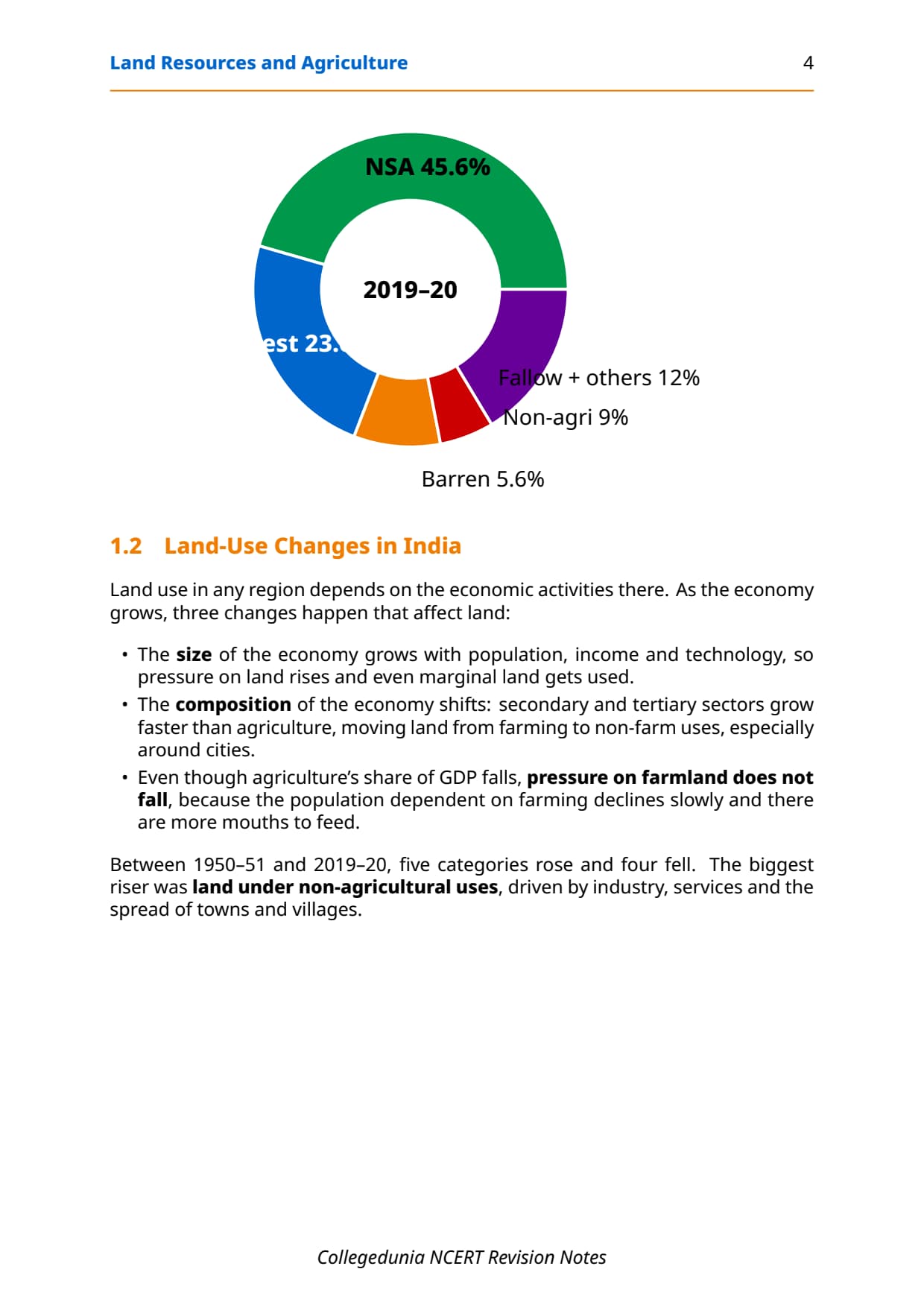
Land-Use Changes in India (1950-51 to 2019-20)
India's economy has shifted from primary to secondary and tertiary activities, and this drives land-use change. Non-agricultural use grows fastest as roads, factories and settlements expand at the cost of wasteland and farmland near cities. Forest area rises mainly because more land gets notified as forest, not because tree cover increases; CBSE tests this as a common-mistake MCQ. Farmland stays under pressure even as agriculture's GDP share falls.
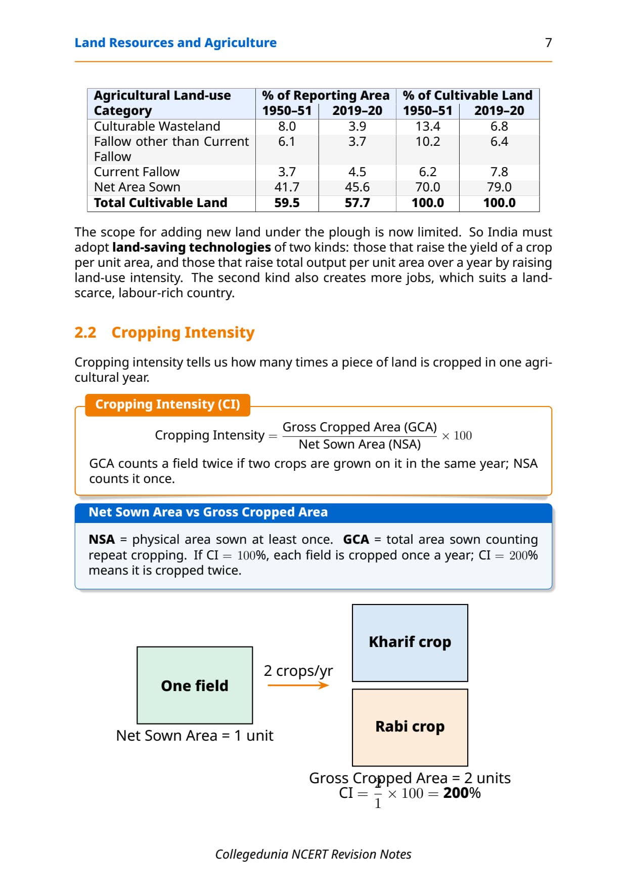
| Agricultural Land Category | % of Reporting Area 1950-51 | % of Reporting Area 2019-20 | Trend |
|---|---|---|---|
| Culturable Wasteland | 8.0% | 3.9% | Declining (brought under cultivation) |
| Fallow other than Current Fallow | 6.1% | 3.7% | Declining |
| Current Fallow | 3.7% | 4.5% | Slight increase (variable with rainfall) |
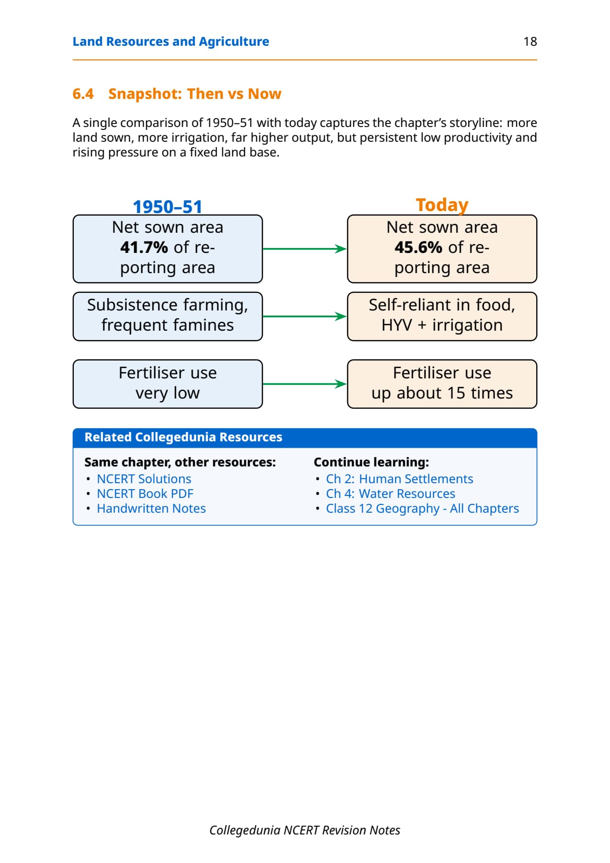
| Net Area Sown | 41.7% | 45.6% | Increasing (recent trend) |
| Total Cultivable Land | 59.5% | 57.7% | Marginal decline overall |
Key takeaway: The scope for adding more land under net sown area is limited. India needs land-saving technologies that raise yield per unit area or raise output through higher cropping intensity.
Cropping Seasons and Types of Farming in India
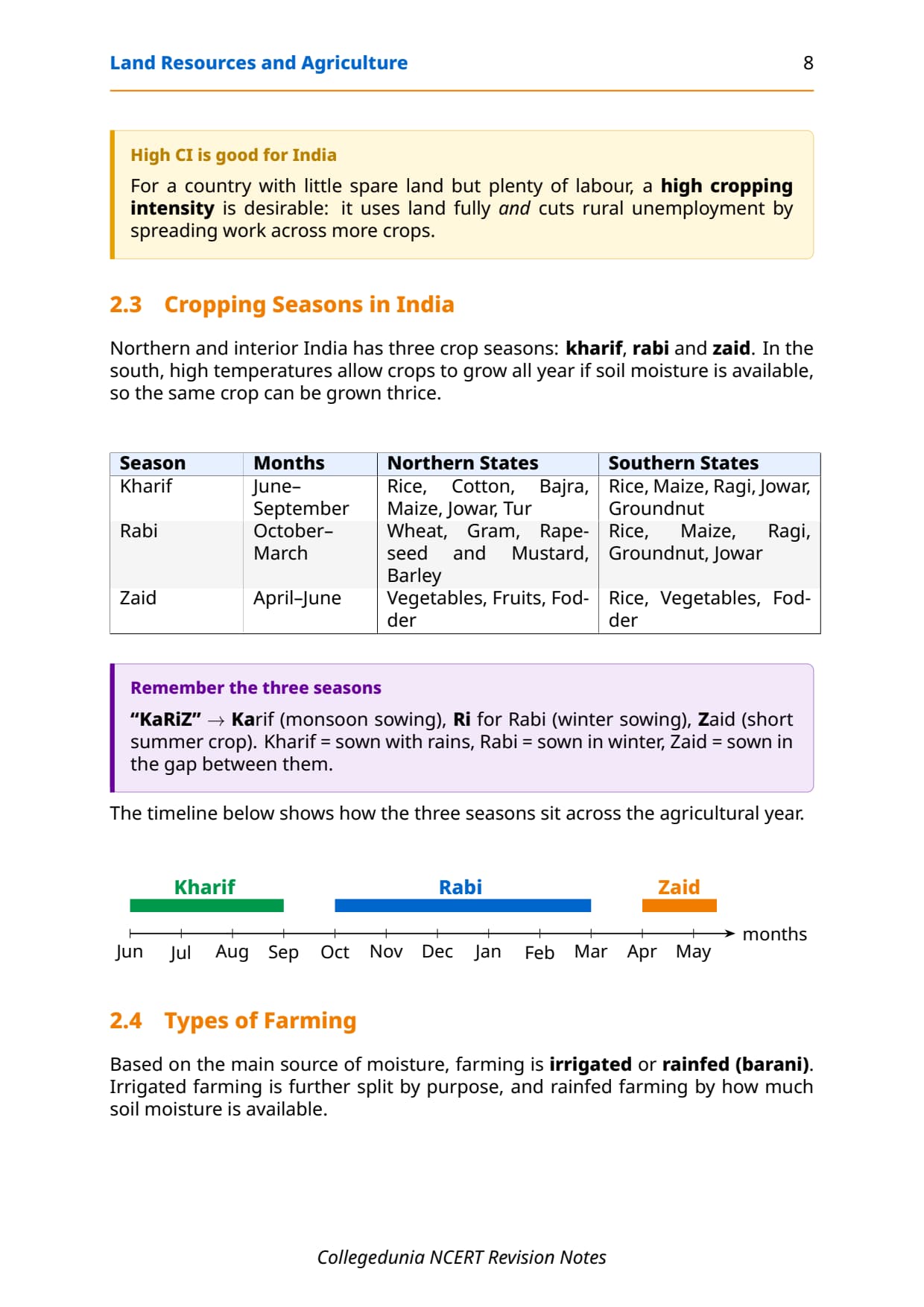
India has three cropping seasons in its northern and interior regions. Matching each crop to its season is the most-tested factual area of this chapter in CBSE MCQs. Southern India differs because high temperatures allow tropical crops year-round wherever soil moisture is available.
| Season | Months | Major Crops (Northern States) | Major Crops (Southern States) |
|---|---|---|---|
| Kharif | June-September | Rice, cotton, bajra, maize, jowar, tur | Rice, maize, ragi, jowar, groundnut |
| Rabi | October-March | Wheat, gram, rapeseed and mustard, barley | Rice, maize, ragi, groundnut, jowar |
| Zaid | April-June | Vegetables, fruits, fodder (on irrigated land) | Rice, vegetables, fodder |
Types of Farming by Moisture Source
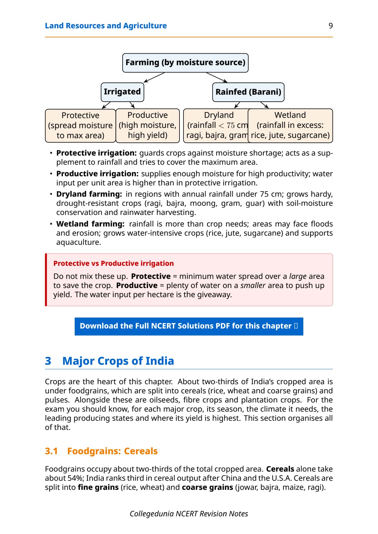
- Irrigated farming: assured water via canals, tube wells or tanks; productive irrigation (high input, high yield) or protective irrigation (supplementary water, wider coverage).
- Rainfed farming: dryland (rainfall below 75 cm/year; hardy crops like ragi, bajra, moong, gram) and wetland (rainfall exceeds crop need; water-intensive crops like rice, jute, sugarcane).
- Cropping Intensity: CI = (GCA / NSA) x 100; raising CI cuts rural unemployment and lifts output without expanding cultivated area.
Major Food Crops: Cereals and Pulses
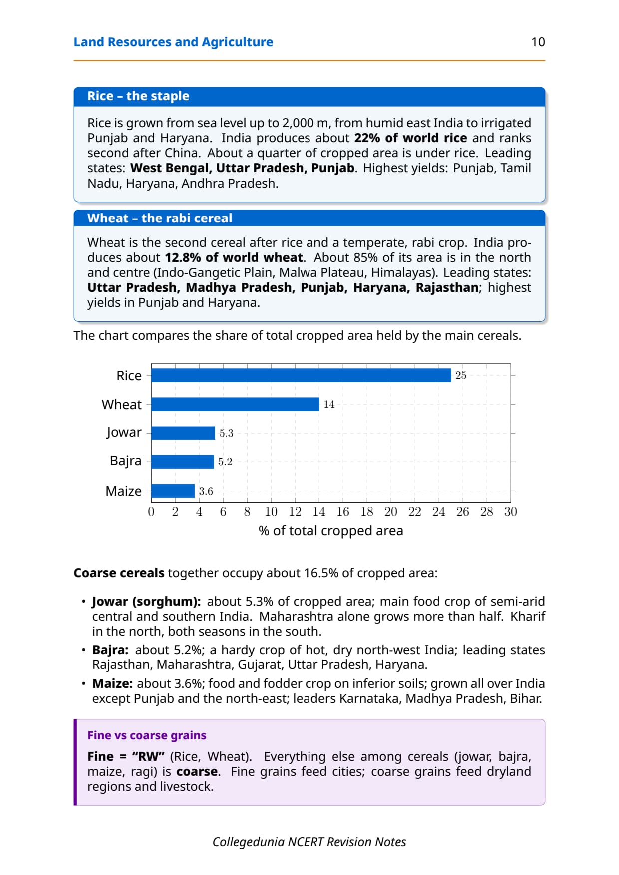
Foodgrains cover about two-thirds of India's cropped area. CBSE frequently asks students to match crops with their leading states and growing conditions, so the table below carries rice, wheat, the coarse cereals and pulses together.
| Crop | Season / Conditions | Leading Producer States | Key Fact |
|---|---|---|---|
| Rice | Tropical humid; grows up to 2,000 m altitude | West Bengal, Uttar Pradesh, Punjab | 2nd in world output (22.07%, 2018); about 1/4 of cropped area |
| Wheat | Rabi (winter); mostly irrigated | Uttar Pradesh, Madhya Pradesh, Punjab, Haryana, Rajasthan | ~12.8% of world output (2017); 85% of area in Indo-Gangetic Plain |
| Jowar | Kharif (north); kharif and rabi (south); semi-arid | Maharashtra (over half the output) | Leading coarse cereal by area |
| Bajra | Kharif; hot, dry, drought-resistant | Rajasthan, Maharashtra, Gujarat, Uttar Pradesh, Haryana | Grown on the poorest soils |
| Maize | Kharif; food and fodder, semi-arid | Karnataka, Madhya Pradesh, Bihar, Andhra Pradesh, Telangana | Grown on inferior soils |
| Pulses (gram, tur) | Rabi/kharif; drylands of the Deccan and north-west | Madhya Pradesh, Uttar Pradesh, Maharashtra, Rajasthan | ~11% of cropped area; fix nitrogen, improve soil fertility |
Commercial Crops: Oilseeds, Fibre Crops and Plantation Crops
Commercial crops supply raw material for industries and export earnings. CBSE asks at least one crop-state matching question on this section every year, so the two tables below carry the state-wise and season facts.
Oilseeds
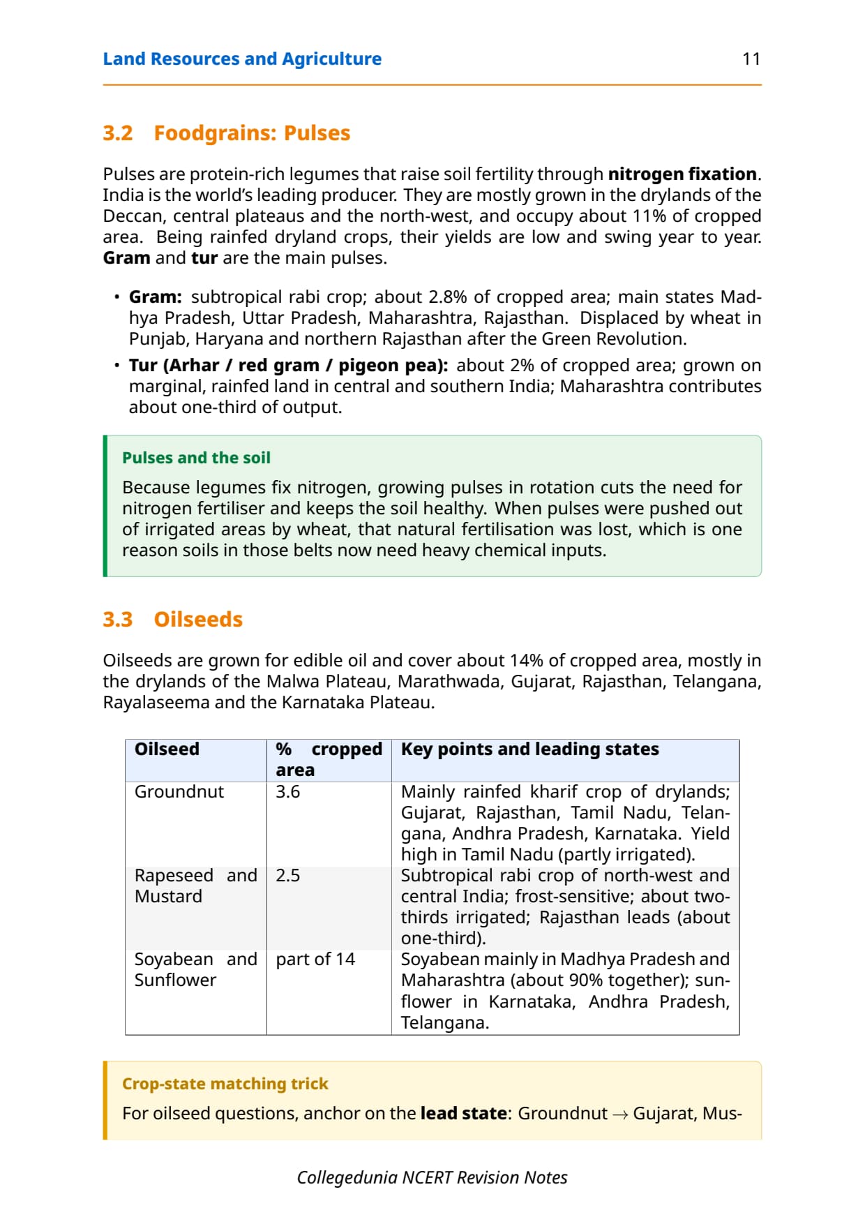
Oilseeds cover about 14% of cropped area, mainly in the drylands of the Malwa plateau, Marathwada, Gujarat, Rajasthan, Telangana, Rayalseema and the Karnataka plateau.
| Oilseed Crop | Season | Leading Producer States | World Rank / Share |
|---|---|---|---|
| Groundnut | Kharif (mostly); rabi in south India | Gujarat, Rajasthan, Tamil Nadu, Telangana, Andhra Pradesh, Karnataka, Maharashtra | 18.8% of world output (2018) |
| Rapeseed and Mustard | Rabi | Rajasthan (one-third), Haryana, Madhya Pradesh | About two-thirds of area irrigated |
| Soyabean | Kharif | Madhya Pradesh and Maharashtra (together 90%) | Growing importance |
| Sunflower | Kharif (mostly) | Karnataka, Andhra Pradesh, Telangana, Maharashtra | Minor in north; higher yield under irrigation |
Fibre and Plantation Crops
| Crop | Type | Season | Leading Producer States | Key Fact |
|---|---|---|---|---|
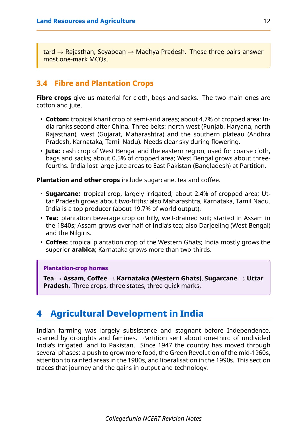
| Cotton | Fibre | Kharif; semi-arid | Gujarat, Maharashtra, Telangana | 2nd in world output after China; 4.7% of cropped area |
| Jute | Fibre | Kharif | West Bengal (~3/4 of output), Bihar, Assam | ~60% of world jute output; 0.5% of cropped area |
| Sugarcane | Plantation | Tropical, year-round | Uttar Pradesh (2/5 of output), Maharashtra, Karnataka, Tamil Nadu | 2nd in world output after Brazil (19.7%, 2018) |
| Tea | Plantation | Perennial; humid sub-tropics | Assam (53.2% of area), West Bengal (Darjeeling), Tamil Nadu (Nilgiris) | 21.22% of world output; 2nd largest exporter after China |
| Coffee | Plantation | Perennial; Western Ghats highlands | Karnataka (over 2/3 of output), Kerala, Tamil Nadu | 3.17% of world output, ranked 8th globally (2018) |
Agricultural Development and the Green Revolution
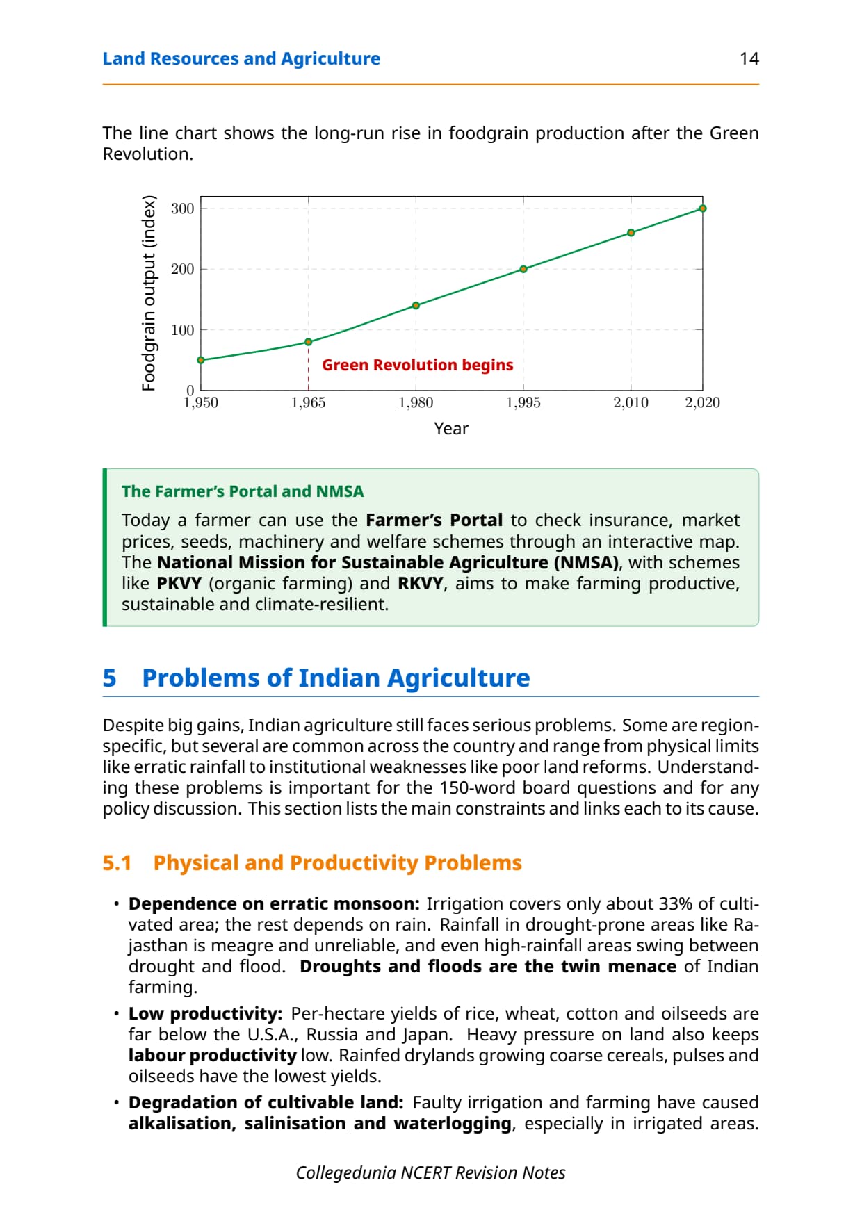
Indian agriculture was subsistence-based before Independence, and Partition transferred about a third of undivided India's irrigated land to Pakistan. Output stagnated through the late 1950s until two droughts in the mid-1960s forced India to import foodgrains. Relief came with HYV wheat (Mexico) and rice (Philippines), paired with chemical fertilisers and assured irrigation, first in Punjab, Haryana, western Uttar Pradesh, Andhra Pradesh and Gujarat: the Green Revolution.
- Key pre-condition: assured irrigation, since HYV seeds deliver high yield only with reliable soil moisture.
- Outcomes: rapid rise in foodgrain output, self-reliance, and growth of agro-input and agro-processing industries.
- Limitation: gains stayed concentrated in irrigated regions; rainfed Madhya Pradesh, Chhattisgarh and Odisha saw little change.
Memory hook: Green Revolution = HYV seeds (Mexico/Philippines) + chemical fertilisers + irrigation. CBSE wants all three, not just "new seeds".
Problems in Indian Agriculture
Despite the Green Revolution, Indian agriculture faces structural and environmental challenges that CBSE and CUET test in 5-mark descriptive questions. The table below covers the six problems NCERT identifies.
| Problem | Why it happens |
|---|---|
| Erratic monsoon | Only about 33% of cultivated area is irrigated; the rest depends on an unreliable south-west monsoon, causing droughts and floods. |
| Low productivity | Per-hectare output of rice, wheat, cotton and oilseeds trails the USA, Russia and Japan; population pressure keeps labour productivity low. |
| Indebtedness | Modern inputs are expensive; small and marginal farmers rely on credit, and crop failure traps them in a cycle of debt. |
| Weak land reforms | Zamindari was an exploitative pre-Independence system; post-Independence reforms were poorly enforced against landlord lobbies. |
| Fragmented holdings | Average landholding keeps shrinking and splitting across generations, making farms uneconomical to work. |
| Land degradation | Faulty irrigation causes waterlogging, alkalisation and salinisation; excess pesticides and soil erosion damage cultivable land. |
Other Resources for Class 12 Geography Chapter 3 Land Resources and Agriculture
Pair these notes with the matching NCERT Solutions, handwritten notes and the official NCERT book chapter for Class 12 Geography Chapter 3.
| Resource | What it covers | Open |
|---|---|---|
| Notes | Concept-first revision notes covering land-use categories, cropping seasons, major crops, Green Revolution and agricultural problems. | You are here |
| NCERT Solutions | Step-by-step answers to all exercise questions including the five 30-word questions and two 150-word questions with full detail. | Class 12 Geography Chapter 3 NCERT Solutions |
| Handwritten Notes | Topper's handwritten revision pages for last-minute board exam practice. | Class 12 Geography Chapter 3 Handwritten Notes |
| NCERT Book PDF | Official NCERT India: People and Economy Chapter 3 textbook in PDF form. | Class 12 Geography Chapter 3 NCERT Book PDF |
| Subject Hub | All chapters of Class 12 Geography with every resource in one place. | Class 12 Geography Subject Hub |
All Chapters Notes for Class 12 Geography India: People and Economy
Related Links: Use the table below to navigate to the Notes for the other chapters of Class 12 Geography India: People and Economy.
| Chapter | Topic | Notes link |
|---|---|---|
| Chapter 1 | Population: Distribution, Density, Growth and Composition | Class 12 Geography Chapter 1 IPE Notes |
| Chapter 2 | Human Settlements | Class 12 Geography Chapter 2 IPE Notes |
| Chapter 3 | Land Resources and Agriculture | You are here |
| Chapter 4 | Water Resources | Class 12 Geography Chapter 4 IPE Notes |
| Chapter 5 | Mineral and Energy Resources | Class 12 Geography Chapter 5 IPE Notes |
| Chapter 6 | Planning and Sustainable Development in Indian Context | Class 12 Geography Chapter 6 IPE Notes |
| Chapter 7 | Transport and Communication | Class 12 Geography Chapter 7 IPE Notes |
| Chapter 8 | International Trade | Class 12 Geography Chapter 8 IPE Notes |
| Chapter 9 | Geographical Perspective on Selected Issues and Problems | Class 12 Geography Chapter 9 IPE Notes |
NCERT Notes Class 12 Geography Chapter 3 Land Resources and Agriculture FAQs
Ques. What are the land resources and agriculture class 12 notes meant to be used for?
Ans. The land resources and agriculture class 12 notes are a concept-first revision file that compress the entire NCERT Chapter 3 of Class 12 India: People and Economy into a printable study guide. They include all nine land-use categories, the land-use change data from 1950-51 to 2019-20, cropping seasons, major food and commercial crops, the Green Revolution and the six major problems of Indian agriculture. Students typically use these notes for a 30-minute first-pass revision and a 20-minute night-before pass; the worked answers to the NCERT exercise questions live in the matching NCERT Solutions PDF, not in this Notes file.
Ques. What are the nine land-use categories in class 12 Geography?
Ans. The nine land-use categories maintained in India's Land Revenue Records are: (1) Forests, (2) Barren and Wastelands, (3) Land under Non-agricultural Uses, (4) Permanent Pastures and Grazing Lands, (5) Miscellaneous Tree Crops and Groves, (6) Culturable Wasteland, (7) Current Fallow, (8) Fallow other than Current Fallow, and (9) Net Area Sown. All nine categories together add up to the reporting area. The most important distinction for CBSE exams is between culturable wasteland (left uncultivated for more than 5 years) and current fallow (left uncultivated for one year or less).
Ques. What is the formula for Cropping Intensity in Class 12 Geography?
Ans. Cropping Intensity (CI) is calculated as: CI (%) = (Gross Cropped Area / Net Sown Area) x 100. When the same piece of land is cropped more than once in an agricultural year, the Gross Cropped Area is larger than the Net Sown Area, and CI exceeds 100%. A CI of 150% means the average plot of land grows 1.5 crops per year. India encourages high cropping intensity because it increases output and employment without bringing additional land under cultivation, which is important given that the scope for expanding net sown area is now limited.
Ques. What were the causes and effects of the Green Revolution in India?
Ans. The Green Revolution was triggered by two consecutive droughts in the mid-1960s that caused a food crisis and forced India to import foodgrains. The government adopted a package technology comprising High Yielding Variety (HYV) seeds for wheat (developed in Mexico) and rice (developed in Philippines), along with chemical fertilisers and assured irrigation. The key pre-condition was irrigated land. Effects included a rapid rise in foodgrain output, achievement of food self-reliance, growth of agro-processing industries and small-scale industries supplying agricultural inputs. The main limitation was that benefits were concentrated in irrigated areas of Punjab, Haryana and western Uttar Pradesh, leaving rainfed regions of Madhya Pradesh, Chhattisgarh and Odisha behind.
Ques. What is the difference between current fallow and culturable wasteland in Geography class 12?
Ans. Current fallow is cultivable land left without cultivation for one agricultural year or less; the farmer deliberately gives the land a rest to recover its natural fertility, and the land returns to cultivation the next season. Culturable wasteland is land left uncultivated for more than five years; it has deteriorated but can still be brought under cultivation through reclamation practices such as land levelling, soil treatment or water management. If land is left uncultivated for more than one year but less than five years, it is called fallow other than current fallow. The time limit (1 year, 1-5 years, more than 5 years) is the key distinction CBSE tests.
Ques. Which states are the leading producers of rice, wheat and cotton in India?
Ans. The leading rice-producing states are West Bengal, Uttar Pradesh and Punjab. The leading wheat-producing states are Uttar Pradesh, Madhya Pradesh, Punjab, Haryana and Rajasthan. For cotton, the leading producers are Gujarat, Maharashtra and Telangana, with three growing zones: northwest (Punjab, Haryana, north Rajasthan), west (Gujarat, Maharashtra) and south plateau (Andhra Pradesh, Karnataka, Tamil Nadu). These state-wise facts appear regularly in CBSE map-based questions and MCQs on crop distribution, and students should link each crop to its season, soil type and irrigation requirement for full marks.
Ques. What are the main problems of Indian agriculture according to class 12 Geography?
Ans. The NCERT chapter identifies six main problems of Indian agriculture: (1) dependence on erratic monsoon, since only 33% of cultivated area is irrigated; (2) low productivity compared to international benchmarks for rice, wheat, cotton and oilseeds; (3) financial constraints and indebtedness of small and marginal farmers who cannot afford expensive modern inputs; (4) lack of effective land reforms, resulting in continued unequal land distribution; (5) small farm size and fragmentation of landholdings under population pressure, making farming uneconomical; and (6) degradation of cultivable land through waterlogging, alkalisation, salinisation and excessive use of chemicals in irrigated areas, and soil erosion by water and wind in rainfed areas.
Ques. What is the difference between dryland and wetland farming in class 12 Geography?
Ans. Dryland farming is rainfed farming in regions with annual rainfall less than 75 cm. Farmers grow hardy drought-resistant crops such as ragi, bajra, moong, gram and guar, and practise soil moisture conservation and rainwater harvesting. These regions face moisture deficit. Wetland farming is rainfed farming in regions where rainfall exceeds the soil moisture requirement of crops during the rainy season. Farmers grow water-intensive crops like rice, jute and sugarcane, and may practise aquaculture in freshwater bodies. These regions face flood and soil erosion hazards rather than drought. The 75 cm annual rainfall figure is the key boundary students should remember for CBSE MCQs.
Ques. Is the Class 12 Geography Chapter 3 syllabus changing in 2026-27?
Ans. No major reductions in 2026-27. The India: People and Economy textbook chapter structure is unchanged for the current cycle, and the CBSE marking scheme continues to reward well-organised answers with clear cause-effect linkages for the longer descriptive questions. These land resources and agriculture class 12 notes for the 2026-27 cycle are aligned to the unchanged textbook and the latest CBSE sample paper released for the 2026 boards. Students should use these notes for both short-answer (30-word) and long-answer (150-word) revision.



Comments