




The Class 9 Social Science Handwritten Notes Chapter 2 Shaping of the Earth's Surface are a topper's own neat revision of this chapter from the new Understanding Society textbook. Every idea, from the Earth's layers and plate tectonics to weathering, erosion, agents of gradation, and landform disasters, is written by hand with each key rule boxed in the margin.
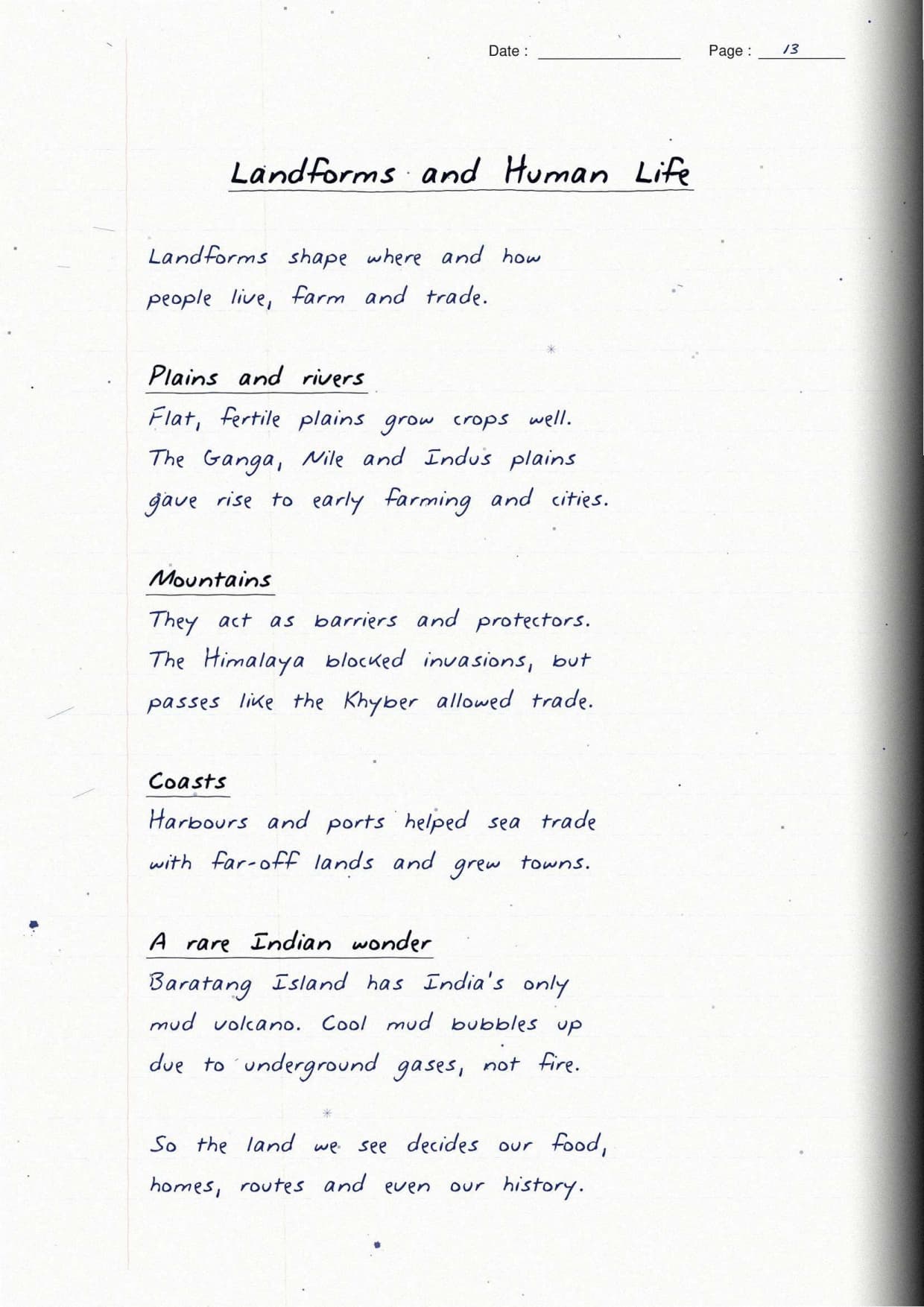
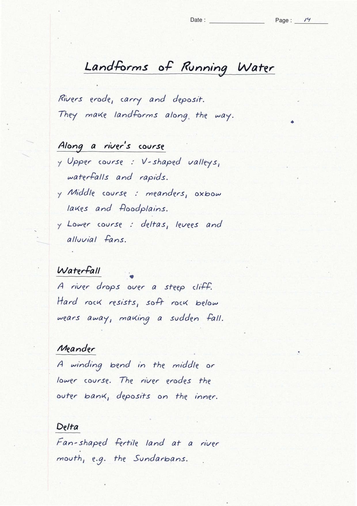
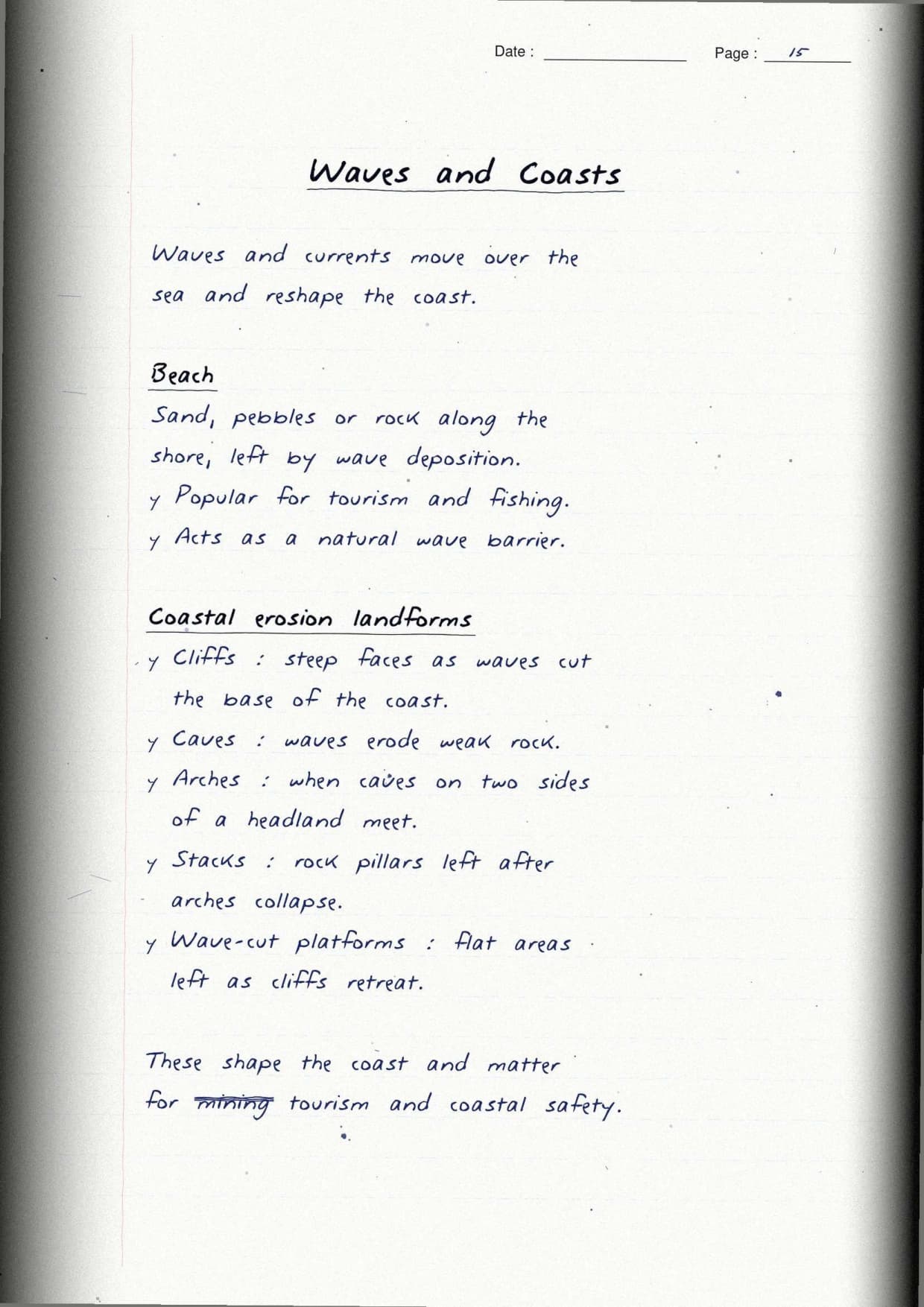
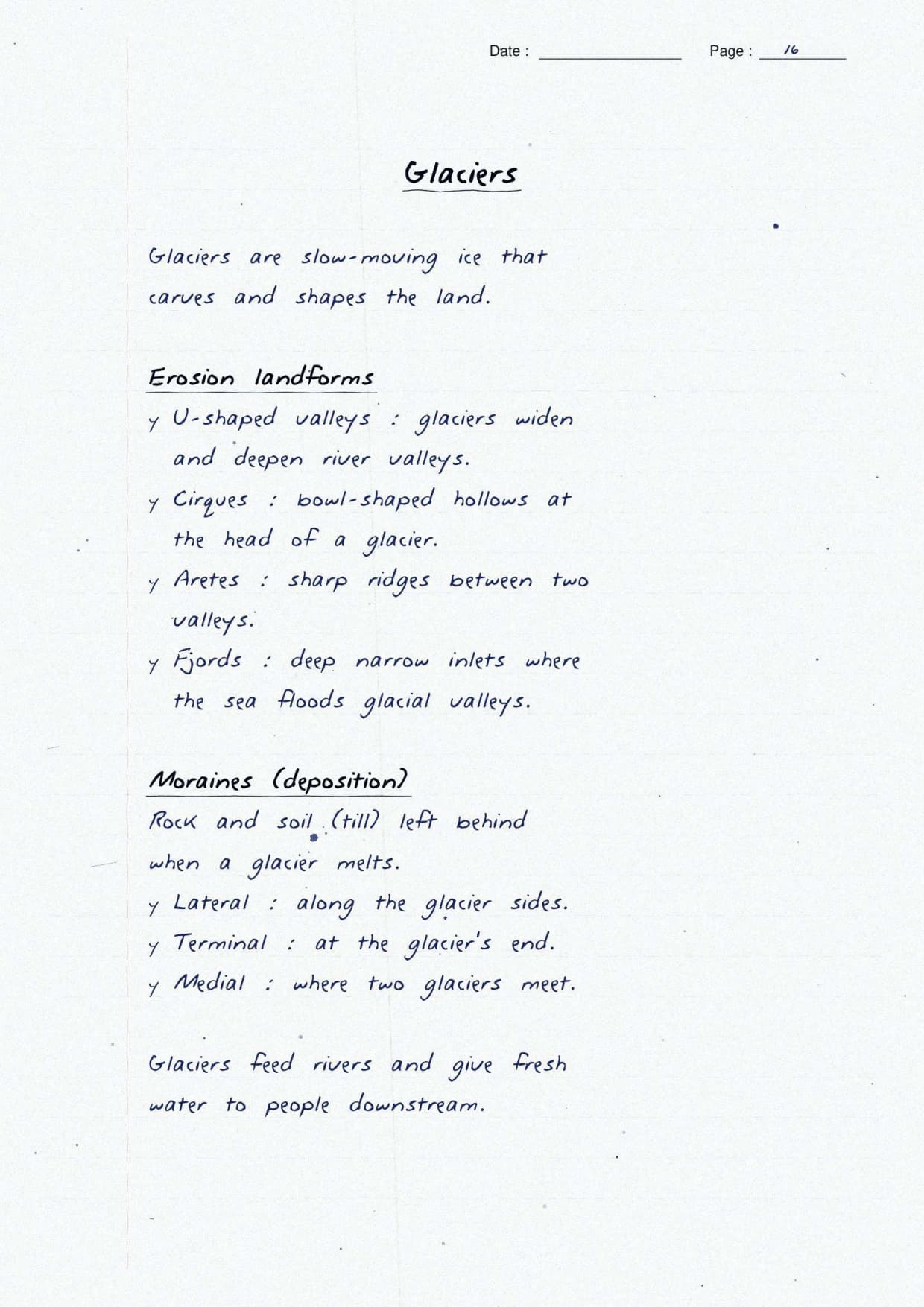
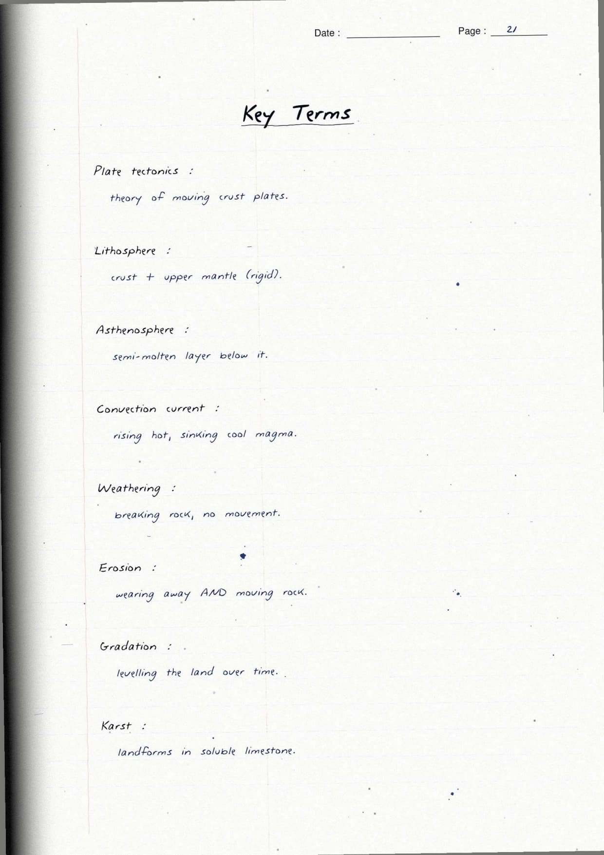
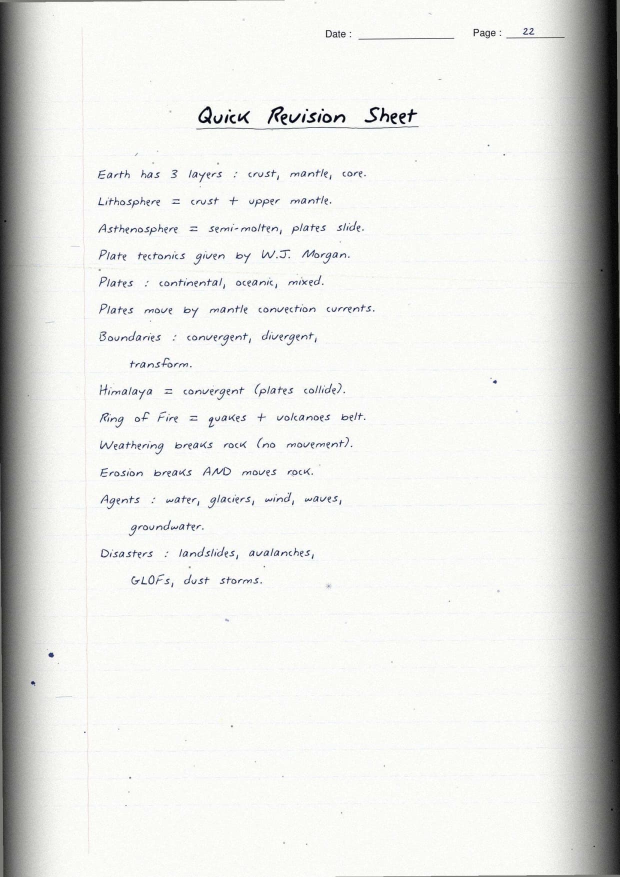
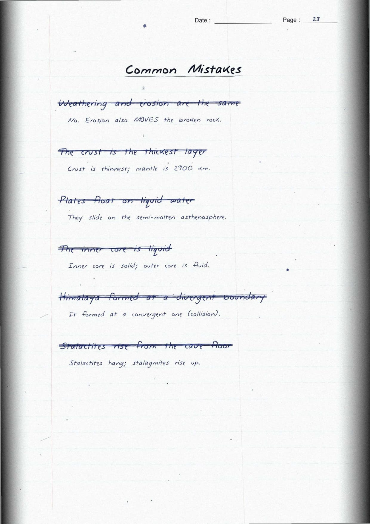
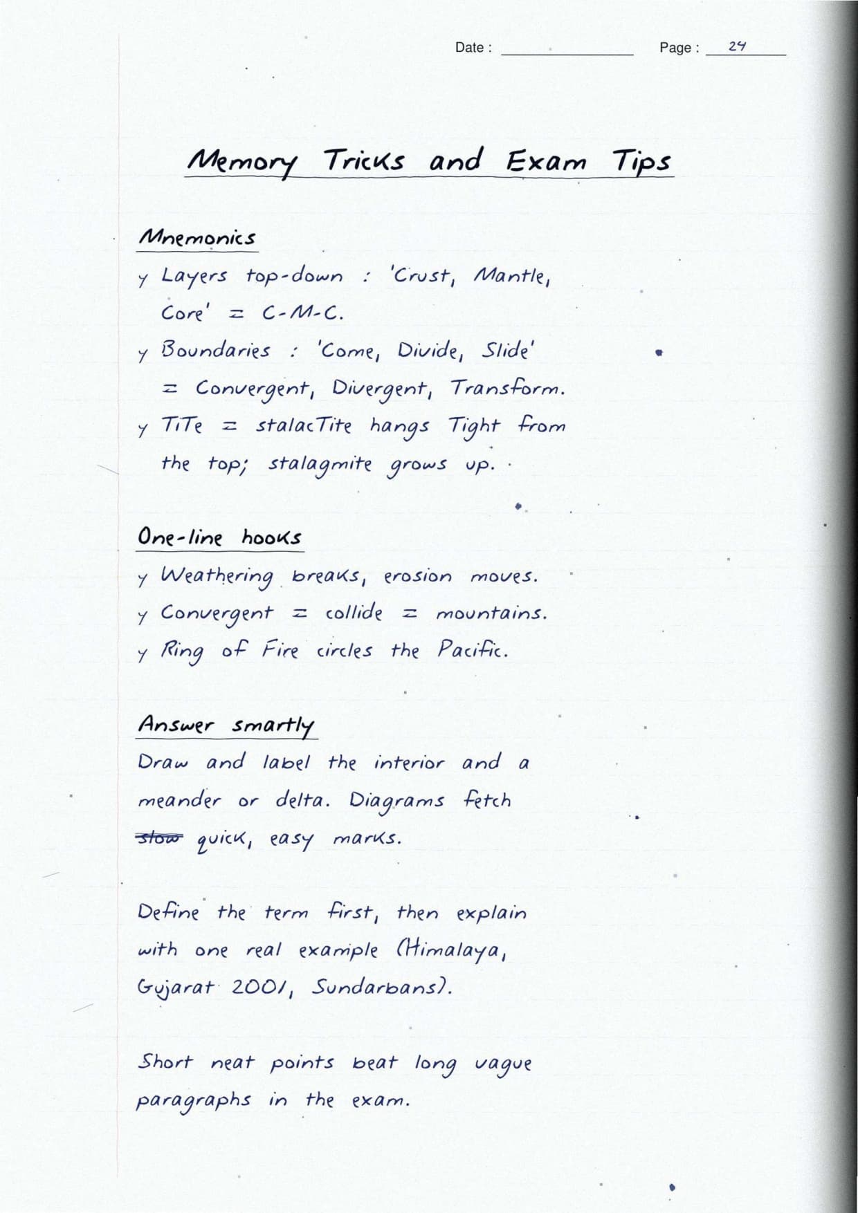
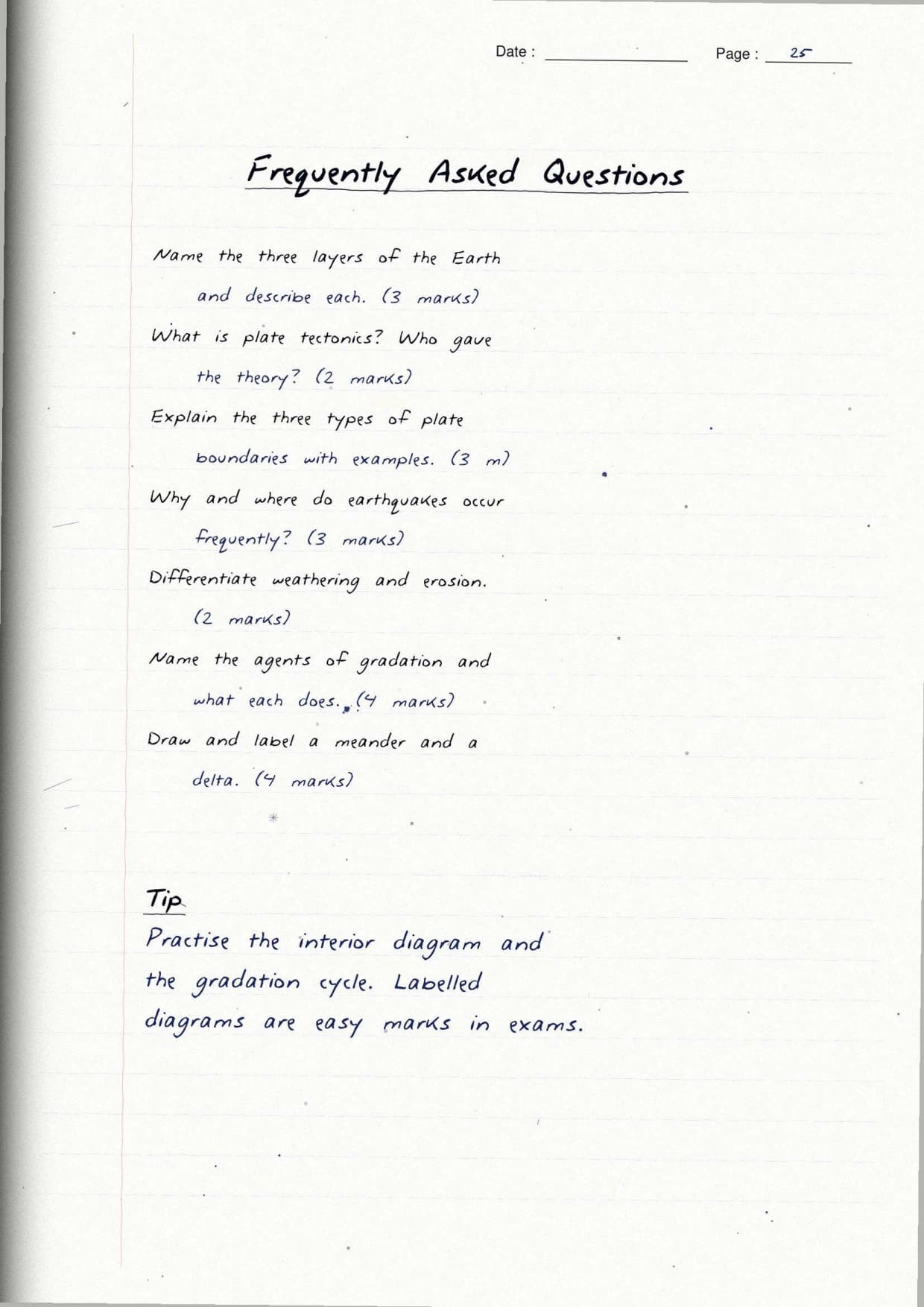
- What you get: the Earth's three layers, plate tectonics, weathering and erosion, five agents of gradation, and landform disasters, all in clear handwriting.
- Colour-coded: new sub-topics in red, each key term and rule in a hand-drawn box, and Indian examples in blue.
- Why by hand: writing each labelled diagram and term by hand helps you recall the whole chapter fast in the exam.
Student Feedback
In a Collegedunia study of 1,180 Class 9 students, 78% said hand-written pages of plate boundaries and the agents of gradation were easier to recall than typed notes. About 4 out of 5 rated the boxed key terms as the most useful part before a test.
Why Use Handwritten Notes for Class 9 Social Science Chapter 2 Shaping of the Earth's Surface
This chapter mixes short definitions with a big theory, diagrams, and examples, so a clean hand-written page saves time. The Class 9 Social Science Handwritten Notes Chapter 2 Shaping of the Earth's Surface keep one idea per line, with a small labelled sketch beside it.
- Each key term, like lithosphere or gradation, sits in its own hand-drawn box.
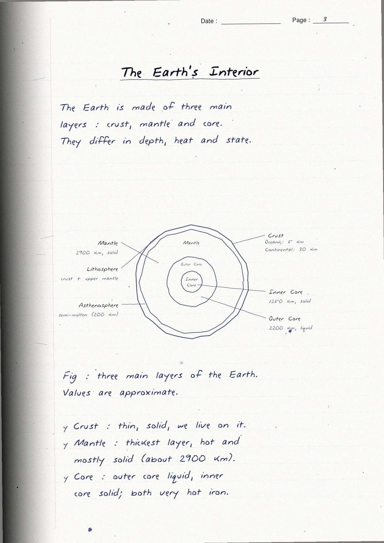
- A labelled diagram of the Earth's layers or a plate boundary sits next to the idea it explains.
- Red sub-headings split the chapter into short, easy parts.
What Is Inside the Shaping of the Earth's Surface Handwritten Notes PDF
The Class 9 Social Science Handwritten Notes Chapter 2 Shaping of the Earth's Surface run to 22 pages. They move from the Earth's three layers to plate tectonics, then weathering and erosion, the five agents of gradation, and landform disasters. The colour code below explains every mark.
- Red: new sub-topic headings, such as Convergent Boundary, Delta, or Karst Topography.
- Boxes: each key term and rule, like weathering versus erosion, drawn by hand.
- Blue: Indian examples, such as the Himalaya, the Sundarbans delta, and the 2001 Gujarat earthquake.
Earth's Layers and Plate Tectonics in the Shaping of the Earth's Surface Notes
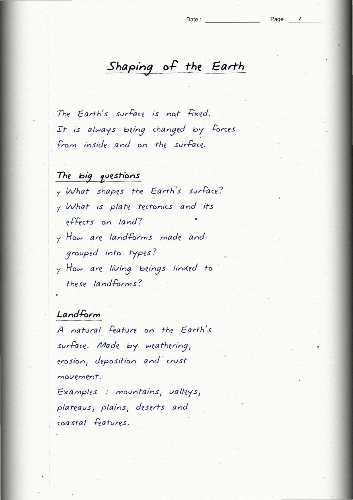
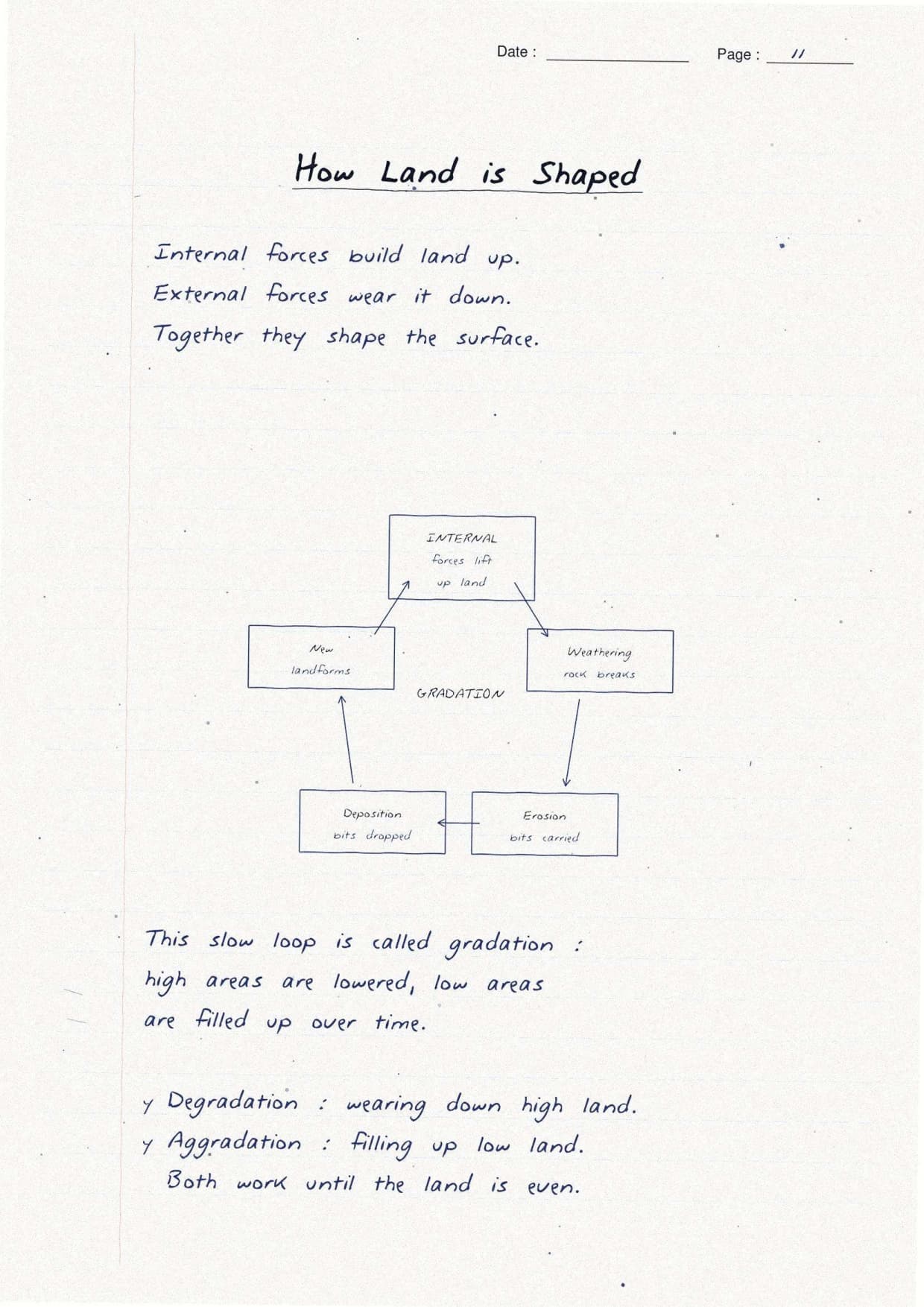
The notes open with the forces that reshape the land. Internal forces come from heat inside the Earth and build land, while external forces wear the surface down. Each point is boxed.
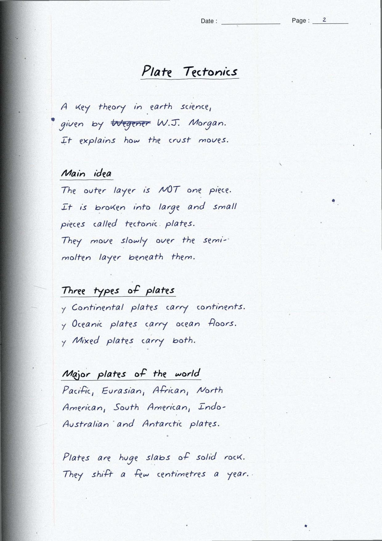
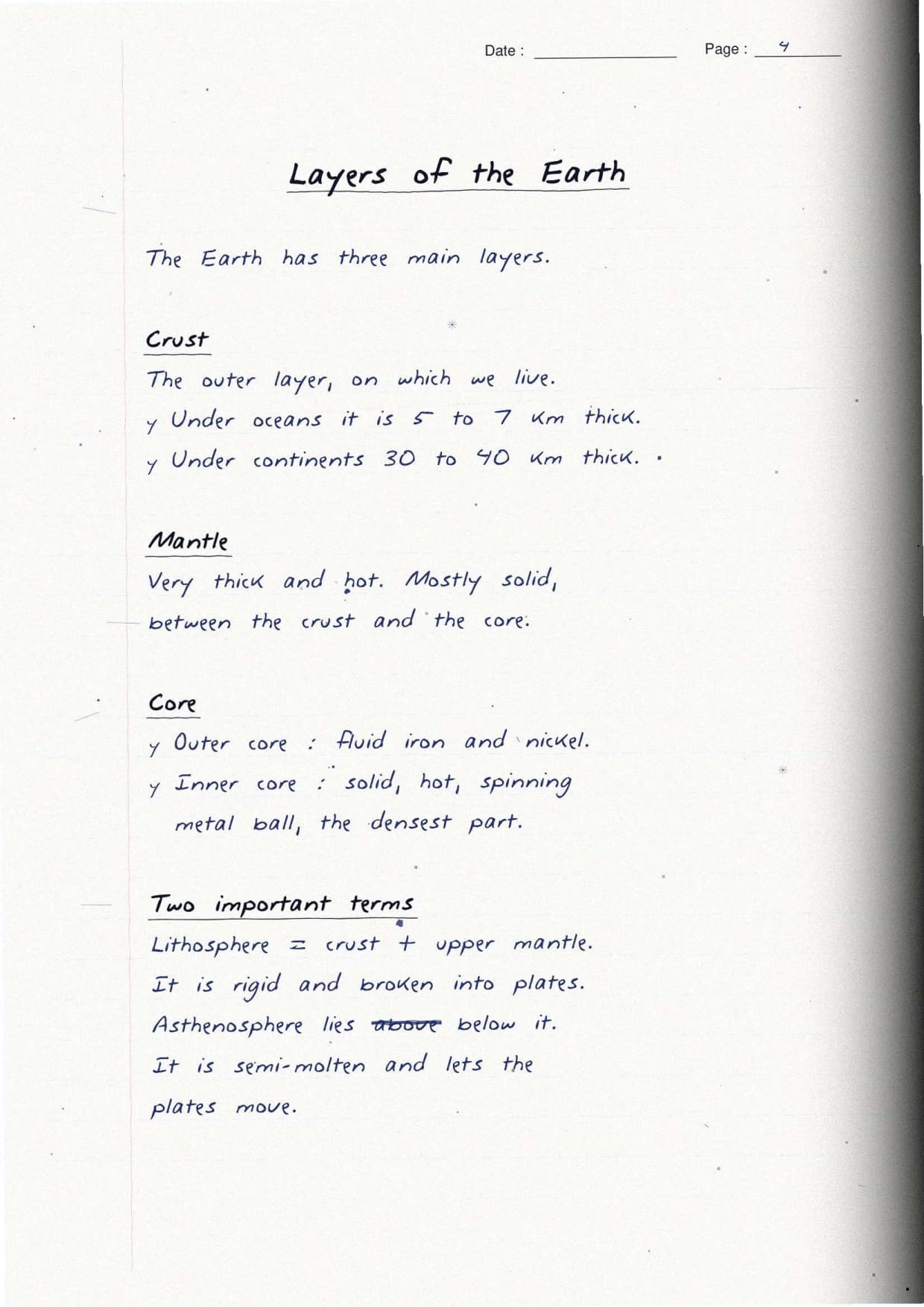
- Three layers: the thin crust where we live, the thick hot mantle, and the iron-nickel core. The crust plus the upper mantle form the rigid lithosphere.
- Plate tectonics: given by W.J. Morgan, this theory says the lithosphere is broken into slow-moving plates that ride on the asthenosphere.
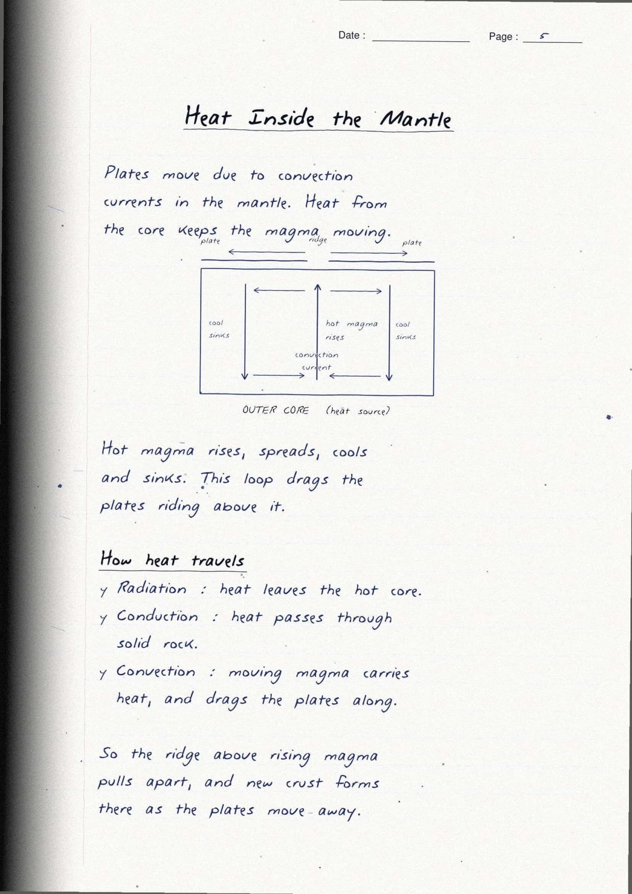
- Why plates move: convection currents in the mantle rise when hot and sink when cool, dragging the plates along.
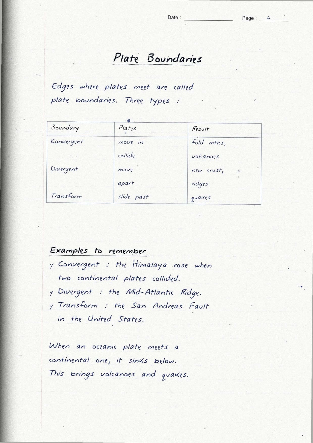
The three plate boundaries are the heart of this topic, so each gets a boxed line with an arrow diagram. Getting the arrows right is the fastest way to name a boundary.
| Boundary | Plate motion | Result |
|---|---|---|
| Convergent | Move towards each other | Fold mountains like the Himalaya, volcanoes, earthquakes |
| Divergent | Move away from each other | New crust, mid-ocean ridges like the Mid-Atlantic Ridge |
| Transform | Slide past each other | Earthquakes, as along the San Andreas Fault |
India's example is flagged in blue: the Indo-Australian plate pushes north into the Eurasian plate. Both carry continents, so neither sinks, and the crust buckles up to raise the Himalaya. This keeps northern India more earthquake-prone than the peninsular plateau.
Weathering and Erosion Compared by Hand in the Notes
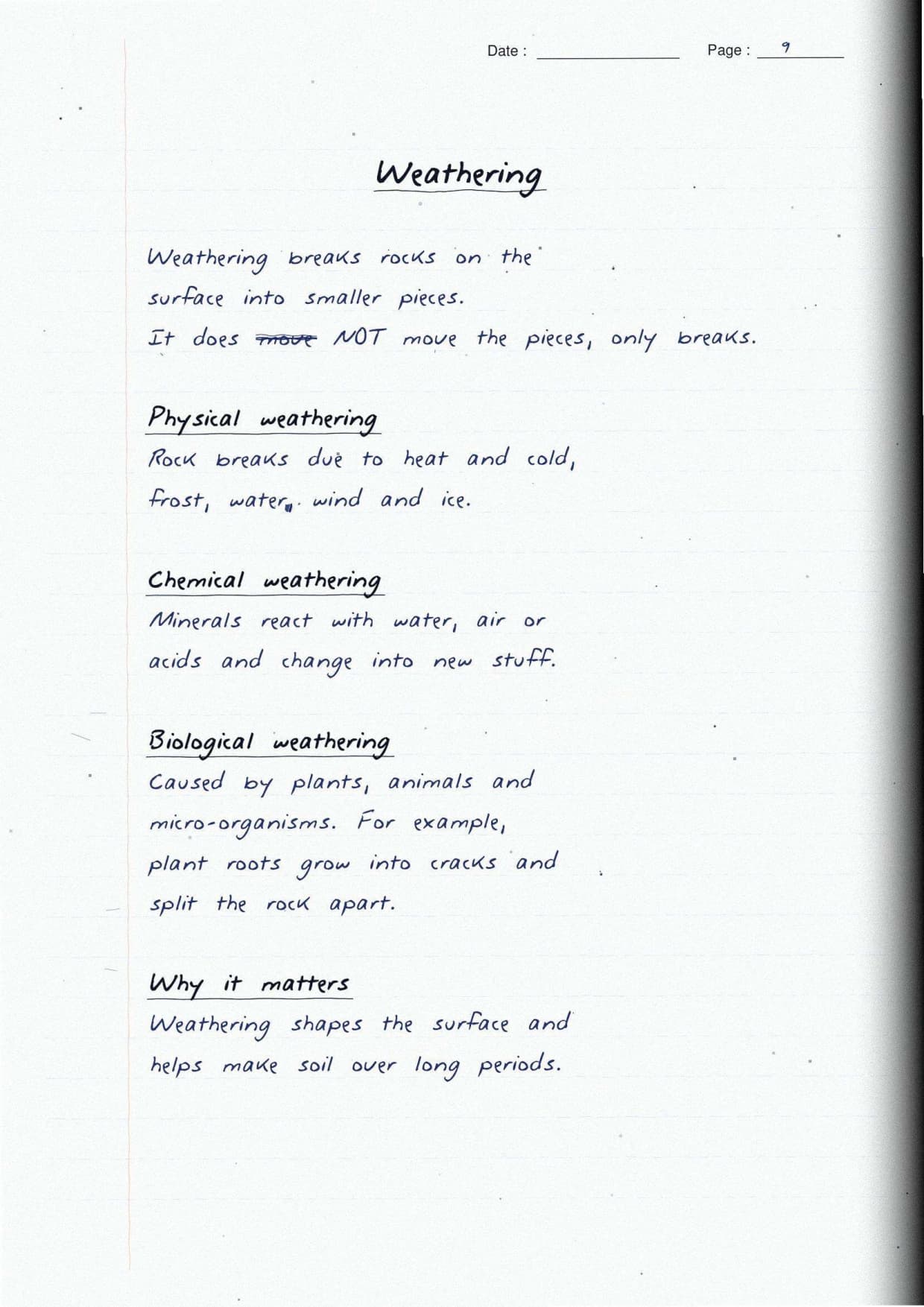
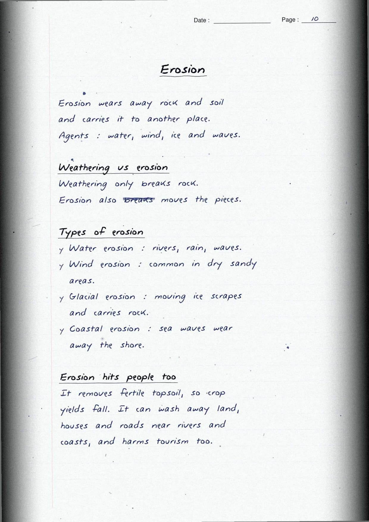
Weathering and erosion are the main external processes, so the notes set them side by side. Weathering only breaks rocks in place, while erosion moves the broken material away.
| Feature | Weathering | Erosion |
|---|---|---|
| Action | Breaks rocks into pieces | Wears away and carries material |
| Movement | No movement of material | Material is moved away |
| Agents | Temperature, water, air, roots | Water, wind, ice, waves |
| Result | Smaller pieces, soil forms | New landforms shaped elsewhere |
The notes box the three types of weathering: physical (heat, frost, wind), chemical (water, air, acids), and biological (plants, animals). A margin mnemonic, "Please Cook Biryani," fixes the order. Indian methods like contour bunding and Nagaland's Zabo system are noted in blue.
Agents of Gradation and Their Landforms in the Shaping of the Earth's Surface Notes
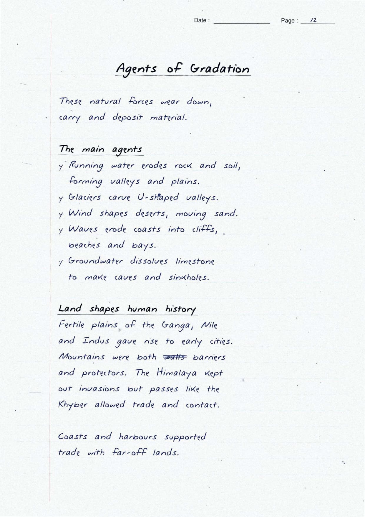
Gradation is the levelling of the surface as land is worn down in one place and built up elsewhere. The notes draw the five agents around a hub and pair each with its landforms. Every agent both erodes and deposits, so the same force cuts a valley and builds a plain.
| Agent | Main landforms |
|---|---|
| Running water | V-shaped valleys, waterfalls, meanders, floodplains, deltas |
| Glaciers | U-shaped valleys, cirques, aretes, fjords, moraines |
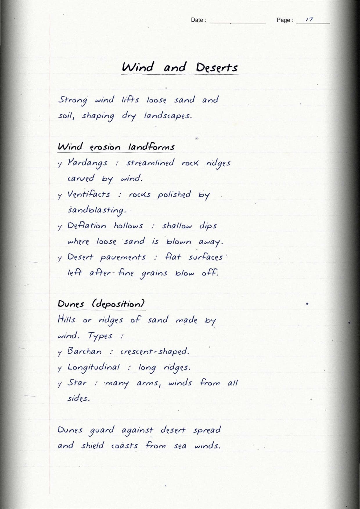
| Wind | Yardangs, ventifacts, deflation hollows, dunes |
| Waves and currents | Beaches, sea cliffs, caves, arches, stacks |
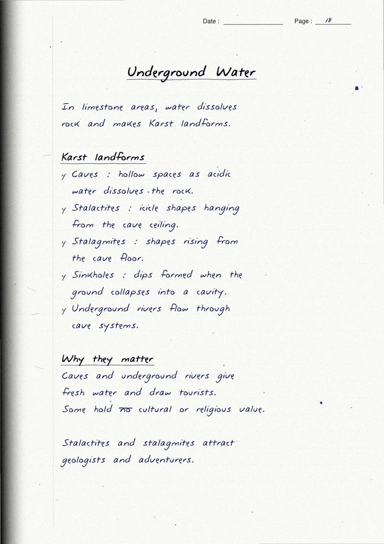
| Underground water | Caves, stalactites, stalagmites, sinkholes (karst topography) |
Running water gets the most space as the most tested agent. The notes draw a labelled river with its three courses: V-shaped valleys and waterfalls upstream, meanders and floodplains in the middle, and a delta at the mouth. The Sundarbans is India's example.
Earthquakes, Volcanoes, and Landform Disasters Flagged in Red
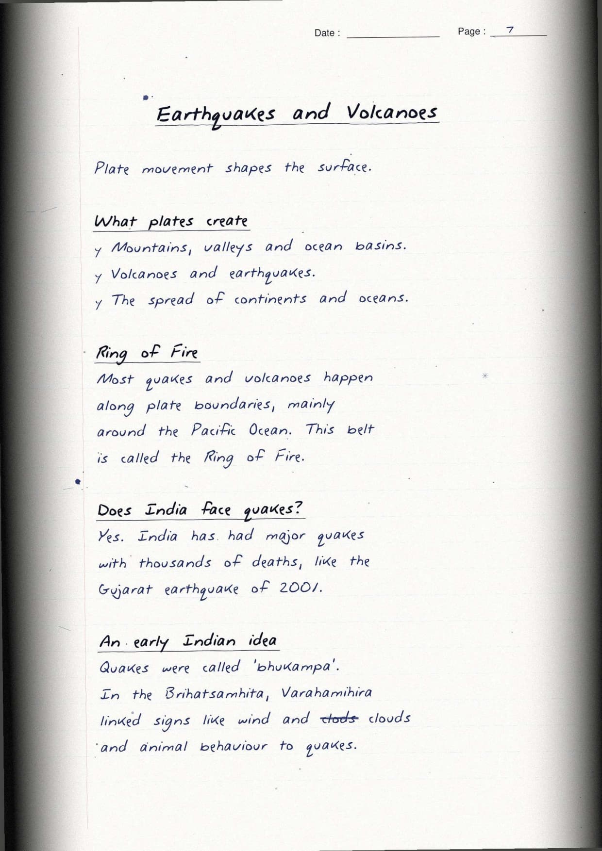
Internal forces also cause sudden events, so the last part covers earthquakes, volcanoes, and landform disasters. Most quakes and volcanoes line up along plate boundaries, especially the Ring of Fire. The four disasters are boxed with their causes.
| Disaster | Main causes | Mitigation steps |
|---|---|---|
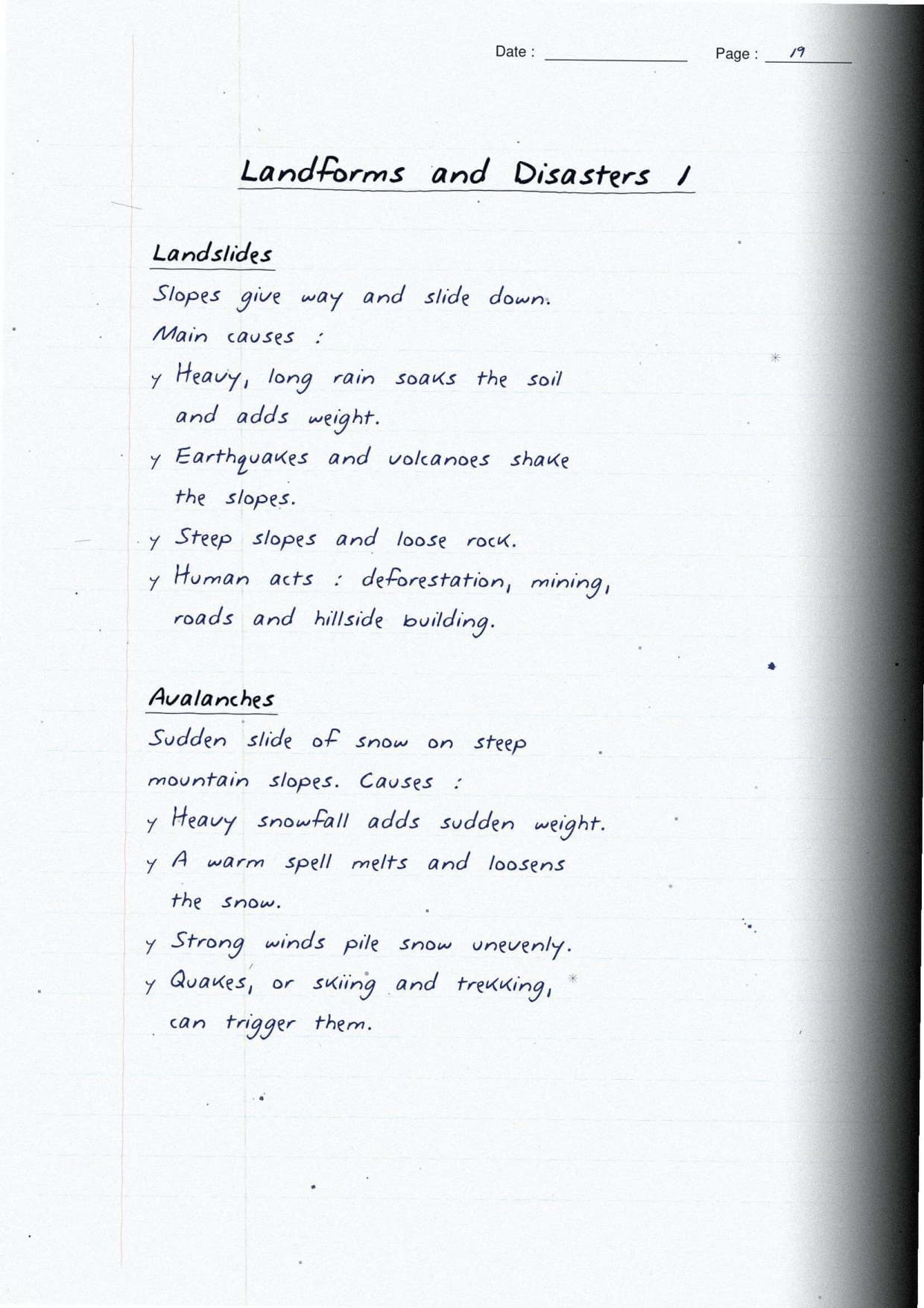
| Landslide | Heavy rain, steep slopes, deforestation, hillside building | Slope drainage, planting trees, retaining walls |
| Avalanche | Heavy snowfall, warming, vibration on steep slopes | Snow barriers, warning systems, safe routes |
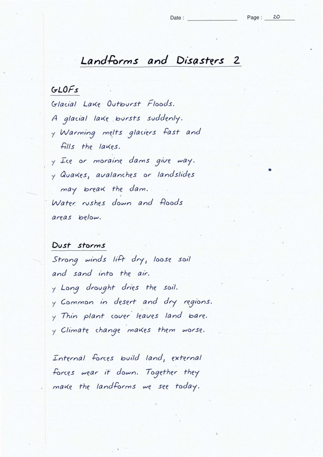
| GLOF | Melting glaciers, weak ice or moraine dams | Monitor glacial lakes, controlled draining, early warning |
| Dust storm | Dry loose soil, sparse plant cover, strong winds | Shelter belts, ground cover, better farming |
Indian examples are marked in blue: the 2001 Gujarat earthquake, the 2021 Chamoli flood, and India's only mud volcano at Baratang. A margin mnemonic, "Causes, Consequences, Control," shows how to structure any disaster answer.
Last-Minute Revision with These Handwritten Notes
The night before your exam, the Class 9 Social Science Handwritten Notes Chapter 2 Shaping of the Earth's Surface work as a quick skim. Every boxed term and red heading is a checkpoint, so you cover the chapter fast.
- Name the three layers of the Earth and define the lithosphere.
- State plate tectonics in one line and explain why plates move.
- Describe the three plate boundaries with one example each.
- Tell weathering from erosion and list the five agents of gradation.
- Name four landform disasters with their causes.
More Shaping of the Earth's Surface Class 9 Social Science Resources
Open the other resources for this chapter of the new Understanding Society book. Also Check: pair these notes with the full solutions for complete practice.
| Resource | Open |
|---|---|
| Handwritten Notes | Shaping of the Earth's Surface Class 9 Social Science Handwritten Notes |
| NCERT Solutions | Shaping of the Earth's Surface Class 9 Social Science NCERT Solutions |
| Revision Notes | Shaping of the Earth's Surface Class 9 Social Science Notes |
| NCERT Book PDF | Shaping of the Earth's Surface Class 9 Social Science NCERT Book PDF |
NCERT Handwritten Notes for Class 9 Social Science: All Chapters
Use the table below to open the handwritten notes for any other chapter of the new Understanding Society book.
| Chapter | Handwritten Notes |
|---|---|
| Chapter 1 | Understanding Social Science |
| Chapter 2 | Shaping of the Earth's Surface |
| Chapter 3 | Atmosphere and Climate |
| Chapter 4 | Early Humans and Beginning of Civilisation |
| Chapter 5 | State and Society up to 1000 CE |
| Chapter 6 | Democracy |
| Chapter 7 | Elections |
| Chapter 8 | Building Blocks in Economics: The Problem of Choice |
| Chapter 9 | The Price Puzzle: What Drives the Market |
Shaping of the Earth's Surface Class 9 Social Science Handwritten Notes FAQs
Ques. How many pages are the Shaping of the Earth's Surface Class 9 Social Science handwritten notes?
Ans. The handwritten notes run to 22 pages. They cover the full chapter, from the Earth's layers and plate tectonics to weathering, erosion, the five agents of gradation, and landform disasters, with a labelled diagram beside each idea.
Ques. Are these real handwritten notes?
Ans. Yes. They are a topper's own clear handwritten revision notes, with each key term boxed, labelled sketches of the Earth's layers and plate boundaries drawn by hand, and sub-headings colour-coded in red.
Ques. What is the difference between weathering and erosion in the notes?
Ans. The notes box this clearly. Weathering only breaks rocks in place and does not move them. Erosion wears away and carries the broken material to another place by water, wind, ice, or waves.
Ques. Is Shaping of the Earth's Surface part of the new Class 9 Social Science book?
Ans. Yes. It is Chapter 2 of the new integrated Understanding Society textbook for the 2026-27 syllabus, and it covers physical geography, from plate tectonics to landforms and their disasters.



Comments