




The NCERT Class 6 Social Science Chapter 2 Oceans and Continents PDF carries the complete printed chapter from Exploring Society: India and Beyond, exactly as NCERT prints it for the 2026-27 session. It brings together every map, picture spread, activity box and definition that the school test actually asks from this chapter, from the five oceans to the seven continents. Nothing is shortened or reworded.
- 14-page official file: Chapter 2 runs from printed page 27 to printed page 40 of the Class 6 textbook.
- Covers oceans, continents, hemispheres, marine life, cyclones, tsunamis, islands and the ocean's role in climate.
- Carries 4 numbered figures, 3 LET'S EXPLORE boxes, 6 DON'T MISS OUT boxes and 4 numbered questions at the end.
This is the unedited NCERT chapter file for the 2026-27 print run, checked page by page against the official Exploring Society: India and Beyond release before it was put on this page.
Student Feedback
What 12,480 students told us about the Oceans and Continents chapter, in a Collegedunia poll taken during the 2026-27 session.
- 61% of students said the continent count table was the part they had to read twice.
- Most-skipped part: the relative-size diagram on printed page 36, left out by about 4 in 10 students.
- Students reported that naming the five oceans on a blank world map fixed the chapter faster than re-reading it.
Source: 2026-27 Class 6 Social Science student poll. Sample of 12,480 students from CBSE schools across 19 states.
What the Oceans and Continents Class 6 PDF Contains, Page by Page
The file is the full chapter as NCERT prints it, not a summary sheet. It opens with a Jules Verne quote from 1870 and two Big Questions, and closes with the crossword on printed page 40. Use the table below to jump straight to the part you need.
| Section in the PDF | Printed pages | What is on these pages |
|---|---|---|
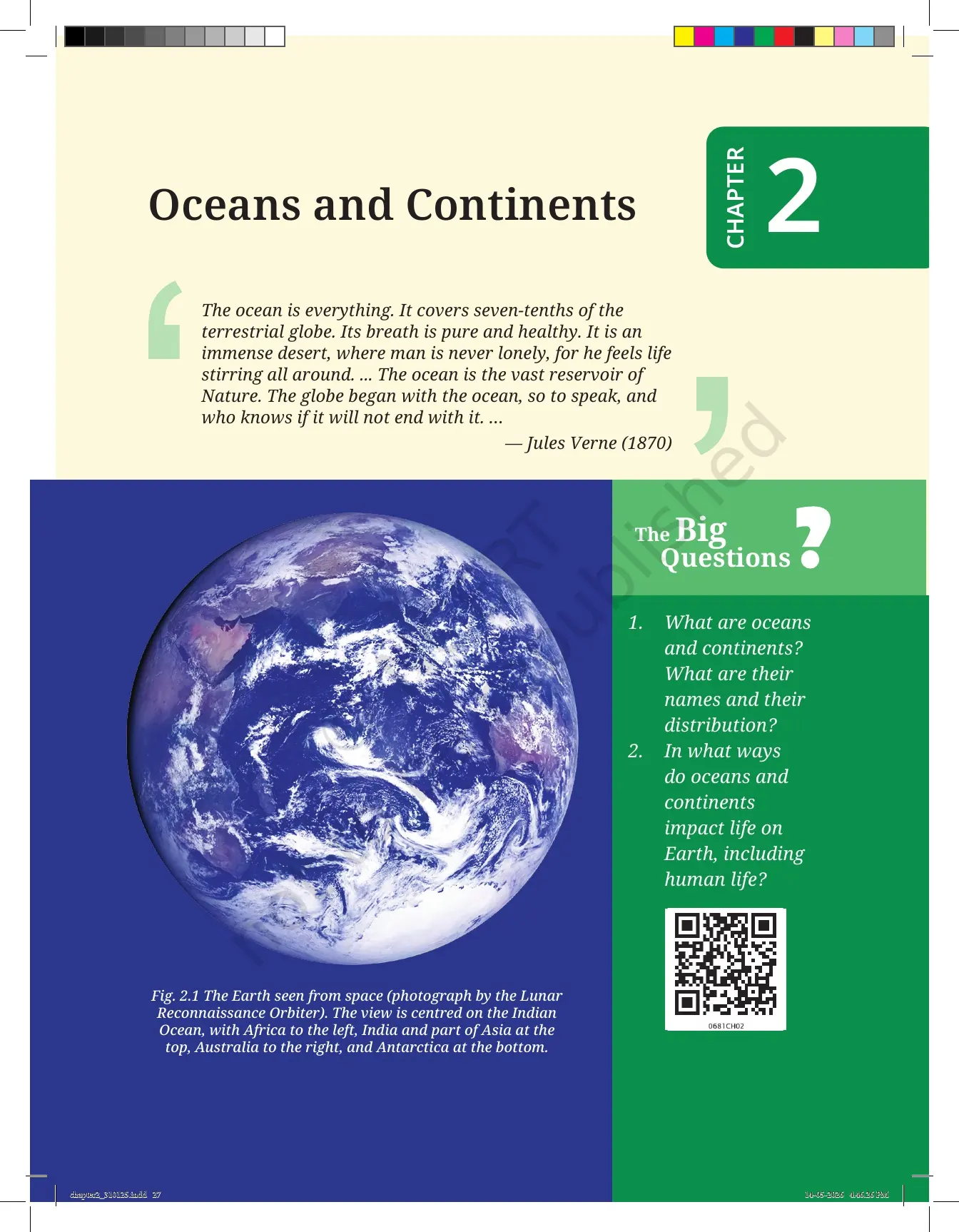
| Chapter opener | 27 | The Jules Verne quote of 1870, the two Big Questions, and Fig. 2.1, the Earth photographed from space by the Lunar Reconnaissance Orbiter |
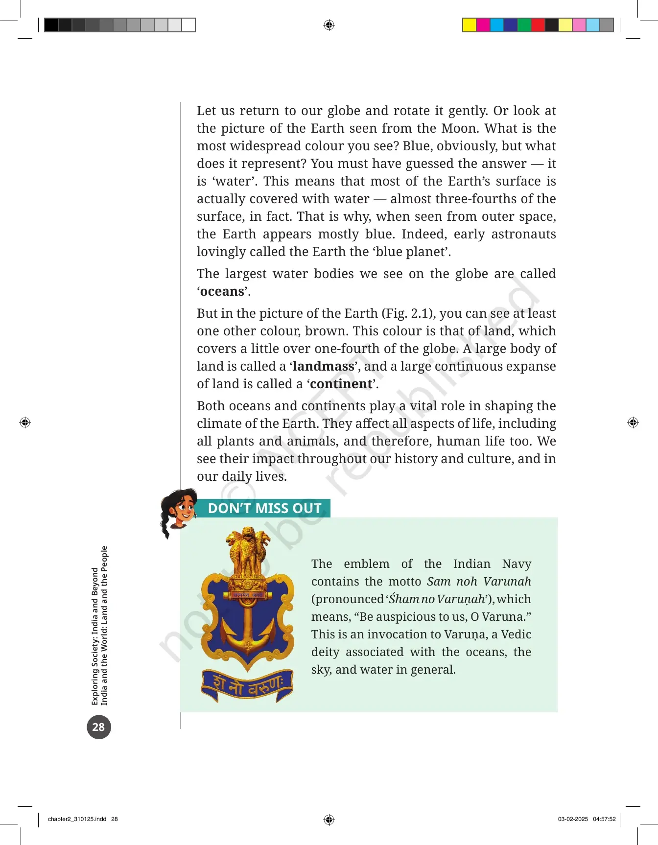
| The blue planet pages | 28 | Why almost three-fourths of the surface is water, what a landmass and a continent are, and the Indian Navy emblem box |
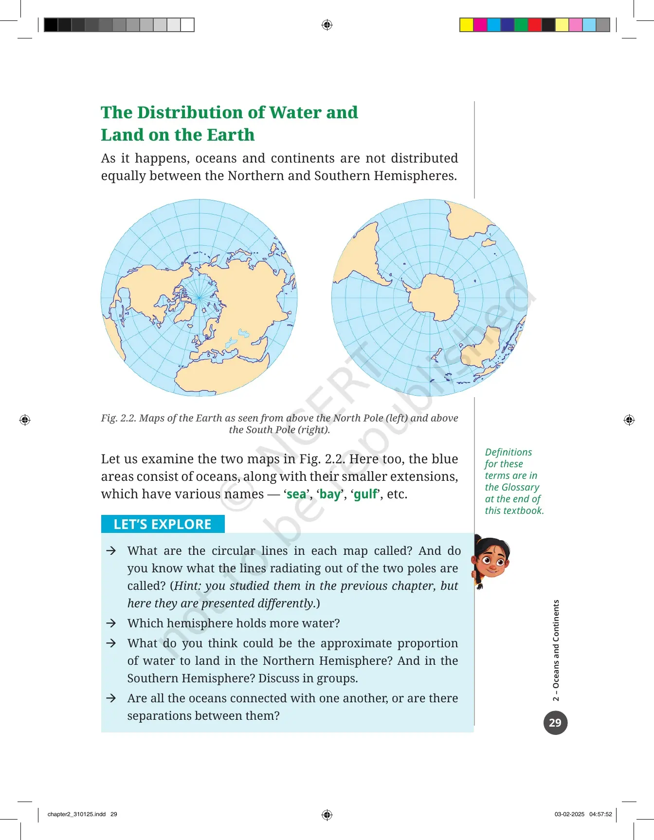
| The Distribution of Water and Land on the Earth | 29 | Fig. 2.2, the Earth seen from above the North Pole and above the South Pole, plus the first LET'S EXPLORE box |
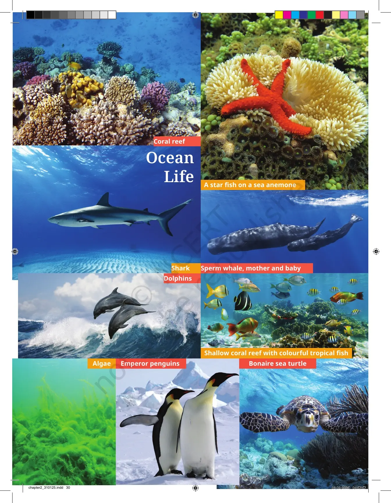
| Ocean Life picture spread | 30 | Photographs of a coral reef, a starfish on a sea anemone, a shark, dolphins, a sperm whale with her baby, algae, emperor penguins and a sea turtle |
| Salt water and freshwater | 31 | Why seawater cannot be drunk, where freshwater is stored, and the THINK ABOUT IT box on water scarcity |
| Oceans | 31 to 32 | The five oceans, Fig. 2.3 world map, the marine, flora and fauna notes in the margin, the hemisphere table and the size ranking |
| Oceans and disasters | 33 to 34 | Fig. 2.4, the map of India with the Arabian Sea and the Bay of Bengal, monsoon clouds, cyclones, tsunamis and the 2004 tsunami box |
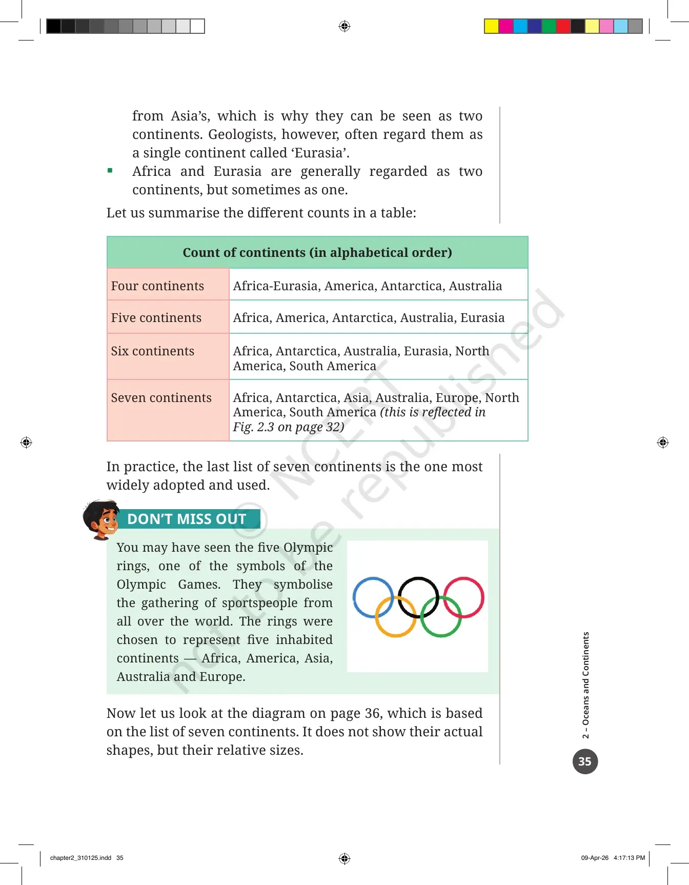
| Continents | 34 to 36 | Why the count runs from four to seven, the count table, the Olympic rings box and the relative-size diagram of the seven continents |
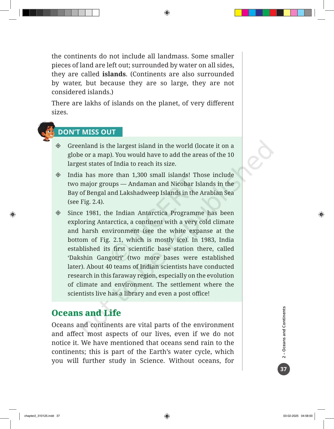
| Islands | 36 to 37 | What makes a piece of land an island, Greenland, India's island groups and the Indian Antarctica Programme |
| Oceans and Life | 37 to 38 | The water cycle link, the planet's lungs, trade, migration and fishing, World Oceans Day and ocean pollution |
| Before we move on ... | 38 | A three-point recap of the whole chapter in the textbook's own words |
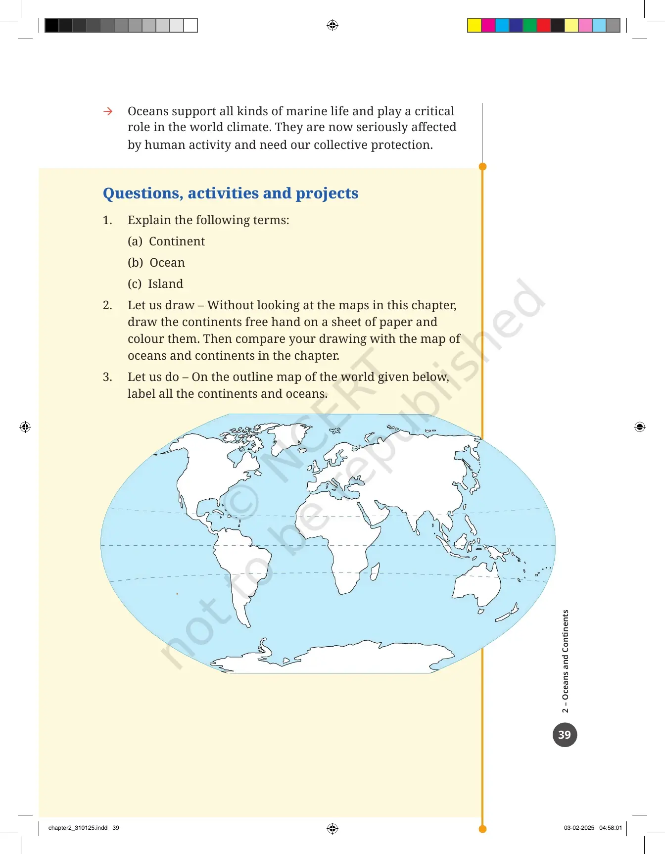
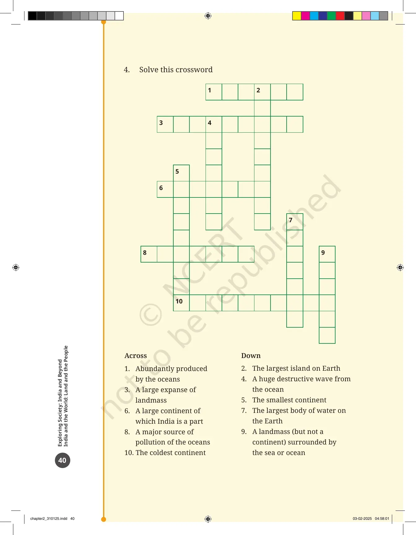
| Questions, activities and projects | 39 to 40 | 4 numbered items, including the freehand continent drawing, the outline map labelling task and a crossword |
Also Check:
Why the Earth Is Called the Blue Planet: Water and Land Across the Two Hemispheres
Rotate a globe slowly, or look at Fig. 2.1 in the PDF. The colour you see most is blue, and blue stands for water. Almost three-fourths of the Earth's surface is covered with water, and land takes up a little over one-fourth. That is why early astronauts called the Earth the blue planet.
- The largest water bodies on the globe are called oceans. Their smaller extensions carry names such as sea, bay and gulf.
- A large body of land is a landmass. A large continuous stretch of land is a continent.
- Water and land are not shared equally between the Northern and the Southern Hemispheres.
- The Northern Hemisphere holds more land, so the Southern Hemisphere holds more water.
Fig. 2.2 shows this in an unusual way. Instead of the flat world map you are used to, it gives two circular maps: the Earth seen from above the North Pole, and the Earth seen from above the South Pole. The circular lines on those maps are parallels of latitude, and the lines spreading out from each pole are meridians of longitude, the same grid you met in the first chapter.
The LET'S EXPLORE box on printed page 29 asks you to name those lines, decide which hemisphere holds more water, guess the water-to-land proportion in each hemisphere, and say whether the oceans are separated from one another. The last question is the important one, because the chapter answers it a page later.
Mapping the Earth's Oceans and Continents
Source: Magnet Brains on YouTube
The Five Oceans of the World and How They Rank by Size
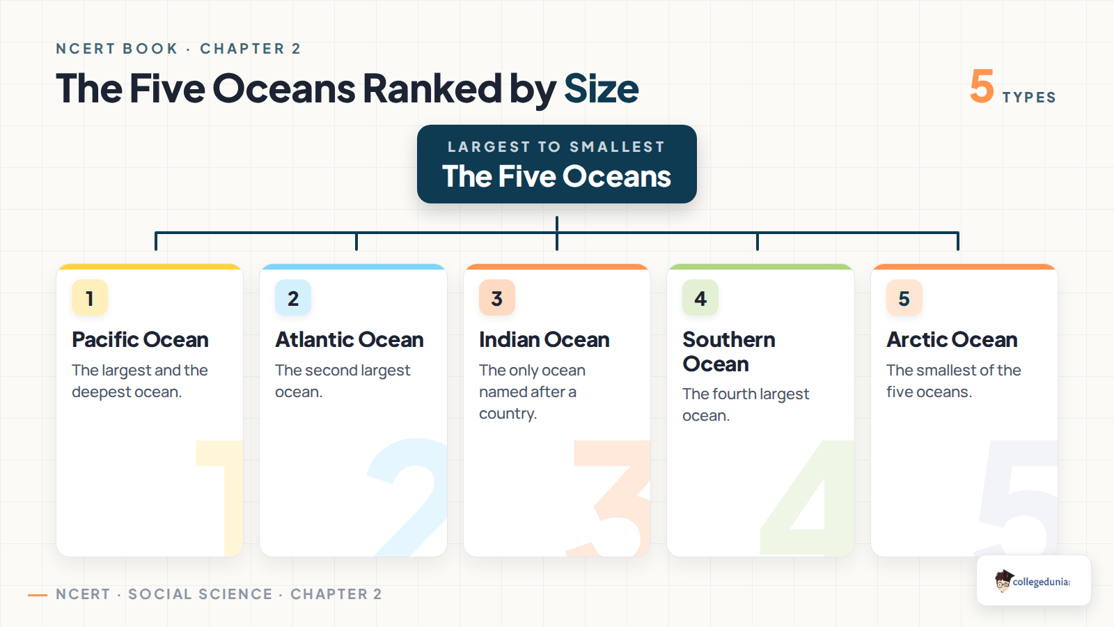
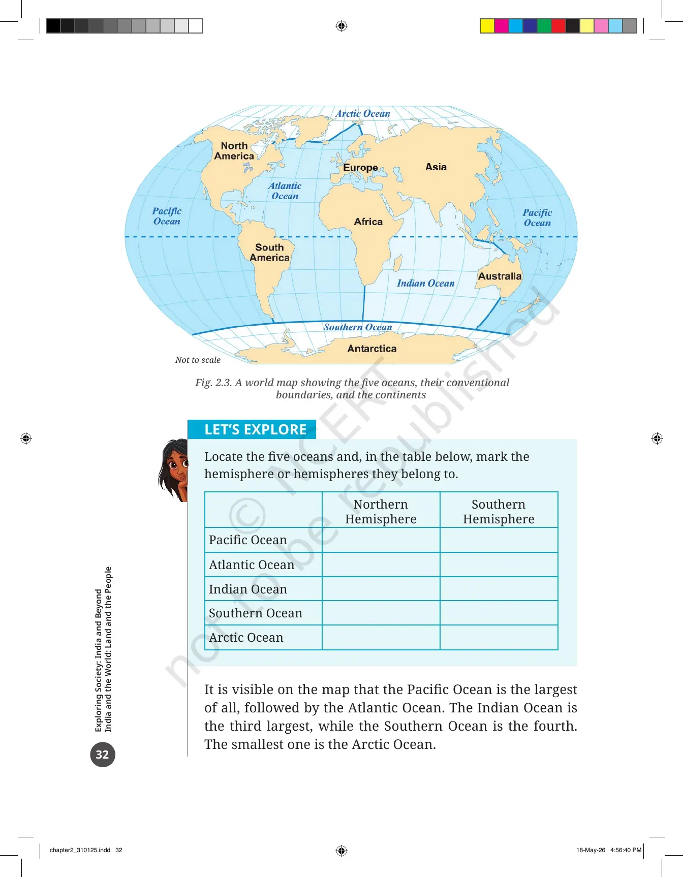
Fig. 2.3 on printed page 32 is the world map the whole chapter hangs on. It shows five oceans: the Pacific, the Atlantic, the Indian, the Arctic and the Southern Ocean, which is also called the Antarctic Ocean. Learn the size order from the table below, because it is the fact most often asked in class tests.
| Rank by size | Ocean | What the chapter says about it |
|---|---|---|
| 1 | Pacific Ocean | The largest of all five, spread across both the Northern and the Southern Hemispheres |
| 2 | Atlantic Ocean | The second largest, also lying in both hemispheres |
| 3 | Indian Ocean | The third largest. Asia lies to its north, Africa to its west, Australia to its east and the Southern Ocean to its south |
| 4 | Southern Ocean | The fourth largest, also called the Antarctic Ocean, ringing the continent of Antarctica |
| 5 | Arctic Ocean | The smallest of the five, sitting around the North Pole |
The chapter then makes a point students often miss. The five oceans are not really separate. The lines that divide them on the map are only conventions that people agreed on. Seawater flows freely across all of them, and the same plant and animal species turn up in more than one ocean.
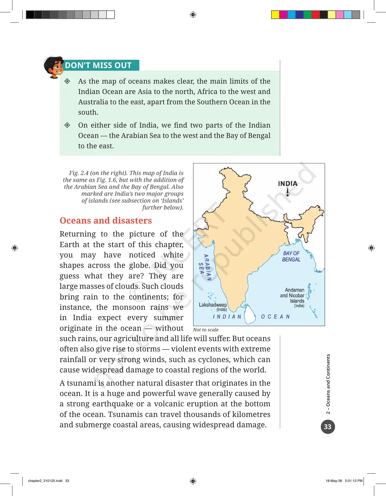
India sits inside this picture in a way you should be able to name from memory. The Arabian Sea lies to the west of India and the Bay of Bengal lies to the east, and both are parts of the Indian Ocean. Fig. 2.4 is the same map of India you saw in the first chapter, with those two water bodies and India's two island groups added to it.
Marine Life, Freshwater and the Water Scarcity Question in the Class 6 Chapter
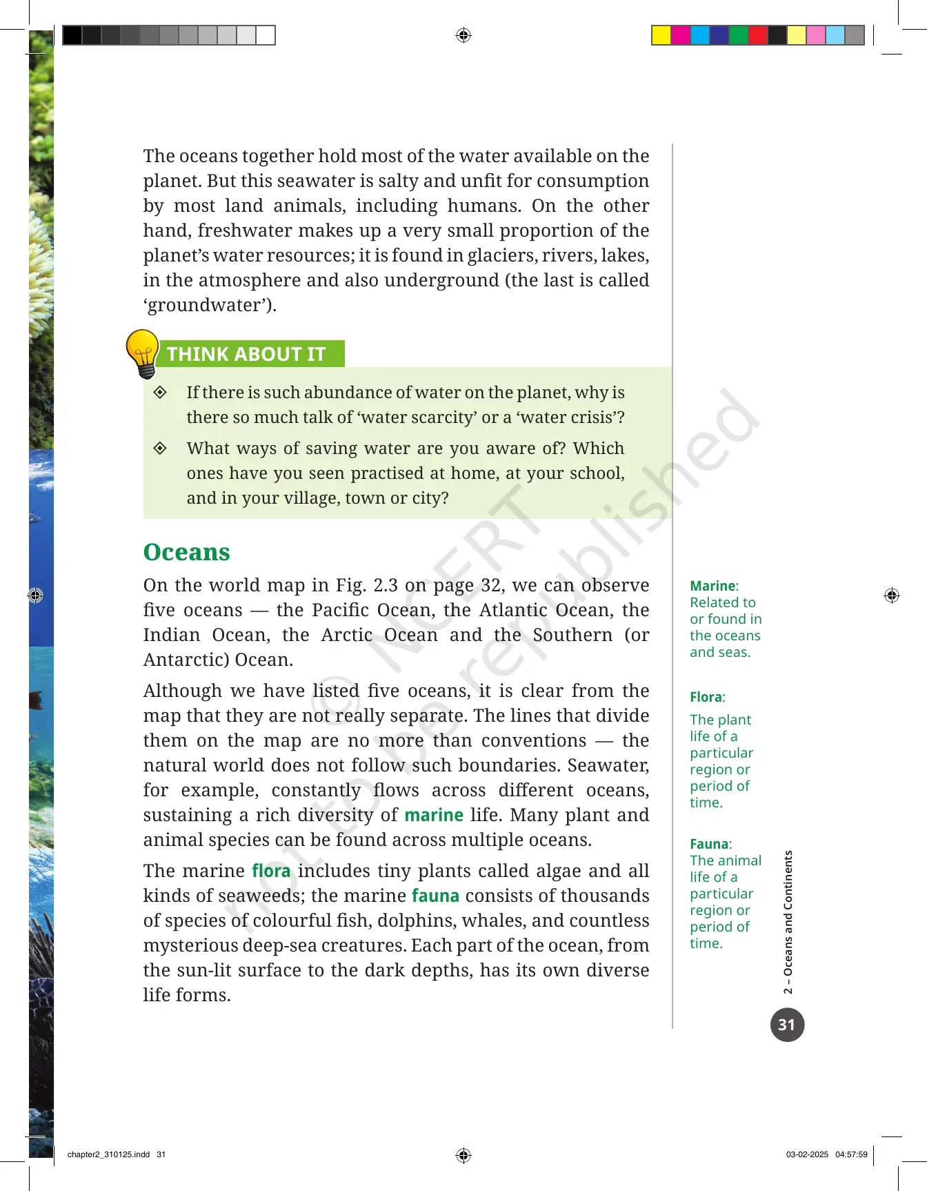
Printed page 30 is a full picture spread called Ocean Life, and it does real teaching work. It shows a coral reef, a starfish resting on a sea anemone, a shark, dolphins, a sperm whale with her baby, algae, emperor penguins, a sea turtle and a shallow reef full of tropical fish. Three margin words on the next page tell you what to call all of this.
- Marine: related to the oceans and seas, or found in them.
- Flora: the plant life of a region or a period of time. Marine flora includes algae and every kind of seaweed.
- Fauna: the animal life of a region or a period of time. Marine fauna runs from colourful fish to deep-sea creatures nobody has named yet.
- Every layer of the ocean, from the sunlit surface to the dark depths, has its own life forms.
Then the chapter turns the tap the other way. The oceans hold most of the water on the planet, but seawater is salty and unfit for humans and most land animals to drink. Freshwater is only a very small share of the planet's water, and it sits in glaciers, rivers, lakes, the atmosphere and underground as groundwater.
The THINK ABOUT IT box on printed page 31 asks the obvious follow-up. If the planet has so much water, why do we keep hearing about a water crisis? It also asks which water-saving habits you have actually seen at home, at school and in your town or village, so keep a rough list ready before the class discussion.
Cyclones, Tsunamis and the 26 December 2004 Indian Ocean Tsunami
The white shapes on the Earth photograph in Fig. 2.1 are large masses of cloud, and those clouds are the link between the ocean and your life on land. The monsoon rains India waits for every summer begin over the ocean. Without them, farming and every other kind of life on the subcontinent would suffer.
- Oceans send rain to the continents, which is why the chapter calls them vital to life on land.
- Oceans also produce storms, violent events with extreme rainfall or very strong winds.
- Cyclones are the storms named in the chapter, and they can badly damage coastal regions.
- A tsunami is a huge, powerful wave caused by a strong earthquake or a volcanic eruption at the bottom of the ocean.
- Tsunamis can travel thousands of kilometres and drown coastal areas far from where they began.
The DON'T MISS OUT box on printed page 34 gives the case study the chapter builds this on. On 26 December 2004, India and 13 other countries around the Indian Ocean were struck by a tsunami caused by an earthquake in Indonesia, and more than two lakh people lost their lives. In India, the Andaman and Nicobar Islands and the coasts of Tamil Nadu and Kerala were hit hardest.
The box does not stop at the damage. It explains that such tsunamis are rare but can often be spotted before they reach a coast. Many countries work together on early warning systems, including the Indian Ocean Tsunami Warning System that India contributes to. Events like these are handled under disaster management, and India has its own National Disaster Management Authority for the purpose.
Why the Continent Count Can Be Four, Five, Six or Seven
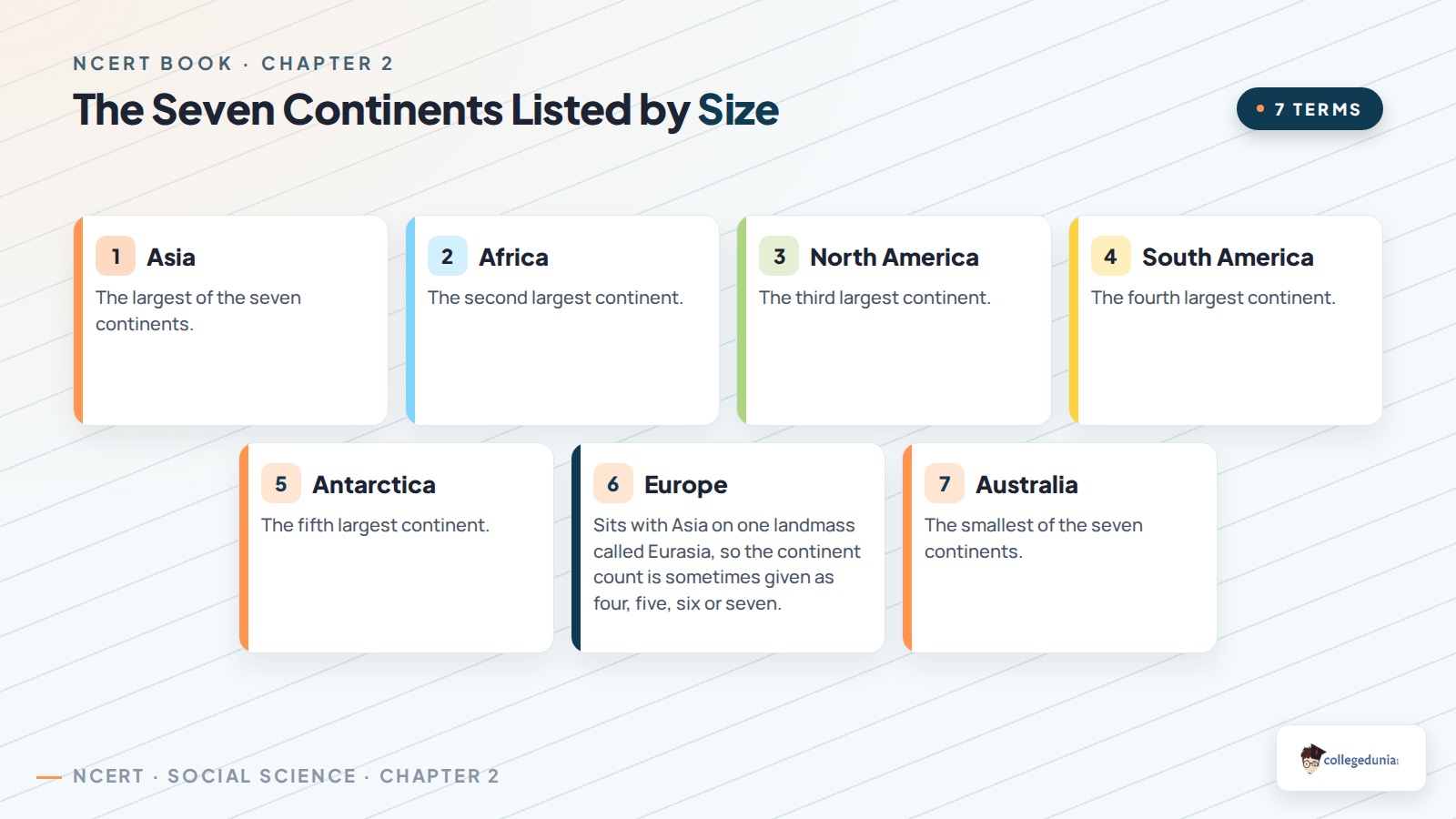
Ask how many continents there are and most students say seven. The chapter shows that the honest answer is anywhere between four and seven, depending on how you group the landmasses. This is the part students most often get wrong in a test, so read the reasoning before you learn the table.
- North America and South America are usually counted as two, but they can be seen as one landmass.
- Europe and Asia sit on a single landmass. History and culture separate them, so they are usually counted as two. Geologists often call the whole thing Eurasia.
- Africa and Eurasia are usually two, but are sometimes grouped as one.
| Count | Continents in that list, in alphabetical order |
|---|---|
| Four continents | Africa-Eurasia, America, Antarctica, Australia |
| Five continents | Africa, America, Antarctica, Australia, Eurasia |
| Six continents | Africa, Antarctica, Australia, Eurasia, North America, South America |
| Seven continents | Africa, Antarctica, Asia, Australia, Europe, North America, South America. This is the list used in Fig. 2.3 and the one most widely adopted |
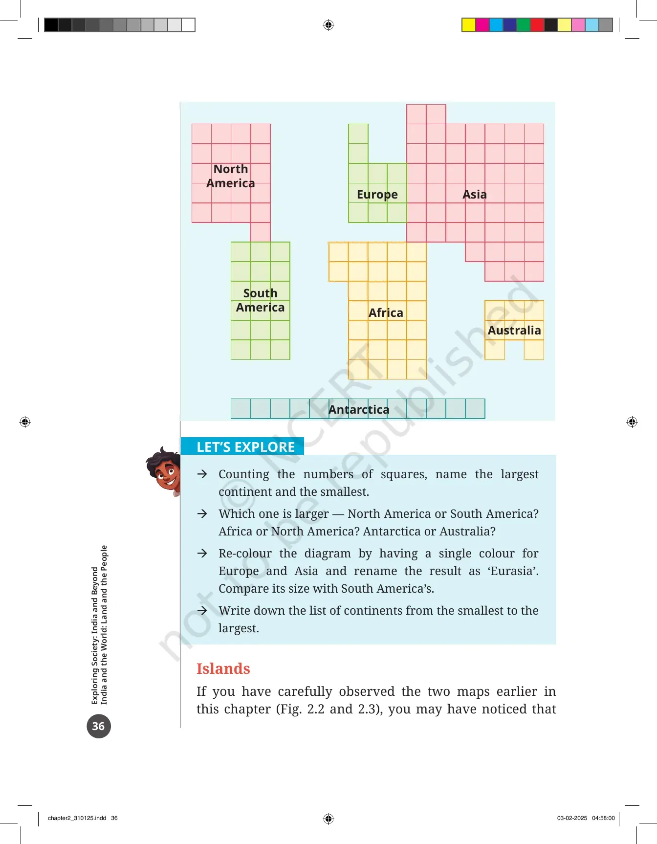
Two more things sit around that table. The DON'T MISS OUT box on printed page 35 explains the five Olympic rings, chosen to stand for the five inhabited continents of Africa, America, Asia, Australia and Europe. Printed page 36 then carries a square-grid diagram that shows the relative sizes of the seven continents rather than their real shapes, and the activity box asks you to count squares to rank them.
Islands, Greenland and India's Antarctica Programme
Look again at Fig. 2.2 and Fig. 2.3 and you will notice that the continents do not account for every piece of land. Smaller pieces are left over, and a piece of land surrounded by water on all sides is called an island. Continents are surrounded by water too, but they are far too large to be called islands.
- There are lakhs of islands on the planet, of very different sizes.
- Greenland is the largest island in the world. You would have to add the areas of India's 10 largest states to match it.
- India has more than 1,300 small islands, in two major groups.
- The Andaman and Nicobar Islands lie in the Bay of Bengal and the Lakshadweep Islands lie in the Arabian Sea, both marked on Fig. 2.4.
The same box carries the Antarctica story, which is the piece students enjoy most. The Indian Antarctica Programme has been running since 1981, and India set up its first scientific base station there, Dakshin Gangotri, in 1983. Two more bases came later.
About 40 teams of Indian scientists have worked in Antarctica, mostly studying how climate and environment have changed over time. The settlement where they live has a library and even a post office, which is worth remembering as a one-line answer about life on the coldest continent.
How Oceans Shape Climate, Trade and Everyday Life
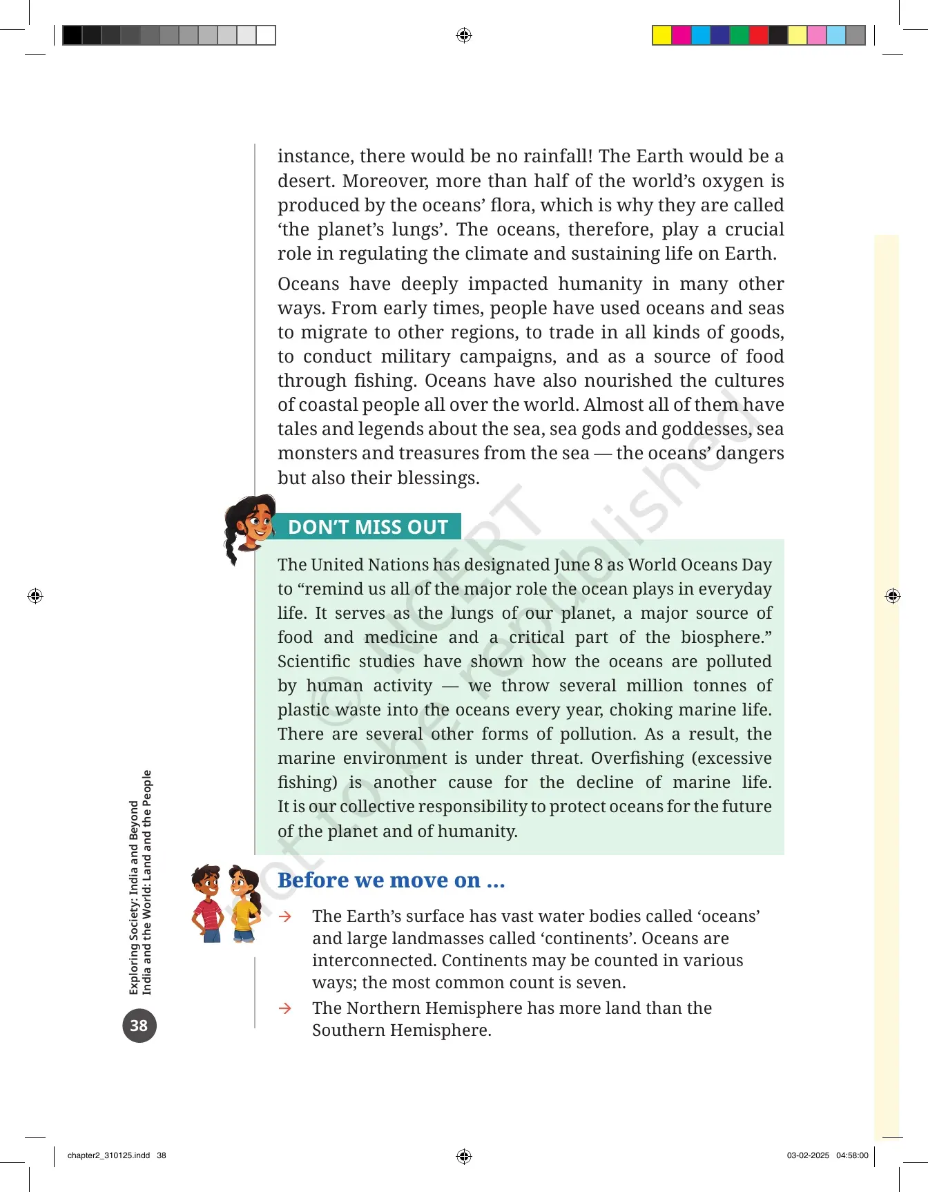
The closing section of the chapter, Oceans and Life, explains why any of this matters. Oceans send rain to the continents as part of the Earth's water cycle. Without oceans there would be no rainfall at all, and the Earth would be a desert. That single sentence is the strongest line in the chapter for a short-answer question.
- More than half of the world's oxygen is produced by the flora of the oceans, which is why they are called the planet's lungs.
- Oceans regulate the climate and keep life on Earth going.
- People have used oceans and seas to migrate, to trade, to run military campaigns and to fish since early times.
- Coastal cultures everywhere carry tales of sea gods, sea monsters and treasures from the sea, holding both the dangers and the blessings of the ocean.
The chapter ends on a warning rather than a celebration. The DON'T MISS OUT box notes that the United Nations marks 8 June as World Oceans Day, calling the ocean the lungs of the planet and a major source of food and medicine. It then lists what is going wrong.
Several million tonnes of plastic waste go into the oceans every year, choking marine life, and other kinds of pollution add to the damage. Overfishing is named as a second cause of the decline in marine life. The textbook closes by calling the protection of the oceans a collective responsibility, and the Indian Navy motto box on printed page 28 gives that idea an older form: Sam noh Varunah, an invocation to Varuna, the Vedic deity of the waters.
Every Figure and Activity Box Inside the Oceans and Continents PDF
This chapter teaches through pictures more than through paragraphs. Four numbered figures do the heavy work, one unnumbered diagram handles continent sizes, and ten boxes turn the reading into tasks. Tick them off as you go.
| Figure or box | Printed page | What it shows or asks |
|---|---|---|
| Fig. 2.1 | 27 | The Earth from space, centred on the Indian Ocean, with Africa left, India and Asia at the top, Australia right and Antarctica at the bottom |
| Fig. 2.2 | 29 | Two circular maps of the Earth, one seen from above the North Pole and one from above the South Pole |
| Fig. 2.3 | 32 | The world map showing the five oceans, their conventional boundaries and the seven continents |
| Fig. 2.4 | 33 | The map of India with the Arabian Sea, the Bay of Bengal and the two island groups added |
| Relative-size diagram | 36 | A square grid comparing the sizes of the seven continents, not their shapes |
| LET'S EXPLORE (1) | 29 | Name the circular and radiating lines, judge which hemisphere holds more water, and say whether the oceans are connected |
| LET'S EXPLORE (2) | 32 | Locate the five oceans and tick the hemisphere or hemispheres each one belongs to, in a ready-made table |
| LET'S EXPLORE (3) | 36 | Count squares to name the largest and smallest continent, then rewrite the list from smallest to largest |
| THINK ABOUT IT | 31 | Why there is a water crisis on a planet full of water, and which water-saving habits you have seen |
| DON'T MISS OUT boxes | 28, 33, 34, 35, 37, 38 | The Indian Navy motto, the limits of the Indian Ocean, the 2004 tsunami, the Olympic rings, Greenland and Antarctica, and World Oceans Day |
Questions, Activities and Projects at the End of the Oceans and Continents Chapter
Before the question set, printed page 38 gives a three-point recap called "Before we move on ...". Then come 4 numbered items on printed pages 39 and 40. They are short, but the school test is usually built straight out of them, so do all four.
- Explain the terms continent, ocean and island. Three one-line definitions, all taken from the chapter.
- Let us draw: draw the continents freehand without looking at the maps, colour them, then compare your sheet with Fig. 2.3.
- Let us do: label all the continents and all the oceans on the outline map of the world printed in the book.
- Solve the crossword on printed page 40, with 5 across clues and 5 down clues, every answer taken from the chapter.
The crossword is the part worth planning for. Its clues cover the gas the oceans produce in plenty, the largest island, the smallest continent, the coldest continent, the largest water body, the destructive ocean wave and the main pollutant of the seas. Every one of those answers appears in the chapter text, so read the chapter once more before you fill the grid.
Common Mistakes Students Make in the Oceans and Continents Chapter
- Saying there are only seven continents. Seven is the most widely used count, but the chapter accepts four, five, six or seven.
- Calling the oceans separate water bodies. The dividing lines on the map are conventions, and seawater flows across all five.
- Mixing up the size order. Pacific, Atlantic, Indian, Southern, Arctic, from largest to smallest.
- Swapping the Arabian Sea and the Bay of Bengal. The Arabian Sea is west of India, the Bay of Bengal is east.
- Calling Australia an island or Greenland a continent. Australia is a continent, and Greenland is the largest island on Earth.
Related Links:
How to Read the Class 6 Oceans and Continents PDF in One 40-Minute Sitting
This chapter is shorter than the first one and needs a single sitting with the PDF open, an atlas nearby and a pencil. Follow the order below and you will finish the reading, the maps and the activity boxes together.
- Minutes 0 to 5: read the two Big Questions on printed page 27 and study Fig. 2.1. They tell you what to look for.
- Minutes 5 to 15: read printed pages 28 to 31 and answer the LET'S EXPLORE box on the two polar maps.
- Minutes 15 to 25: read the Oceans section and fill the hemisphere table for all five oceans on printed page 32.
- Minutes 25 to 35: read the Continents and Islands sections and copy the count table into your notebook.
- Minutes 35 to 40: read the "Before we move on ..." recap and write the three definitions asked in question 1.
Come back the next day for the freehand continent drawing and the crossword. That second pass is what turns a chapter you have read into a chapter you can answer, and it is why students who keep the official PDF on their phone finish Theme A faster than students working from guide books alone.
More Oceans and Continents Class 6 Resources
The book PDF gives you the printed chapter. These three pages give you the answers, the revision layer and the last-day recap for the same chapter.
| Resource | What it gives you |
|---|---|
| Oceans and Continents Class 6 NCERT Solutions | Step-by-step answers to all 4 questions, activities and projects, including the three definitions and the full crossword grid |
| Oceans and Continents Class 6 Revision Notes | The five oceans, the continent counts, islands and the ocean's role in climate in one short read |
| Oceans and Continents Class 6 Handwritten Notes | A topper's handwritten pages with hand-drawn ocean and continent maps and colour-coded sub-headings for a last-day recap |
| Oceans and Continents Class 6 NCERT Book PDF | This page. The official 2026-27 chapter file, printed pages 27 to 40 of Exploring Society: India and Beyond |
NCERT Book PDF for Class 6 Social Science: All 14 Chapters
Exploring Society: India and Beyond runs to 14 chapters across five themes. Download the ones your school has taught, or take the full set in one go.
Oceans and Continents Class 6 Social Science NCERT Book PDF FAQs
Common Questions on the Class 6 Social Science Chapter 2 File
Ques. Where can I download the NCERT Class 6 Social Science Chapter 2 Oceans and Continents PDF?
Ans. You can download it directly from this page. It is the official NCERT chapter file for the 2026-27 print of Exploring Society: India and Beyond, and it is free.
Ques. How many pages is the Oceans and Continents chapter PDF?
Ans. The file runs to 14 pages. It covers printed pages 27 to 40 of the textbook, from the Jules Verne quote on the opening page to the crossword on the last page.
Ques. What is an ocean and what is a continent?
Ans. An ocean is one of the largest water bodies on the Earth's surface. A continent is a large continuous expanse of land. Smaller extensions of the oceans carry names such as sea, bay and gulf, and a large body of land in general is called a landmass.
Ques. What are the five oceans of the world in order of size?
Ans. The Pacific Ocean is the largest, followed by the Atlantic Ocean, then the Indian Ocean, then the Southern Ocean, which is also called the Antarctic Ocean. The Arctic Ocean is the smallest. The chapter also notes that the lines dividing them on a map are only conventions, since seawater flows across all five.
Ques. What is an island and which is the largest island in the world?
Ans. An island is a piece of land surrounded by water on all sides. Continents are surrounded by water too, but they are too large to be called islands. Greenland is the largest island in the world, and you would have to add the areas of India's 10 largest states to match its size.
Ques. How many continents are there according to the Class 6 chapter?
Ans. The count can be four, five, six or seven, depending on how the landmasses are grouped. Seven is the list most widely used and the one shown in Fig. 2.3: Africa, Antarctica, Asia, Australia, Europe, North America and South America.
Ques. Which two parts of the Indian Ocean lie on either side of India?
Ans. The Arabian Sea lies to the west of India and the Bay of Bengal lies to the east. Both are parts of the Indian Ocean, and both are marked on Fig. 2.4 along with the Lakshadweep Islands and the Andaman and Nicobar Islands.
Ques. What happened in the 26 December 2004 Indian Ocean tsunami?
Ans. An earthquake in Indonesia set off a tsunami that struck India and 13 other countries around the Indian Ocean. More than two lakh people lost their lives. In India, the Andaman and Nicobar Islands and the coasts of Tamil Nadu and Kerala suffered the worst damage.
Ques. Why are the oceans called the lungs of the planet?
Ans. More than half of the world's oxygen is produced by the flora of the oceans, mainly algae and seaweeds. The oceans also send rain to the continents through the water cycle and help regulate the climate, so life on land depends on them.
Ques. How many questions are there at the end of the Oceans and Continents chapter?
Ans. There are 4 numbered items under "Questions, activities and projects". They ask you to explain the terms continent, ocean and island, draw the continents freehand, label the continents and oceans on an outline world map, and solve a crossword with 5 across clues and 5 down clues.
Ques. Do I need the NCERT Solutions if I already have the book PDF?
Ans. The book PDF carries the questions but not the answers. Use the Oceans and Continents Class 6 NCERT Solutions to check your definitions, your map labelling and every crossword answer.



Comments