




Inside the NCERT Class 6 Social Science Chapter 1 Locating Places on the Earth PDF you get the full printed chapter from Exploring Society: India and Beyond, plus the textbook Introduction that comes before it. The file carries the map activities, the globe diagrams, the time-zone maps and the eight end-of-chapter questions exactly as NCERT prints them for the 2026-27 session. Nothing is shortened or reworded.
- 26-page official file: the Introduction "Why Social Science?" on printed pages 1 to 6, then Chapter 1 on printed pages 7 to 26.
- Covers maps, scale, directions, symbols, latitudes, longitudes, time zones, Indian Standard Time and the International Date Line.
- Carries 9 figures, 6 LET'S EXPLORE activity boxes and 8 numbered questions at the end. It is the first chapter of Theme A, India and the World: Land and the People.
This is the unedited NCERT chapter file for the 2026-27 print run, checked page by page against the official Exploring Society: India and Beyond release before it was put on this page.
Student Feedback
What 11,240 students told us about their first Social Science chapter, in a Collegedunia poll taken during the 2026-27 session.
- 68% of students said time zones were the hardest part of the chapter, ahead of latitude and longitude.
- Most-skipped part: the LET'S EXPLORE activity boxes, left out by roughly 5 in 10 students.
- Students reported that drawing the globe grid once by hand made the parallels and meridians stick.
Source: 2026-27 Class 6 Social Science student poll. Sample of 11,240 students from CBSE schools across 17 states.
What the Locating Places on the Earth Class 6 PDF Contains, Page by Page
The file is the complete chapter as NCERT prints it, not a summary sheet. It opens with the textbook Introduction, which explains the five themes of the book. Chapter 1 itself begins with an Aryabhata quote from around 500 CE and three Big Questions. Use the table below to jump to the part you need.
| Section in the PDF | Printed pages | What is on these pages |
|---|---|---|
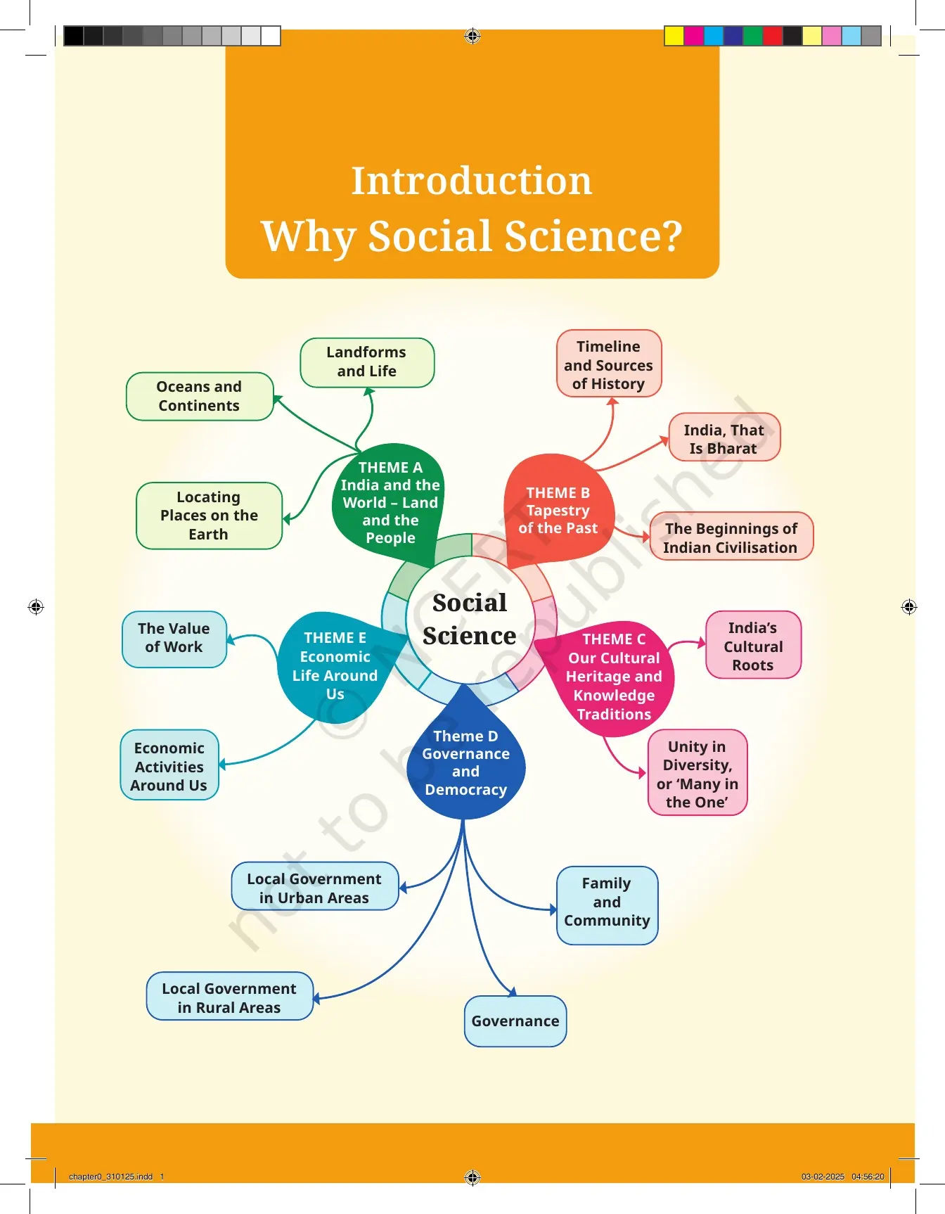
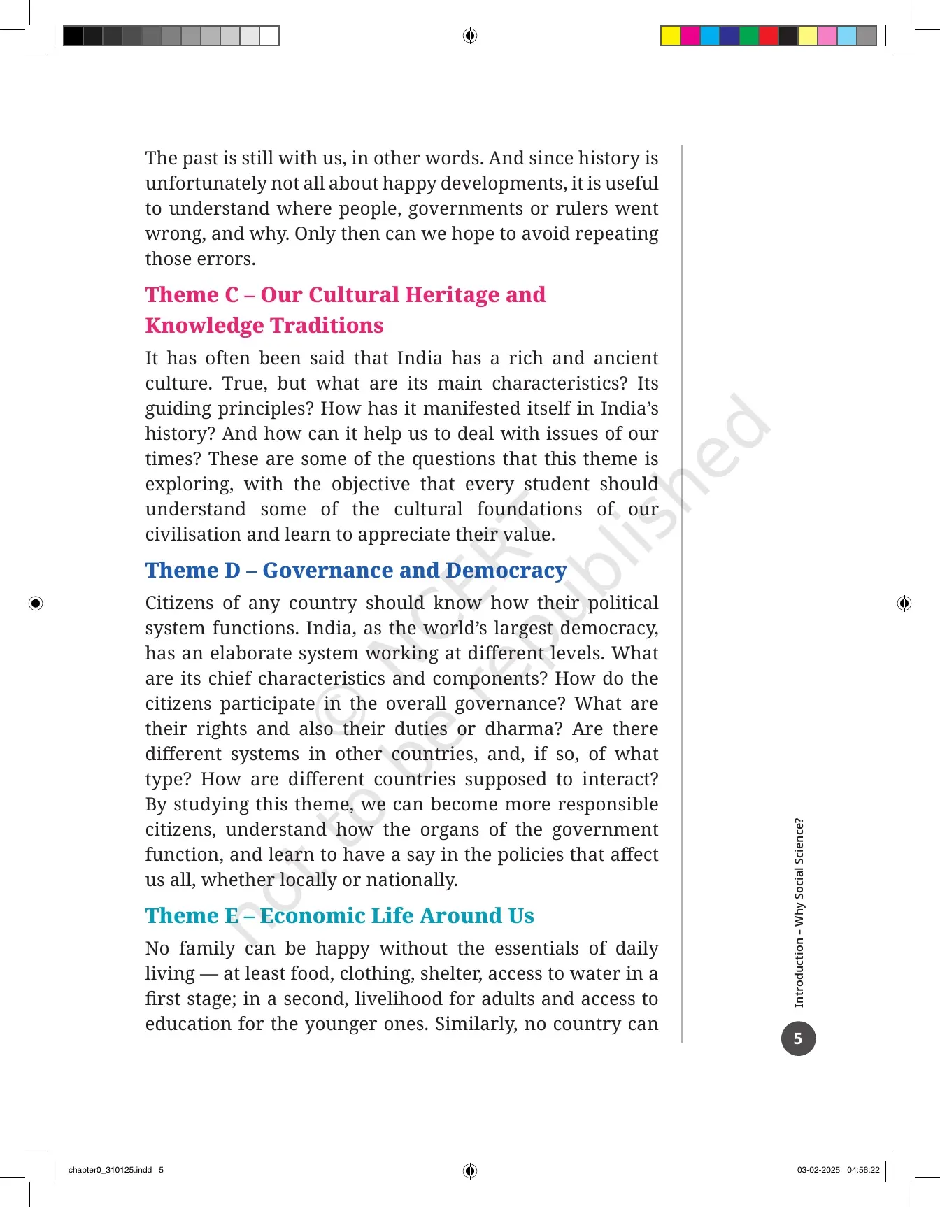
| Introduction: Why Social Science? | 1 to 6 | The theme wheel diagram and short notes on Themes A to E, from Land and the People to Economic Life Around Us |
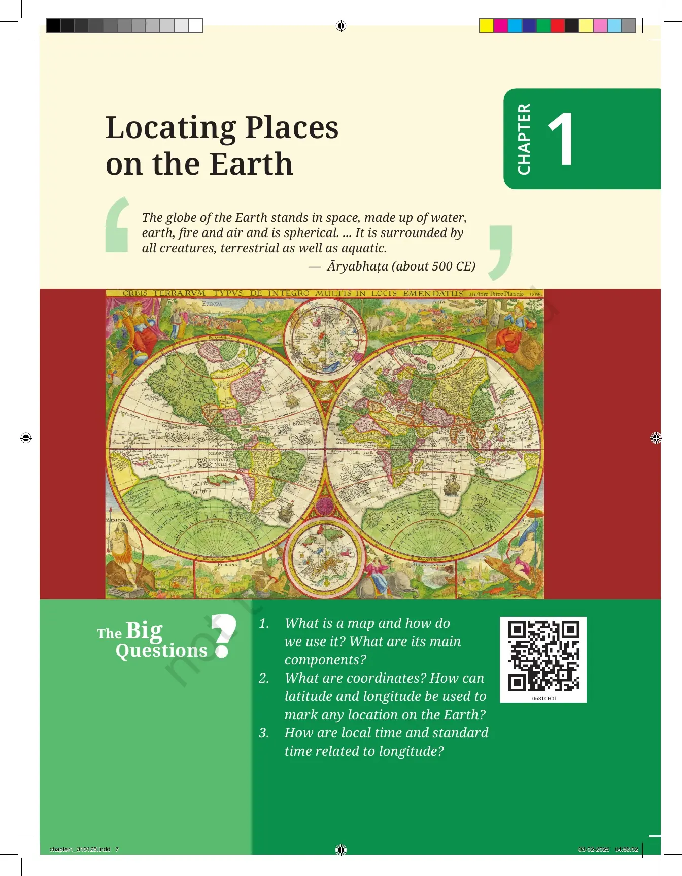
| Chapter opener | 7 | The Aryabhata quote on the spherical Earth and the three Big Questions the chapter answers |
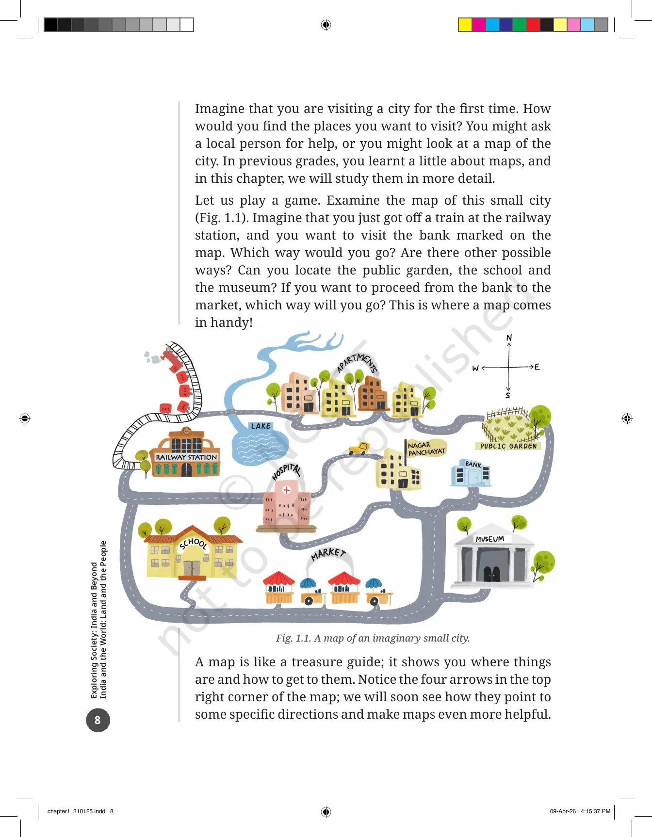
| The small city map game | 8 | Fig. 1.1, a map of an imaginary small city with a railway station, bank, school, museum and public garden |
| A Map and Its Components | 9 to 12 | Physical, political and thematic maps, then scale, direction and symbols, closing with Fig. 1.2 |
| Mapping the Earth | 12 to 14 | The orange-peel test, the globe, coordinates through the market and chessboard examples |
| Latitudes | 14 to 15 | Parallels, the Equator at 0 degrees, the poles at 90 degrees, and the link between latitude and climate |
| Longitudes | 15 to 19 | Meridians, the Prime Meridian at Greenwich, hemispheres in Fig. 1.4, the Ujjayini meridian in Fig. 1.5, India in Fig. 1.6 |
| Understanding Time Zones | 20 to 23 | The 15 degrees per hour rule, Fig. 1.7, Indian Standard Time, the world time-zone map and the International Date Line |
| Before we move on ... | 23 | A four-point recap of the whole chapter in the textbook's own words |
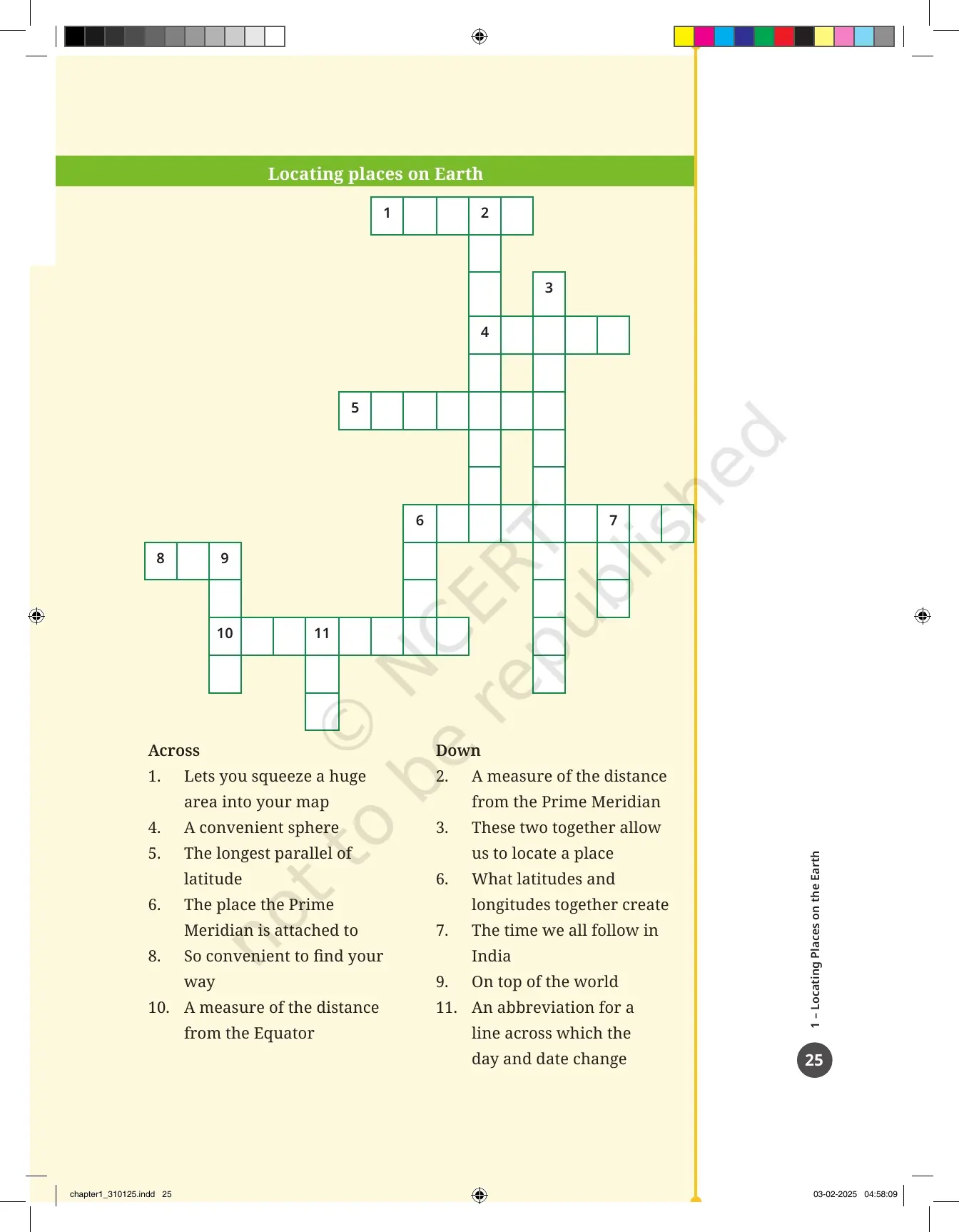
| Questions, activities and projects | 24 to 25 | 8 numbered items, including the Narmada to Ganga distance sum, a 6-part true or false set and a crossword |
| Noodles page | 26 | A blank Notes and Doodles page for your own rough work |
Also Check:
- Locating Places on the Earth Class 6 NCERT Solutions
- Locating Places on the Earth Class 6 Revision Notes
A Map and Its Three Components: Distance, Direction and Symbols
A map is a drawing of an area seen from the top. It can show a village, a district, a country or the whole world. A book or collection of maps is called an atlas. The chapter first sorts maps into three kinds, then names the three parts every map must have.
- Physical maps show natural features such as mountains, oceans and rivers.
- Political maps show countries, states, boundaries and cities, like a map of India with its States, Union Territories and capitals.
- Thematic maps carry one specific kind of information, such as trade routes or population.
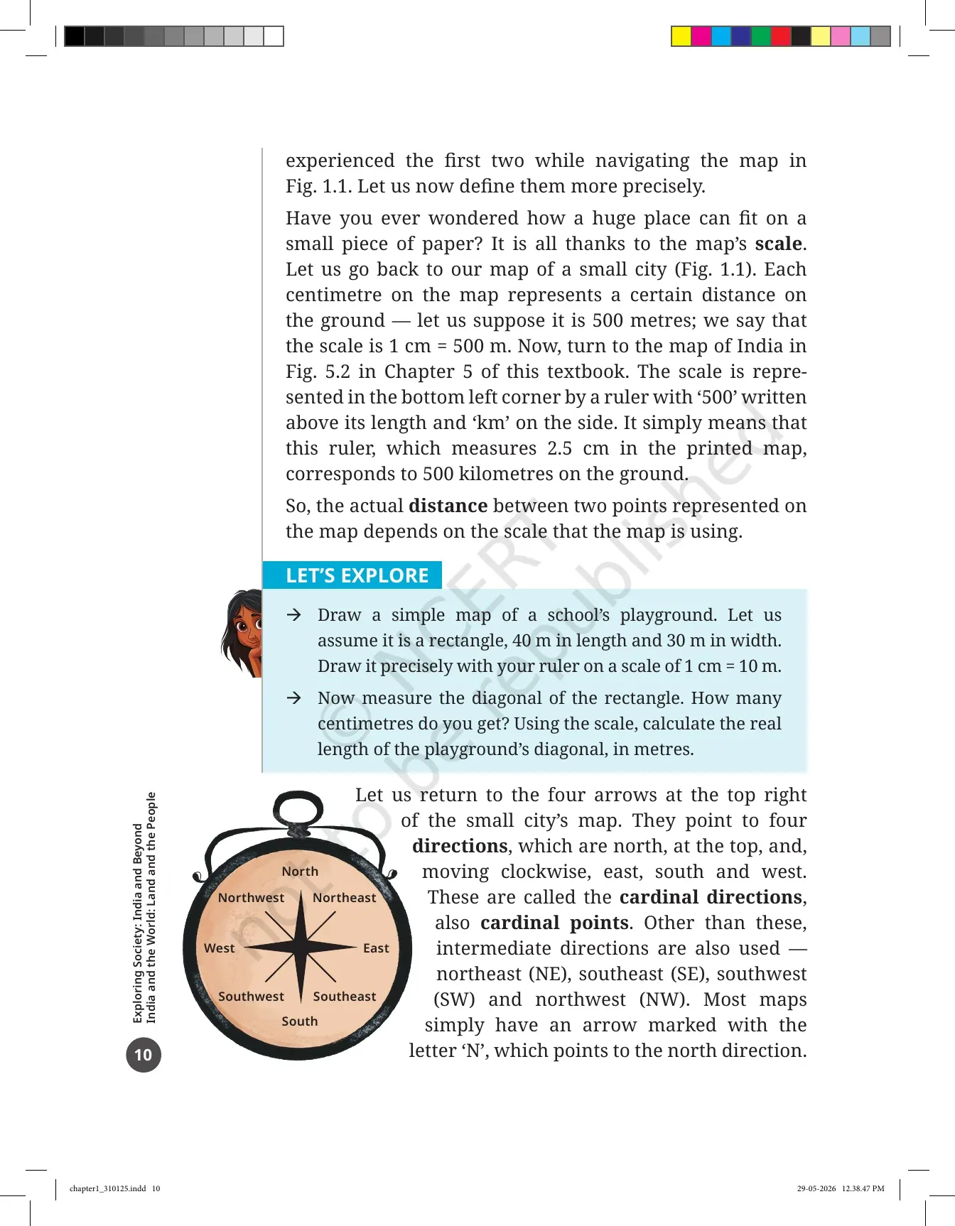
The three components are distance, direction and symbols. Distance is handled by the scale. If the scale is 1 cm = 500 m, then one centimetre measured on the paper equals five hundred metres on the ground. The real distance between two places depends entirely on the scale the map uses.
Direction is handled by the four cardinal points: north at the top, then east, south and west moving clockwise. Between them sit the four intermediate directions, northeast, southeast, southwest and northwest. Most maps only print an arrow marked with the letter N.
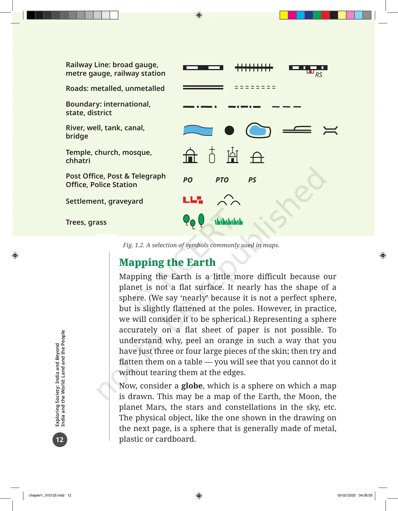
Symbols are handled by a fixed set. The Survey of India, a government body, has fixed the symbols used on maps of India. Fig. 1.2 in the PDF shows a small selection of them.
| Survey of India symbol group | What it marks on the map |
|---|---|
| Railway lines | Broad gauge, metre gauge and the railway station, marked RS |
| Roads | Metalled and unmetalled roads, drawn with different line styles |
| Boundaries | International, state and district borders |
| Water features | River, well, tank, canal and bridge |
| Places of worship | Temple, church, mosque and chhatri |
| Public buildings | Post Office (PO), Post and Telegraph Office (PTO), Police Station (PS) |
| Land use | Settlement, graveyard, trees and grass |
Locating Places on the Earth Class 6 One Shot Revision
Source: Magnet Brains on YouTube
Mapping the Earth: Why a Sphere Cannot Be Flattened on Paper
The Earth is not flat. It is nearly a sphere, slightly flattened at the poles, and the chapter asks you to treat it as spherical. That creates a problem for map makers, and the textbook proves it with a simple kitchen test.
- The orange-peel test: peel an orange in three or four large pieces, then press the skin flat on a table. It tears at the edges every time.
- The lesson: a sphere cannot be shown accurately on a flat sheet of paper without stretching or tearing it somewhere.
- The fix: a globe, which is a sphere with a map drawn on it. Because the globe and the Earth share the same shape, it represents the Earth better than any flat map.
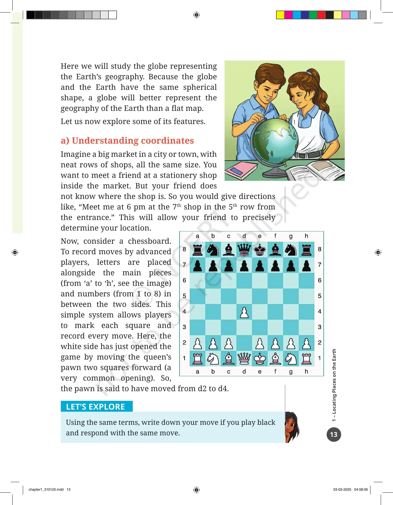
Before the chapter reaches the globe grid, it explains coordinates using two everyday examples. The first is a market: "meet me at the 7th shop in the 5th row from the entrance" fixes a shop with two numbers. The second is a chessboard, where letters a to h and numbers 1 to 8 name every square, so a queen's pawn opening is written as d2 to d4. Two coordinates are enough to fix one exact point, and that is the whole idea behind latitude and longitude.
Latitudes, Parallels and the Equator Explained for Class 6 Students
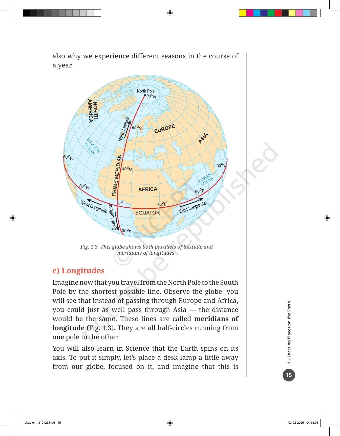
Spin a globe and two points stay still: the North Pole and the South Pole. Halfway between them runs the Equator. Latitude measures how far a place is from the Equator, and Fig. 1.3 in the PDF shows these lines drawn on a globe.
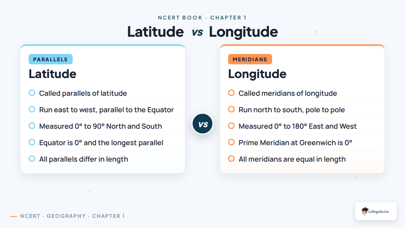
- A line running east to west, parallel to the Equator, is called a parallel of latitude. It draws a full circle around the Earth.
- The Equator is the longest parallel. The circles get smaller as you move north or south towards a pole.
- Latitude is written in degrees. The Equator is 0 degrees. The poles are 90 degrees North (90N) and 90 degrees South (90S).
- Latitude is linked to climate. Near the Equator the climate is hot, or torrid. Further away it turns moderate, or temperate. Near the poles it turns cold, or frigid.
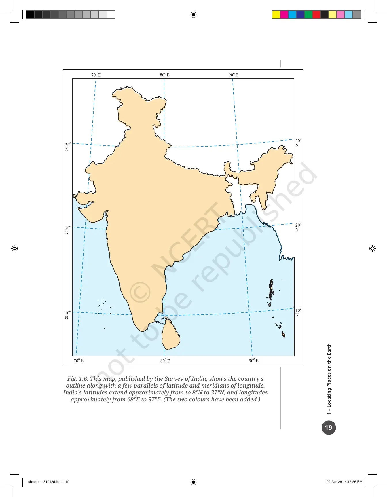
Fig. 1.6 in the PDF is a Survey of India map showing where our own country sits on this grid. India's latitudes run roughly from 8 degrees North to 37 degrees North, and its longitudes from about 68 degrees East to 97 degrees East. Learn that pair of ranges early, because later chapters keep coming back to it.
Longitudes, the Prime Meridian at Greenwich and the Ujjayini Meridian
Now travel from the North Pole to the South Pole by the shortest line. You could go through Europe and Africa, or through Asia, and the distance would be the same. These lines are called meridians of longitude, and each one is a half-circle joining the two poles.
- Longitude needs a starting line. That reference is the Prime Meridian, marked 0 degrees.
- It is also called the Greenwich Meridian, because several nations agreed that the meridian through Greenwich in London would be the international standard.
- Longitude is measured in degrees, rising from 0 to 180 both eastward and westward, with E or W added. New York is about 74W, Delhi about 77E, Tokyo about 140E.
- 180 degrees West and 180 degrees East are the same line, so it is written simply as 180 degrees, with no letter.
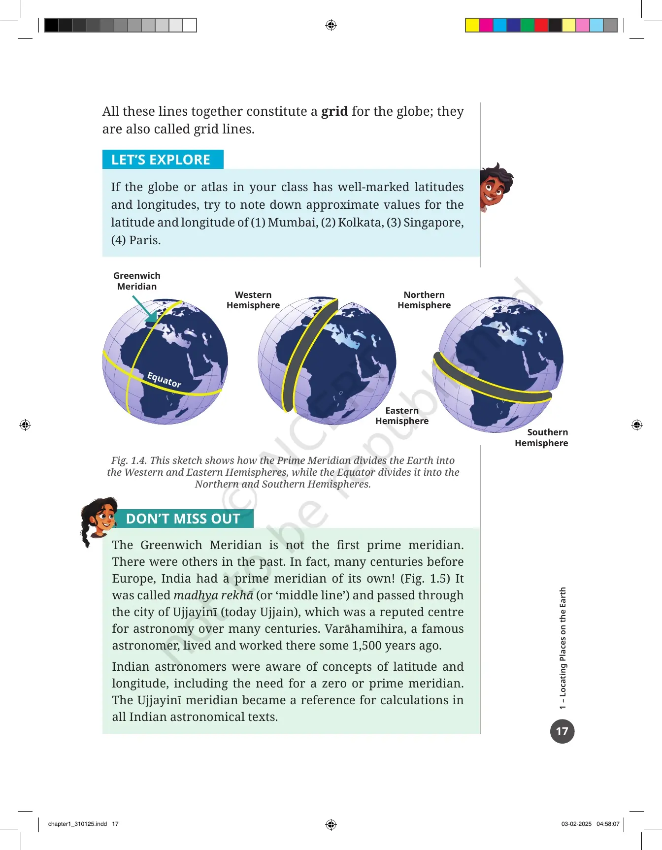
- Fig. 1.4 shows how the Prime Meridian splits the Earth into the Western and Eastern Hemispheres, while the Equator splits it into the Northern and Southern Hemispheres.
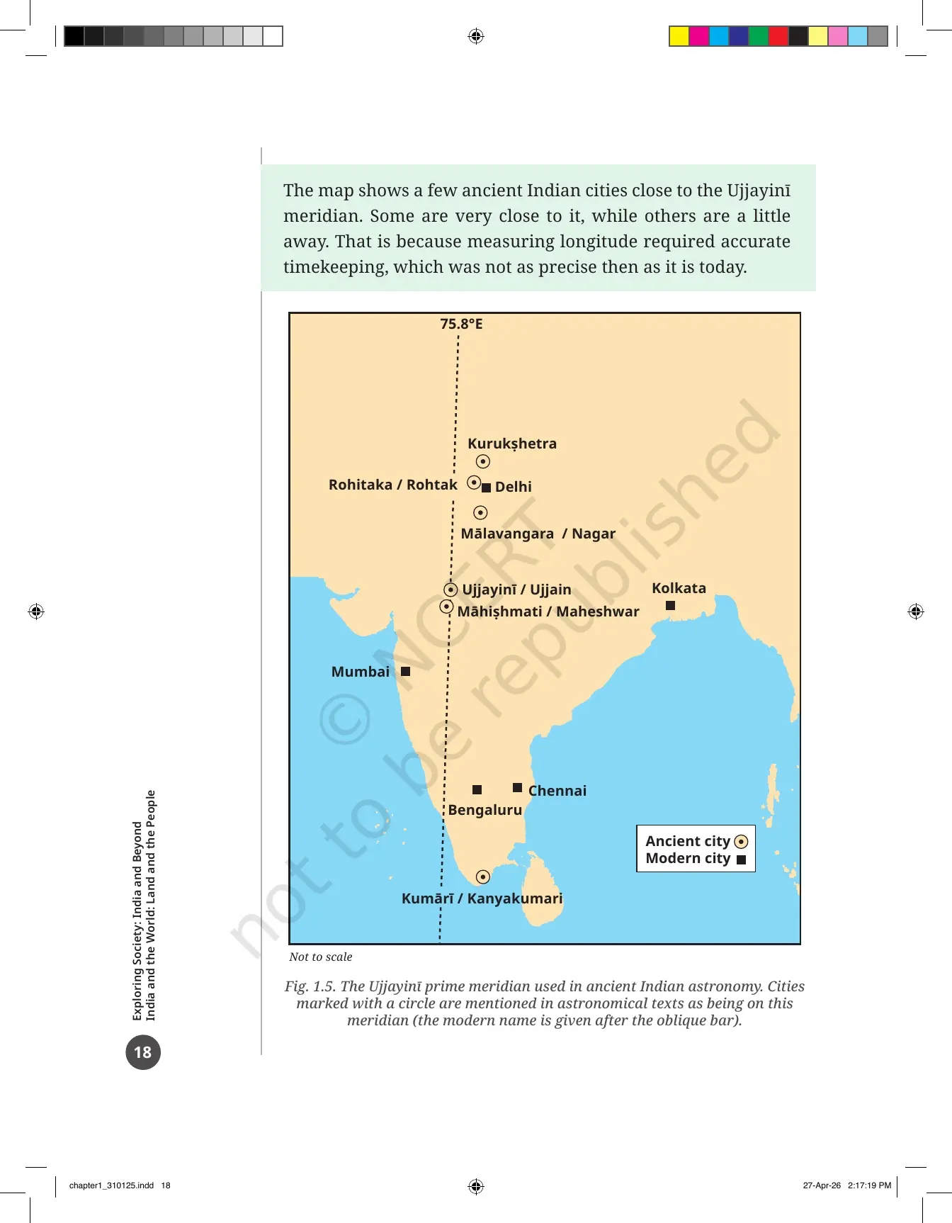
The chapter then makes a point students often miss. Greenwich was not the first prime meridian. Many centuries earlier India had one of its own, called madhya rekha, or middle line. It passed through Ujjayini, the city we now call Ujjain, a famous centre of astronomy where Varahamihira worked about 1,500 years ago.
Fig. 1.5 maps ancient cities near that meridian, including Rohitaka (Rohtak), Kurukshetra, Mahishmati (Maheshwar) and Kumari (Kanyakumari). Some sit right on the line and some sit slightly off it, because measuring longitude needed accurate clocks that did not exist then. The Ujjayini meridian stayed the reference for calculations in Indian astronomical texts.
Understanding Time Zones, Indian Standard Time and the International Date Line
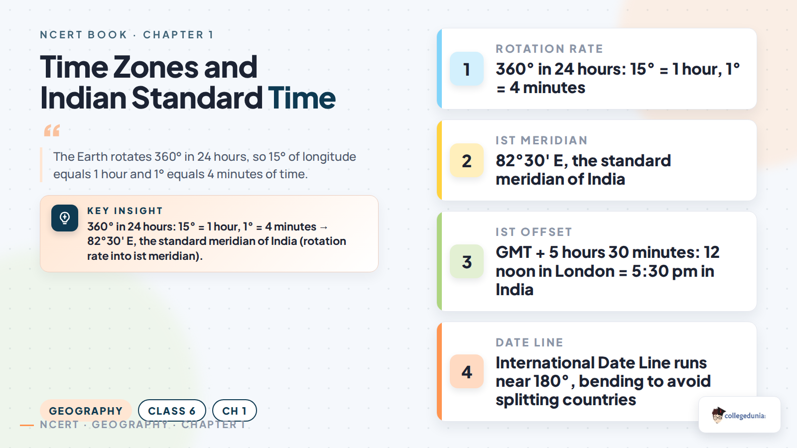
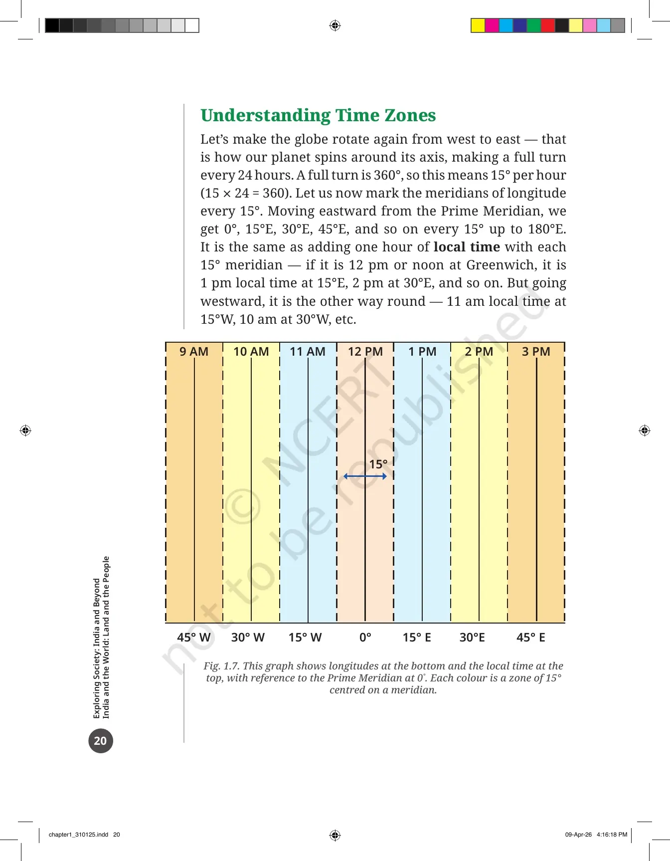
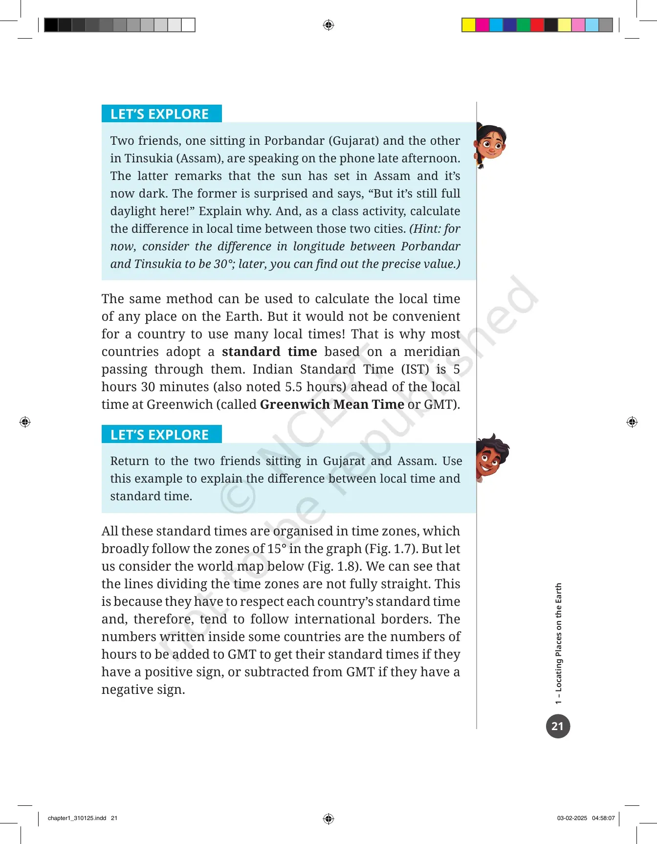
The Earth spins from west to east and takes 24 hours for one full turn. One full turn is 360 degrees. Divide 360 by 24 and you get 15 degrees for every hour. That single number explains the whole time-zone section, and Fig. 1.7 in the PDF draws it as a graph.
- Mark meridians every 15 degrees, starting from the Prime Meridian at 0 degrees.
- Move east and add one hour at each step. If it is 12 noon at Greenwich, it is 1 pm at 15E and 2 pm at 30E.
- Move west and subtract one hour at each step. It is 11 am at 15W and 10 am at 30W.
- A country cannot run on many local times at once, so it picks one standard time based on a meridian passing through it.
- Indian Standard Time is 5 hours 30 minutes ahead of Greenwich Mean Time, and it is based on the meridian at 82 degrees 30 minutes East.
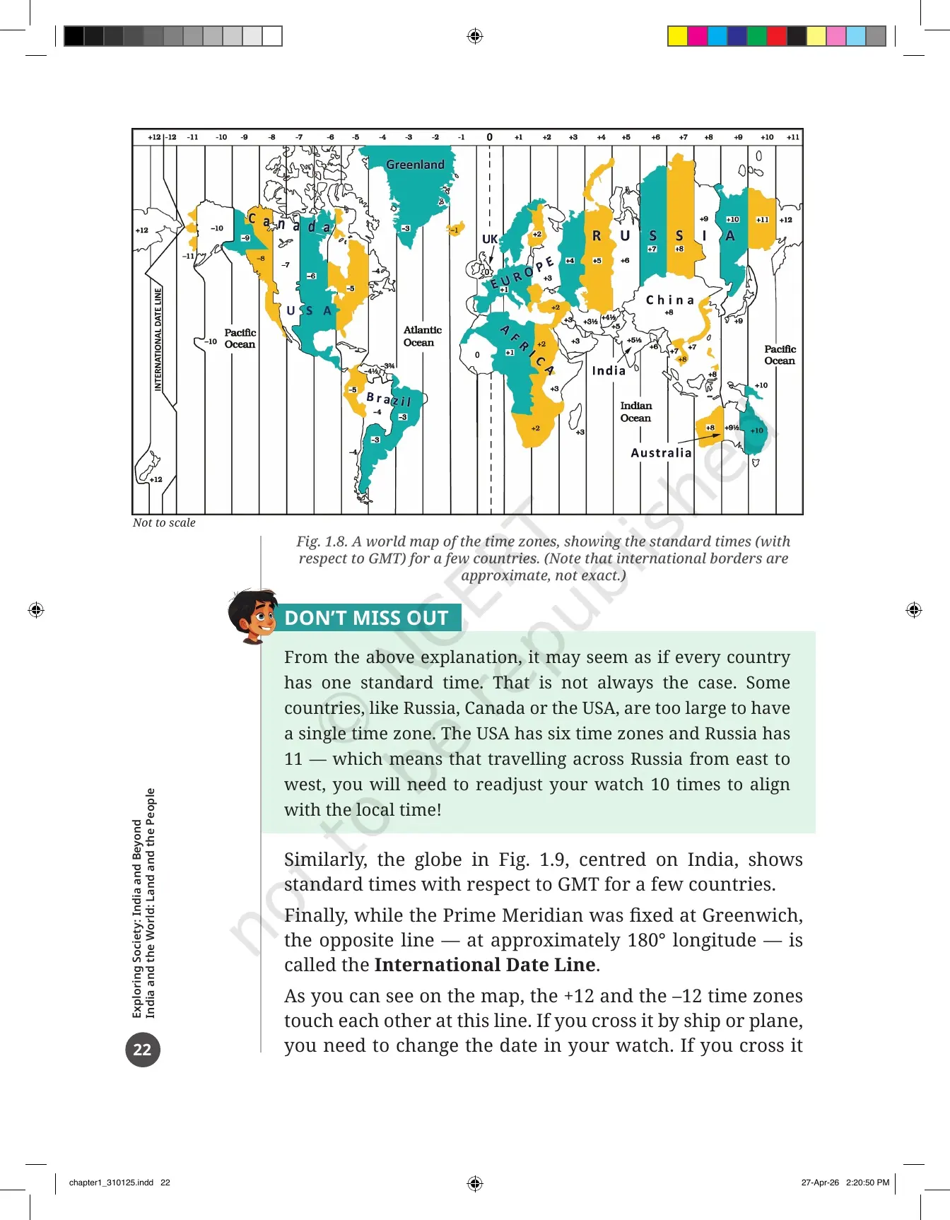
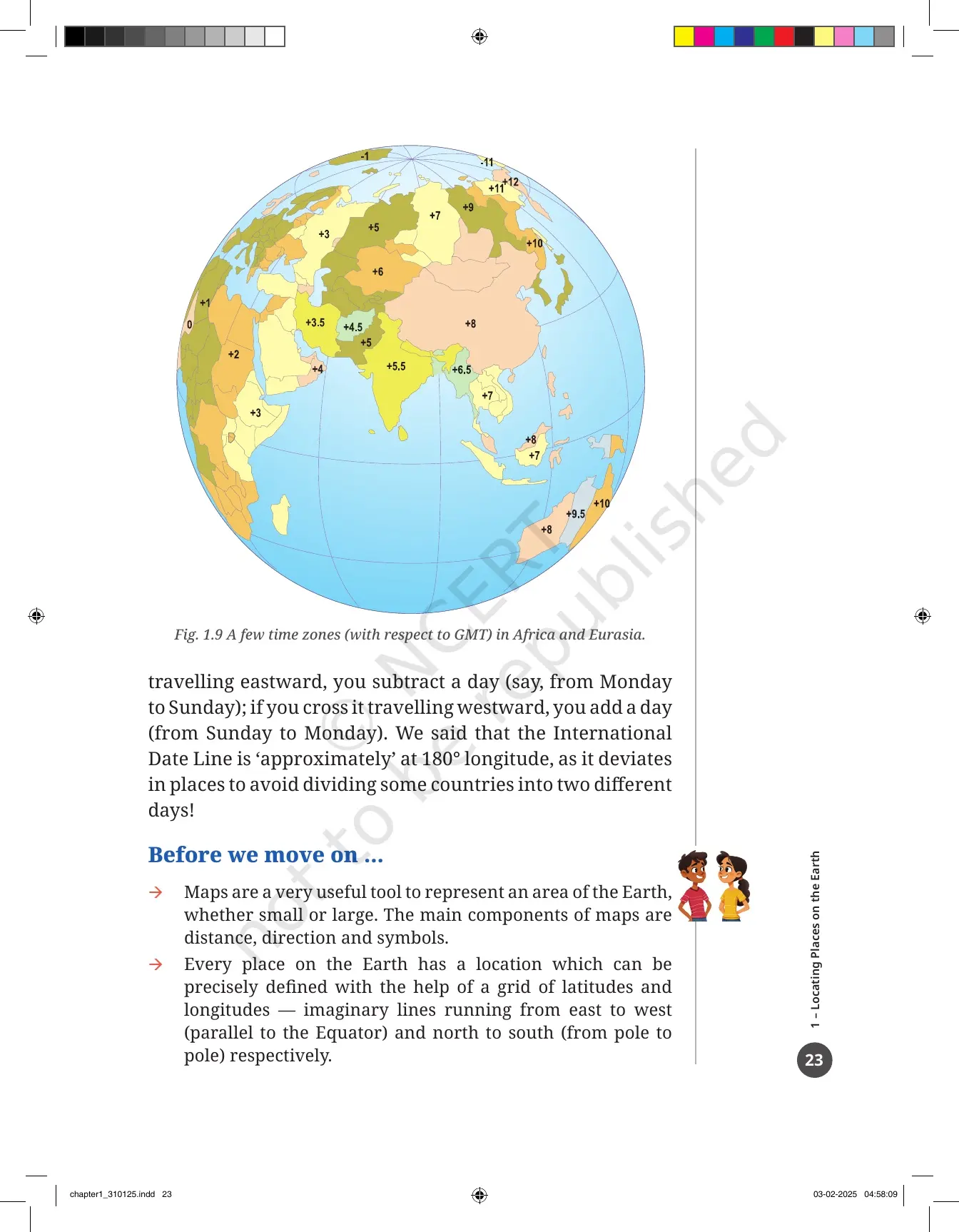
Fig. 1.8 is a world map of time zones and Fig. 1.9 shows the zones across Africa and Eurasia with India at the centre. Look closely and the dividing lines bend. Time-zone lines follow international borders, so they are not the same as meridians of longitude. That exact point appears in the true or false question at the end of the chapter.
Some countries are simply too wide for one zone. The USA has six time zones and Russia has 11, which means a traveller crossing Russia resets a watch ten times. Opposite the Prime Meridian, at roughly 180 degrees, runs the International Date Line. Cross it going east and you subtract a day. Cross it going west and you add a day. It bends in places so that no country is split across two different dates.
Every Figure and Activity Box Inside the Chapter 1 PDF
The chapter is built around its pictures. Nine numbered figures do most of the teaching, and six LET'S EXPLORE boxes turn each one into a task. Tick them off as you read.
| Figure | What it shows |
|---|---|
| Fig. 1.1 | A map of an imaginary small city, used for the direction and distance game |
| Fig. 1.2 | A selection of Survey of India map symbols |
| Fig. 1.3 | A globe showing parallels of latitude and meridians of longitude together as a grid |
| Fig. 1.4 | A sketch of the four hemispheres formed by the Prime Meridian and the Equator |
| Fig. 1.5 | The Ujjayini prime meridian with ancient and modern Indian cities marked on it |
| Fig. 1.6 | A Survey of India map of the country with a few parallels and meridians drawn on it |
| Fig. 1.7 | A graph matching longitude at the bottom to local time at the top, in bands of 15 degrees |
| Fig. 1.8 | A world map of time zones with the plus and minus hours against GMT |
| Fig. 1.9 | Time zones across Africa and Eurasia, centred on India |
The activity boxes ask you to mark a hospital on Fig. 1.1, draw a map of your school in a group, draw a playground to a scale of 1 cm = 10 m and measure its diagonal, judge four direction statements as right or wrong, sketch your own locality using Survey of India symbols, write a chess reply as black, note the coordinates of Mumbai, Kolkata, Singapore and Paris, and explain why the sun sets earlier in Tinsukia in Assam than in Porbandar in Gujarat.
Questions, Activities and Projects at the End of Chapter 1
Before the question set, the PDF gives a four-line recap called "Before we move on ...". Then come eight numbered items on printed pages 24 and 25. They are the best revision test you can get for this chapter, because the school test is usually built from them.
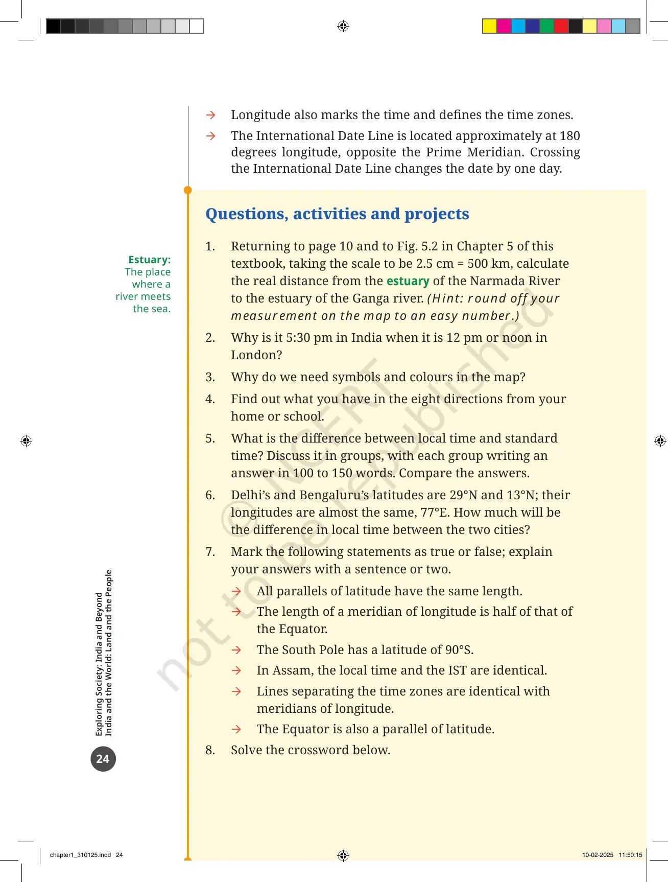
- The scale sum: using a scale of 2.5 cm = 500 km, work out the real distance from the estuary of the Narmada to the estuary of the Ganga.
- The time sum: why is it 5:30 pm in India when it is 12 noon in London?
- Why do we need symbols and colours on a map?
- Find out what lies in each of the eight directions from your home or school.
- Explain the difference between local time and standard time, in 100 to 150 words, as a group task.
- Delhi and Bengaluru share almost the same longitude of 77E. Work out the difference in their local time.
- A 6-part true or false set, each answer to be explained in a sentence or two.
- A crossword with 6 across clues and 5 down clues, all built from chapter words.
Question 6 is a trap worth knowing. Two cities on the same longitude have the same local time, so the difference is zero. Many students calculate a latitude difference instead and lose the mark.
Common Mistakes Students Make in the Locating Places on the Earth Chapter
- Swapping latitude and longitude. Latitude runs east to west and measures distance from the Equator. Longitude runs pole to pole and measures distance from the Prime Meridian.
- Saying all parallels are equal in length. Only the Equator is the longest. Parallels shrink towards the poles.
- Treating time-zone lines as meridians. They bend to follow international borders.
- Mixing up local time and standard time. Local time changes with every longitude. Standard time is one time fixed for a whole country.
- Getting the date line direction backwards. Going east you subtract a day, going west you add one.
Related Links:
How to Read the Class 6 Chapter 1 PDF in One 40-Minute Sitting
This chapter does not need a week. It needs one sitting with the PDF open, a ruler and a pencil. Follow the order below and you will finish the reading, the diagrams and the activities together.
- Minutes 0 to 5: read the three Big Questions on page 7. They tell you what to look for.
- Minutes 5 to 15: read pages 8 to 12 and play the small city map game on Fig. 1.1.
- Minutes 15 to 25: read the globe pages and copy the grid of Fig. 1.3 into your notebook by hand.
- Minutes 25 to 35: read the time-zone pages and work the 15 degrees per hour rule on Fig. 1.7 yourself.
- Minutes 35 to 40: read the "Before we move on ..." recap and try the 6-part true or false question.
Come back the next day for the crossword and the two calculation questions. That second pass is what turns a chapter you have read into a chapter you can answer, and it is why students who keep the official PDF on their phone finish Theme A faster than students working only from guide books.
More Locating Places on the Earth Class 6 Resources
The book PDF gives you the printed chapter. These three pages give you the answers, the revision layer and the last-day recap for the same chapter.
| Resource | What it gives you |
|---|---|
| Locating Places on the Earth Class 6 NCERT Solutions | Step-by-step answers to all 8 questions, activities and projects, including the Narmada to Ganga scale sum and the crossword |
| Locating Places on the Earth Class 6 Revision Notes | Map components, the latitude and longitude grid, time zones and Indian Standard Time in one short read |
| Locating Places on the Earth Class 6 Handwritten Notes | A topper's handwritten pages with hand-drawn globe diagrams and colour-coded sub-headings for a last-day recap |
| Locating Places on the Earth Class 6 NCERT Book PDF | This page. The official 2026-27 chapter file, printed pages 7 to 26 of Exploring Society: India and Beyond |
NCERT Book PDF for Class 6 Social Science: All 14 Chapters
Exploring Society: India and Beyond runs to 14 chapters across five themes. Download the ones your school has taught, or take the full set in one go.
Locating Places on the Earth Class 6 Social Science NCERT Book PDF FAQs
Common Questions on the Class 6 Social Science Chapter 1 File
Ques. Where can I download the NCERT Class 6 Social Science Chapter 1 Locating Places on the Earth PDF?
Ans. You can download it directly from this page. It is the official NCERT chapter file for the 2026-27 print of Exploring Society: India and Beyond, and it is free.
Ques. How many pages is the Locating Places on the Earth chapter PDF?
Ans. The file runs to 26 pages. Printed pages 1 to 6 carry the textbook Introduction "Why Social Science?", and printed pages 7 to 26 carry Chapter 1 itself, including the question set and the crossword.
Ques. What is a map and what are its main components?
Ans. A map is a drawing of an area seen from the top. It can cover a village, a state, a country or the whole world. Its three main components are distance, shown through the scale, direction, shown through the cardinal points, and symbols, which stand for features such as roads, rivers and railway stations.
Ques. What is latitude and what is the Equator?
Ans. Latitude measures how far a place is from the Equator. Lines of latitude run east to west and are called parallels. The Equator is the parallel halfway between the two poles, marked 0 degrees, and it is the longest one. The North Pole is 90 degrees North and the South Pole is 90 degrees South.
Ques. What are meridians of longitude and where is the Prime Meridian?
Ans. Meridians of longitude are half-circles running from the North Pole to the South Pole. The Prime Meridian is the reference line marked 0 degrees. It passes through Greenwich in London, which is why it is also called the Greenwich Meridian. Longitude rises from 0 to 180 degrees both east and west.
Ques. What was the Ujjayini prime meridian?
Ans. Ujjayini, the city now called Ujjain, had its own prime meridian called madhya rekha, or middle line. It was used many centuries before Greenwich. Ujjayini was a leading centre of astronomy, where Varahamihira worked about 1,500 years ago, and the meridian stayed the reference for Indian astronomical calculations.
Ques. Why is it 5:30 pm in India when it is 12 noon in London?
Ans. India lies east of Greenwich, so its time is ahead. Indian Standard Time is 5 hours 30 minutes ahead of Greenwich Mean Time, and it is based on the meridian at 82 degrees 30 minutes East. Add 5 hours 30 minutes to 12 noon and you get 5:30 pm. This is question 2 of the end-of-chapter set.
Ques. What is the International Date Line?
Ans. It is the line at roughly 180 degrees longitude, opposite the Prime Meridian, where the plus 12 and minus 12 time zones meet. Crossing it eastward means subtracting a day, and crossing it westward means adding a day. It bends in places so that no country is split into two different dates.
Ques. How many questions are there at the end of Chapter 1?
Ans. There are 8 numbered items under "Questions, activities and projects". They include the Narmada to Ganga scale-distance sum, the India and London time question, a group discussion on local time versus standard time, a 6-part true or false set and a crossword.
Ques. Do I need the NCERT Solutions if I already have the book PDF?
Ans. The book PDF carries the questions but not the answers. Use the Locating Places on the Earth Class 6 NCERT Solutions to check your working on the scale sum, the time sums and the true or false set.



Comments