




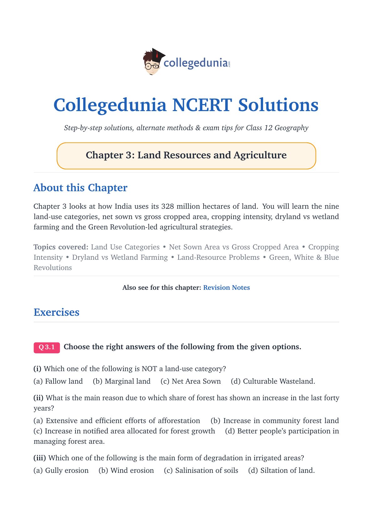
The NCERT Solutions for Class 12 Geography (India: People and Economy) Chapter 3 Land Resources and Agriculture cover all 3 exercise questions, in line with the 2026-27 CBSE syllabus. Every answer is in plain English and follows the textbook order: land-use categories, land-use changes, agricultural strategies and the Green Revolution.
- 3 NCERT exercise questions solved with plain prose and bullets, plus an Expert's Solution per question with exam strategy.
- Covers the nine land-use categories, the Green, White and Blue Revolutions, dryland vs wetland farming, and environmental problems of Indian land resources.
- Aligned with the 2026-27 CBSE Class 12 Geography syllabus and CUET Geography patterns.
Every answer here is curated by Geography subject experts, mapped to the 2026-27 NCERT textbook, and refined against the last five years of CBSE board papers.
Student Feedback: What 10,200 students told us about this chapter
71% of students rated the nine land-use categories the trickiest part of Chapter 3, especially telling barren from culturable wasteland, and many confused dryland and wetland farming without the rainfall threshold. Toppers found that writing all five phases of agricultural strategy in order, with one named scheme each, added 2 to 3 marks per long answer.
Source: 2026-27 Class 12 Geography student poll, 10,200 CBSE students across 14 states.
What the NCERT Solutions for Class 12 Geography Chapter 3 Cover
The chapter answers one question: how does India use its land, and how has its farming economy changed since 1947? The textbook answers in four blocks, which these solutions follow.
- Nine land-use categories: the classification used in Land Revenue Records, with the key difference between barren and culturable wasteland.
- Agricultural land use: Net Sown Area, Gross Cropped Area, cropping intensity and Common Property Resources.
- Farming systems: dryland farming (below 75 cm rainfall, ragi and jowar) vs wetland farming (above 200 cm or irrigation, rice and sugarcane).
- Post-independence strategies: five phases from 1950s land reforms through the Green, White and Blue Revolutions to today's sustainability agenda.
Source: Humanities Wallah - Class 12th on YouTube
Exercise-wise Breakdown: Chapter 3 Land Resources and Agriculture NCERT Solutions
Chapter 3 carries 3 exercise questions mixing MCQs, short answers and long answers. The table below maps each to its topic, answer style and typical marks.
| Question | Topic covered | Answer style | Typical marks |
|---|---|---|---|
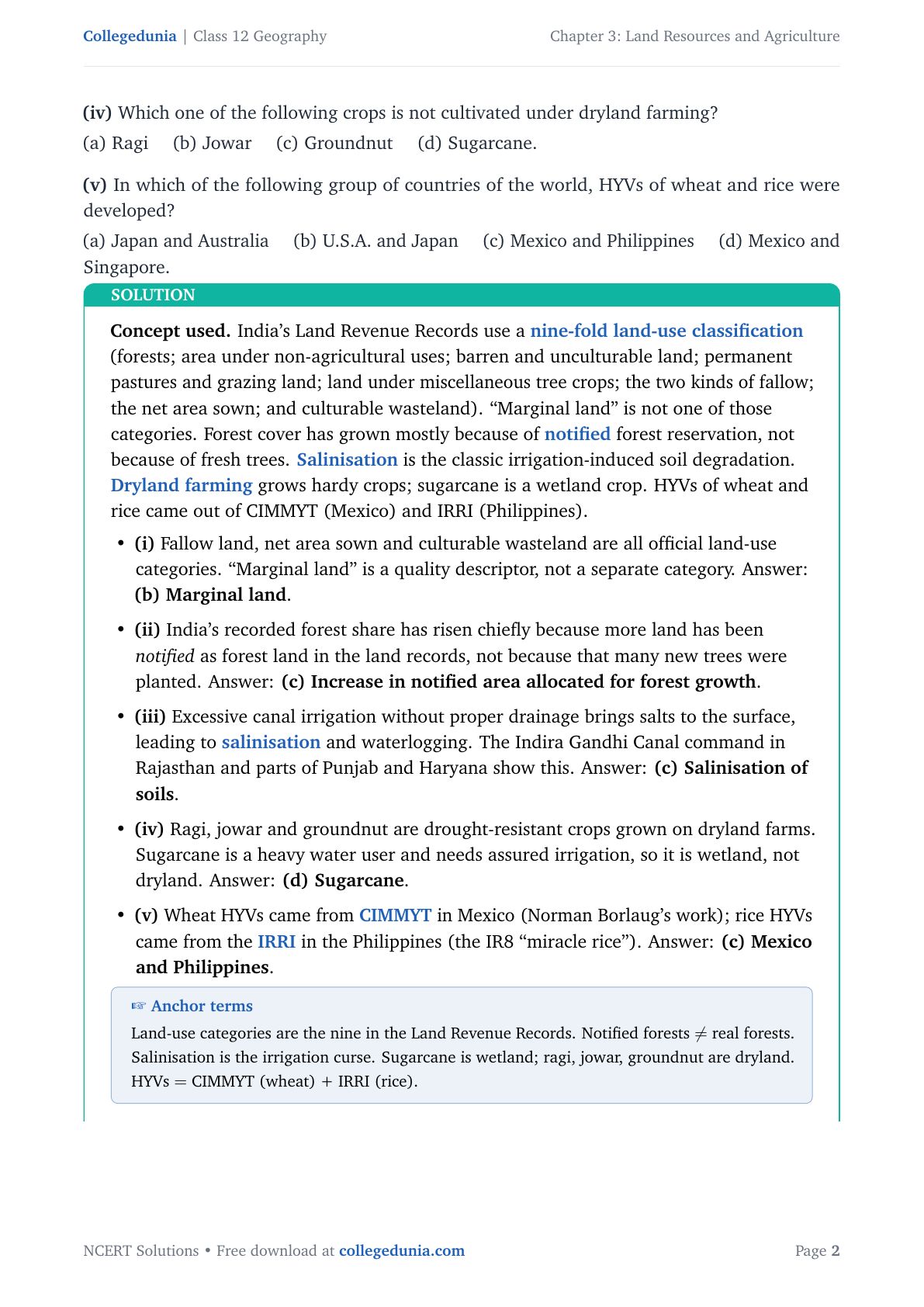
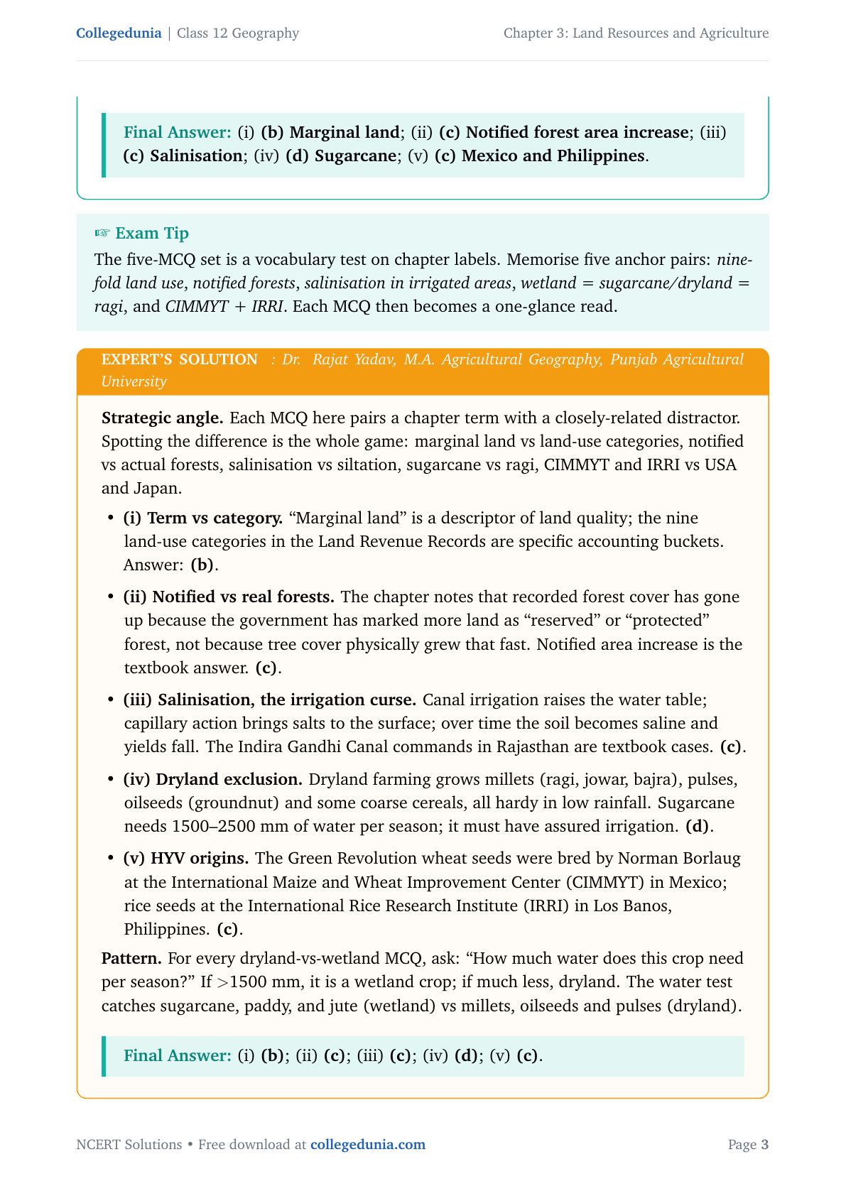
| Q 3.1 | MCQ set: land-use category not in records; reason for forest share increase; main irrigation degradation; crop not grown under dryland farming; HYV origins | One correct option per sub-part with a one-line reason | 1 mark each (5 sub-parts) |
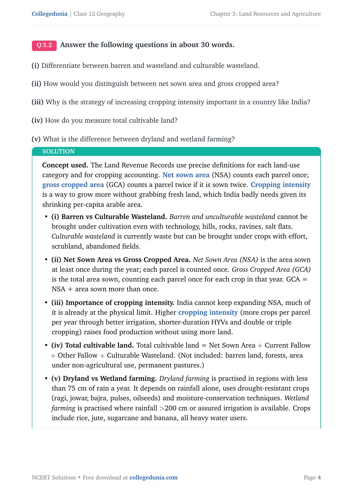
| Q 3.2 | Barren vs culturable wasteland; NSA vs GCA; cropping intensity; total cultivable land; dryland vs wetland farming | Short answer, about 30 words per sub-part, plain prose or bullets | 2-3 marks each |
| Q 3.3 | Environmental problems of land resources; post-independence agricultural development strategies | Long answer, about 150 words per sub-part, with named examples and chronological phases | 5-6 marks each |
The two sub-parts of Q 3.3 carry the heaviest marks. Naming four environmental problems with a region each and walking through all five phases in order with one named scheme each scores full marks.
Nine Land-Use Categories in India: Full Breakdown
India's land-use data uses a nine-fold classification in the Land Revenue Records. The nine categories, defined below, add up to the total reporting area.
| Category | What it means | Key note for exams |
|---|---|---|
| Forests | Land notified or demarcated by government for forest growth | Different from actual forest cover; area can rise without any new trees being planted |
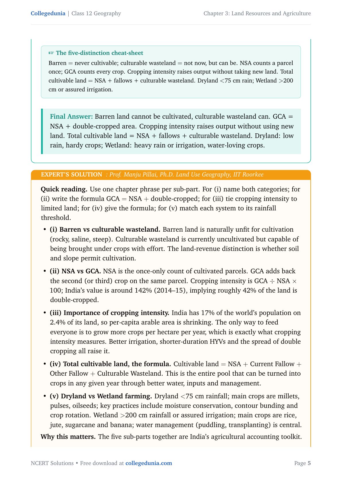
| Barren and Unculturable Wasteland | Rocky hills, ravines, desert lands that cannot be brought under cultivation with available technology | Cannot be reclaimed, unlike culturable wasteland |
| Land under Non-agricultural Uses | Settlements, roads, canals, industries and shops | Has grown the fastest since 1950-51 due to urbanisation and infrastructure expansion |
| Permanent Pastures and Grazing Lands | Land used for grazing livestock; mostly owned by village panchayat or government | Falls under Common Property Resources (CPRs) |
| Miscellaneous Tree Crops and Groves | Orchards and fruit trees not counted in net sown area | Mostly privately owned; has declined under pressure from agricultural land |
| Culturable Wasteland | Land left fallow for more than five years but capable of being brought under cultivation | Can be reclaimed through soil improvement and water management |
| Current Fallow | Land left uncultivated for one year or less to allow soil to rest and recover fertility | Deliberate practice; land recovers through natural processes |
| Fallow Other than Current Fallow | Cultivable land left unused for more than one year but less than five years | If unused for more than five years, reclassified as culturable wasteland |
| Net Area Sown (NSA) | Physical extent of land on which crops are sown and harvested at least once in the year | Each parcel counted only once, regardless of how many crops it grows in a year |
Tip: The Q 3.1(i) MCQ turns on "Marginal land." It sounds official but is NOT one of the nine categories; it is a quality descriptor.
Net Sown Area vs Gross Cropped Area
Net Sown Area (NSA) counts each parcel once, however many crops it grows. Gross Cropped Area (GCA) counts a parcel once per crop, so a double-cropped field is counted twice in GCA but once in NSA.
- Formula: GCA = NSA + area sown more than once.
- Cropping Intensity = (GCA ÷ NSA) × 100, around 142% in India, so about 42% of net sown area is double-cropped.
- Raising cropping intensity is India's main path to higher food output, since NSA expansion has nearly hit its physical limit.
Dryland and Wetland Farming in India: Key Differences
Dryland and wetland farming are two systems shaped by rainfall, crop choice and soil management. CBSE tests this through Q 3.1(iv) and Q 3.2(v); the rainfall threshold is the most-tested number here.
| Feature | Dryland Farming | Wetland Farming |
|---|---|---|
| Rainfall | Less than 75 cm per year; depends entirely on rain | More than 200 cm per year OR assured irrigation available |
| Main crops | Ragi, jowar, bajra, pulses, groundnut (drought-resistant) | Rice, jute, sugarcane, banana (heavy water users) |
| Key practices | Moisture conservation, contour bunding, crop rotation with short-duration varieties | Puddling, transplanting, flood irrigation, canal and tank water management |
| Regions | Rajasthan, parts of Gujarat, interior Maharashtra and Karnataka | West Bengal, Assam, coastal Andhra Pradesh, Kerala |
For Q 3.1(iv), ask how much water the crop needs. Sugarcane needs 1,500 to 2,500 mm per season (a wetland crop); ragi, jowar and groundnut are drought-resistant dryland crops. Sugarcane is the answer.
Environmental Problems of Indian Land Resources
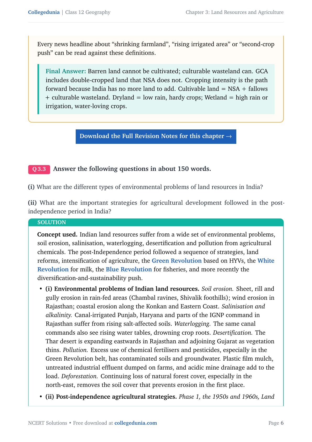
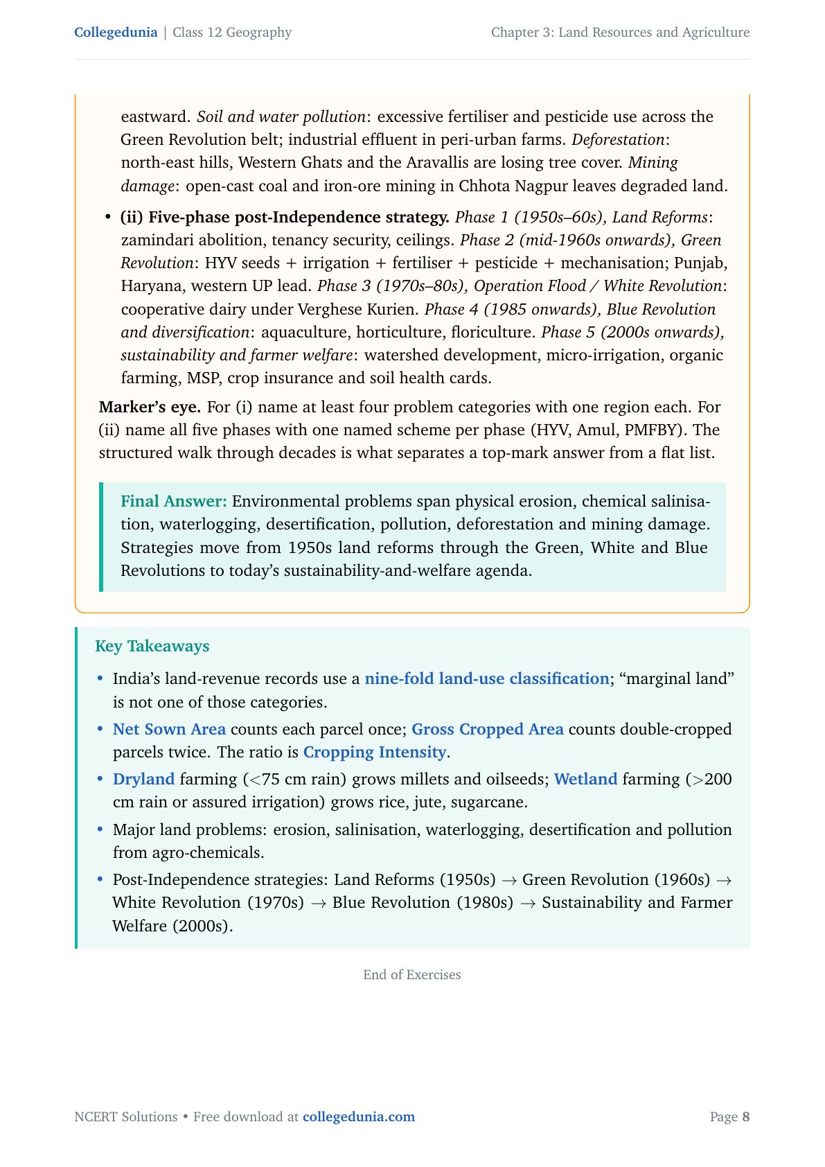
Six categories of land resource problems tested in CBSE and CUET:
- Soil erosion: sheet, rill and gully erosion (Chambal ravines); wind erosion in Rajasthan.
- Salinisation and waterlogging: canal irrigation in Punjab, Haryana and the IGNP command brings salts up and raises the water table.
- Desertification: the Thar expands eastward into Rajasthan and Gujarat.
- Fertiliser and pesticide pollution: excess inputs in the Green Revolution belt contaminate soils and groundwater.
- Deforestation: forest loss, especially in the north-east, removes the soil cover that checks erosion.
- Mining damage: open-cast mining in Chhota Nagpur leaves degraded land.
For Q 3.3(i), name at least four categories with one region each; naming all six earns full marks.
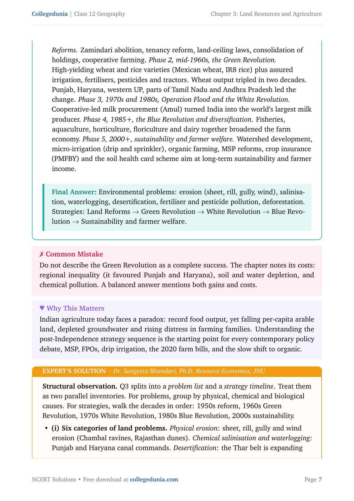
Post-Independence Agricultural Strategies: Five Phases
The Q 3.3(ii) long answer is the most-asked 6-mark question here, expecting a chronological walk through the five phases with a named scheme per phase.
Phase 1 (1950s-1960s): Land Reforms
The focus was redistribution: zamindari abolition, tenancy security, land-ceiling laws, consolidation of holdings and cooperative farming. This freed small farmers from feudal control but left productivity low.
Phase 2 (Mid-1960s onwards): The Green Revolution
The shift came with High-Yielding Variety (HYV) seeds: Mexican wheat from CIMMYT and IR8 rice from IRRI. With irrigation, fertilisers, pesticides and tractors, wheat output more than tripled in two decades. Punjab, Haryana and western Uttar Pradesh led it.
Phase 3 (1970s-1980s): Operation Flood and the White Revolution
Verghese Kurien's cooperative milk network (Amul, scaled through Operation Flood) made India the world's largest milk producer and added a non-crop income stream for rural households.
Phase 4 (1985 onwards): Blue Revolution and Diversification
Fisheries, aquaculture, horticulture and floriculture were scaled up, broadening the farm economy and opening new income sources for coastal and hill communities.
Phase 5 (2000s onwards): Sustainability and Farmer Welfare
This phase responds to the damage from intensive farming. Key schemes: watershed development, micro-irrigation, organic farming, MSP, PMFBY crop insurance and the Soil Health Card.
Common Mistakes Students Make in Chapter 3 Answers
The five repeat-offender mistakes on this chapter:
- Calling marginal land a land-use category: it is a quality descriptor, not one of the nine categories.
- Mixing up barren and culturable wasteland: barren cannot be cultivated even with available technology; culturable can be reclaimed.
- Confusing NSA and GCA: NSA counts each parcel once, GCA counts every crop on each parcel.
- Blaming salinisation on drought: it is caused by excessive canal irrigation without drainage, the key to Q 3.1(iii).
- Listing only the Green Revolution: the board expects all five phases with a named scheme each, or you lose 2 to 4 marks.
Previous Year Question Trends from Chapter 3
Chapter 3 questions follow a stable pattern. The table below maps question types and typical marks across recent papers.
| Year | Question type asked | Marks |
|---|---|---|
| 2025 | MCQ on dryland vs wetland farming crop; short answer on cropping intensity importance | 1 + 3 |
| 2024 | Distinguish barren wasteland from culturable wasteland; name two environmental problems of land resources with regions | 3 + 4 |
| 2023 | Difference between NSA and GCA with formula; long answer on post-independence agricultural strategies | 3 + 6 |
| 2022 | MCQ on HYV origins (CIMMYT and IRRI); short answer on Common Property Resources | 1 + 3 |
| 2021 | Environmental problems of land resources in India; dryland vs wetland farming with examples | 6 + 3 |
Also Check: CUET Geography regularly asks MCQs and short answers from this chapter; land-use categories, HYV origins and salinisation are favourites in CUET section B.
Other Resources for Class 12 Geography Chapter 3
Pair this with the matching notes, handwritten notes and the official NCERT book chapter, all linked below.
| Resource | What it covers | Open |
|---|---|---|
| NCERT Solutions | Step-by-step answers to all 3 exercise questions, with Expert's Solution alternatives. | You are here |
| Notes | Concept-first revision notes covering nine land-use categories, farming systems and all five post-independence agricultural strategies. | Class 12 Geography Chapter 3 Notes |
| Handwritten Notes | A topper's genuine handwritten revision pages for last-minute board practice. | Class 12 Geography Chapter 3 Handwritten Notes |
| NCERT Book PDF | Official NCERT India: People and Economy Chapter 3 textbook in PDF form. | Class 12 Geography Chapter 3 NCERT Book PDF |
| Subject Hub | All chapters of Class 12 Geography with every resource in one place. | Class 12 Geography Subject Hub |
India: People and Economy - All Chapters NCERT Solutions
Related Links: Use the table below for the NCERT Solutions of the other Class 12 IPE chapters, each with the same plain-English style, PDF and FAQ.
| Chapter | Topic | NCERT Solutions link |
|---|---|---|
| Chapter 1 | Population Distribution, Density, Growth and Composition | NCERT Solutions for Class 12 Geography Chapter 1 IPE |
| Chapter 2 | Human Settlements | NCERT Solutions for Class 12 Geography Chapter 2 Human Settlements |
| Chapter 3 | Land Resources and Agriculture | You are here |
| Chapter 4 | Water Resources | NCERT Solutions for Class 12 Geography Chapter 4 Water Resources |
| Chapter 5 | Mineral and Energy Resources | NCERT Solutions for Class 12 Geography Chapter 5 Mineral and Energy Resources |
| Chapter 6 | Planning and Sustainable Development in Indian Context | NCERT Solutions for Class 12 Geography Chapter 6 Planning and Sustainable Development |
| Chapter 7 | Transport and Communication | NCERT Solutions for Class 12 Geography Chapter 7 Transport and Communication |
| Chapter 8 | International Trade | NCERT Solutions for Class 12 Geography Chapter 8 International Trade |
| Chapter 9 | Geographical Perspective on Selected Issues and Problems | NCERT Solutions for Class 12 Geography Chapter 9 Geographical Perspective |
NCERT Solutions for Class 12 Geography Chapter 3: Step-by-Step Answers
Choose the right answers of the following from the given options.
Answer the following questions in about 30 words.
Answer the following questions in about 150 words.
FAQs on NCERT Solutions for Class 12 Geography Chapter 3
What is the difference between barren wasteland and culturable wasteland in Class 12 Geography?
Barren and unculturable wasteland consists of land that cannot be brought under cultivation with available technology, such as rocky hills, steep ravines, salt flats and desert dunes. Culturable wasteland is land that is currently unused or left fallow for more than five years but can be brought under crops with soil improvement, water management and reclamation practices. The key test is whether the land can be cultivated; if yes, it is culturable wasteland; if no, it is barren wasteland.
What is the difference between Net Sown Area and Gross Cropped Area?
Net Sown Area (NSA) is the physical area sown with crops at least once in the agricultural year, with each parcel counted only once. Gross Cropped Area (GCA) is the total sown area, counting each parcel once for every crop grown on it in that year. So a field that grows two crops in one year contributes once to NSA but twice to GCA. The formula is GCA = NSA + Area sown more than once. Cropping intensity = (GCA divided by NSA) multiplied by 100.
What are the nine land-use categories in India?
The nine land-use categories maintained in India's Land Revenue Records are: (1) Forests, (2) Barren and unculturable wasteland, (3) Land under non-agricultural uses, (4) Permanent pastures and grazing lands, (5) Miscellaneous tree crops and groves, (6) Culturable wasteland, (7) Current fallow, (8) Fallow other than current fallow, and (9) Net area sown. These categories add up to the total reporting area maintained by the land revenue department.
What are the five phases of post-independence agricultural strategy in India?
The five phases are: Phase 1 (1950s-60s) Land Reforms, including zamindari abolition, tenancy reform and land-ceiling laws. Phase 2 (mid-1960s) the Green Revolution using HYV wheat (from CIMMYT, Mexico) and rice (from IRRI, Philippines) with assured irrigation and fertilisers. Phase 3 (1970s-80s) Operation Flood and the White Revolution, led by Amul and Verghese Kurien, making India the world's largest milk producer. Phase 4 (1985 onwards) the Blue Revolution and diversification into fisheries, horticulture and floriculture. Phase 5 (2000s) sustainability and farmer welfare through PMFBY crop insurance, Soil Health Cards and micro-irrigation schemes.
Why is cropping intensity important for India?
India supports 17% of the world's population on only 2.4% of its land area, so per-capita arable land is very small and shrinking. The Net Sown Area has nearly reached its physical limit because most usable land is already under crops. The only practical way to produce more food without clearing new land is to grow more crops per parcel per year, which is exactly what higher cropping intensity achieves. Better irrigation, shorter-duration HYV seeds and the spread of double and triple cropping all increase cropping intensity and raise food output without taking new land.



Comments