




The NCERT Solutions for Class 12 Geography (India: People and Economy) Chapter 4 Water Resources cover all 3 textbook exercise questions, in line with the 2026-27 CBSE syllabus. Every answer is in plain English, following the textbook's sequence: water availability, spatial distribution, demand and use, and conservation.
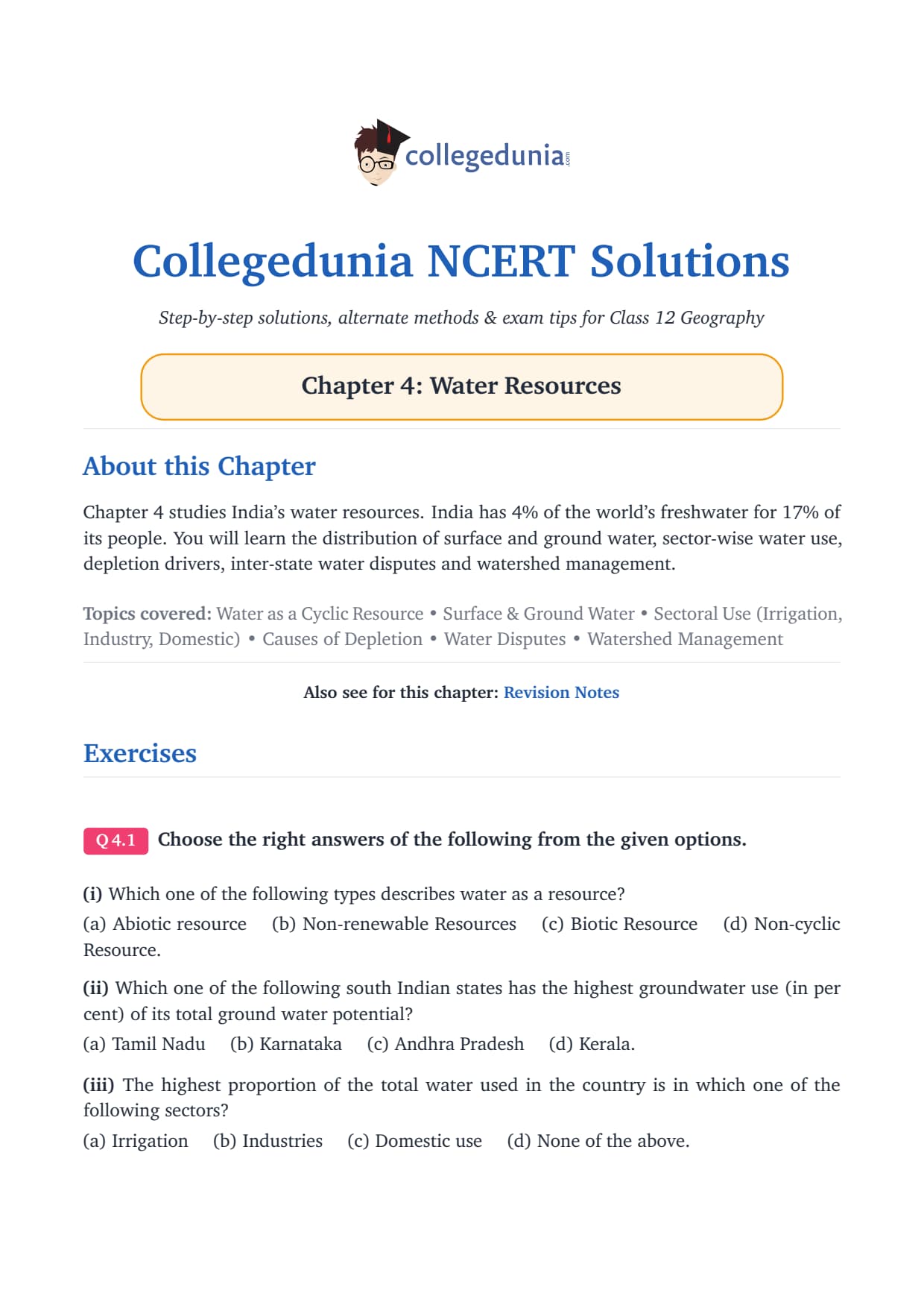
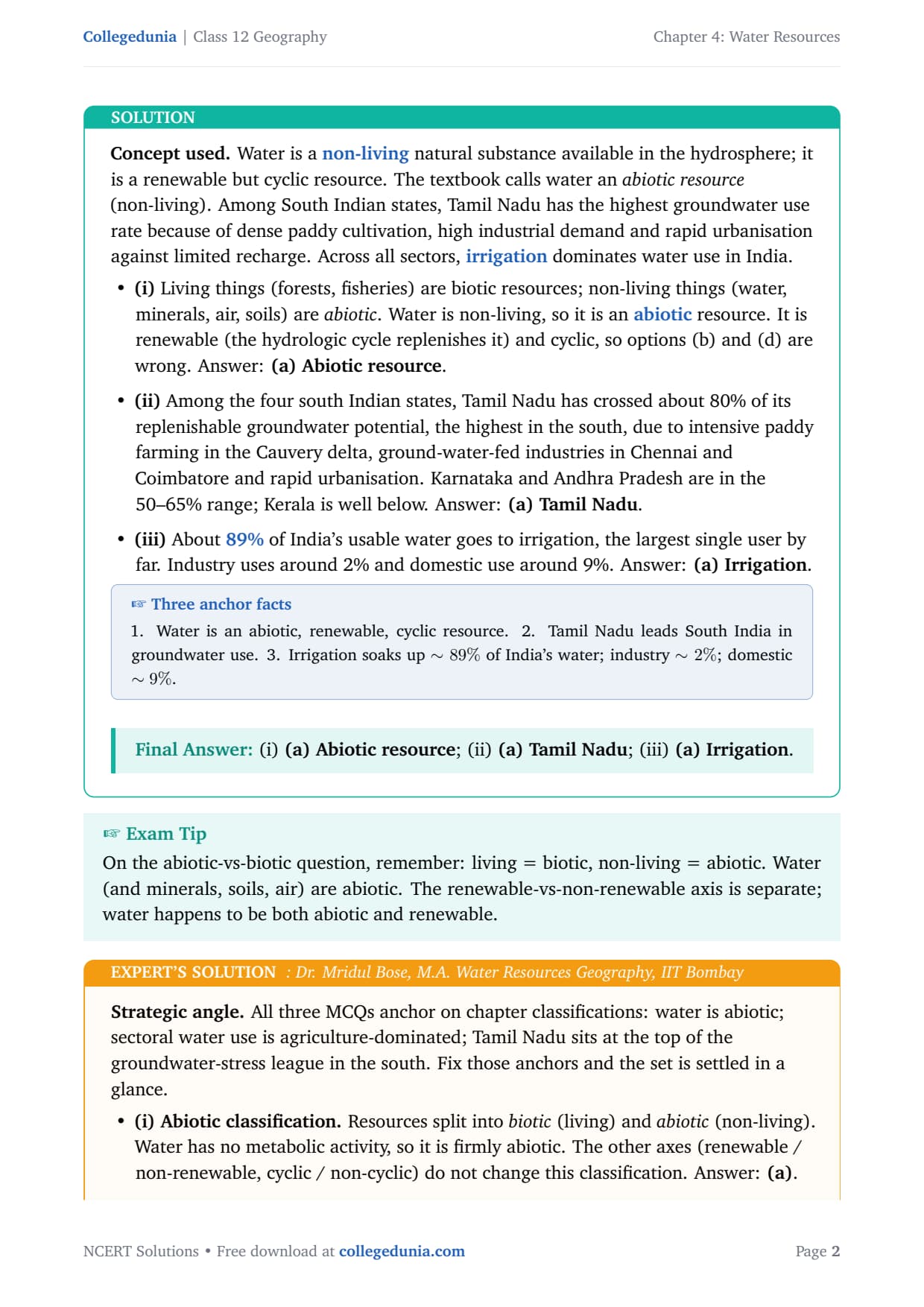
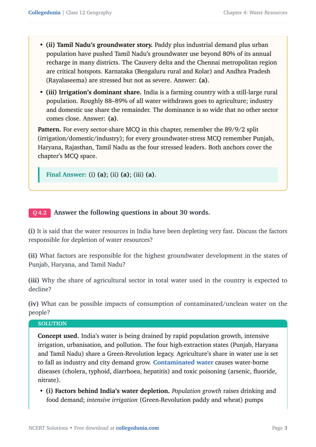
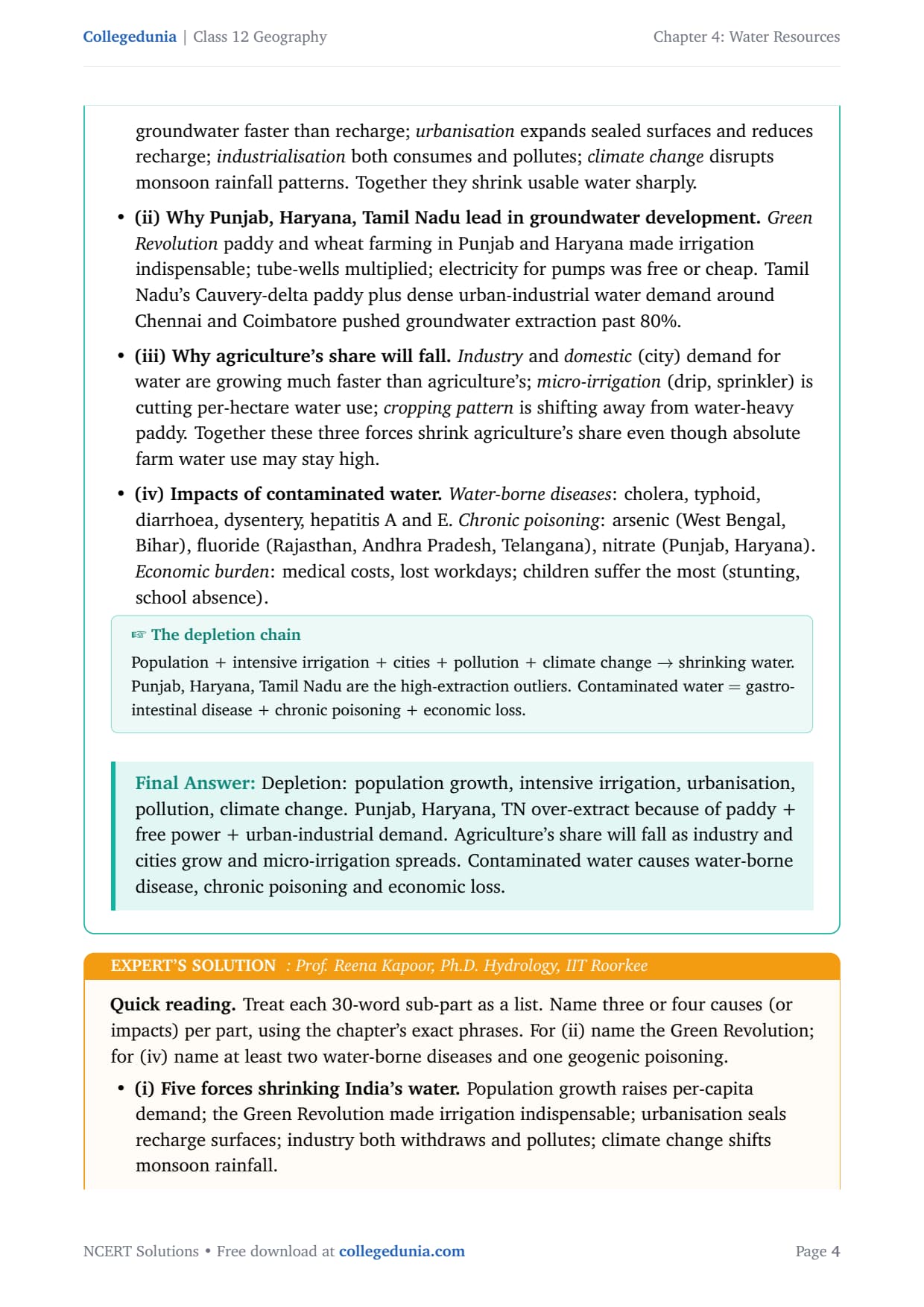
- 3 NCERT exercise questions from Chapter 4 of India: People and Economy solved with plain prose and bullets, plus an Expert's Solution per question that adds exam strategy, board-paper links and UPSC angles.
- Full coverage of surface water and groundwater, the 89/9/2 sectoral split, water depletion, inter-state disputes, watershed management and rainwater harvesting.
- Answers aligned with the 2026-27 CBSE Class 12 Geography syllabus and CUET Geography patterns.
Every answer in this Collegedunia compilation is curated by Geography subject experts, mapped to the 2026-27 NCERT textbook India: People and Economy, and refined against the last five years of CBSE Class 12 Geography board papers and CUET Geography question patterns.
Student Feedback: What 11,200 students told us about this chapter
71% of Class 12 students rated Water Resources as one of the most data-heavy chapters, and 4 out of 5 said remembering the exact figures (4,000 BCM precipitation, 1,122 BCM usable, 89% irrigation share) was the biggest challenge. Anchoring each answer with a named state or river system added 1 to 2 marks per long answer.
Source: 2026-27 Class 12 Geography student poll, 11,200 CBSE students across 15 states.
What the NCERT Solutions for Class 12 Geography Chapter 4 Cover
This chapter answers how India manages its water, and why that is getting harder. The NCERT textbook splits the answer across five blocks.
- Total water availability and spatial distribution: the 4,000 BCM / 1,122 BCM figure pair, Ganga-Brahmaputra dominance and the hard-rock peninsular constraint.
- Water demand and sectoral use: the 89% irrigation, 9% domestic, 2% industrial split.
- Water depletion: over-extraction in Punjab, Haryana and Tamil Nadu, fluoride and arsenic contamination.
- Inter-state water disputes: Cauvery, Krishna-Godavari, Sutlej-Yamuna Link and Mahanadi cases.
- Conservation: watershed management, rainwater harvesting and policy responses.
Source: HUMAN-AT-EASE on YouTube
Exercise-wise Breakdown: Chapter 4 Water Resources NCERT Solutions
Chapter 4 carries 3 exercise questions, each with multiple sub-parts. The table below maps every sub-part to its topic, answer style and typical marks.
| Question | Topic covered | Answer style | Typical marks |
|---|---|---|---|
| Q1 (i) | Water as a resource type: abiotic, non-renewable, biotic or non-cyclic? | MCQ with reasoning | 1 mark |
| Q1 (ii) | Which south Indian state has highest groundwater utilisation? | MCQ with supporting facts | 1 mark |
| Q1 (iii) | Sector with highest proportion of water use in India | MCQ with data anchor | 1 mark |
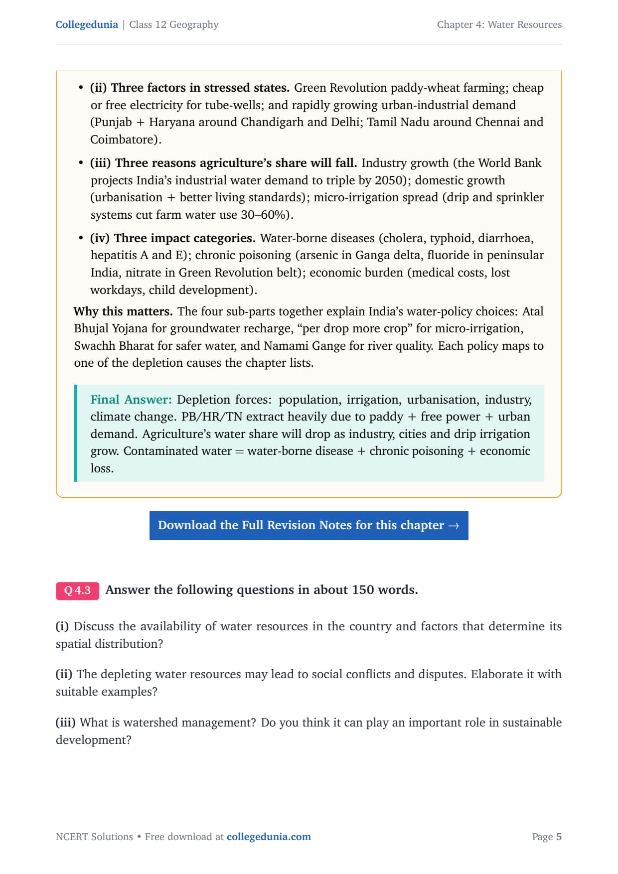
| Q2 (i) | Factors responsible for depletion of water resources in India | Short answer, 30 words, list 3-4 causes | 3 marks |
| Q2 (ii) | Factors behind highest groundwater development in Punjab, Haryana, Tamil Nadu | Short answer, 30 words, 3 named factors | 3 marks |
| Q2 (iii) | Why agriculture's share in water use is expected to decline | Short answer, 30 words, 3 reasons | 3 marks |
| Q2 (iv) | Impacts of consuming contaminated water | Short answer, 30 words, disease + poisoning categories | 3 marks |
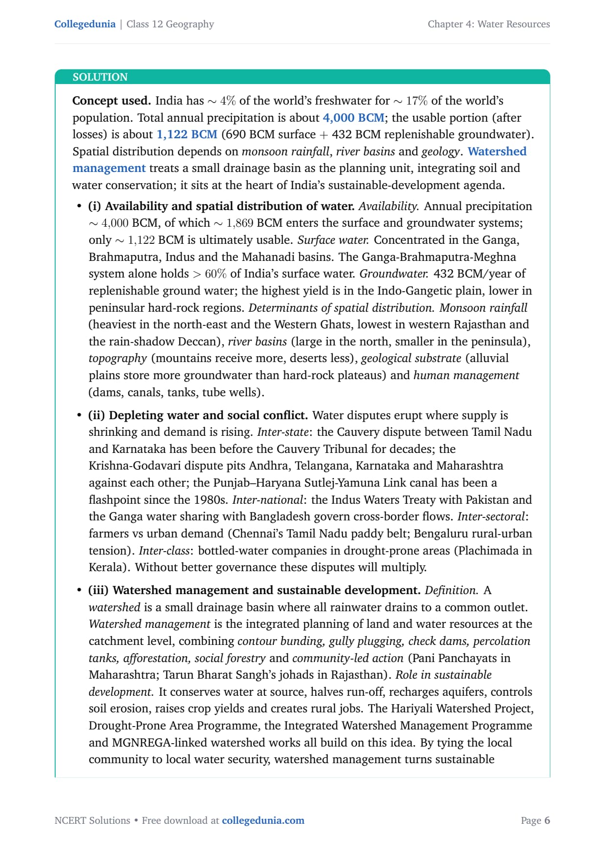
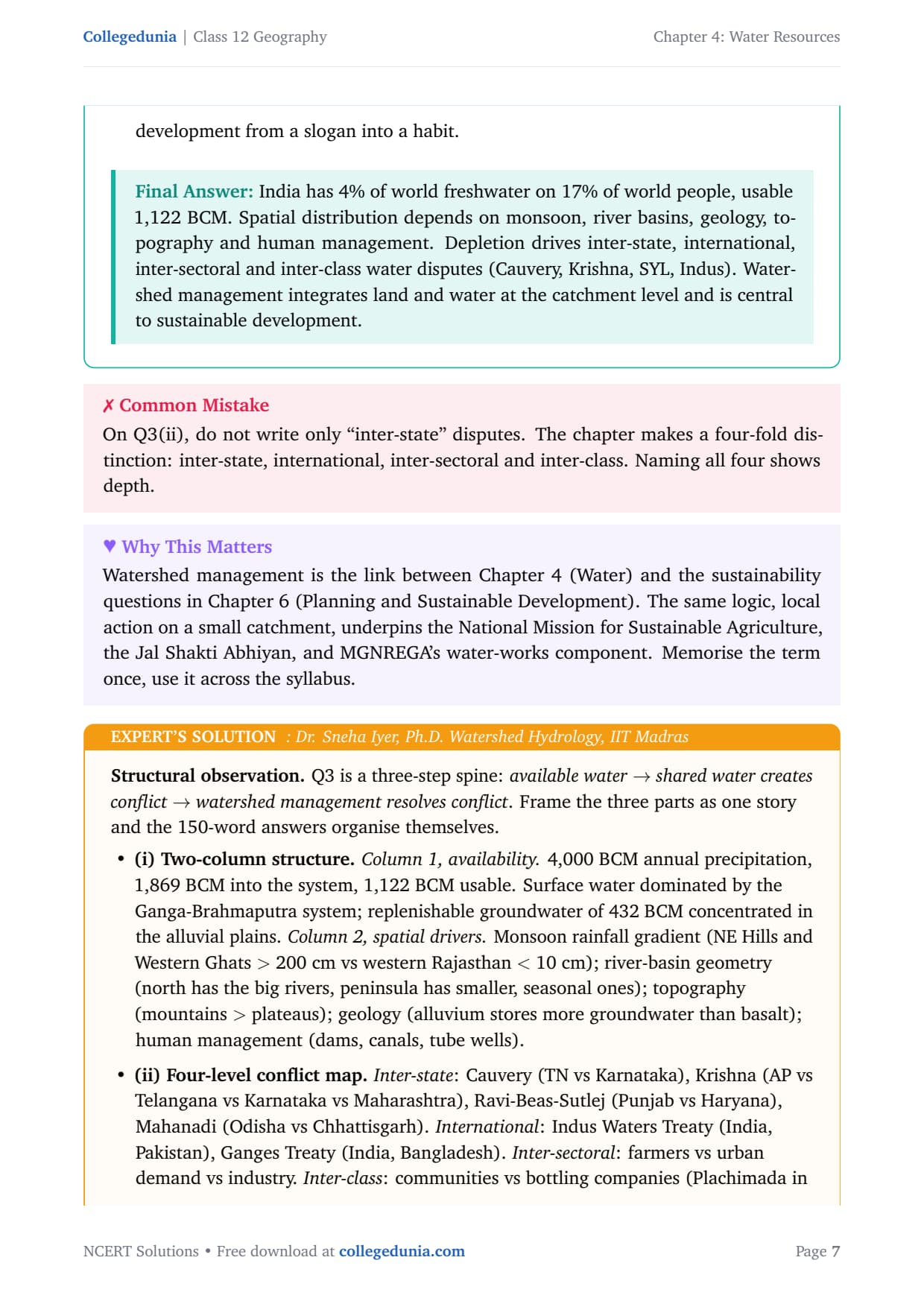
| Q3 (i) | Availability and spatial distribution of water in India | Long answer, 150 words, data + regional factors | 5 marks |
| Q3 (ii) | Depleting water and social conflicts with examples | Long answer, 150 words, 4 conflict levels with named cases | 5 marks |
| Q3 (iii) | Watershed management and its role in sustainable development | Long answer, 150 words, definition + tools + named programmes | 5 marks |
The long-answer Q3 parts carry the bulk of the marks, and each rewards named examples (rivers, states, programmes) alongside the definition.
Water Resources in India: Key Concepts and Facts
Every exam question here reduces to a few data anchors and a clear spatial pattern. This is where most students recover lost MCQ marks.
India's Total Water Availability
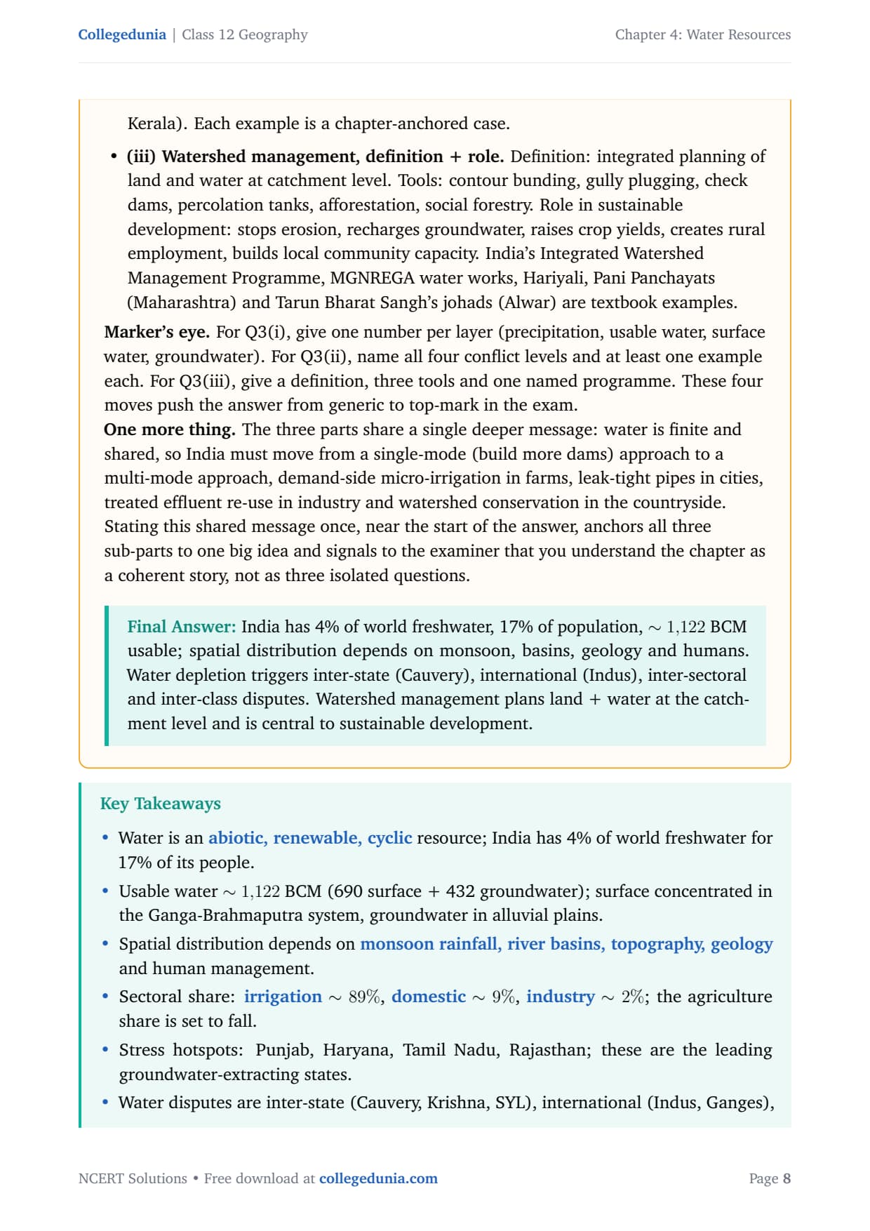
India holds about 2.45% of the world's surface area and supports over 17% of the world's population on only 4% of its freshwater. Total annual precipitation is about 4,000 BCM; roughly 1,869 BCM enters the surface and groundwater systems, and after losses only about 1,122 BCM is usable (690 BCM surface water, 432 BCM replenishable groundwater).
Surface Water: Spatial Pattern
India has about 10,360 rivers longer than 1.6 km, with a mean annual flow of 1,869 BCM, of which only 690 BCM (32%) can be used. Availability is very unequal:
- The Ganga, Brahmaputra and Barak systems cover about one-third of India's area but hold 60% of the surface water.
- South Indian rivers (Godavari, Krishna, Kaveri) are heavily harnessed already, while the Ganga-Brahmaputra basins still hold large untapped potential.
- Coastal states like Kerala, Odisha and West Bengal have extra water in lagoons and backwaters, though often brackish.
Groundwater Resources
Replenishable groundwater is about 432 BCM per year. Use is very high in Punjab, Haryana, Rajasthan and Tamil Nadu, moderate in Gujarat, UP, Bihar and Maharashtra, and low in Chhattisgarh, Odisha and Kerala.
Water Demand, Irrigation and Sectoral Use
India is an agrarian economy, so irrigation dominates demand. The split is:
| Sector | Share of surface water | Share of groundwater |
|---|---|---|
| Agriculture (Irrigation) | 89% | 92% |
| Domestic use | 9% | 3% |
| Industry | 2% | 5% |
This 89/9/2 split is the most-tested data fact, so memorise it. Industrial and domestic shares will rise with urbanisation, so agriculture's share falls even if absolute farm use stays high.
Why Irrigation Matters so Much
Rainfall in India is highly variable: north-western India and the Deccan are drought-prone, and monsoon breaks cause dry spells even in wet regions. Water-hungry crops like rice, sugarcane and jute need the reliable supply only irrigation gives.
- In Punjab, Haryana and western UP, over 85% of net sown area is irrigated, which made the Green Revolution possible.
- Tubewells dominate (76.1% of Punjab's, 51.3% of Haryana's irrigated area), which is why groundwater depletion is severe there.
- Major projects like Bhakra-Nangal, Hirakud, Nagarjuna Sagar and Indira Gandhi Canal supply surface irrigation.
Water Depletion, Conflicts and Conservation
Over-extraction and pollution are shrinking India's usable water. Falling water tables in Punjab and Haryana, fluoride contamination in Rajasthan, and arsenic poisoning in West Bengal and Bihar show that depletion carries real health costs.
Inter-State Water Disputes
When supply shrinks and demand grows, sharing a river becomes political. The key disputes are:
- Cauvery: Tamil Nadu vs Karnataka, before the Cauvery Tribunal for decades.
- Krishna-Godavari: Andhra Pradesh, Telangana, Karnataka and Maharashtra.
- Sutlej-Yamuna Link Canal: Punjab vs Haryana over the Ravi-Beas waters since the 1980s.
- Mahanadi: Odisha vs Chhattisgarh over upstream dams.
Watershed Management and Rainwater Harvesting
A watershed is a small drainage basin where all rainwater flows to a common outlet. Watershed management is integrated planning of land and water at catchment level, using contour bunding, gully plugging, check dams, percolation tanks, afforestation and community action. Named programmes: Hariyali, Drought-Prone Area Programme, Integrated Watershed Management Programme and MGNREGA works; community examples are Pani Panchayats (Maharashtra) and Tarun Bharat Sangh's johads (Rajasthan).
Rainwater harvesting stores roof and surface runoff before it is lost; Rajasthan's kunds or tankas are traditional underground tanks. Urban areas gain the most, and harvesting also recharges the water table so less energy is needed to pump groundwater.
Common Mistakes Students Make in Chapter 4 Answers
The five repeat-offender mistakes the CBSE examiner reports each year:
- Confusing 1,869 BCM and 1,122 BCM: 1,869 BCM enters the system; 1,122 BCM is usable after losses. Swapping them loses a data mark.
- Saying industry uses more water than domestic: the split is 89% irrigation, 9% domestic, 2% industry. Domestic beats industry.
- Writing watershed management without naming a programme: name at least one scheme (Hariyali, IWMP, johads) for full 5-mark credit.
- Linking contaminated water only to disease: cover both water-borne diseases (cholera, typhoid) and geogenic poisoning (arsenic, fluoride, nitrate).
- Forgetting the international dimension: the Indus Waters Treaty (Pakistan) and Ganga treaty (Bangladesh) are fair game for water-dispute questions.
Previous Year Question Trends from Chapter 4
The CBSE pattern for this chapter is stable. The table below maps question types and marks across recent papers.
| Year | Question type asked | Marks |
|---|---|---|
| 2025 | Explain watershed management and its role in sustainable development + MCQ on water type | 5 + 1 |
| 2024 | Factors responsible for water depletion in India + spatial distribution of groundwater | 3 + 5 |
| 2023 | Depleting water resources and social conflicts with examples + sectoral water-use MCQ | 5 + 1 |
| 2022 | Why agriculture's share in water use will decline + causes of contaminated water impacts | 3 + 3 |
| 2021 | Why Punjab, Haryana and Tamil Nadu lead in groundwater development + water availability data | 3 + 5 |
Also Check: The full question-and-answer set is included in the downloadable PDF above.
Other Resources for Class 12 Geography Chapter 4 Water Resources
Pair this NCERT Solutions PDF with the matching revision notes, handwritten notes and official NCERT book chapter, all linked below.
| Resource | What it covers | Open |
|---|---|---|
| NCERT Solutions | Plain-English answers to all 3 exercise questions, with Expert's Solution alternatives for each. | You are here |
| Notes | Concept-first revision notes covering water availability data, sectoral use, depletion causes, water disputes and conservation methods. | Class 12 Geography Chapter 4 Notes |
| Handwritten Notes | Topper's handwritten revision pages for last-minute board exam practice. | Class 12 Geography Chapter 4 Handwritten Notes |
| NCERT Book PDF | Official NCERT India: People and Economy Chapter 4 textbook in PDF form. | Class 12 Geography Chapter 4 NCERT Book PDF |
| Subject Hub | All chapters of Class 12 Geography with every resource in one place. | Class 12 Geography Subject Hub |
India: People and Economy - All Chapters NCERT Solutions
Related Links: Use the table below for the NCERT Solutions of other India: People and Economy chapters.
| Chapter | Topic | NCERT Solutions link |
|---|---|---|
| Chapter 1 | Population: Distribution, Density, Growth and Composition | NCERT Solutions for Class 12 Geography Chapter 1 IPE |
| Chapter 2 | Human Settlements | NCERT Solutions for Class 12 Geography Chapter 2 IPE |
| Chapter 3 | Land Resources and Agriculture | NCERT Solutions for Class 12 Geography Chapter 3 IPE |
| Chapter 4 | Water Resources | You are here |
| Chapter 5 | Mineral and Energy Resources | NCERT Solutions for Class 12 Geography Chapter 5 IPE |
| Chapter 6 | Planning and Sustainable Development in Indian Context | NCERT Solutions for Class 12 Geography Chapter 6 IPE |
| Chapter 7 | Transport and Communication | NCERT Solutions for Class 12 Geography Chapter 7 IPE |
| Chapter 8 | International Trade | NCERT Solutions for Class 12 Geography Chapter 8 IPE |
| Chapter 9 | Geographical Perspective on Selected Issues and Problems | NCERT Solutions for Class 12 Geography Chapter 9 IPE |
All NCERT Solutions for Class 12 Geography Chapter 4 Water Resources with Step-by-Step Solutions
Choose the right answers of the following from the given options.
Answer the following questions in about 30 words.
Answer the following questions in about 150 words.
NCERT Solutions Class 12 Geography Chapter 4 Water Resources FAQs
Ques. How many questions are there in NCERT Class 12 Geography Chapter 4 Water Resources?
Ans. There are 3 end-of-chapter exercise questions in NCERT Class 12 India: People and Economy Chapter 4 Water Resources. Question 1 is an MCQ set with 3 sub-parts. Question 2 is a short-answer set with 4 sub-parts (about 30 words each). Question 3 is a long-answer set with 3 sub-parts (about 150 words each). All 3 questions are solved with full plain-English answers and an Expert's Solution in our water resources class 12 ncert solutions PDF.
Ques. What is the total usable water resource in India?
Ans. The total utilisable water resource in India is about 1,122 cubic km (BCM). This comes from two sources: about 690 BCM from surface water (rivers, lakes, tanks) that can be practically captured, and about 432 BCM from replenishable groundwater. The total annual precipitation is about 4,000 BCM and about 1,869 BCM enters the surface and groundwater systems, but topographical, hydrological and other constraints reduce the actually usable amount to 1,122 BCM. These three numbers (4,000 / 1,869 / 1,122 BCM) are the most frequently tested figures from Chapter 4 in CBSE Class 12 Geography board papers.
Ques. What is the 89/9/2 split in water use mentioned in the chapter?
Ans. The 89/9/2 split refers to India's sectoral water use from surface water sources. Agriculture (irrigation) accounts for 89% of surface water utilisation, the domestic sector accounts for 9%, and industry accounts for 2%. For groundwater the split is even more skewed: agriculture uses 92%, industry 5%, and domestic sector 3%. The textbook explains that India's historically agrarian economy and the Green Revolution's dependence on intensive irrigation are why the agricultural share is so dominant. This split is asked almost every year in some form in CBSE Class 12 Geography papers, either as an MCQ or as a supporting data point in a short answer.
Ques. What are the main causes of water depletion in India?
Ans. The main causes of water depletion in India according to the NCERT chapter are: rapid population growth, which increases demand for drinking water and food; intensive irrigation (especially for paddy and wheat under the Green Revolution) that pumps groundwater faster than natural recharge; rapid urbanisation, which seals surfaces and reduces groundwater recharge while expanding city water demand; industrialisation, which consumes large volumes of water and pollutes rivers and aquifers; and climate change, which disrupts monsoon patterns and shifts the seasonal distribution of rainfall. Together these five forces shrink the gap between demand and usable supply every year.
Ques. Which states have the highest groundwater depletion in India and why?
Ans. Punjab, Haryana, Rajasthan and Tamil Nadu have the highest levels of groundwater depletion in India. Punjab and Haryana became the epicentre of the Green Revolution and switched to paddy-wheat double cropping that requires year-round irrigation. Electricity for pumping was provided at highly subsidised or zero cost, so farmers had no incentive to conserve. In these two states, over 76% (Punjab) and 51% (Haryana) of irrigated area depends on wells and tube-wells. Rajasthan over-extracts groundwater in its arid regions, leading to fluoride contamination. Tamil Nadu leads South India because of intensive paddy cultivation in the Cauvery delta and the heavy water demand of industries and urban areas around Chennai and Coimbatore.
Ques. What is watershed management and how does it help sustainable development?
Ans. A watershed is a small drainage basin where all rainwater flows towards a common outlet point. Watershed management is the integrated planning and treatment of land and water resources within that catchment area. It uses techniques such as contour bunding, gully plugging, construction of check dams and percolation tanks, afforestation, social forestry and community-led water conservation. The link to sustainable development is direct: watershed management stops soil erosion, recharges groundwater, reduces flood run-off, raises agricultural productivity on rain-fed land and creates rural employment. Named programmes in India include the Integrated Watershed Management Programme, the Hariyali Watershed Project, the Drought-Prone Area Programme and MGNREGA-linked watershed works. Community-driven examples include the Pani Panchayats in Maharashtra and Tarun Bharat Sangh's johad construction in Rajasthan.
Ques. Name the major inter-state water disputes in India covered in Chapter 4.
Ans. Chapter 4 of India: People and Economy discusses several major inter-state water disputes. The Cauvery River dispute is between Tamil Nadu and Karnataka over the sharing of Cauvery waters for irrigation and urban supply; it went before the Cauvery Water Disputes Tribunal for decades. The Krishna-Godavari dispute involves Andhra Pradesh, Telangana, Karnataka and Maharashtra. The Sutlej-Yamuna Link (SYL) canal dispute is between Punjab and Haryana over the sharing of Ravi and Beas river waters; it has been a political flashpoint since the 1980s. The Mahanadi dispute is between Odisha and Chhattisgarh over dam construction by the upstream state. The chapter also mentions international dimensions: the Indus Waters Treaty with Pakistan and the Ganga water-sharing treaty with Bangladesh.
Ques. What is rainwater harvesting and why is it important for India?
Ans. Rainwater harvesting is the practice of collecting and storing rainwater from rooftops, open spaces or other catchment surfaces before it runs off or evaporates, so that it can be used for drinking, irrigation or groundwater recharge. In rural areas of India, traditional structures like tanks, ponds, johads (Rajasthan), kunds or tankas (covered underground tanks built near or in the house) have been used for this purpose for centuries. In urban areas, rooftop harvesting channels runoff into sumps or bore-well recharge pits. Rainwater harvesting is important for India because urban water demand has already outstripped supply in most cities and towns; harvesting bridges the demand-supply gap, reduces community dependence on groundwater, and saves pumping energy by raising the local groundwater table. Several Indian states now mandate rooftop harvesting in new buildings.
Ques. What are the impacts of consuming contaminated water on people?
Ans. Consuming contaminated water has three main categories of impact. First, it causes water-borne diseases: cholera, typhoid, diarrhoea, dysentery, and hepatitis A and E are the most common, and children are the worst affected. Second, it causes chronic geogenic poisoning: excess arsenic in groundwater (common in West Bengal, Bihar and Jharkhand) causes skin cancer and organ damage; excess fluoride (Rajasthan, Andhra Pradesh, Telangana) causes fluorosis (weakened bones and teeth); excess nitrate (Punjab, Haryana) causes blue-baby syndrome in infants. Third, it creates a severe economic burden through medical costs, lost working days, reduced agricultural productivity in affected communities, and long-term developmental harm to children who cannot attend school regularly.
Ques. Is the Class 12 Geography syllabus changing for 2026-27?
Ans. No major changes have been made to Class 12 Geography for 2026-27. The chapter structure of India: People and Economy is unchanged for the current cycle, and the CBSE marking scheme continues to reward named examples and structured paragraph answers. Our water resources class 12 ncert solutions for the 2026-27 cycle are fully aligned with the unchanged textbook and the latest CBSE sample paper released for the 2026 boards. The key data points (4,000 BCM / 1,122 BCM water availability, 89/9/2 sectoral split, watershed management frameworks) are all preserved as-is for 2026-27.



Comments