




CUET Geography Question Paper 2024 Set C is available here. NTA conducted CUET 2024 Geography paper on 17 May in Shift 1A from 10 AM to 10:45 AM. CUET Geography Question Paper 2024 is based on objective-type questions (MCQs). Candidates get 45 minutes to solve 40 MCQs out of 50 in CUET 2024 question paper for Geography.
CUET Geography Question Paper 2024 Set C PDF Download
| CUET 2024 Geography Question Paper Set C with Answer Key |  Download Download |
Check Solution |
CUET Geography Question Paper with Solution
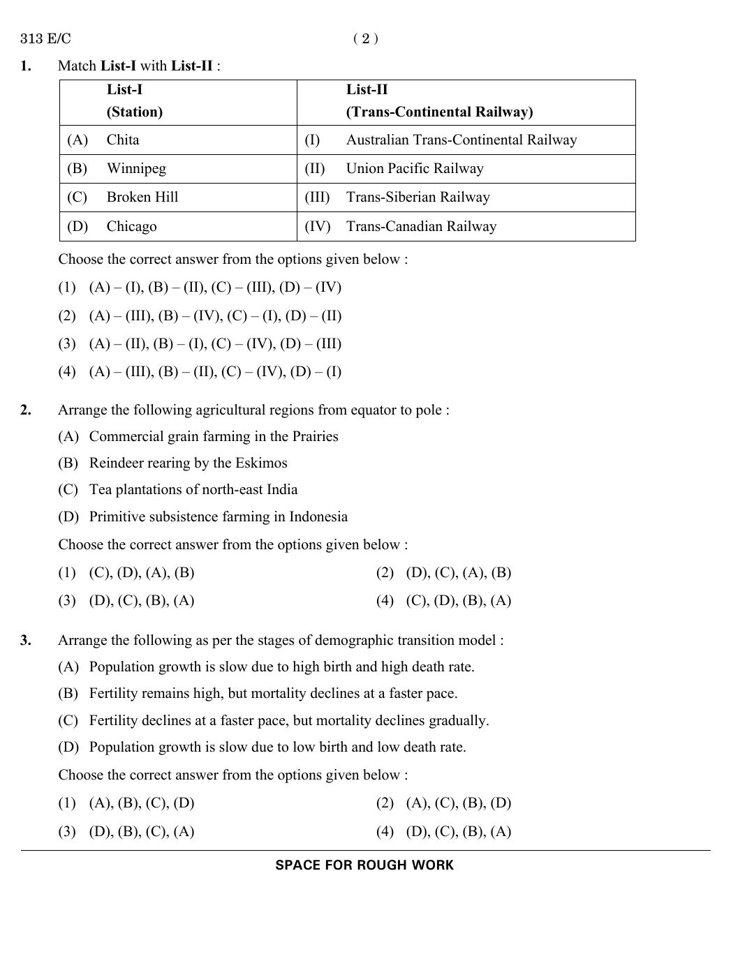
Match List-I with List-II :
List-I (Station)
(A) Chita
(B) Winnipeg
(C) Broken Hill
(D) Chicago
List-II (Trans-Continental Railway)
(I) Australian Trans-Continental Railway
(II) Union Pacific Railway
(III) Trans-Siberian Railway
(IV) Trans-Canadian Railway
View Solution
Arrange the following agricultural regions from equator to pole :
(A) Commercial grain farming in the Prairies
(B) Reindeer rearing by the Eskimos
(C) Tea plantations of north-east India
(D) Primitive subsistence farming in Indonesia
View Solution
Arrange the following as per the stages of demographic transition model :
(A) Population growth is slow due to high birth and high death rate.
(B) Fertility remains high, but mortality declines at a faster pace.
(C) Fertility declines at a faster pace, but mortality declines gradually.
(D) Population growth is slow due to low birth and low death rate.
View Solution
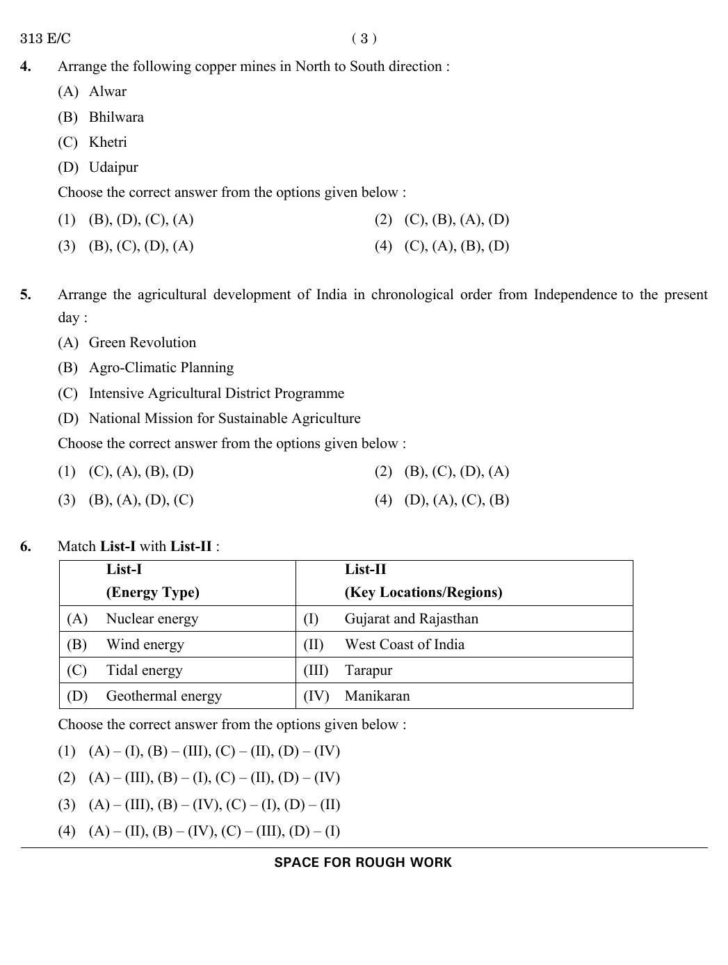
Arrange the following copper mines in North to South direction :
(A) Alwar
(B) Bhilwara
(C) Khetri
(D) Udaipur
View Solution
Arrange the agricultural development of India in chronological order from Independence to the present day:
(A) Green Revolution
(B) Agro-Climatic Planning
(C) Intensive Agricultural District Programme
(D) National Mission for Sustainable Agriculture
View Solution
Match List-I with List-II :
List-I (Energy Type)
(A) Nuclear energy
(B) Wind energy
(C) Tidal energy
(D) Geothermal energy
List-II (Key Locations/Regions)
(I) Gujarat and Rajasthan
(II) West Coast of India
(III) Tarapur
(IV) Manikaran
View Solution
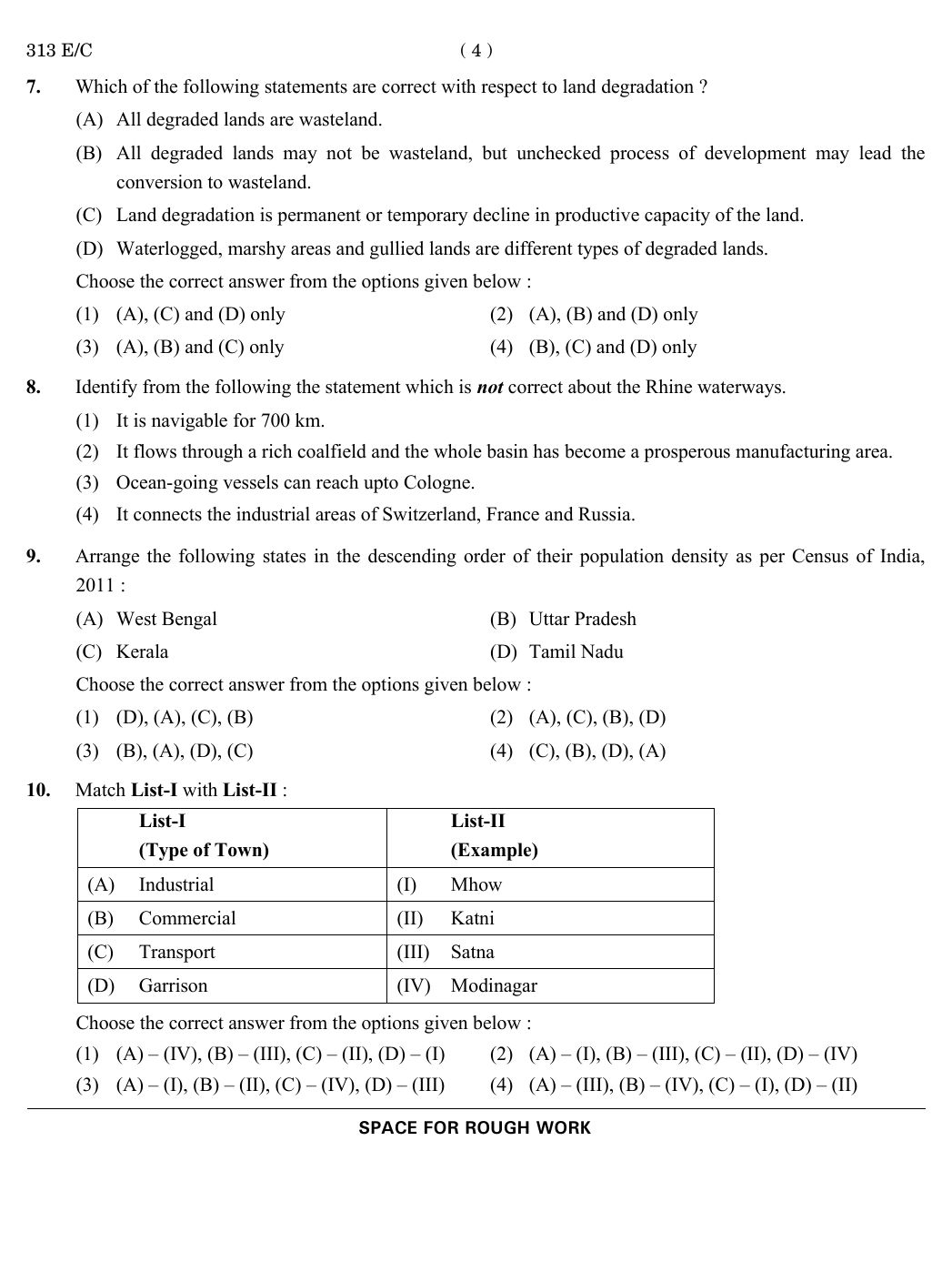
Which of the following statements are correct with respect to land degradation?
(A) All degraded lands are wasteland.
(B) All degraded lands may not be wasteland, but unchecked processes of development may lead to conversion to wasteland.
(C) Land degradation is permanent or temporary decline in the productive capacity of the land.
(D) Waterlogged, marshy areas, and gullied lands are different types of degraded lands.
View Solution
Identify from the following the statement which is not correct about the Rhine waterways.
View Solution
Arrange the following states in the descending order of their population density as per Census of India, 2011:
(A) West Bengal
(B) Uttar Pradesh
(C) Kerala
(D) Tamil Nadu
View Solution
Match List-I with List-II:
List-I (Type of Town)
(A) Industrial
(B) Commercial
(C) Transport
(D) Garrison
List-II (Example)
(I) Mhow
(II) Katni
(III) Satna
(IV) Modinagar
View Solution
Identify from the following, the correct statements with reference to the metropolis:
(A) It is often the chief centre or seat of some form of activity.
(B) It could be an administrative, commercial or industrial centre.
(C) It generally serves a small hinterland.
(D) It is a very large city or agglomeration of population.
View Solution
Match List-I with List-II:
List-I (Economic Activity)
(A) Quaternary
(B) Secondary
(C) Tertiary
(D) Primary
List-II (Example)
(I) Manufacturing
(II) Mining
(III) Taxi services
(IV) Research scientist
View Solution
Identify from the following, the correct statements with reference to oil refineries in India:
(A) Digboi is an example of market-based oil refinery.
(B) Tatipaka Oil Refinery is located in Andhra Pradesh.
(C) Numaligarh Oil Refinery is located in north-east India.
(D) Bina Oil Refinery is located in Madhya Pradesh.
View Solution
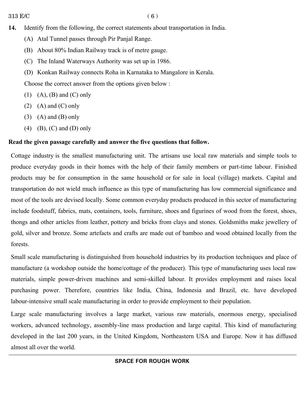
Identify from the following the correct statements about transportation in India:
(A) Atal Tunnel passes through Pir Panjal Range.
(B) About 80% of Indian Railway track is of metre gauge.
(C) The Inland Waterways Authority was set up in 1986.
(D) Konkan Railway connects Roha in Karnataka to Mangalore in Kerala.
View Solution
The small scale manufacturing and the cottage manufacturing are distinguished on the basis of _________ .
View Solution
Which one of the following is not a feature of small scale manufacturing?
View Solution
From the following, identify the feature of the cottage industry:
View Solution
Large scale manufacturing is not ___________________ .
View Solution
Which of the following is not a product of cottage industry?
View Solution
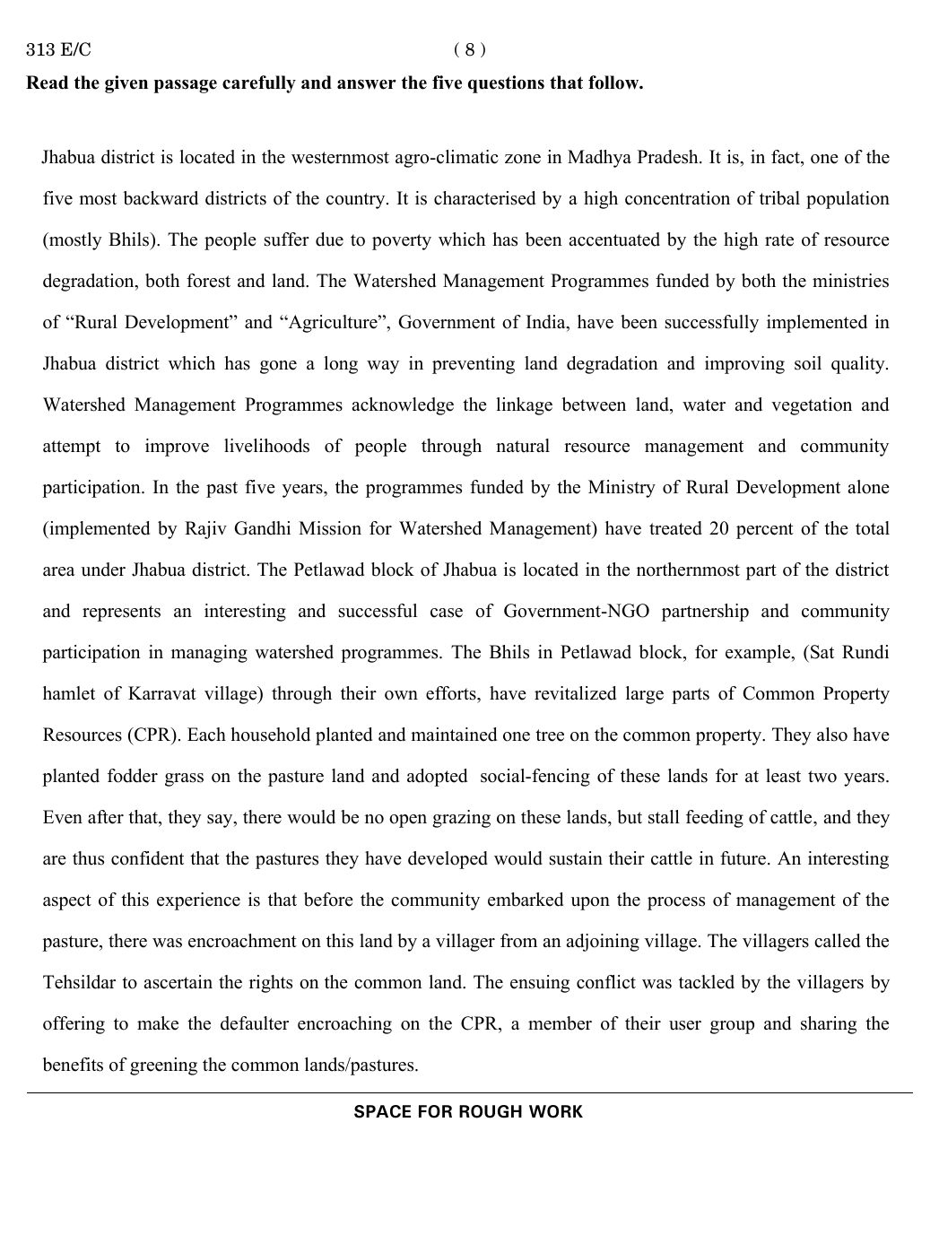
Read the given passage carefully and answer the five questions that follow.
Passage:
Jhabua district is located in the westernmost agro-climatic zone in Madhya Pradesh. It is, in fact, one of the five most backward districts of the country. It is characterised by a high concentration of tribal population (mostly Bhils). The people suffer due to poverty which has been accentuated by the high rate of resource degradation, both forest and land. The Watershed Management Programmes funded by both the ministries of “Rural Development” and “Agriculture”, Government of India, have been successfully implemented in Jhabua district which has gone a long way in preventing land degradation and improving soil quality. Watershed Management Programmes acknowledge the linkage between land, water and vegetation and attempt to improve livelihoods of people through natural resource management and community participation. In the past five years, the programmes funded by the Ministry of Rural Development alone (implemented by Rajiv Gandhi Mission for Watershed Management) have treated 20 percent of the total area under Jhabua district. The Petlawad block of Jhabua is located in the northernmost part of the district and represents an interesting and successful case of Government-NGO partnership and community participation in managing watershed programmes. The Bhils in Petlawad block, for example, (Sat Rundi hamlet of Karravat village) through their own efforts, have revitalized large parts of Common Property Resources (CPR). Each household planted and maintained one tree on the common property. They also have planted fodder grass on the pasture land and adopted social-fencing of these lands for at least two years. Even after that, they say, there would be no open grazing on these lands, but stall feeding of cattle, and they are thus confident that the pastures they have developed would sustain their cattle in future. An interesting aspect of this experience is that before the community embarked upon the process of management of the pasture, there was encroachment on this land by a villager from an adjoining village. The villagers called the Tehsildar to ascertain the rights on the common land. The ensuing conflict was tackled by the villagers by offering to make the defaulter encroaching on the CPR, a member of their user group and sharing the benefits of greening the common lands/pastures.
View Solution
Which of the following practices were adopted by the Bhils in Petlawad block to manage pasture lands?
View Solution
What conflict occurred in Petlawad block regarding common property resources (CPR)?
View Solution
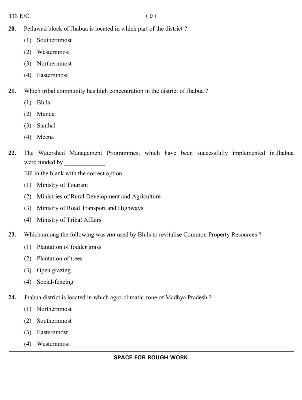
Petlawad block of Jhabua is located in which part of the district?
View Solution
Which tribal community has high concentration in the district of Jhabua?
View Solution
The Watershed Management Programmes, which have been successfully implemented in Jhabua were funded by _____________.
View Solution
Which among the following was not used by Bhils to revitalise Common Property Resources?
View Solution
Jhabua district is located in which agro-climatic zone of Madhya Pradesh?
View Solution
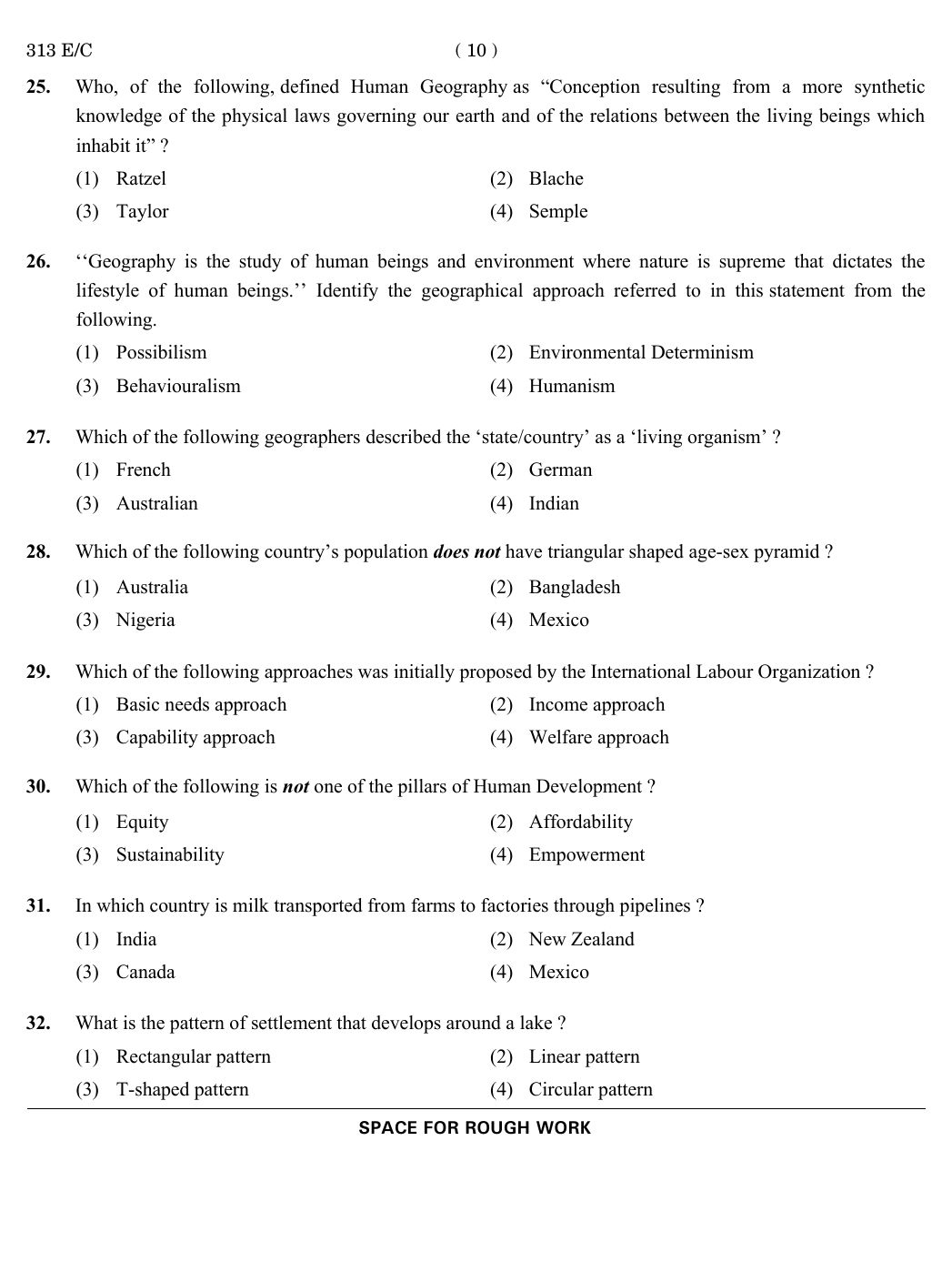
Who, of the following, defined Human Geography as “Conception resulting from a more synthetic knowledge of the physical laws governing our earth and of the relations between the living beings which inhabit it” ?
View Solution
‘‘Geography is the study of human beings and environment where nature is supreme that dictates the lifestyle of human beings.’’ Identify the geographical approach referred to in this statement from the following.
View Solution
Which of the following geographers described the ‘state/country’ as a ‘living organism’ ?
View Solution
Which of the following country’s population does not have a triangular shaped age-sex pyramid ?
View Solution
Which of the following approaches was initially proposed by the International Labour Organization ?
View Solution
Which of the following is not one of the pillars of Human Development ?
View Solution
In which country is milk transported from farms to factories through pipelines ?
View Solution
What is the pattern of settlement that develops around a lake ?
View Solution
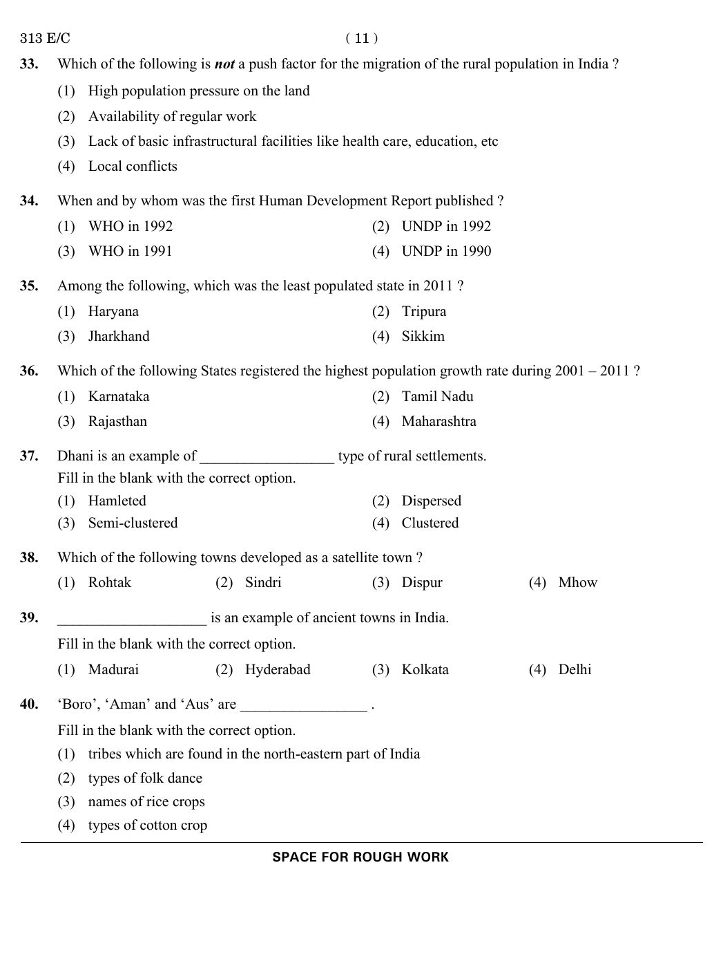
Which of the following is not a push factor for the migration of the rural population in India?
View Solution
When and by whom was the first Human Development Report published?
View Solution
Among the following, which was the least populated state in 2011?
View Solution
Which of the following States registered the highest population growth rate during 2001 – 2011?
View Solution
Dhani is an example of __________________ type of rural settlements.
View Solution
Which of the following towns developed as a satellite town?
View Solution
____________________ is an example of ancient towns in India.
View Solution
‘Boro’, ‘Aman’ and ‘Aus’ are _________________ .
View Solution
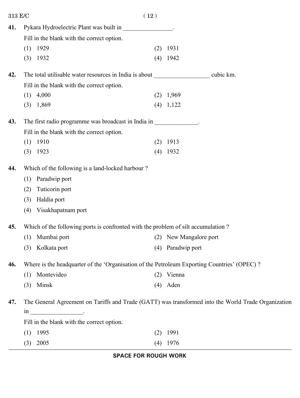
Pykara Hydroelectric Plant was built in ________________.
View Solution
The total utilisable water resources in India is about __________________ cubic km.
View Solution
The first radio programme was broadcast in India in ______________.
View Solution
Which of the following is a land-locked harbour?
View Solution
Which of the following ports is confronted with the problem of silt accumulation?
View Solution
Where is the headquarter of the ‘Organisation of the Petroleum Exporting Countries’ (OPEC) ?
View Solution
The General Agreement on Tariffs and Trade (GATT) was transformed into the World Trade Organization in ________________.
View Solution
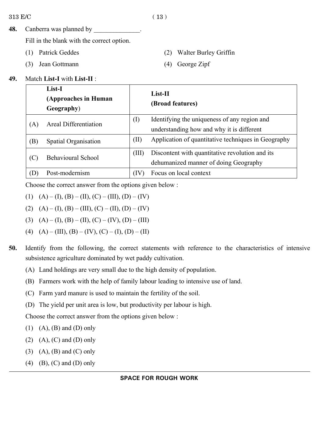
Canberra was planned by ______________.
View Solution
Match List-I with List-II :
List-I (Approaches in Human Geography)
(A) Areal Differentiation
(B) Spatial Organisation
(C) Behavioural School
(D) Post-modernism
List-II (Broad features)
(I) Identifying the uniqueness of any region and understanding how and why it is different
(II) Application of quantitative techniques in Geography
(III) Discontent with quantitative revolution and its dehumanized manner of doing Geography
(IV) Focus on local context
View Solution
Identify from the following, the correct statements with reference to the characteristics of intensive subsistence agriculture dominated by wet paddy cultivation.
(A) Land holdings are very small due to the high density of population.
(B) Farmers work with the help of family labour leading to intensive use of land.
(C) Farm yard manure is used to maintain the fertility of the soil.
(D) The yield per unit area is low, but productivity per labour is high.
View Solution









Comments